As we left The North Rim of the Grand Canyon, we headed east for a series of stops across Arizona. The space is vast out here, so much to see and so much to do. Large ranches cover acres, horses and cattle roaming freely. And national parks, state parks, and Bureau of Land Management protect huge areas. A great place to enjoy.
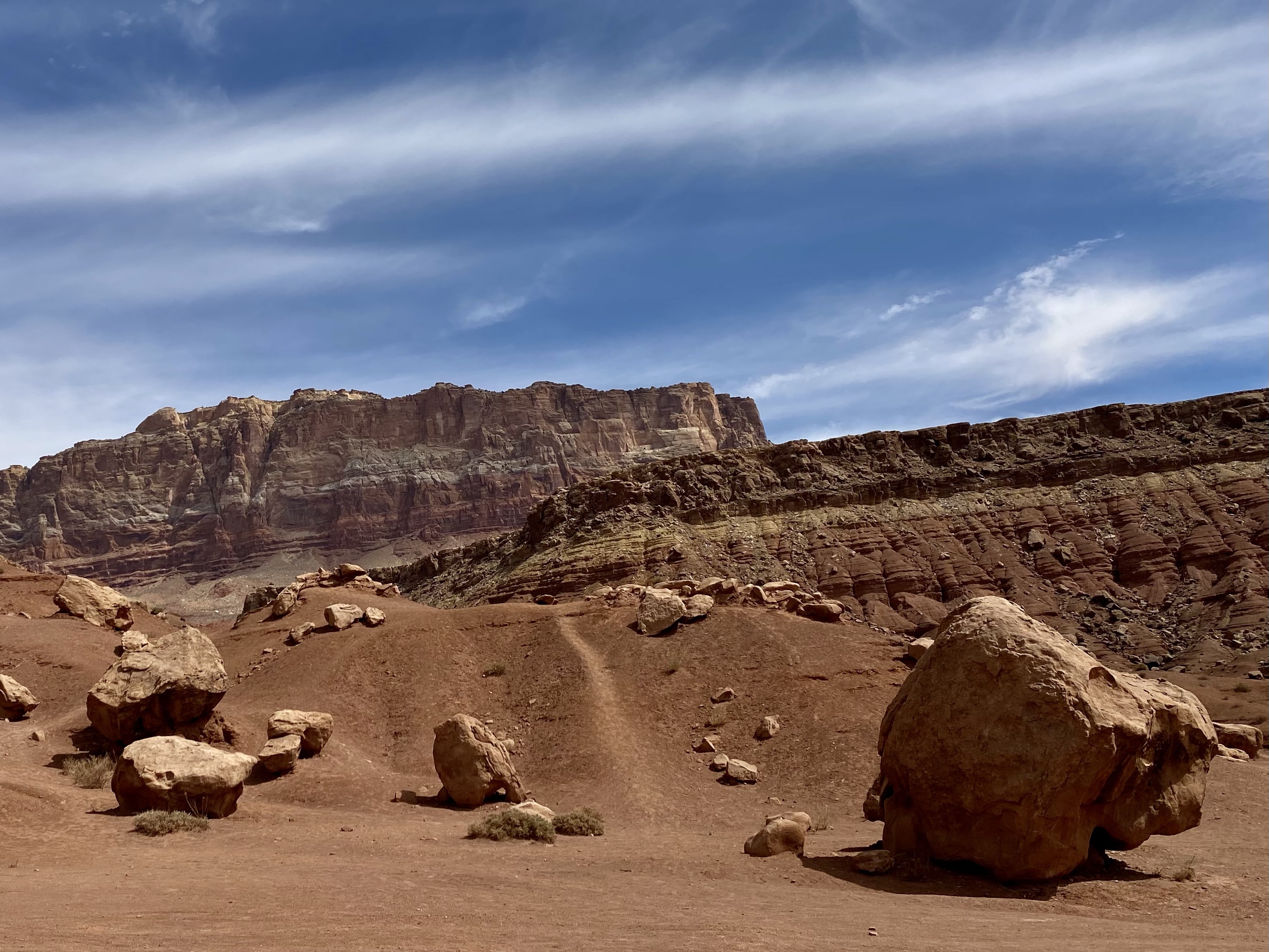
Just outside The North Rim lie the Vermillion Cliffs, a national monument. As we drove the scenic highway, we rolled up and down hills, then entered into a rust red canyon. On the other side the view opened wide to a magnificent view of the cliffs. Jutting up above the yellow desert floor, they stood tall and sturdy stretching in both directions for miles. Even from afar you could see their rugged beauty, raked by the wind and striped by the earth. They proudly displayed a deep red from floor to ceiling.
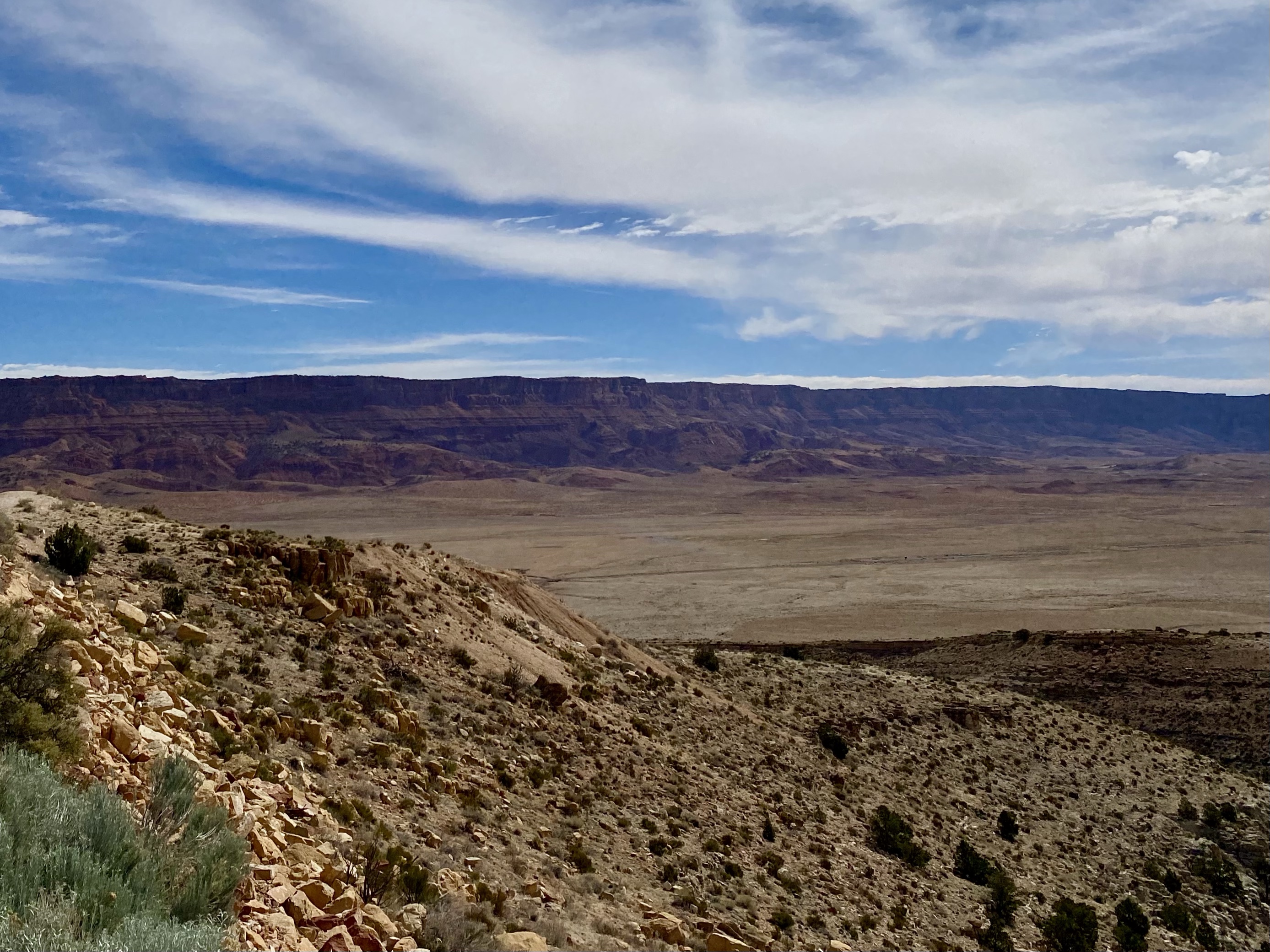
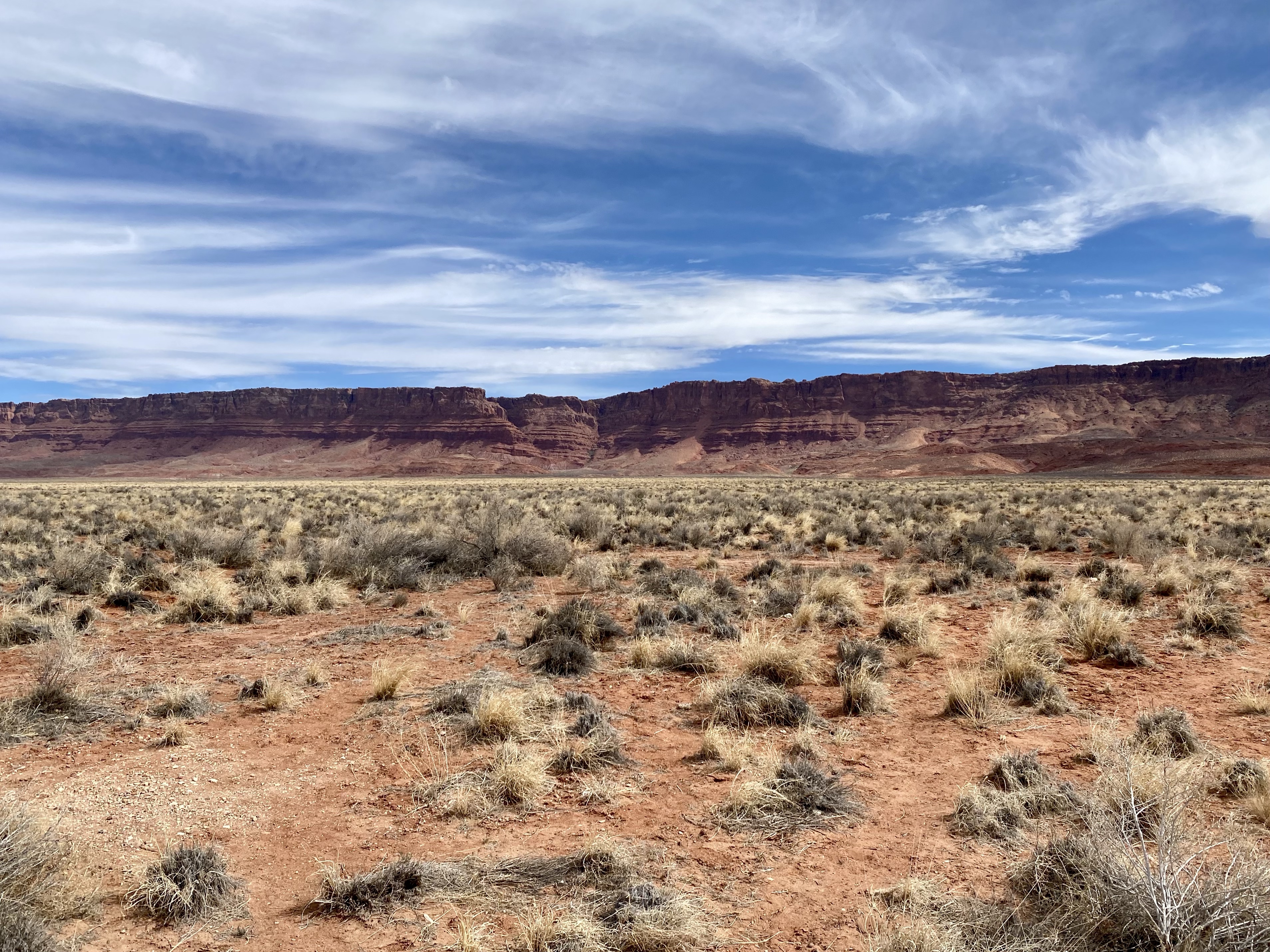
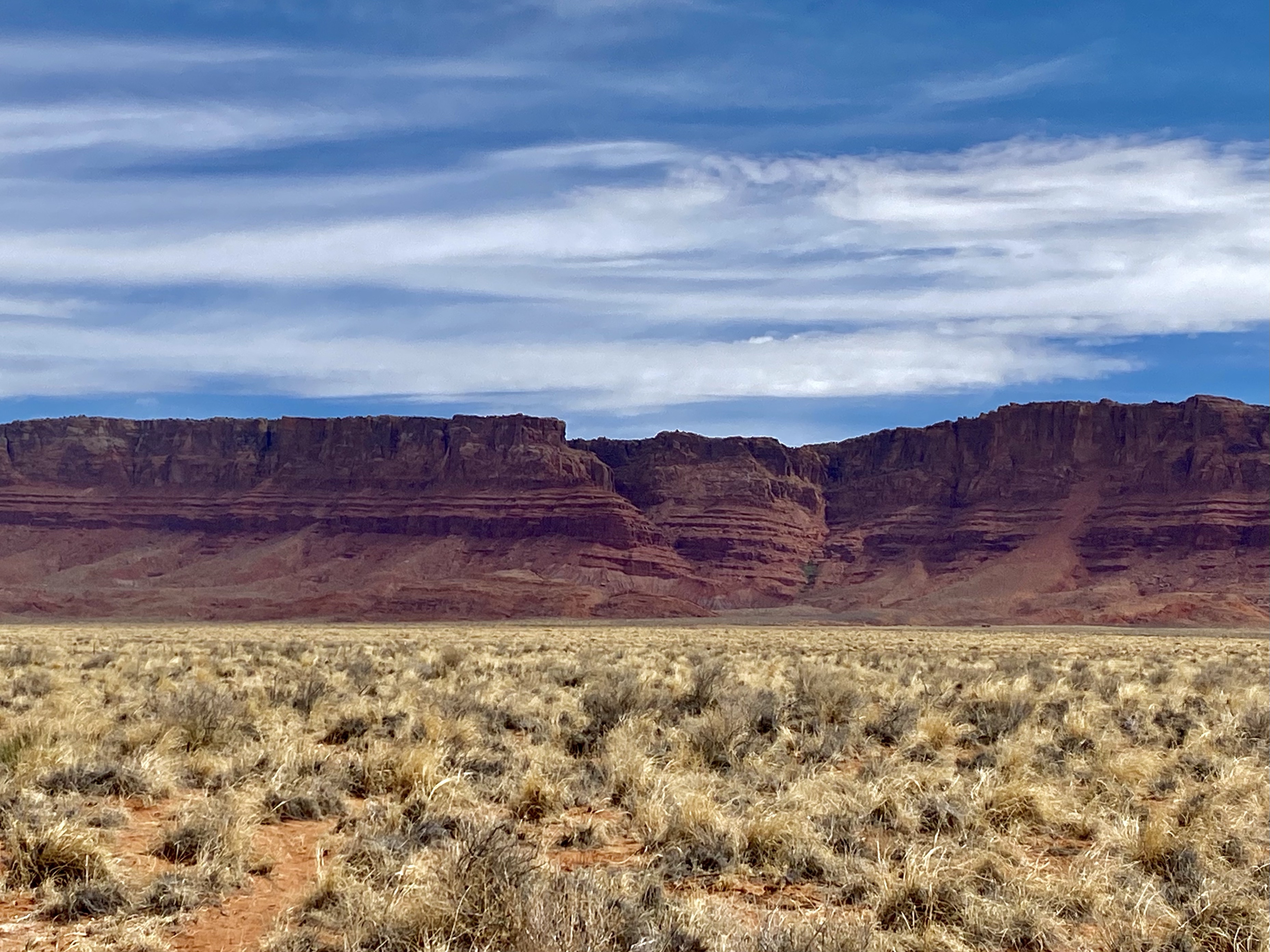
As we drove down the road further, the Vermillion Cliffs continued to evolve, sometimes a tall wall, other time various shapes of rock outcroppings, and still other moments of stand alone towers. The colors changed too, now red mixed with white and yellow, sometimes dashes of green. No part looked the same as the last.
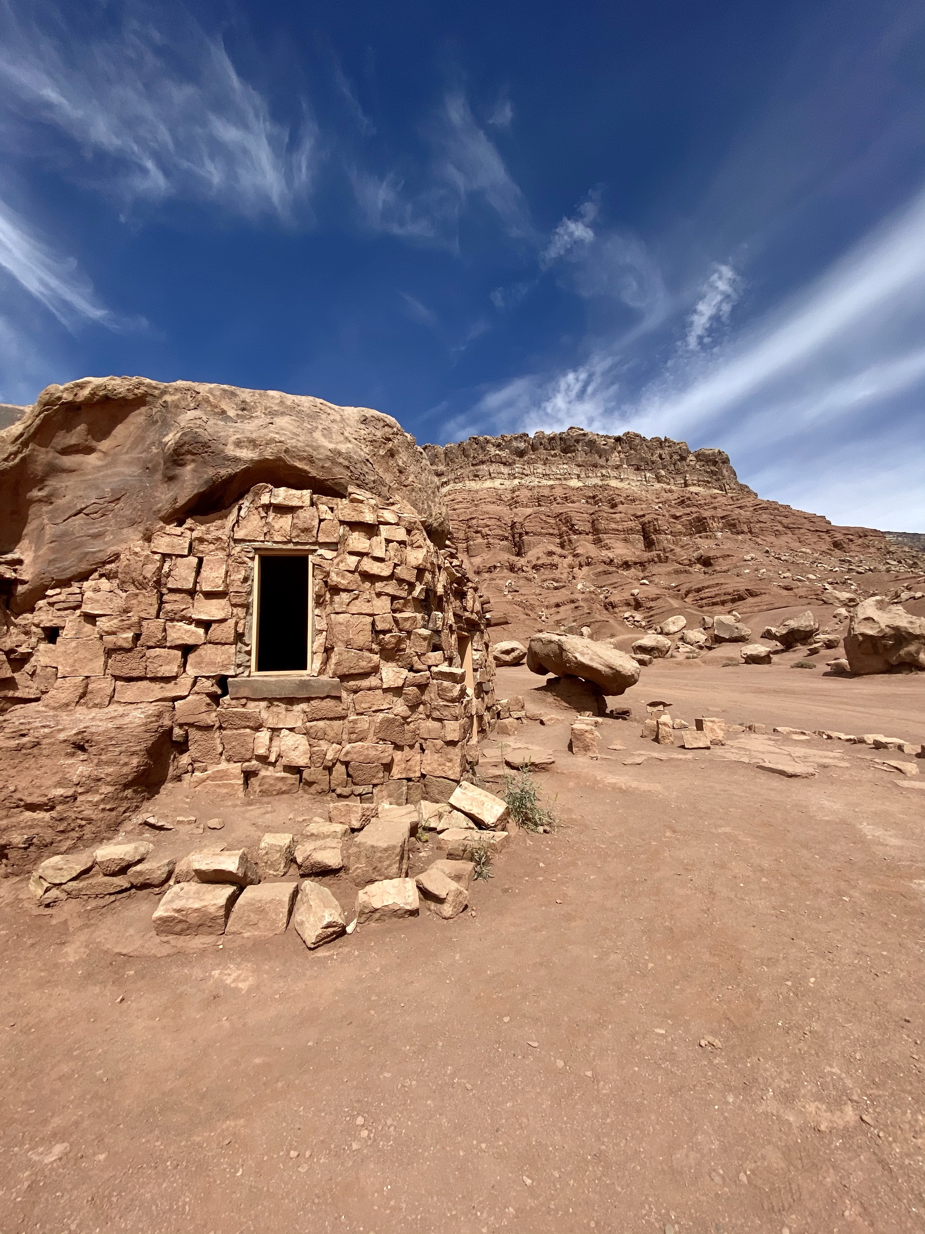
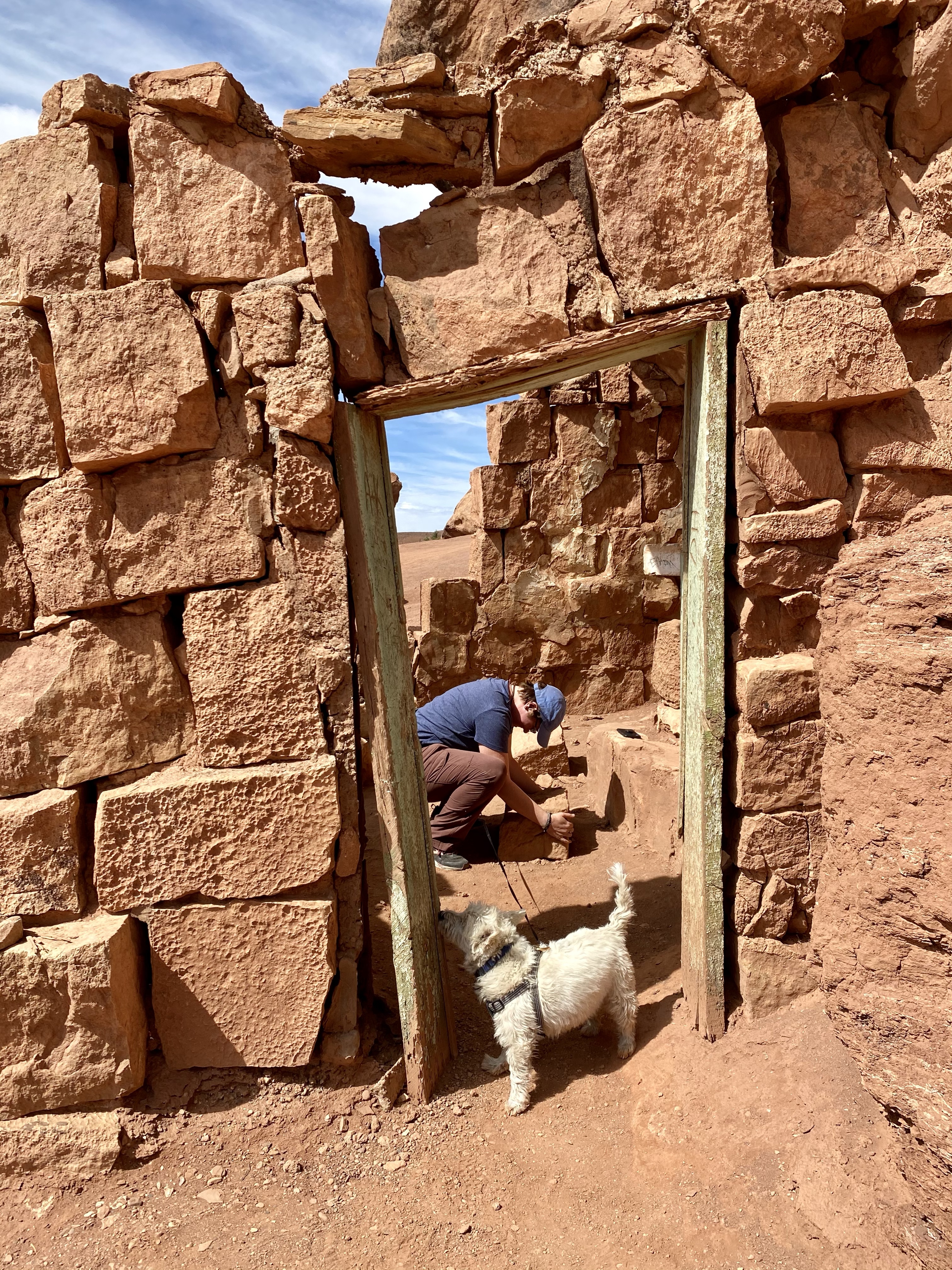
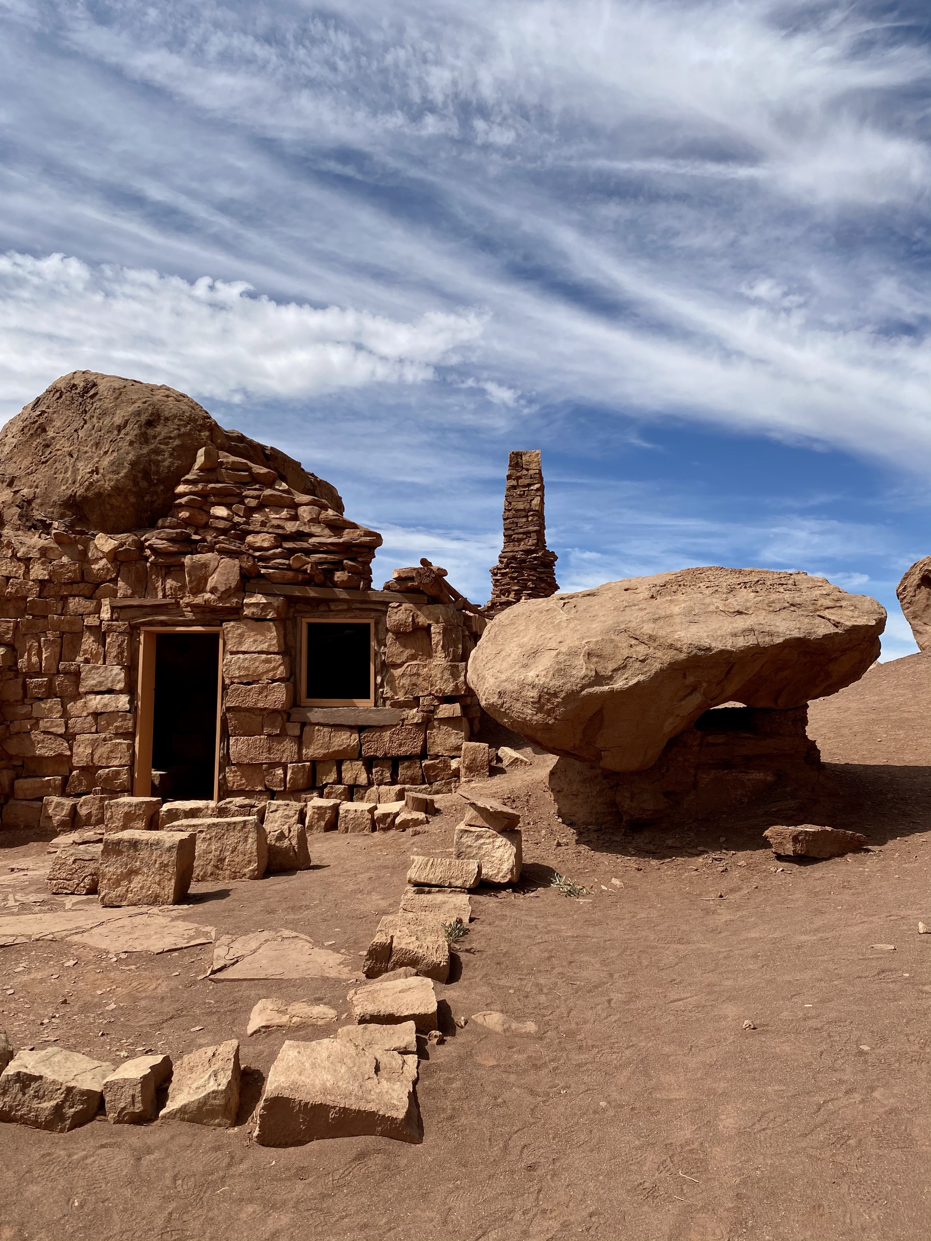
Farther down the highway we stopped at ancient cliff dwellings, red stone houses once inhabited by prehistoric indigenous people. There were no signs to help us with the history, which was unfortunate. The houses and storage rooms are built around large boulders that fell from the cliffs and rested on the sandy red earth below. Today, this area is Navajo Nation, the land the tribe was relocated to years ago.

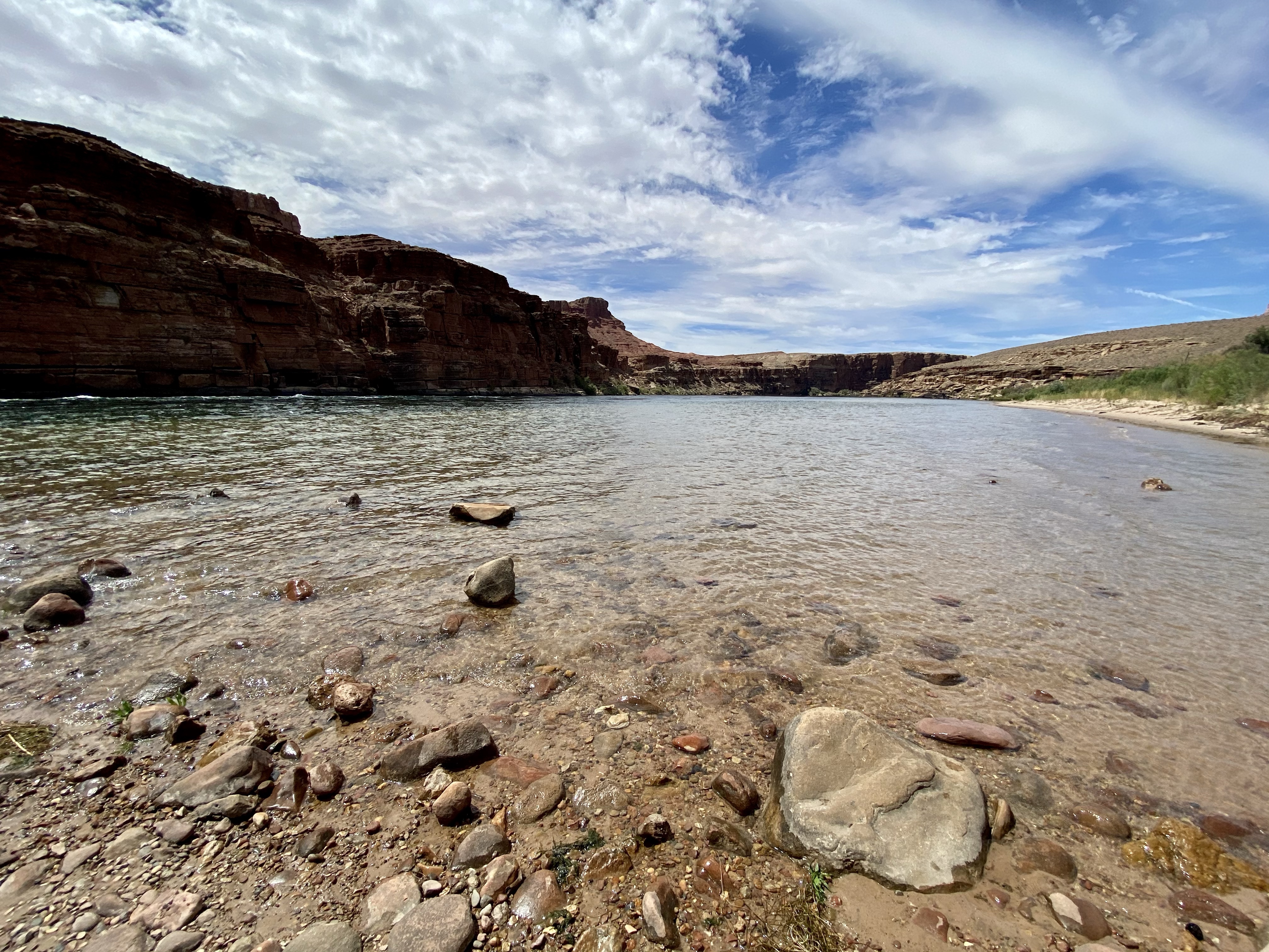
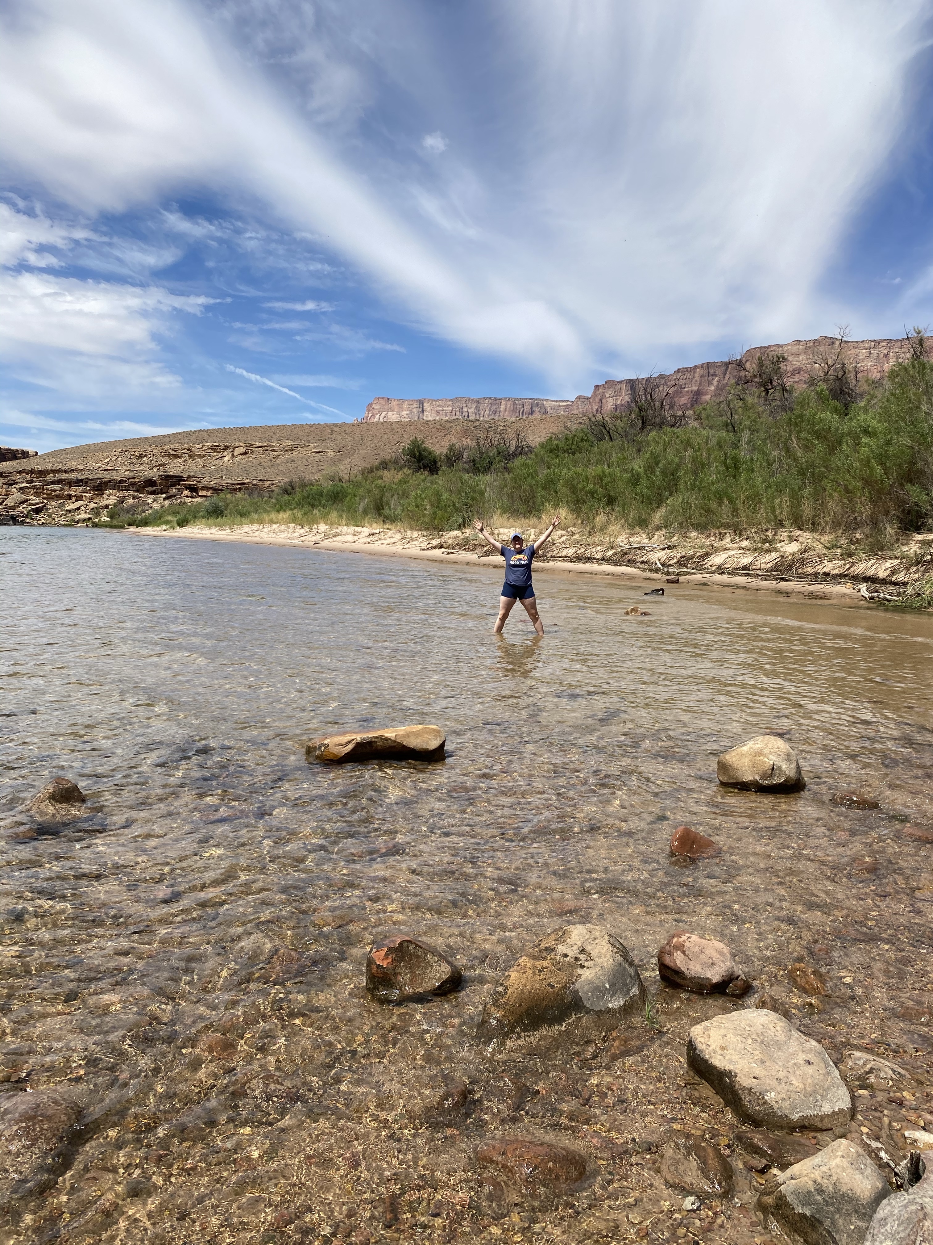
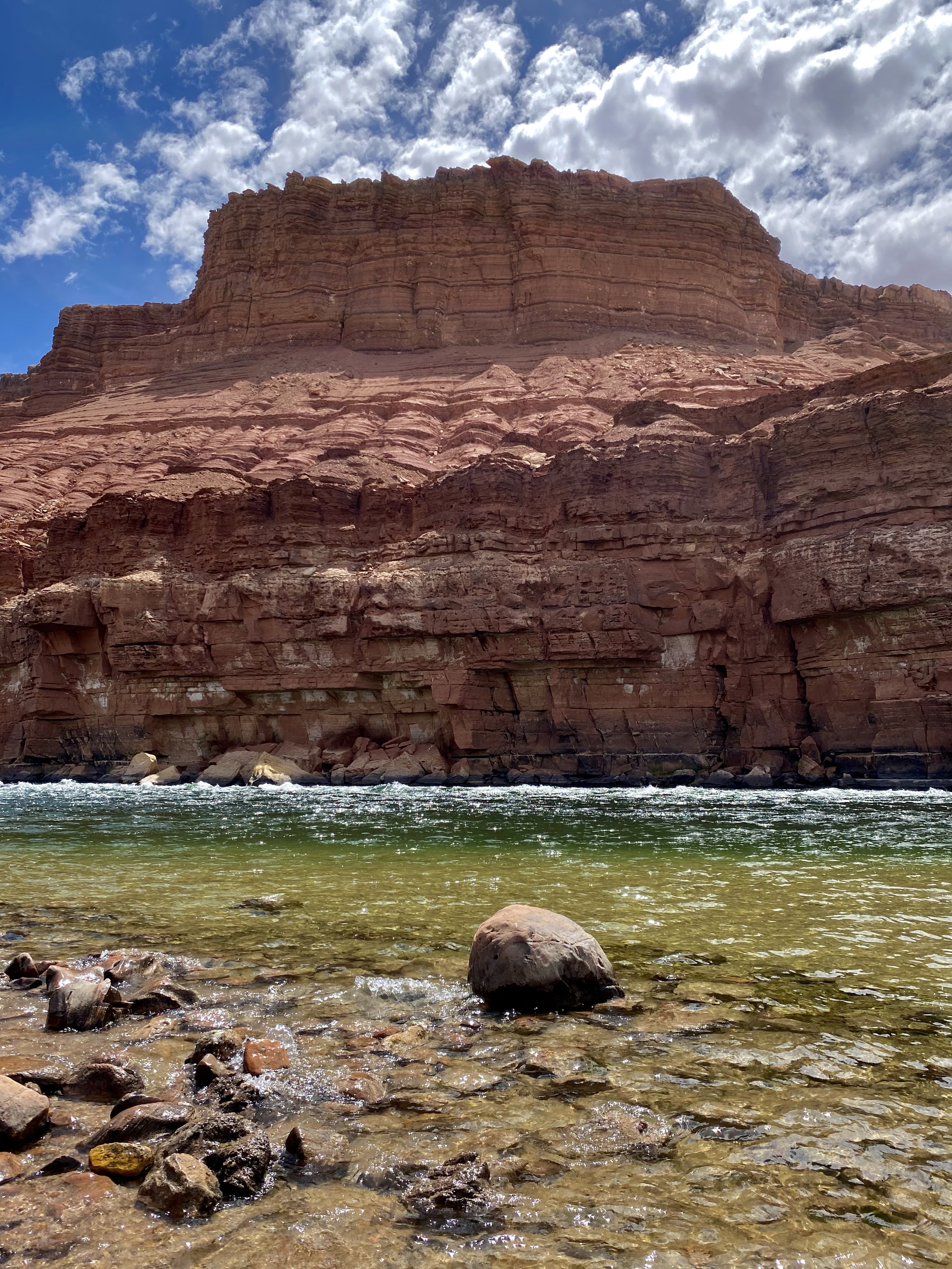
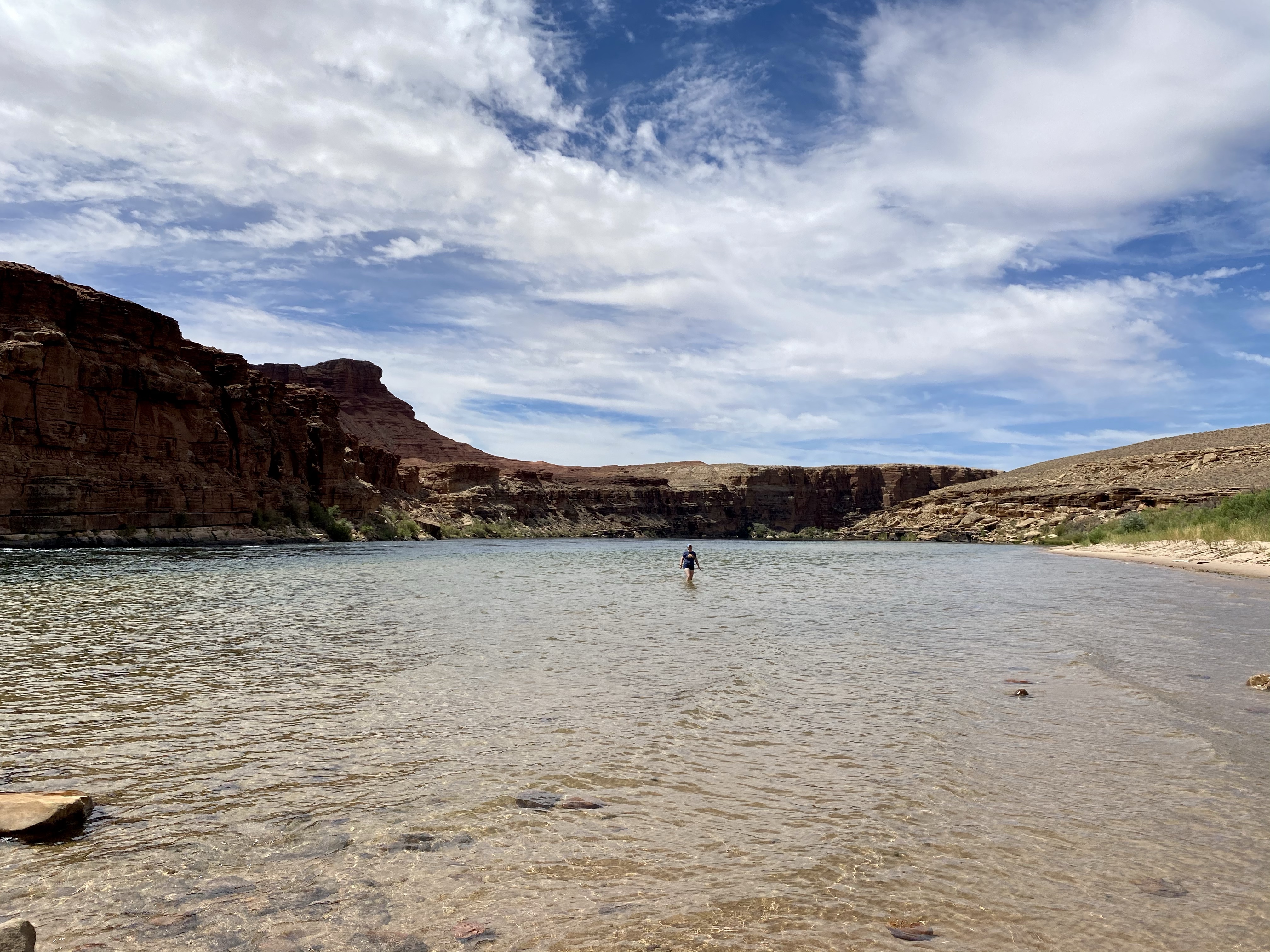
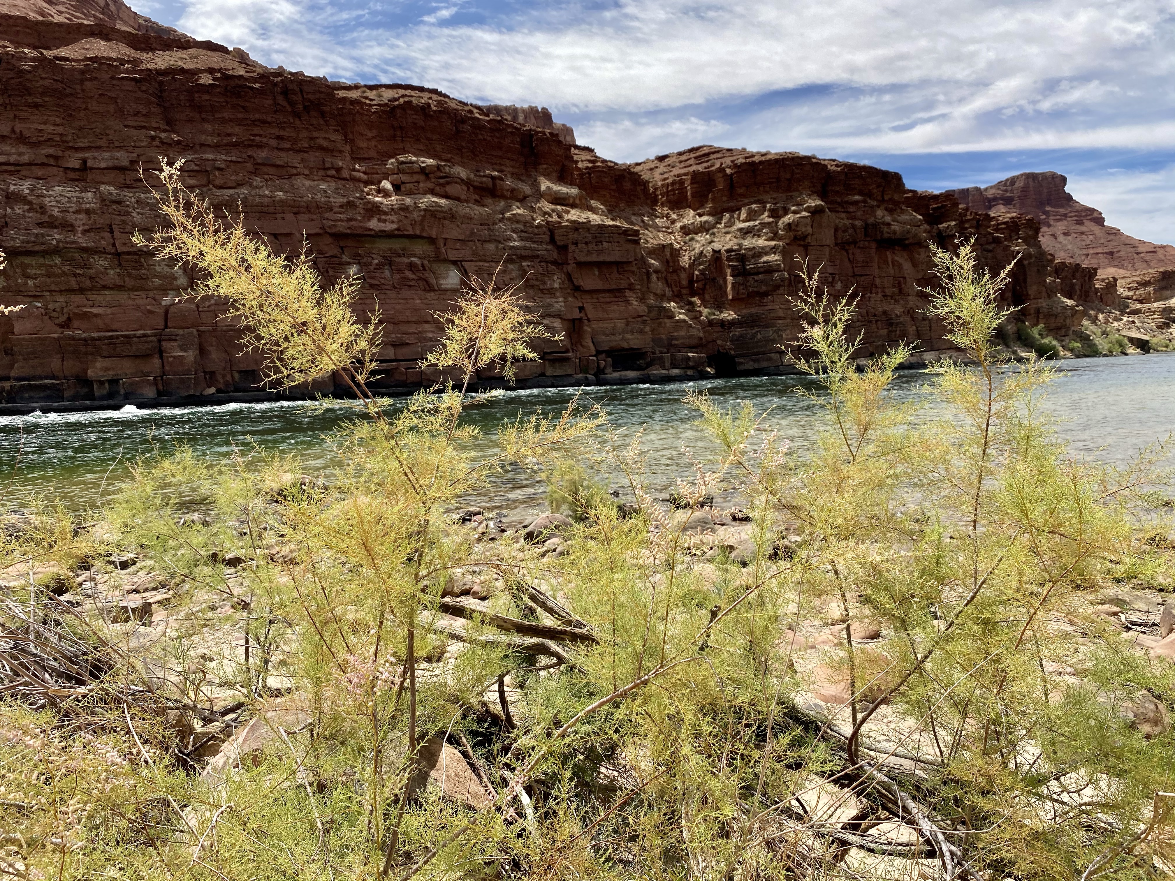
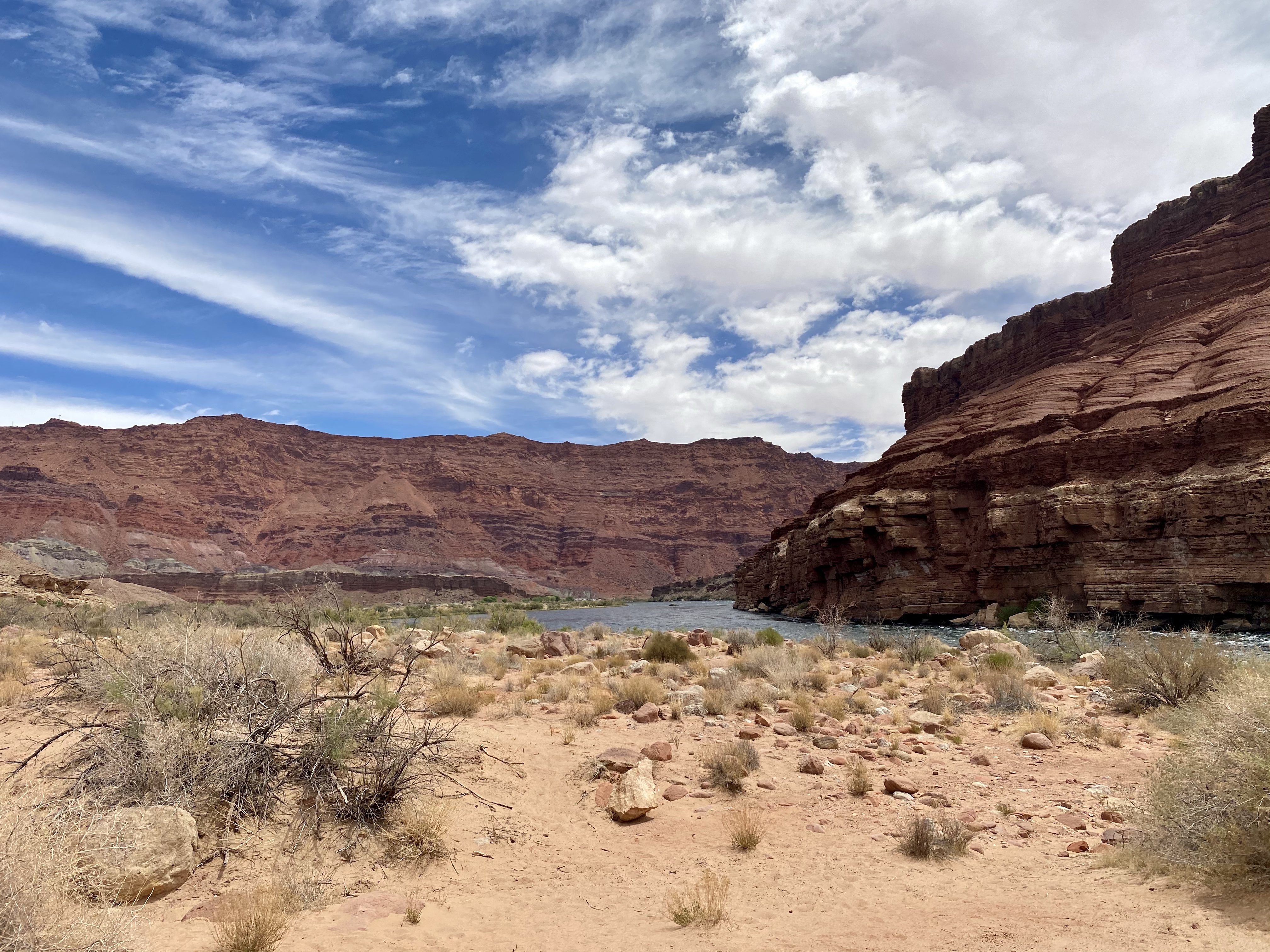
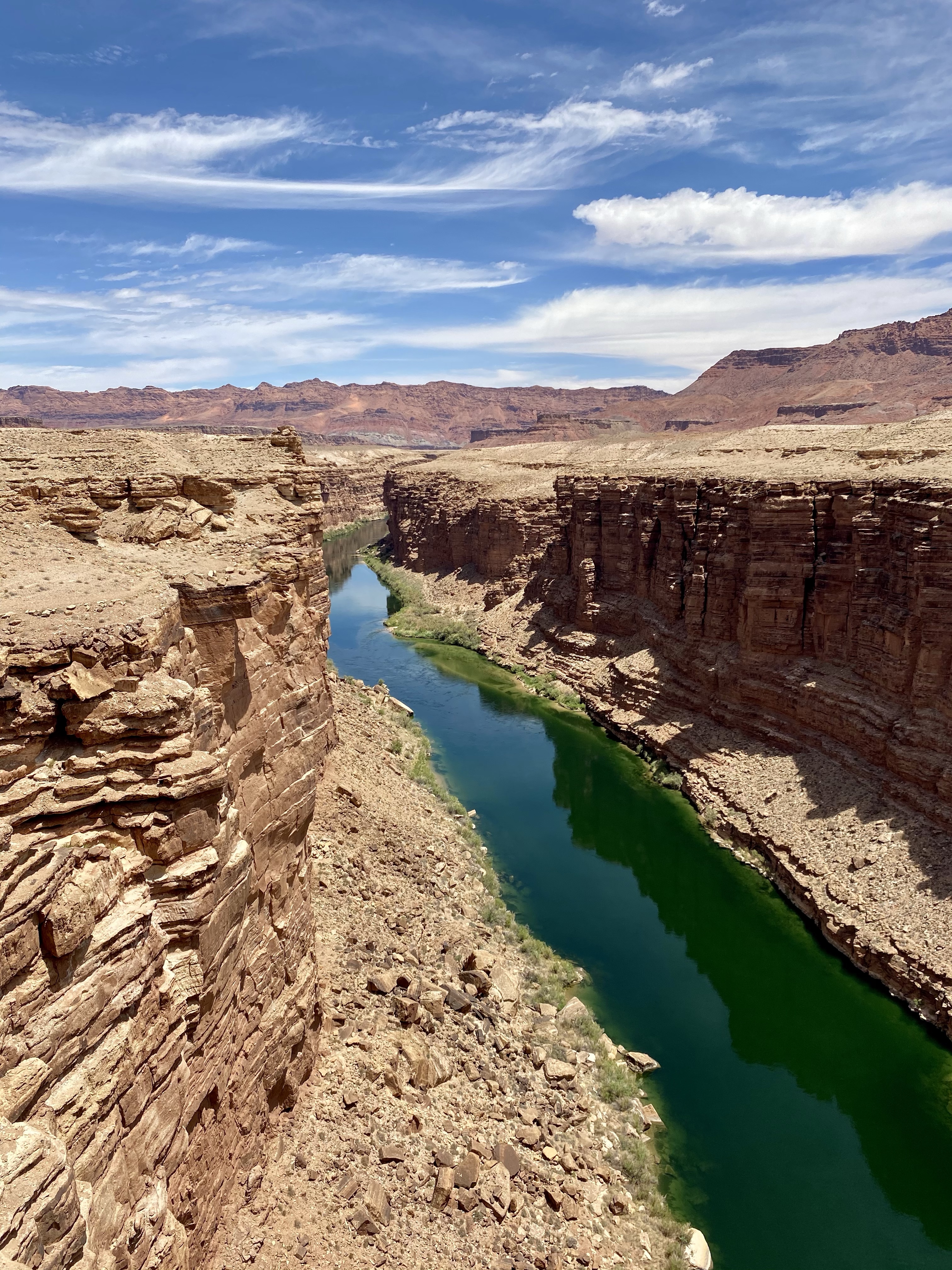
From there we continued on to Glen Canyon National Recreation Area, where the Colorado River enters Marble Canyon, then Glen Canyon, and eventually Lake Powell. A short side trip proved to have stunning views, and a refreshing body of water to wade in. Down in Glen Canyon the brick red walls rose up from the blue green water of the Colorado River. Rushing by with little white ripples, the shore was calm and full of people fishing. Bright colored lizards scampered around and I tried to capture them with my camera while Crystal took a dip in the ice cold water. Brrrr! Max and I stayed on the shore, happy to be warm and dry. Max did get a little wet looking for Crystal, so they both got a parking lot shower before we headed off!

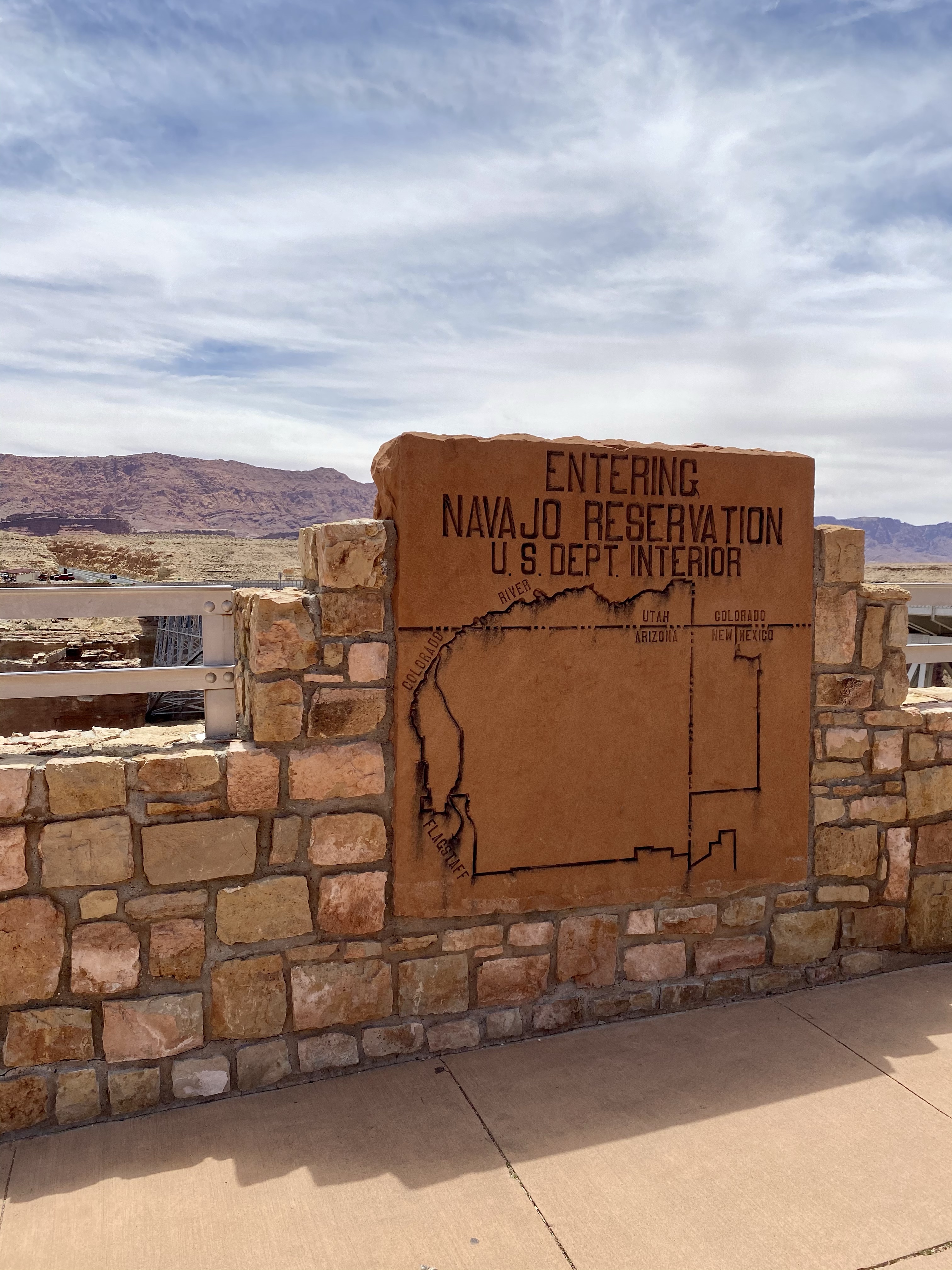
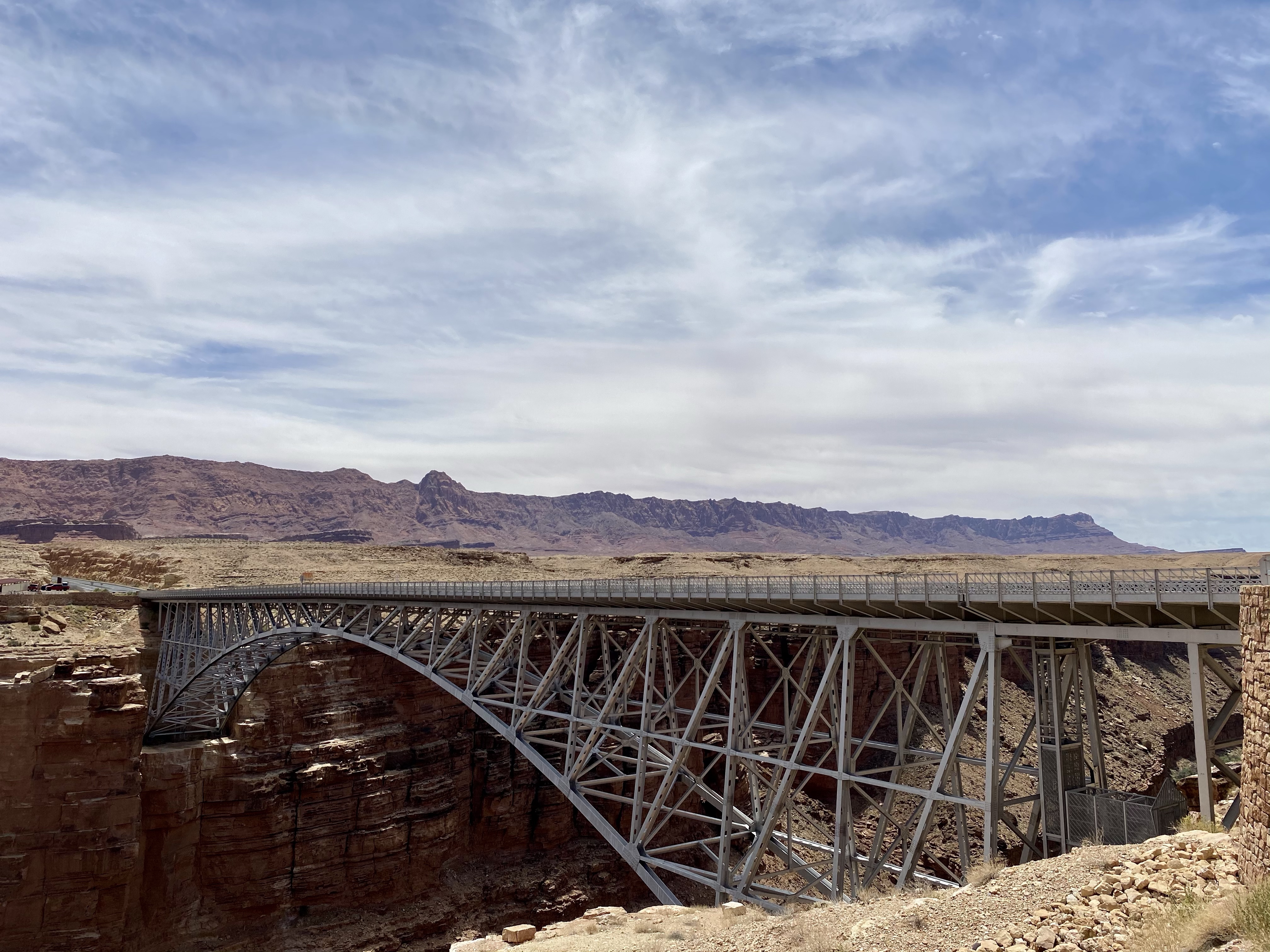
Shortly down the road we paused at Navajo Bridge, the entrance to Navajo Nation. The steel masterpiece was built over the Colorado a river between 1927 and 1928, making travel easier and safer. Previously, Navajo people had used Lee’s Ferry to transport people back and forth, but it was dangerous and many lost their lives. For example, John Deering of the Deer Water Clan would transport supplies and U.S. mail to Flagstaff, AZ. He ran Lee’s a ferry until the bridge was completed. Another example is Lewis Nez of the Bitter Water Clan. He worked for the Bitter Ridge Trading Post and ferried supplies, mail, and money for local merchants. Once across the River, he took the goods the rest of the way by wagon.
This area is of great importance to the Navajo people. Today they continue to cross back and forth by bridge and set up shops to sell their handmade goods. Fine jewelry, pottery, weavings and more line their shops and help support their clans. Crystal and I spent time picking out gifts before crossing back over.

We sat near the entrance, eating lunch and watching the California condors ride the thermal waves overhead. They are gigantic birds with wingspans of nine feet across. Endangered, they are slowly being reintroduced to their native habitats. Here, four of them soared happily above the deep blue river.
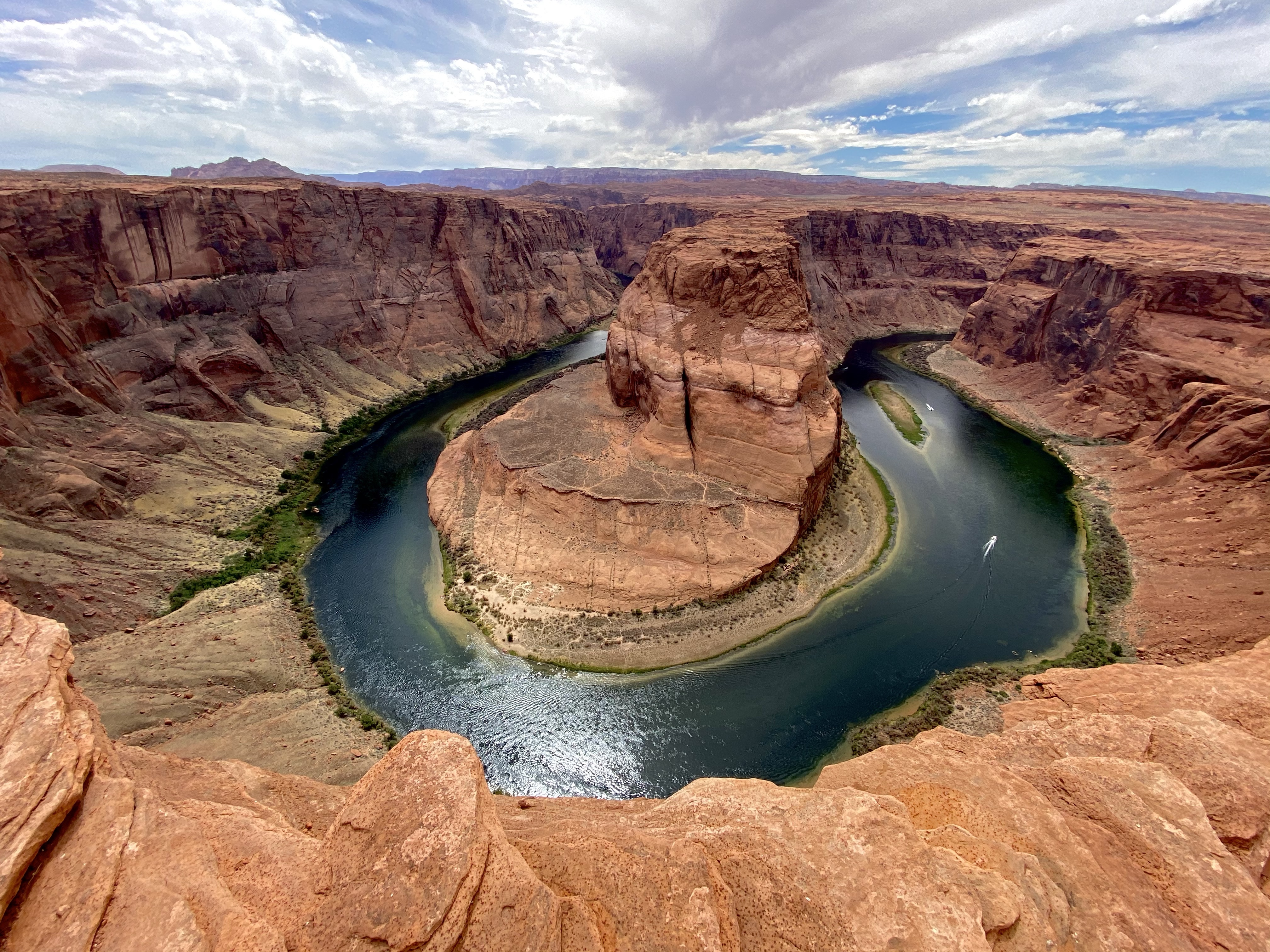
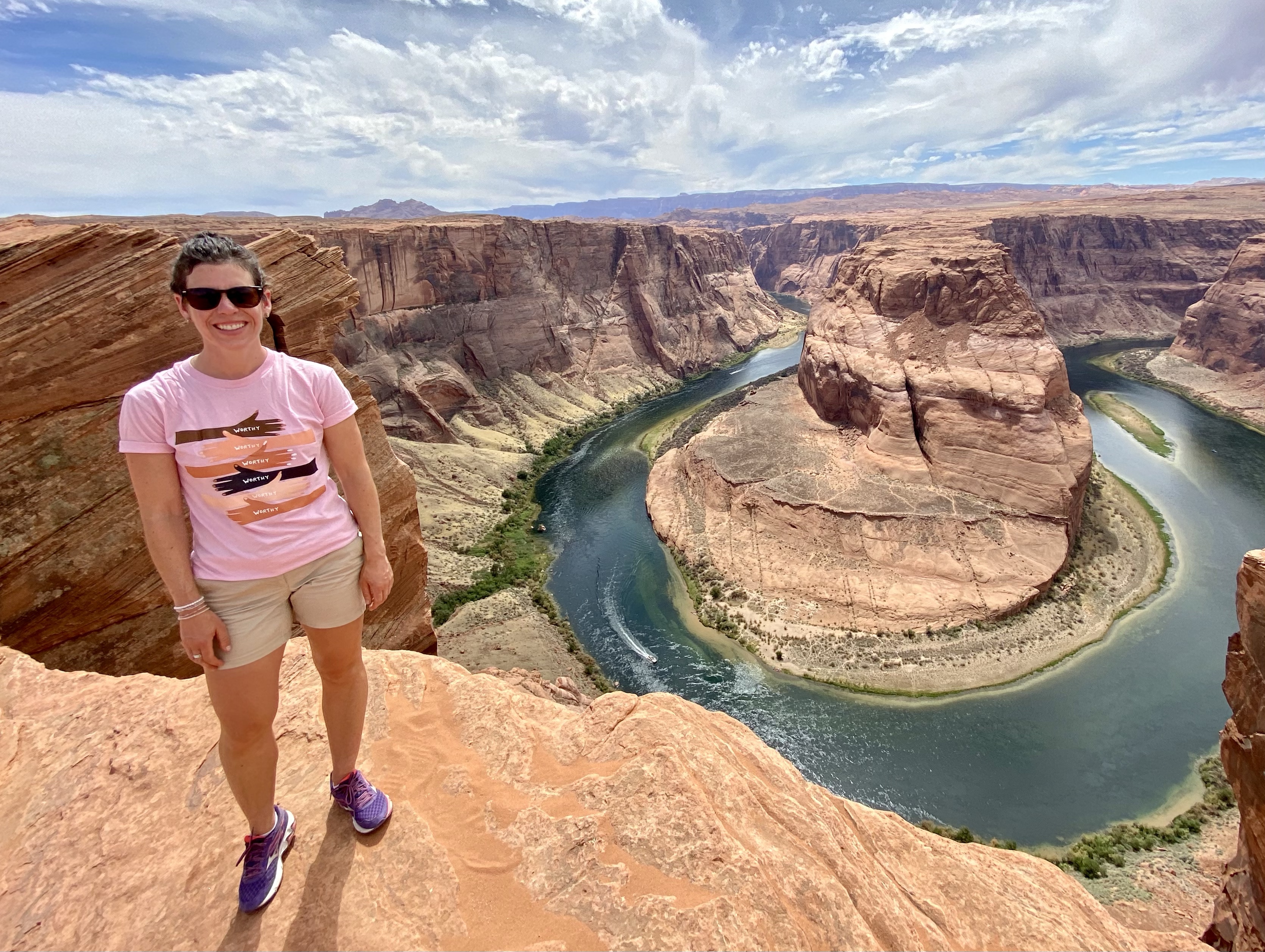
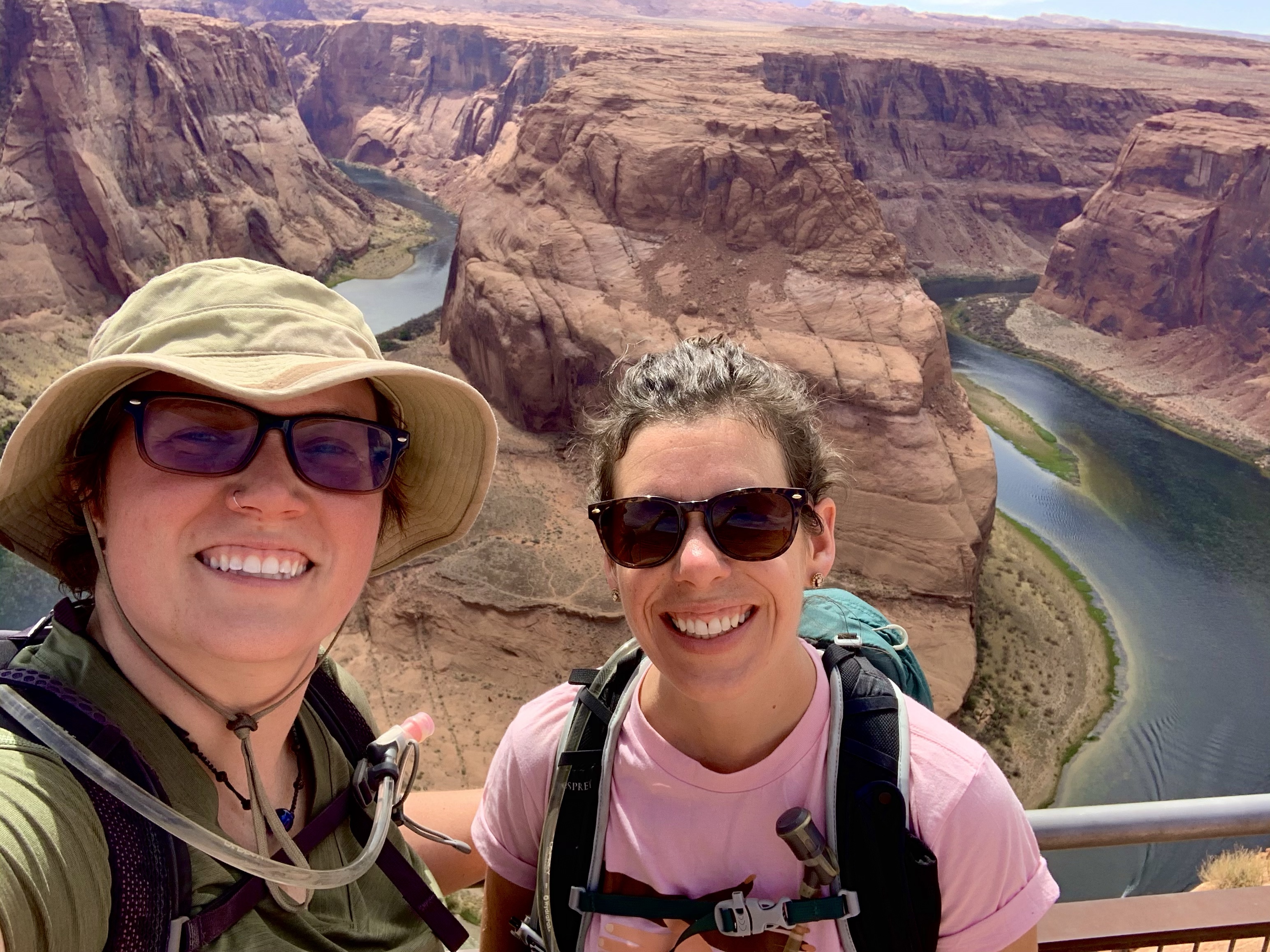
Next stop on our tour was Horseshoe Bend, the famous curve in the mighty River. The afternoon heat was brutal, but we didn’t let it stop us. Max was prepared for the hot pavement with his booties and we set off, down the paved path to the popular attraction.
The lookout point was crawling with people, so we climbed over the sandstone for a ways to get a quieter view. This place is everything you may have seen in pictures. Far below, the Colorado River flows a deep blue around a sharp curve, brilliant green vegetation separating the red banks from the water. In the middle of the bend, far away from your feet, stand a tall tower that slowly grows as the river floor has sunk from erosion. Boats zip along below, kayaks from paddlers rest on the Bend’s shore, all looking like tiny ants from the rim. I wandered around for a while, catching different angles, while Crystal and Max sat and rested and reflected. A breeze made the heat tolerable.
Eventually we headed back, stopping at the shade benches for a rest and water. Max was happy for the break! But we all made it back to the car safely, and cranked the AC right away. Haha!

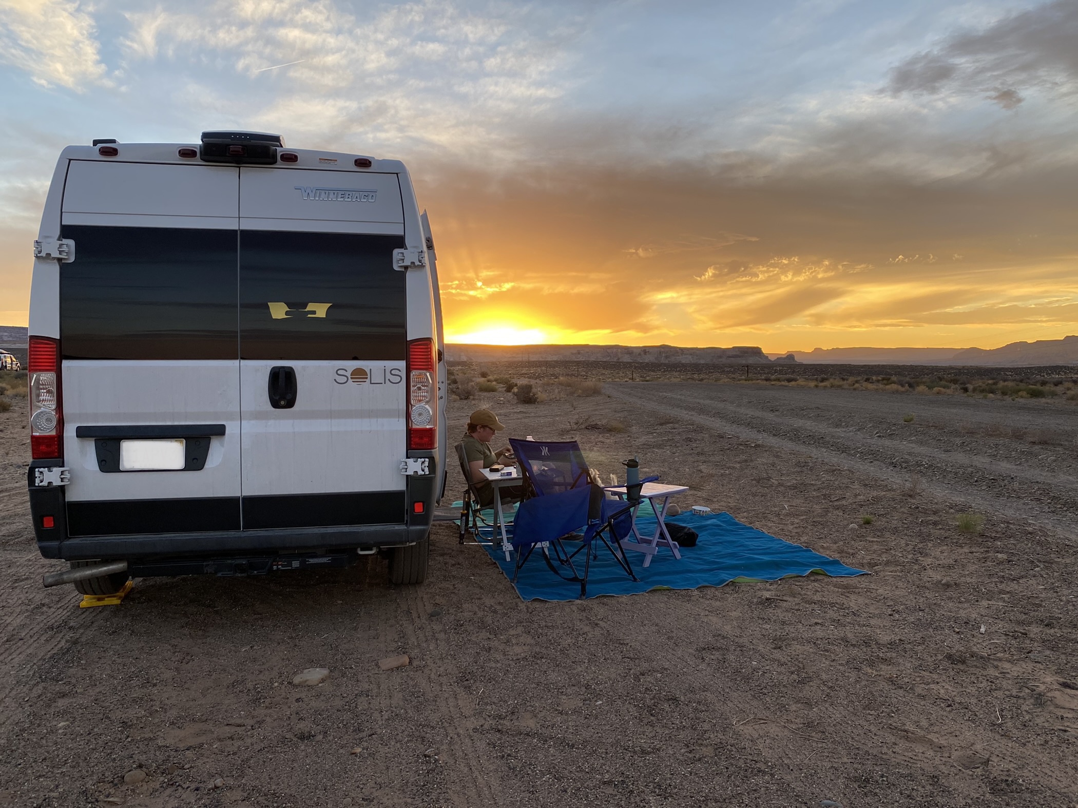
We drove through Page, AZ, grabbed groceries and gas, and headed to our camping spot. Our first try was full, so we found the entrance to the BLM land and made our our spot down the road! You can camp almost anywhere on BLM land, just pay attention to signs.
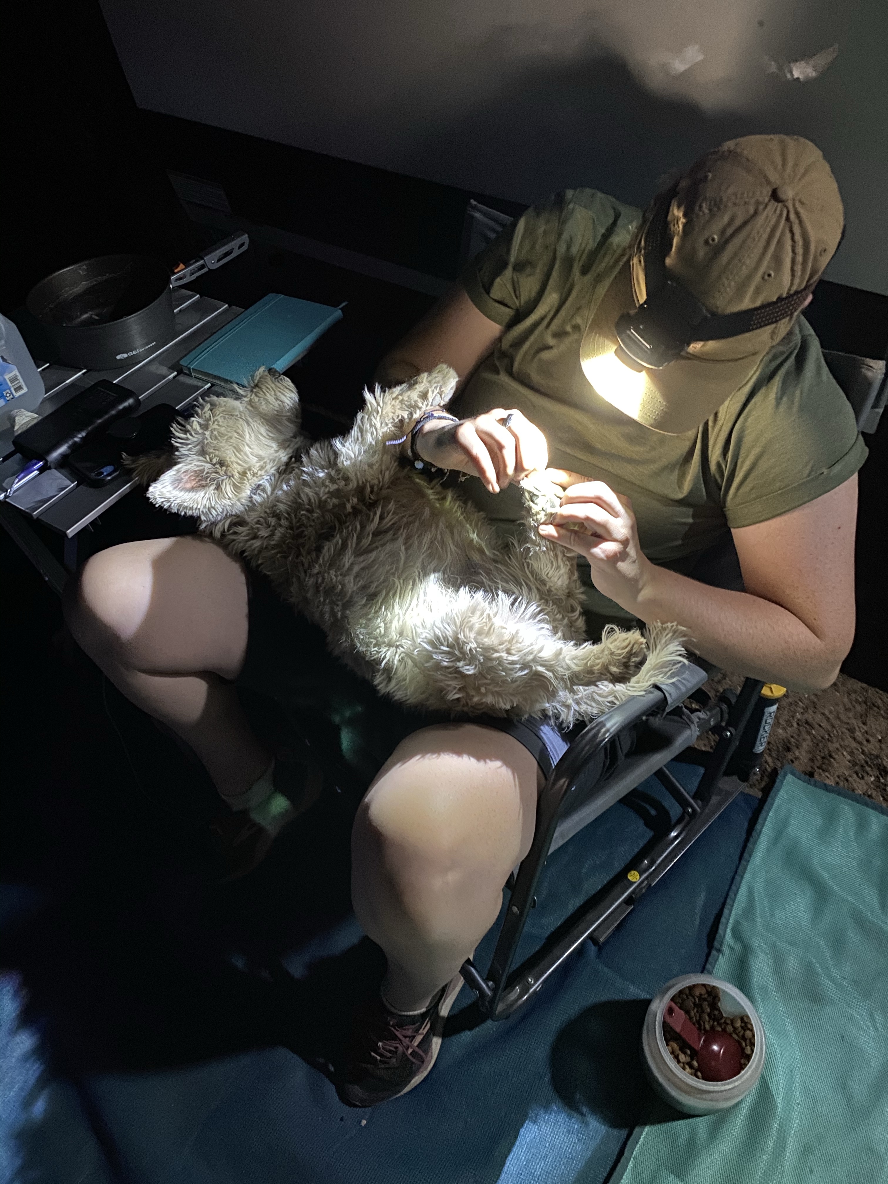
Happy with our quiet spot, we eased into the evening. As the fiery ball of orange set over the cliffs in the west, those in the east glowed a pale pink. Then the whole sky lit up, neon pinks and oranges like a disco party. When the sun finally disappeared, Crystal donned a head lamp and performed a pedicure on Max. These random, simple spots and nights are my favorite.
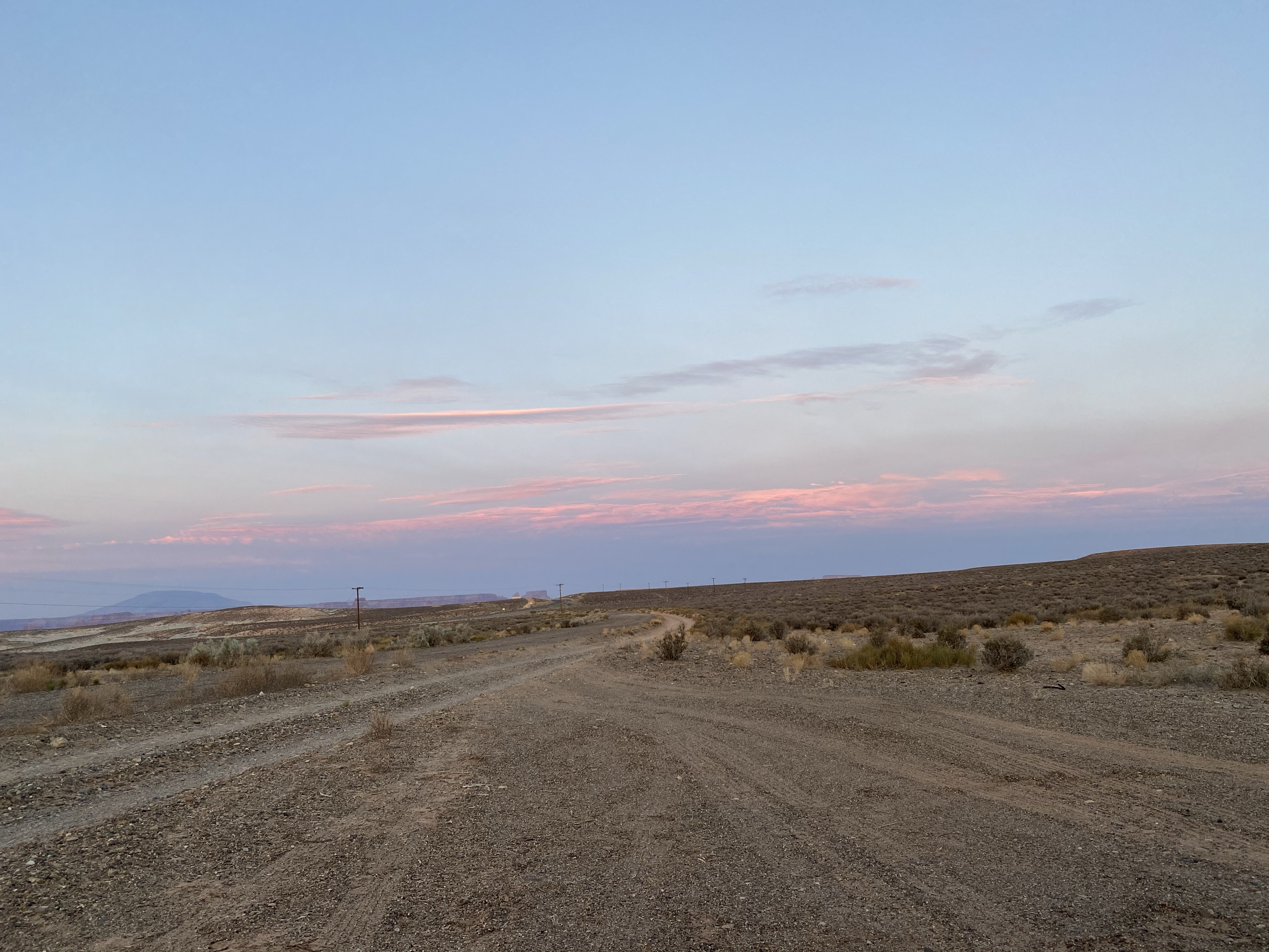
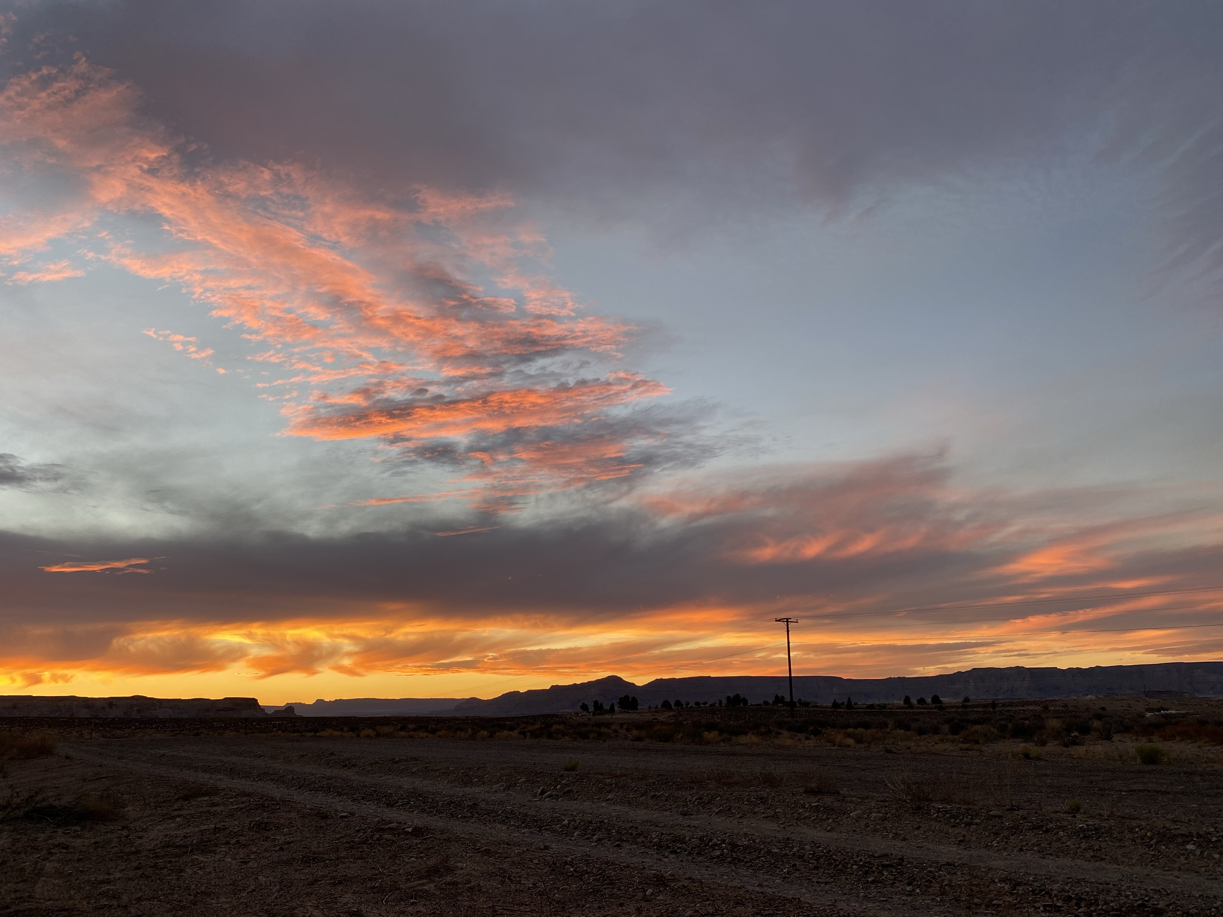
The next morning I awoke to a truck driving down the road, which at first was bothersome. But then I noticed the neon pink sunrise and I was happy for the distribution. I did sneak in another hour of sleep after that, but waking to see the sunrise is something special.
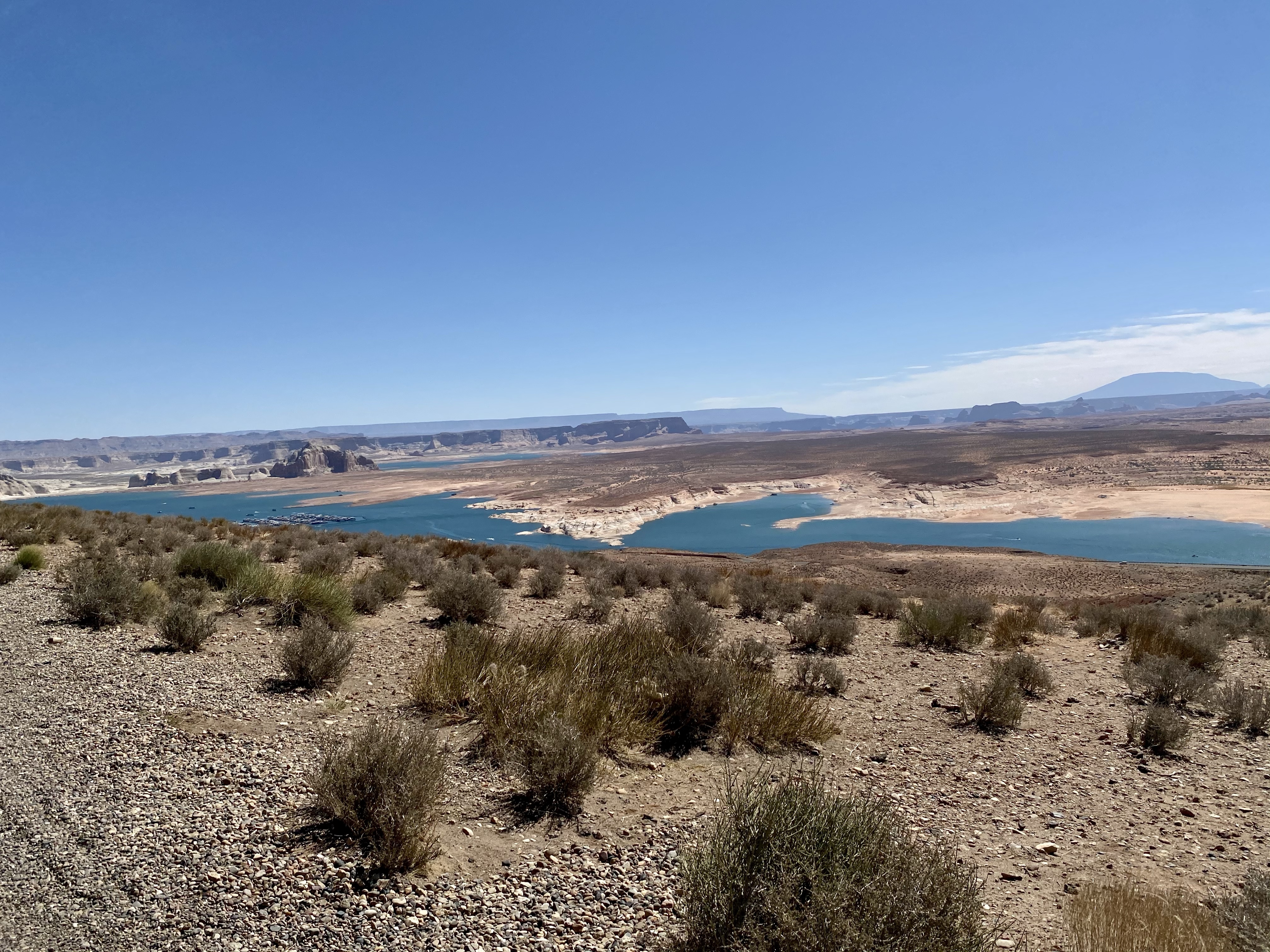
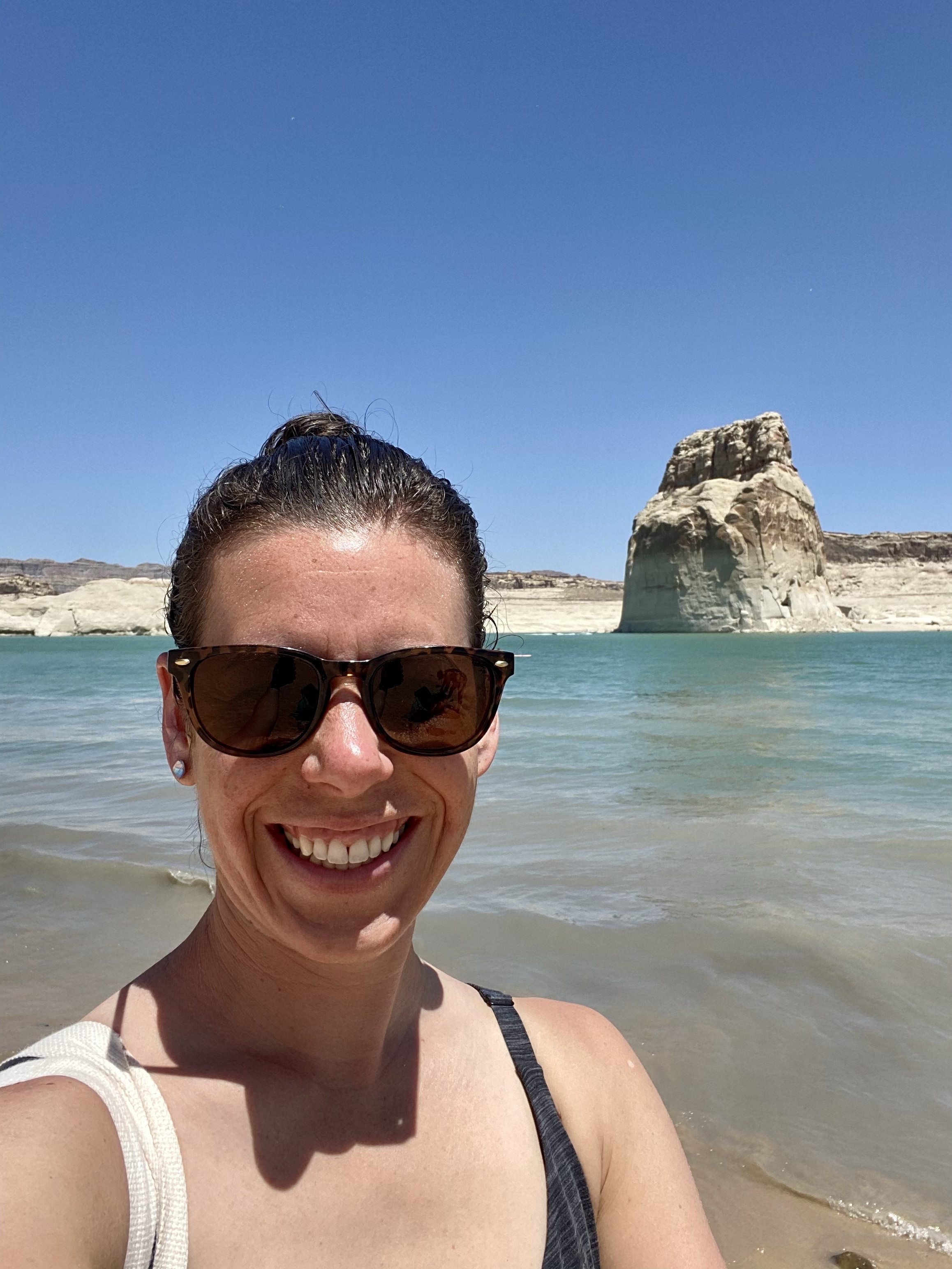
When we are all fully awake, we drove over to Wahweap Bay for some sand and sun. (Technically we crossed into Utah for this, but part of the bay is in Arizona.) We had planned on kayaking for our last day together, but strong winds deterred us. Instead, a day at the shore would do.
With the right vehicle, you can drive right down to the water and camp on the beach. I do not have such a vehicle, but I did make it down to the first landing. It was a little touch and go when I came upon some loose sand, and I got a little stressed when Crystal kept driving around looking for the right spot, but we finally parked with a view and walked the couple hundred feet down to the water.
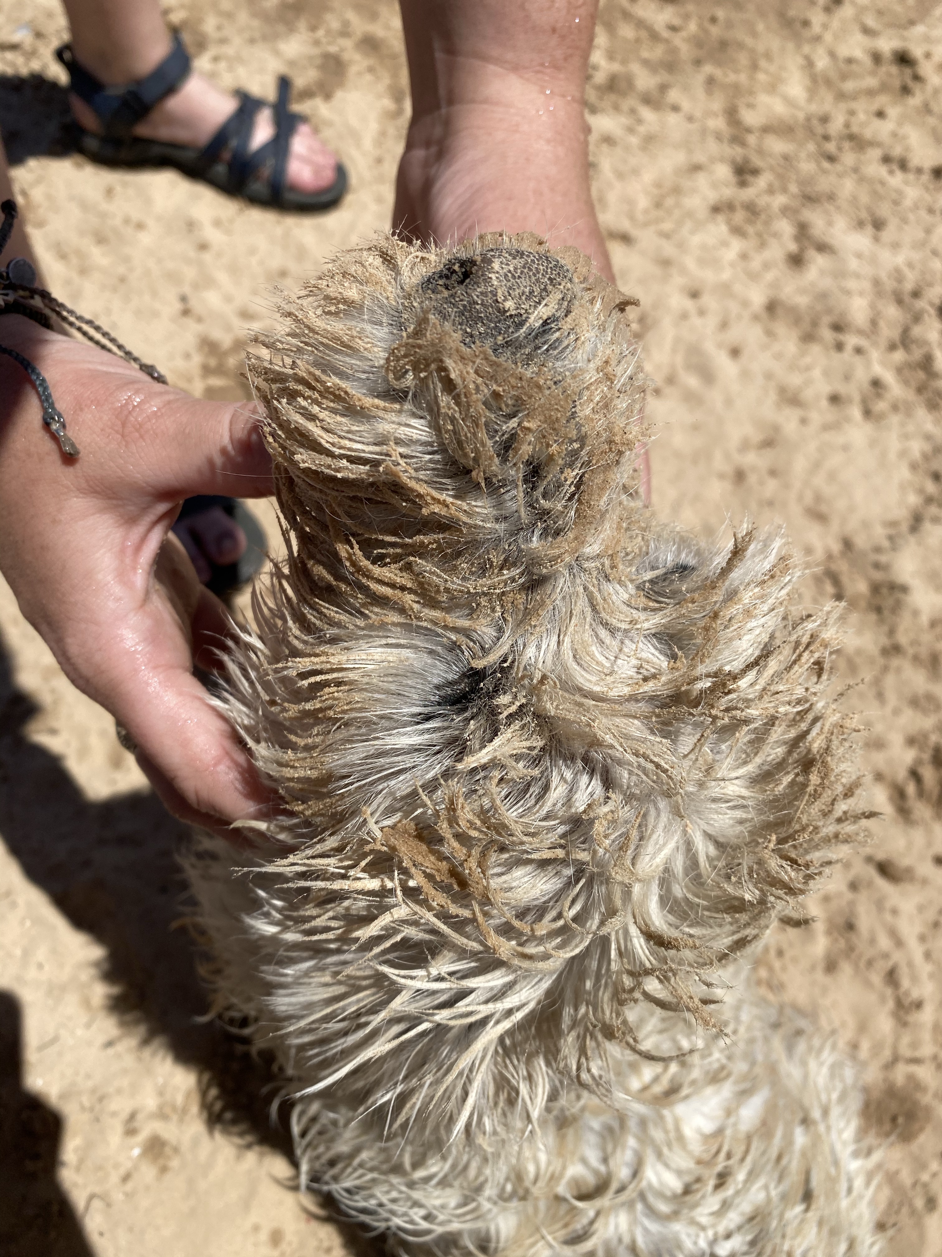
The bay was crystal clear and comfortable, great for a good dip and twirl. Max came in too, much to his disappointment. He’s a good swimmer, but did not appreciate being brought out deep by Crystal. He got his revenge though. Each time he swam back to shore he rolled around in the sand and had a muddy, muddy face. Glad he wasn’t riding with me!
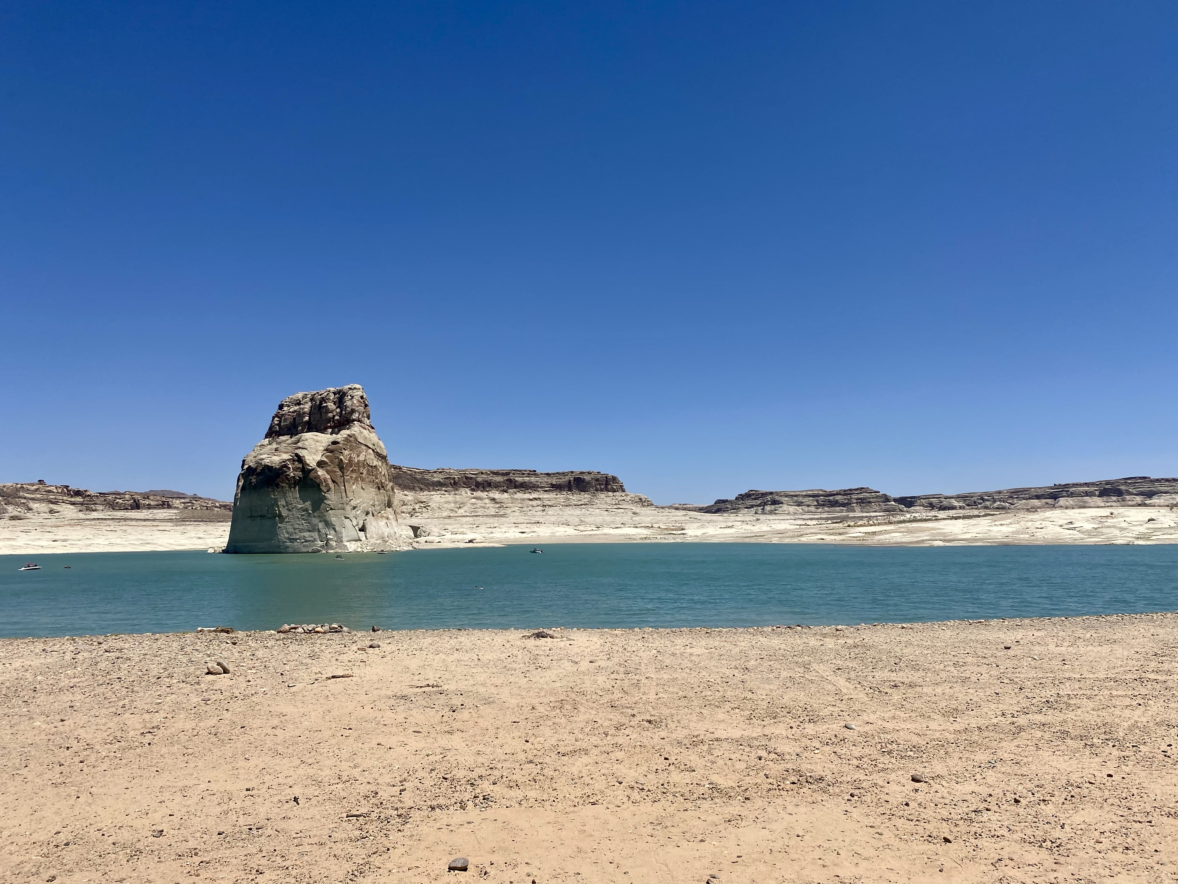
Then I saw girls jumping off the cliff and knew I had to partake! It wasn’t a high cliff, but looked so fun. Once I confirmed the water was deep enough for the plunge, I climbed up and gingerly stepped toward the edge. Then splash! Into the water I went. Awesome.
I convinced Crystal to go too and she conquered her fear. We can do hard things! Although still scared afterwards, she was glad she jumped.
Shortly after we cleaned up and said our goodbyes, full of hugs and promises to visit each other again soon. It was certainly nice to have company for a while! And just like that, I was off to my next park. Any guesses?
