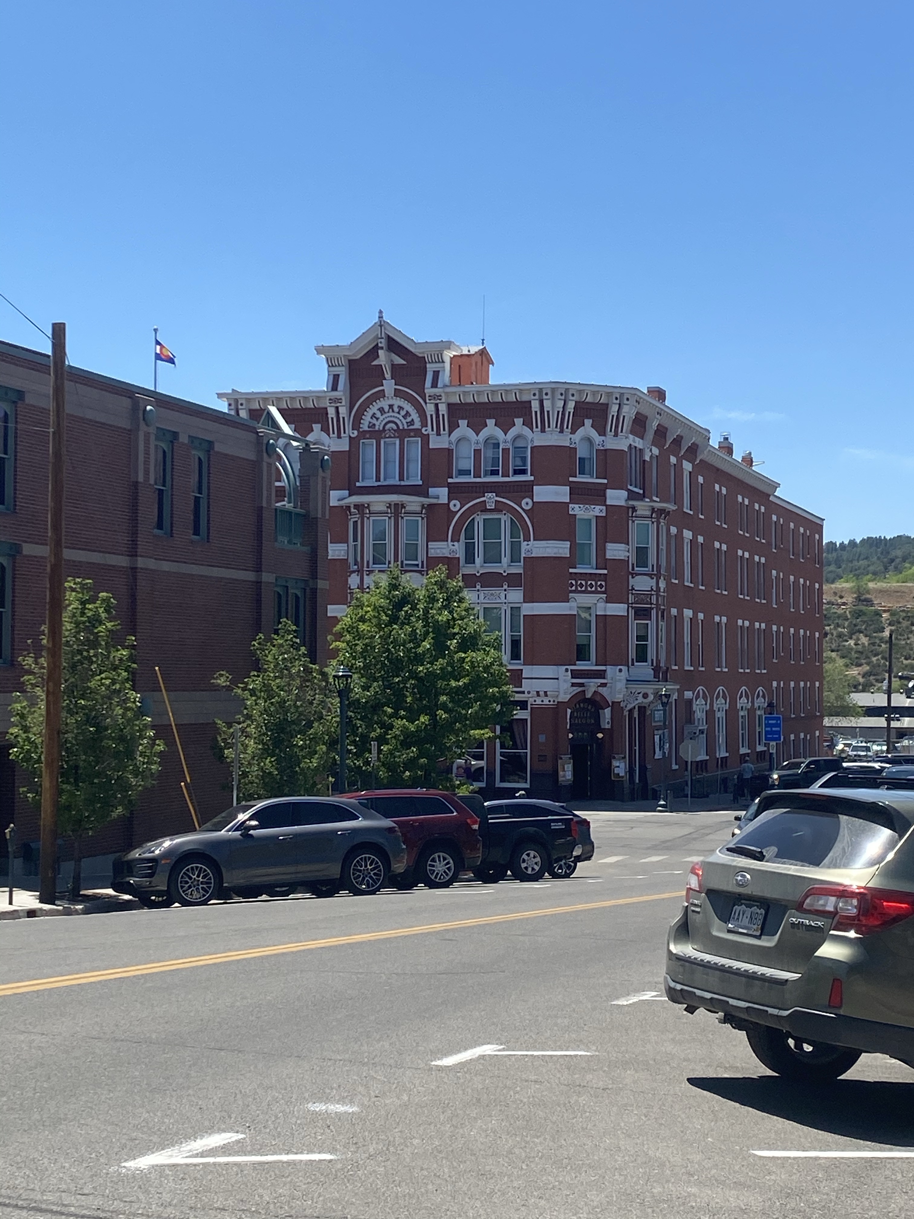
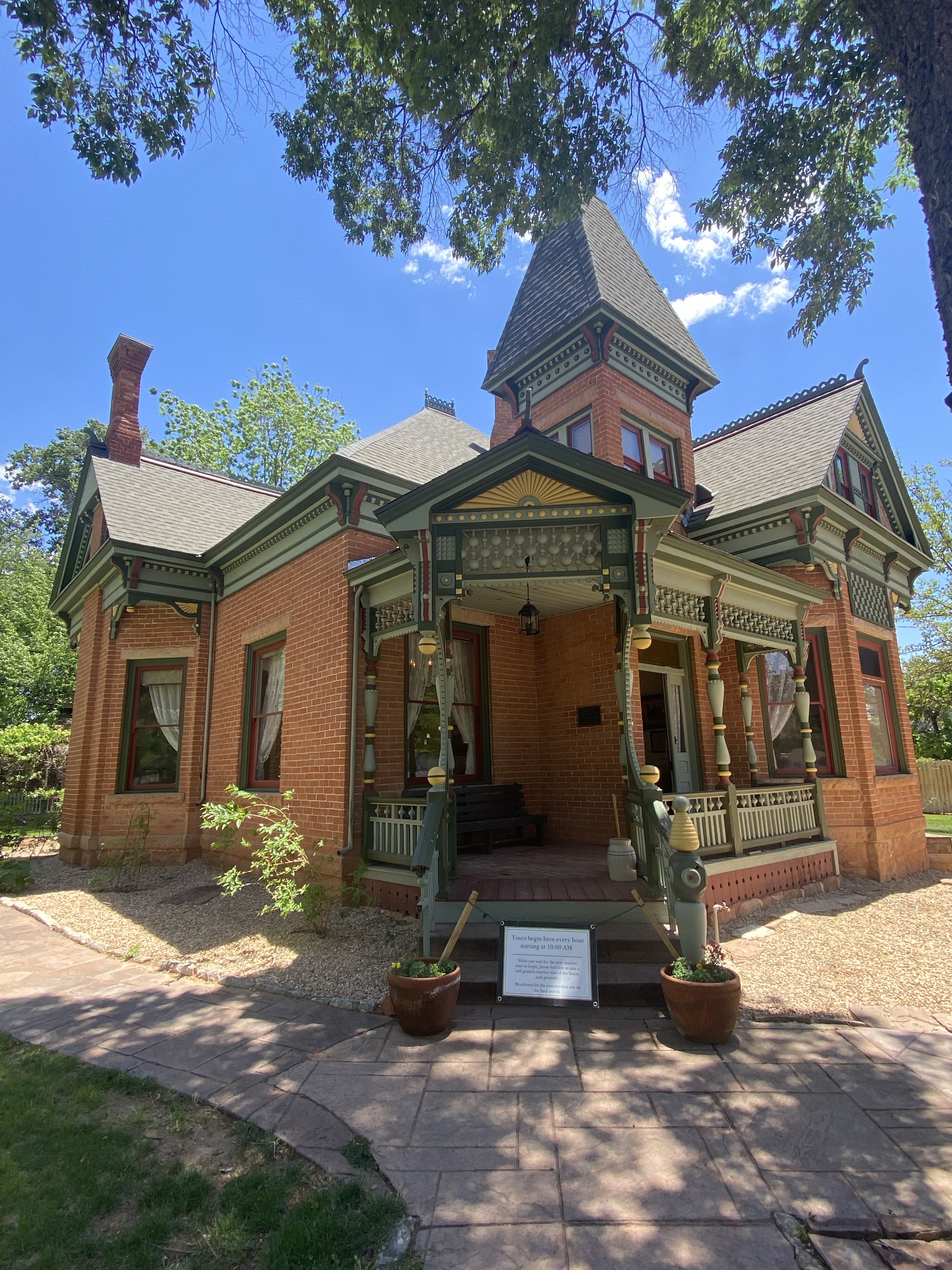
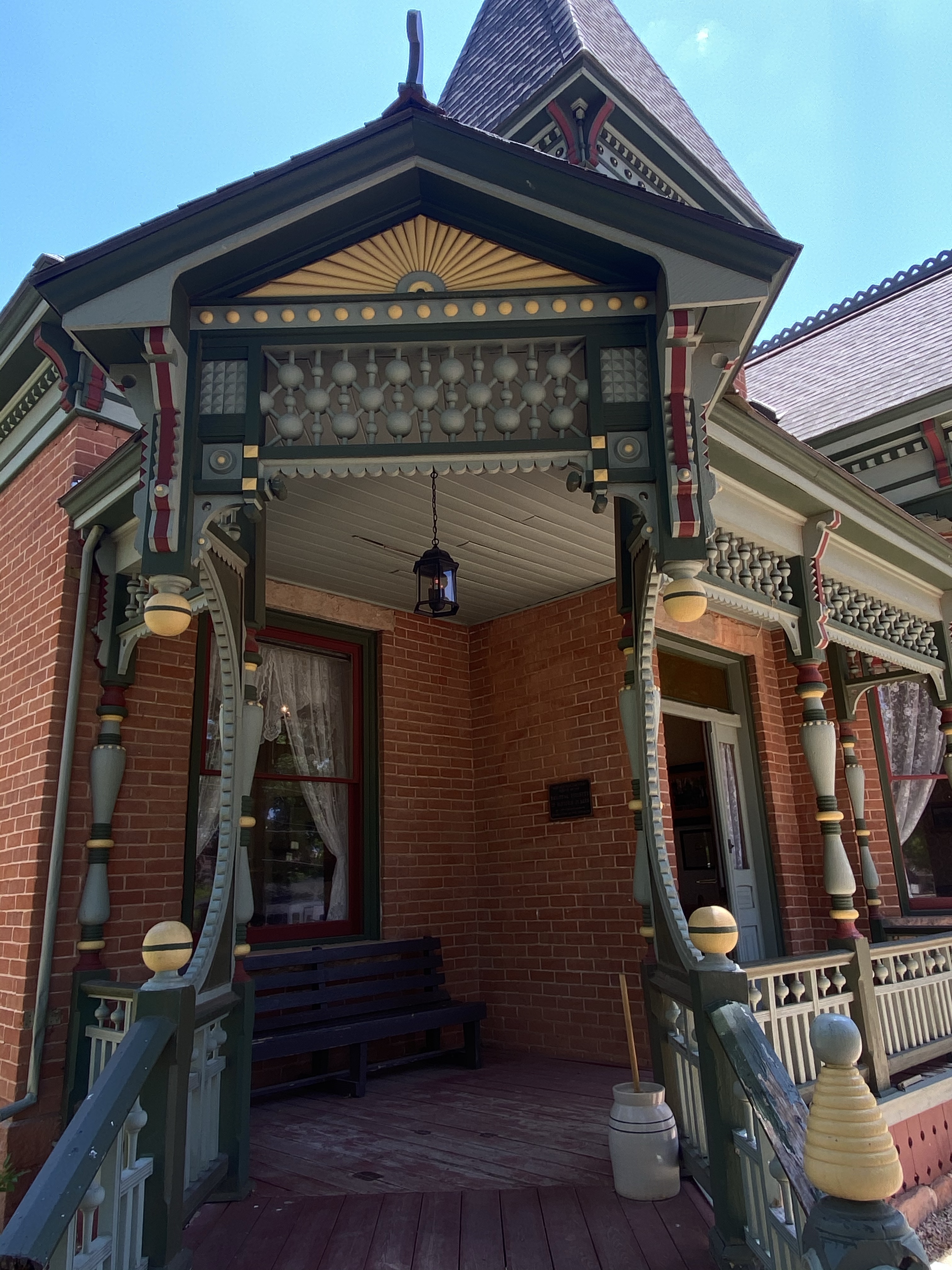
After leaving Mesa Verde, on my way to Great Sand Dunes, I indulged in a day of lavish self-care. Durango, Colorado has long been a favorite city of my parents’, so I had to stop on my way across the state. If we were to relocate to Colorado, this spot is high on the list!
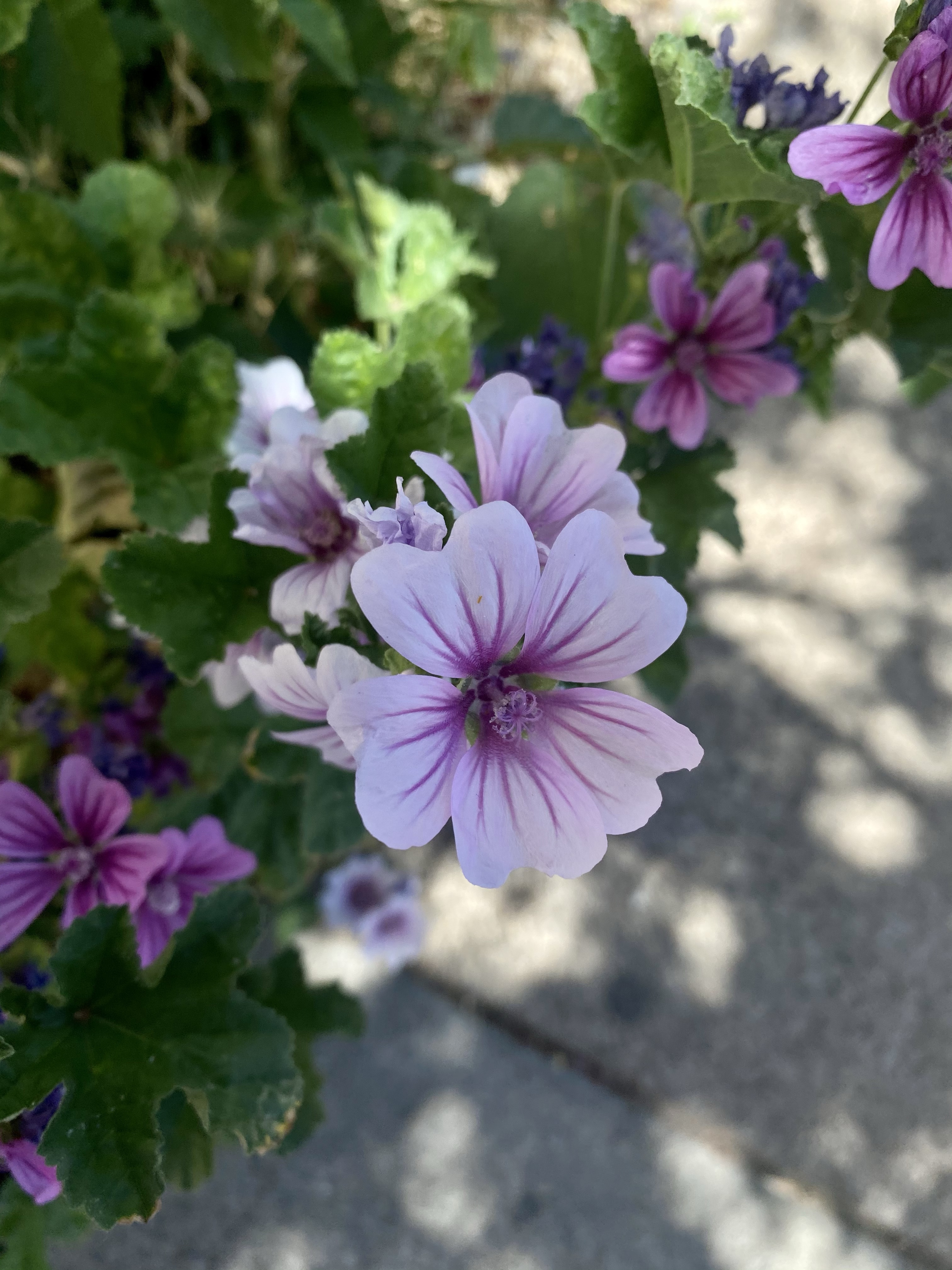
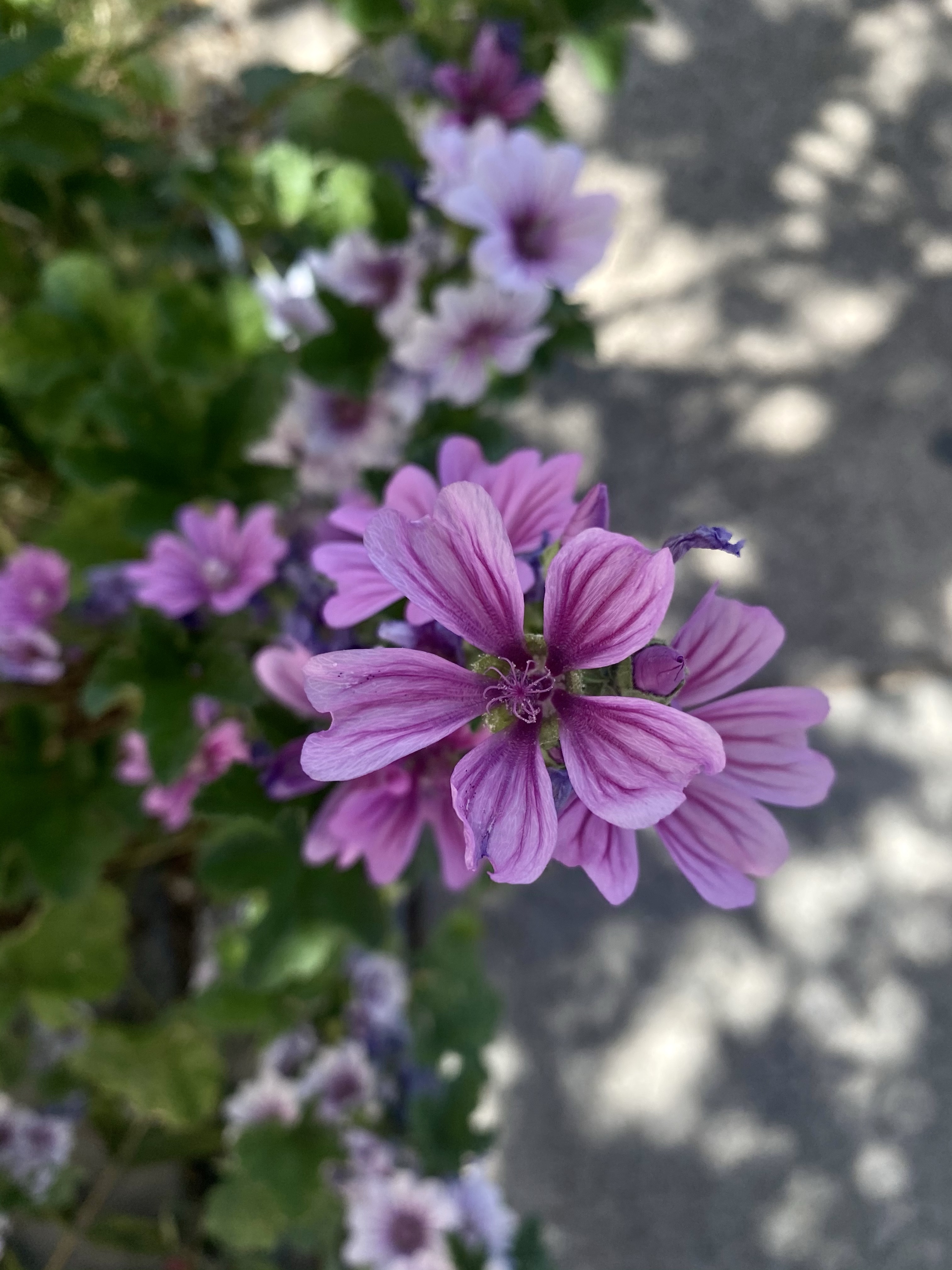
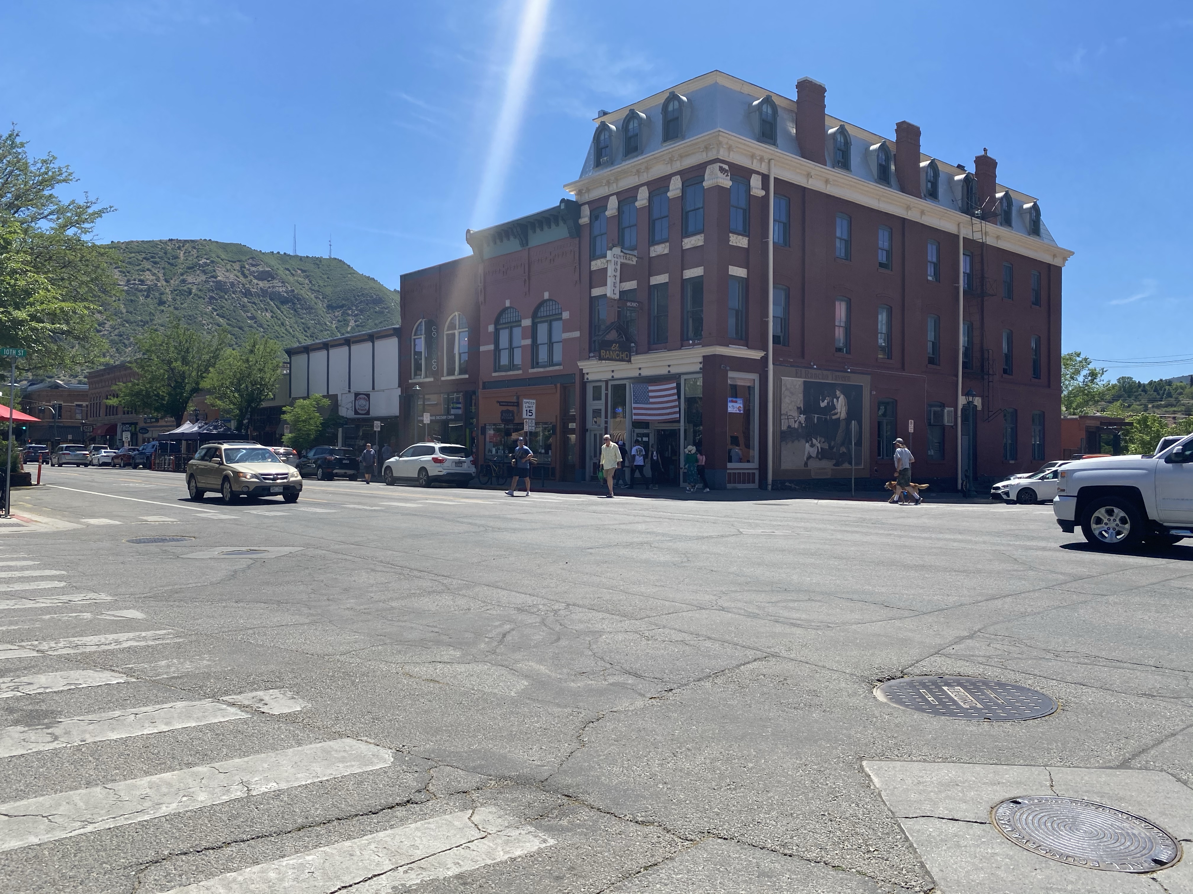
Durango is a lovely small city nestled between the mountains with a bustling main street. Here you can shop, eat, drink, enjoy the mountains, and visit the recreation center for a workout, swim in the pool, or dip in the hot tub. Sounds lovely, right? I spent the day walking around and poking in and out of stores. A local business owner recommended Dandelion Cafe, so there I went for lunch.
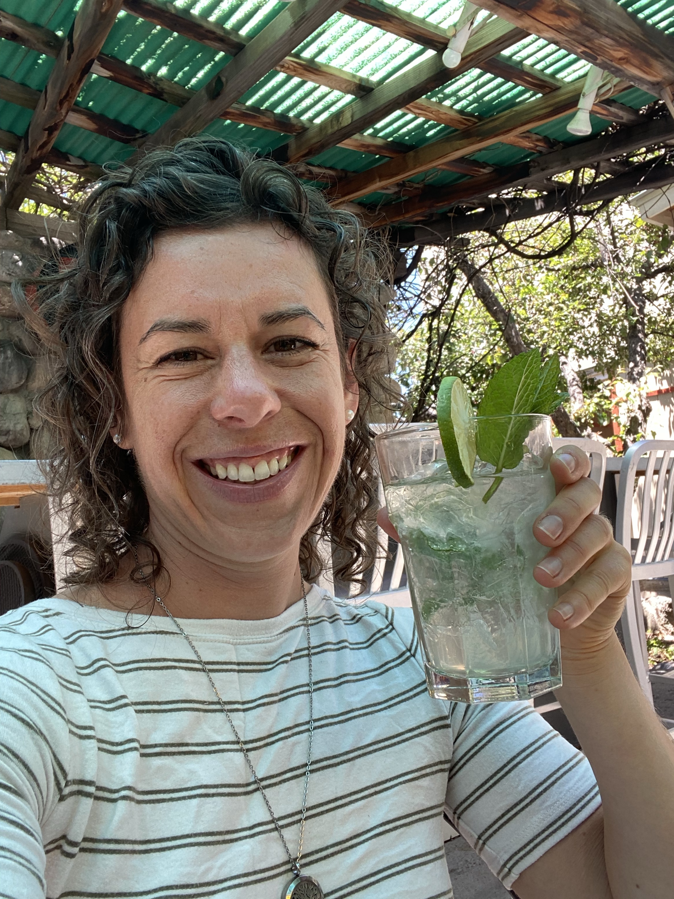
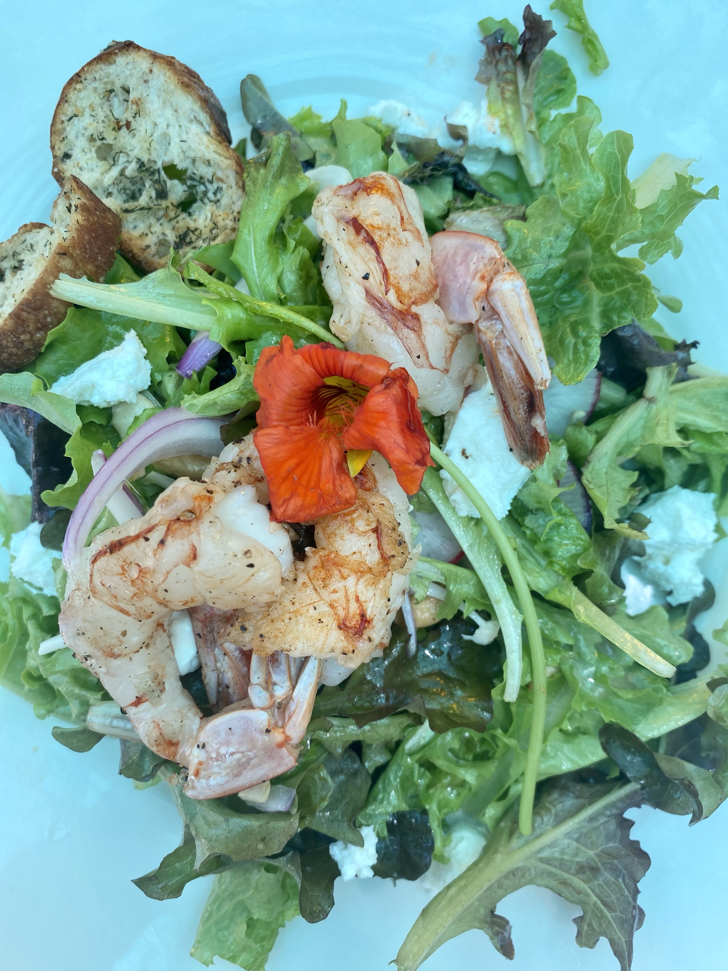
Other than a pick up order from Chipotle mid-trip, I haven’t eaten out in nearly two months! Dandelion Cafe was the perfect place to treat myself. I had a patio table in the corner all the myself, great for people watching and privacy. Assorted olives for an appetizer, salad special with shrimp for my main, and a delicious house cocktail for a splurge. Yum!
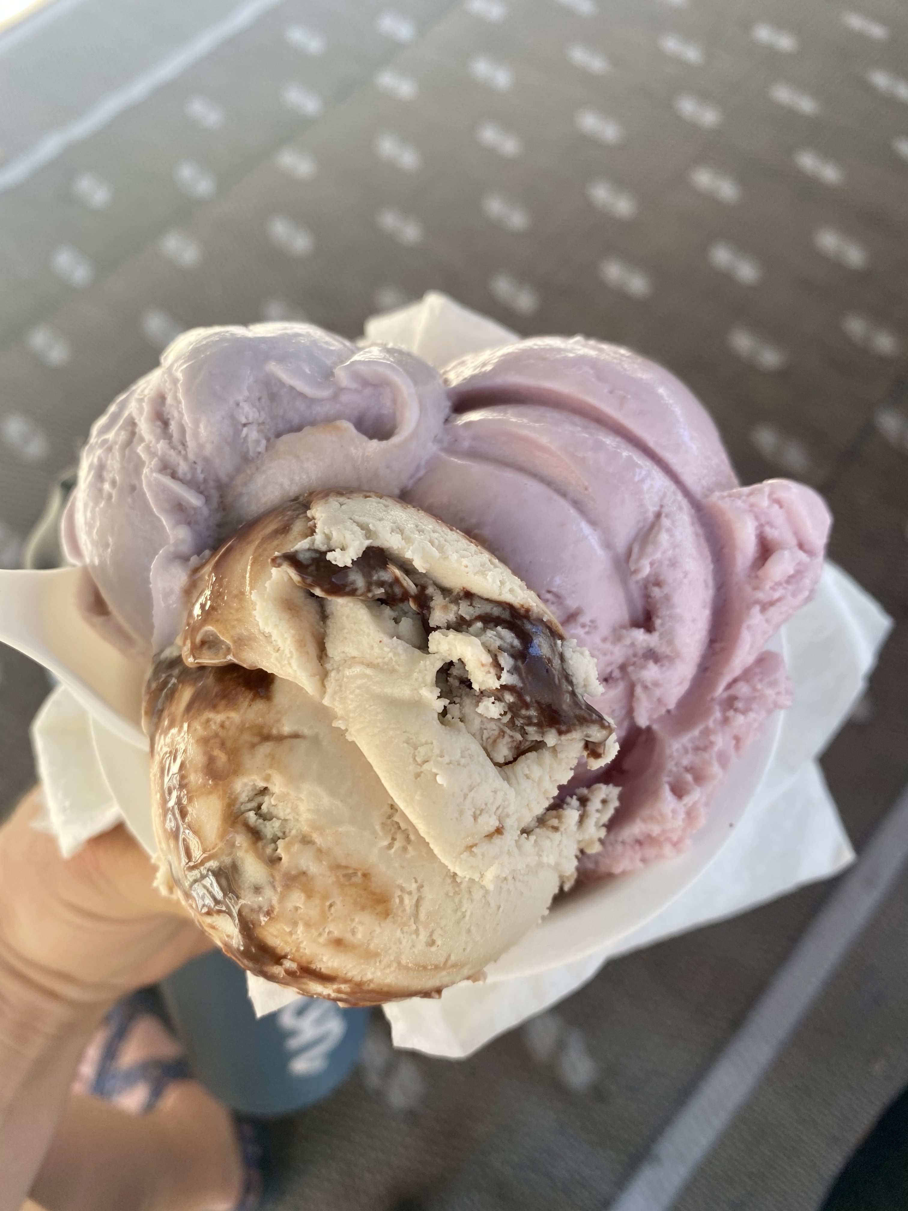
After, I went to Cream Bean Berry for ice cream. Homemade and full of delicious flavors, I couldn’t pass it up. In case you don’t know, I LOVE ice cream and am bit of an “ice cream snob.” I’m chipset about where I patron, usually only homemade places. I know, I’m spoiled. This spot didn’t disappoint. A triple scoop let me enjoy three flavors – honey lavender, strawberry rhubarb, and vegan peanut butter fudge. Delicious!
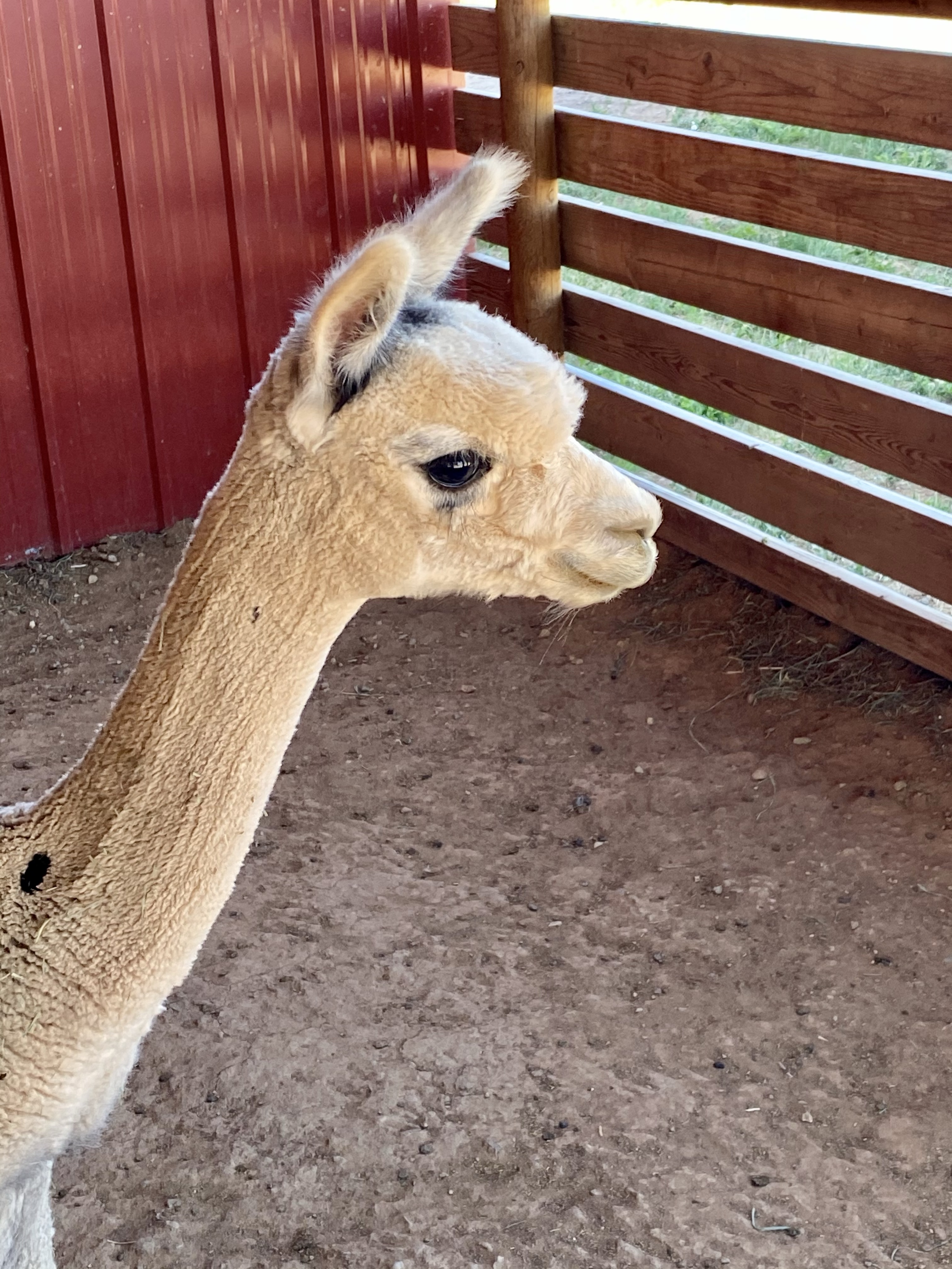
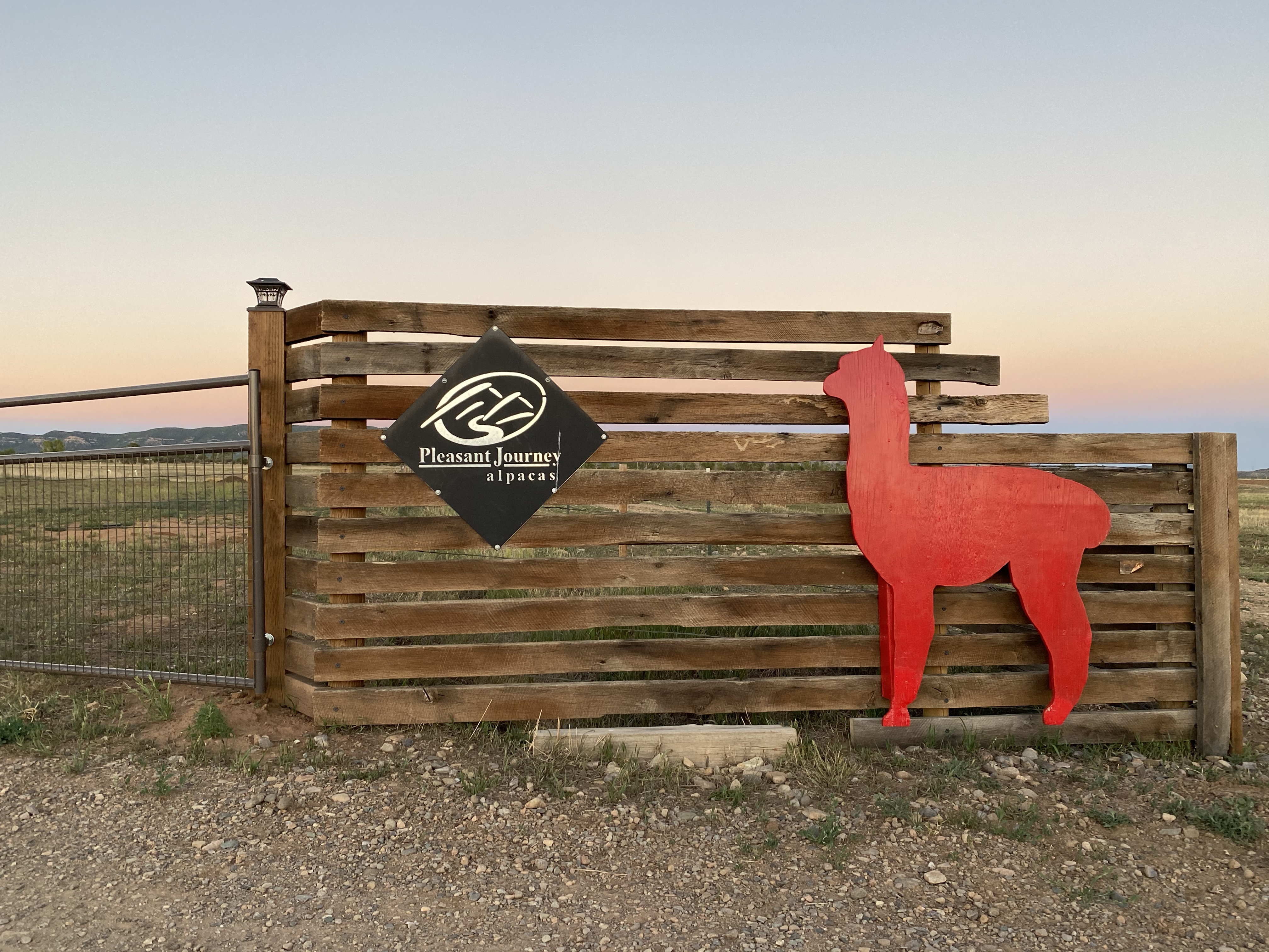
From there I went to the post office to mail notes and headed to my Harvest Host spot for the night, an alpaca farm!
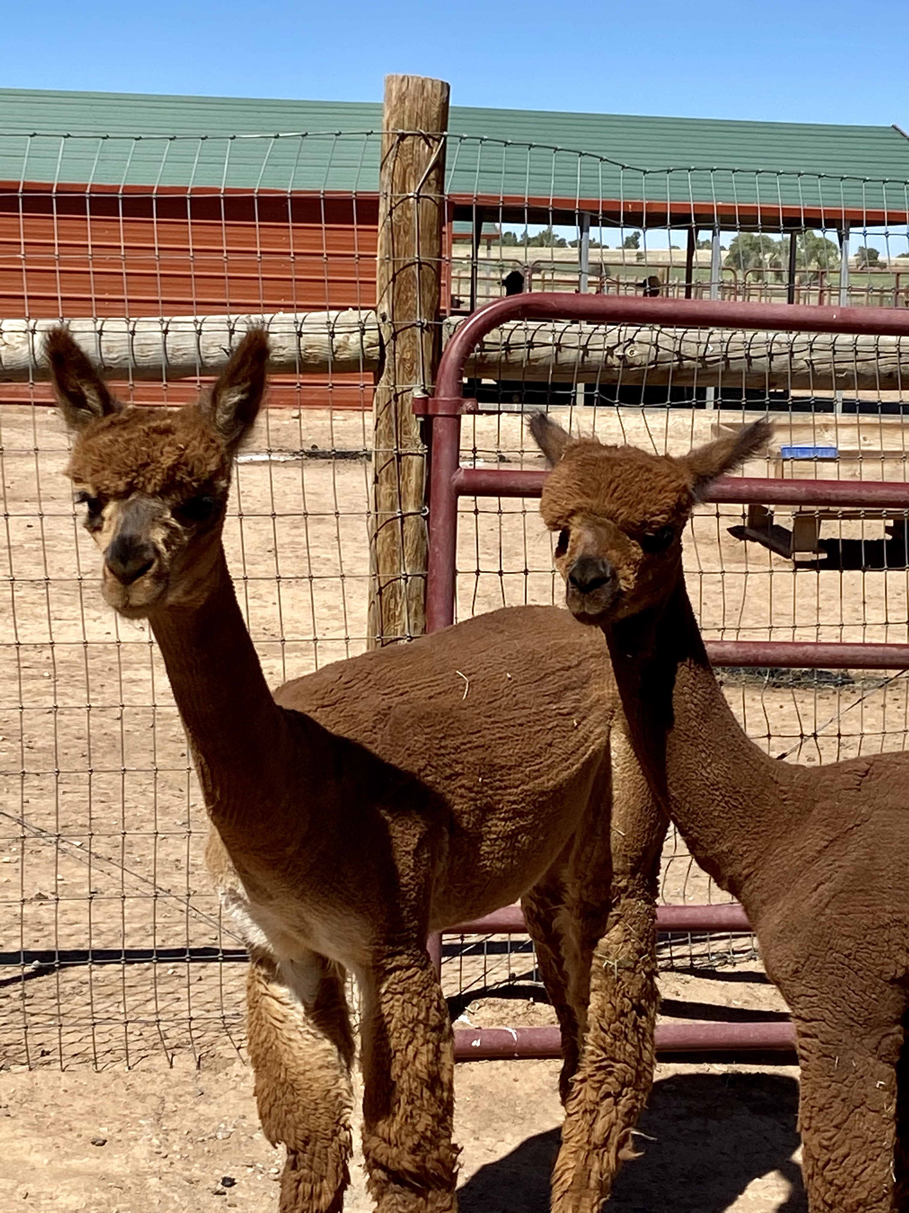
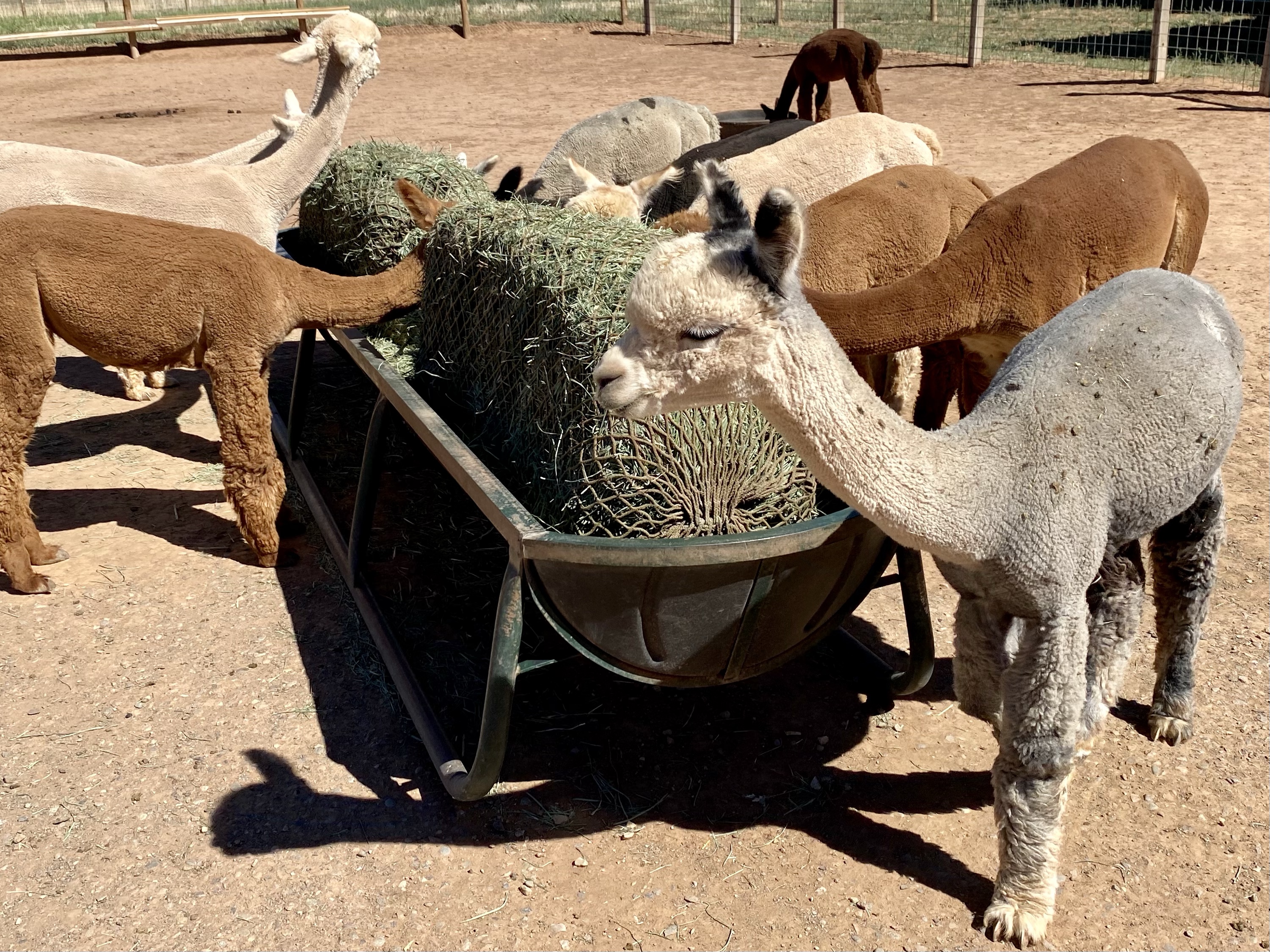
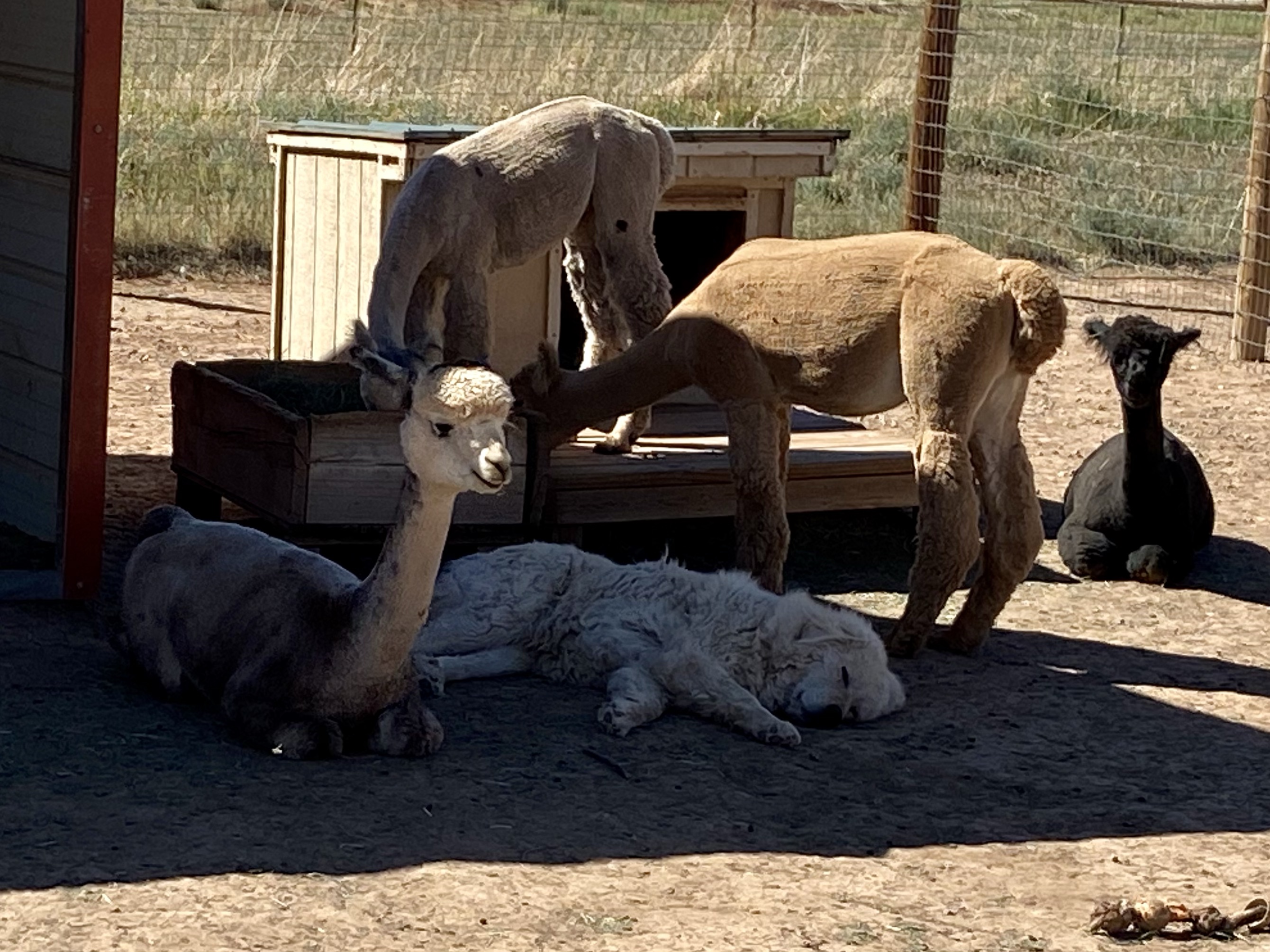
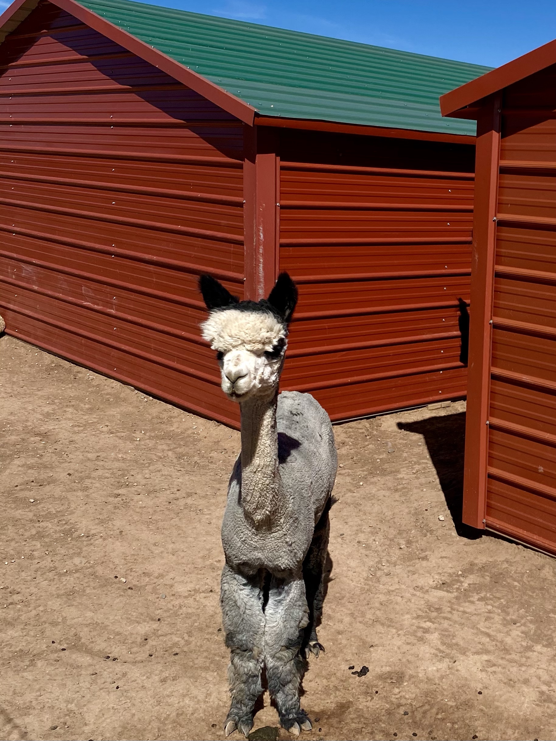
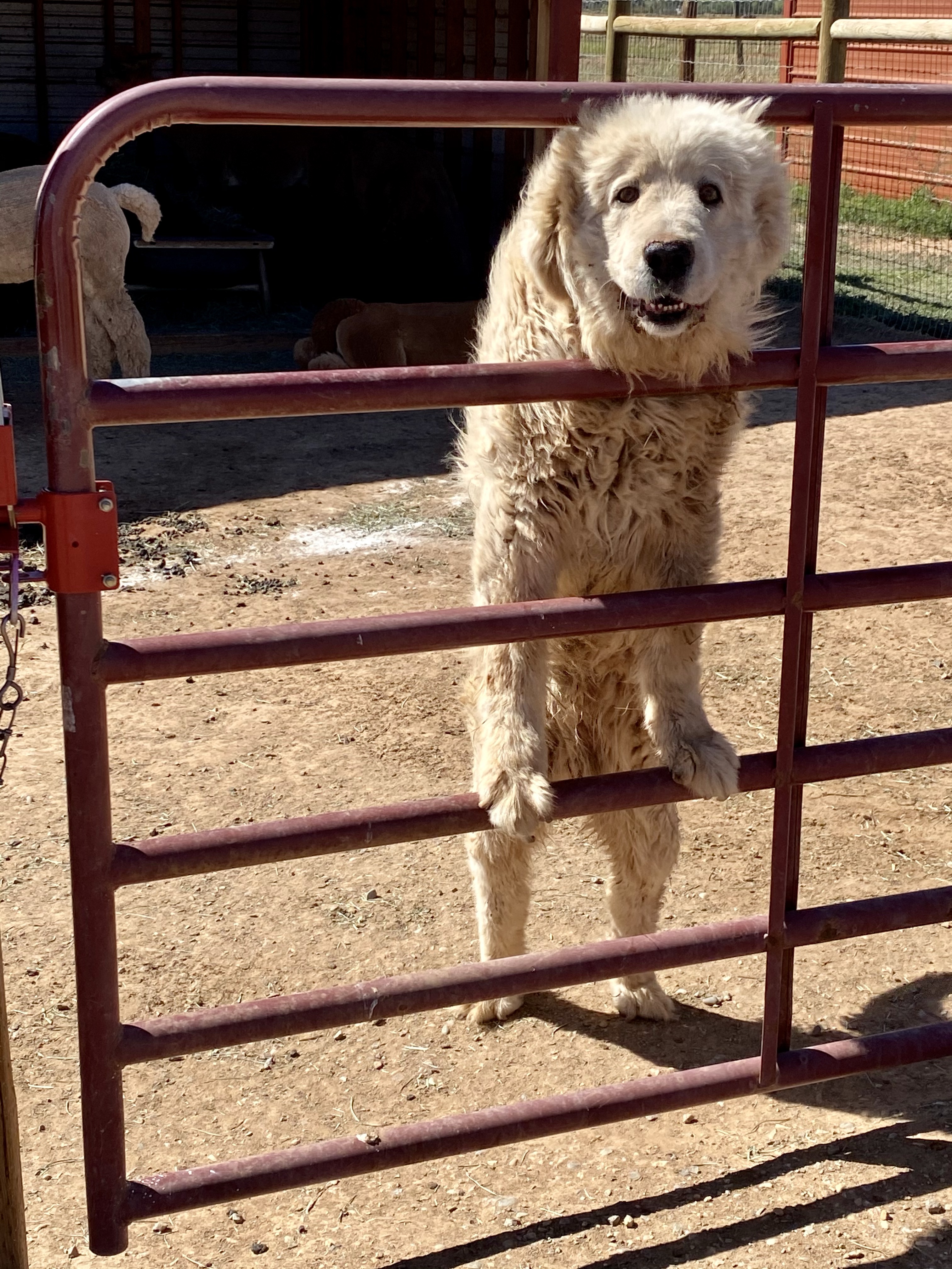
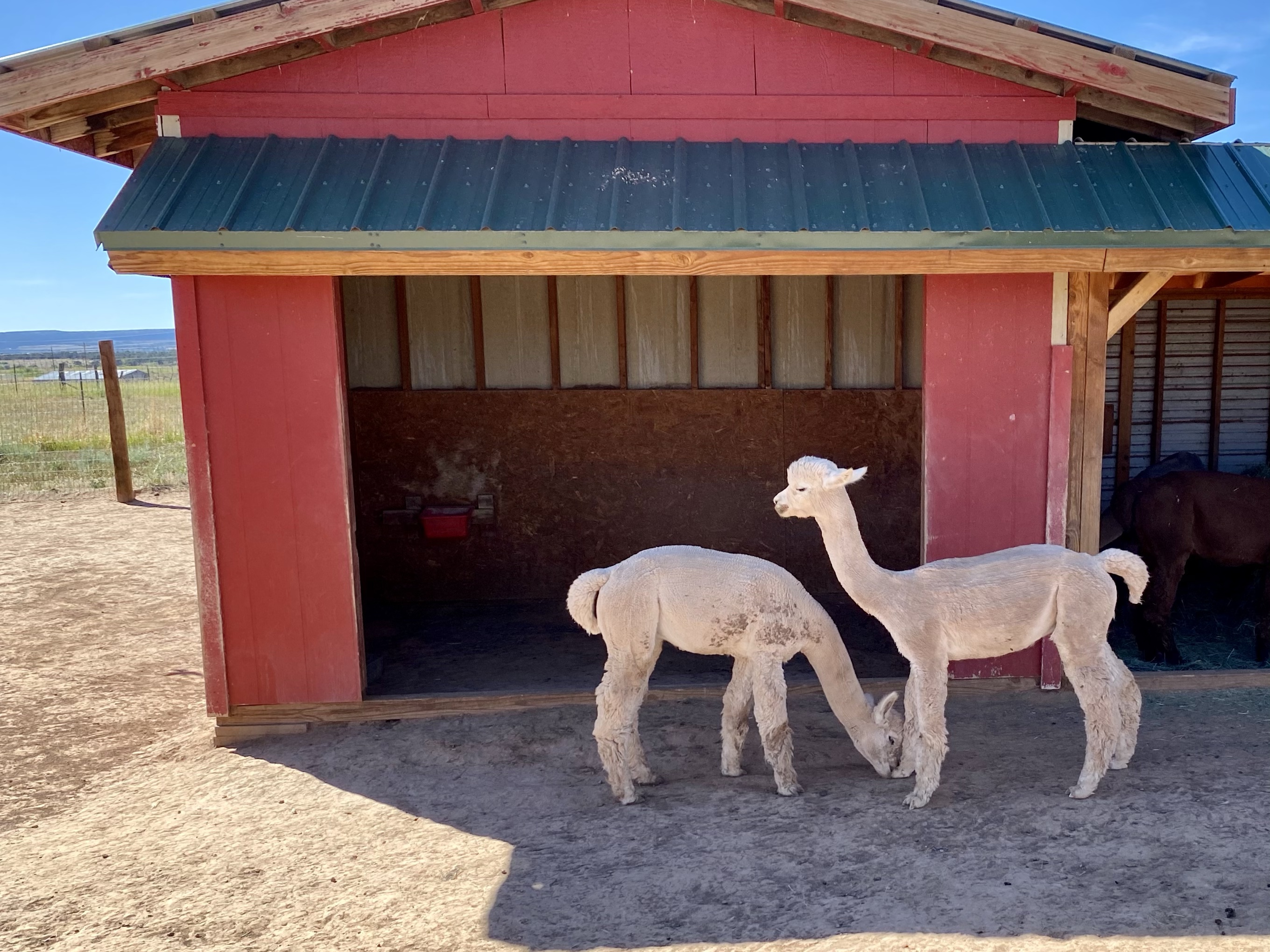
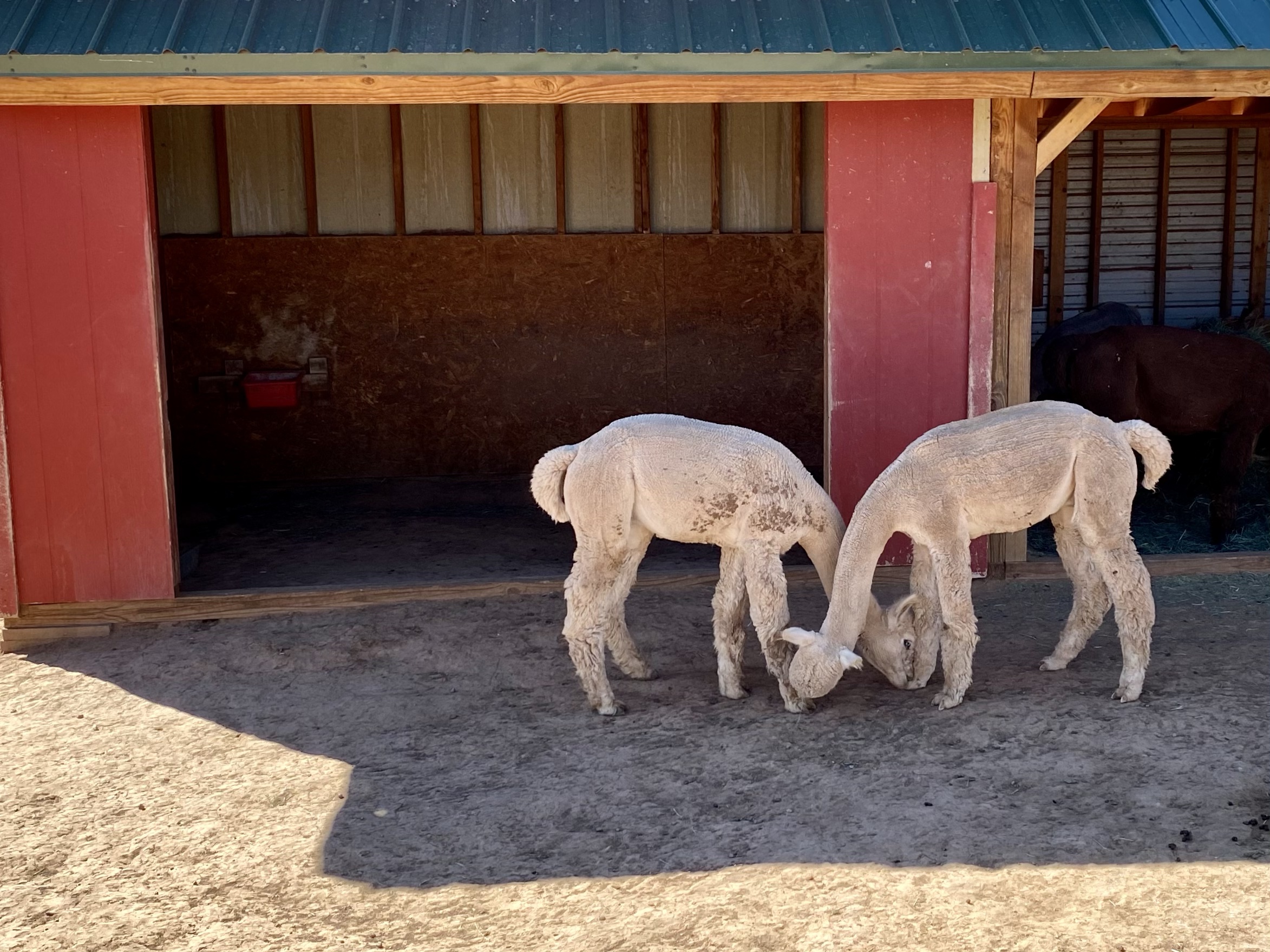
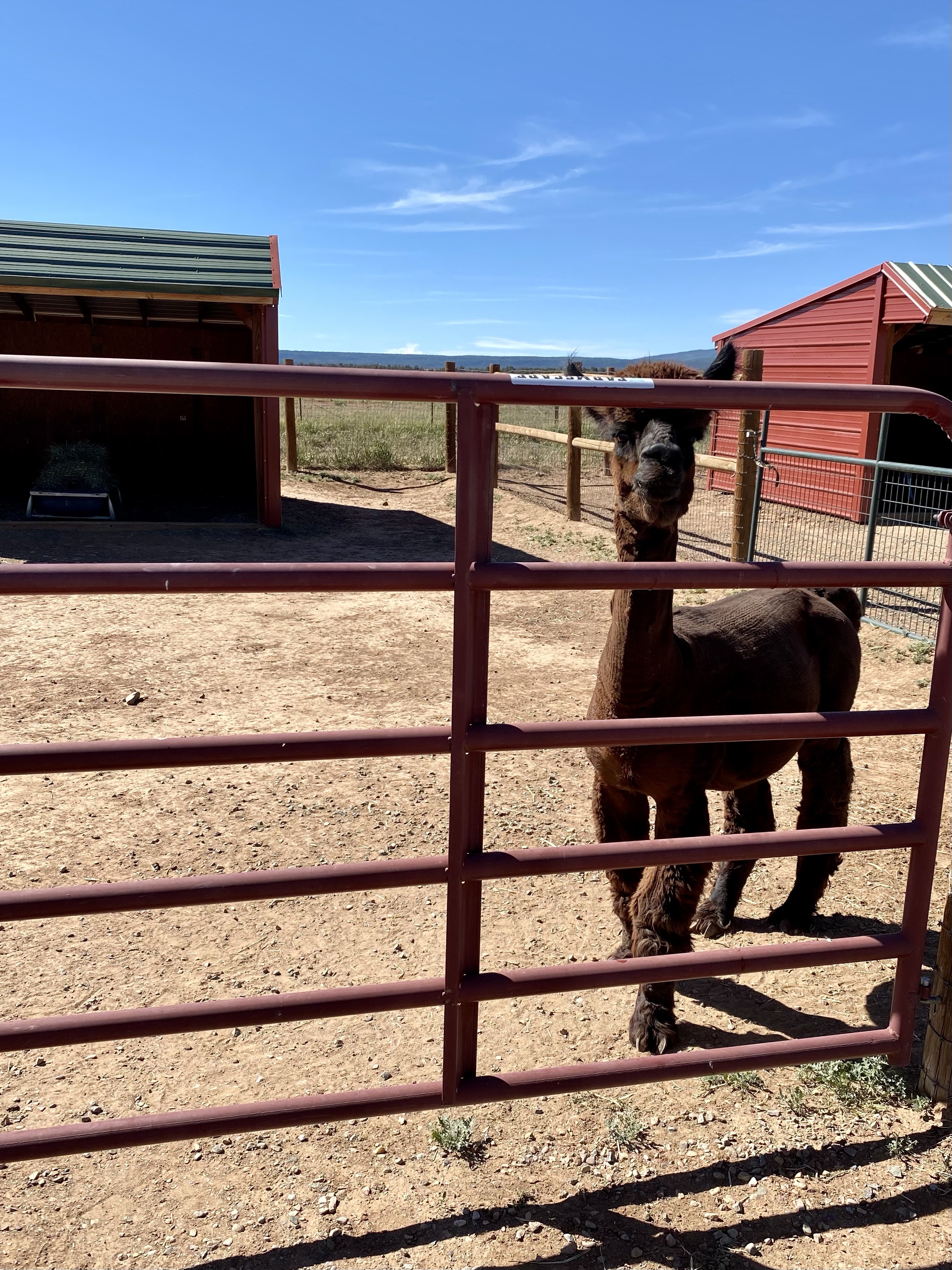
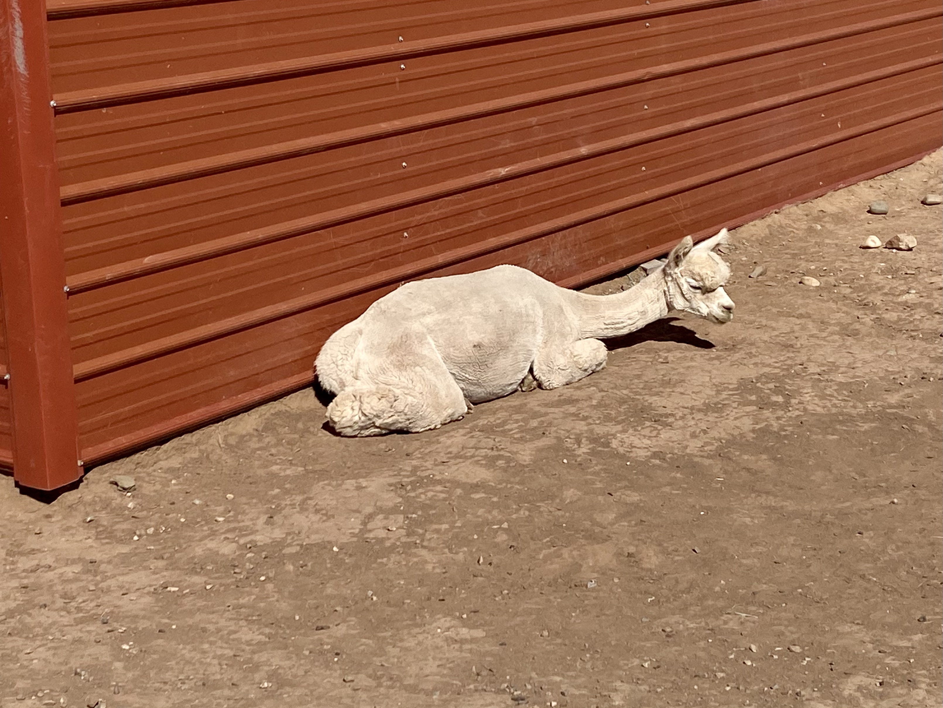
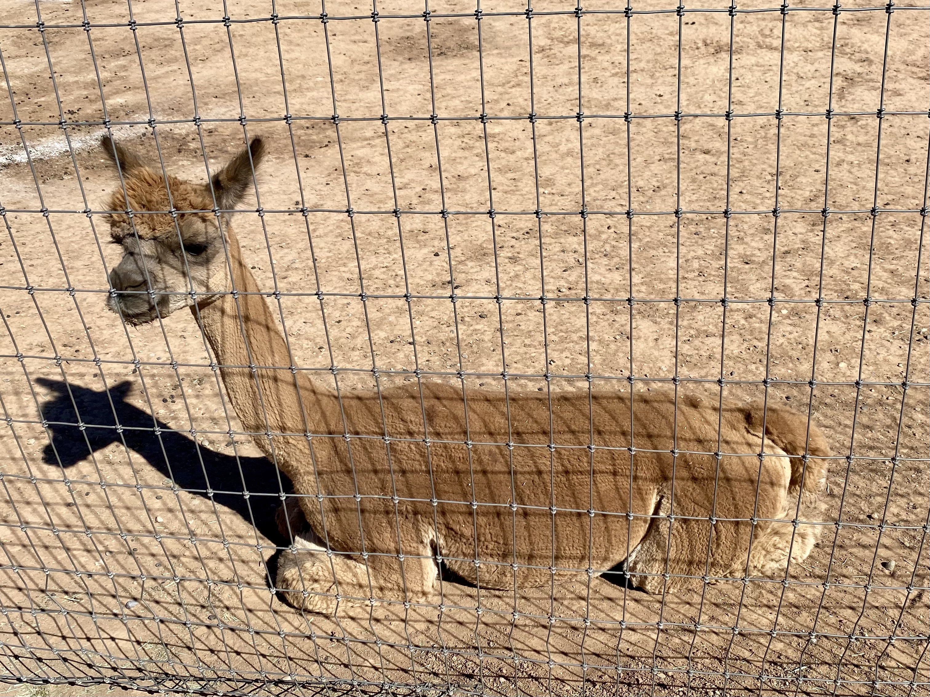
Pleasant Journey Alpacas is outside of Durango on a quiet farm. There Sue gave us a tour of the alpacas and taught us all about how to care for them. I learned that people also show alpacas, like they show dogs or horses! The alpacas are judged in their fleece quality as well as their body shape. PJA has many award winning alpacas! Another interesting thing is that there are 16 different fleece colors for alpacas. Who knew? Alpacas also can lay down on their legs, the front two folding under in a V and the back folding like a Z. It doesn’t look comfortable, but apparently it is for them! Finally, I learned how to tell the difference between llamas and alpacas. Llamas are much larger, but they also have banana shaped ears while alpacas have straight ears! Now I will never be confused.
After meeting all the babies, petting a few and feeling their super soft fleece, we met the adult males and females and the guard dogs. It is quite the operation! PJA has their own herd and boards alpacas for many other farmers. There were at least 40 animals here!
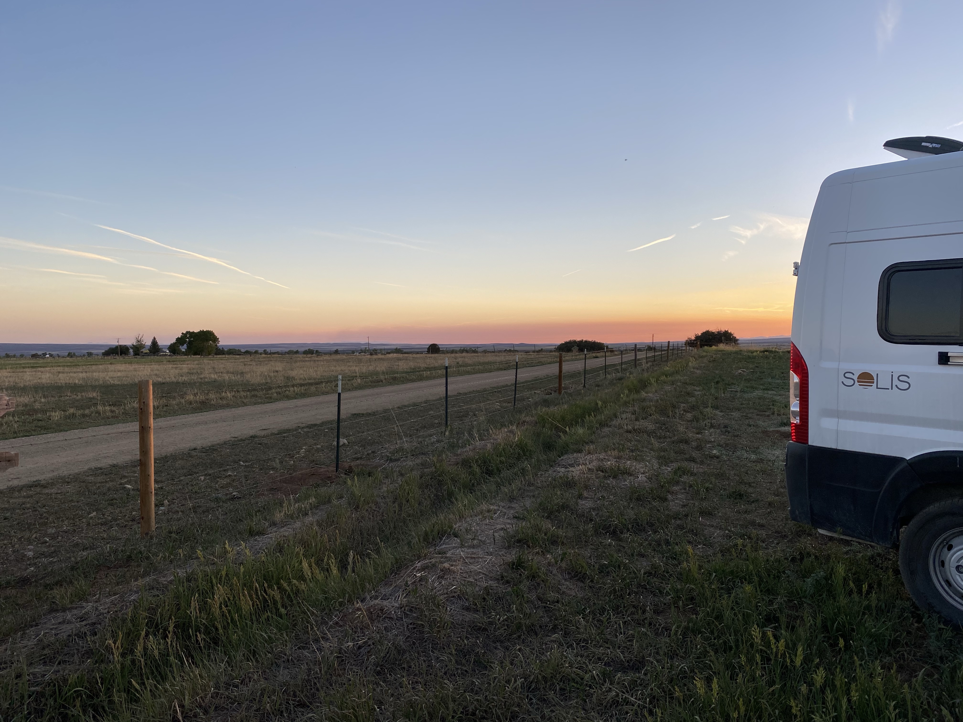
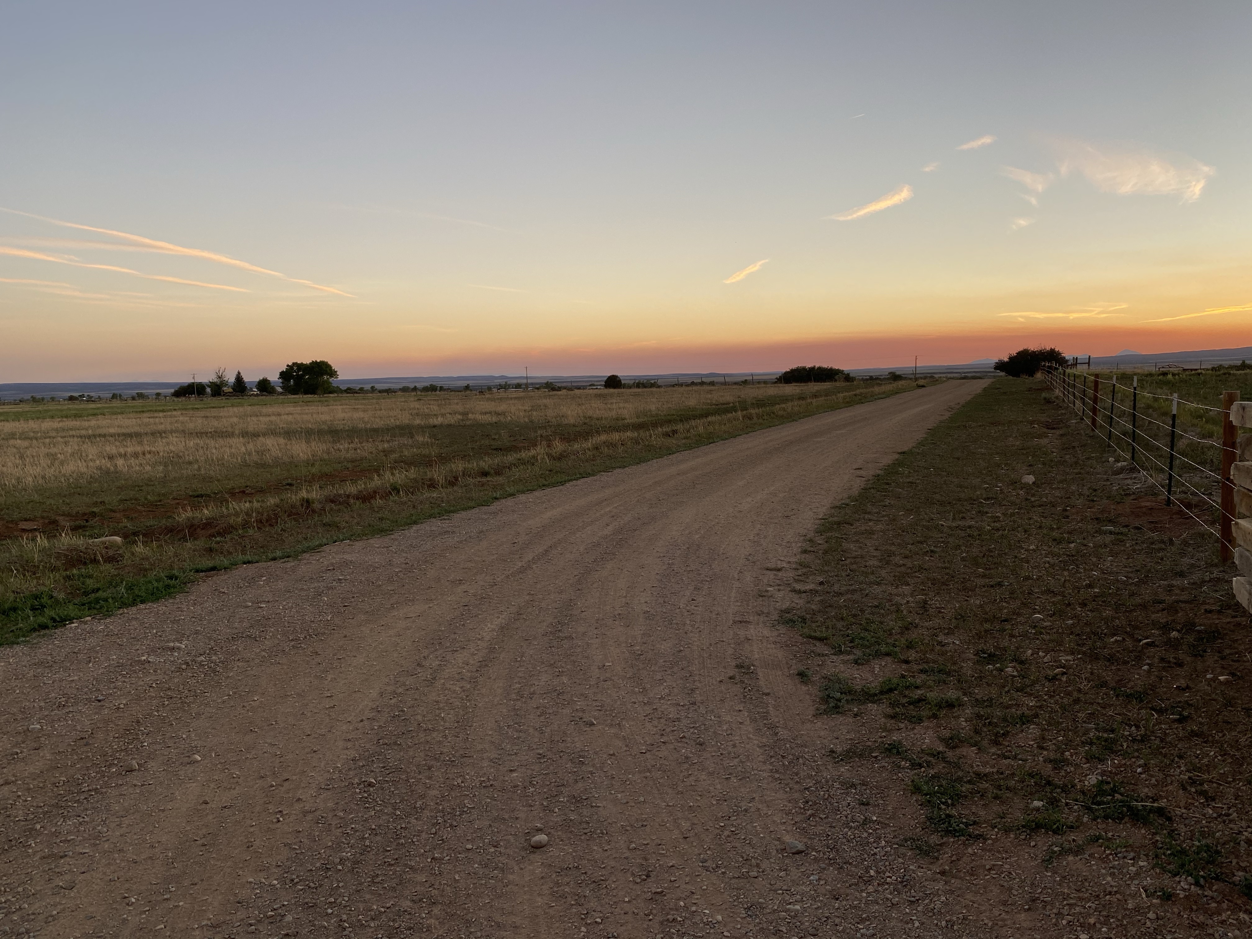
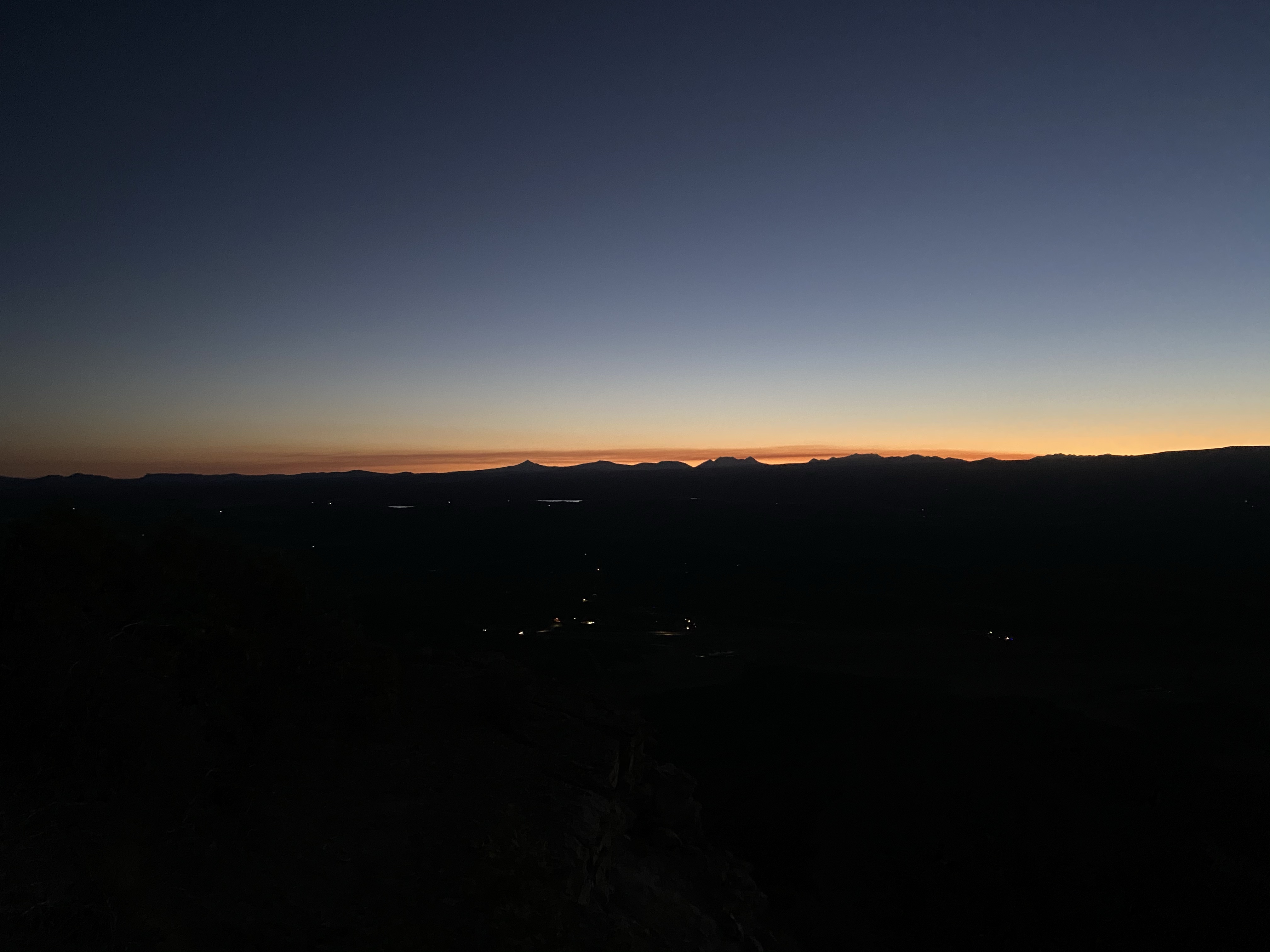
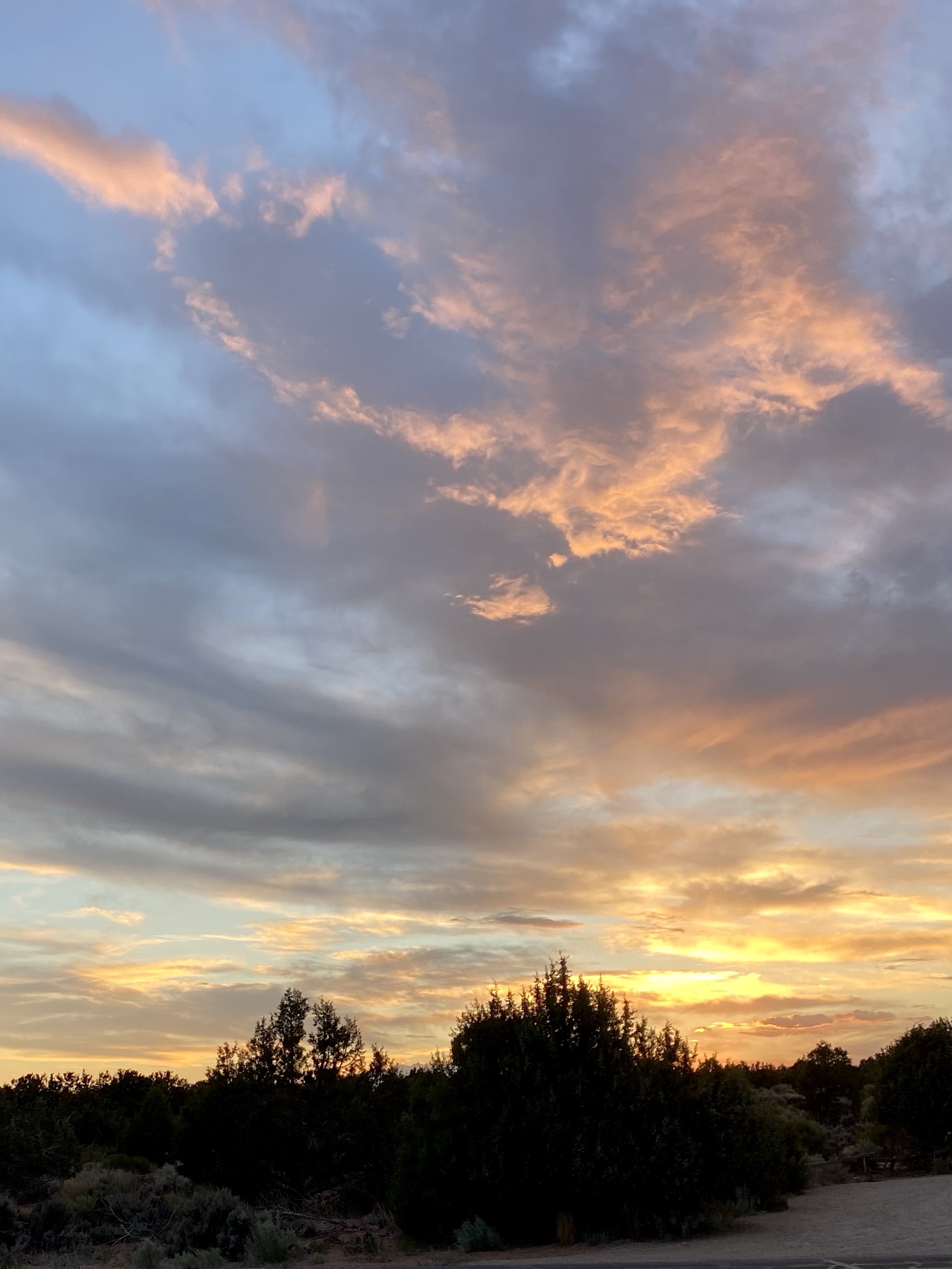
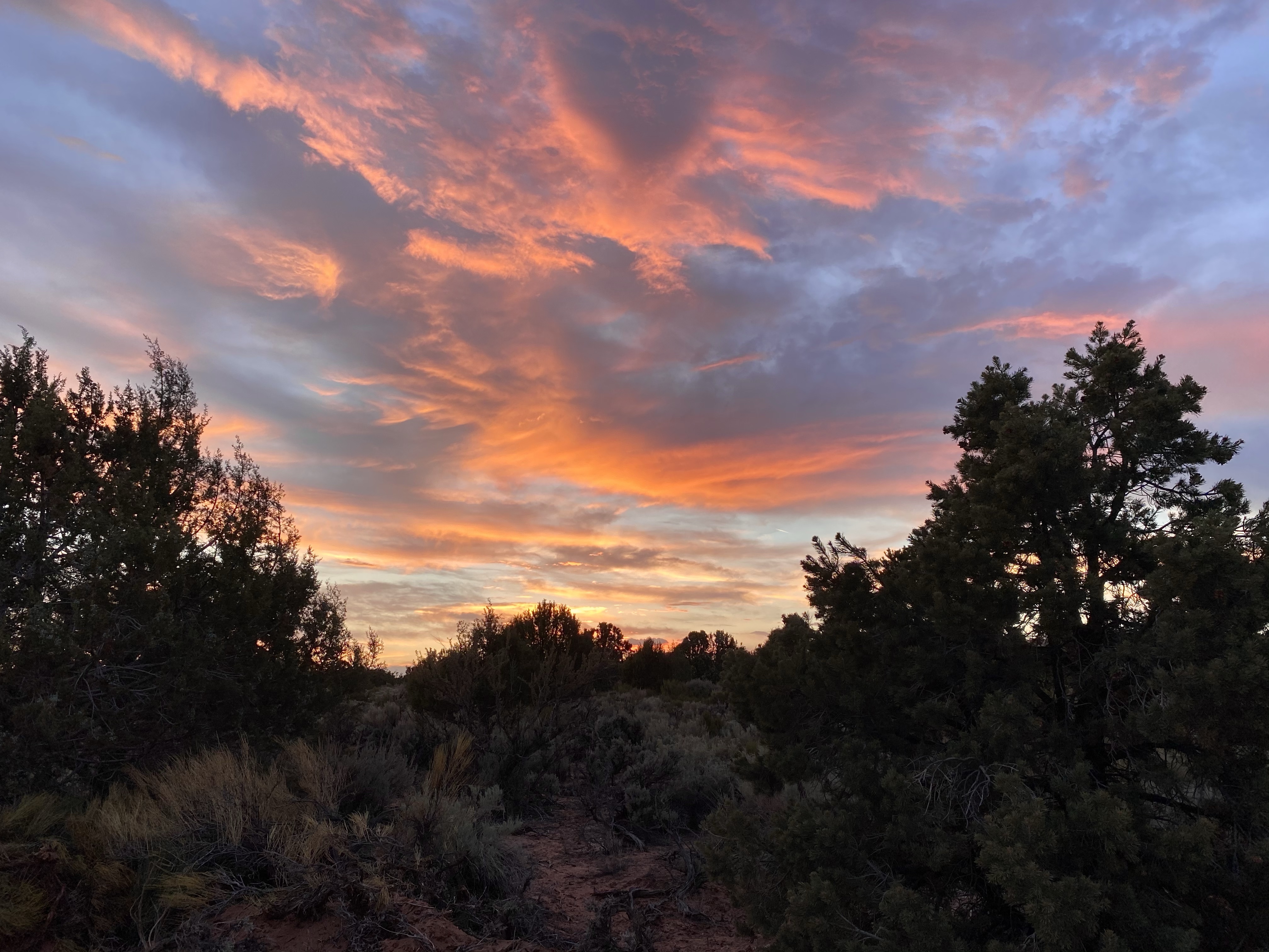
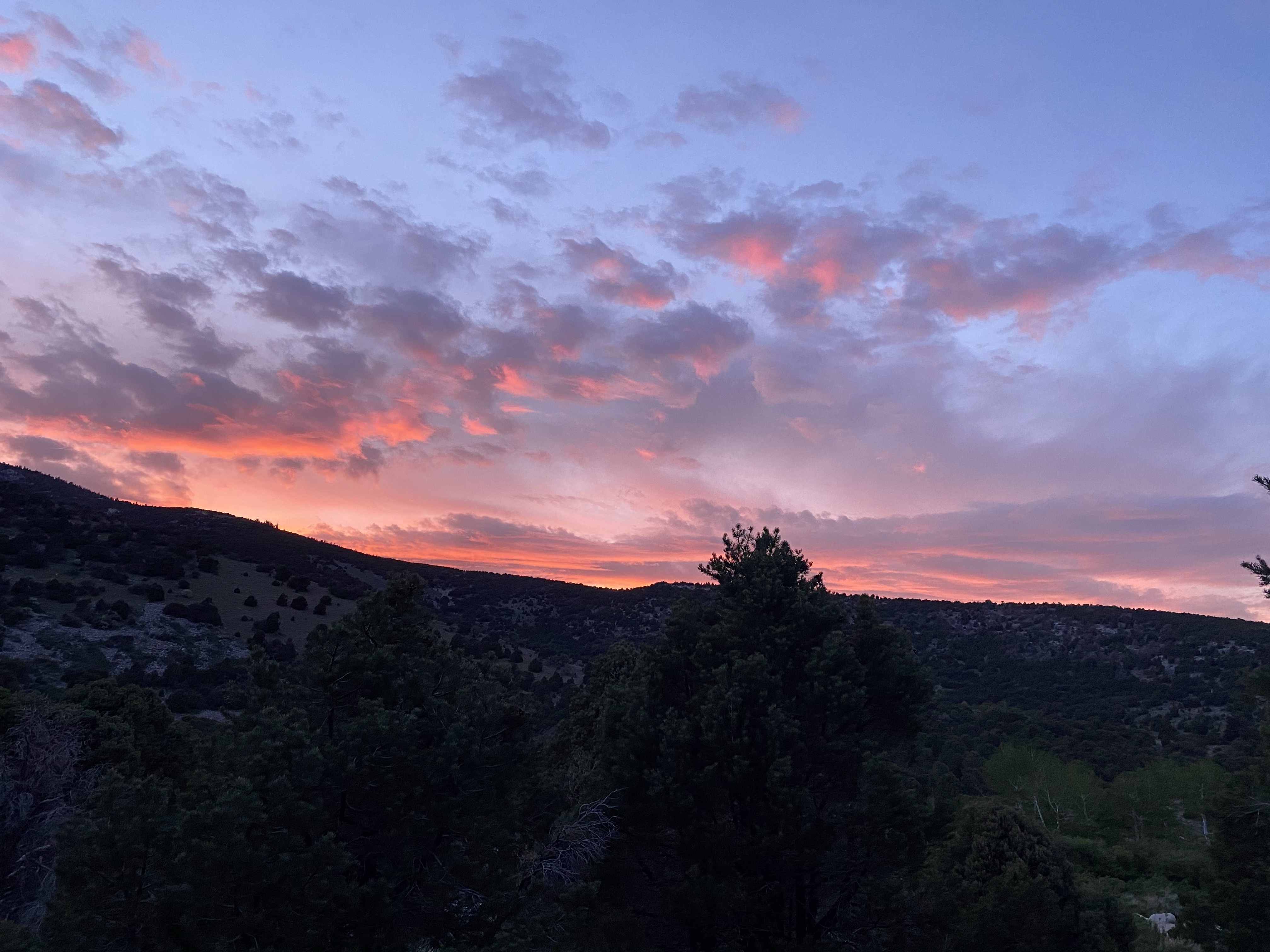
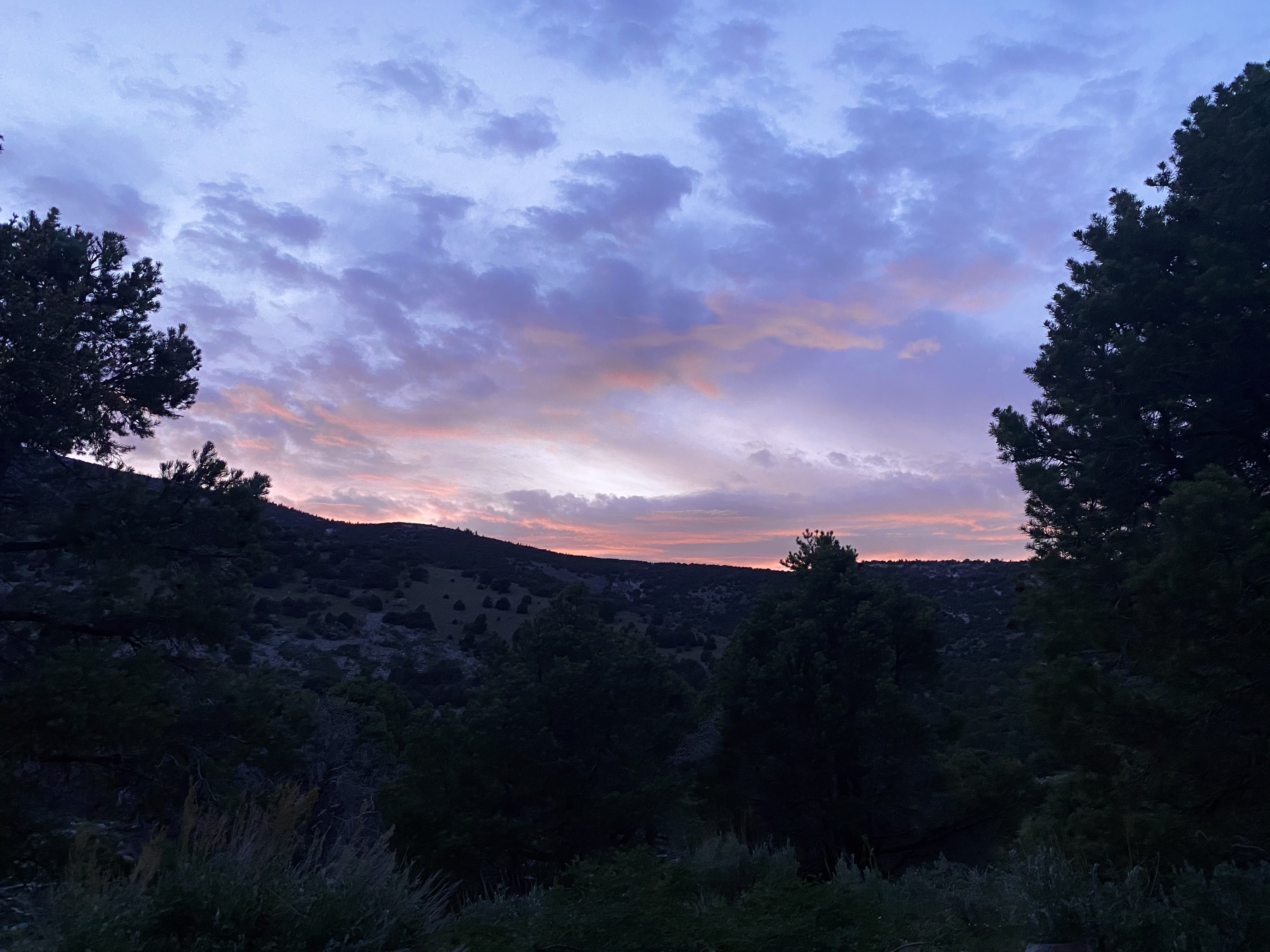
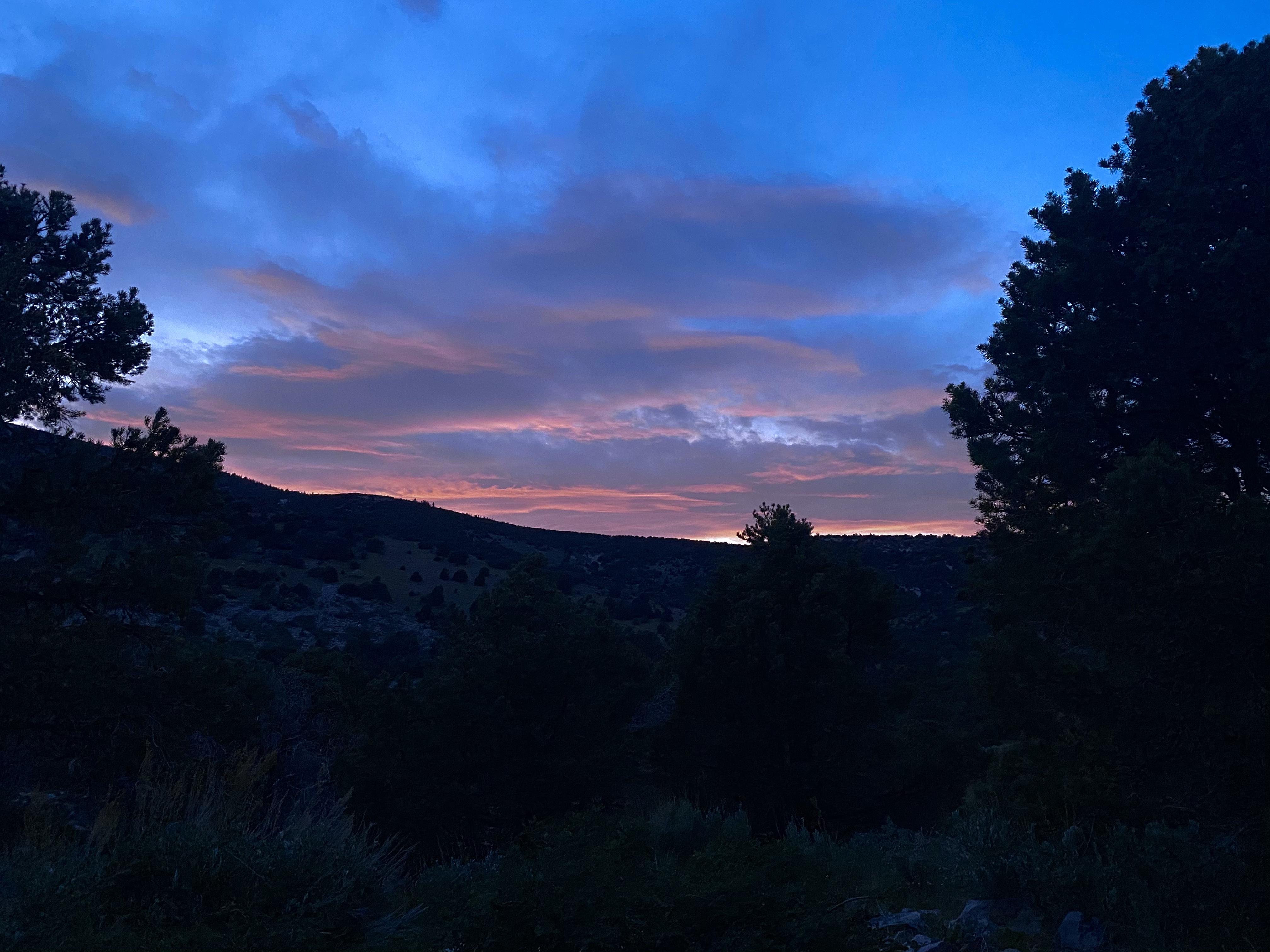
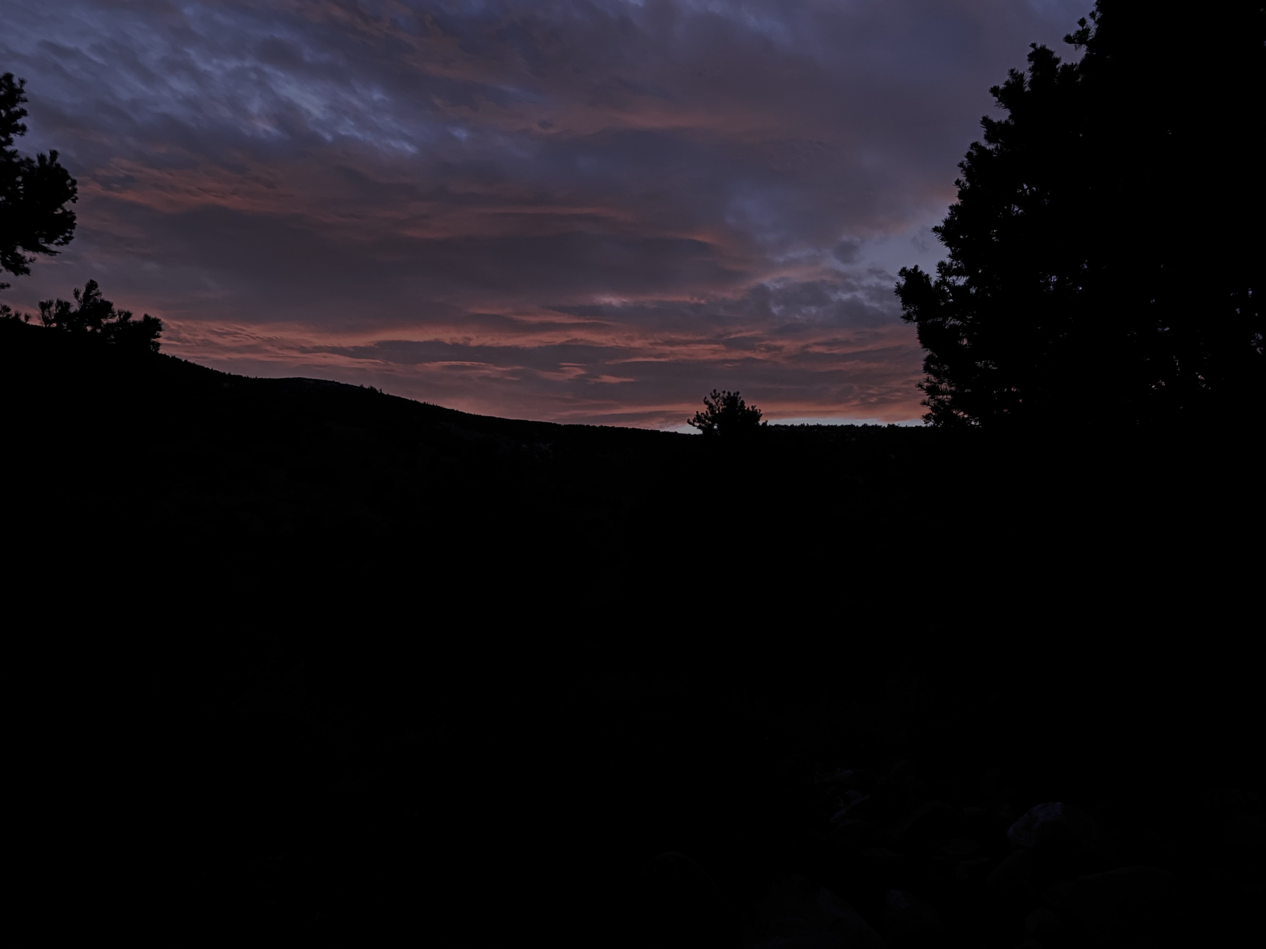
That evening was quiet and calm. The sunset spectacular. And then off to bed.
The next day I stopped by Durango again for some gluten free goodies. A piece of spinach quiche, a nutty bar, and brownie were my treats of choice! Picked up some Colorado cider for later and then hit the road!
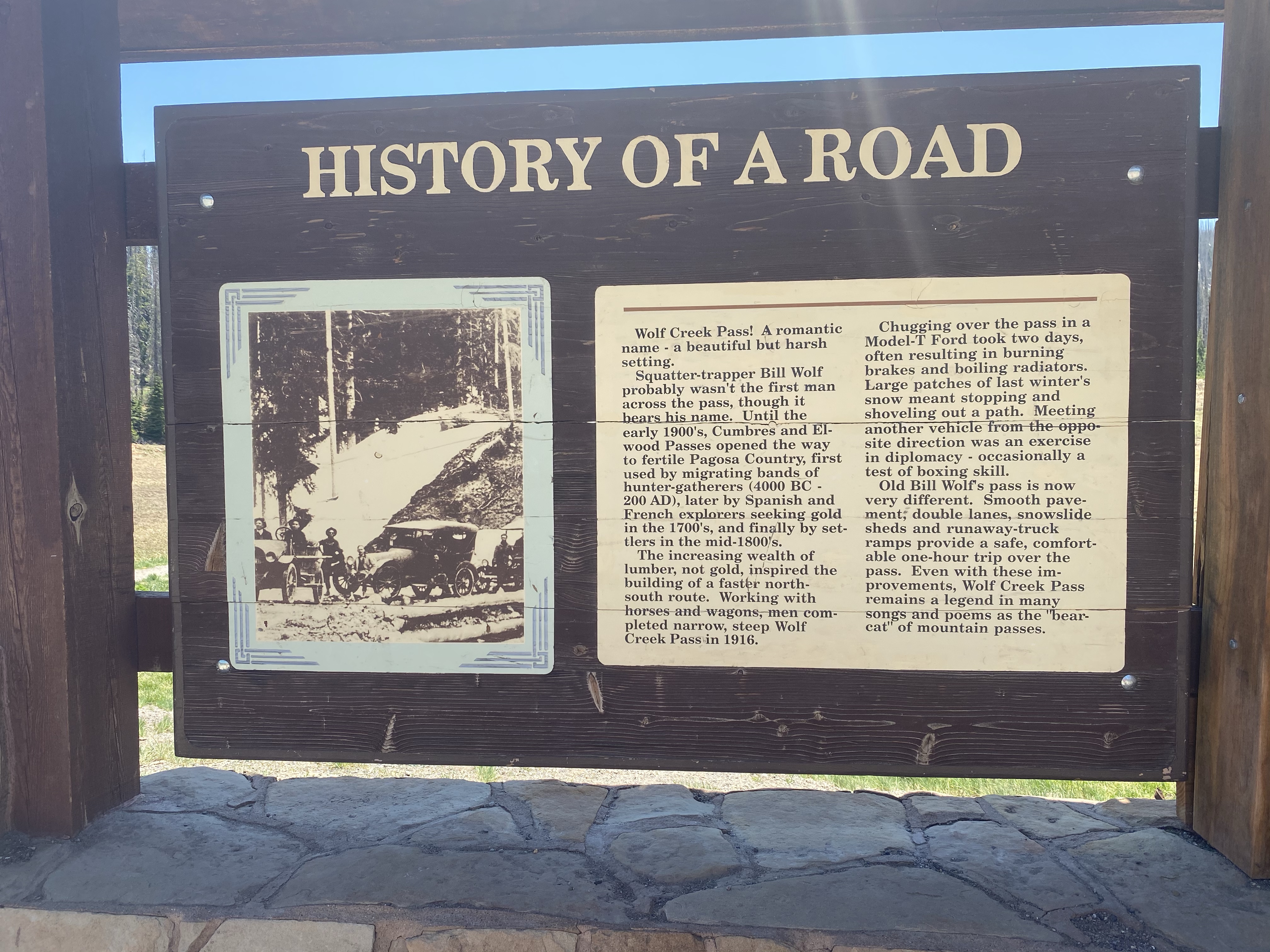
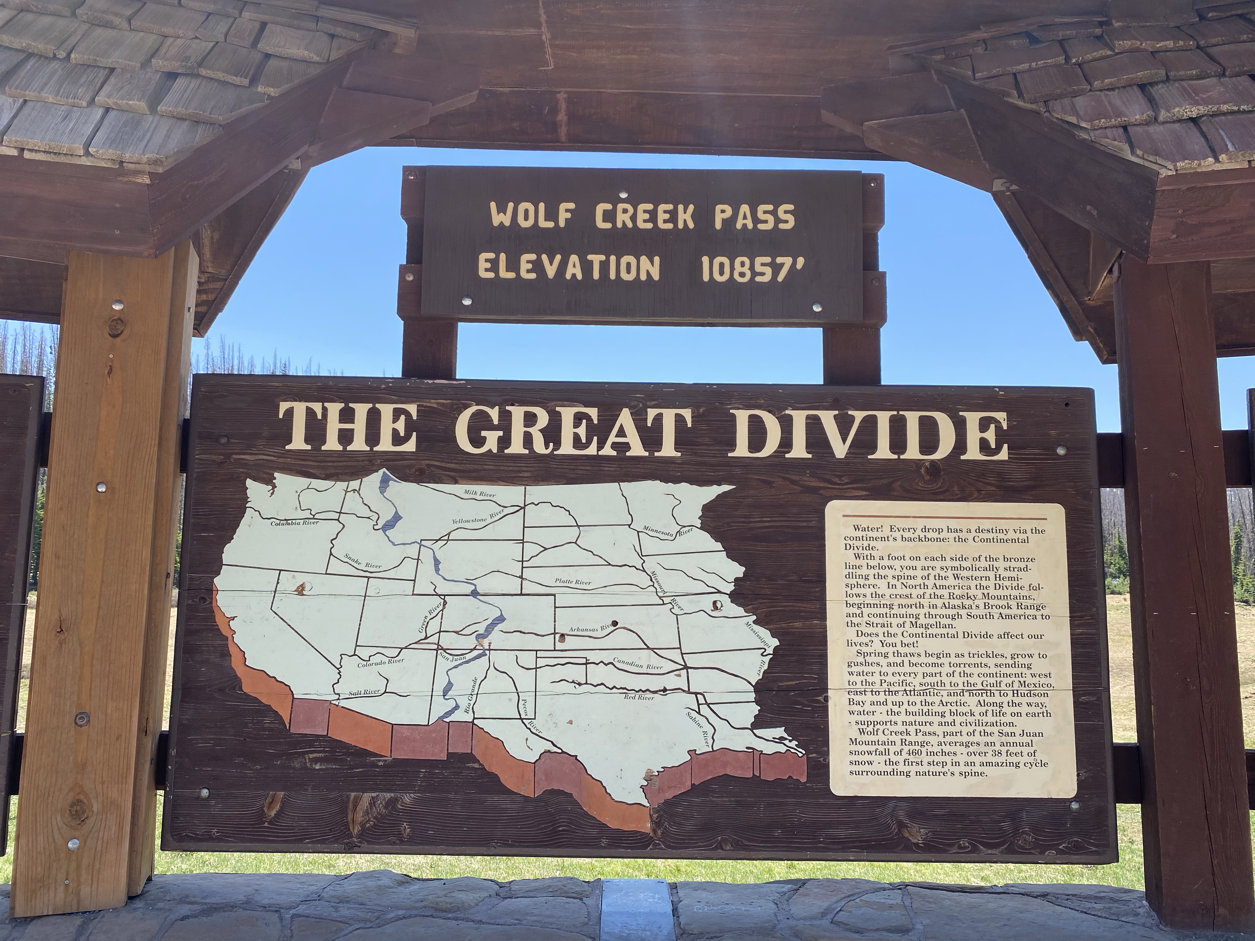
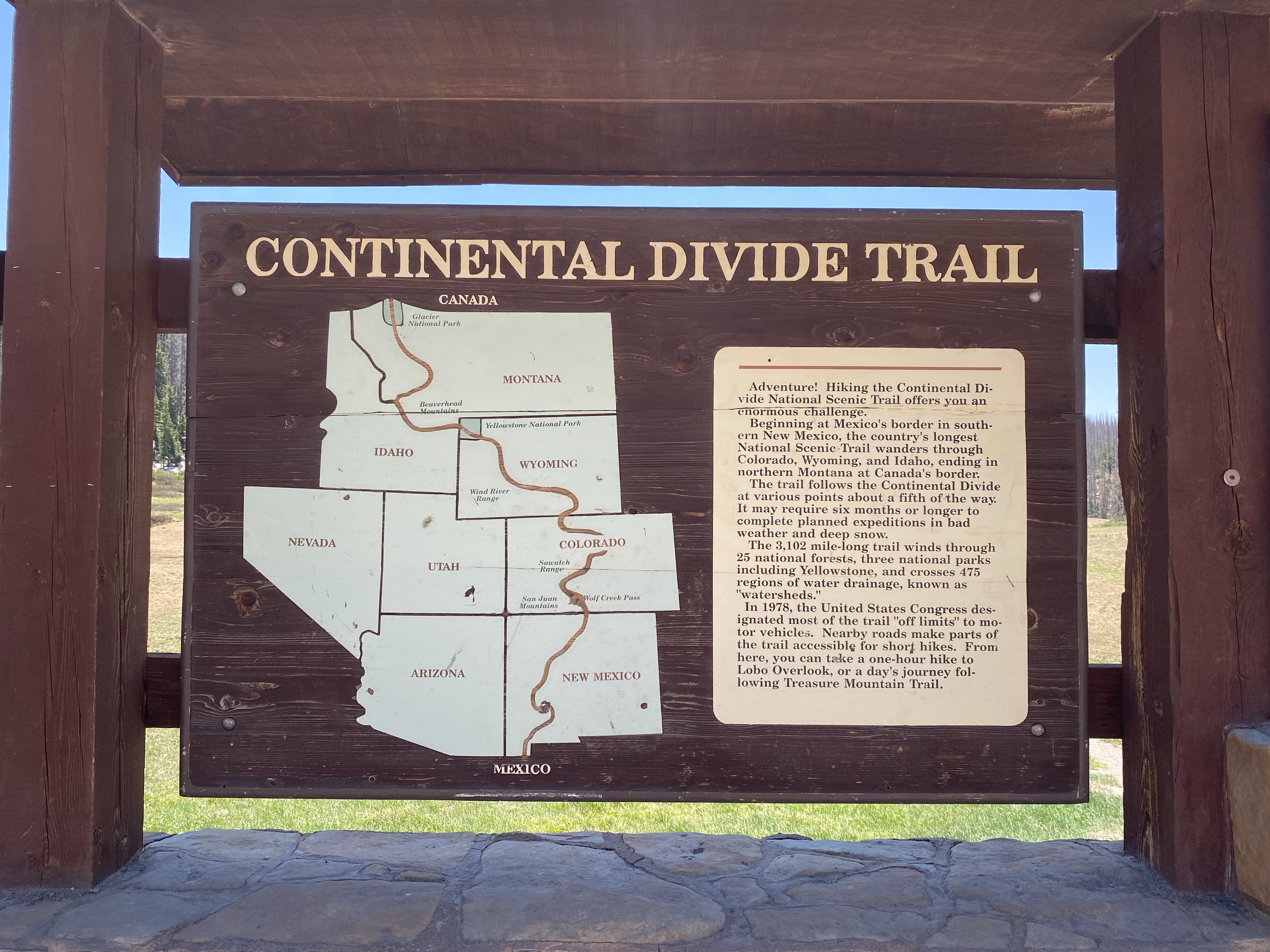
Along the scenic road I climbed into the mountains and crossed the Continental Divide at Wolf Creek Pass. 10,857 feet high! Snow still graced the ground in the woods. After a quick pit stop, I continued on to Great Sand Dunes, the next great adventure.
Next step on my journey home was Mesa Verde, a National Park and a World Heritage Site. Created in 1906, the site aims to preserve the archeological heritage of the Ancestral Pueblo (previously referred to as Anasazi) people through the safeguarding of the dwellings on the mesa top and on the sides of the cliffs. This place is home to 4,500 archeological sites!
The Ancestral Pueblo people were inventive and resilient. On top of the mesas they farmed and hunted. Below the mesa tops, over time, the built communities in the alcoves of the cliffs. They used hand-and-toe hold trails, little more than indents in the cliff faces, to enter and exit their homes. When they inhabited the land, the soil was fertile and water was plentiful. They used sticks to dig dams and holding areas for reservoirs of snow and rain. They adapted to their environment to survive. For nearly 700 years, from AD 550 to the late 1200s they flourished here.
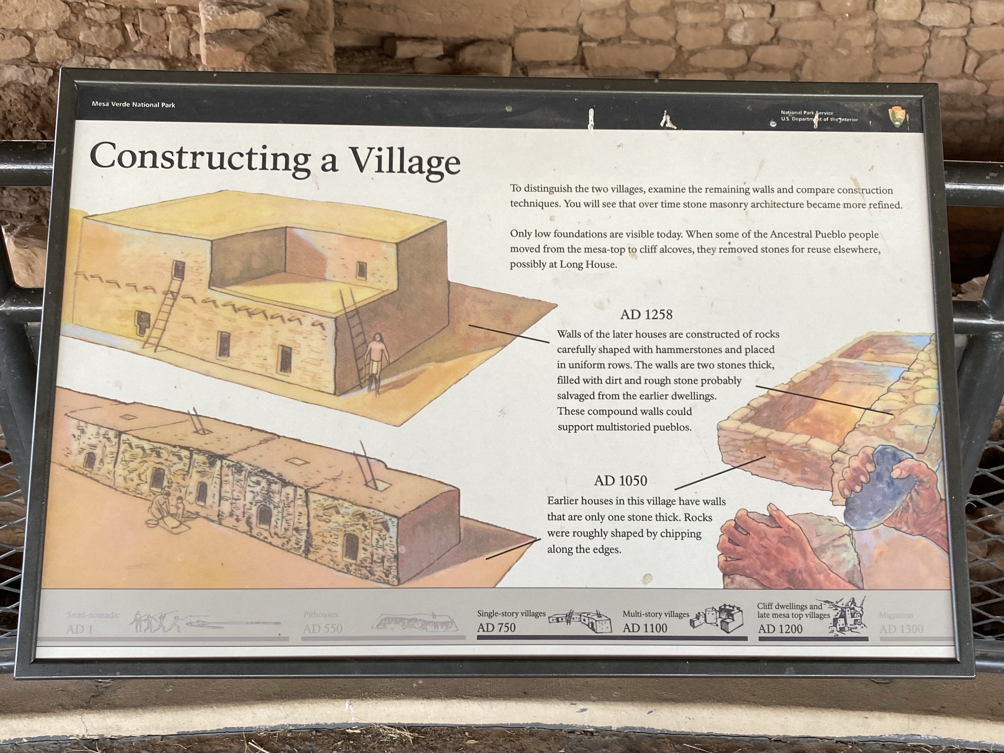
These skillful people first built their communities on the mesa tops and later below the cliffs in alcoves. The first Ancestral Pueblo people to occupy this land were expert basket makers and lived in pit houses. Pit houses were dug into the ground and had wooden roofs. By 750 AD, homes were built together in clusters, each one touching the next, in long curving rows with walls of mud and stick. Their skills developed over the decades to include stone masonry and larger villages.
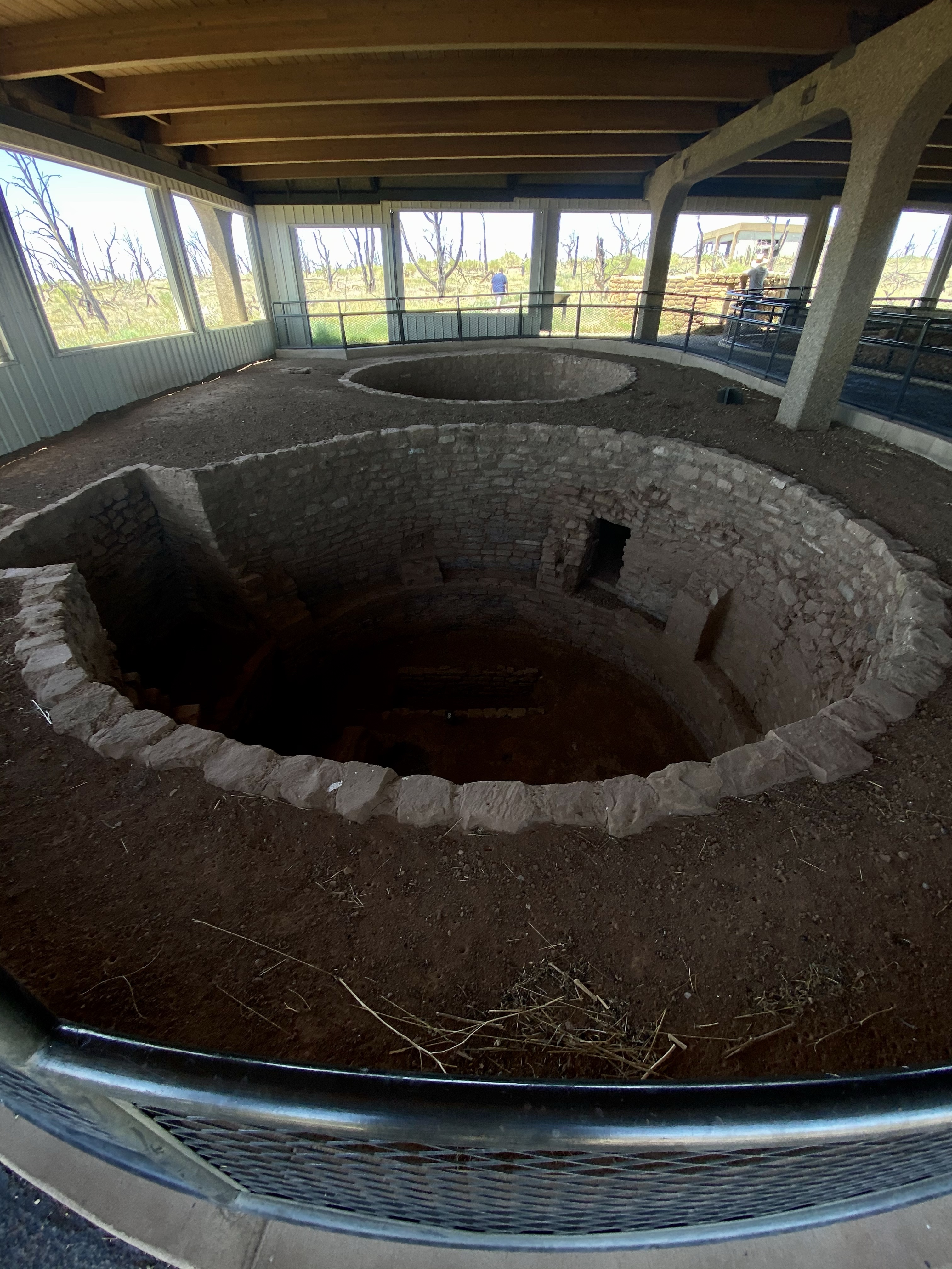
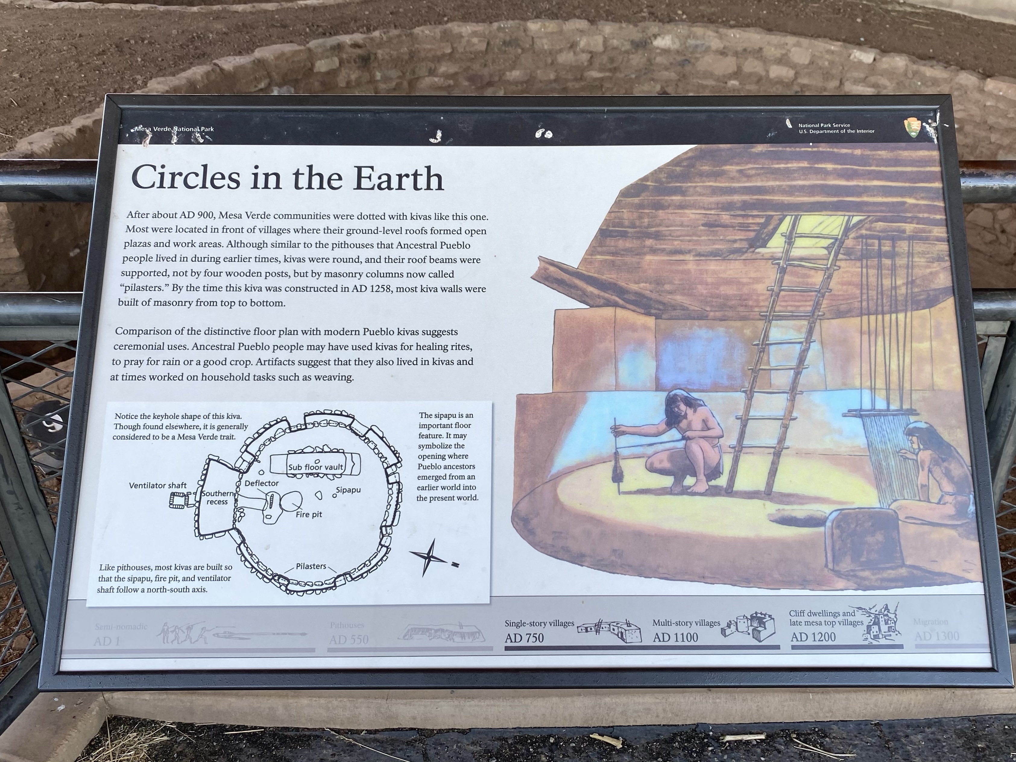
Kivas were eventually created, a word from the Hopi language which refers to round chambers. These spaces in the villages on mesa tops are found in every community and hold multiple purposes, including social religious, and storage. A ladder was used to climb down into the space. Kivas are still important spaces in current Pueblo communities and ceremonies.
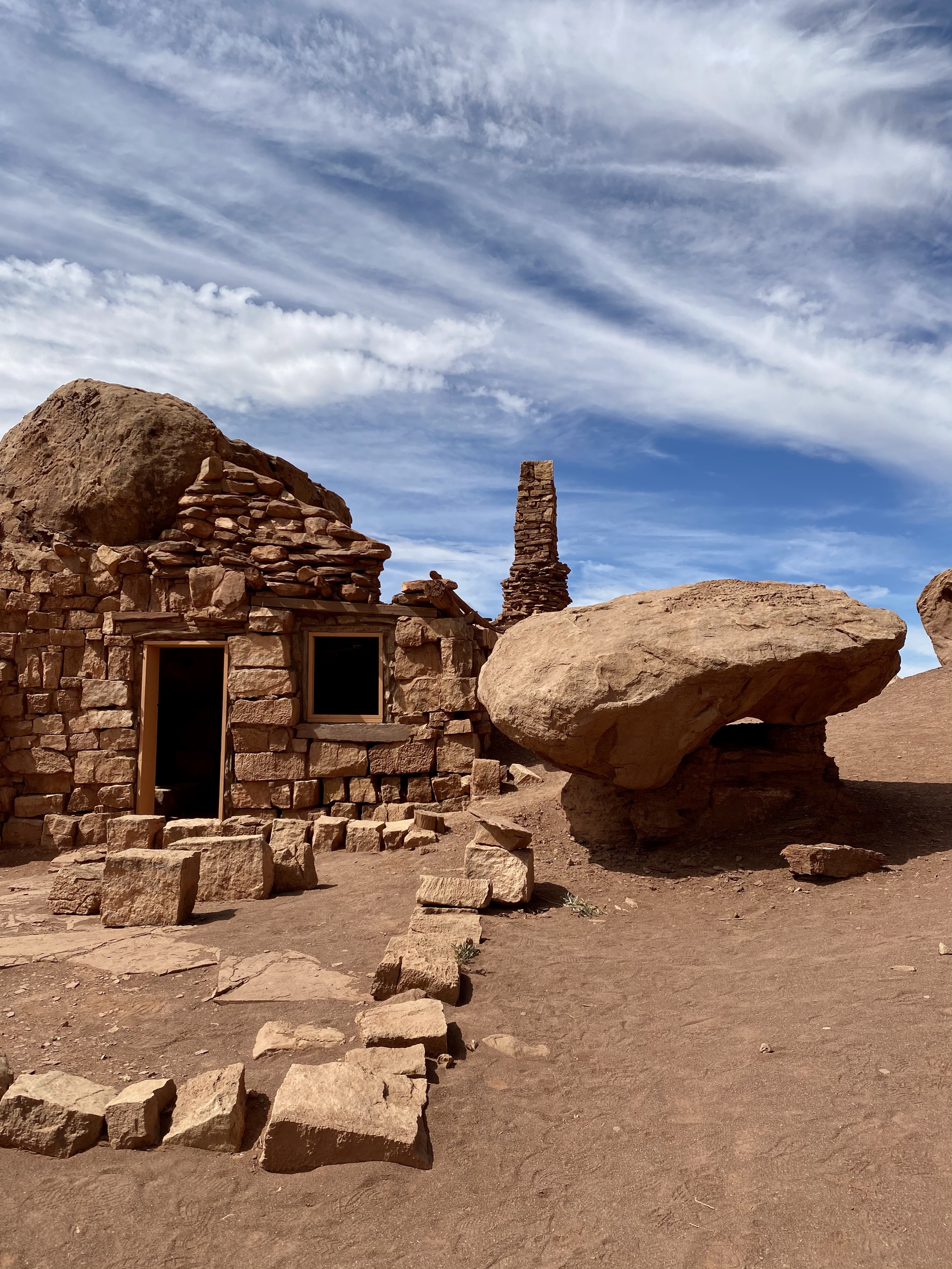
In the late 1190s, many of the Ancestral Pueblo people begun building cliff dwellings. For cliff dwellings, they cut sandstone into bricks and stuck them together with mortar made of mud and water. Experienced builders they made rooms big enough for a few people and created space for storing crops. An open courtyard in the front was a community space where fires where built for cooking in the summer and warmth in the bitter cold winter.
These cliff dwellings were deserted after only 100 years. One theory is that severe drought plagued the area and forced the inhabitants to relocate. Another idea is that the land was over used. The Ancestral Pueblo people had thrived and their population grew rapidly, so perhaps the land was depleted of nutrient and animals. Or maybe there was social or political conflict. And new theories are still being tested.
When they left, they migrated with others to New Mexico and Arizona. Today, many tribes trace their heritage back to the Ancestral Puebloans, including the Hopi of Northern Arizona and the people of Zuni, Laguna, Acoma, and the pueblos of the Rio Grande.
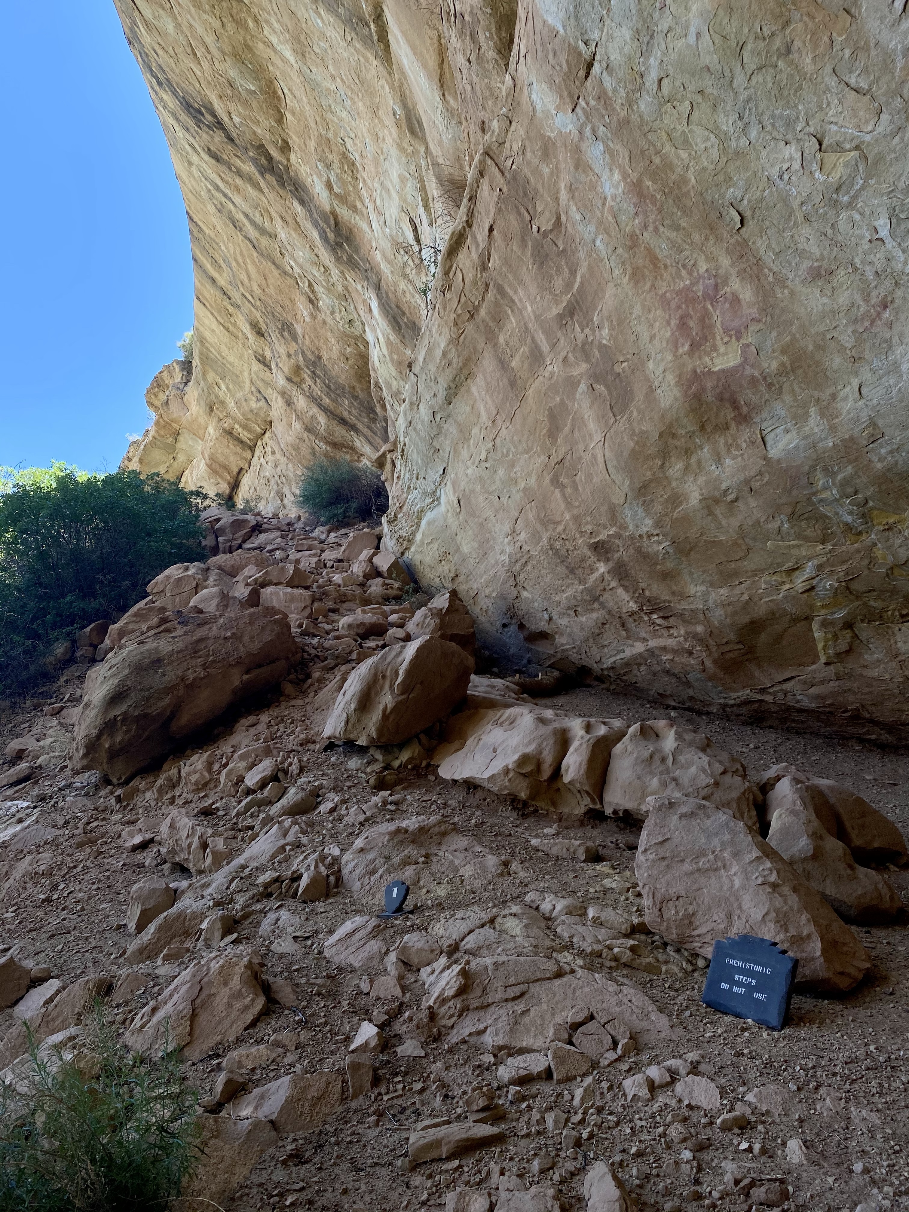
I would have thoroughly enjoyed a tour of these marvelous cliff dwellings, but I was unaware that I needed to book tours in advance. So, alas, I had to enjoy them from afar. I’ll be back though!
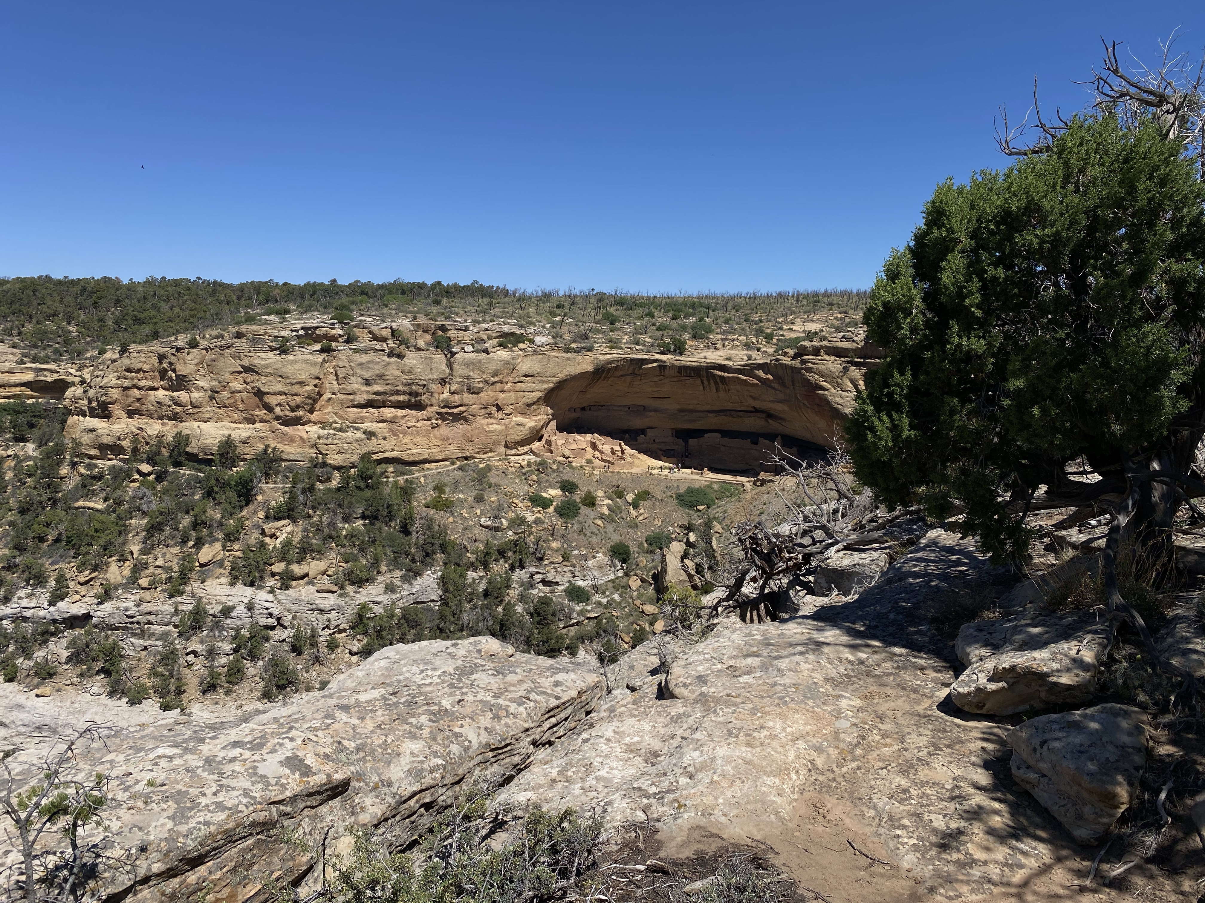
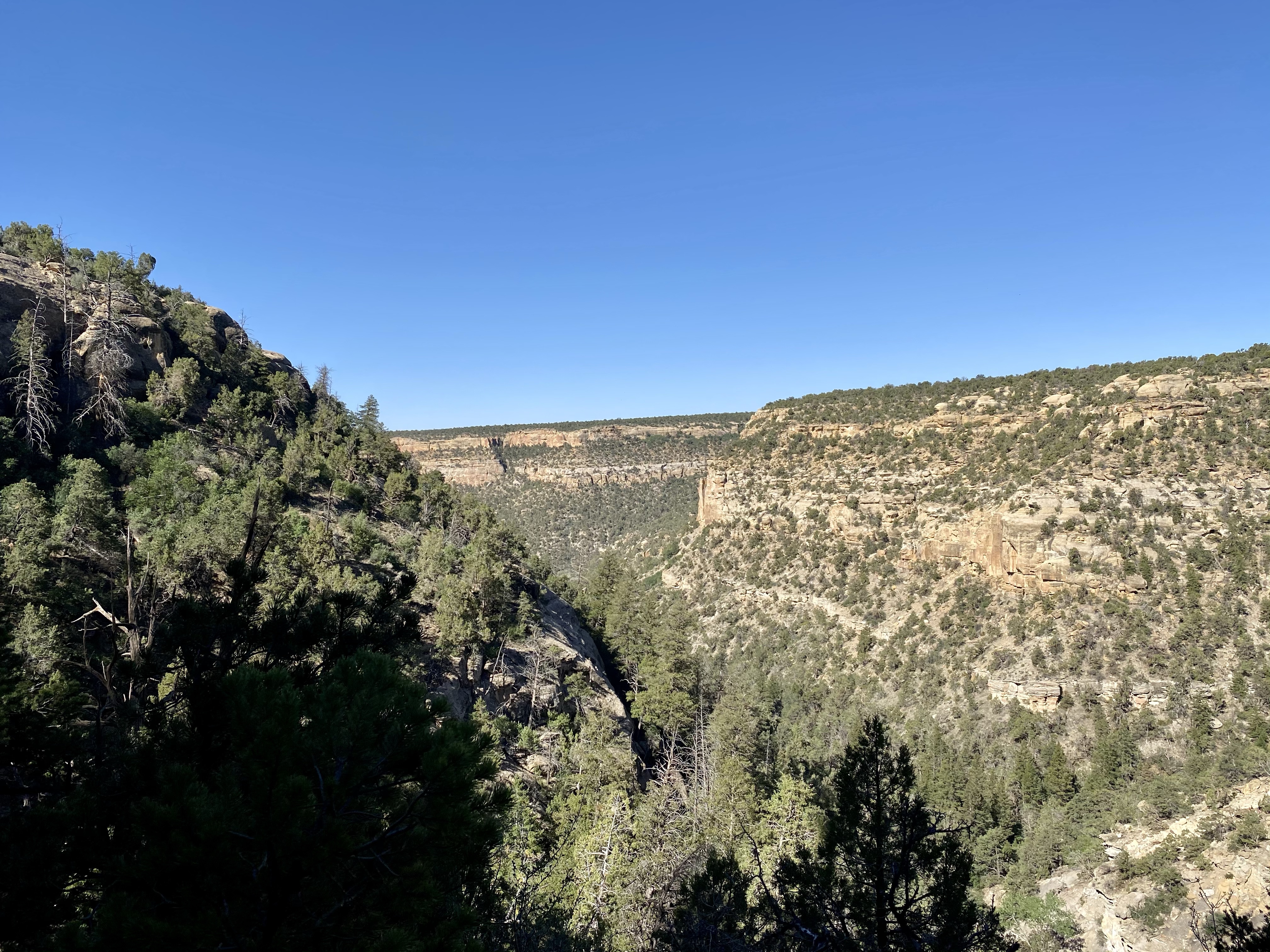
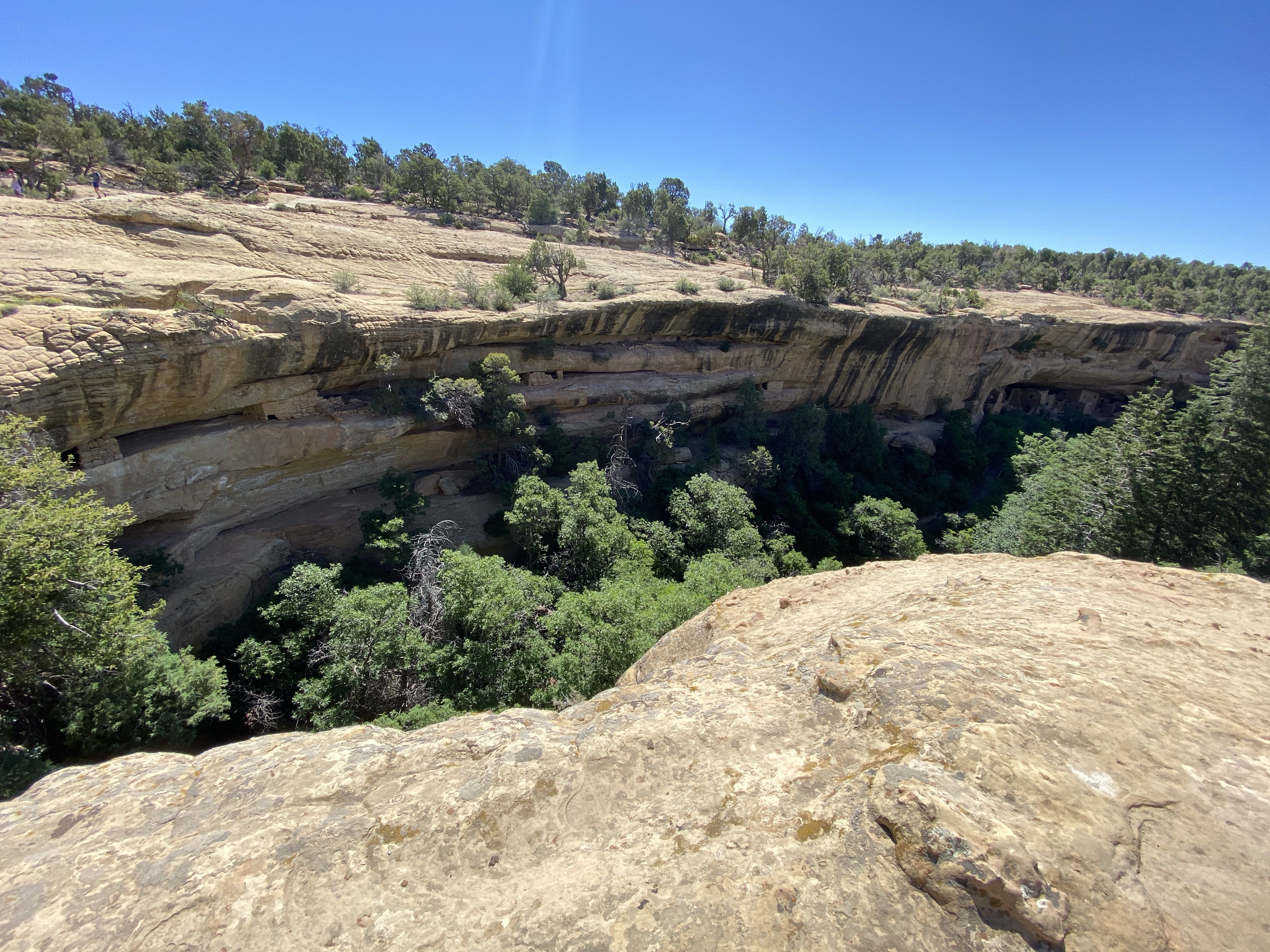
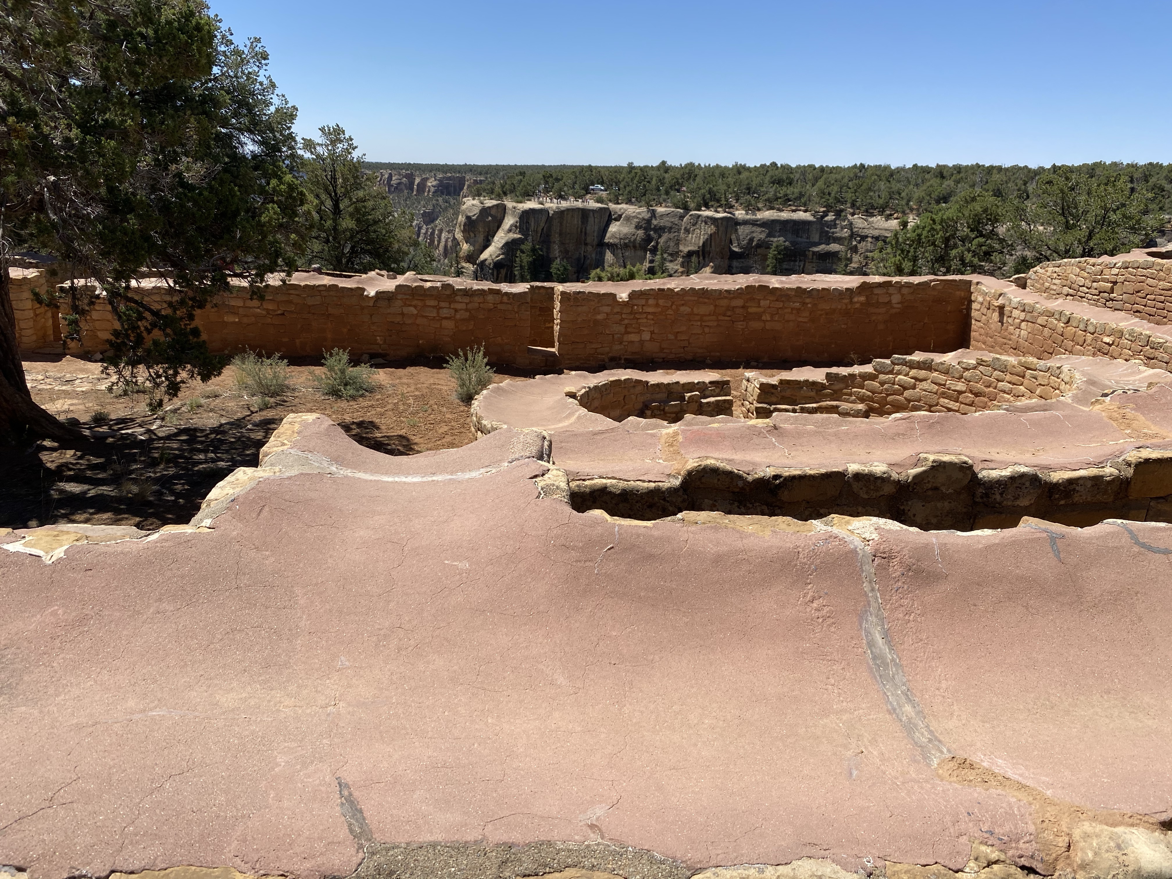
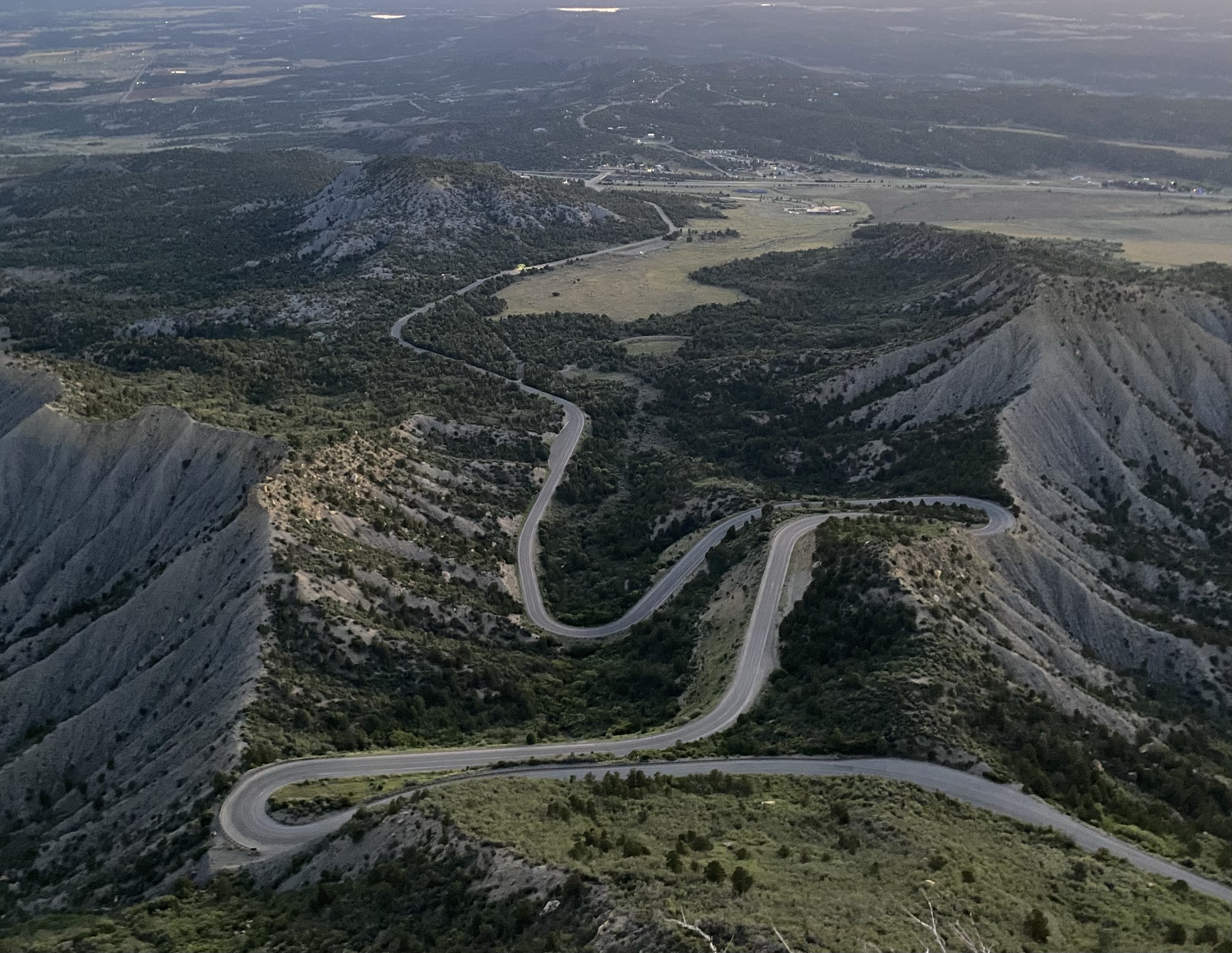
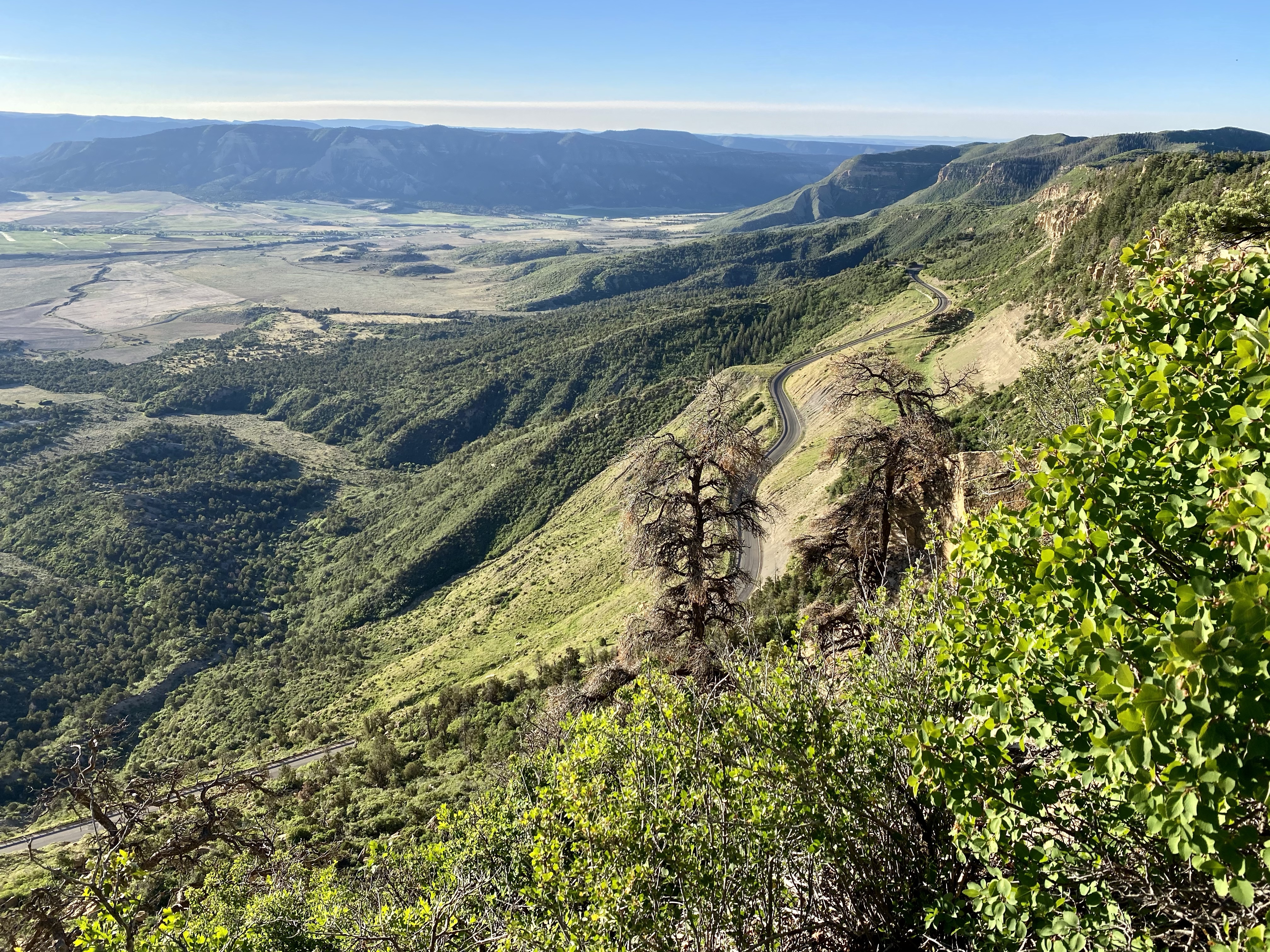
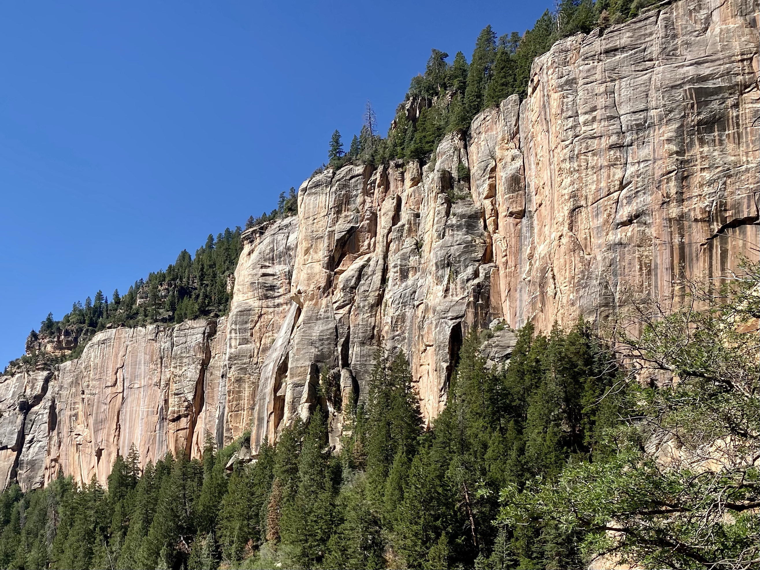
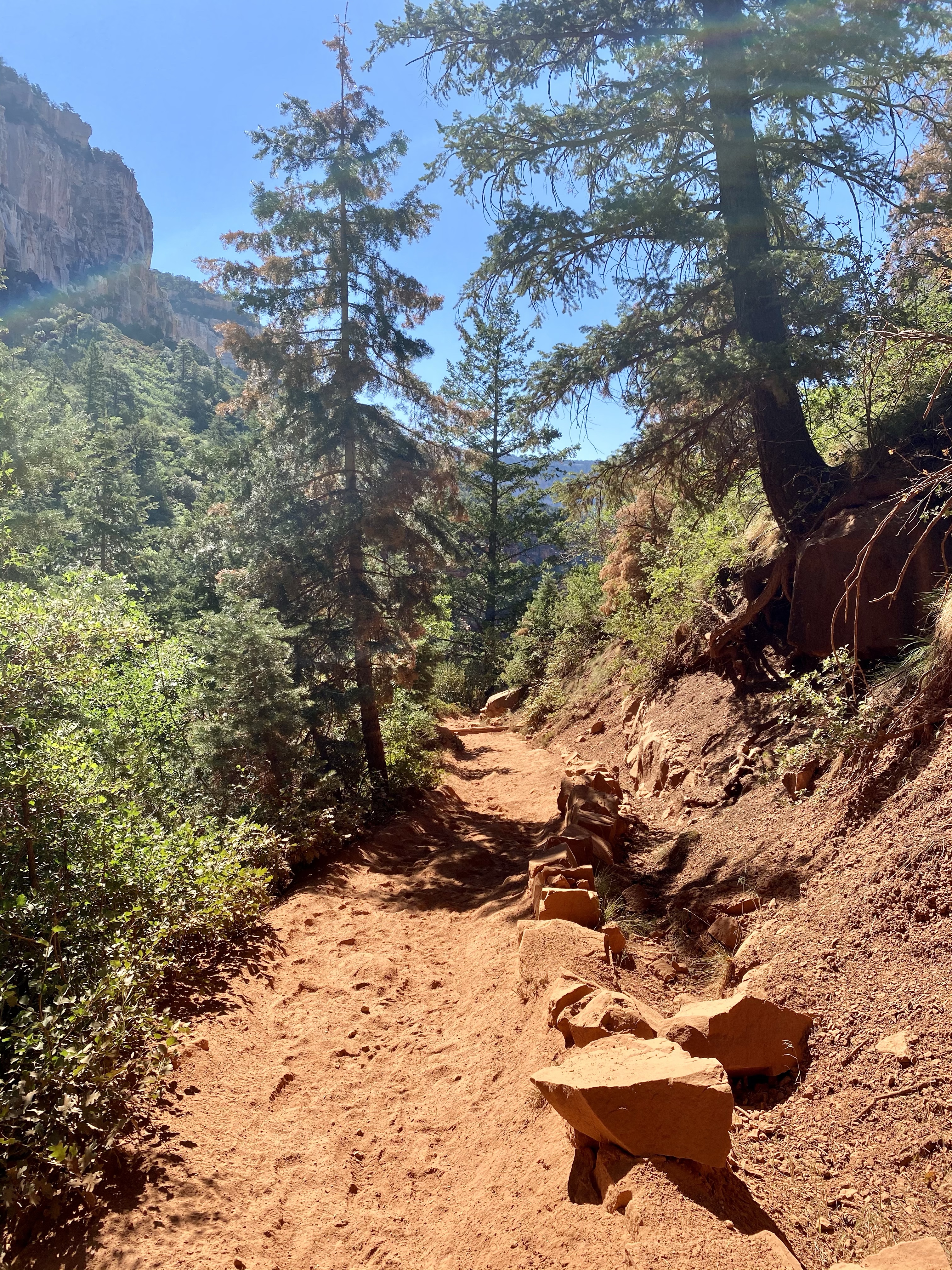
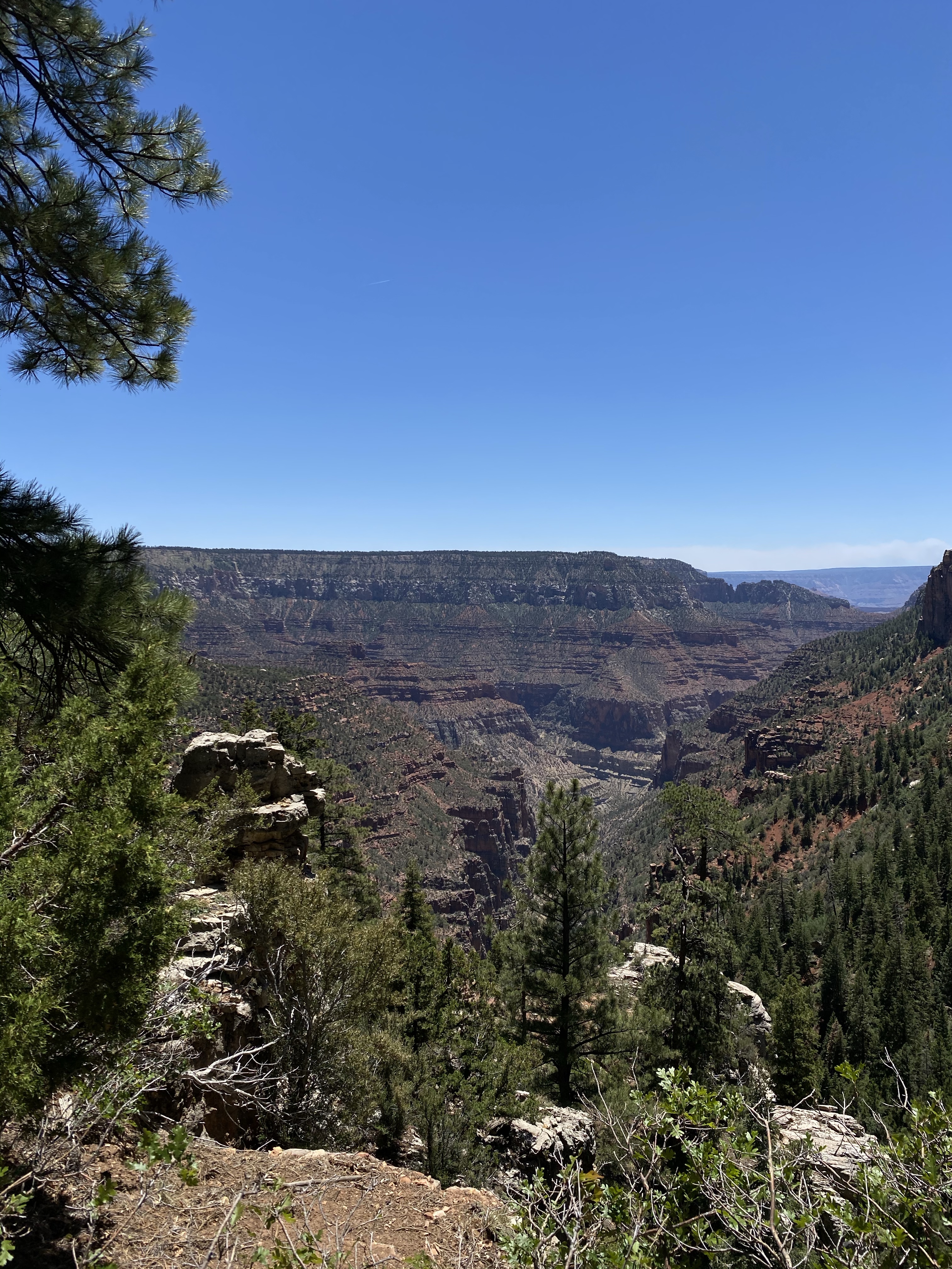
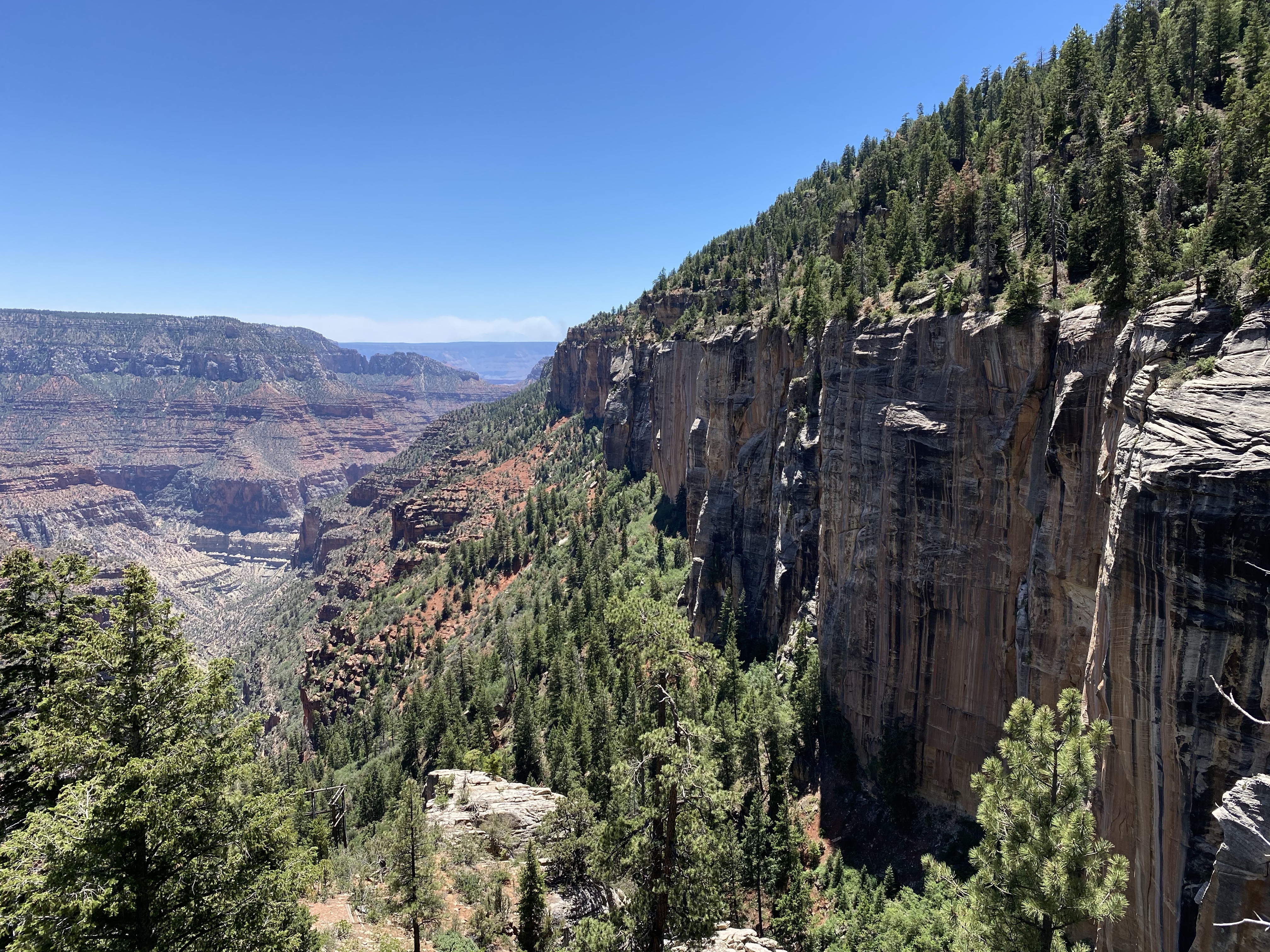
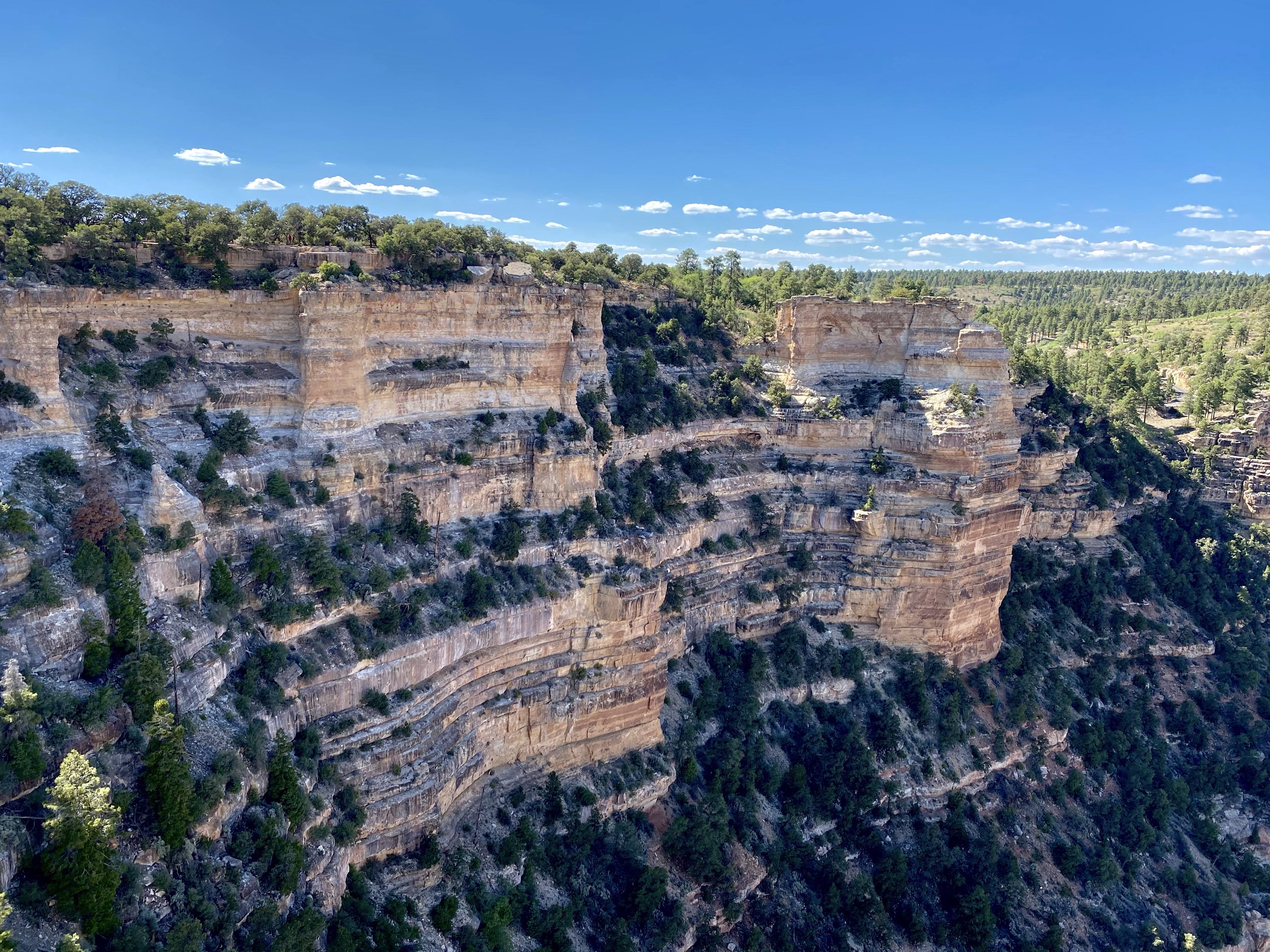
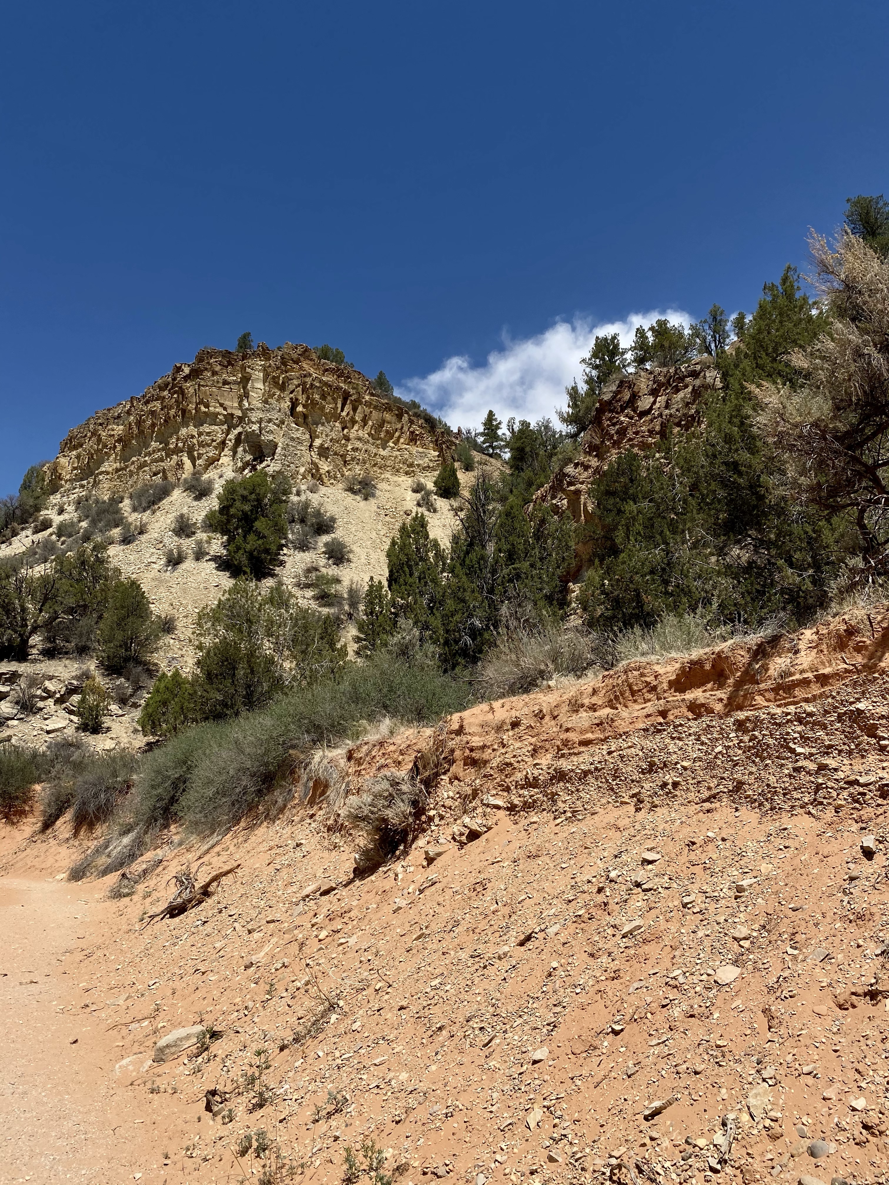
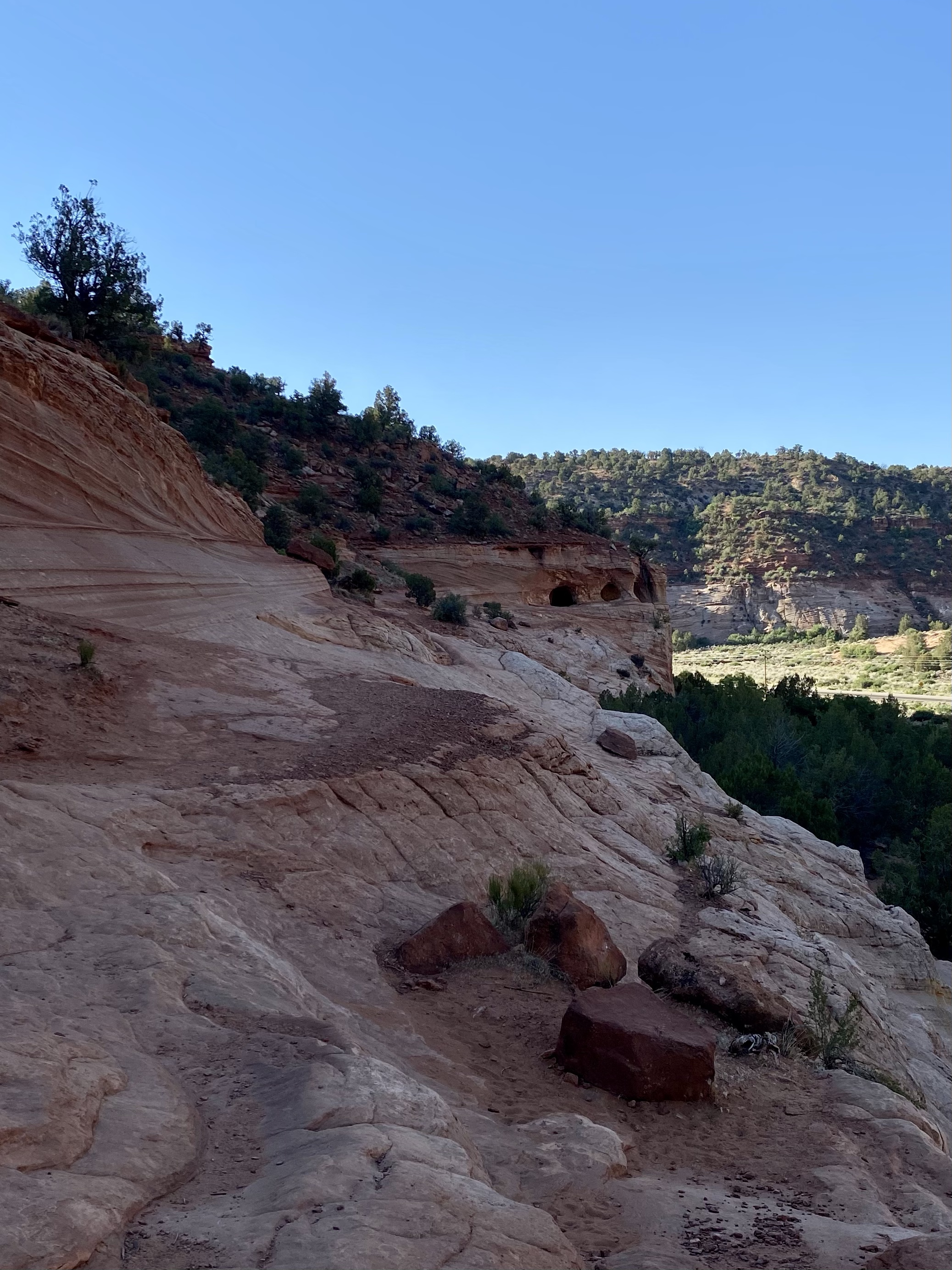
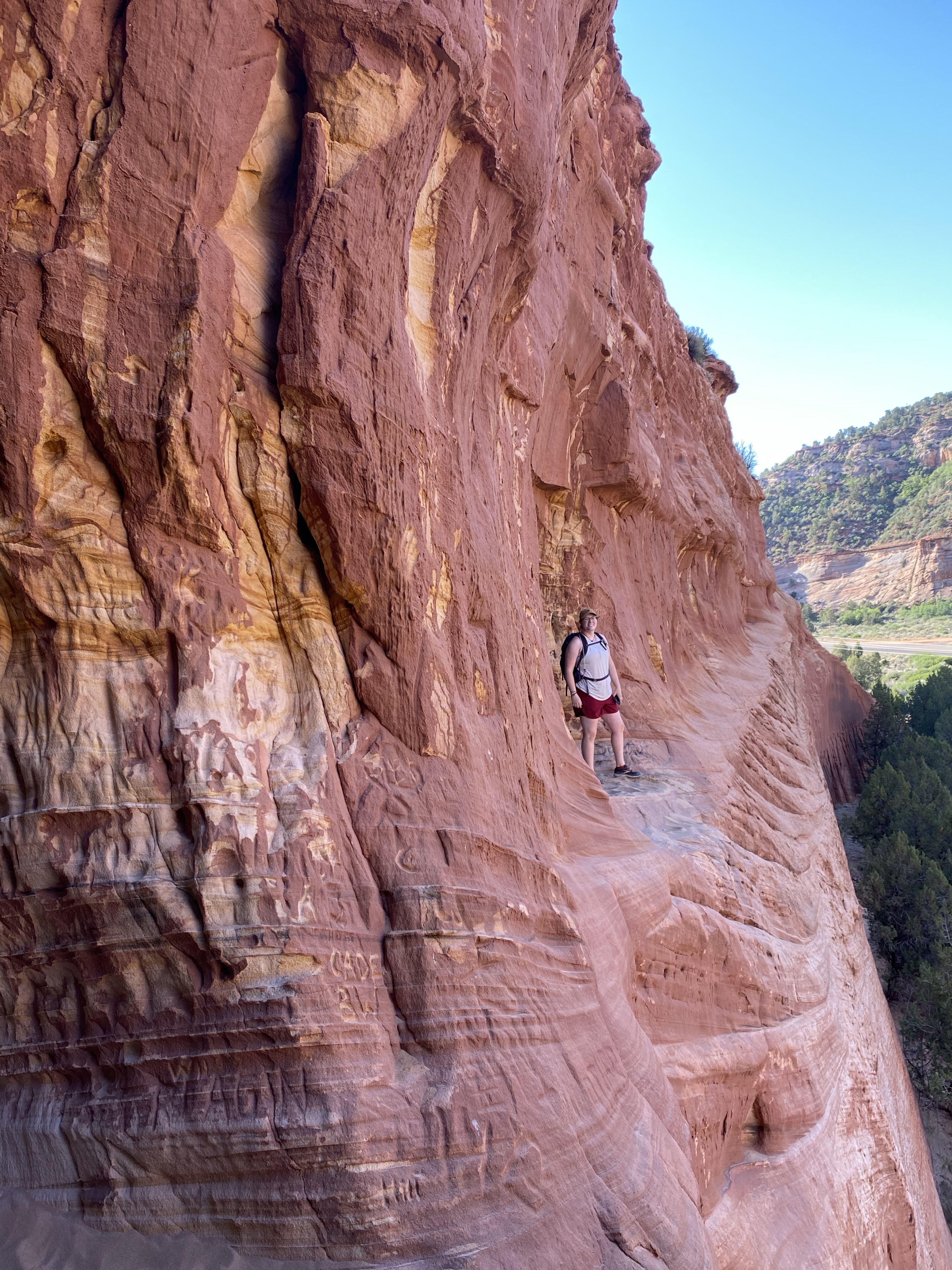
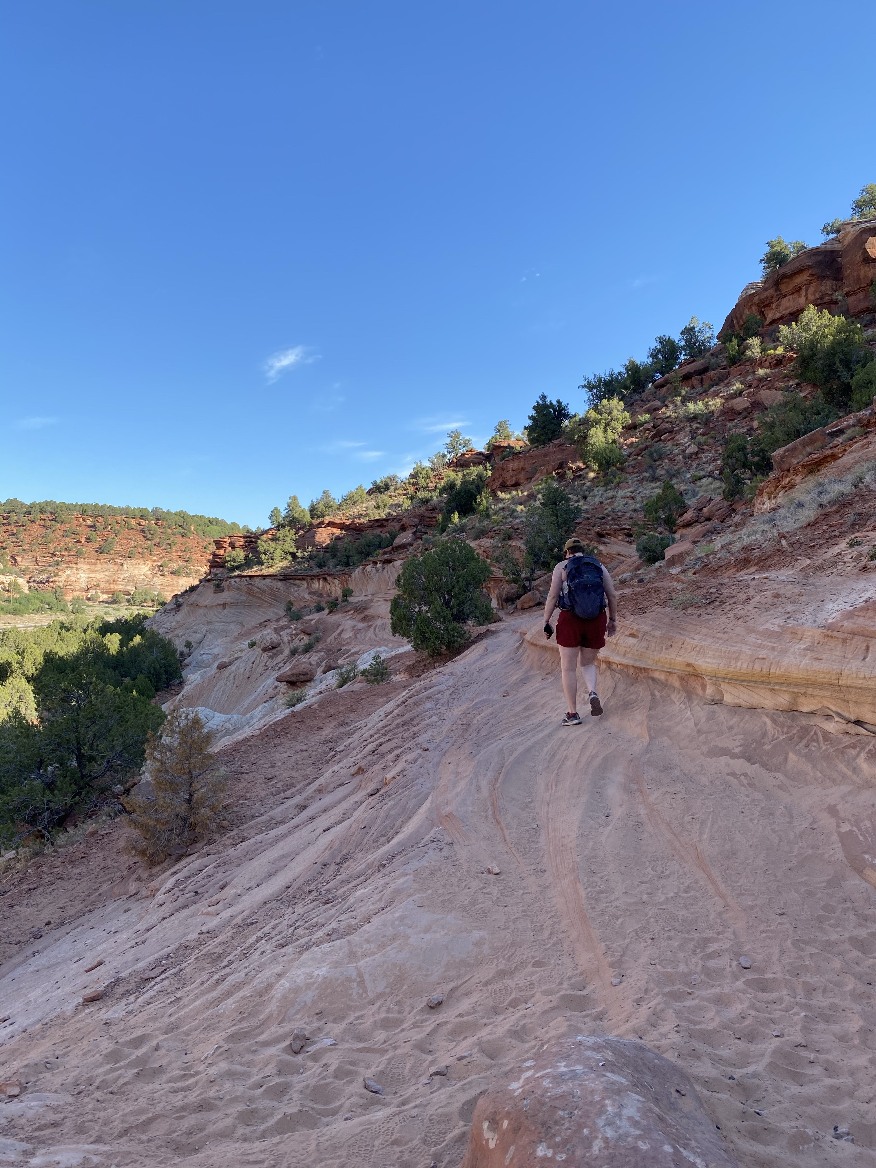
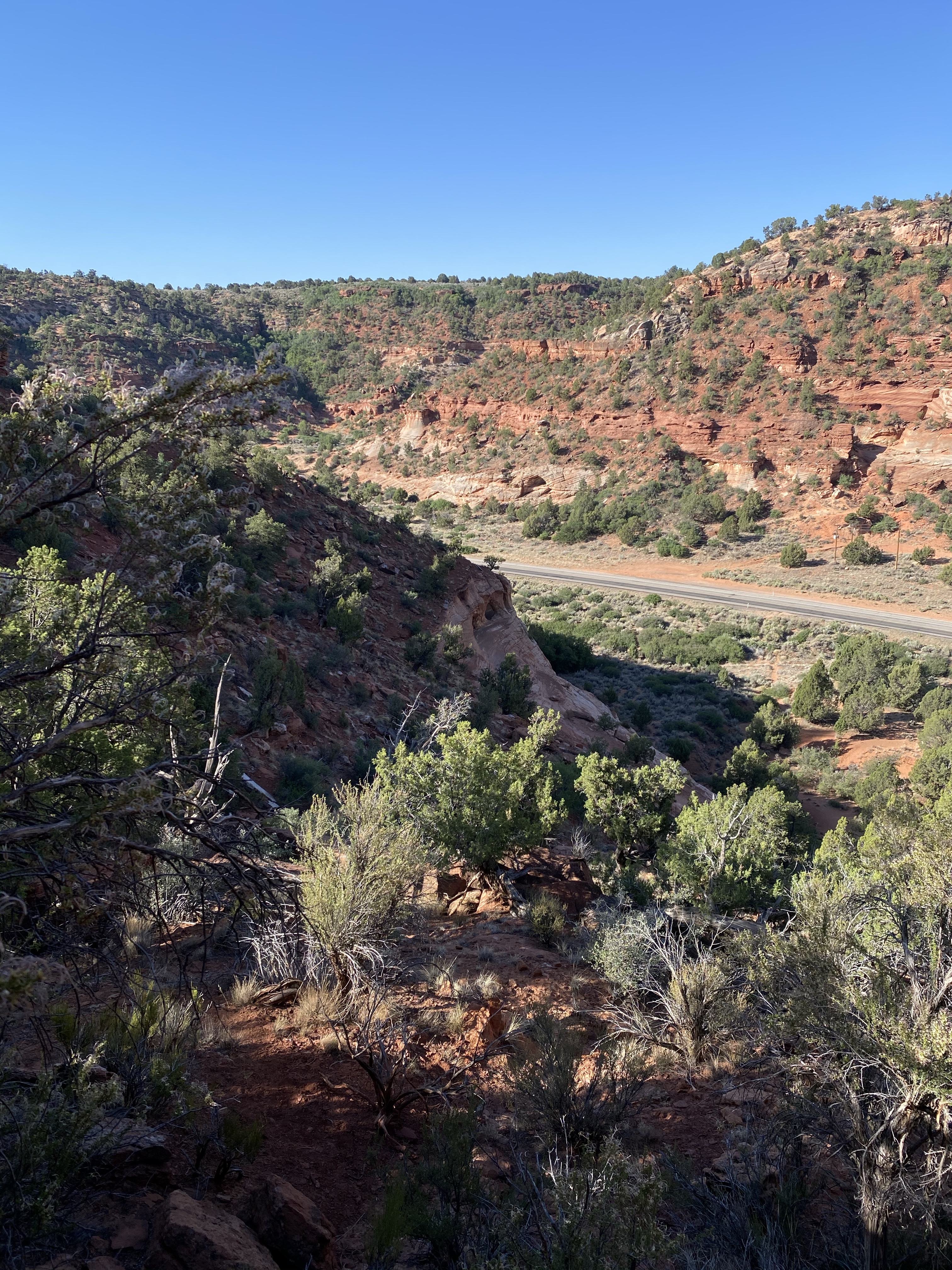
My first day in the park I drove out to Wetherill Mesa on the far western side of the park. It is a long a snaking road through the park, traversing over several mesa tops, down into the valleys, and up again. Sunny and I are now very experienced with long windy roads. When we arrived the lot was busy, but not over crowded. I stopped quickly at the information kiosk and headed out on the paved Long House Loop.
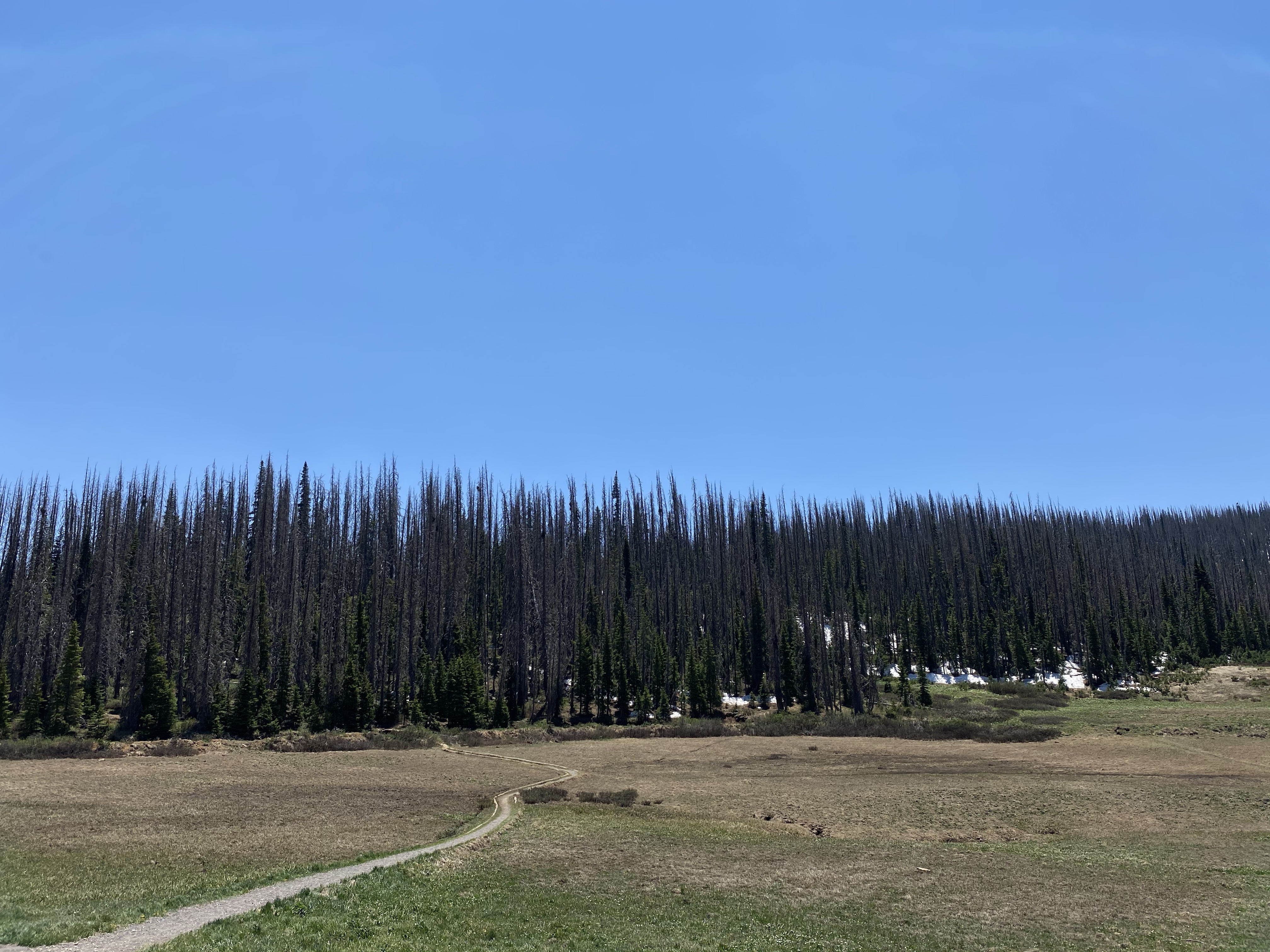
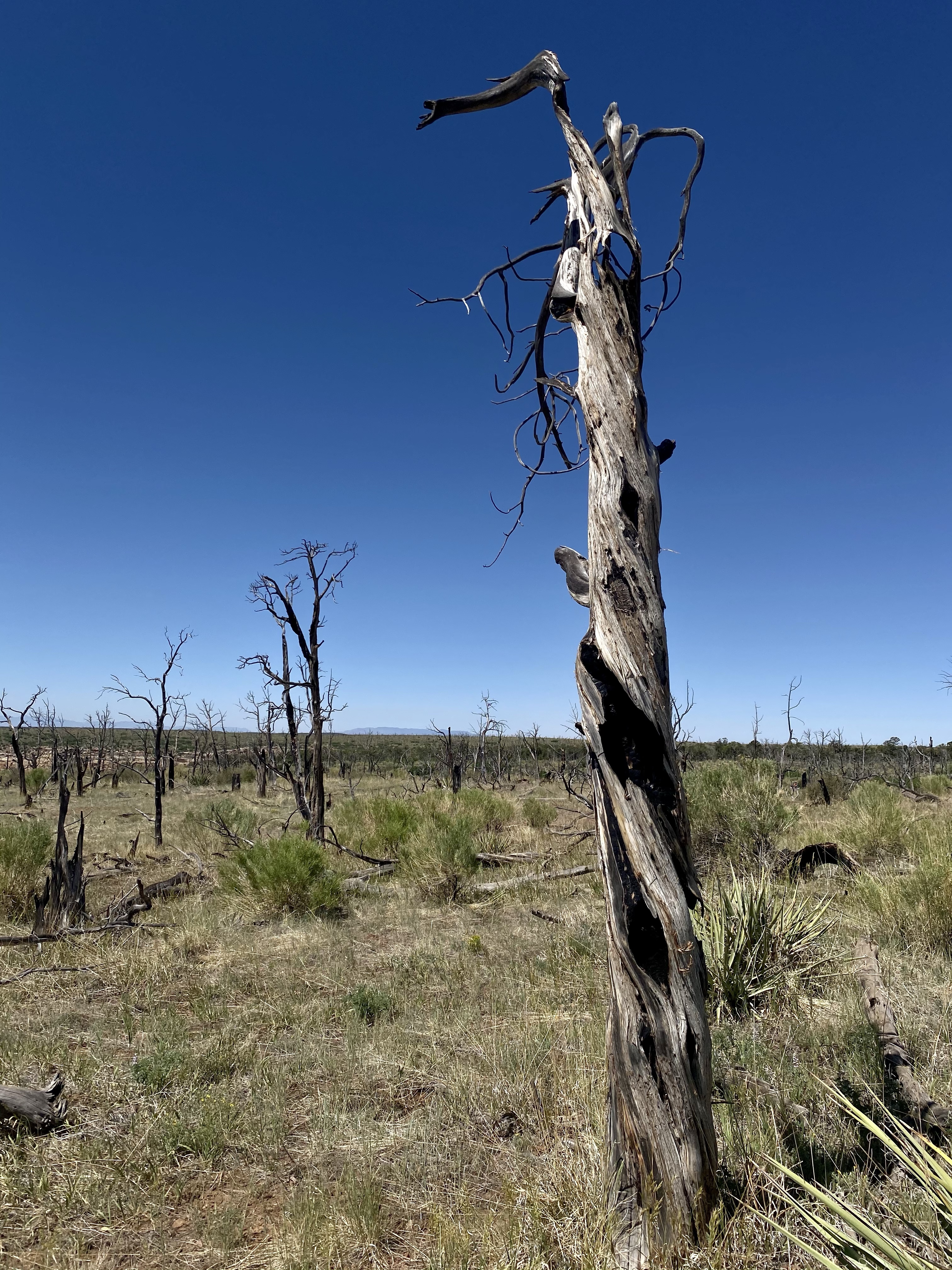
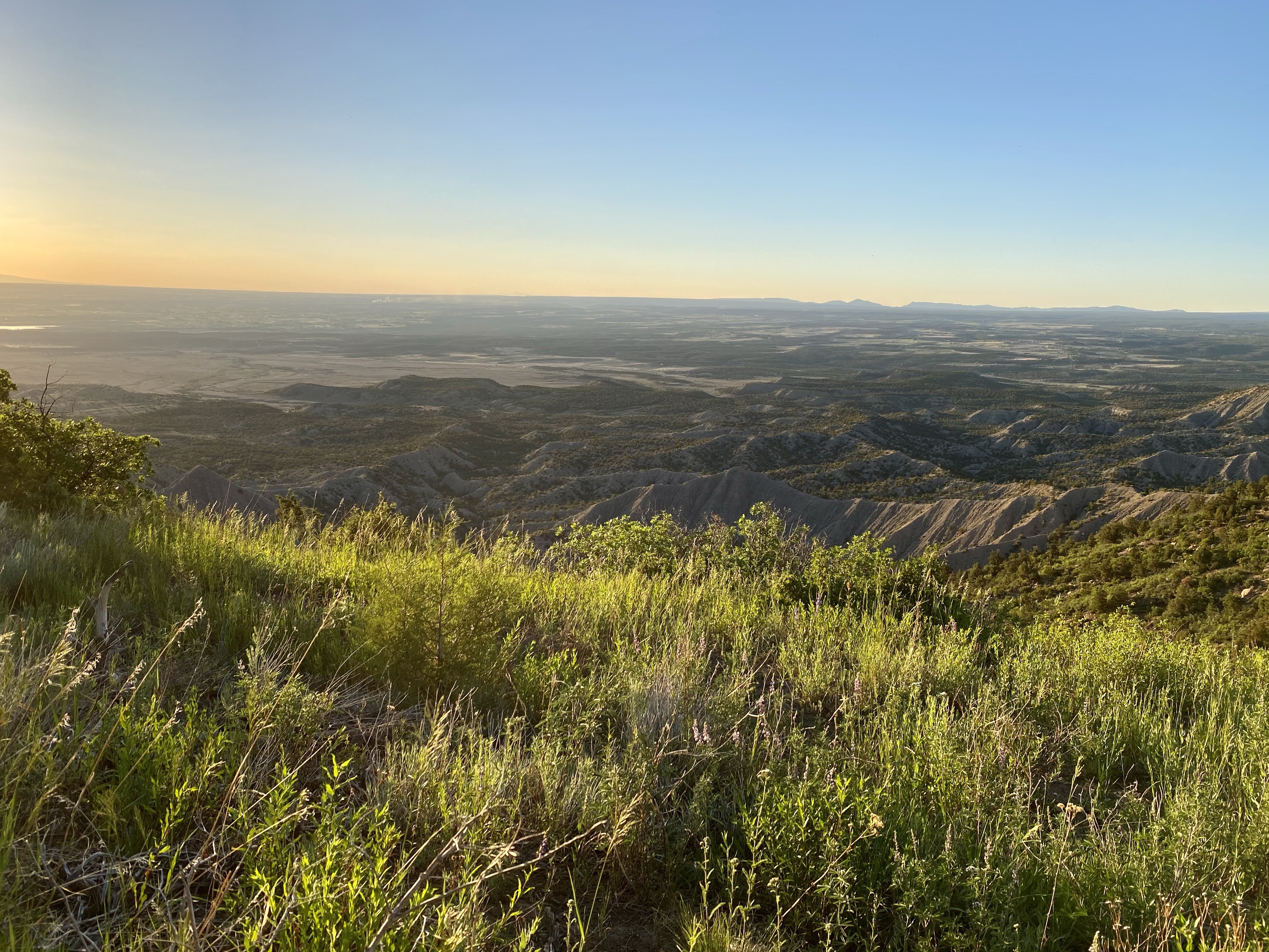
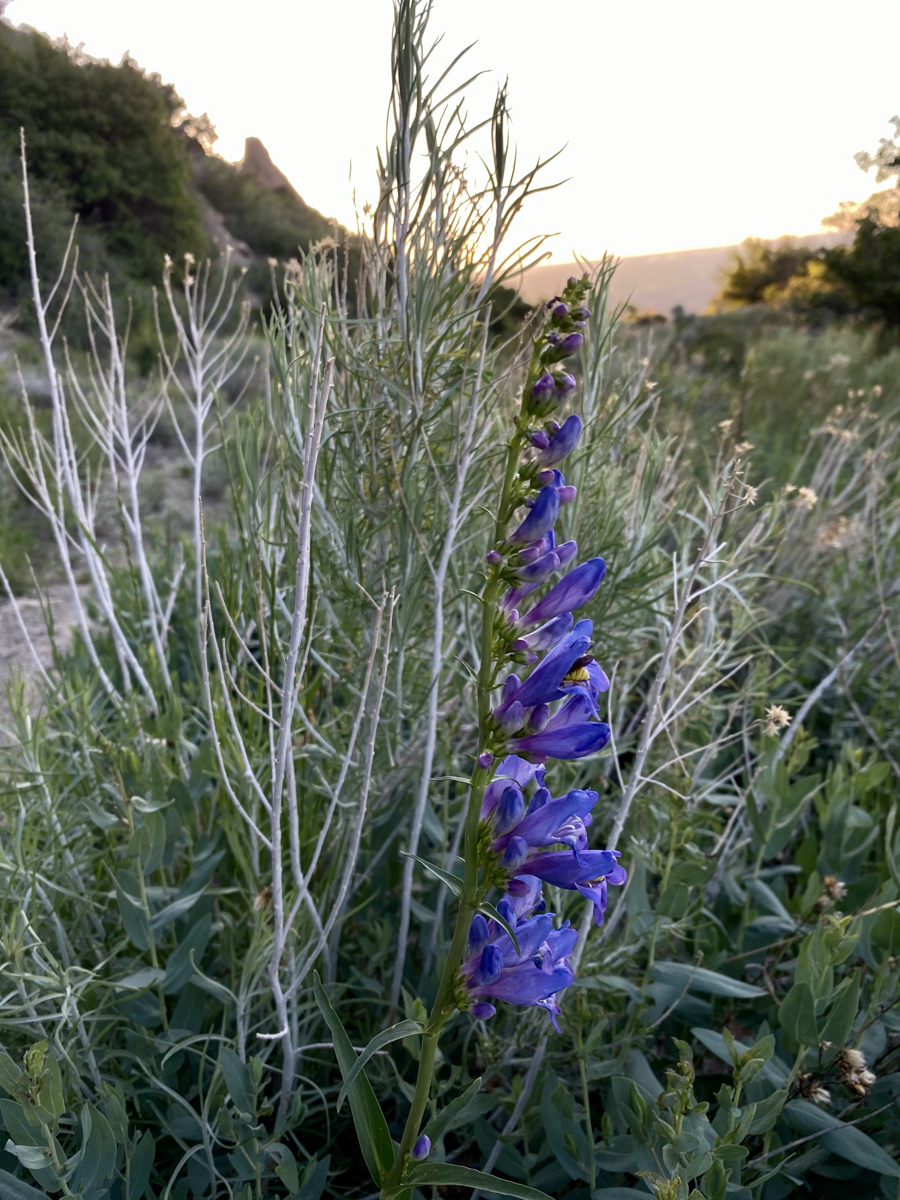
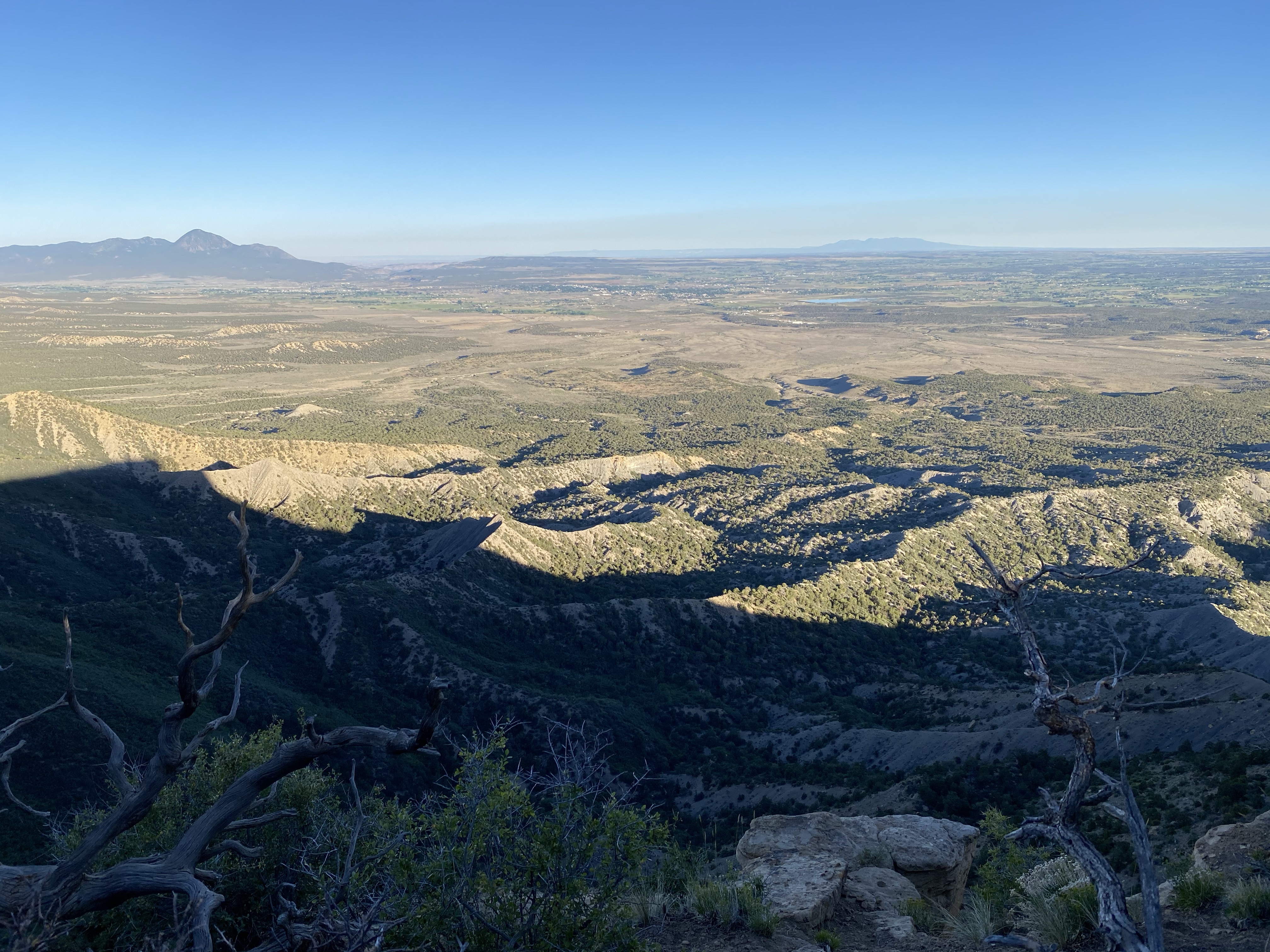
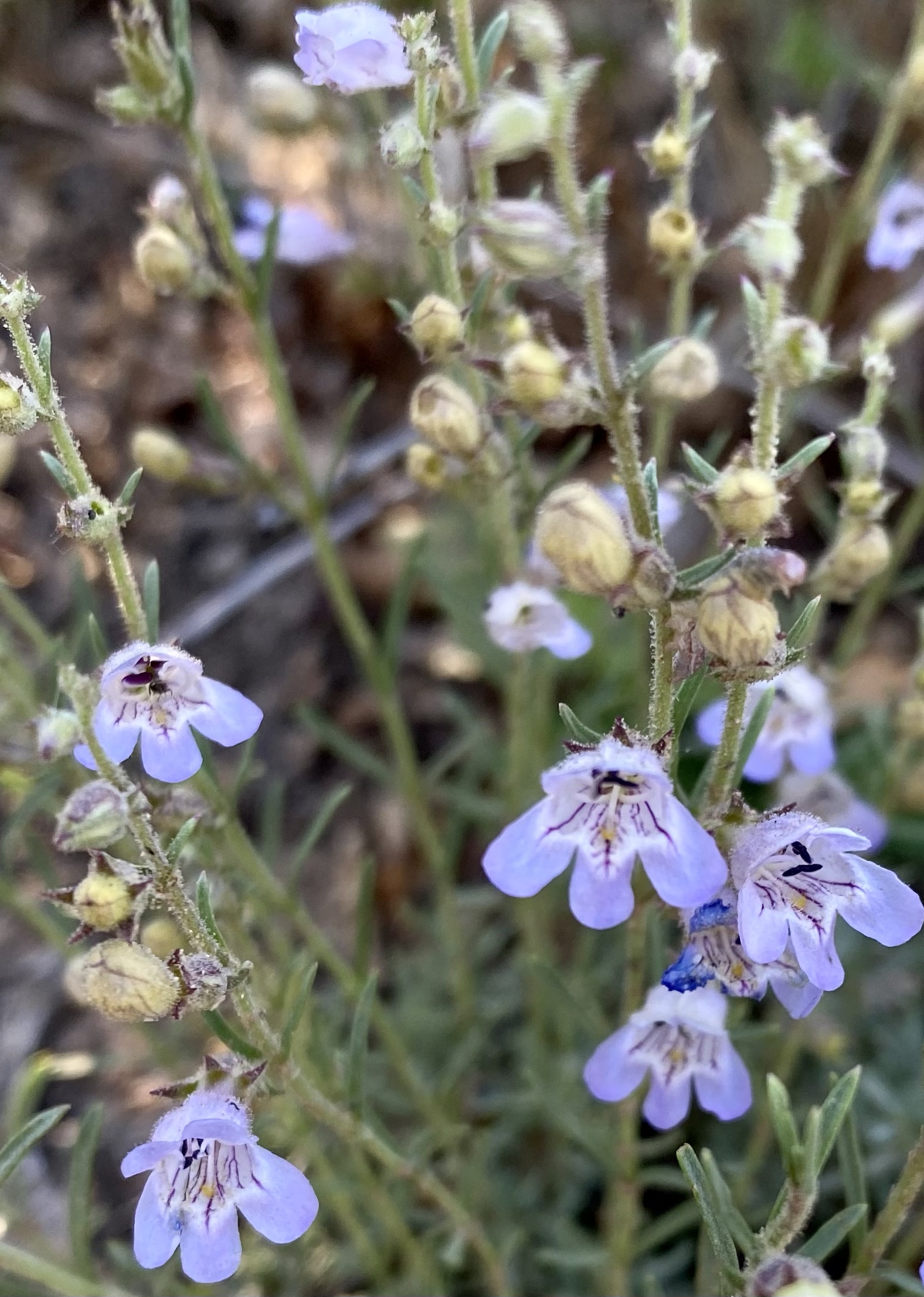
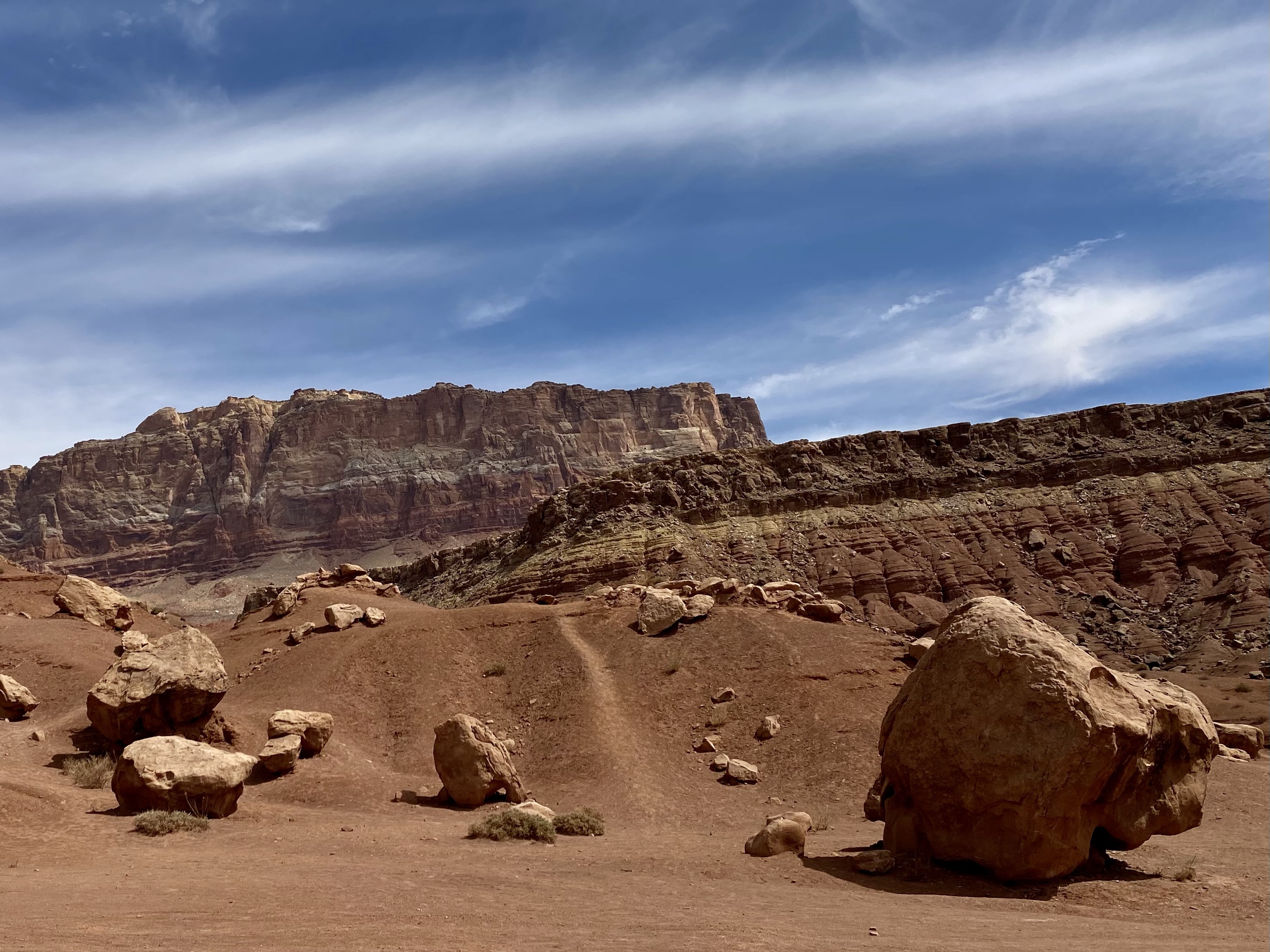
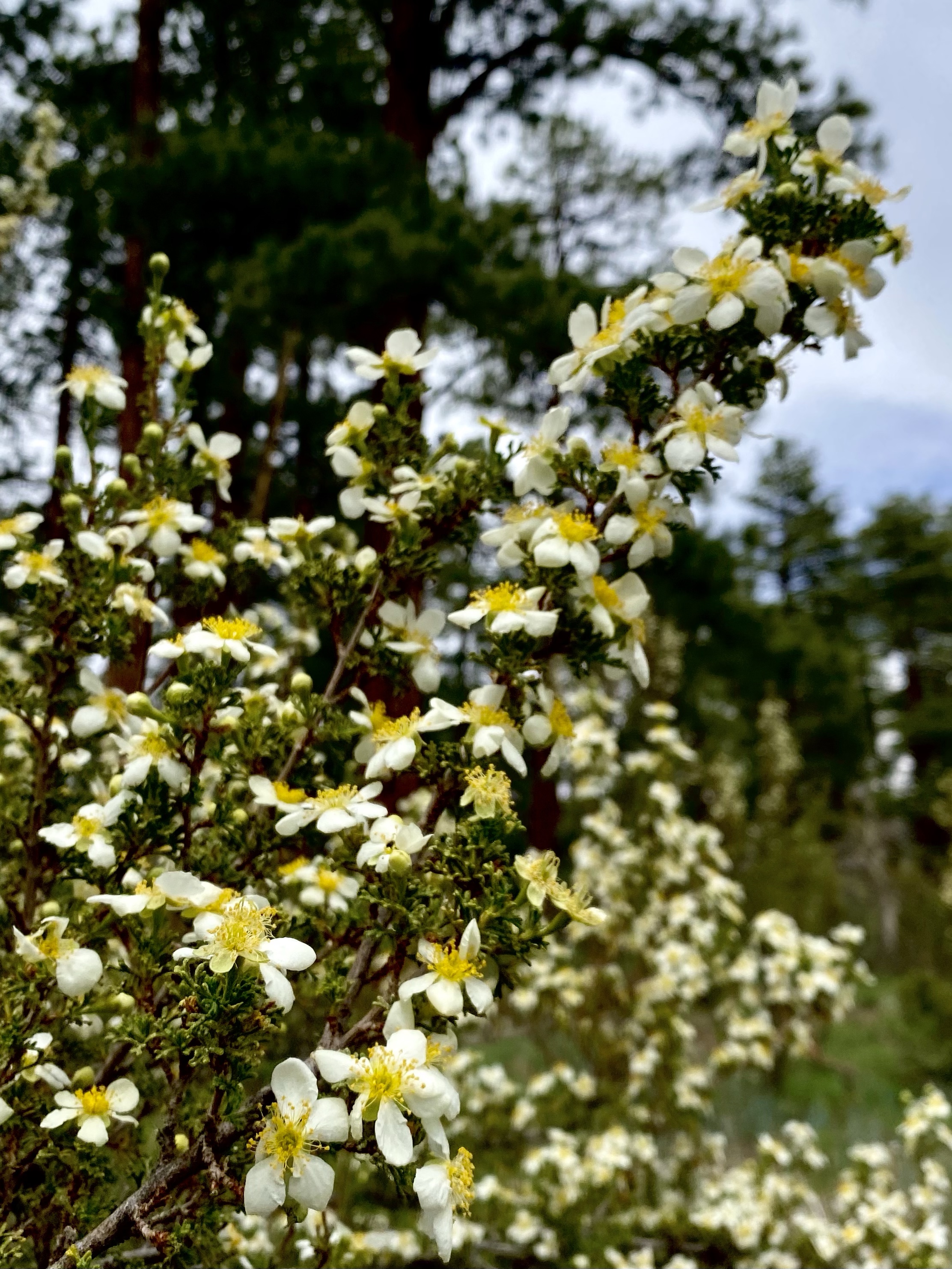
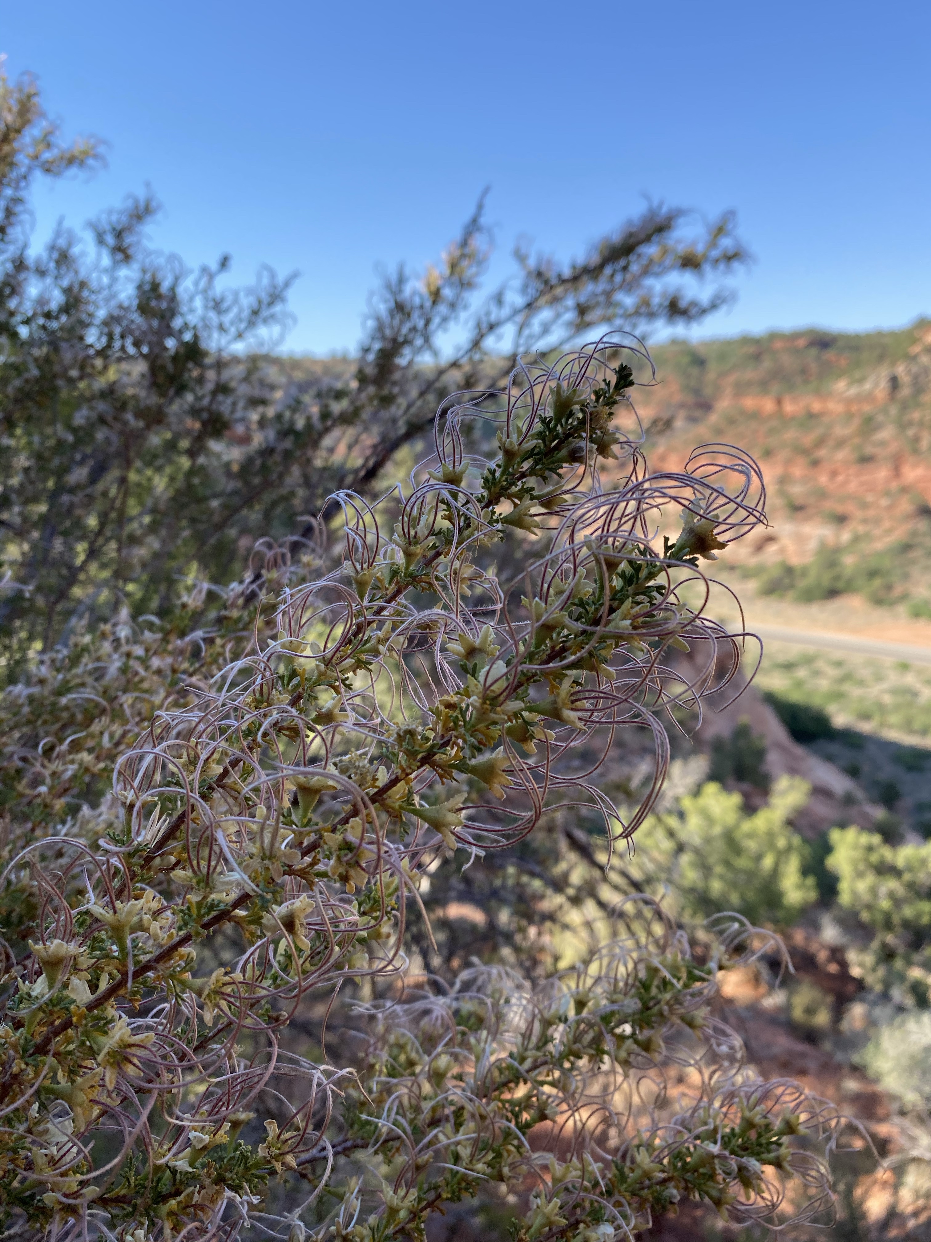
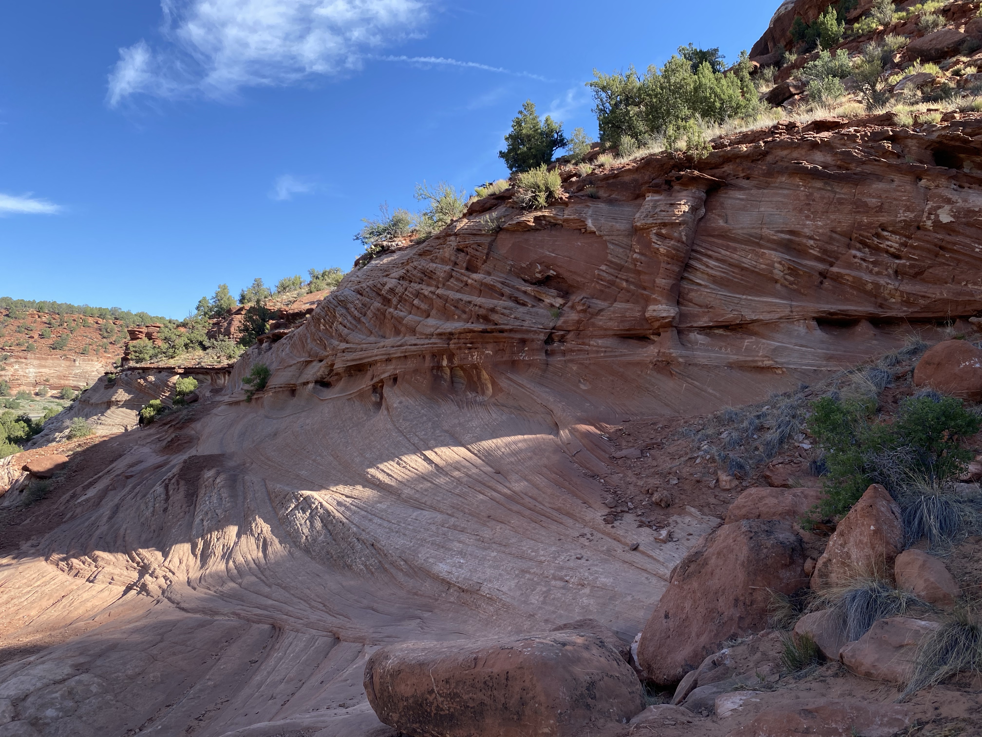
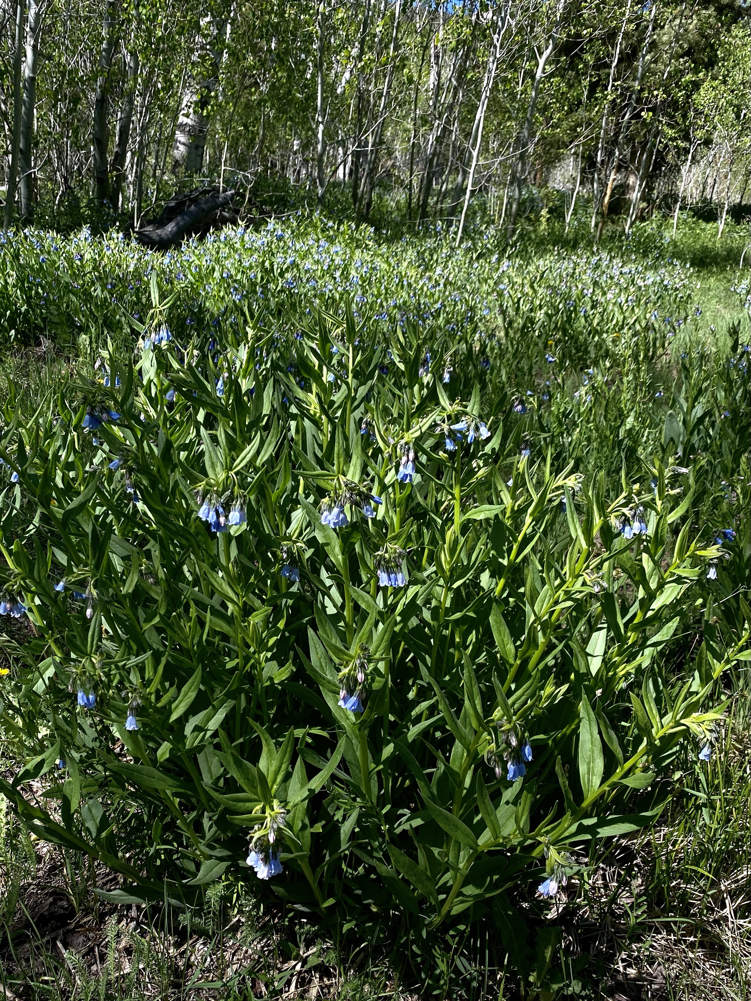
The mesa top is a recovering forest, burned in the recent past from a common forest fire. Gnarled tree trunks remain standing, surrounded by fields of green grass and bright wildflowers. Being on top of the mesa means you can see for a long distance on a clear day, mountains barely visible miles away.
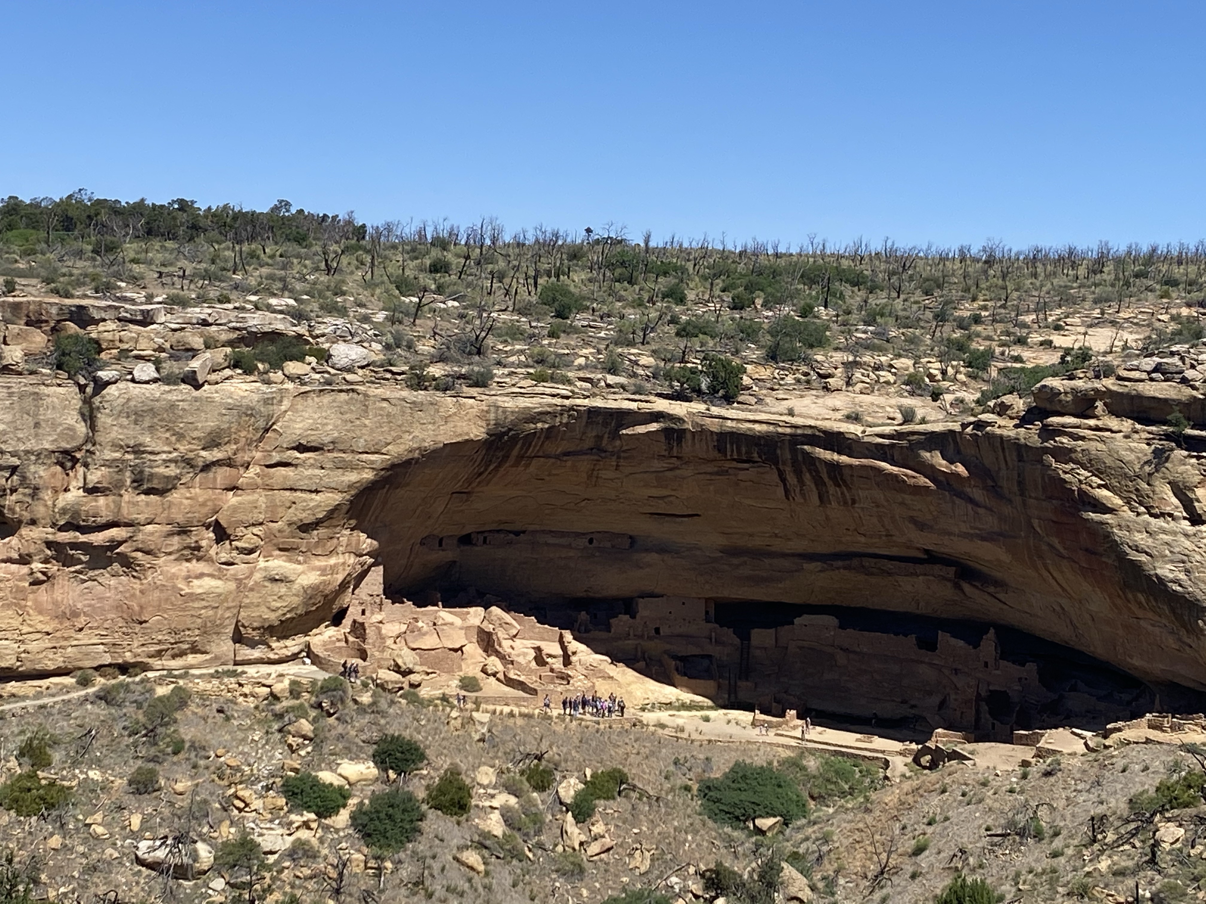
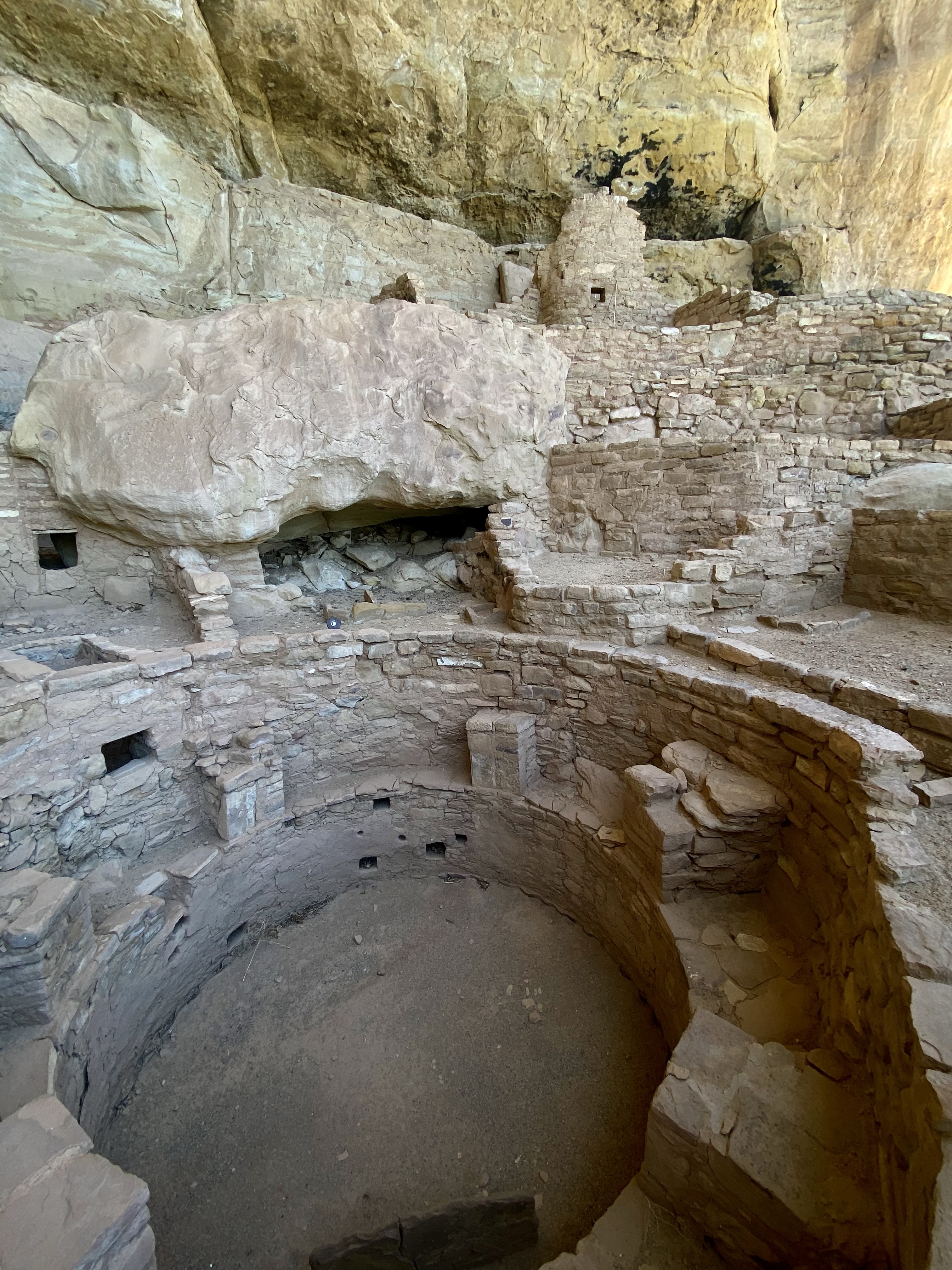
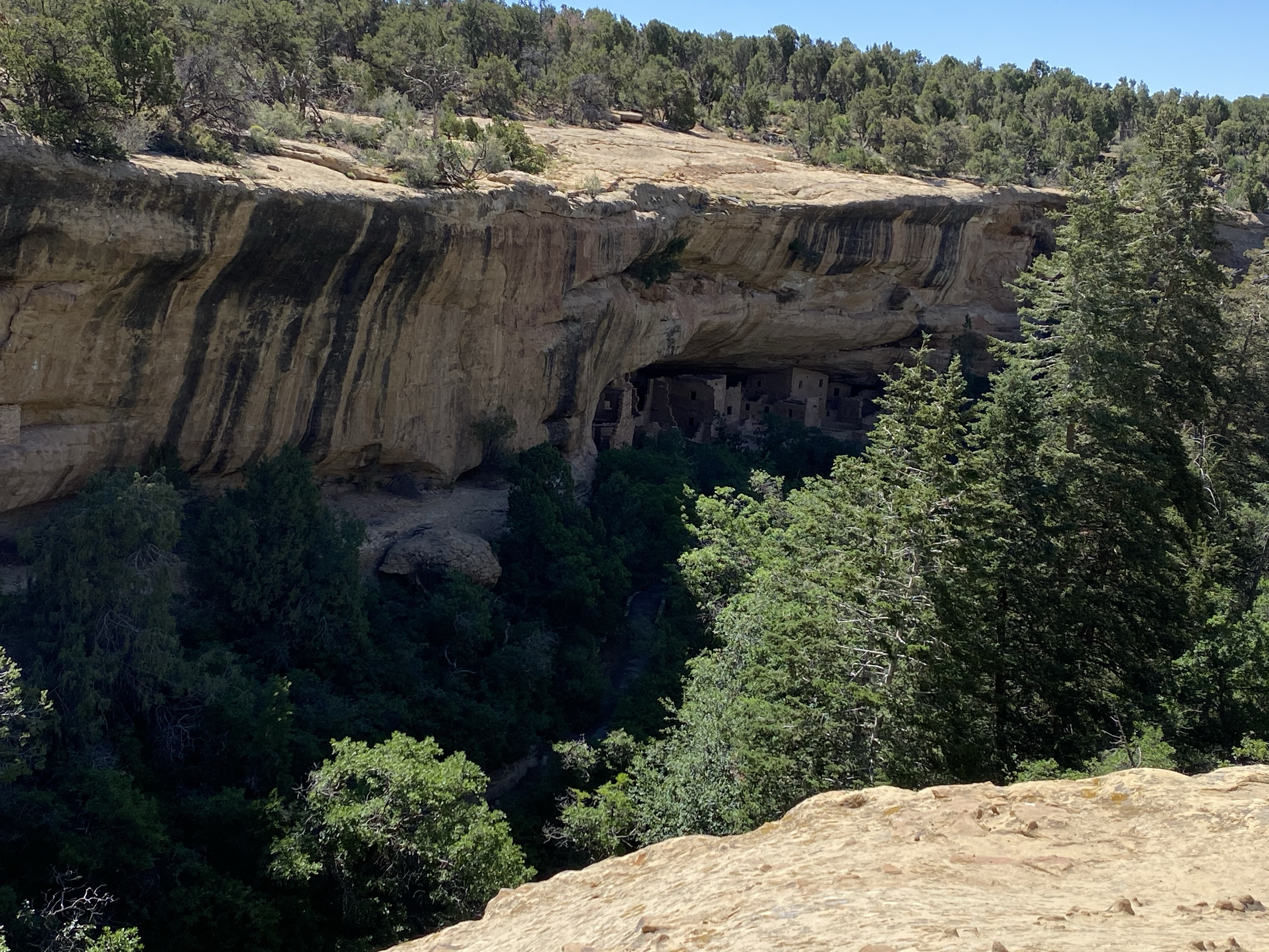
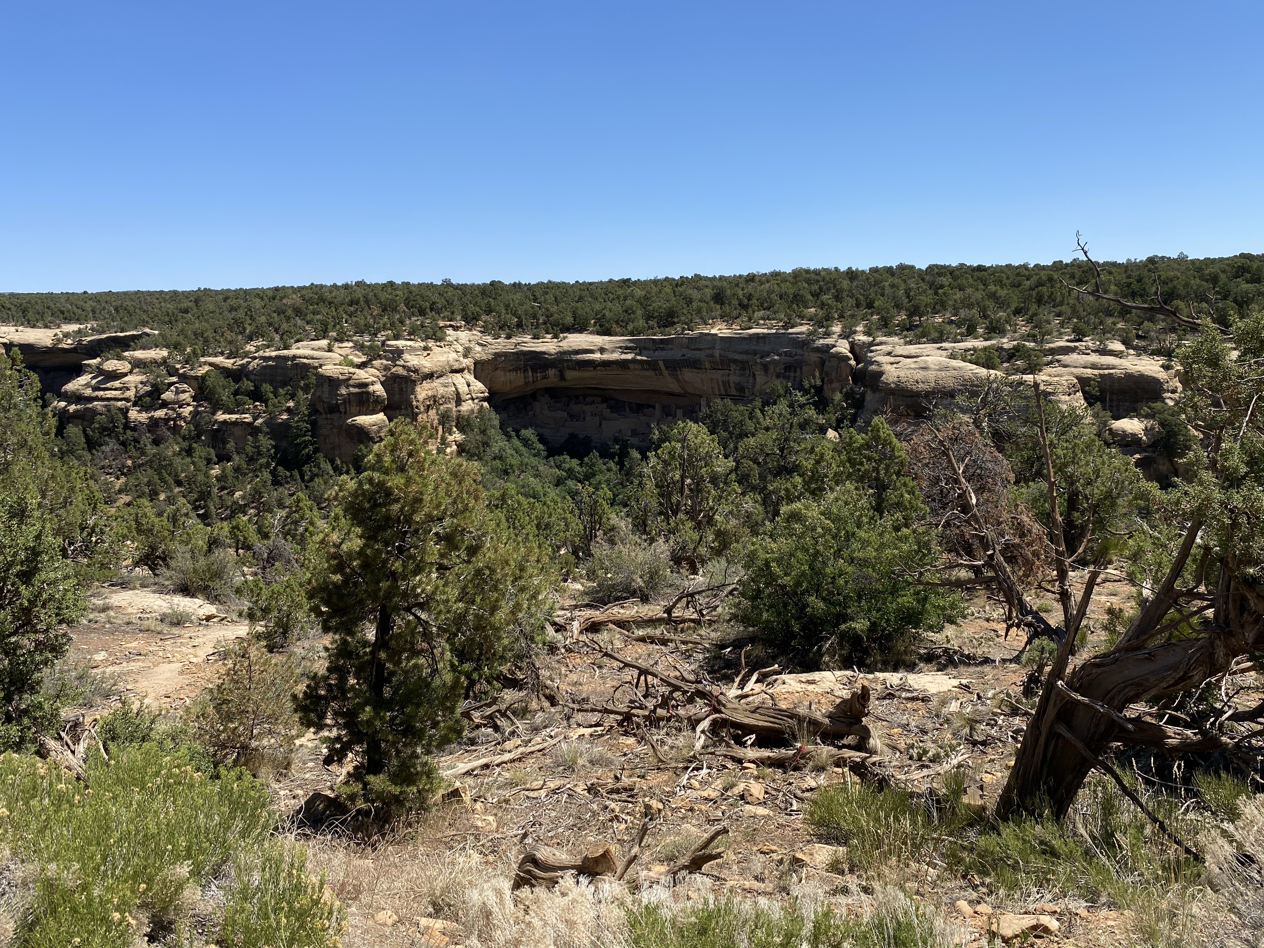
My first stop was the Long House Overlook. This cliff dwelling was discovered in 1889 by The Wetherill Brothers (hence the name of the mesa). They excavated a few rooms but the majority of the site was left untouched until 1961 when the National Park Service and National Geographic Society were collaborating in a massive, multi-year archeological project, the country’s first large-scale one. The Long House is set in a 298 foot long alcove and has about 150 rooms and 21 kivas. It dates back to AD 1145-1279 and was home to between 150-175 people. To visit, you climb down 130 feet! This cliff dwelling may have been a place to hold community gatherings or trade goods. It has an unusually large formal plaza and high number of rooms, suggesting it was an important place. While I couldn’t tell much of this from afar, I did marvel at home people constructed such a village 130 feet below the mesa top! Wow.
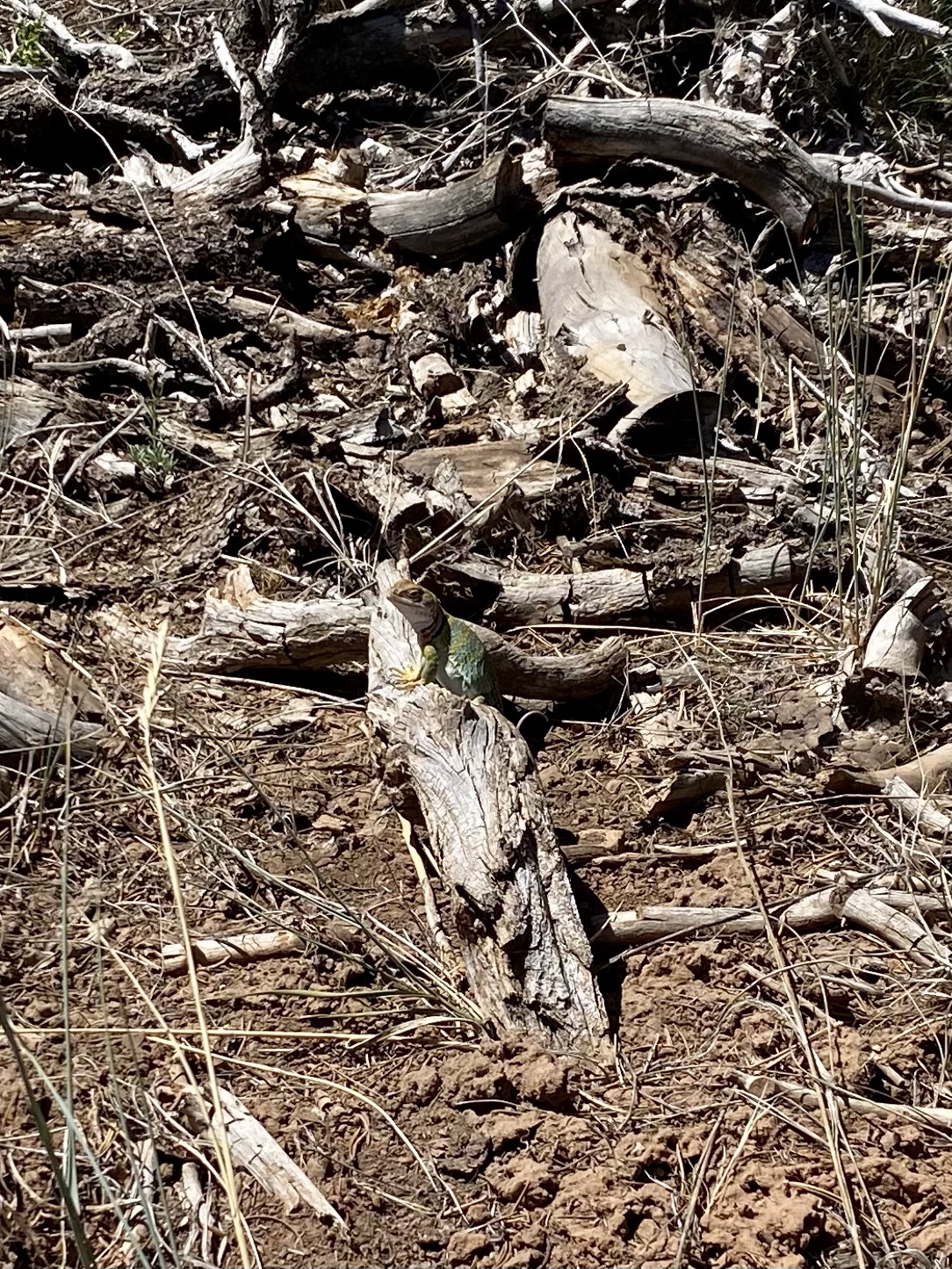
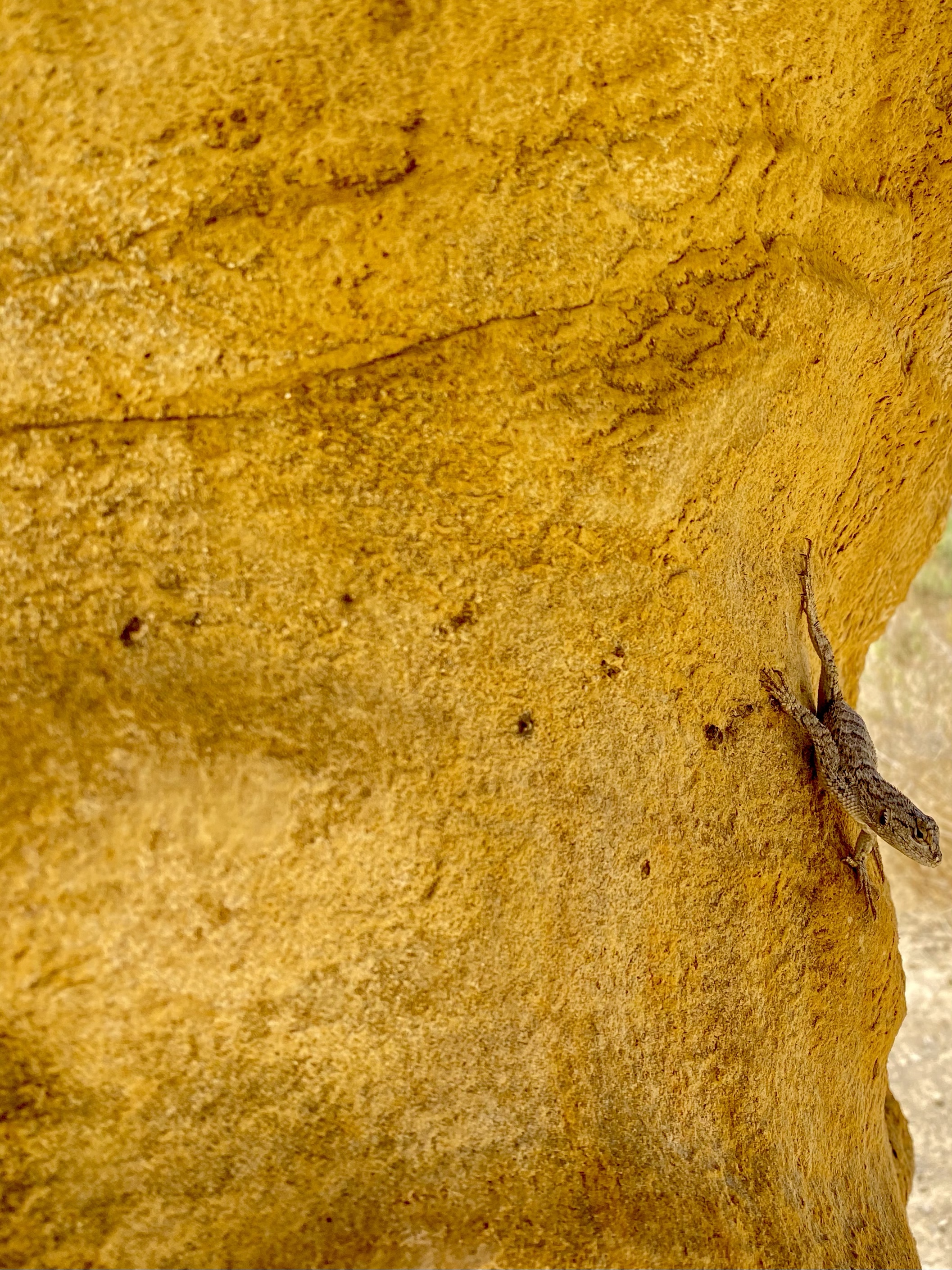
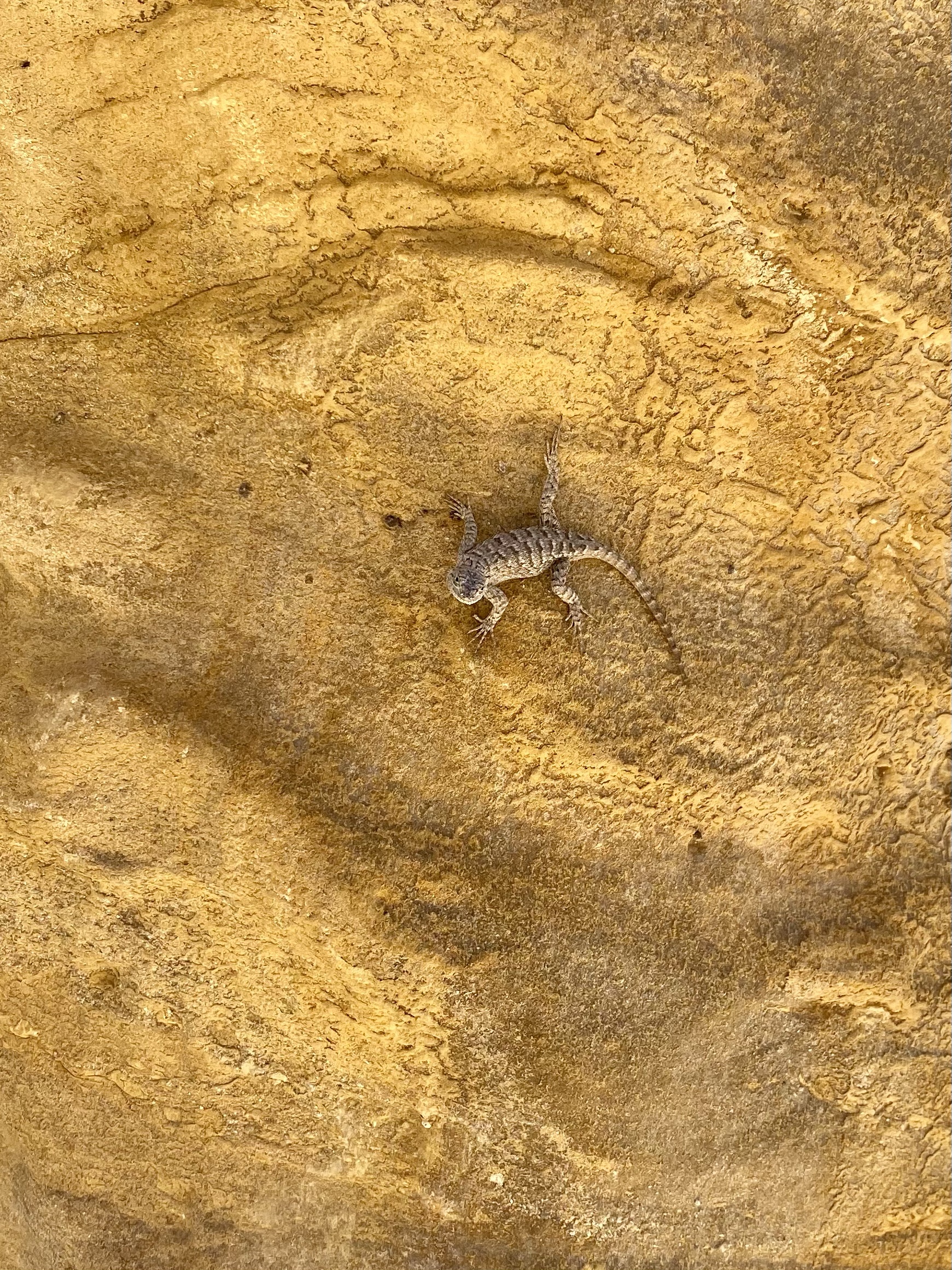
On my way to my next stop I was treated to a show from a colorful, far lizard posing nicely on a branch. What a treat!
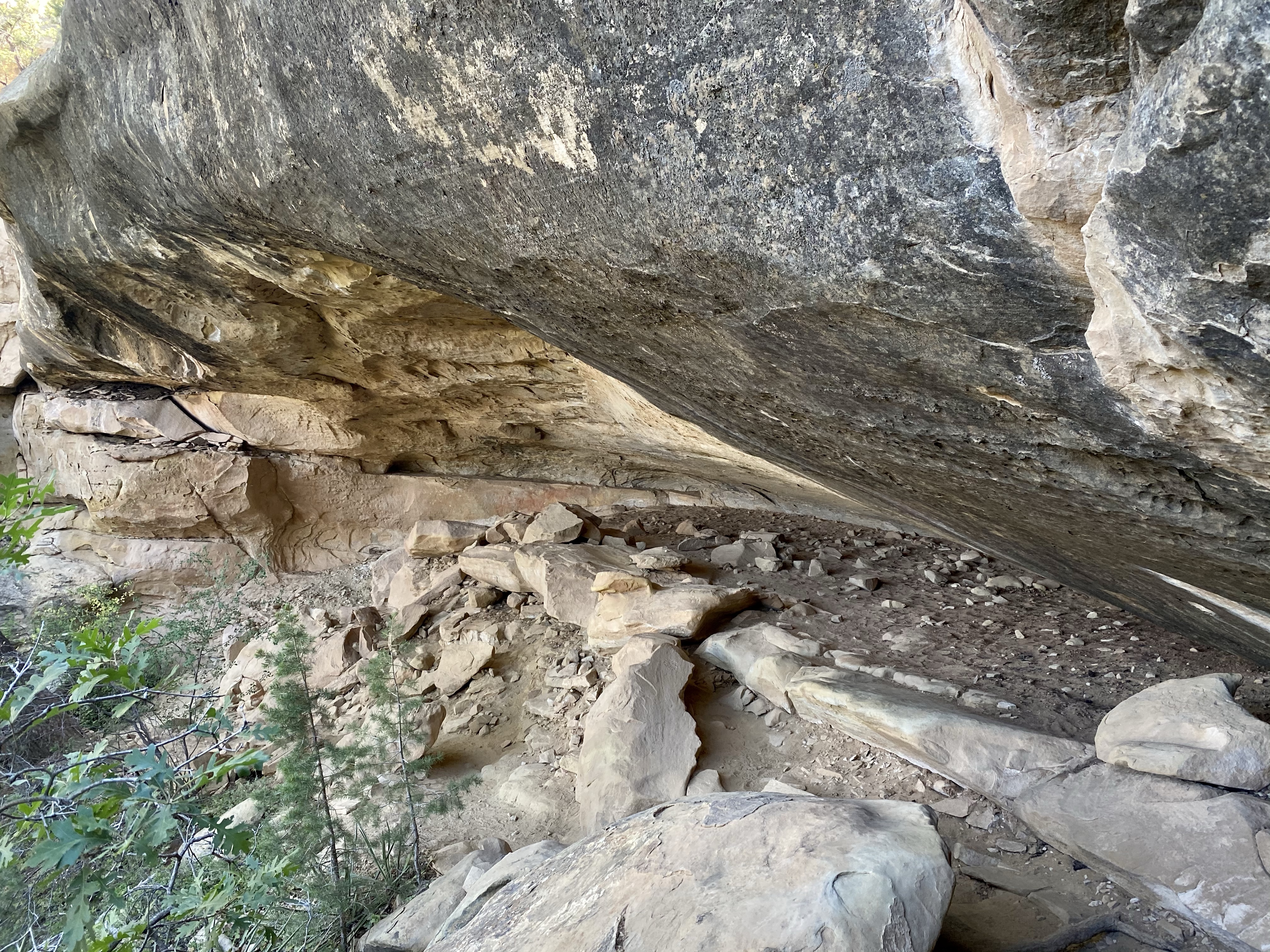
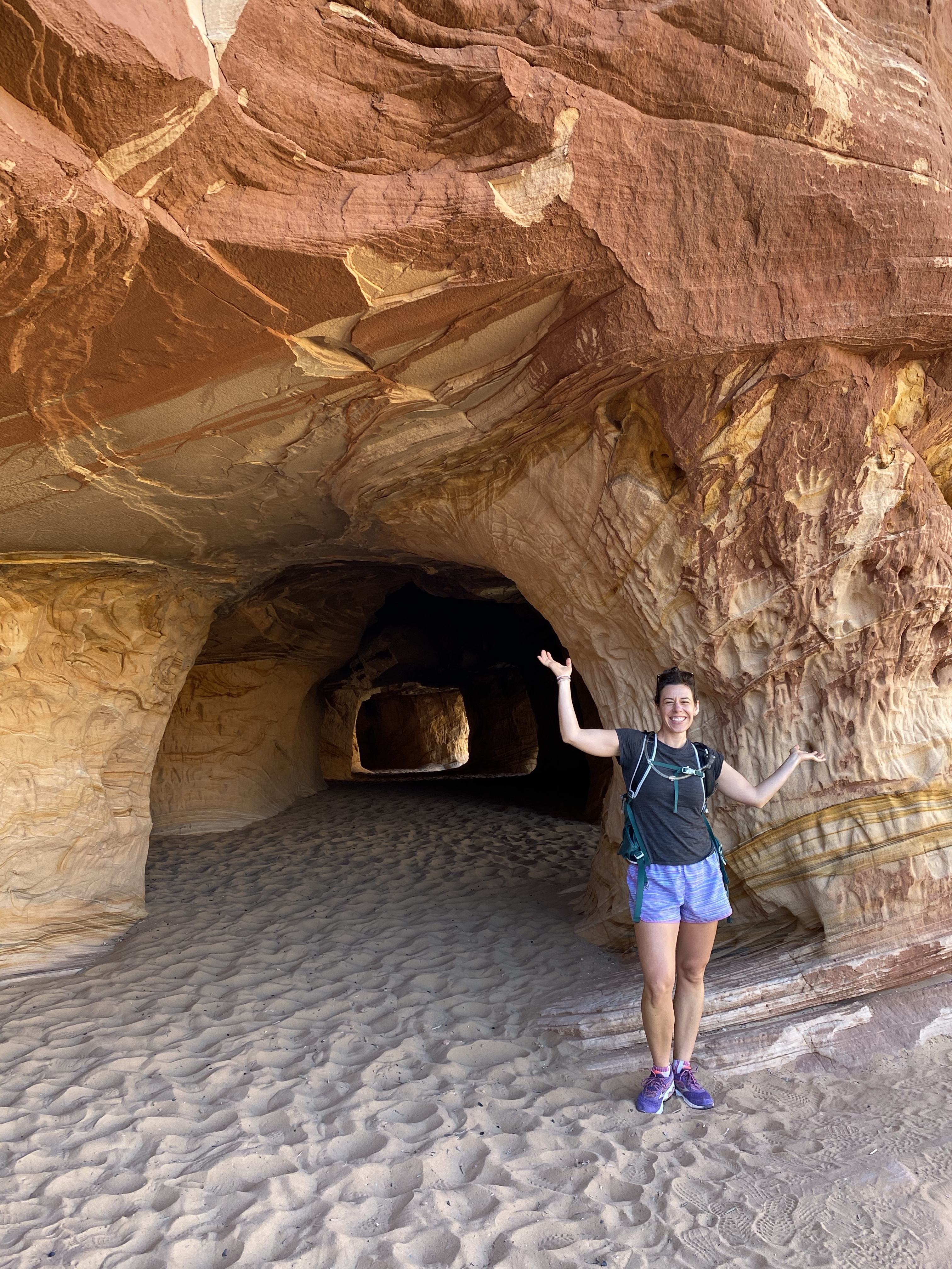
From there I continued on to the Kodak House, another large community but not as well preserved. The interesting thing about the Kodak House is the ravine above it. The Ancestral Pueblo people dams such ravines to make fertile soil in the terraces above their communities. The dam here hold three feet of soil behind it, showing how successful this practice was.
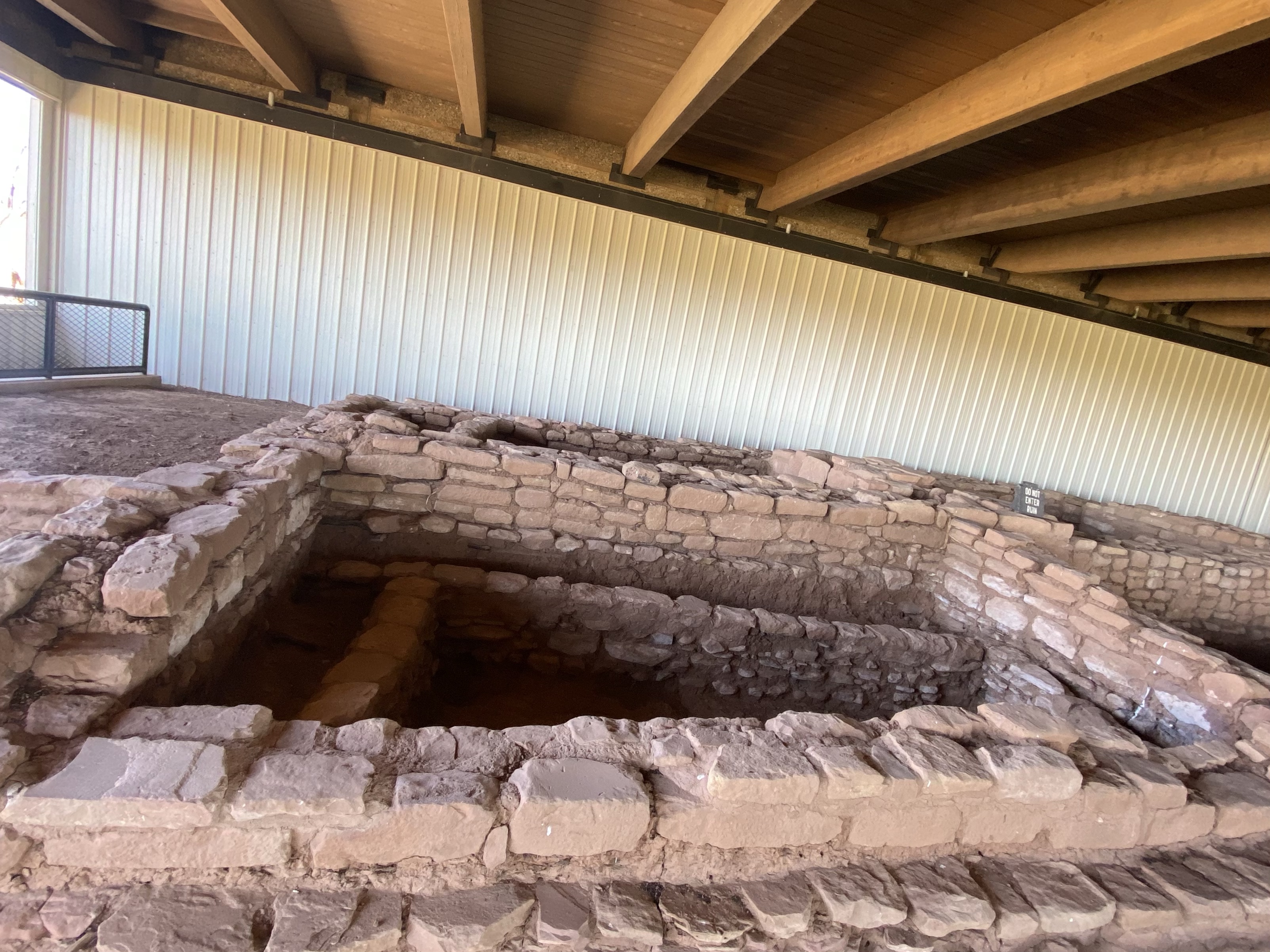
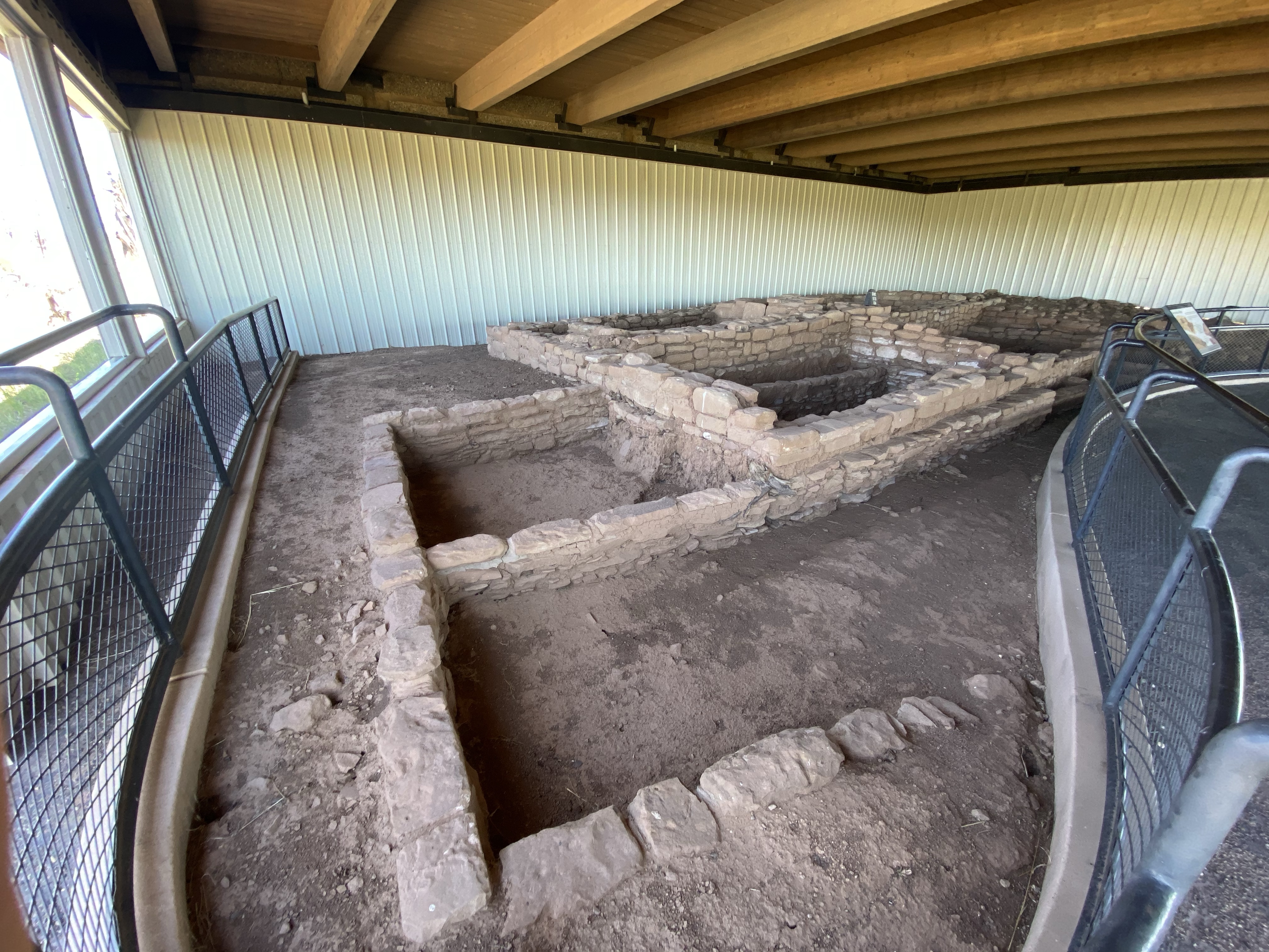
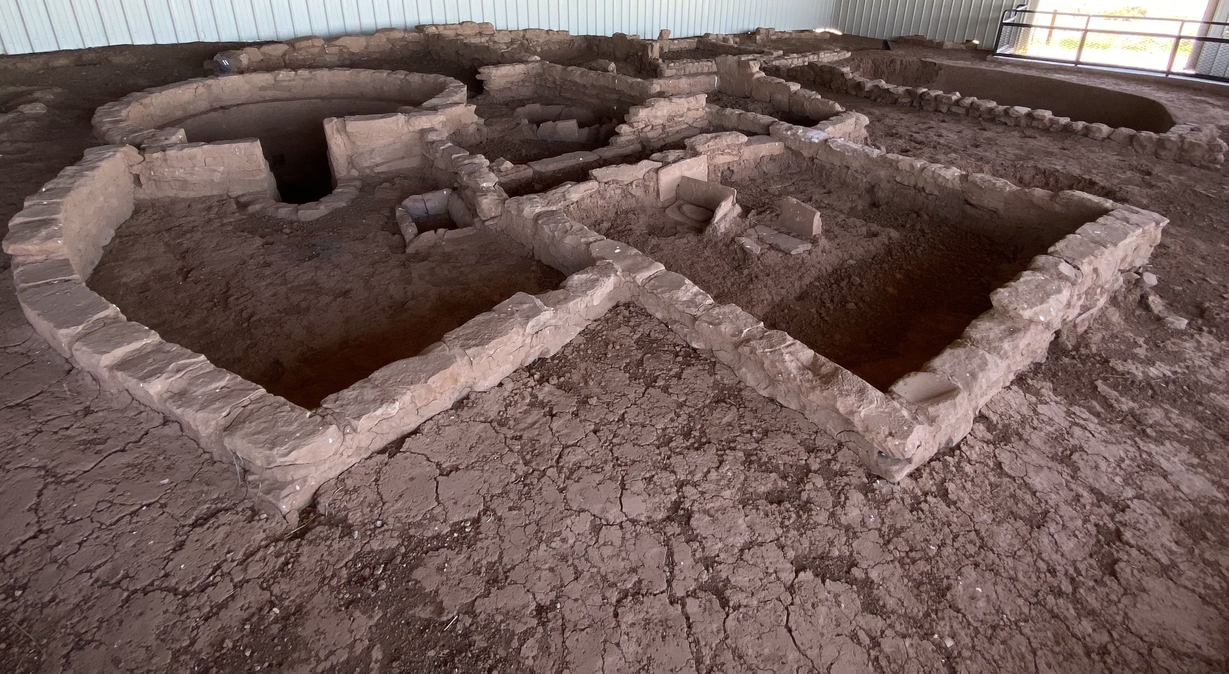
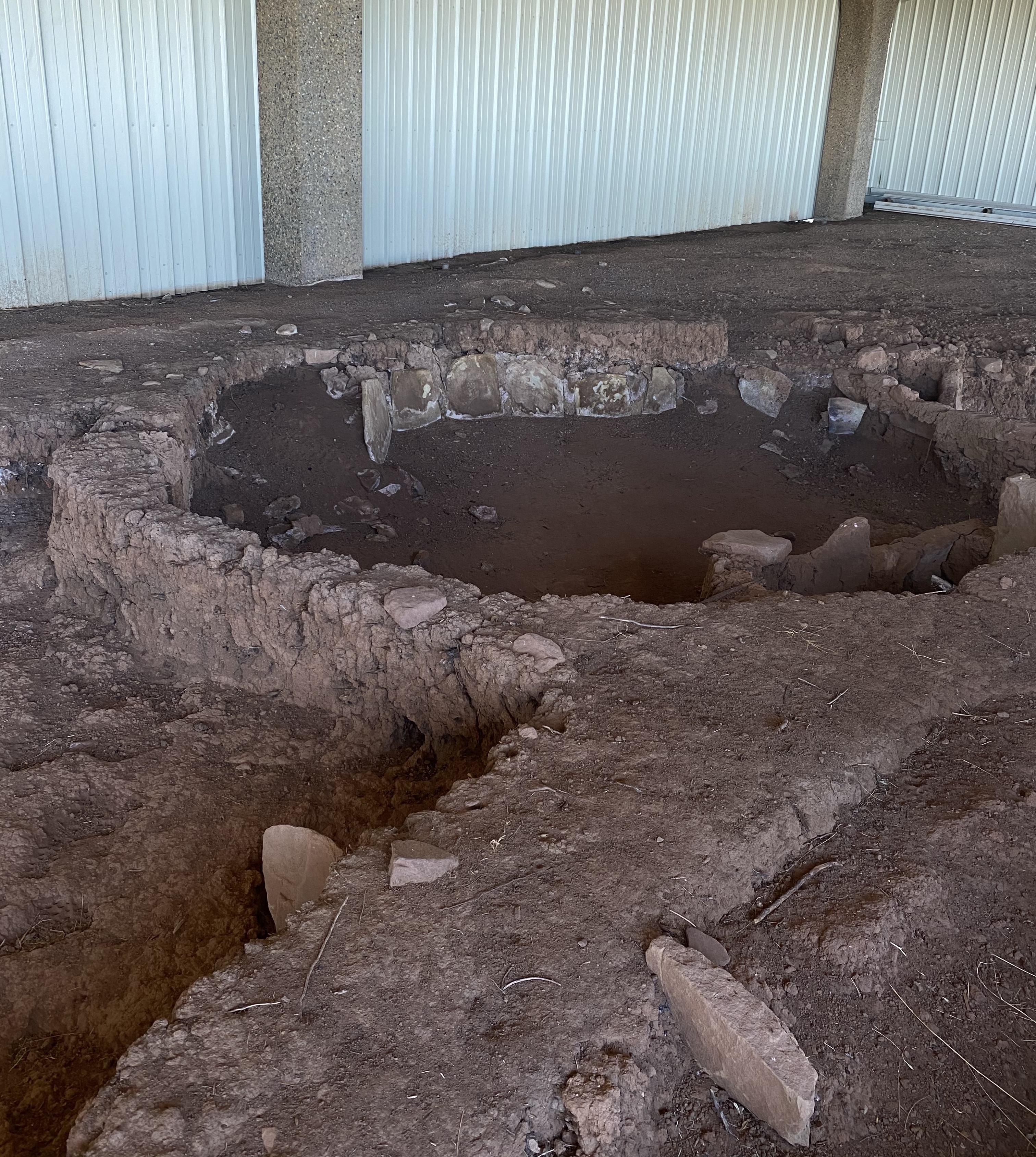
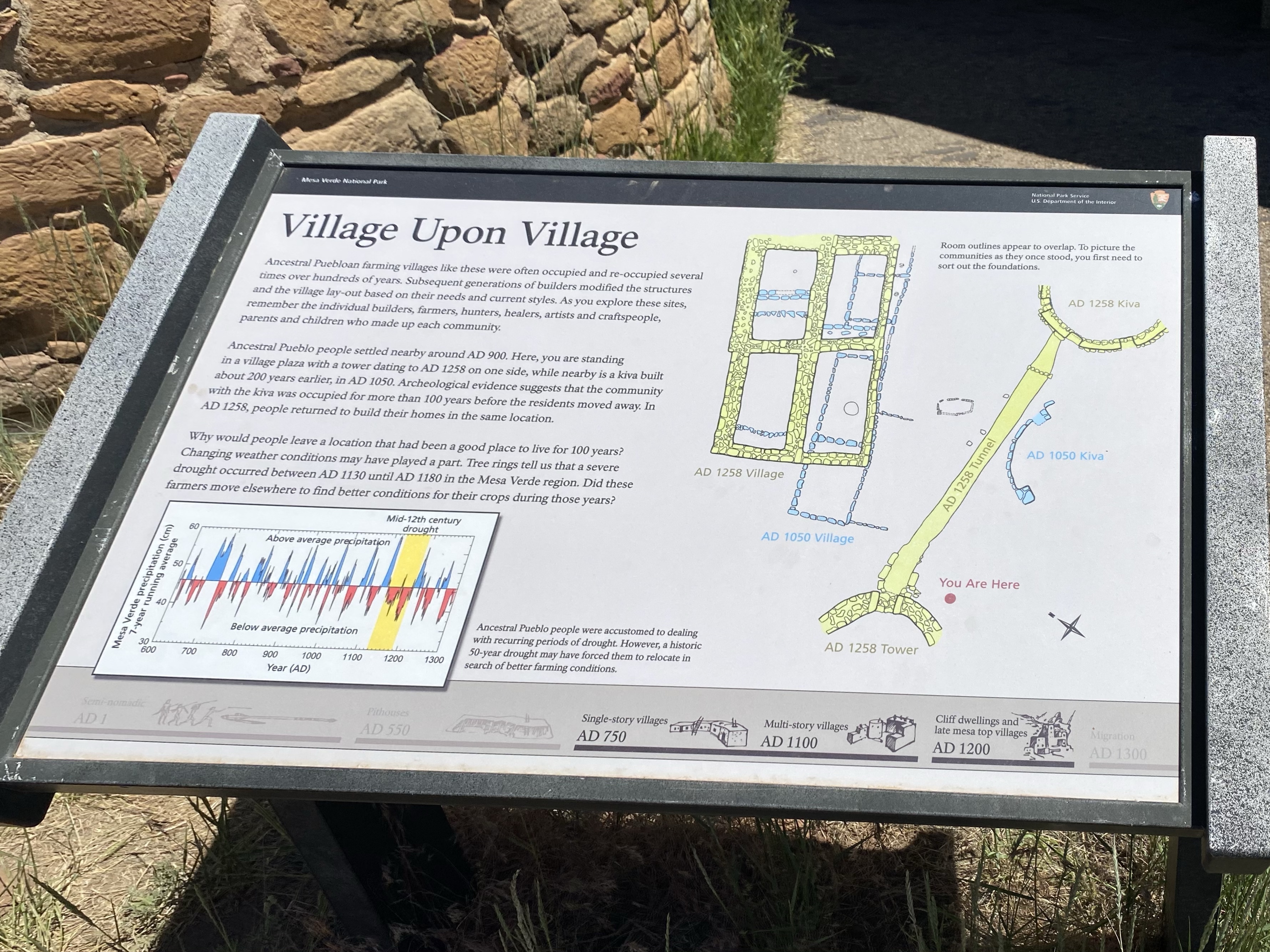
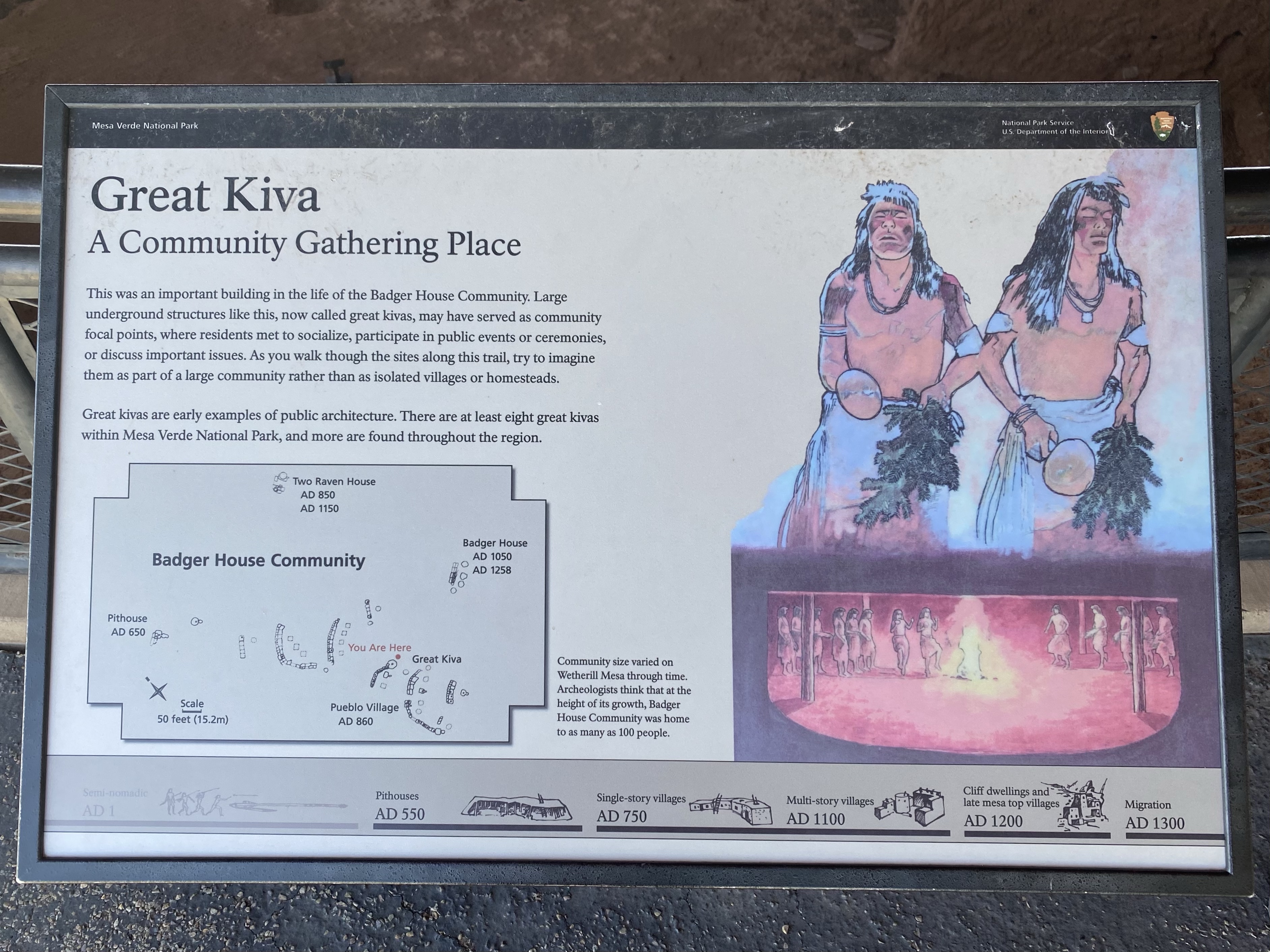
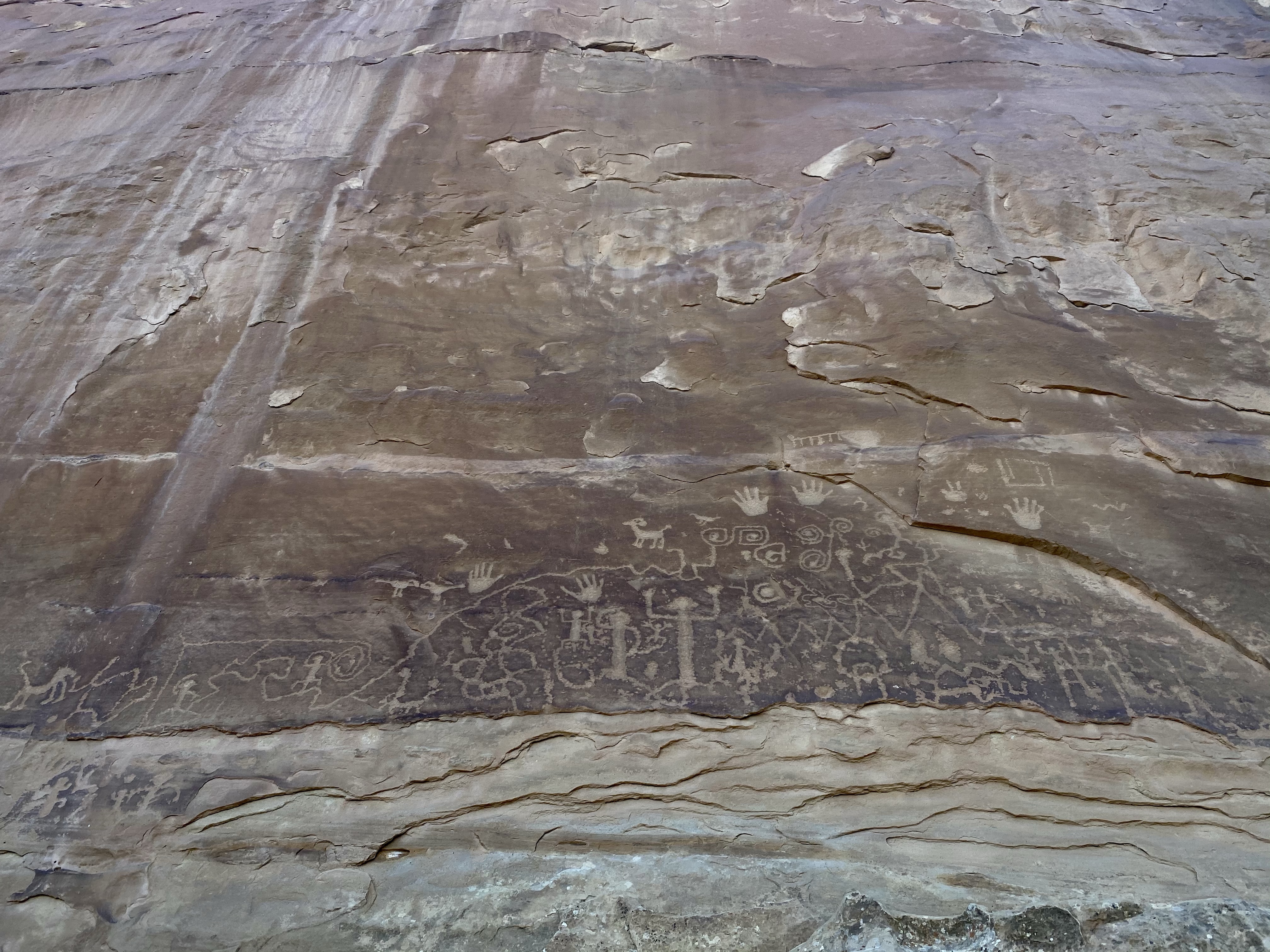
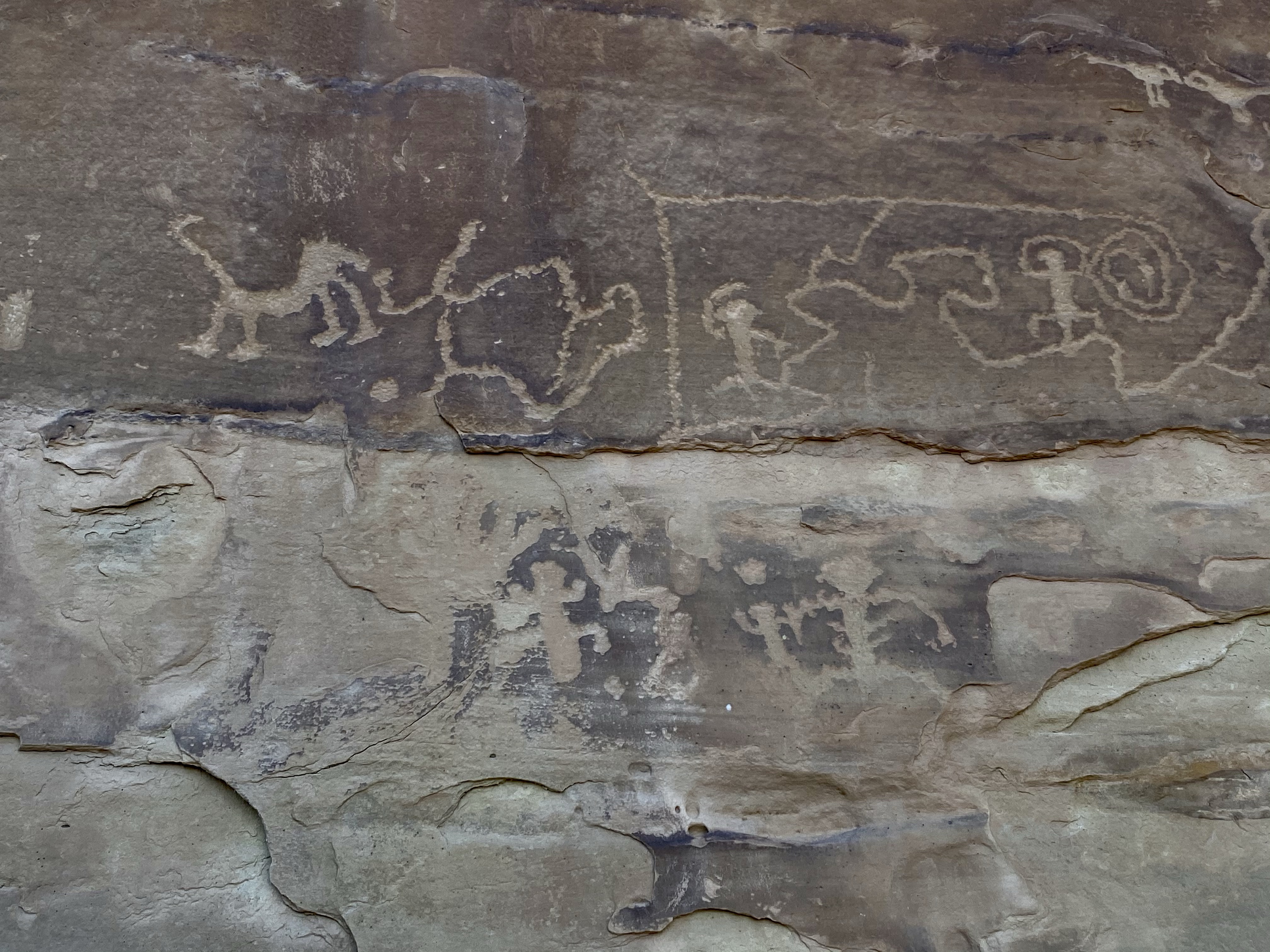
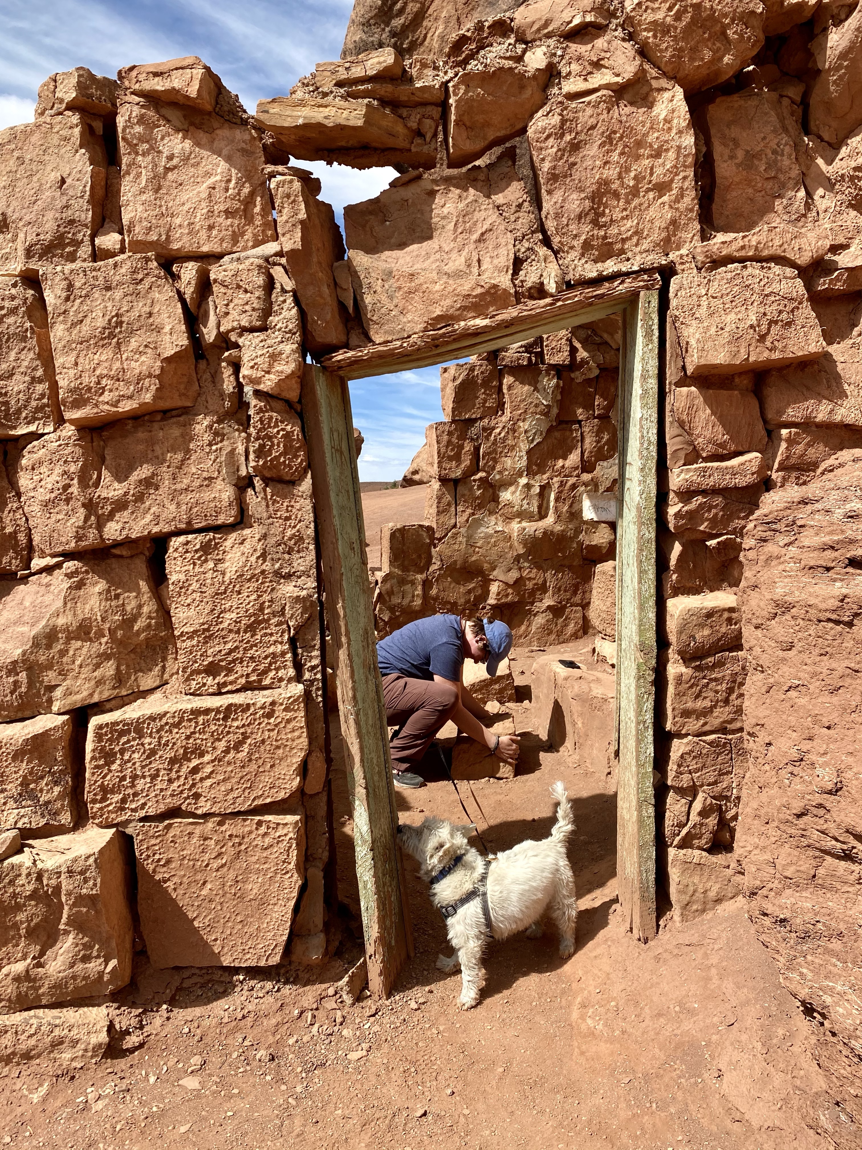
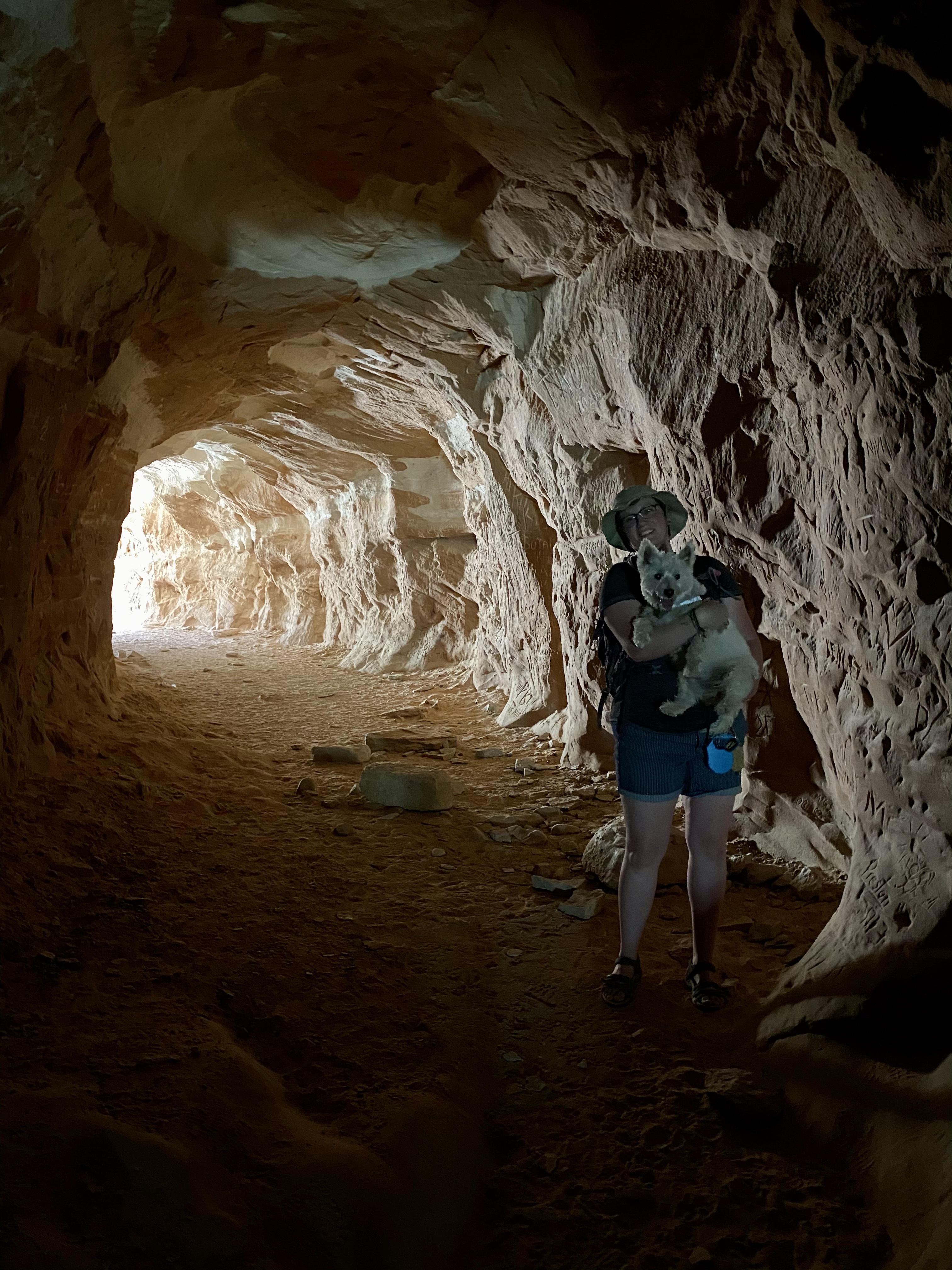
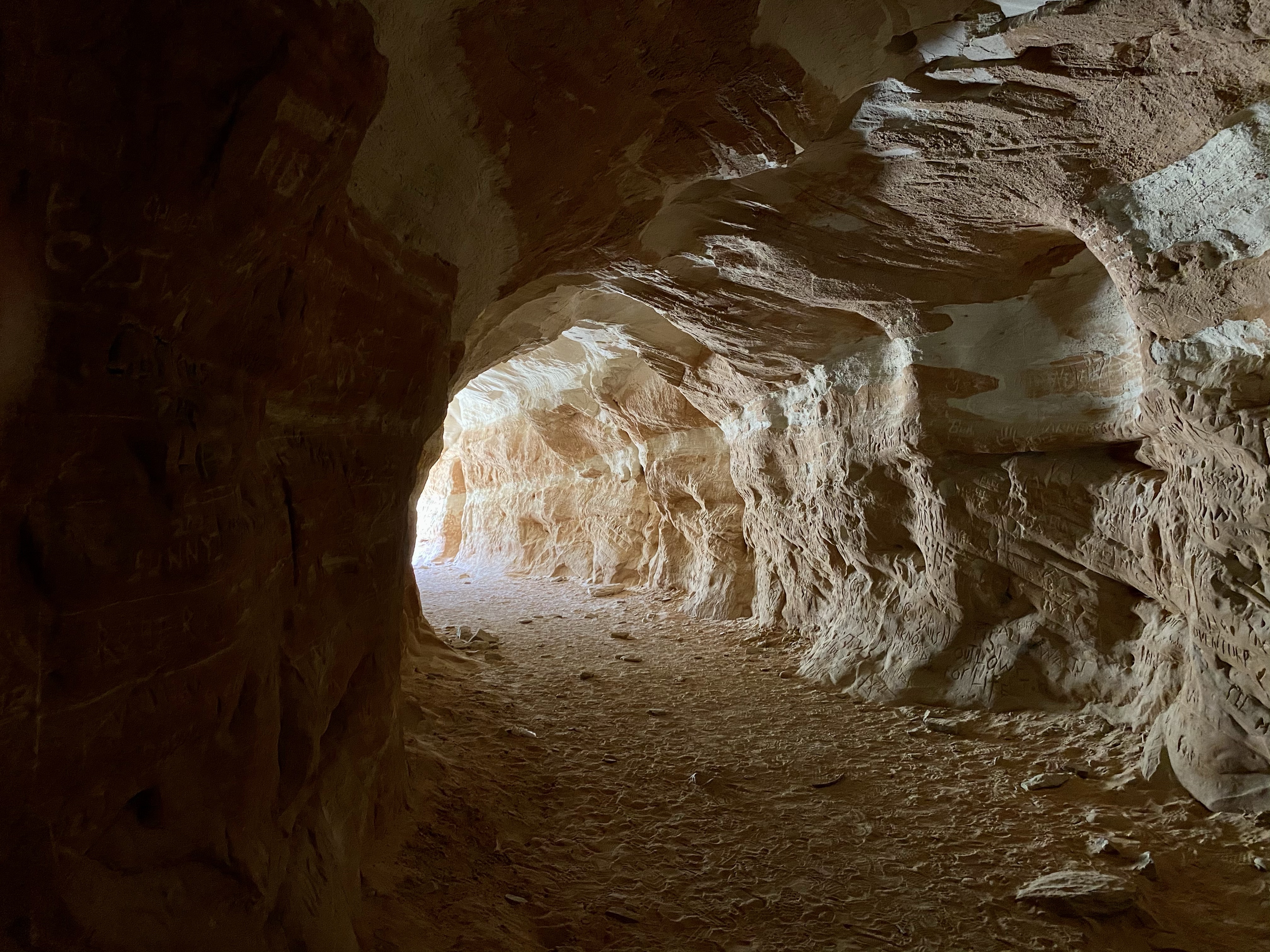
As I continued my walk I had the company of a fellow learner. Good conversation helped pass the time and allowed us to share our newly gathered history lessons. Together we looked at the pit houses at Badger House Community, the red brick structures above and below ground. What surprised me most about these buildings were their small size! Due to little protein and genetics, it is assumed these Ancestral Pueblo people were of small stature. They must have been to fit in the rooms and doorways!
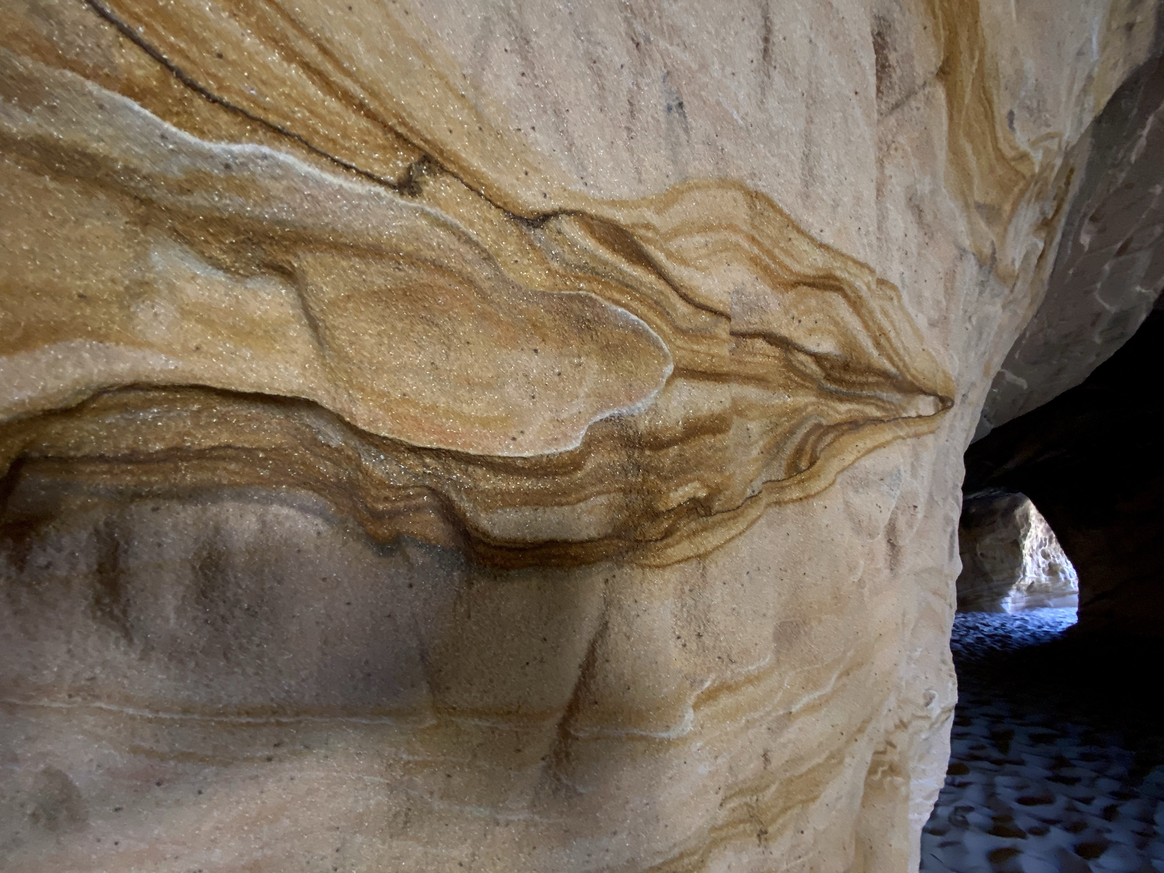
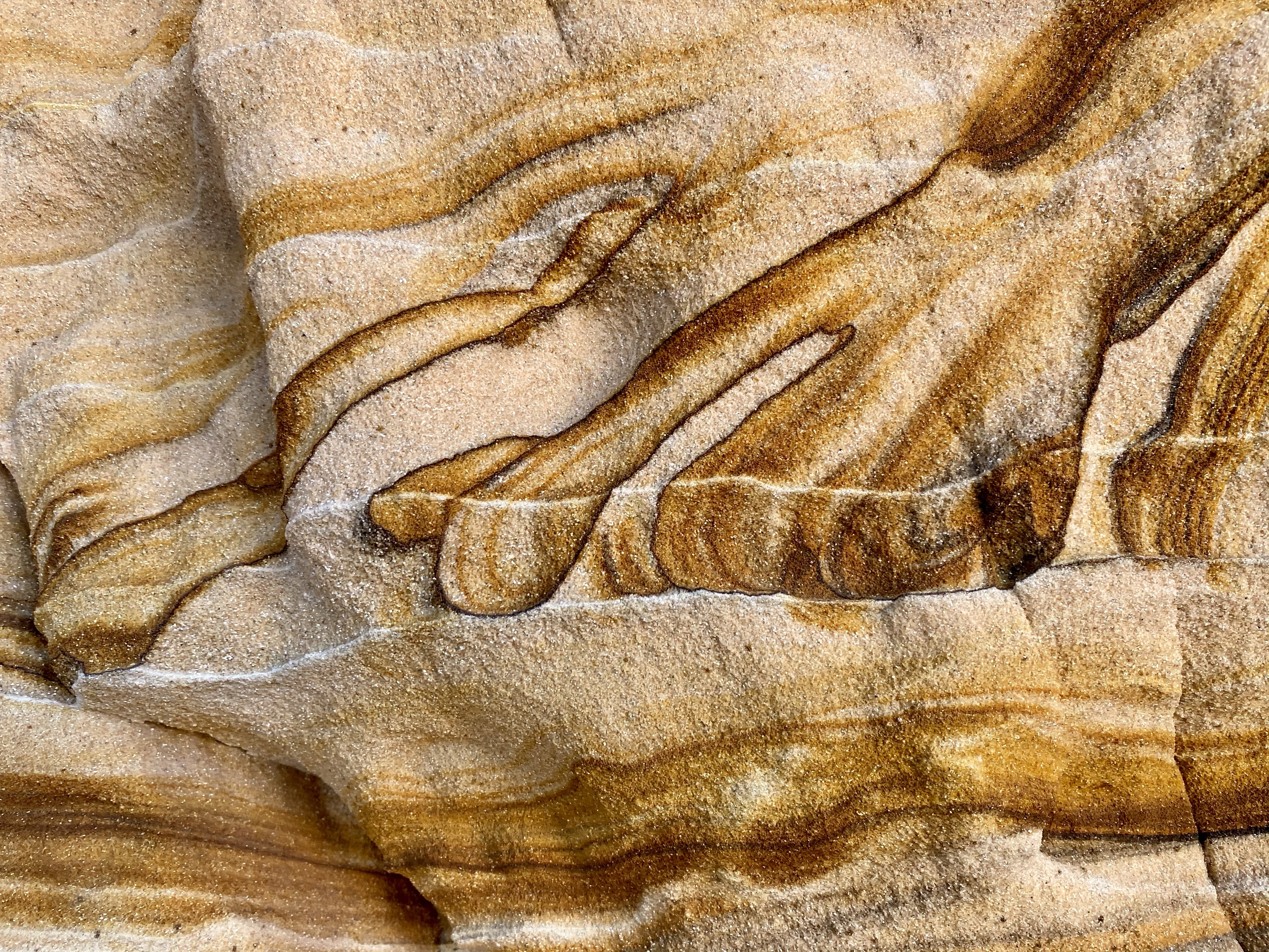
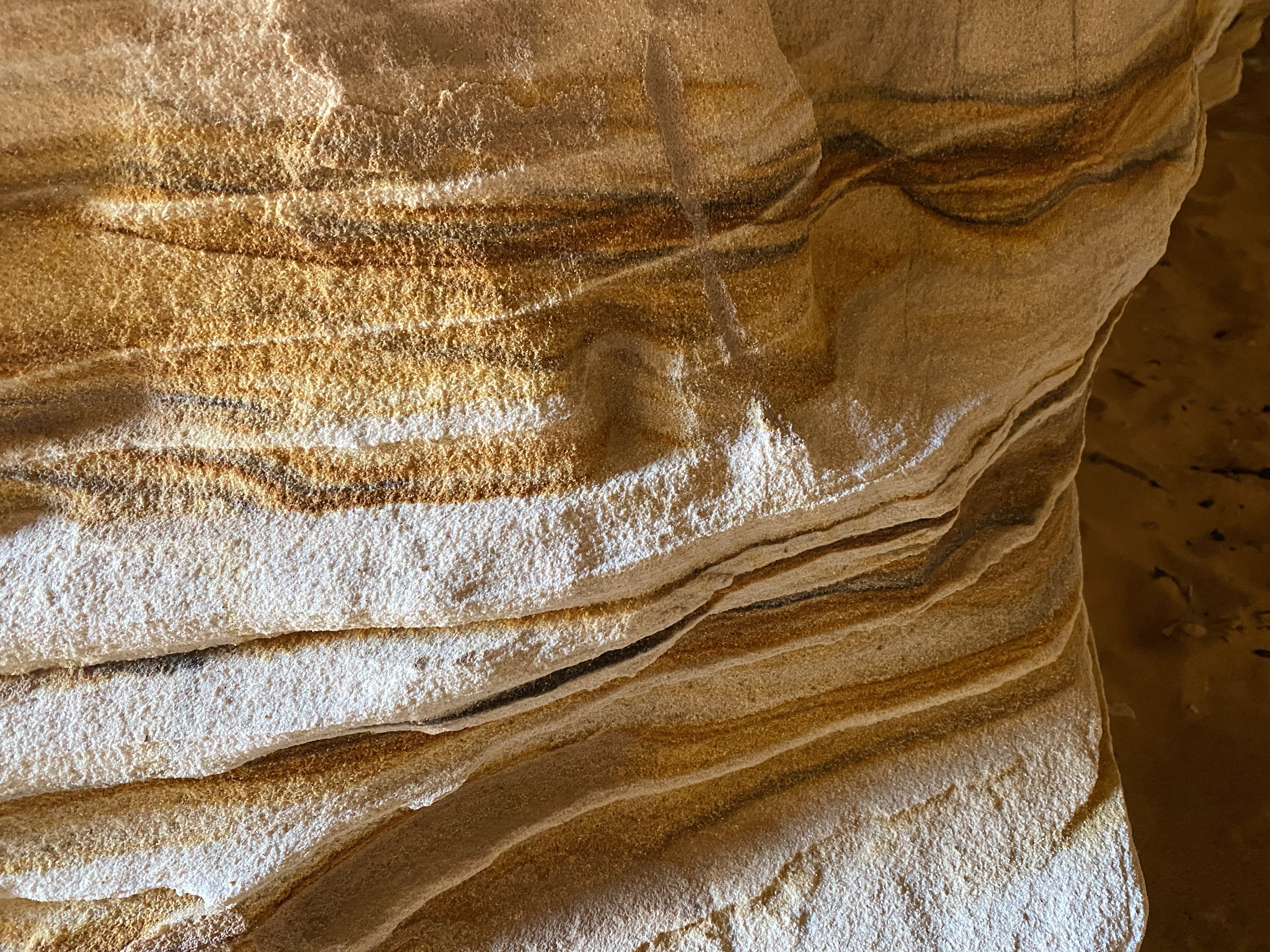
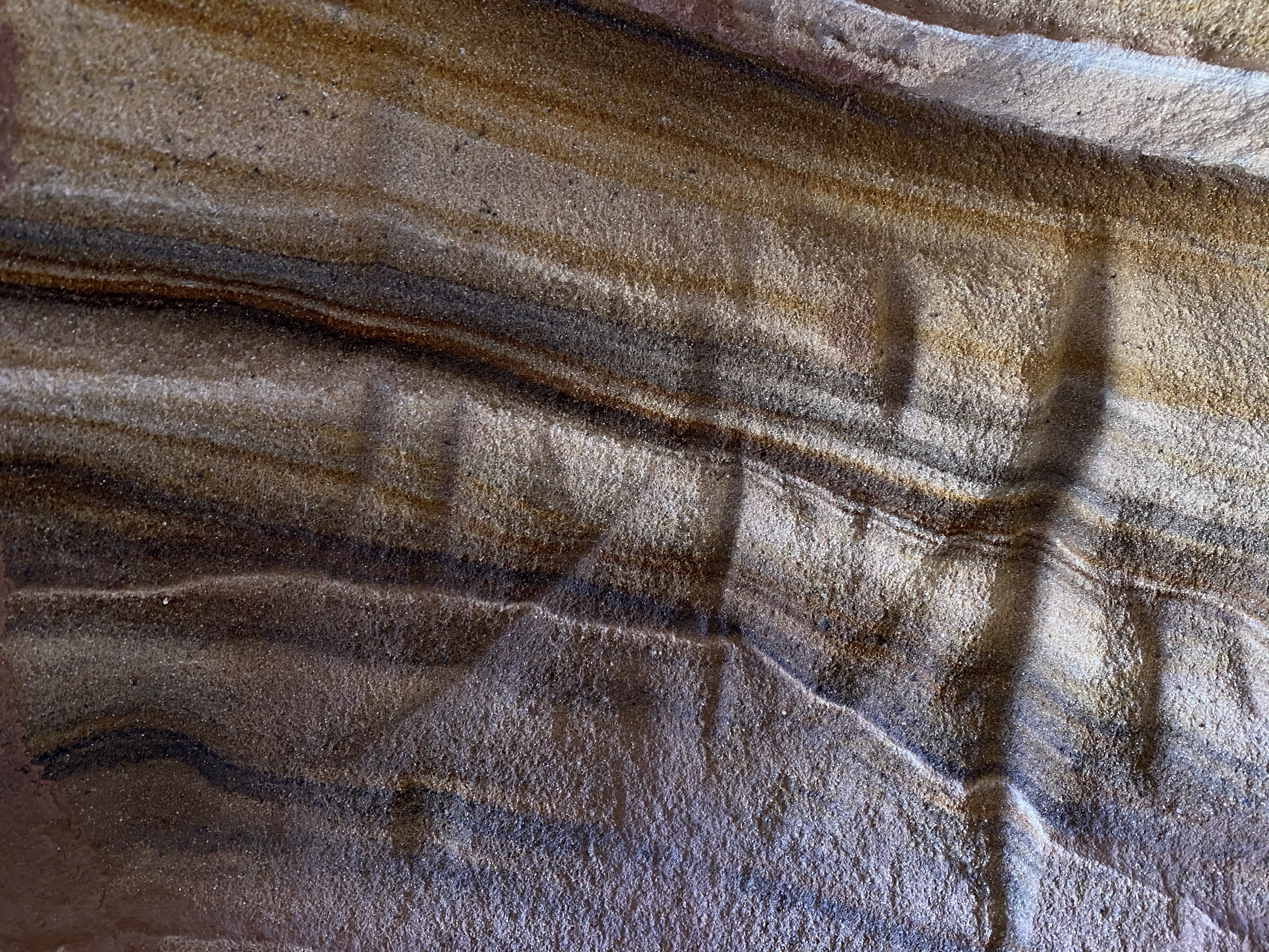
Below are pictures of more information about this style of construction.
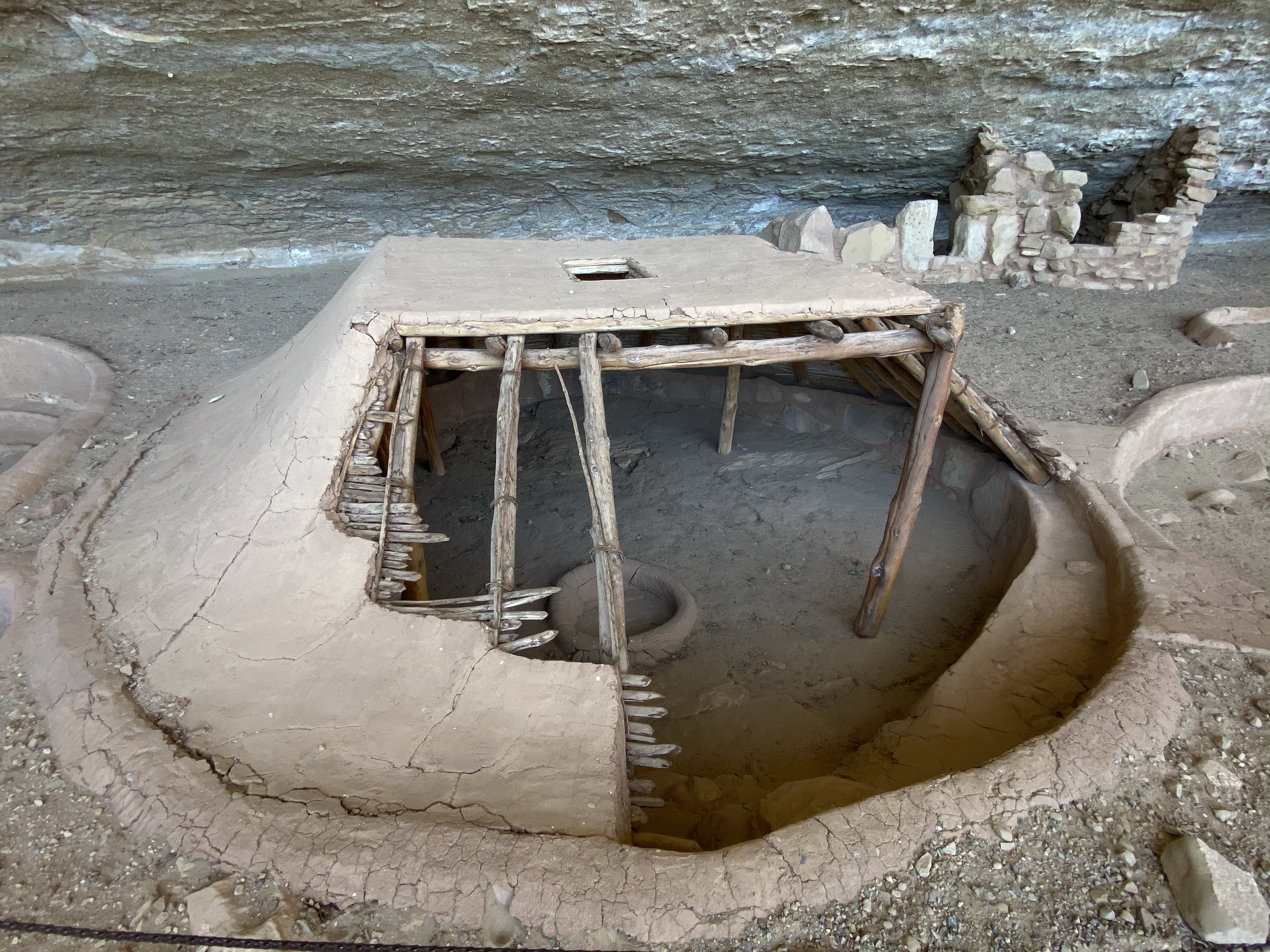
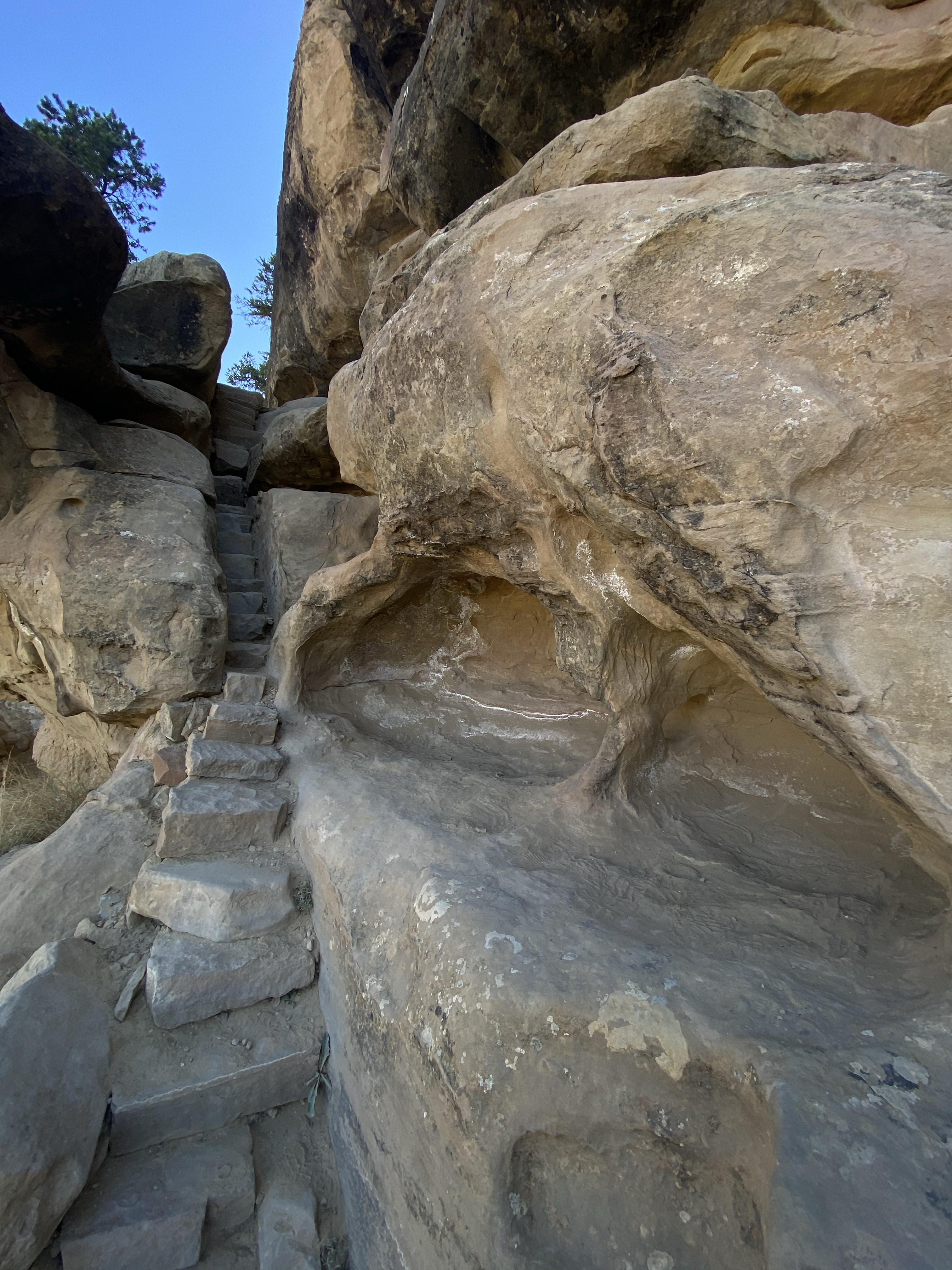
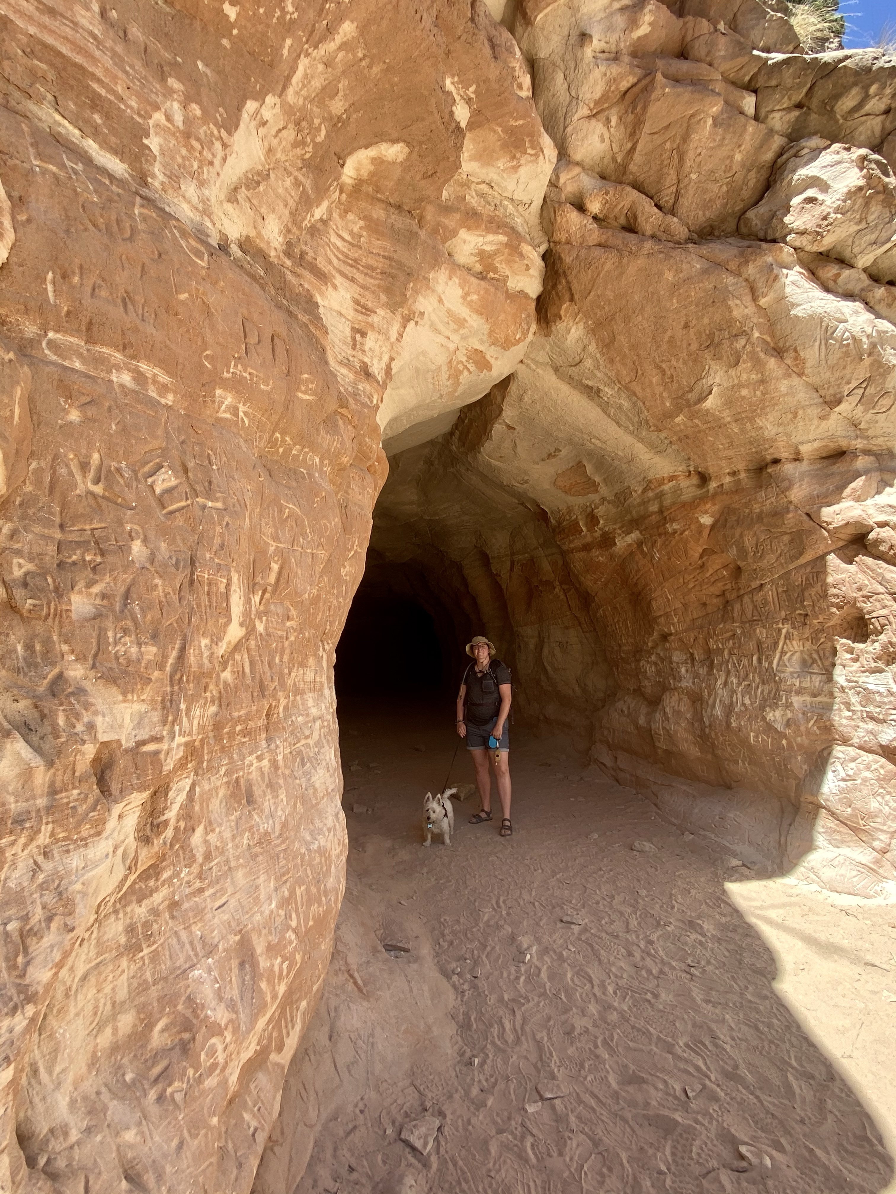
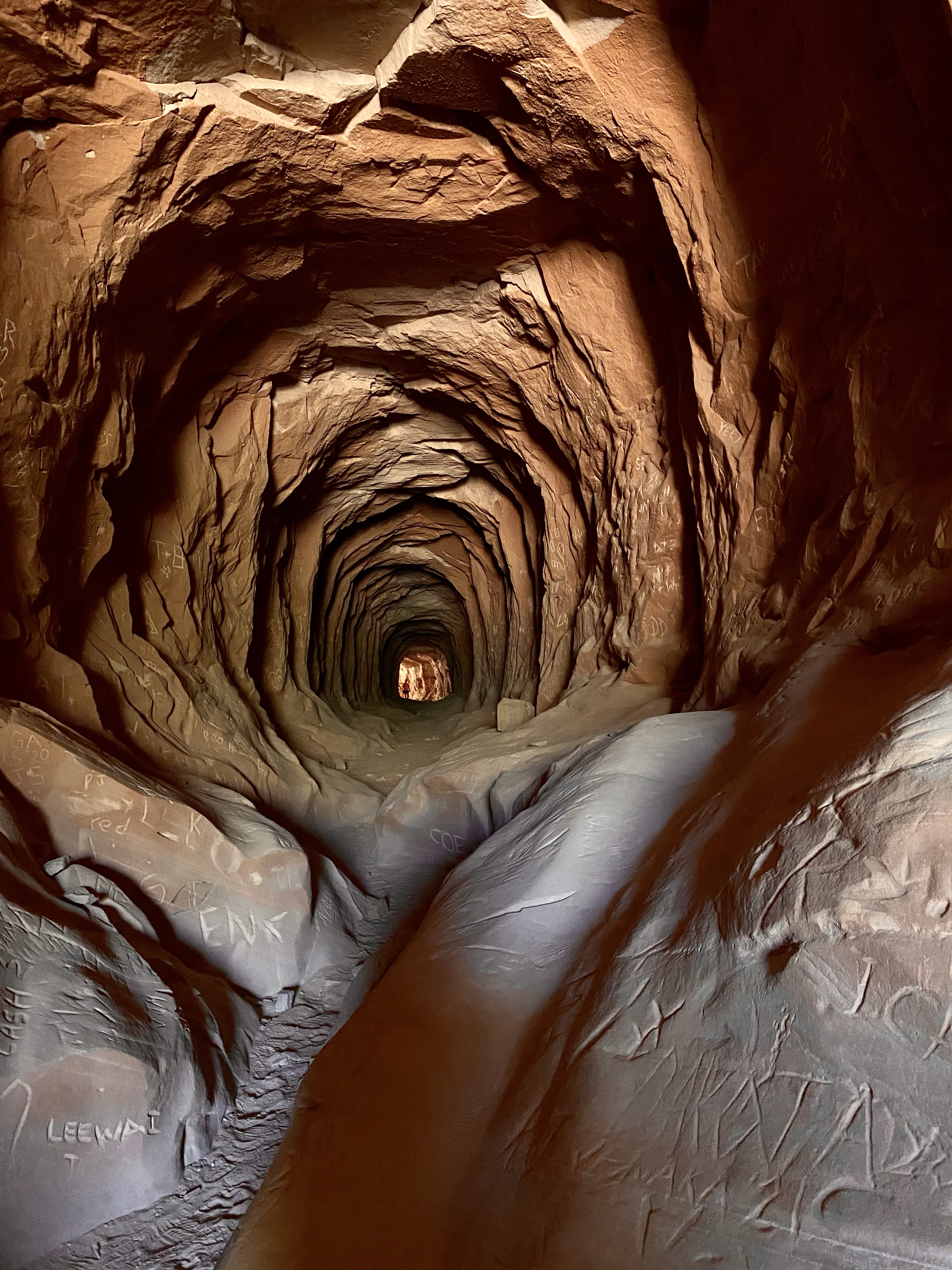
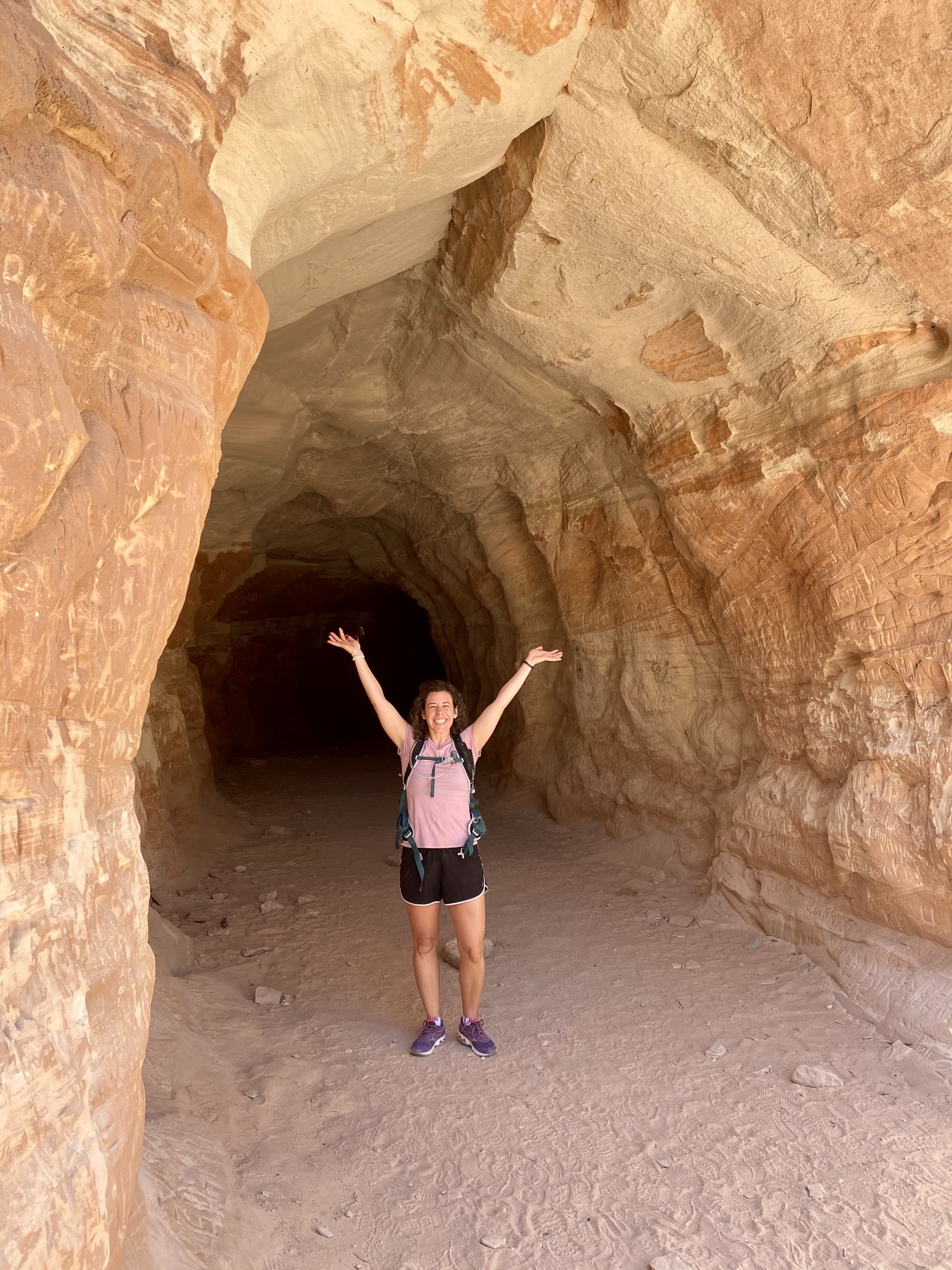
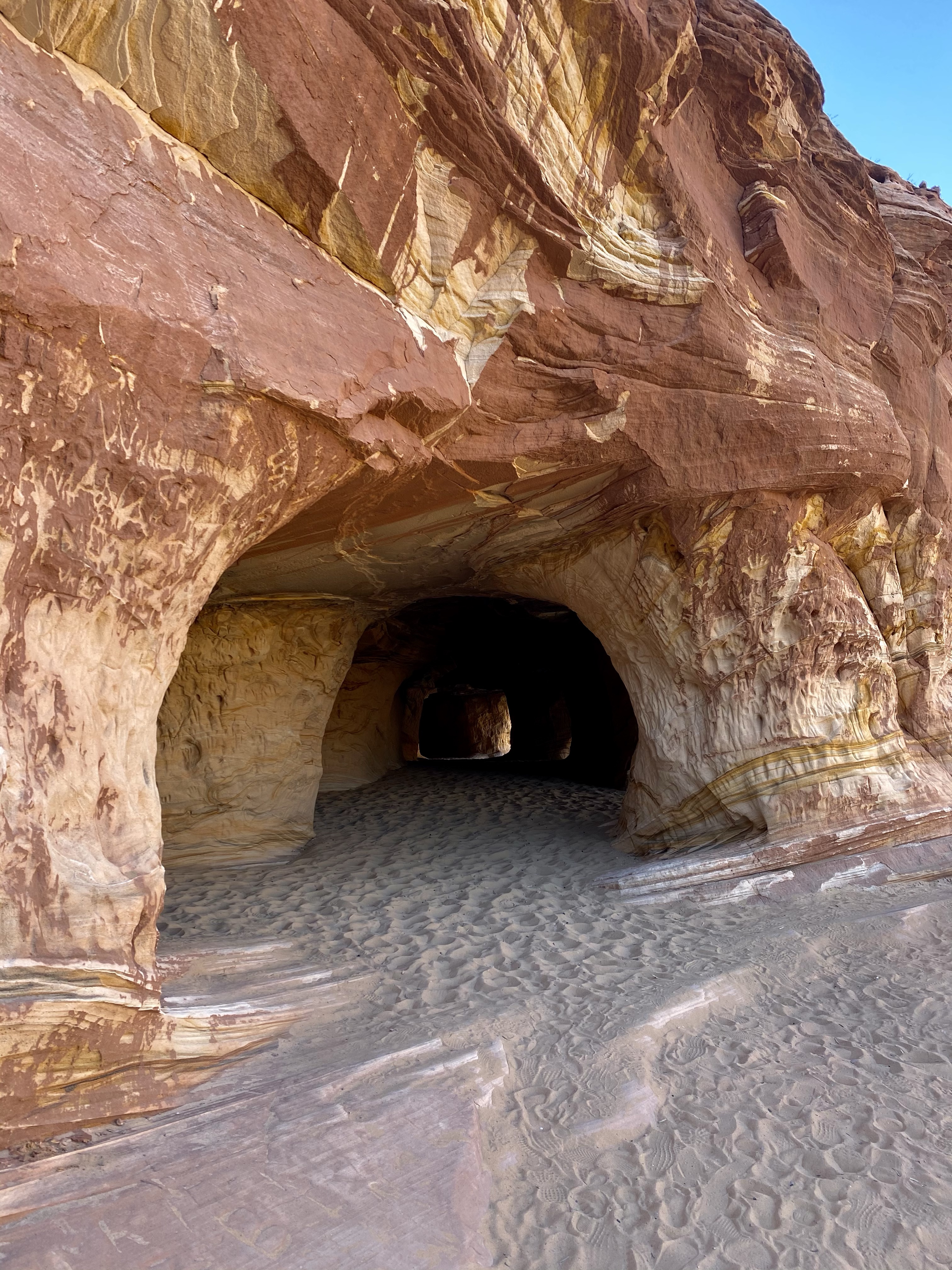
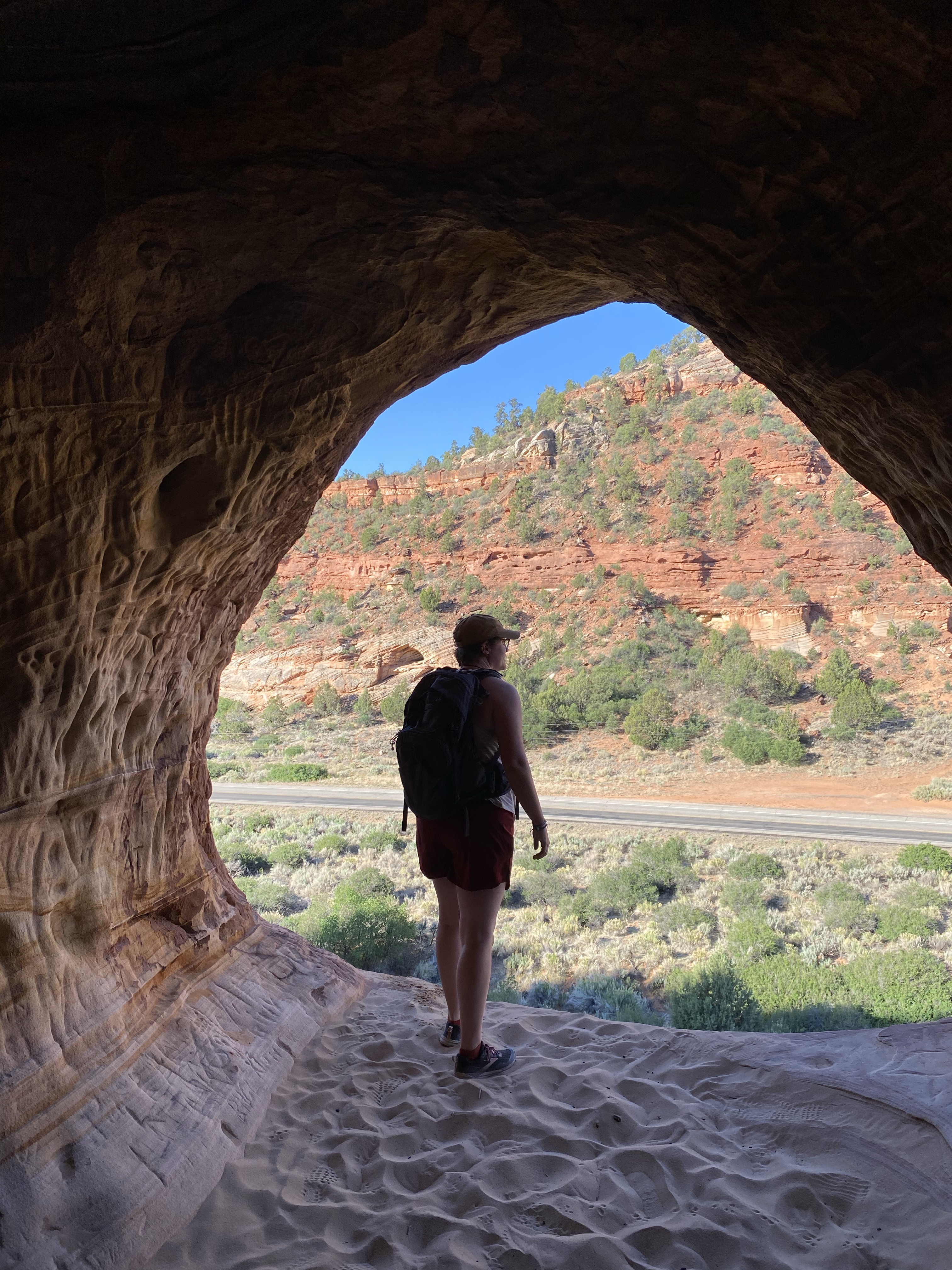
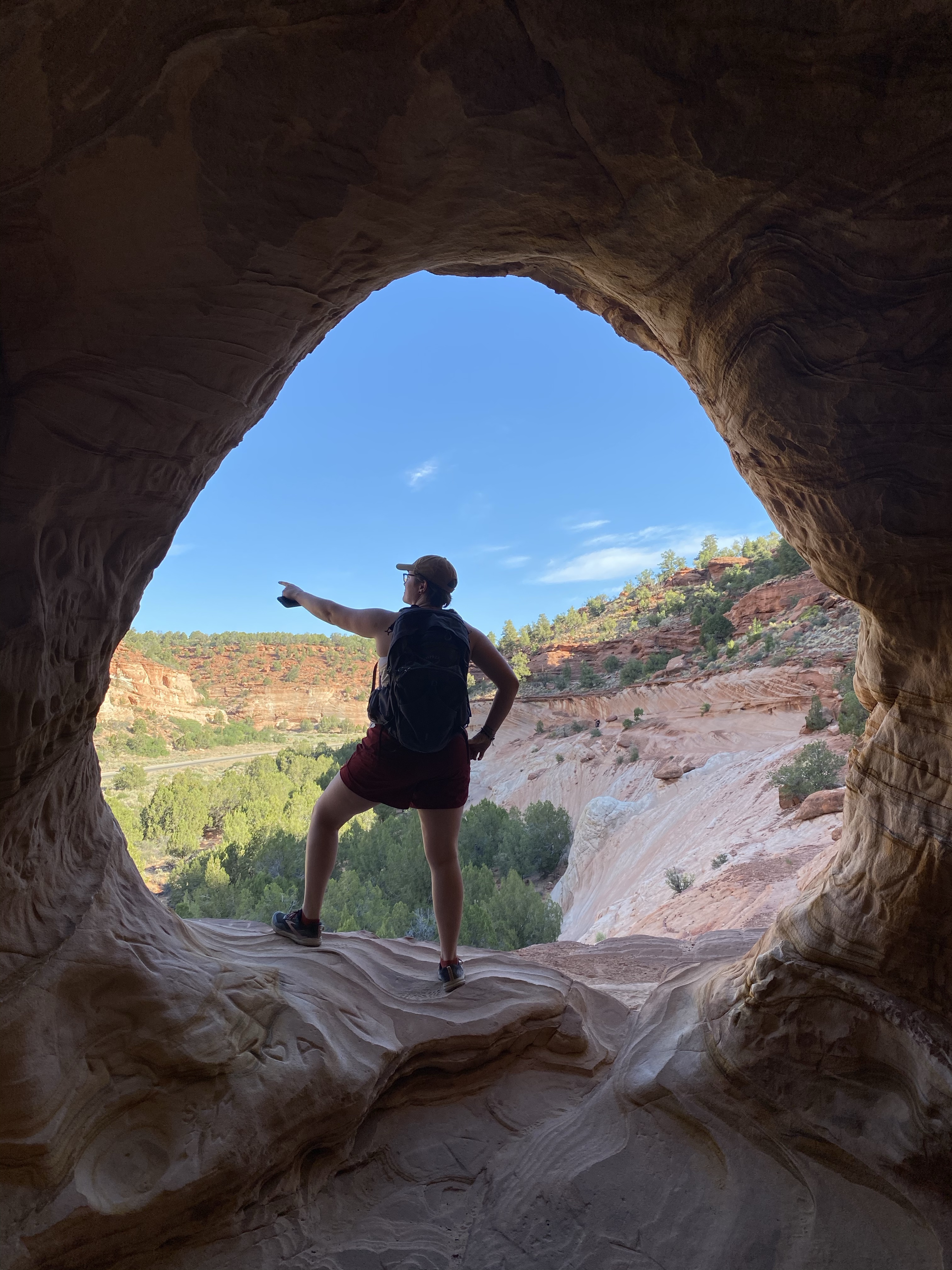
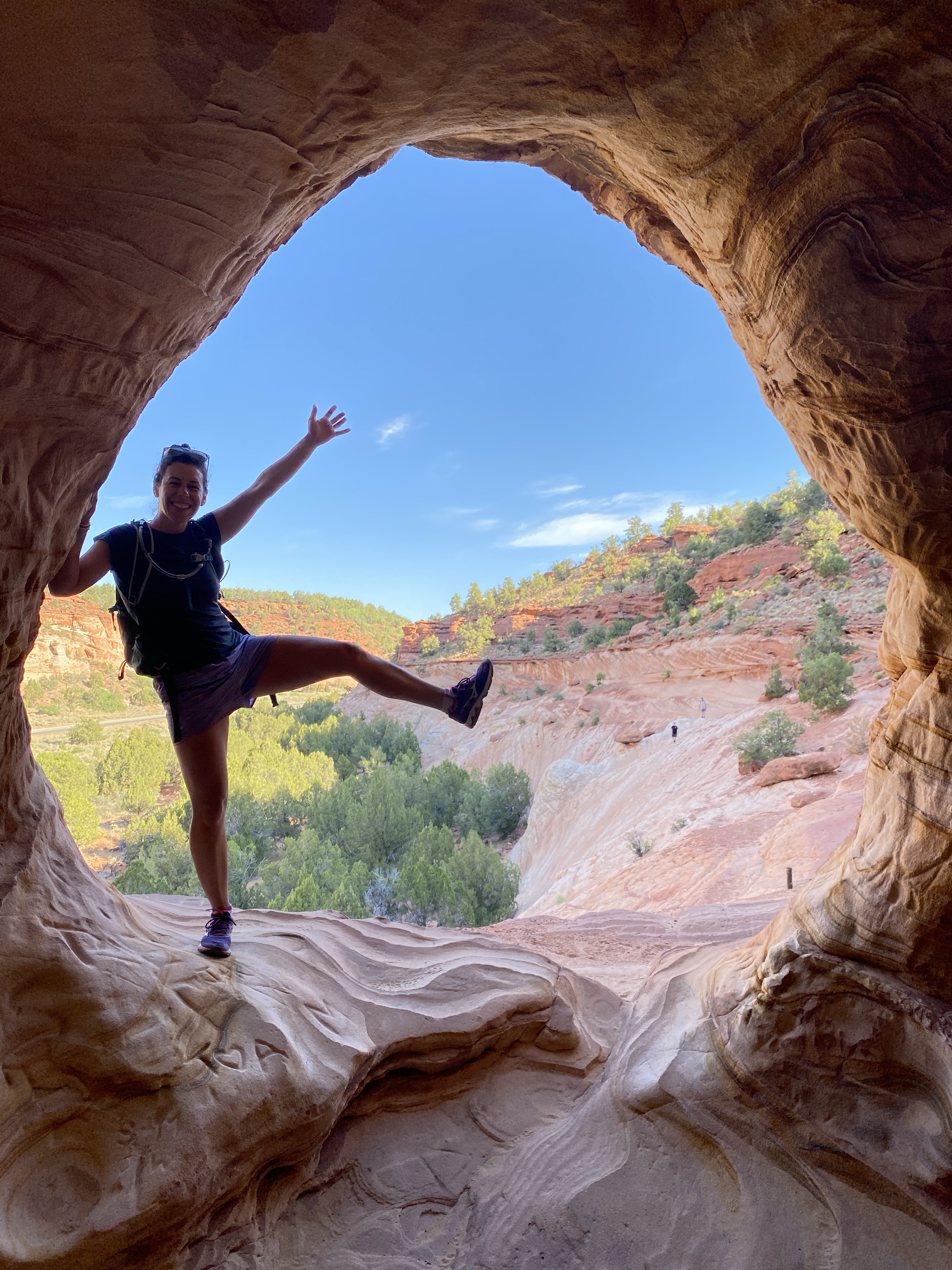
Back at the kiosk my walking buddy and I parted ways. I continued on to Step House, a place he had already visited. Step House is one of the only cliff dwellings you can visit without a tour, and is a reconstructed version of the small pit house village once there. Nestled into an alcove 100 feet from the mesa top, it’s called Step House because of the evidence of stairs used to access this historical home. I’d like to live here! Stairs rather than scaling a wall!
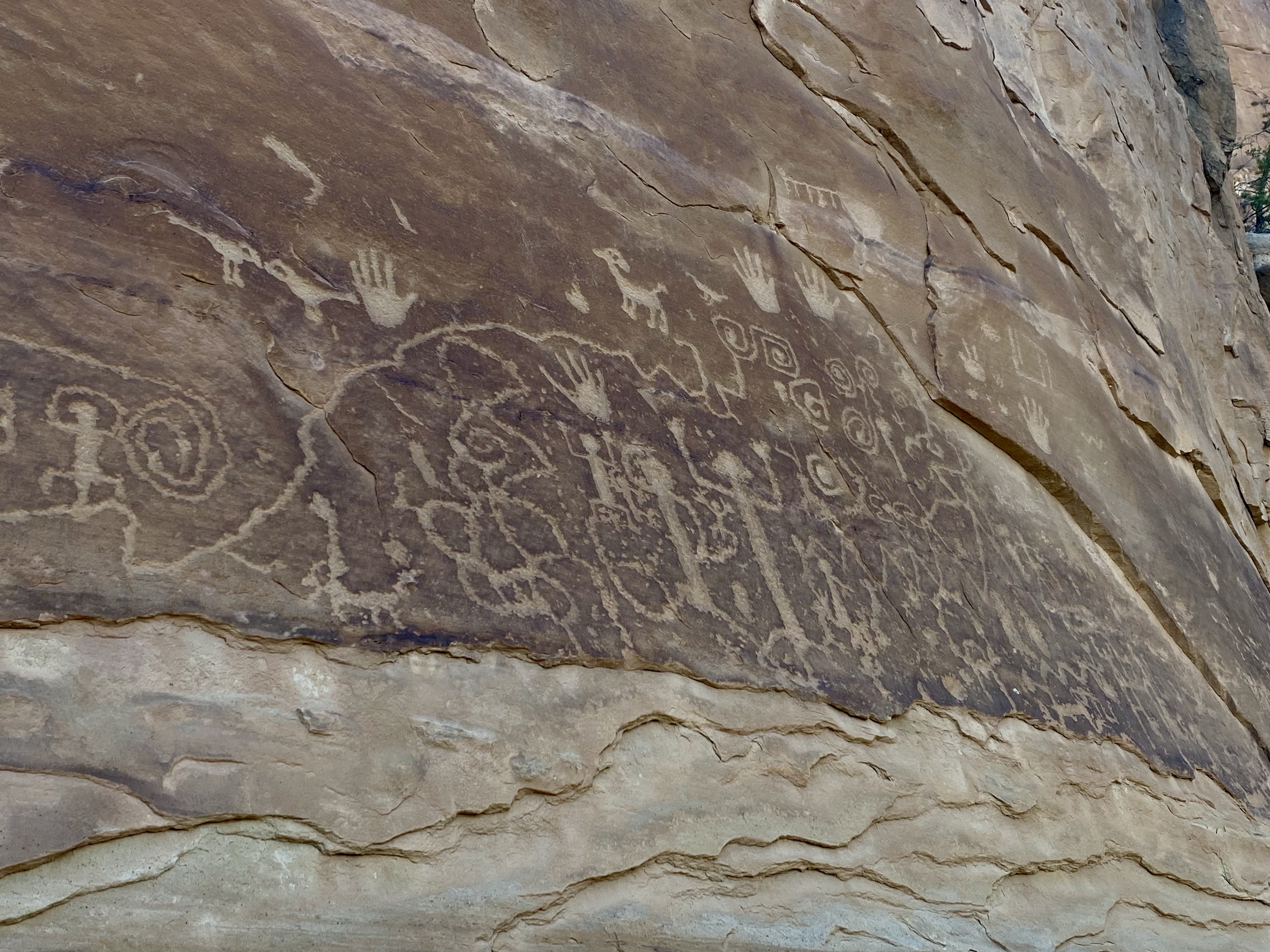
This space was used by two different generations of people, first as pit houses in the 500-600 range and then again as a cliff dwelling in the 1200s. Here you can take a self-guided tour with a handy booklet and learn about many interesting features. (If you’d like to borrow the booklet, let me know! I have a copy.) my favorite part was the Petroglyphs carved into the boulder.
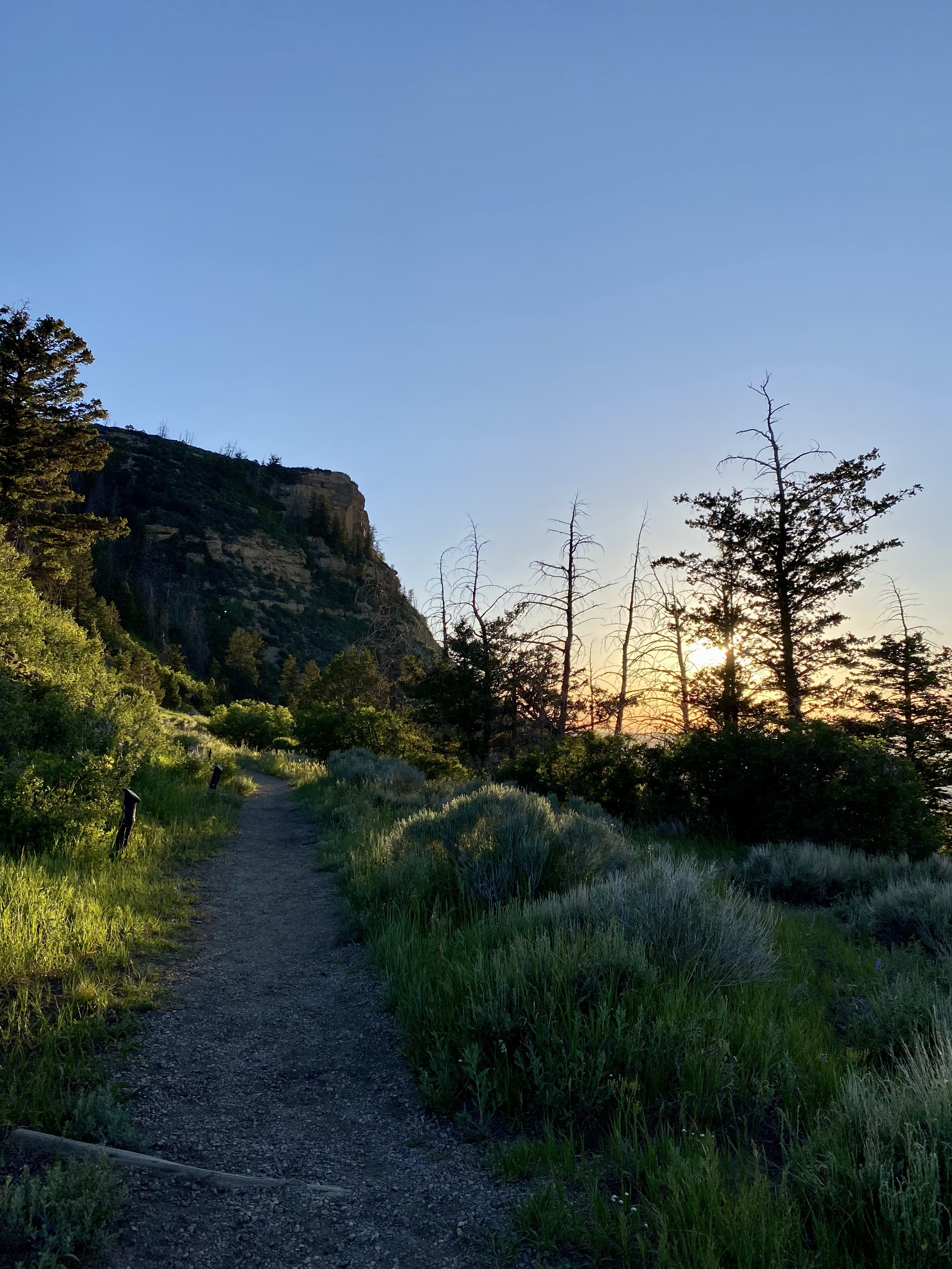
After hiking out of the Step House, I drove to my campsite and settled in for the evening. My feet were tired! After a rest and long chat with my mom, I ate dinner and decided to go on an easy sunset walk.
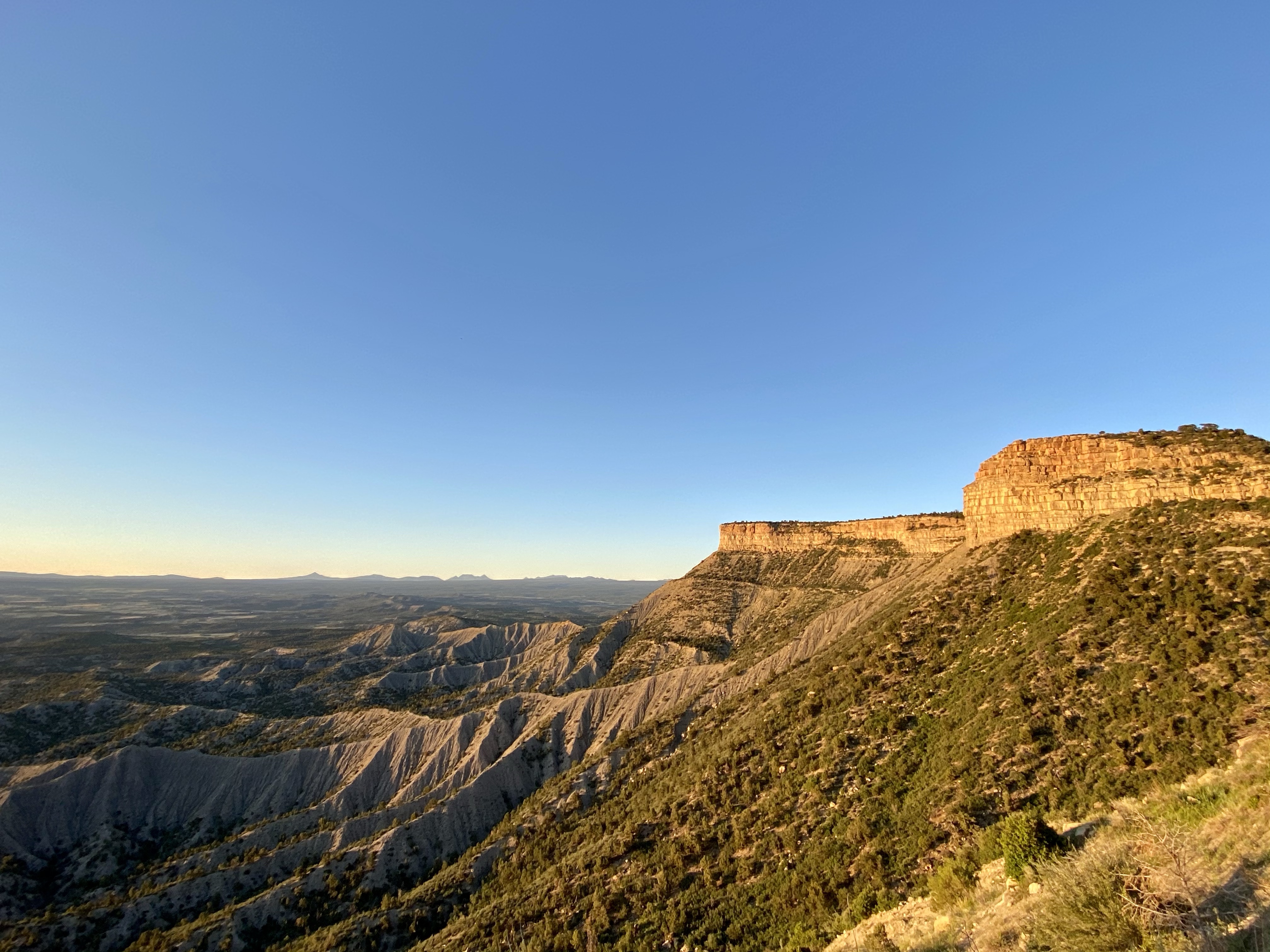
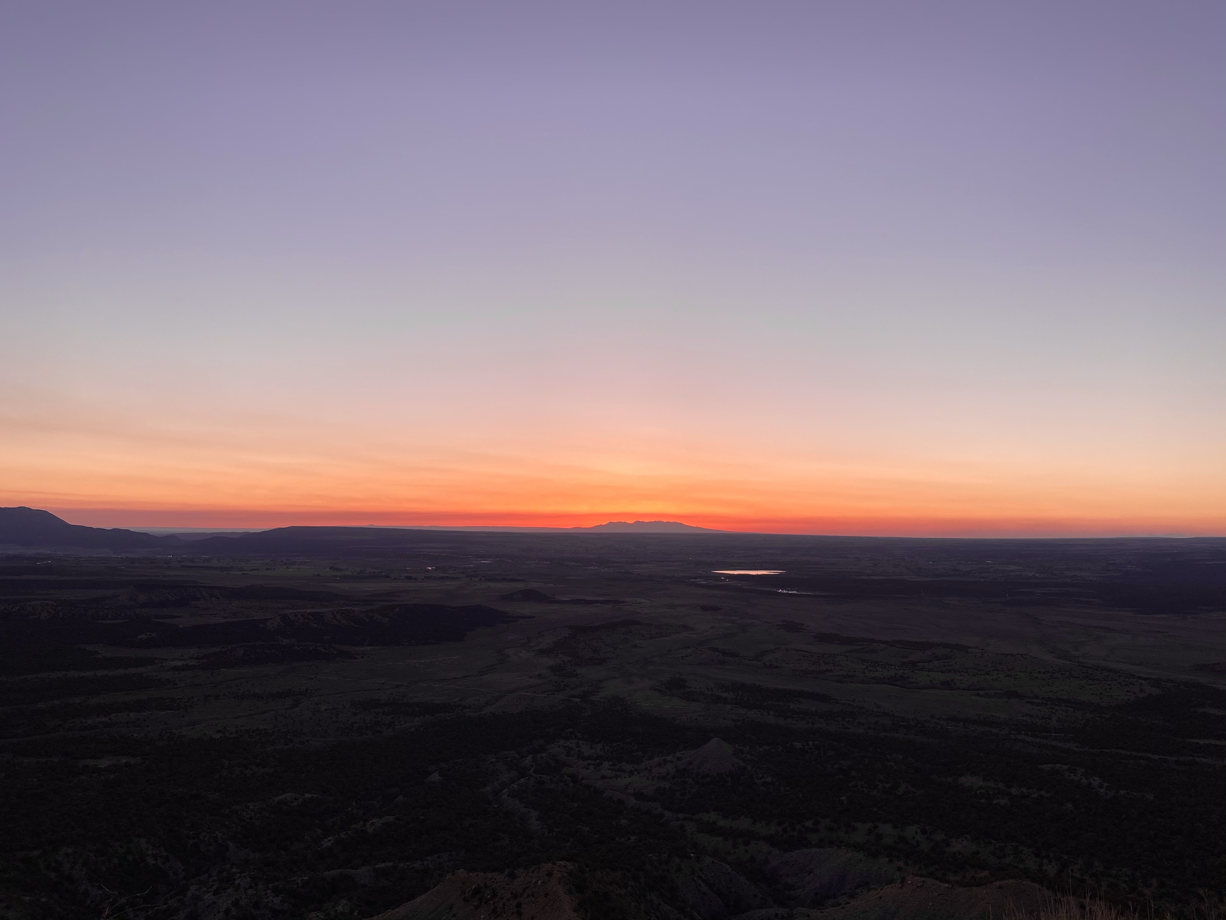
I headed down the path as golden hour was in prime time and listened to the chorus of bugs sing around me. The cliffs glowed as the sun lowered, the fields sparkled. Out at the viewpoint I had a good view of the craggy valley below, the lights of a fair blinking in the distance. The sun did what is does best, casting beautiful colors across the sky. As I walked back that night I turned my headlamp off and looked at the rising stars and moon. Any crankiness I had that day evaporated. Grateful to enjoy these sites and views.
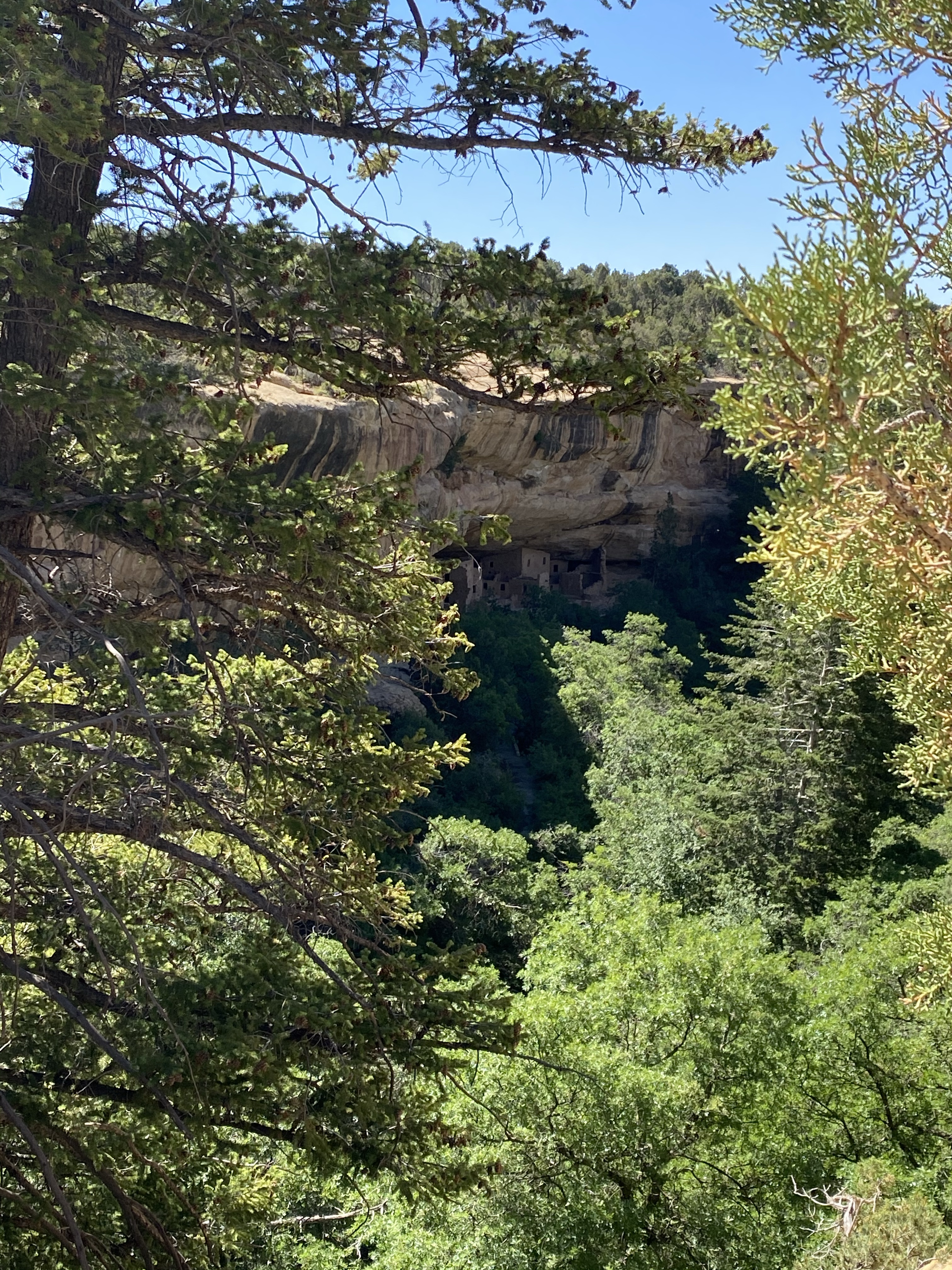
My second day in the park I headed to Chapin Mesa early, as it was a Saturday. My goal was to visit Spruce Tree House and hike to the petroglyphs before driving to the different viewpoints. I pulled into the quiet parking lot and headed out.
Unfortunately, Spruce Tree House and the museum were both closed for renovation. Womp womp. I was
Able to view the cliff dwellings from afar, and then continued down the trail.
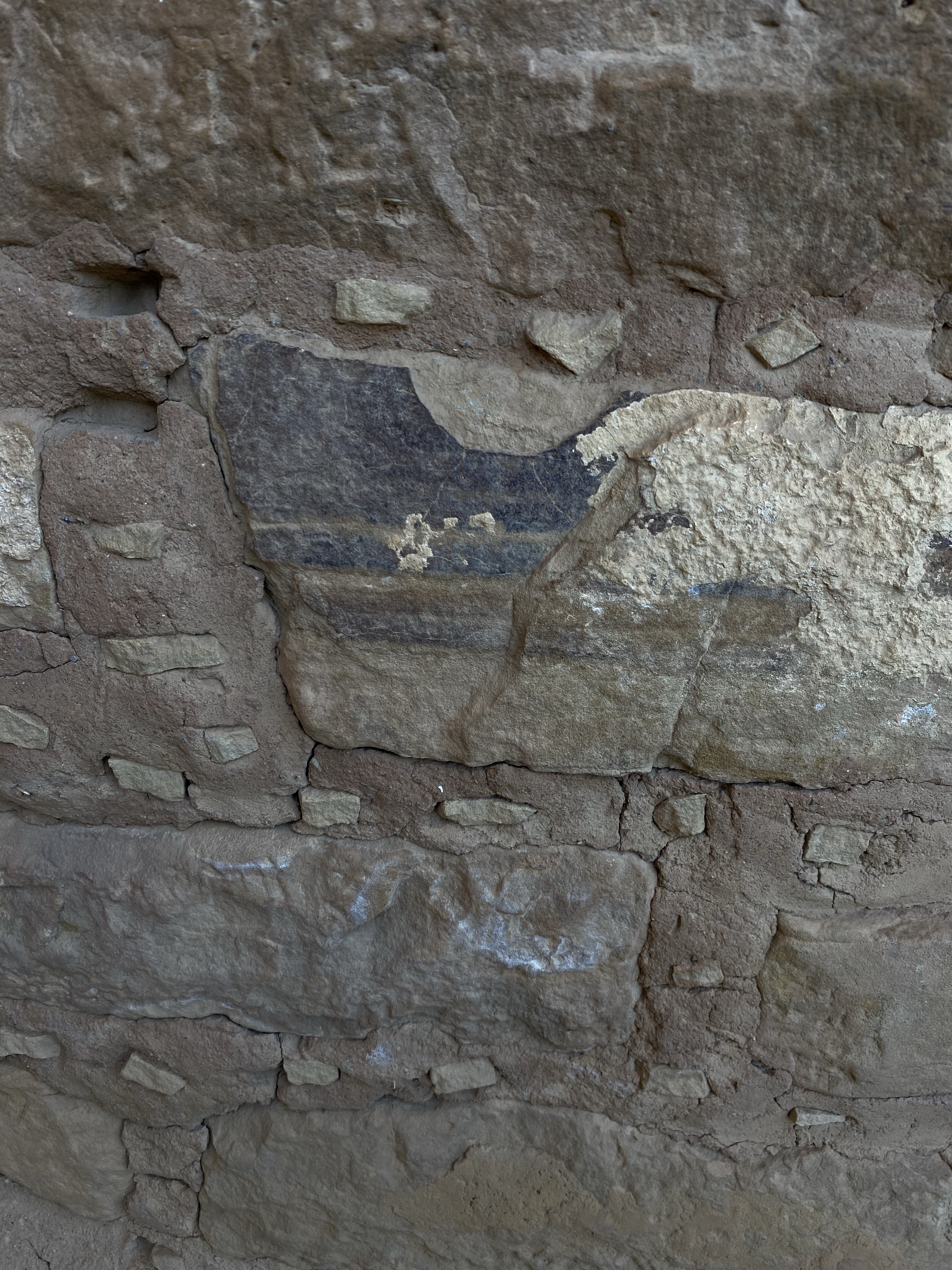
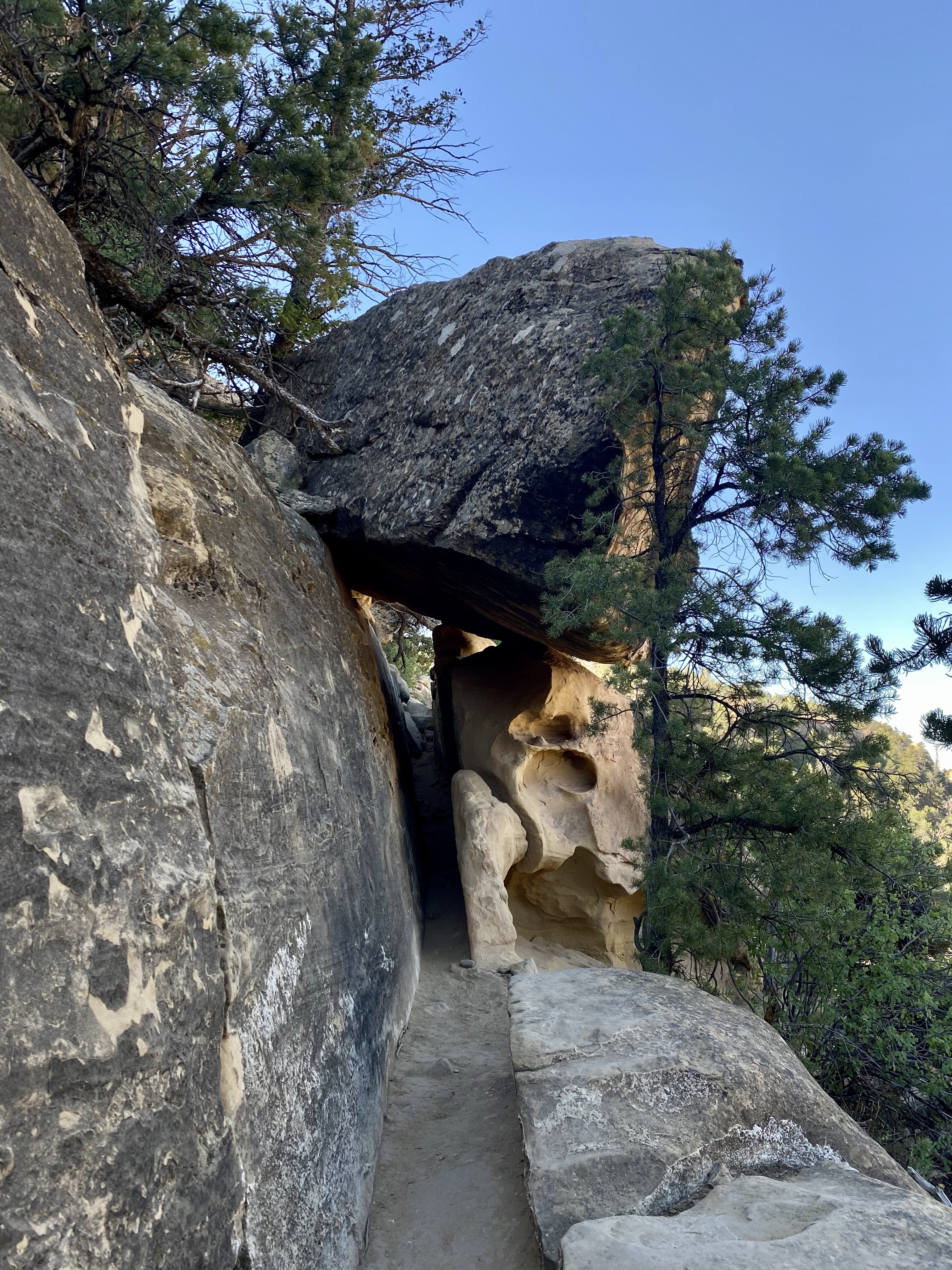
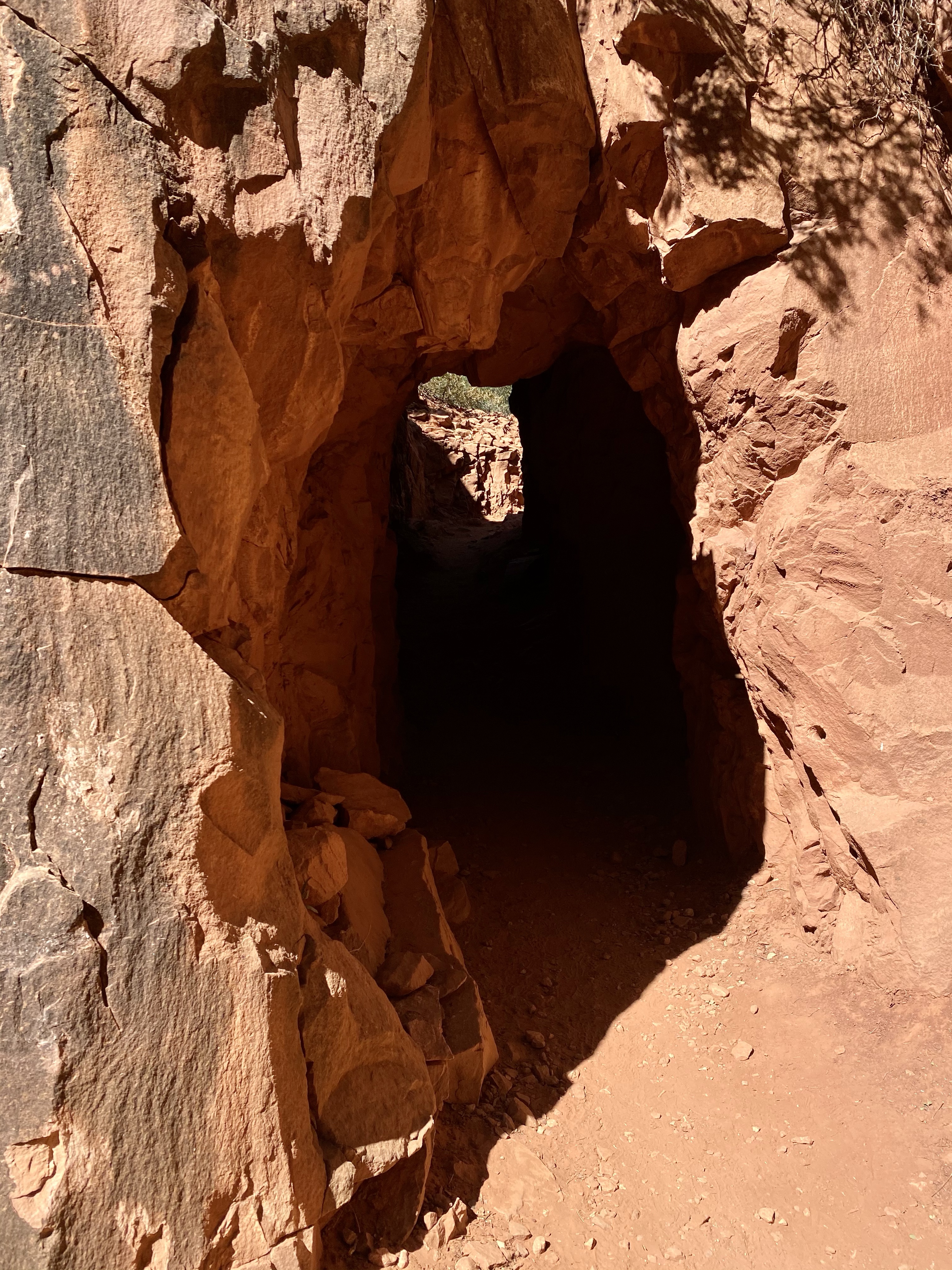
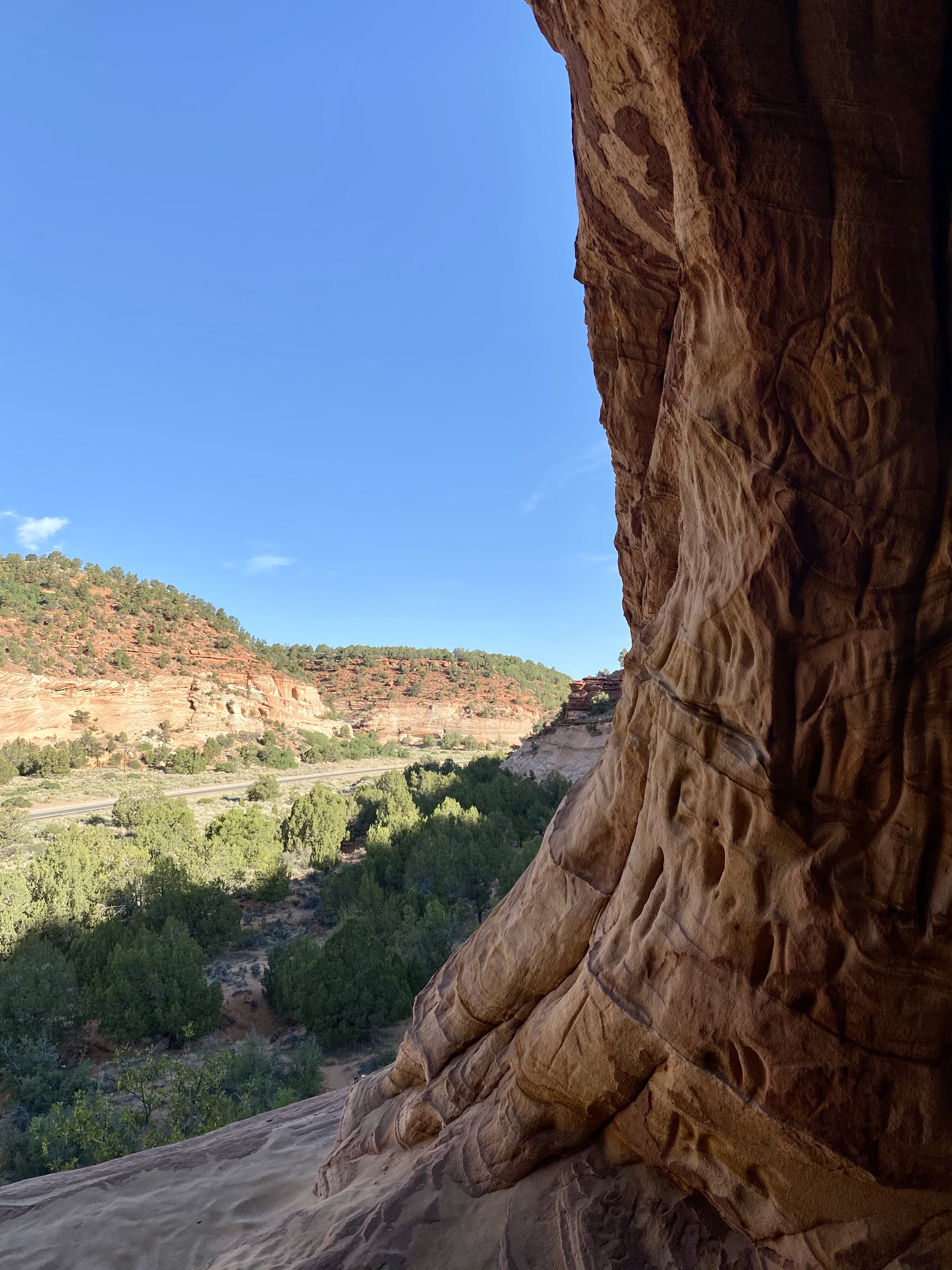
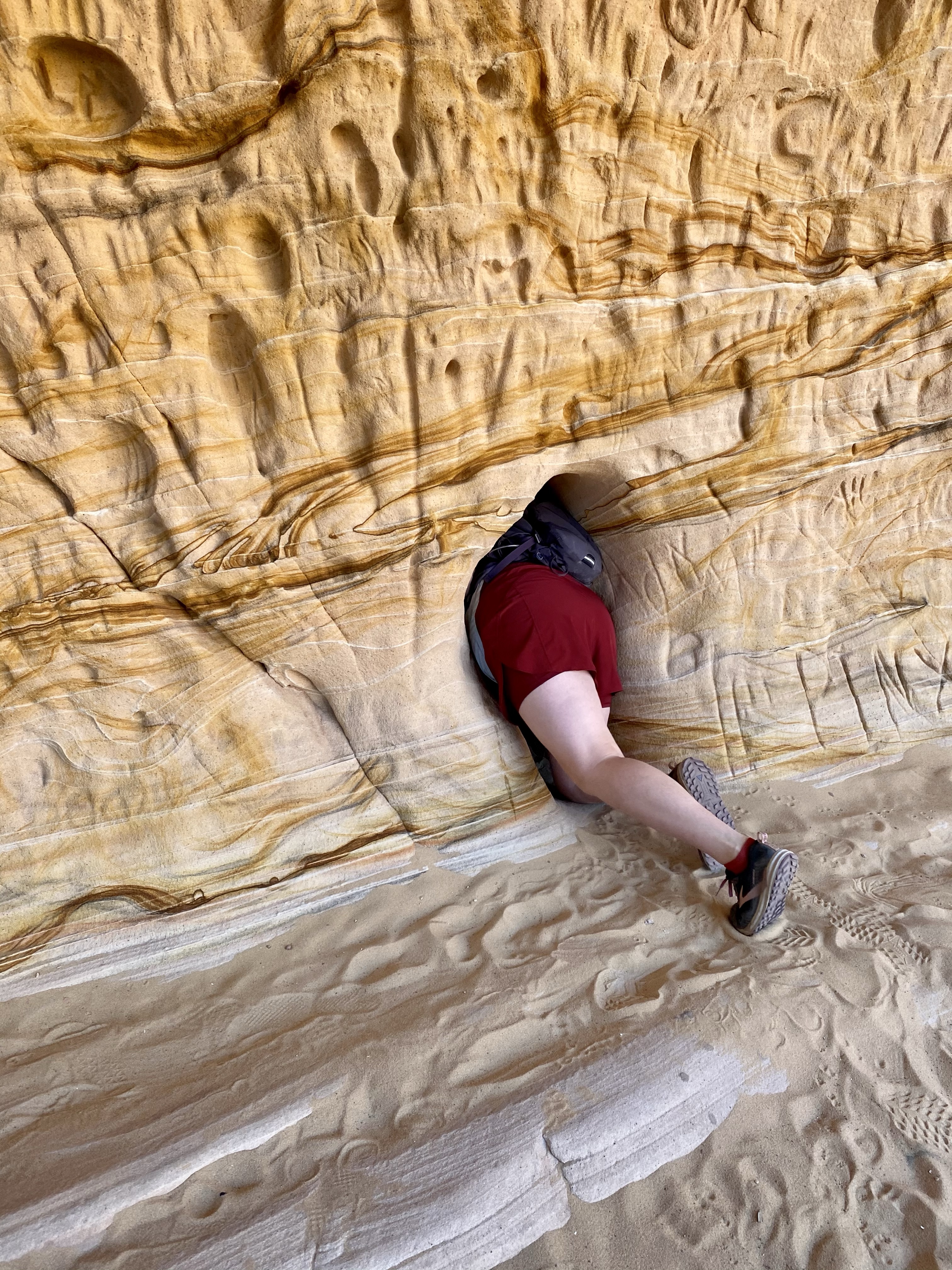
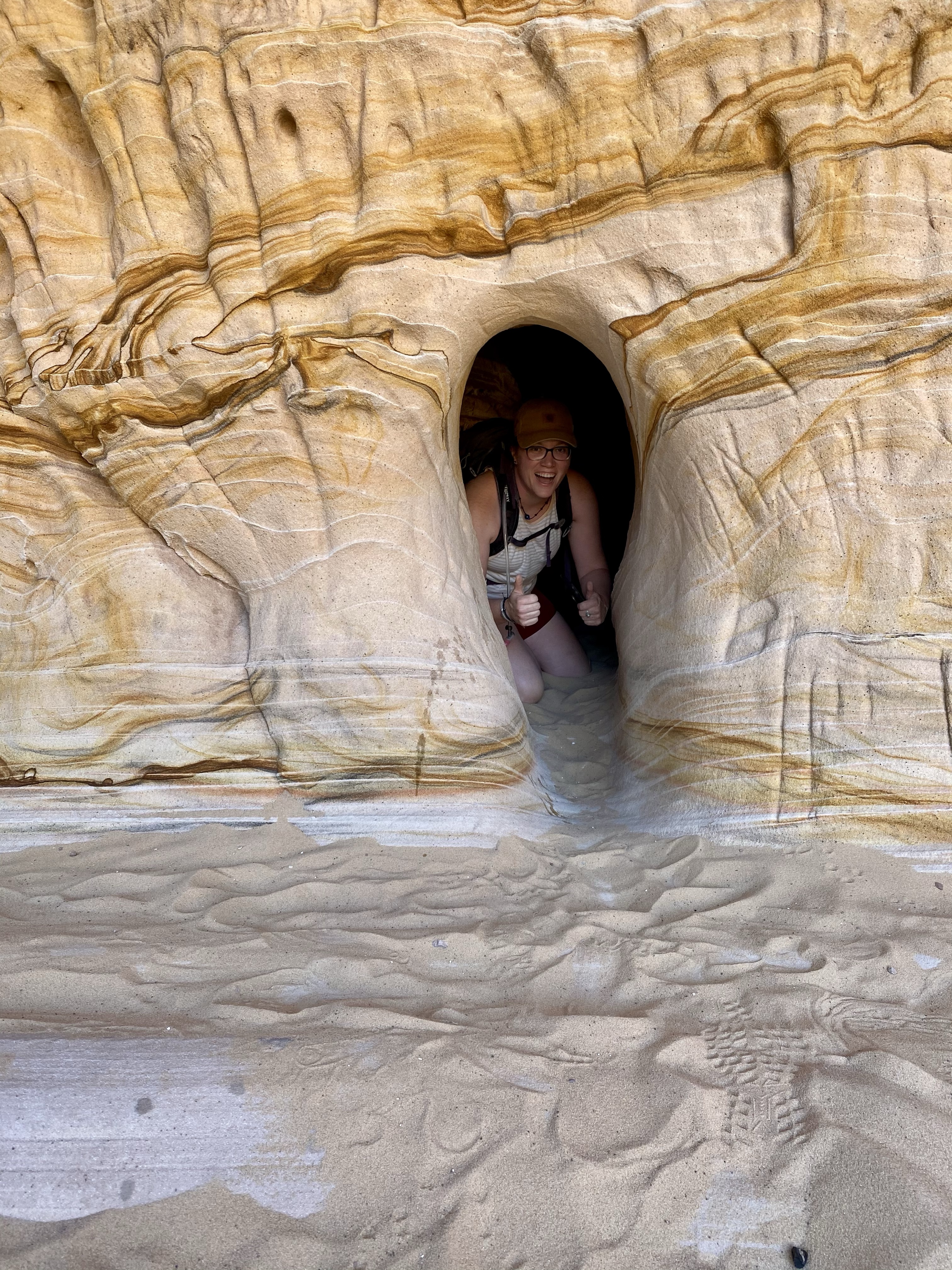
The path was narrow, edging around the cliff wall. It was tree lined on the other side, so not scary, just narrow. I climbed over small boulders, squeezed between some fallen rocks, and down several steps. The cliff wall provided a lot of welcome shade, and an attractive distraction. At times it hung over me like an awning, other times providing small caves for little people to crawl into. Light yellow with splashes of red and black, it was ever changing as I looped around.
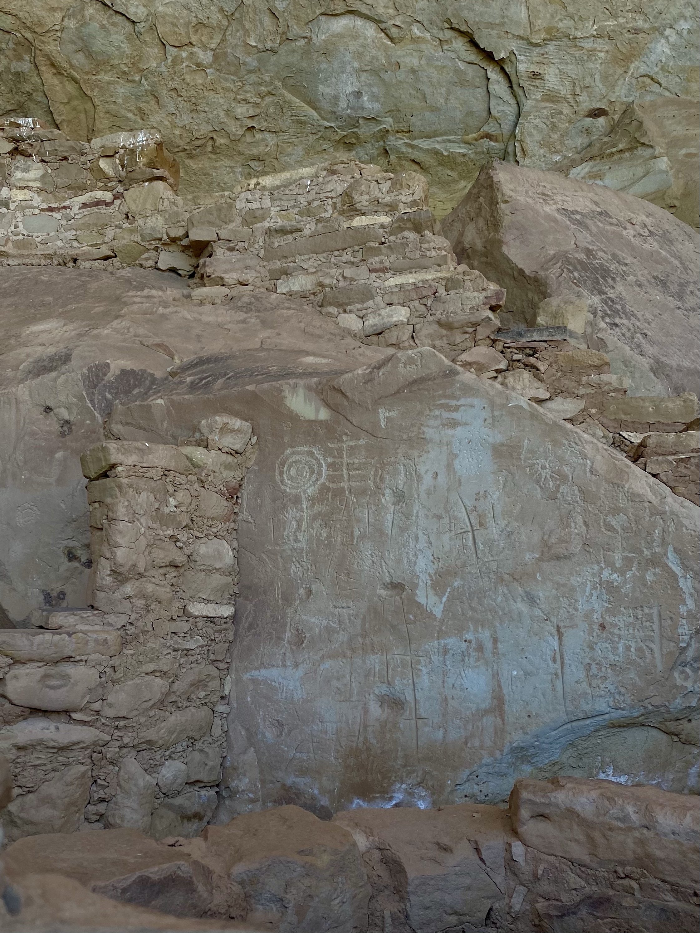
I passed a few hikers on the way, anxiously waiting for the petroglyphs. It seemed like they’d never appear. I kept looking up and around, but no sightings yet. Up ahead I heard a group laughing about their ascent up some large steps and boulders and slowed down to give them space. Just then, the petroglyphs! It was one small area well preserved, no explanation provided, but interesting to admire and try to decipher.
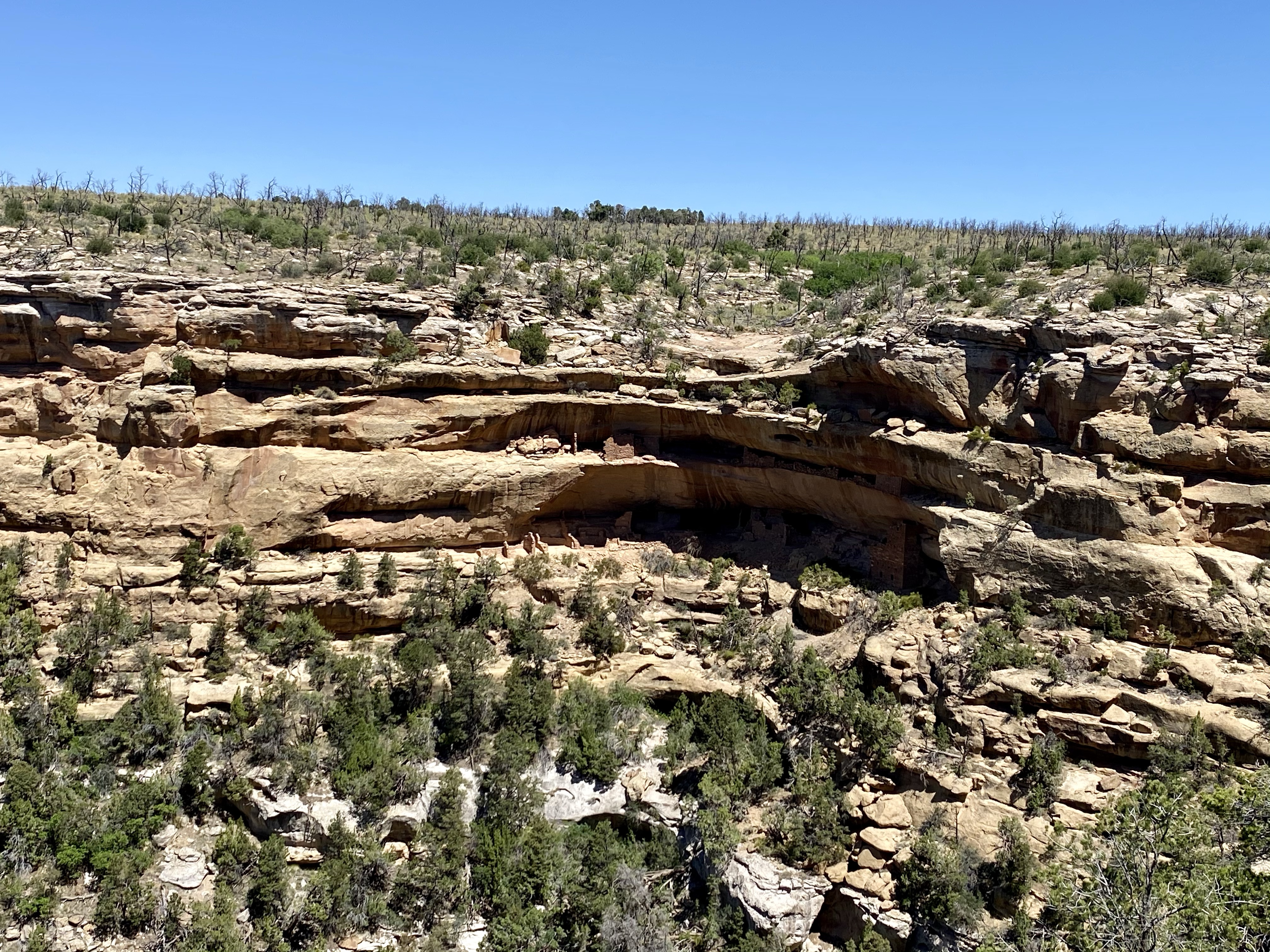
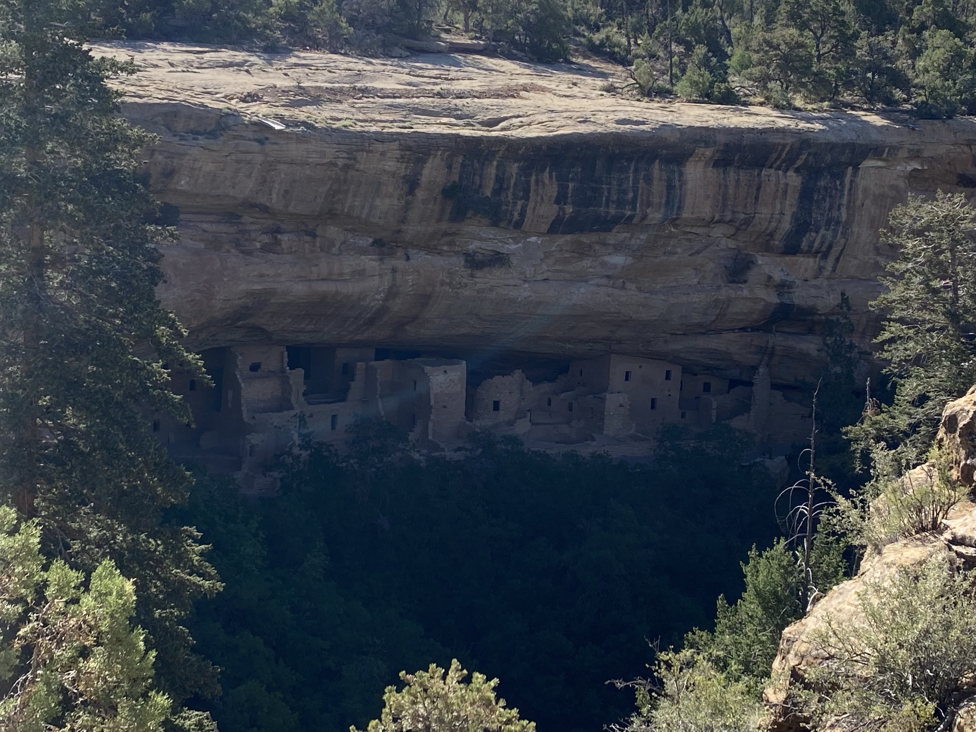
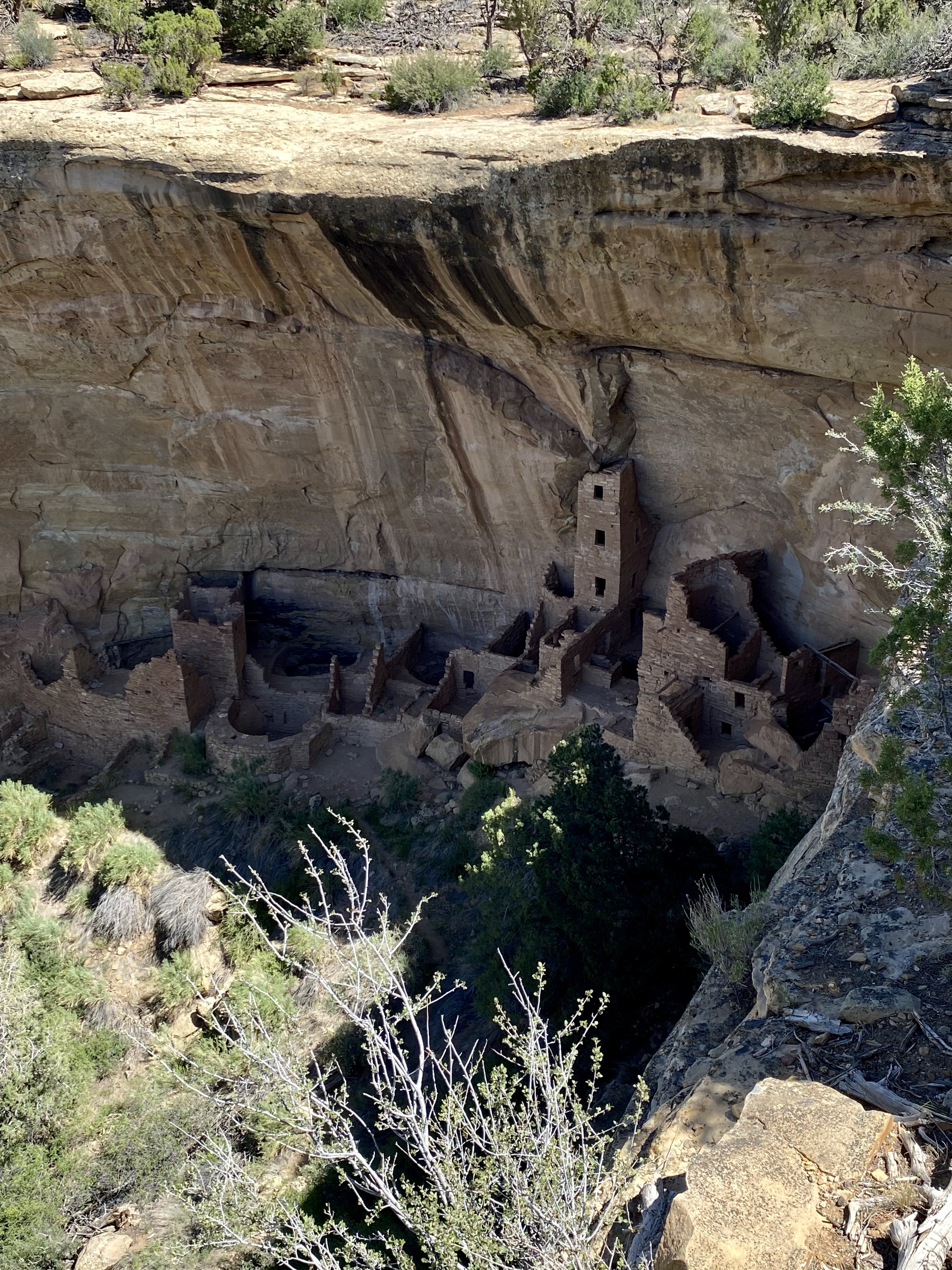
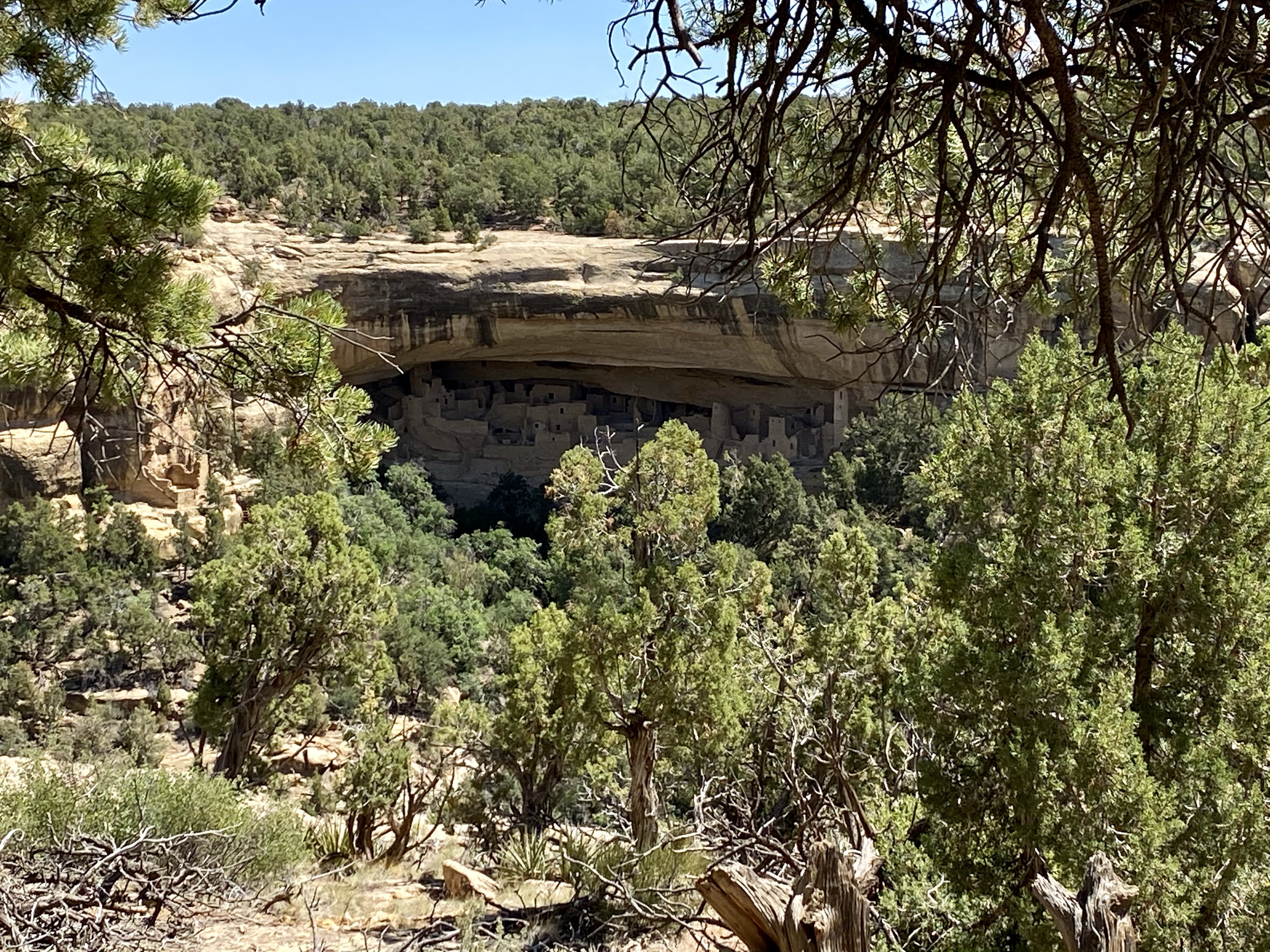
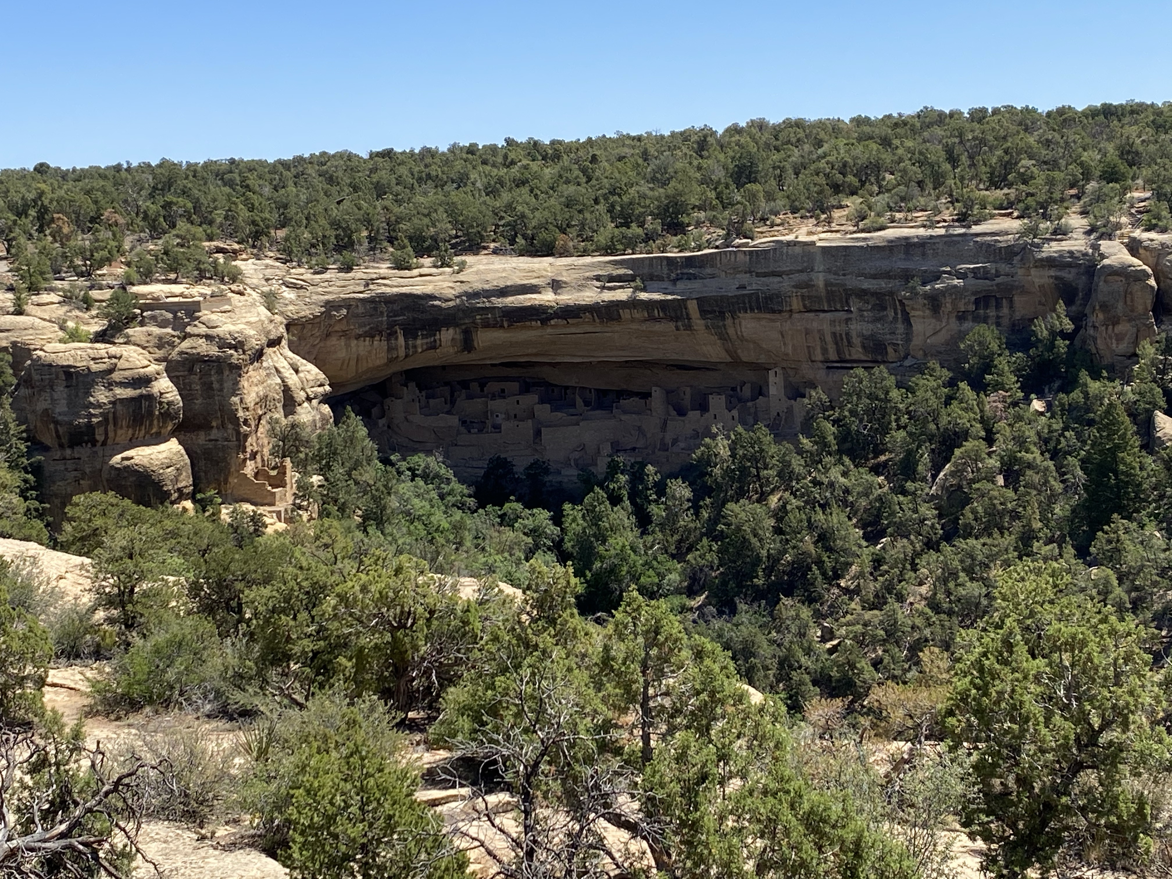
When the path was clear, I climbed up. And up and up, and series of stairs brought me to the top of the mesa. From there it was easy going, flat trail circling back to the parking lot. As I approached, crossing over the bridge, I had a surprise second view of Spruce Tree House! From this angle you could really see it nestled in the cliff alcove, a few short, tiny dwellings on the outskirts of the village. So neat.
Another community where citizens had to climb up to the mesa to farm their corn, squash, and beans, and then down the toe and hand holds to rest. While I didn’t get to see it up close, I did learn that Spruce Tree House has an unusual feature, a large sub-floor cistern that may have been used for water storage! This village was in a space 216 feet long and 89 feet deep with 120 rooms, 10 associated ledge rooms, 7 kivas and 2 towers! Not everything was created at once but rather grew over time as the communities needs changed. Occupied between 1200 and 1278, it is estimated that 60-90 people across 19 households lived here. Another interesting aspect of this dwelling is the T-shaped doorways, which may have been created to allow easier entry for people carrying large loads!
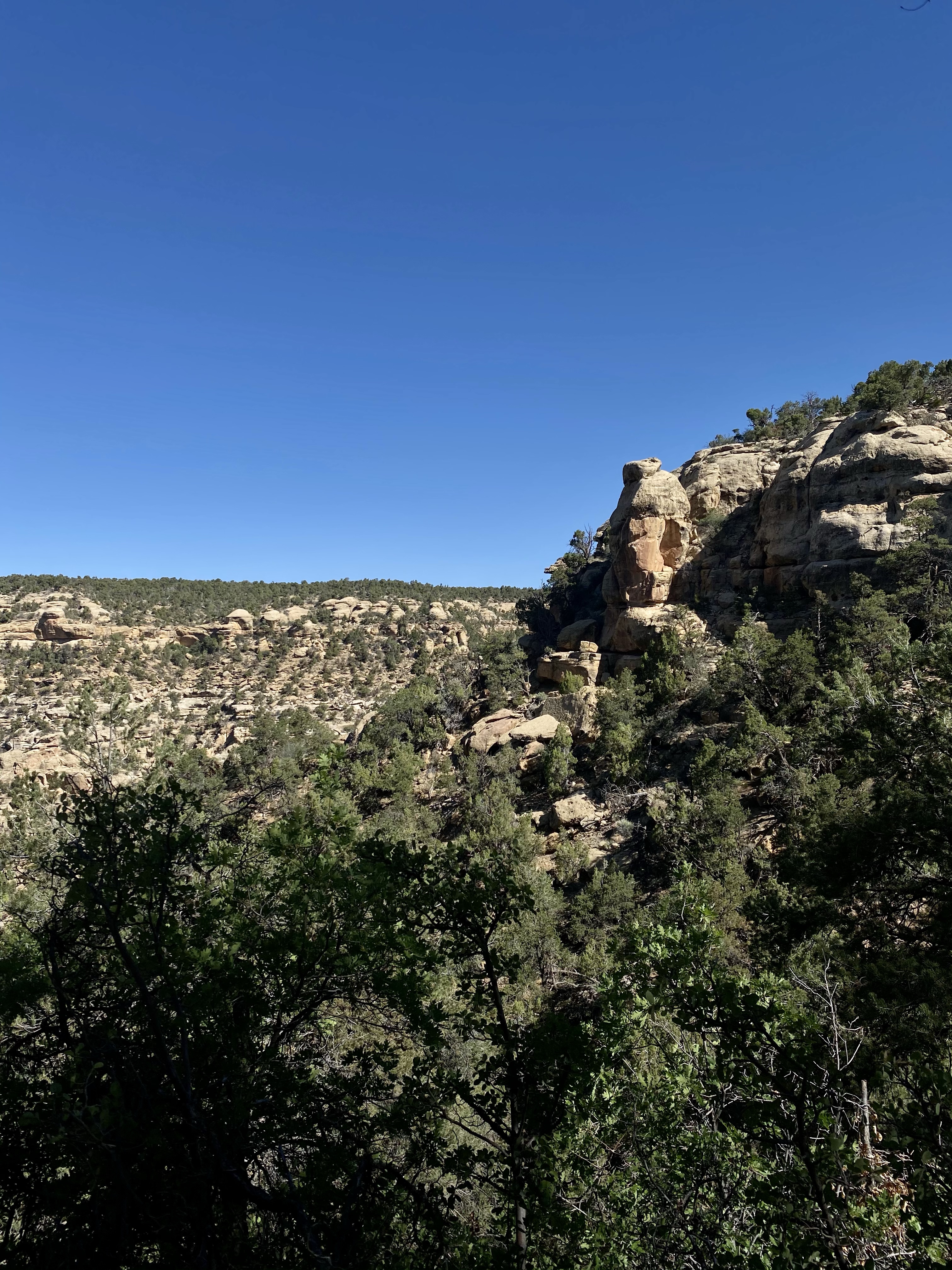
Back at the car, I drove around to a few of the other historic sites but didn’t linger long or visit them all as the crowds were growing. I did make sure to see Sun Temple and Cliff Palace, two of the main attractions. Sun Temple is unique in that it is a D-shapes structure with no doorways but instead two windows that reveal a maze of three circular structures inside. It is thought that this space may have astronomical significance, perhaps having to do with the solstices. It is the only building of this kind in the Pueblo world. Cliff Palace is the largest cliff dwelling in the park and thought to be a government center, place of business, or cultural exchange center rather than living quarters. All these sites are awesome from afar, and I hope one day I can enjoy them up close!
I spent the rest of the afternoon doing laundry, showering, and relaxing at the campsite in the quiet. I headed to bed early because the next morning I wanted to catch the sunrise!
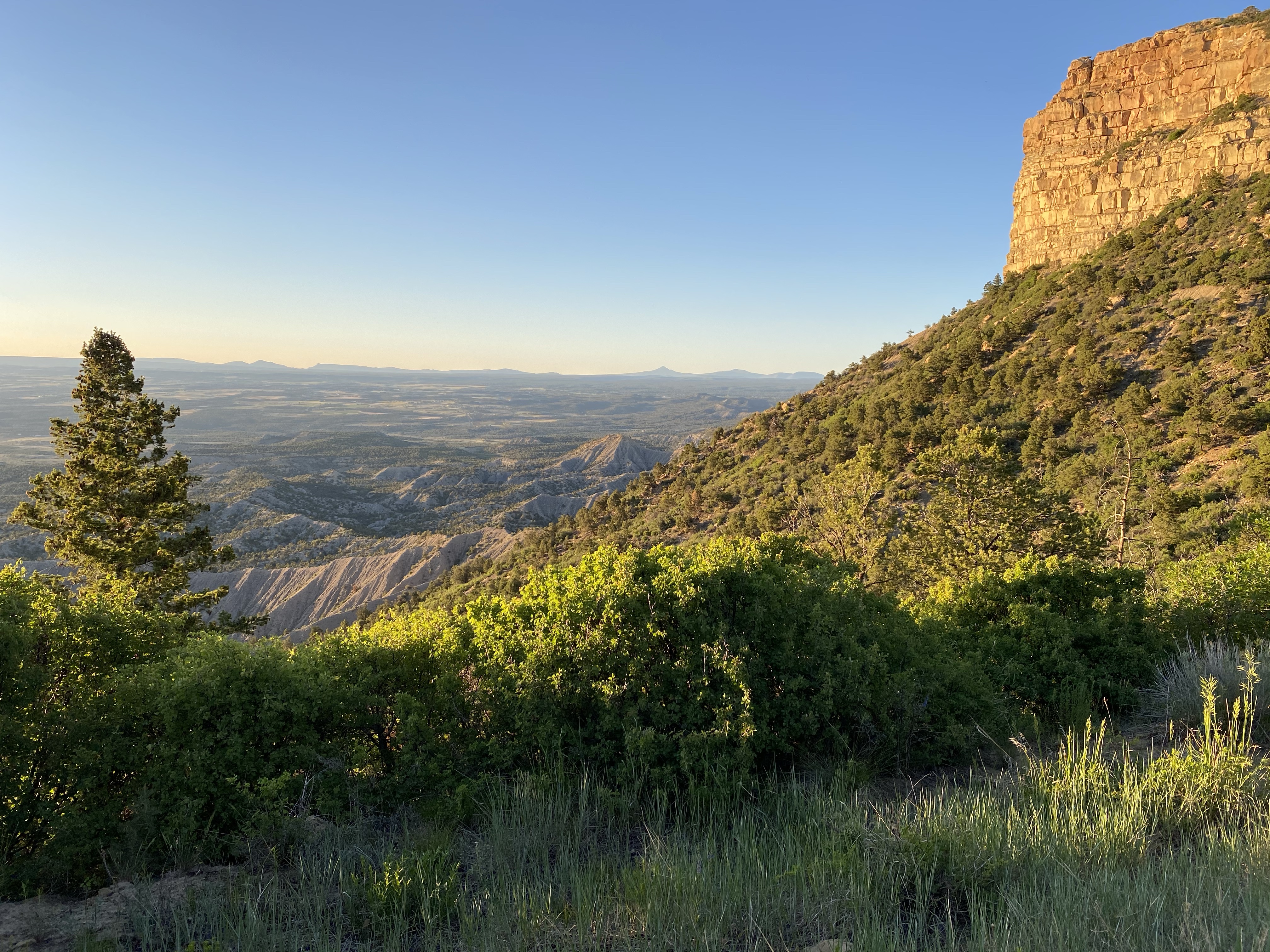
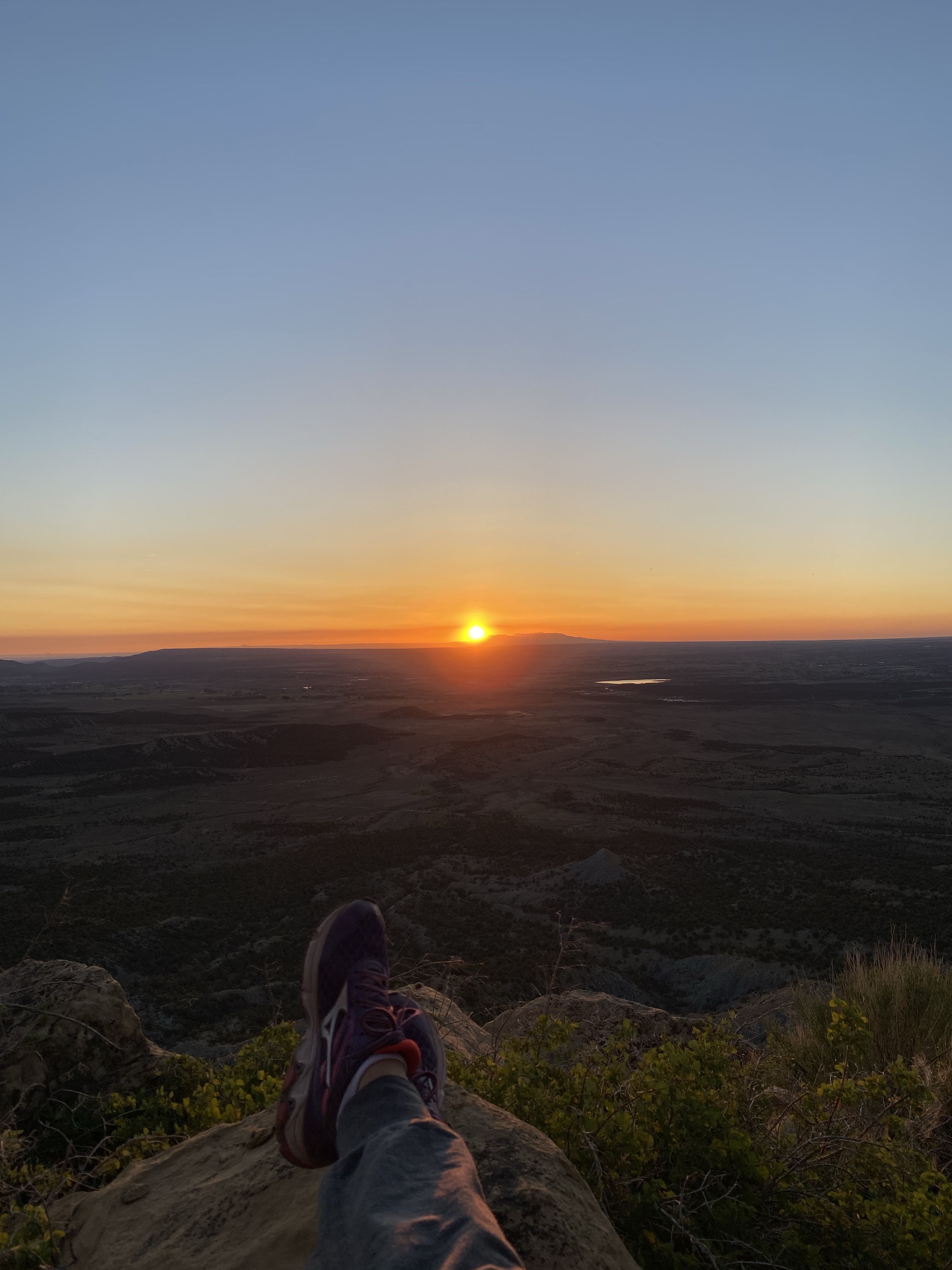
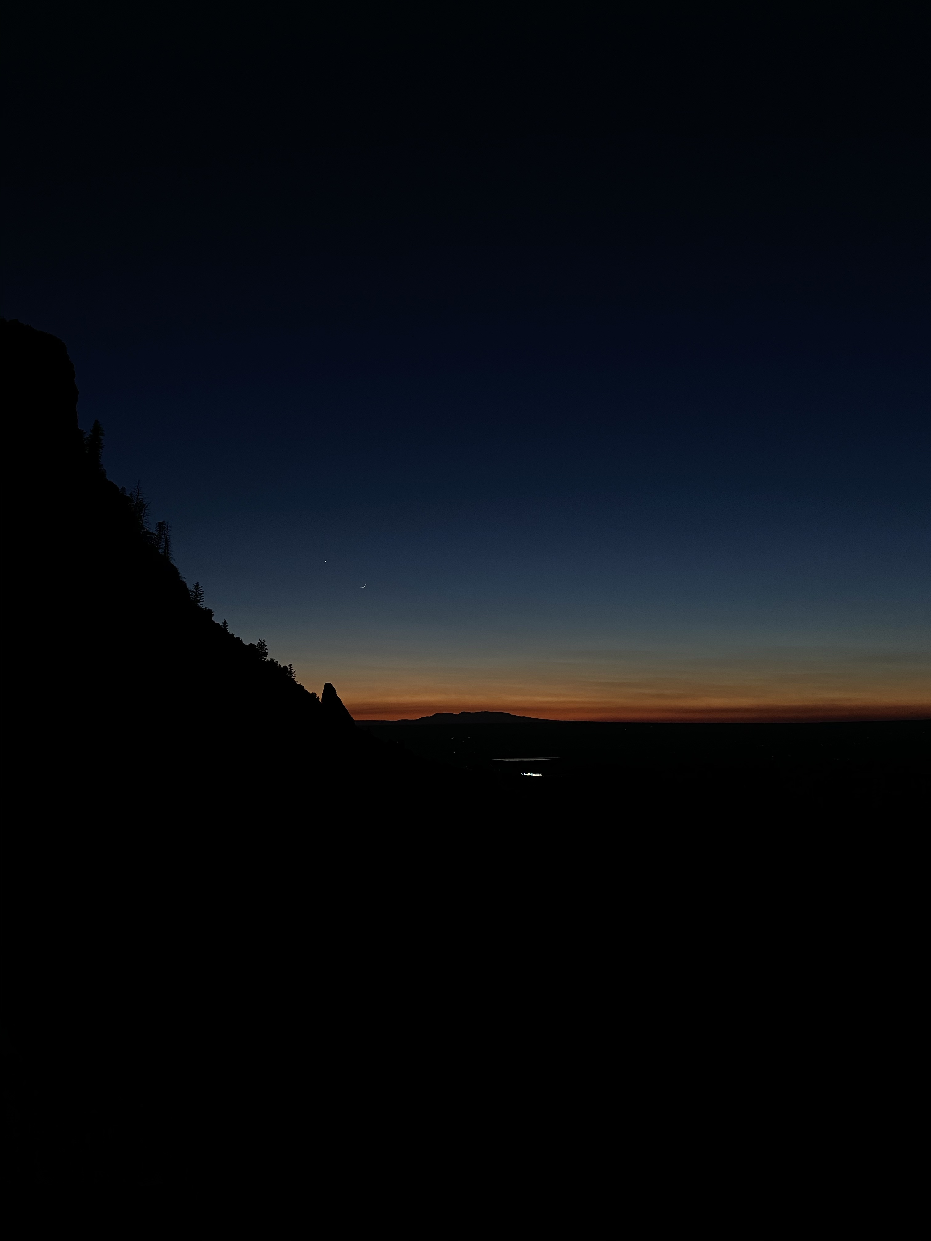
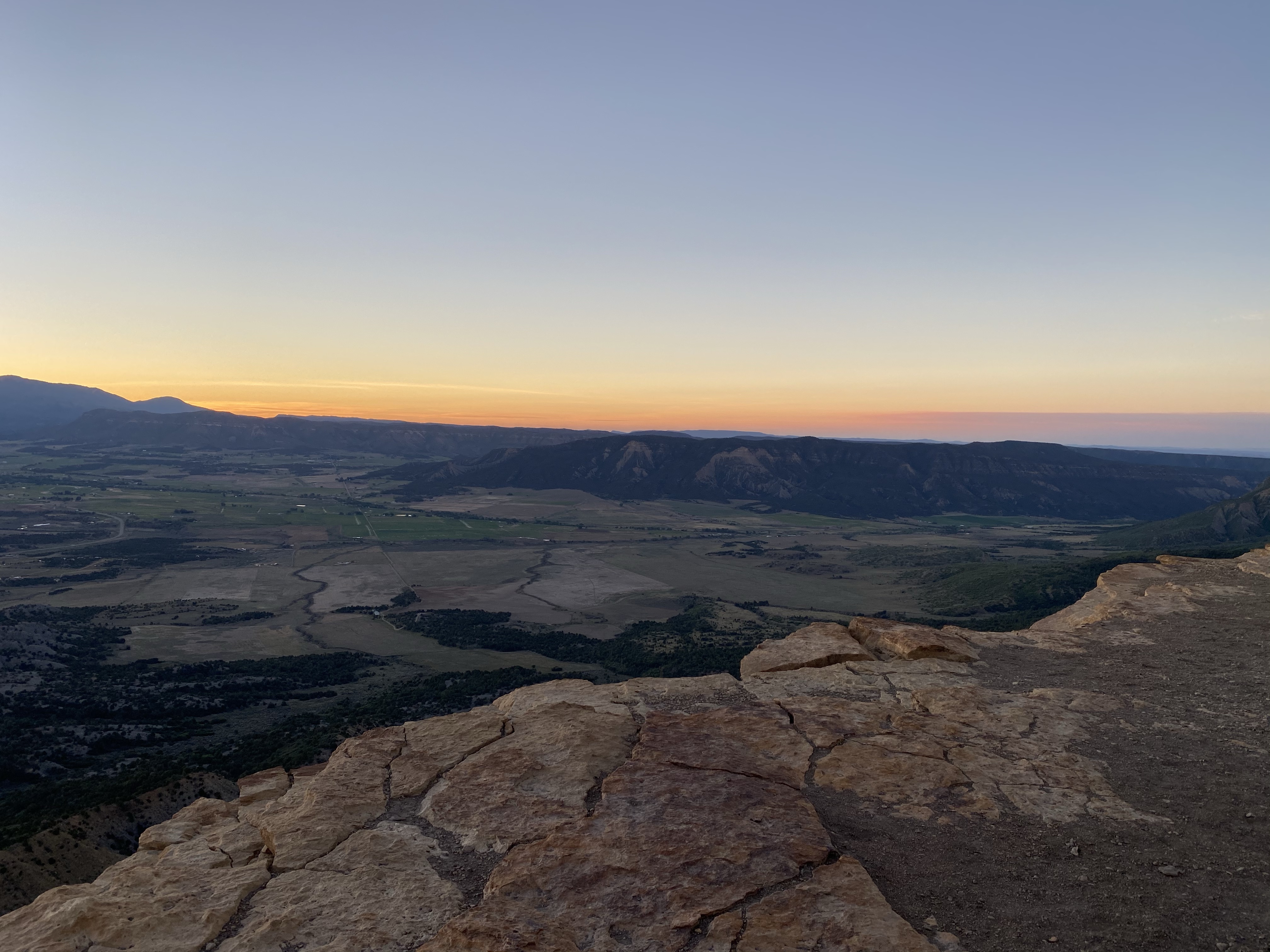
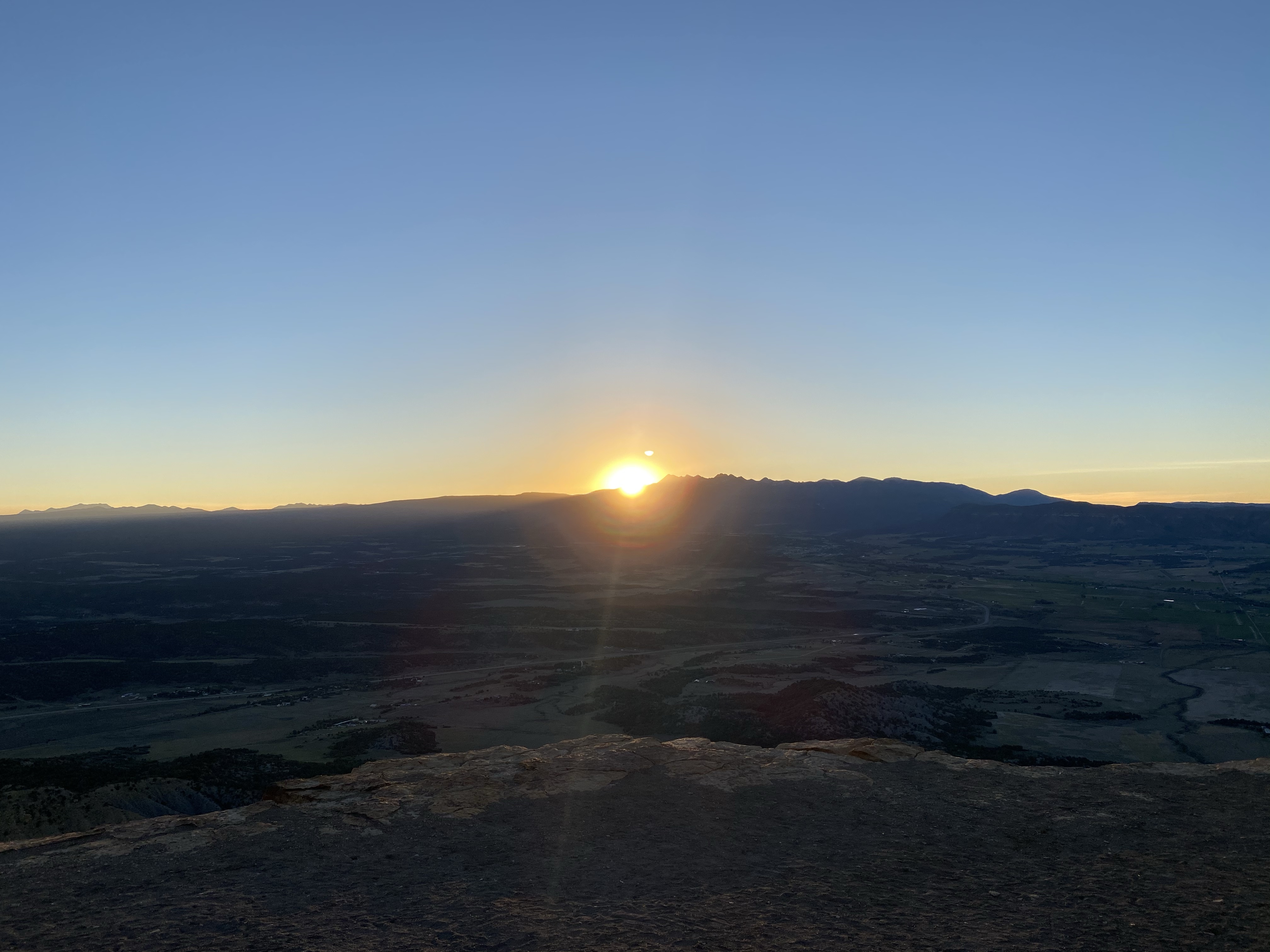
Before leaving, I woke up before sunrise for my final hike in the park. Another first for me! With my headlamp on and keys in hand to jangle and warn any waking animals, I set off on the trail. Climbing switchbacks quickly warmed me up. I hurried along, admiring the lingering stars overhead and waking lights down in the city. I traveling along the ridge and out to the clearing, the whole place to myself.
I sat down, bundled in my coat, and watched the ever changing sky. If you’ve never purposefully woken to watch the sun rise, I highly recommend it. A peaceful and spiritual experience, a good reminder that there is always another day ahead. I watched quietly for a while, moving slowly to different angles, and enjoyed these early morning moments.
After enjoying the calm and slowness of the morning, I called my mom for another chat. Bundled in another layer to ward off the slight breeze, it was nice to hear her voice and see her face.
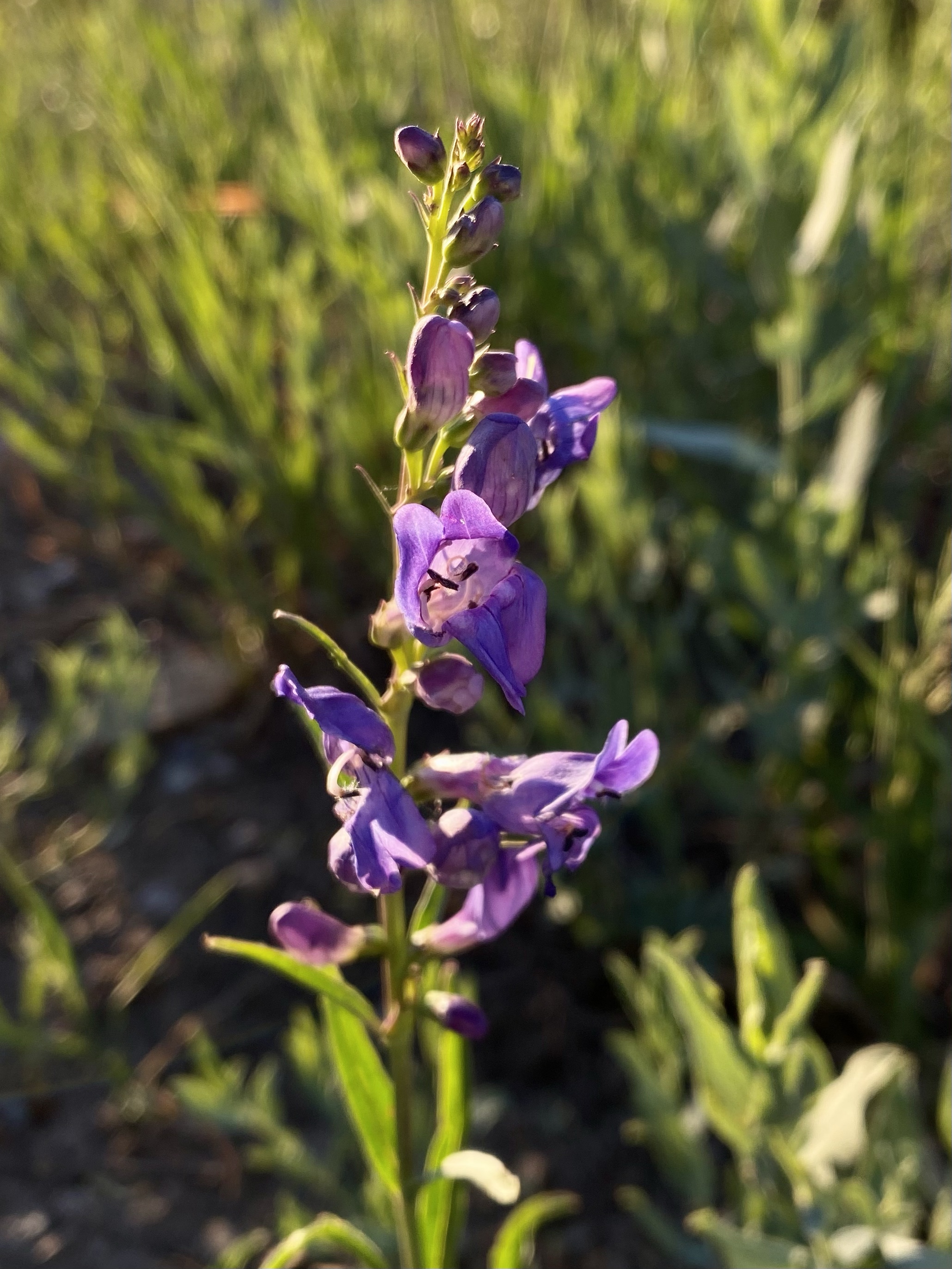
Then I headed down the trail, admiring all the flowers and views I missed in the darkness of the morning. I had a great view of the road into the park, beautiful flowers, and spectacular mountains. Certainly put me in a good mood for the day!
After a nap and cleaning up camp, off to my next destination. Stay tuned!
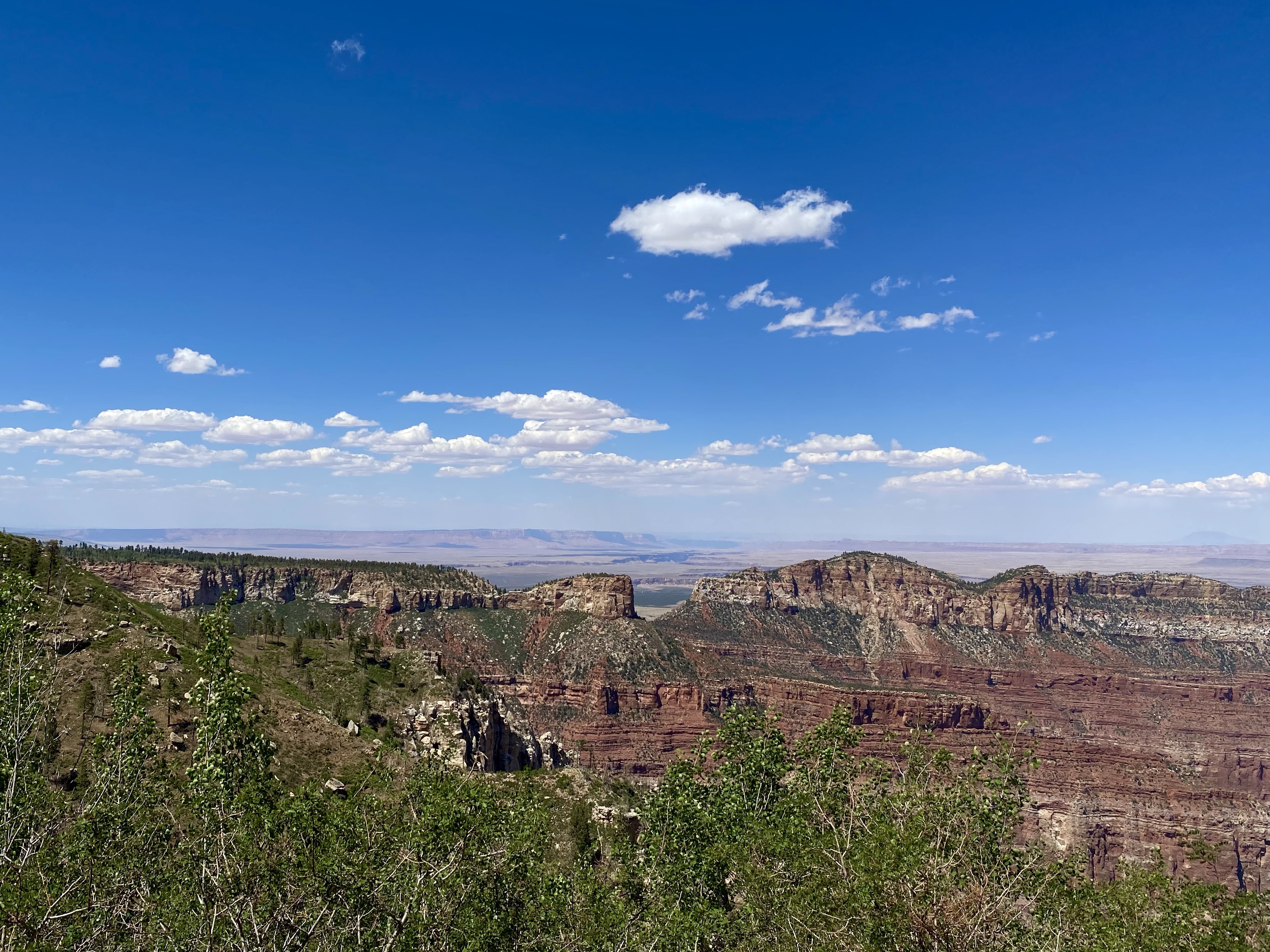
As we left The North Rim of the Grand Canyon, we headed east for a series of stops across Arizona. The space is vast out here, so much to see and so much to do. Large ranches cover acres, horses and cattle roaming freely. And national parks, state parks, and Bureau of Land Management protect huge areas. A great place to enjoy.
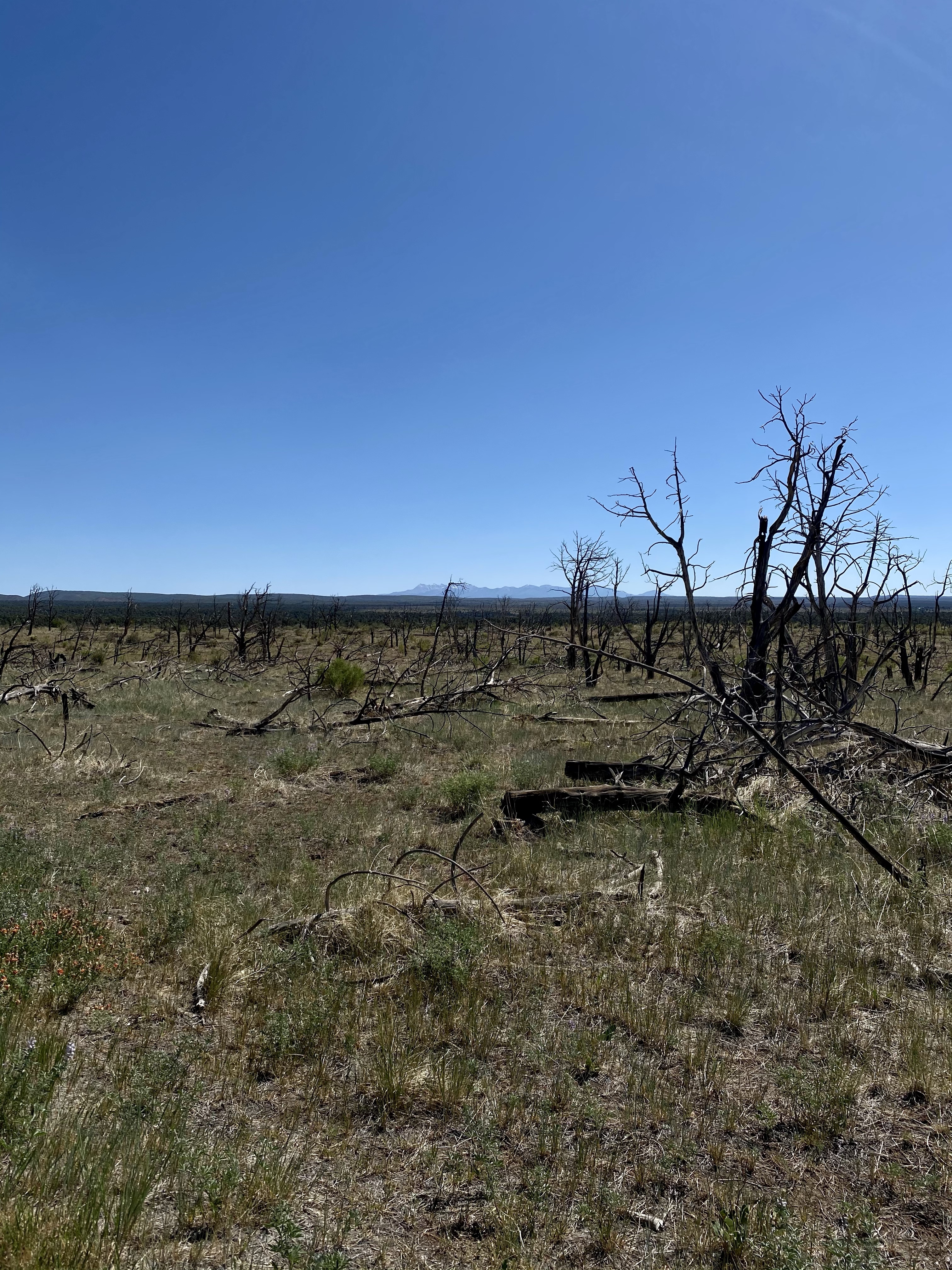
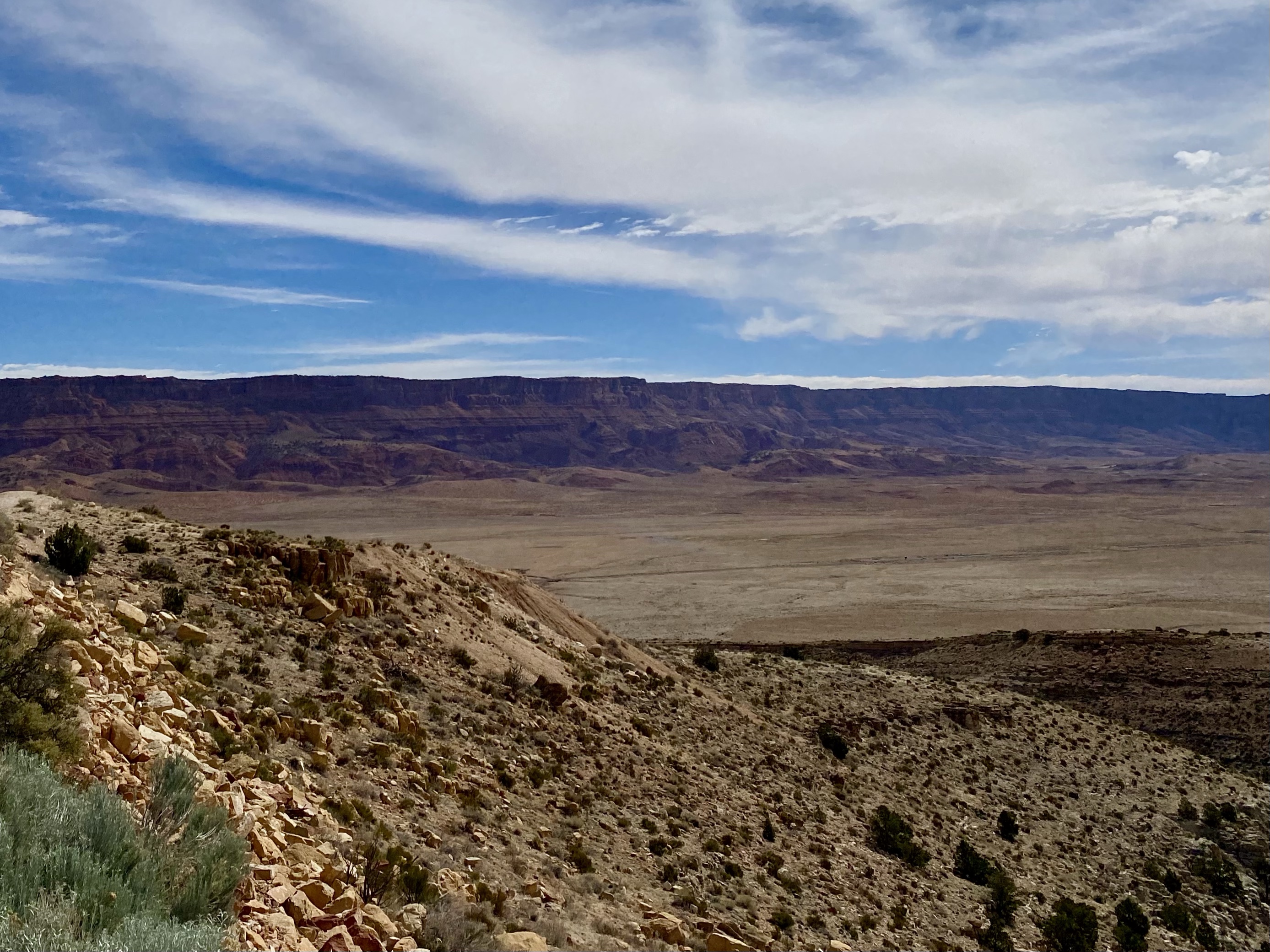
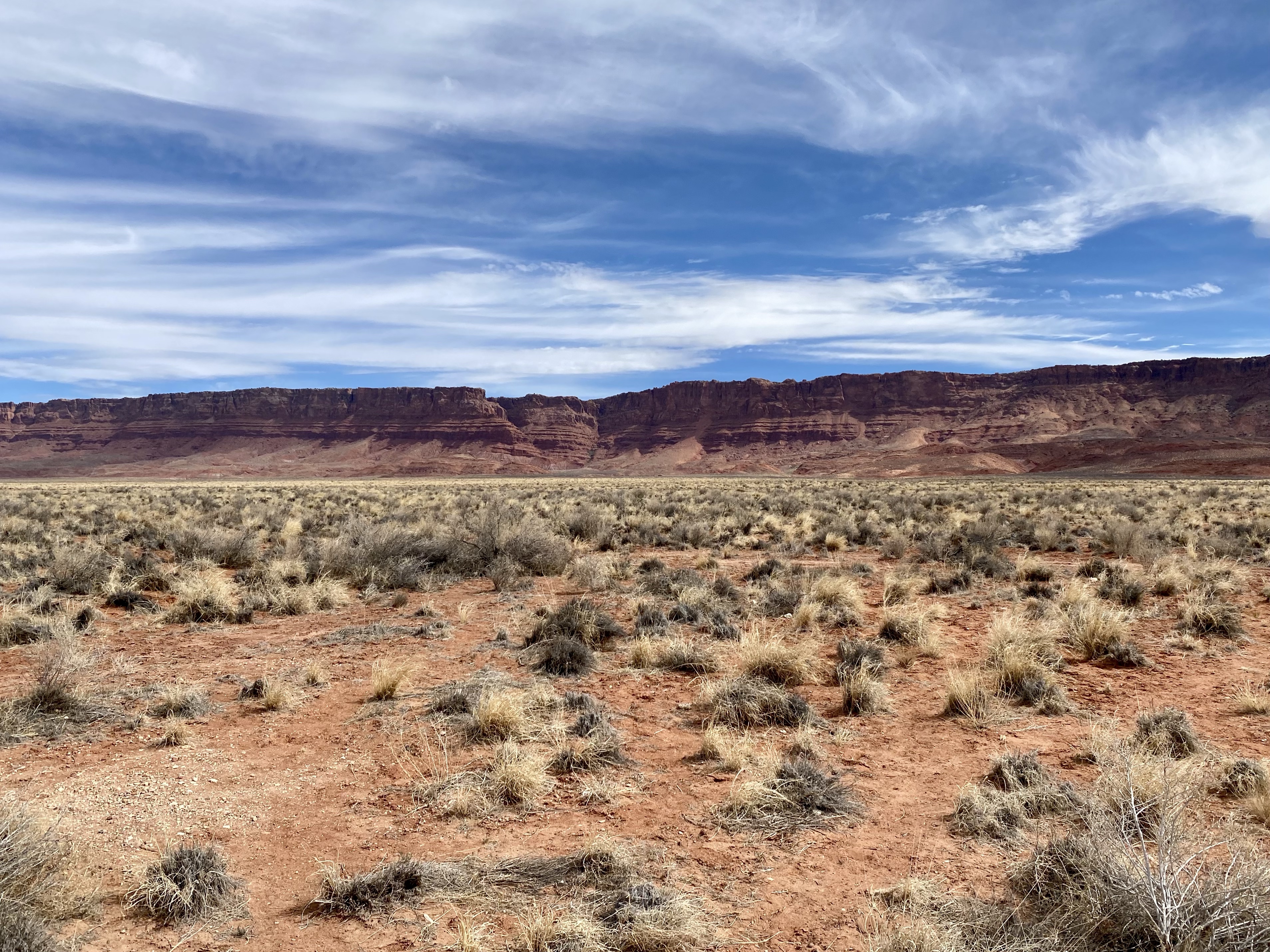
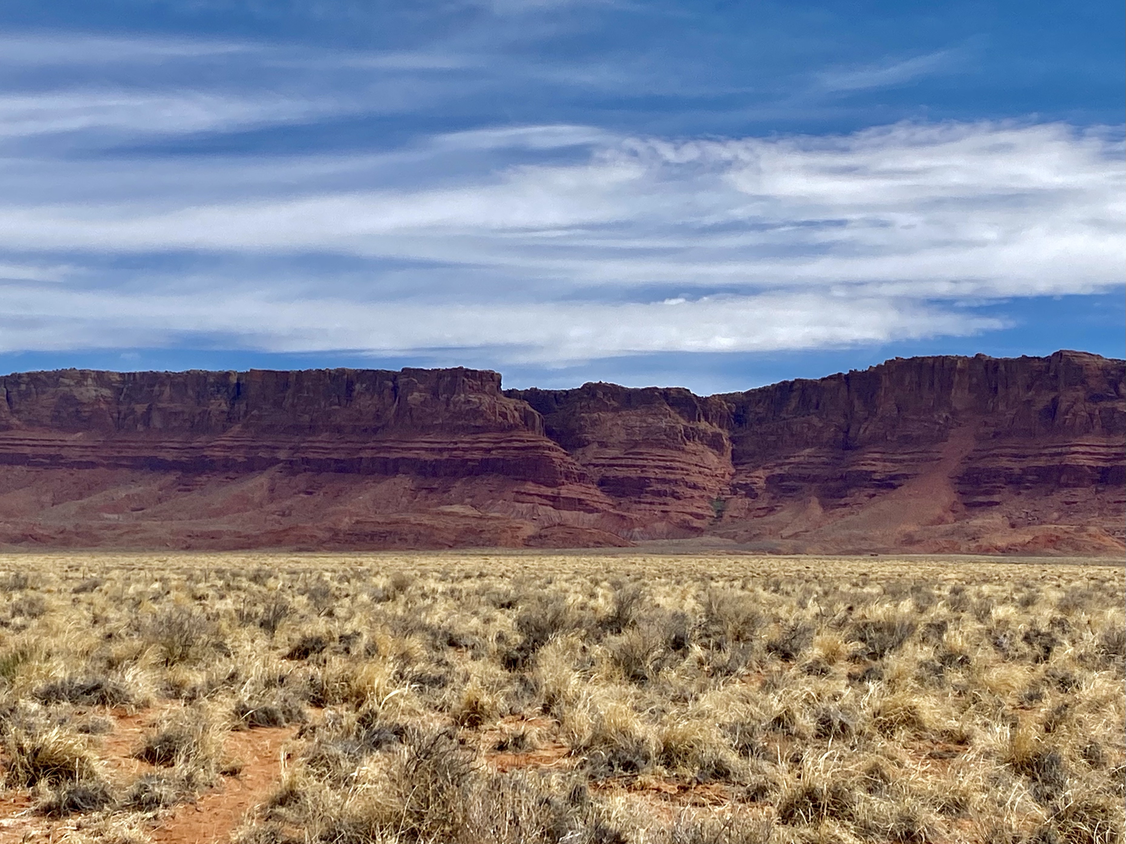
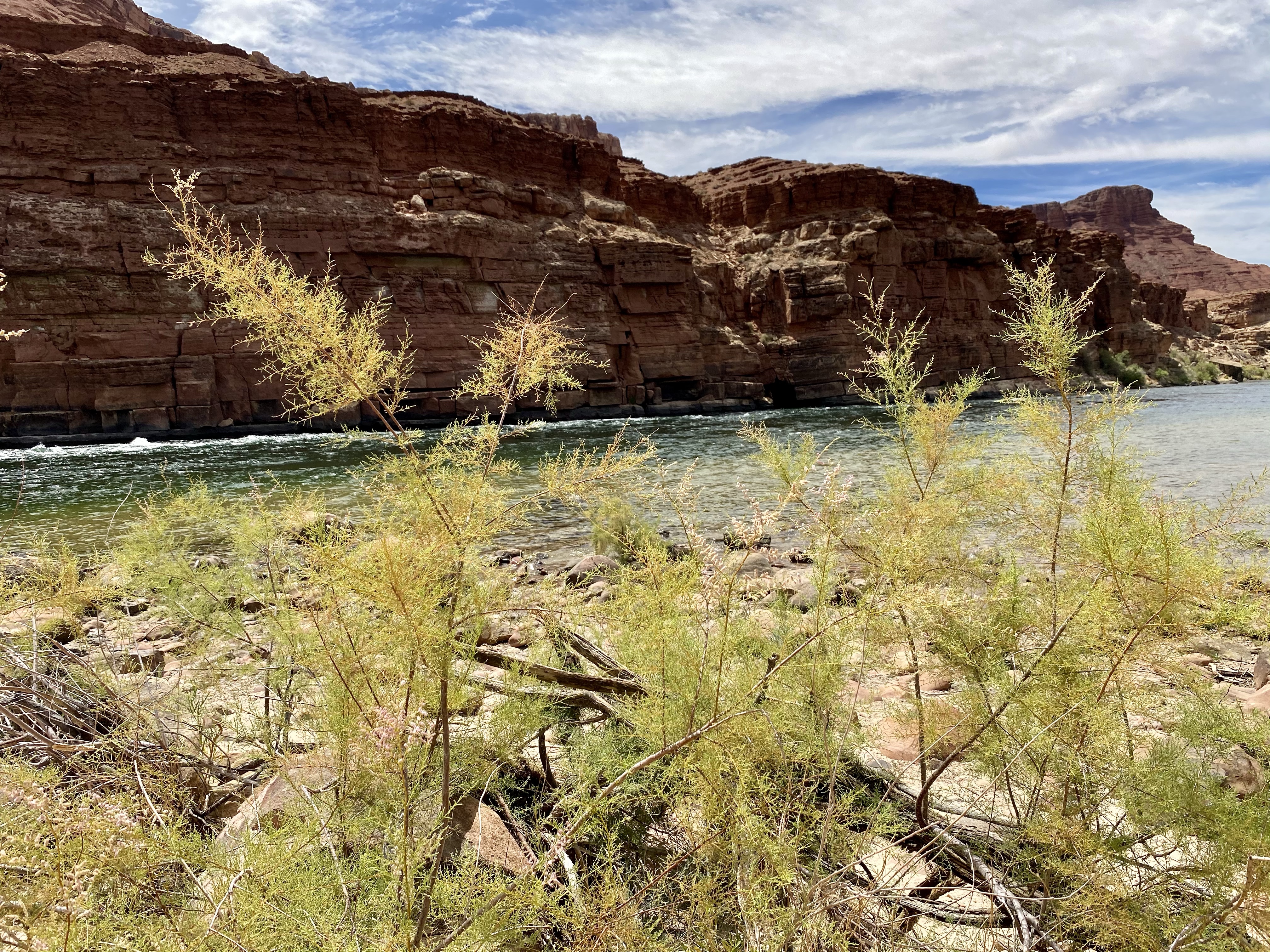
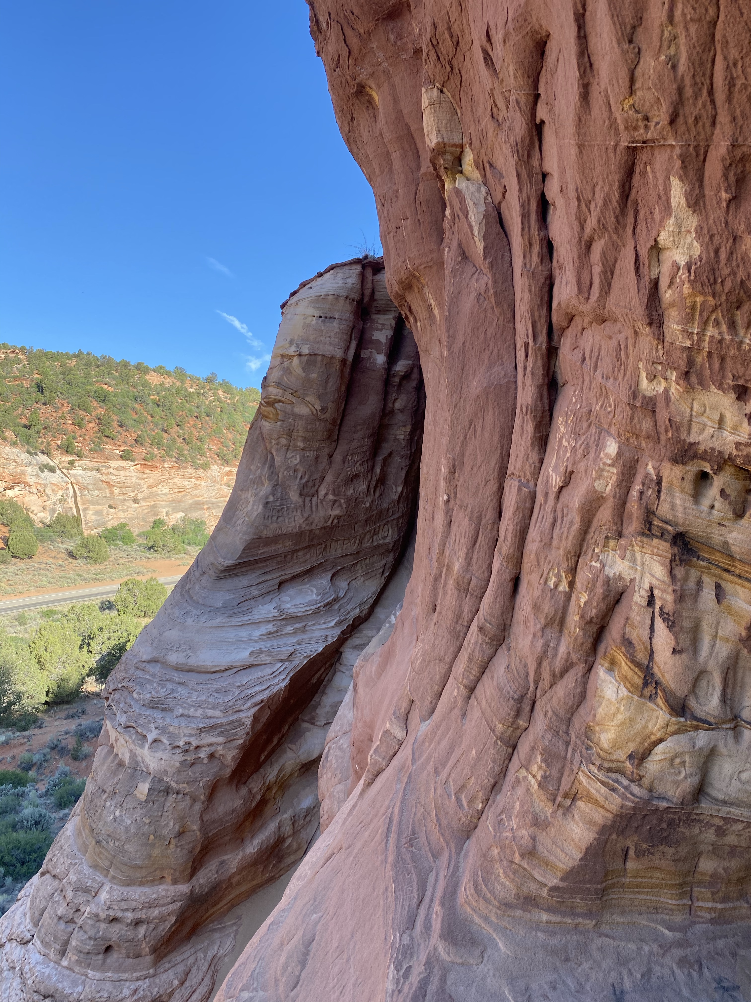
Just outside The North Rim lie the Vermillion Cliffs, a national monument. As we drove the scenic highway, we rolled up and down hills, then entered into a rust red canyon. On the other side the view opened wide to a magnificent view of the cliffs. Jutting up above the yellow desert floor, they stood tall and sturdy stretching in both directions for miles. Even from afar you could see their rugged beauty, raked by the wind and striped by the earth. They proudly displayed a deep red from floor to ceiling.
As we drove down the road further, the Vermillion Cliffs continued to evolve, sometimes a tall wall, other time various shapes of rock outcroppings, and still other moments of stand alone towers. The colors changed too, now red mixed with white and yellow, sometimes dashes of green. No part looked the same as the last.
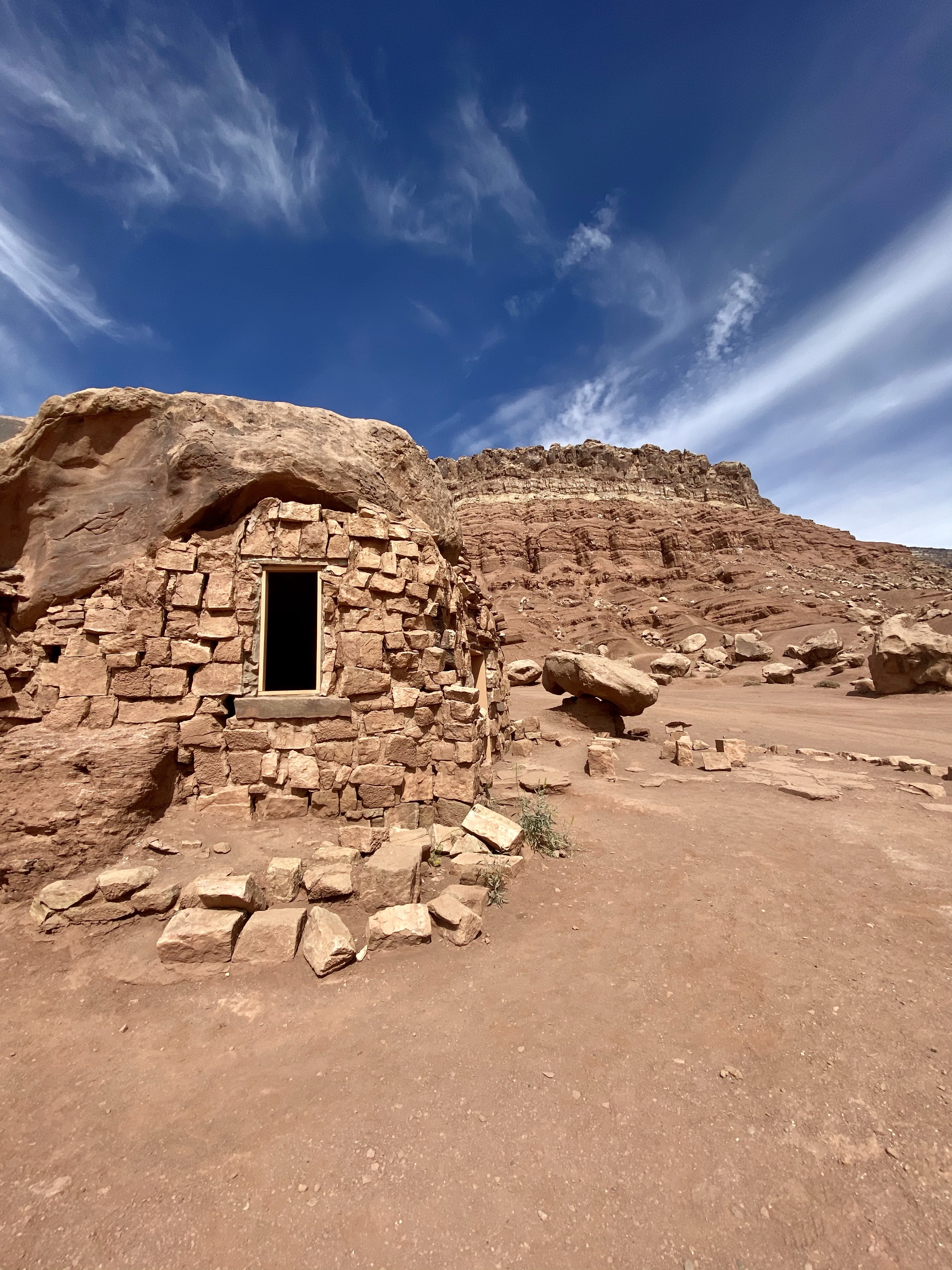
Farther down the highway we stopped at ancient cliff dwellings, red stone houses once inhabited by prehistoric indigenous people. There were no signs to help us with the history, which was unfortunate. The houses and storage rooms are built around large boulders that fell from the cliffs and rested on the sandy red earth below. Today, this area is Navajo Nation, the land the tribe was relocated to years ago.
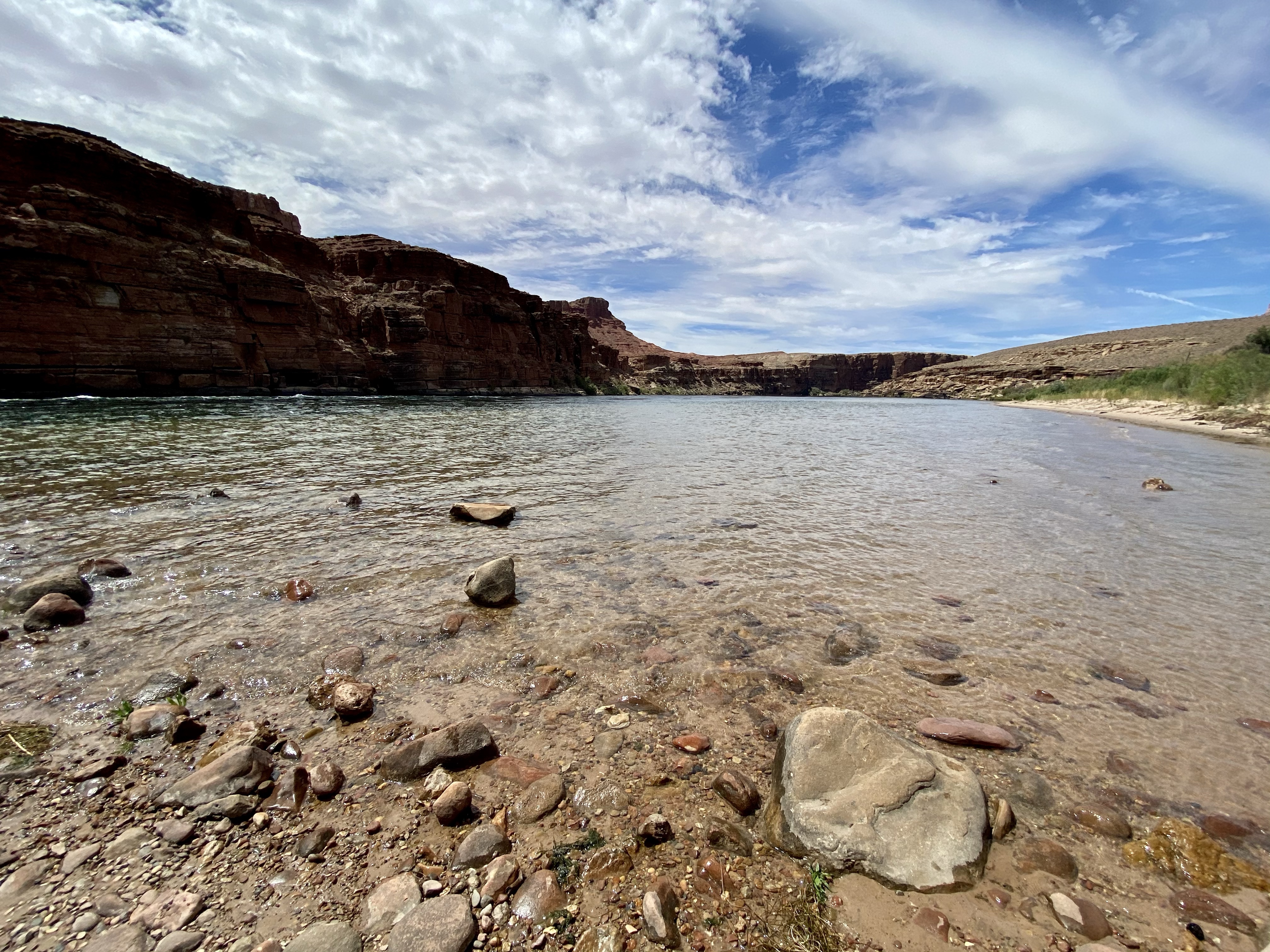
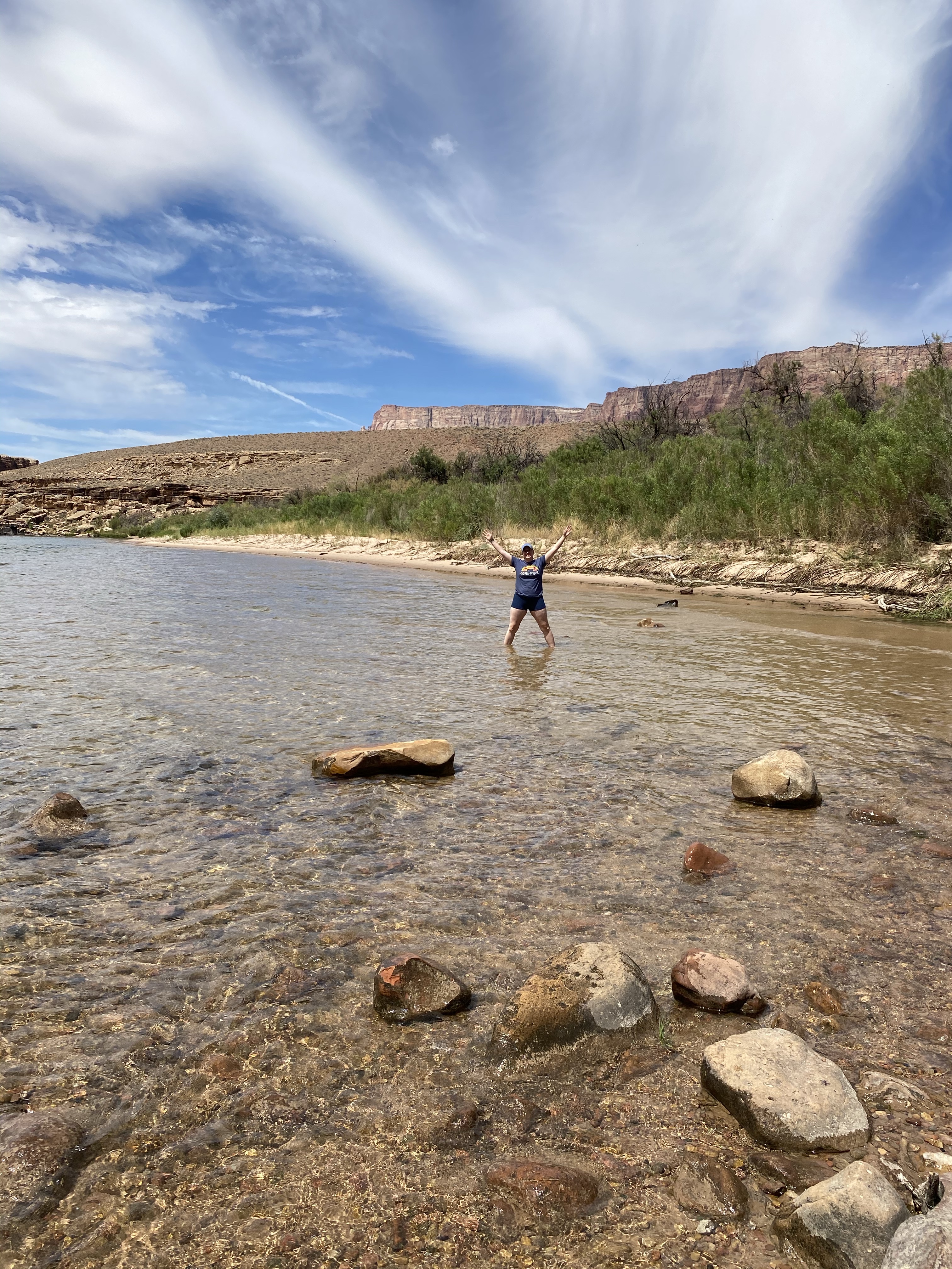
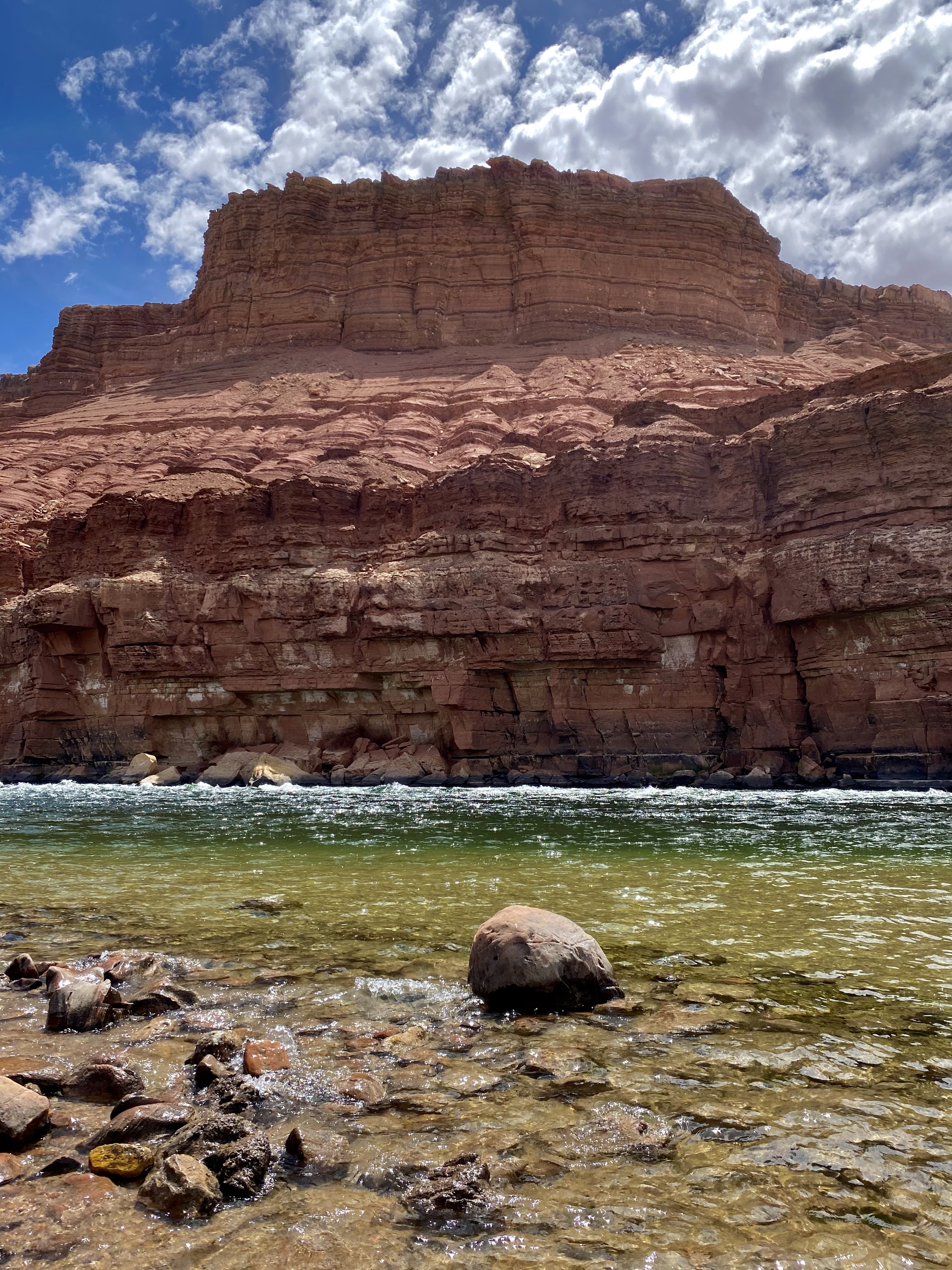
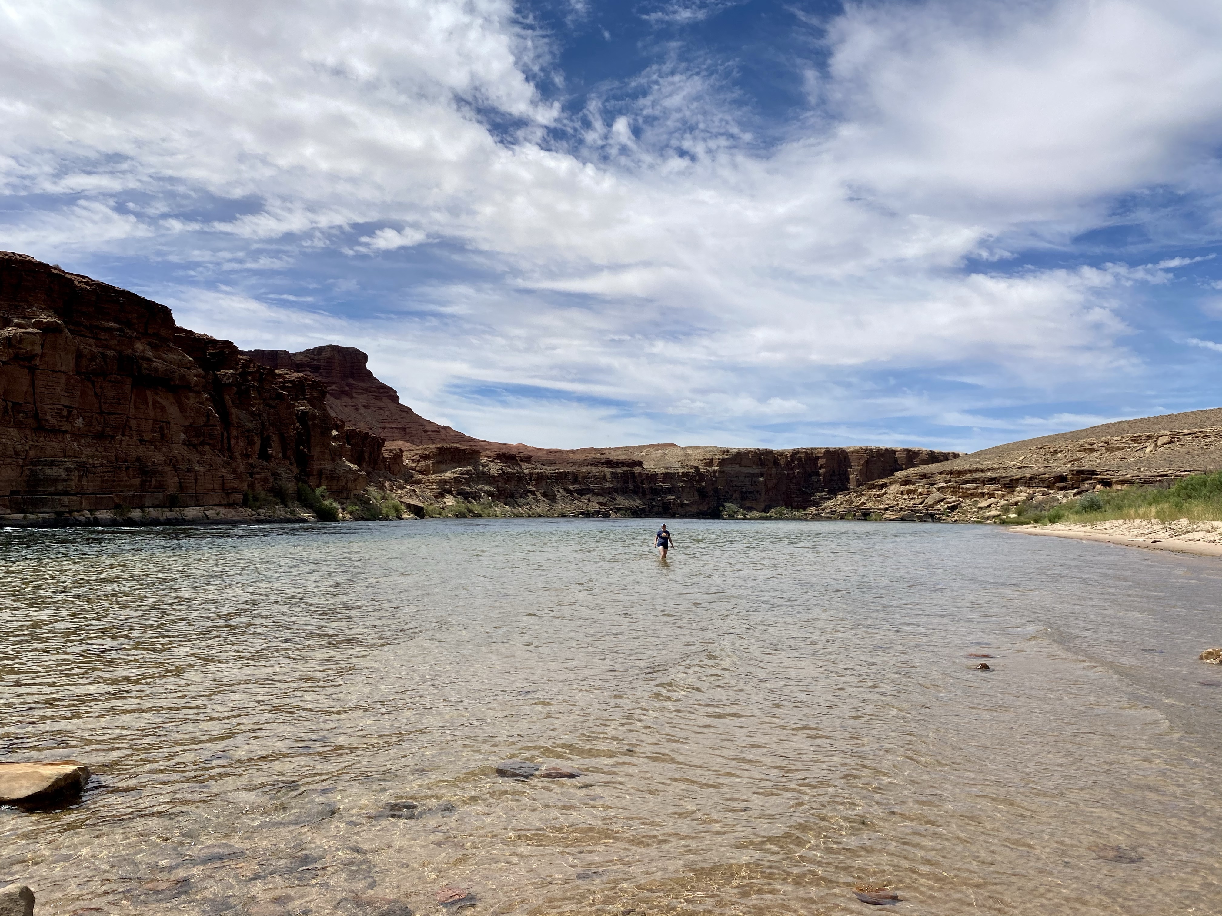
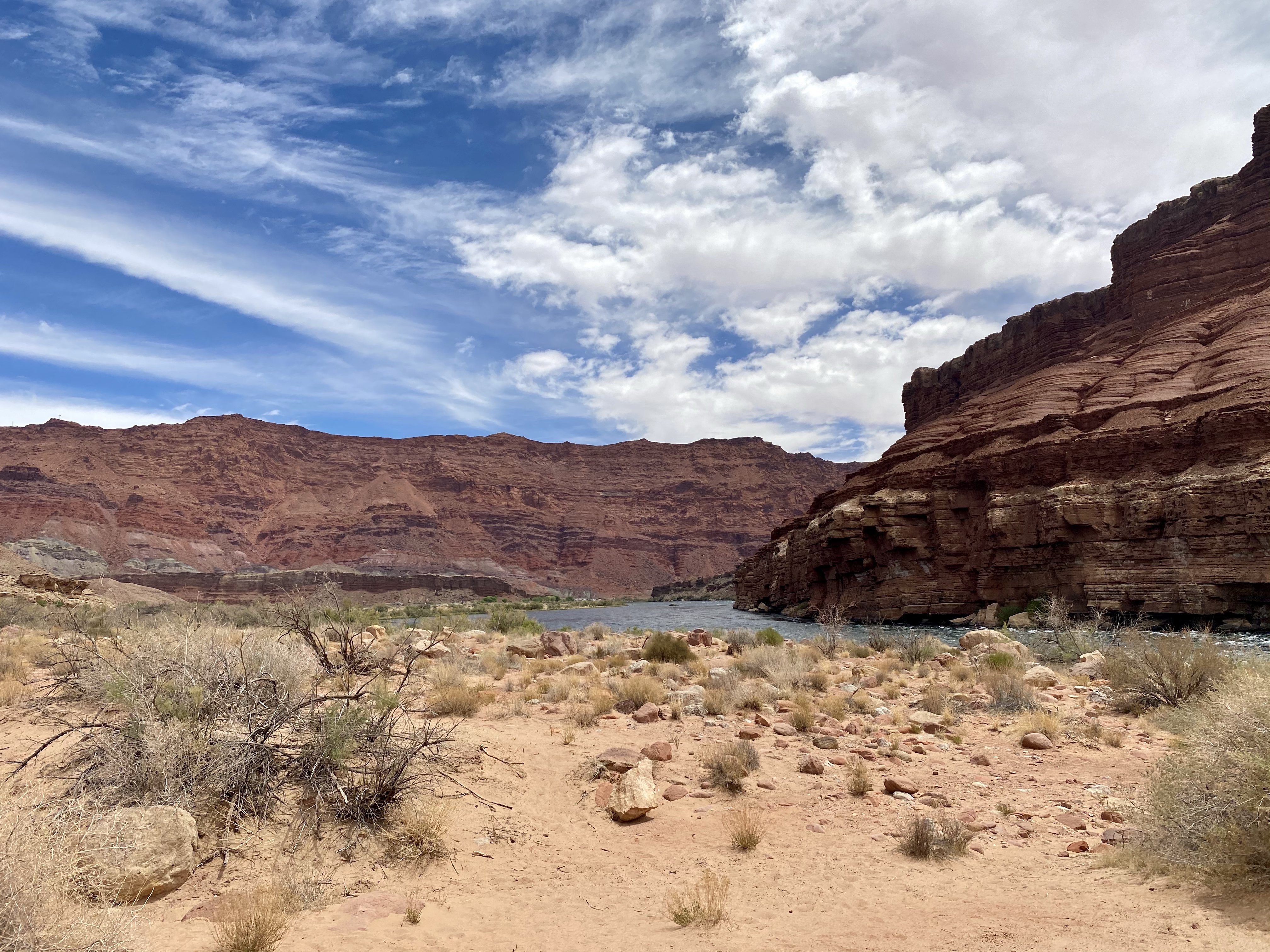
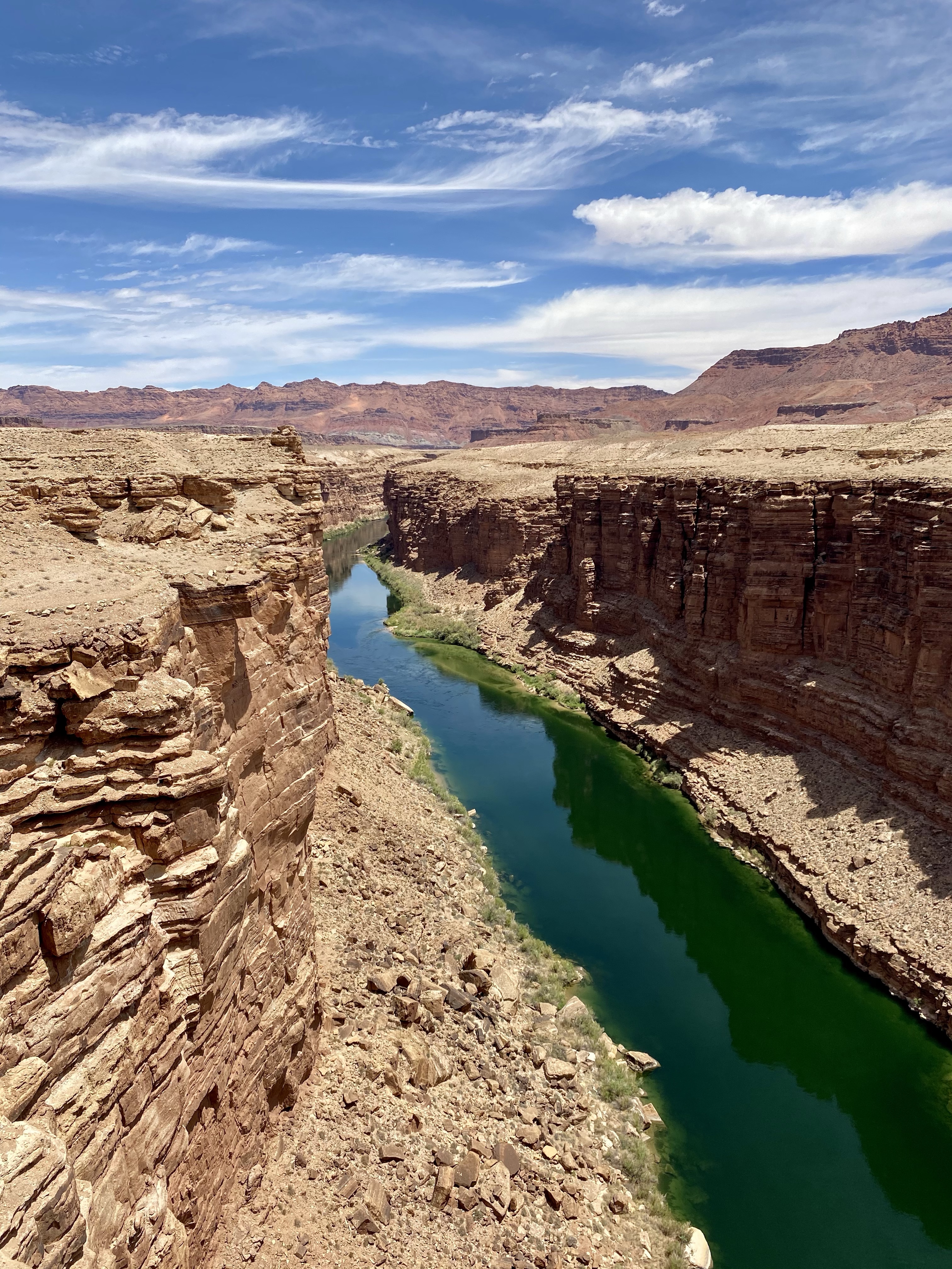
From there we continued on to Glen Canyon National Recreation Area, where the Colorado River enters Marble Canyon, then Glen Canyon, and eventually Lake Powell. A short side trip proved to have stunning views, and a refreshing body of water to wade in. Down in Glen Canyon the brick red walls rose up from the blue green water of the Colorado River. Rushing by with little white ripples, the shore was calm and full of people fishing. Bright colored lizards scampered around and I tried to capture them with my camera while Crystal took a dip in the ice cold water. Brrrr! Max and I stayed on the shore, happy to be warm and dry. Max did get a little wet looking for Crystal, so they both got a parking lot shower before we headed off!
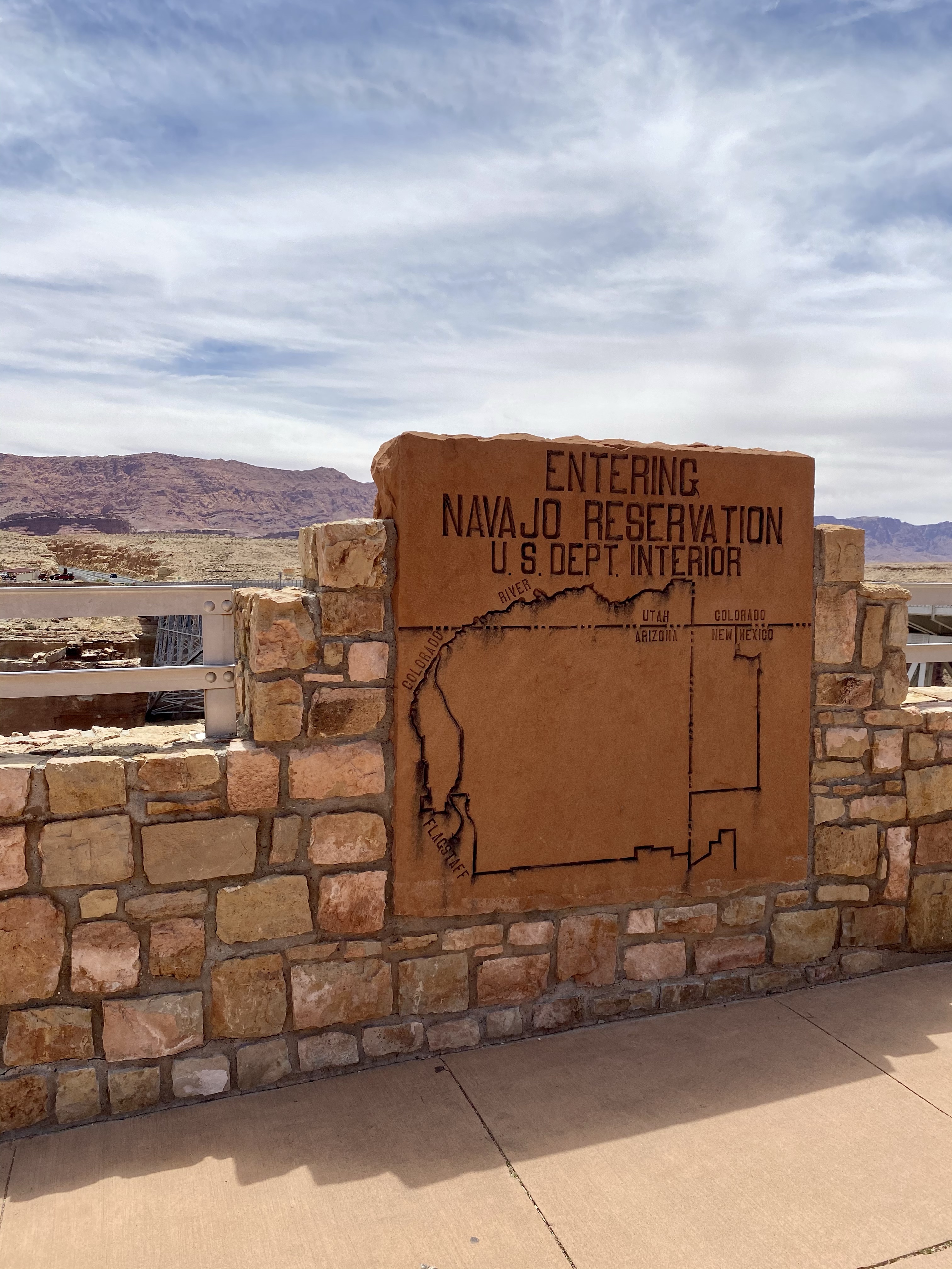
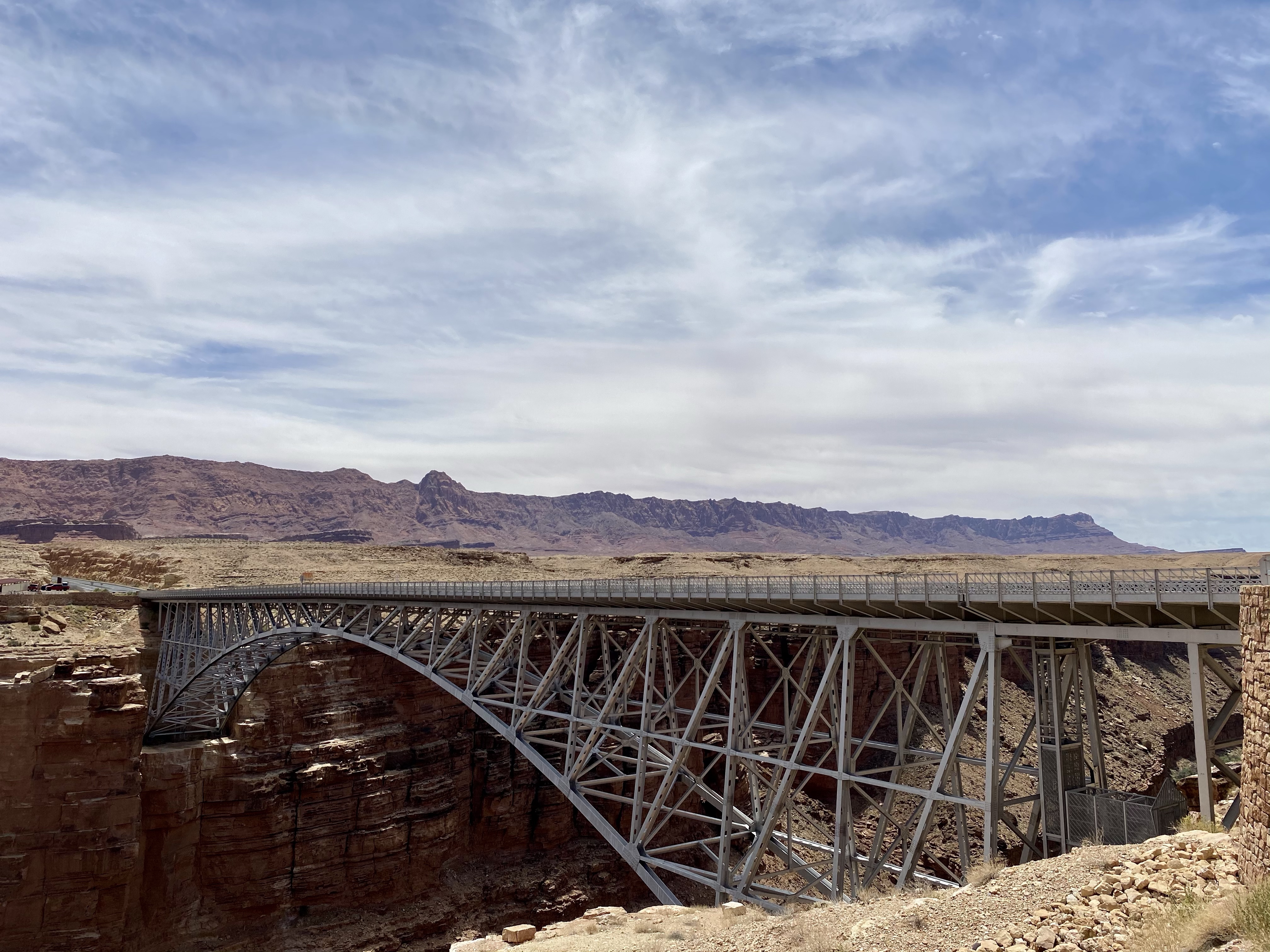
Shortly down the road we paused at Navajo Bridge, the entrance to Navajo Nation. The steel masterpiece was built over the Colorado a river between 1927 and 1928, making travel easier and safer. Previously, Navajo people had used Lee’s Ferry to transport people back and forth, but it was dangerous and many lost their lives. For example, John Deering of the Deer Water Clan would transport supplies and U.S. mail to Flagstaff, AZ. He ran Lee’s a ferry until the bridge was completed. Another example is Lewis Nez of the Bitter Water Clan. He worked for the Bitter Ridge Trading Post and ferried supplies, mail, and money for local merchants. Once across the River, he took the goods the rest of the way by wagon.
This area is of great importance to the Navajo people. Today they continue to cross back and forth by bridge and set up shops to sell their handmade goods. Fine jewelry, pottery, weavings and more line their shops and help support their clans. Crystal and I spent time picking out gifts before crossing back over.
We sat near the entrance, eating lunch and watching the California condors ride the thermal waves overhead. They are gigantic birds with wingspans of nine feet across. Endangered, they are slowly being reintroduced to their native habitats. Here, four of them soared happily above the deep blue river.
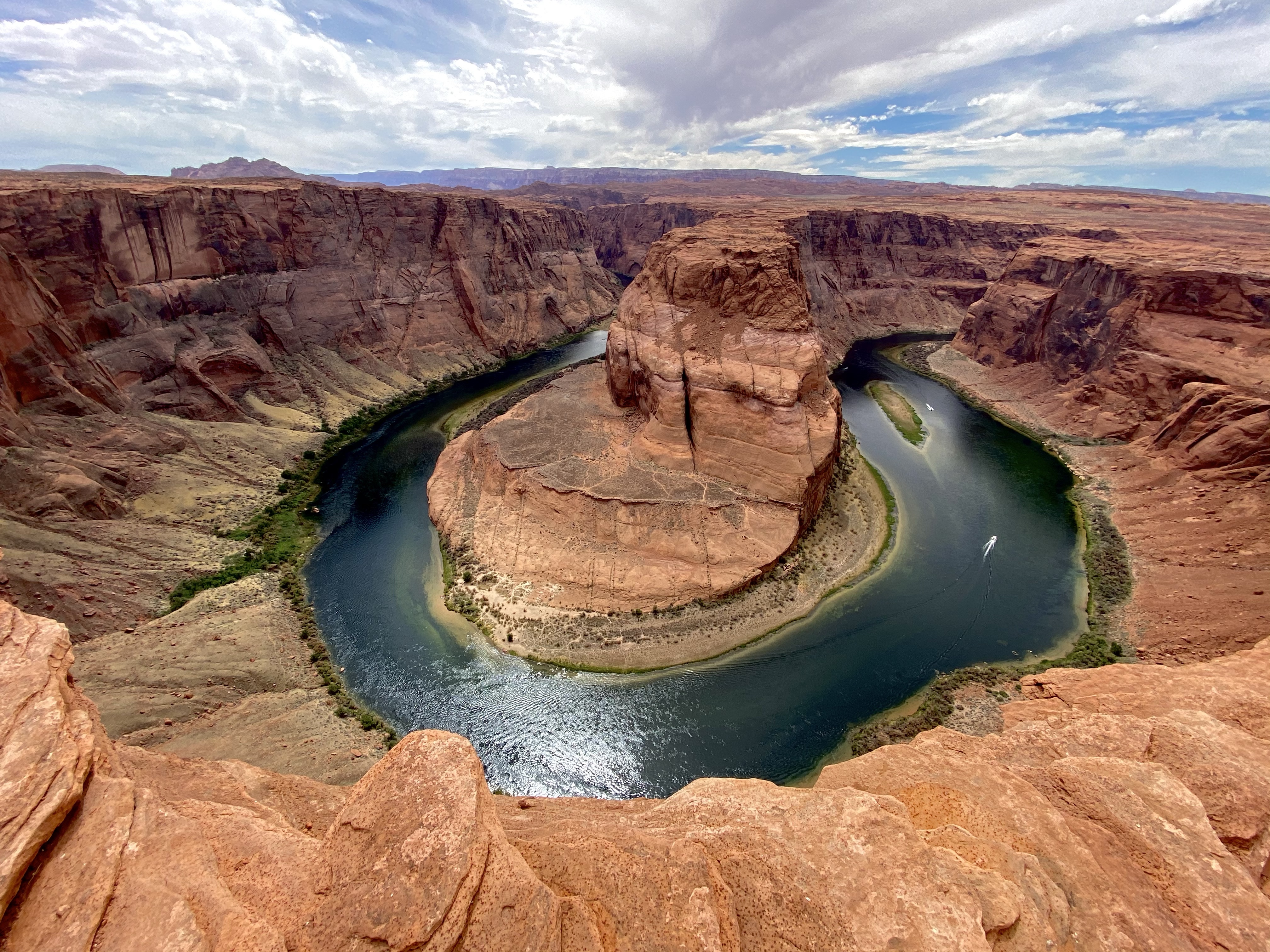
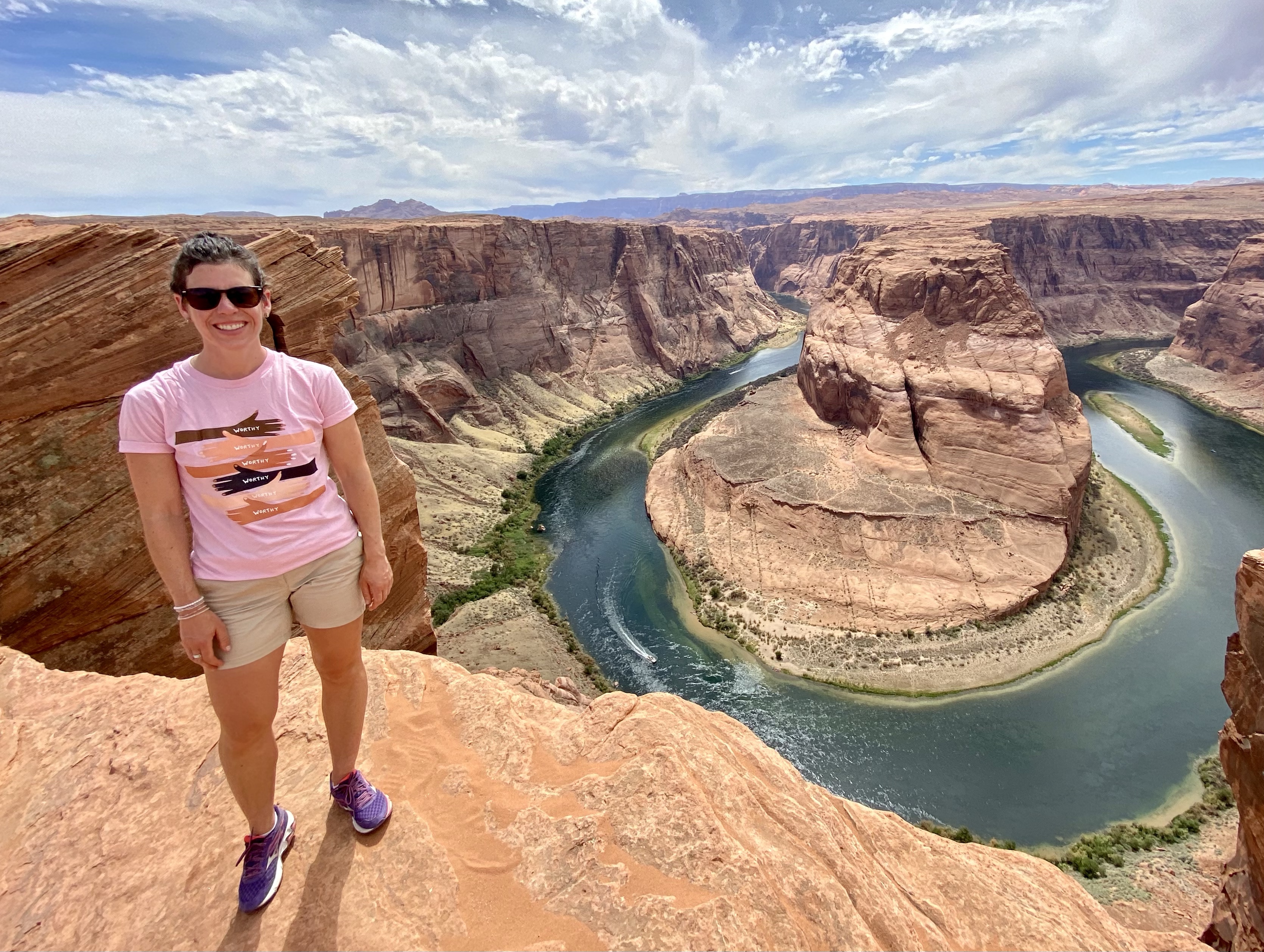
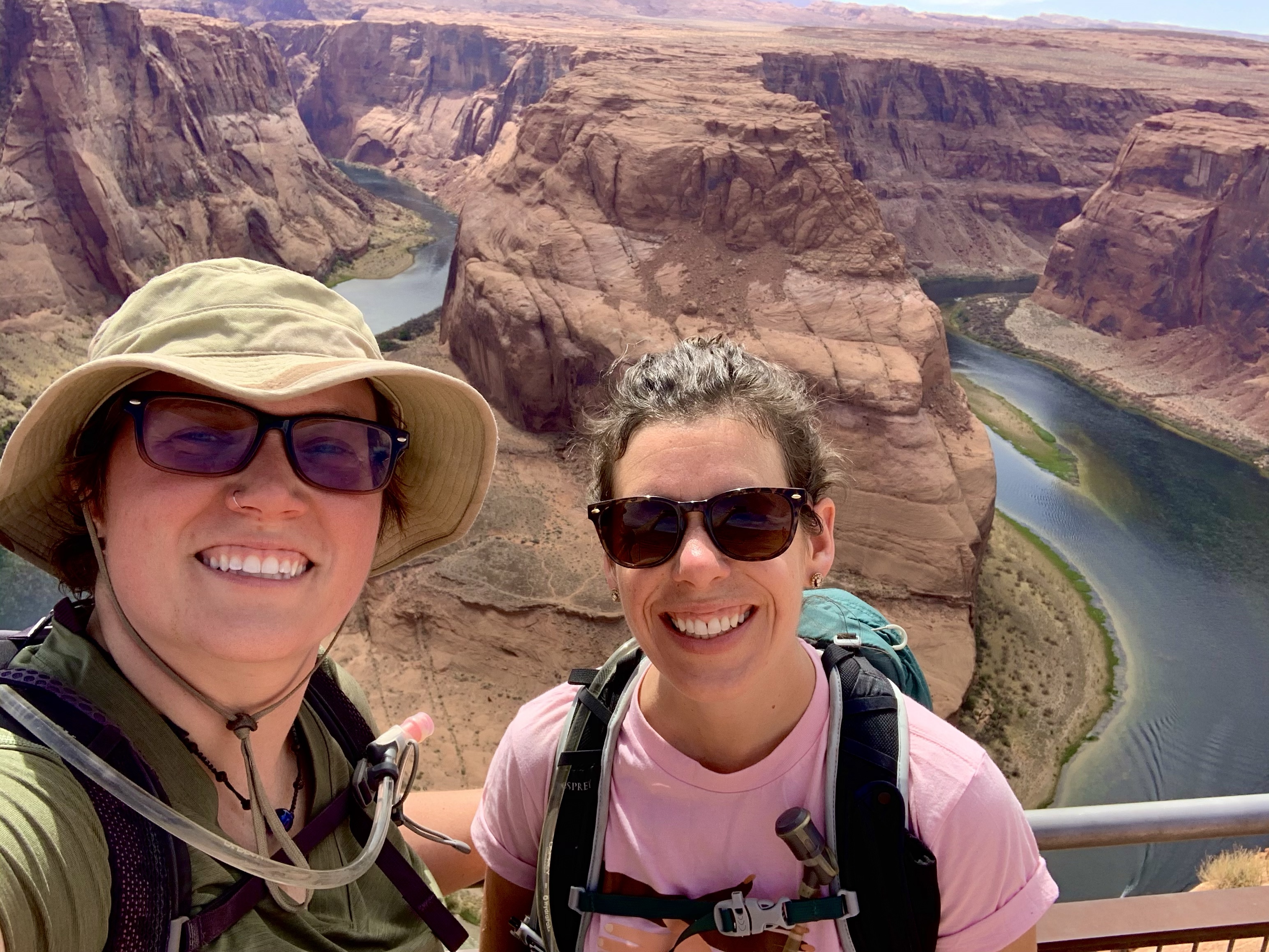
Next stop on our tour was Horseshoe Bend, the famous curve in the mighty River. The afternoon heat was brutal, but we didn’t let it stop us. Max was prepared for the hot pavement with his booties and we set off, down the paved path to the popular attraction.
The lookout point was crawling with people, so we climbed over the sandstone for a ways to get a quieter view. This place is everything you may have seen in pictures. Far below, the Colorado River flows a deep blue around a sharp curve, brilliant green vegetation separating the red banks from the water. In the middle of the bend, far away from your feet, stand a tall tower that slowly grows as the river floor has sunk from erosion. Boats zip along below, kayaks from paddlers rest on the Bend’s shore, all looking like tiny ants from the rim. I wandered around for a while, catching different angles, while Crystal and Max sat and rested and reflected. A breeze made the heat tolerable.
Eventually we headed back, stopping at the shade benches for a rest and water. Max was happy for the break! But we all made it back to the car safely, and cranked the AC right away. Haha!
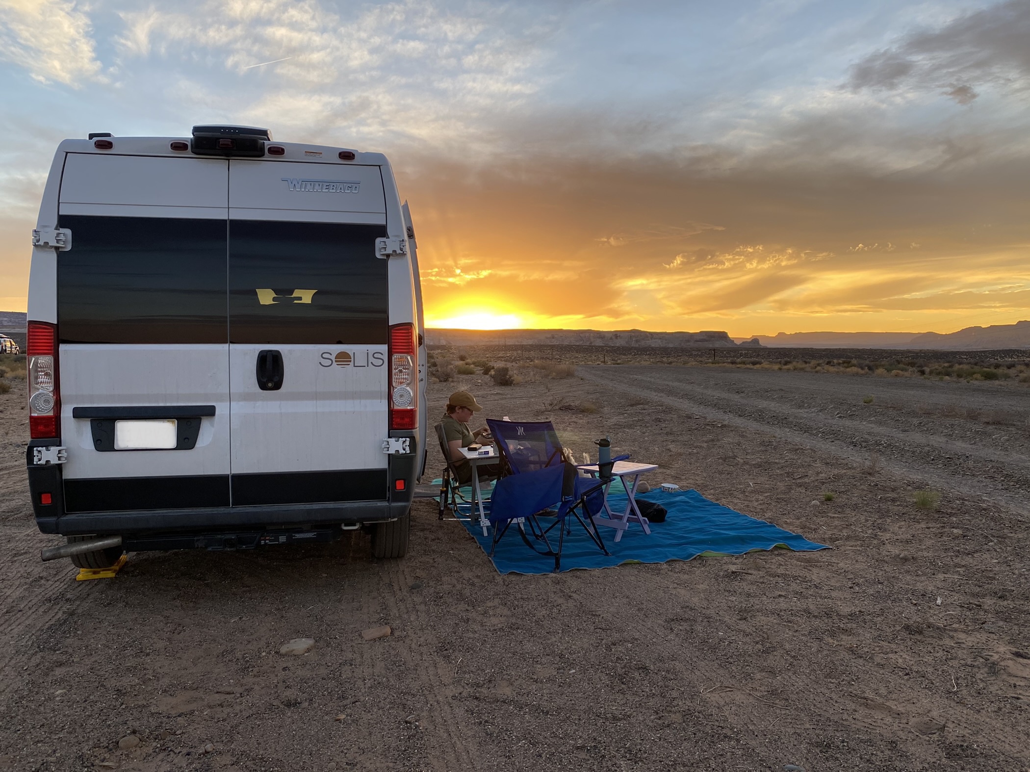
We drove through Page, AZ, grabbed groceries and gas, and headed to our camping spot. Our first try was full, so we found the entrance to the BLM land and made our our spot down the road! You can camp almost anywhere on BLM land, just pay attention to signs.
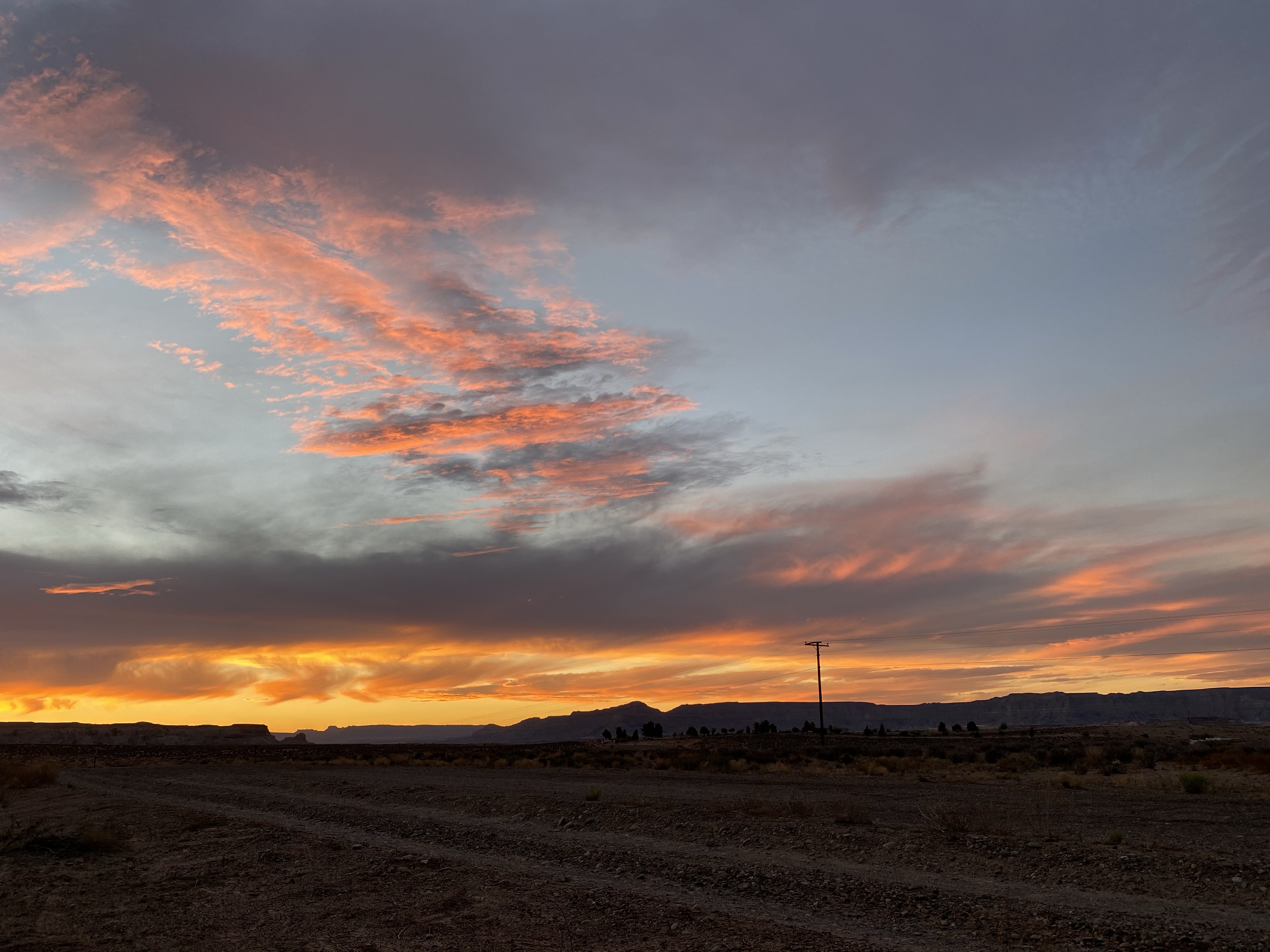
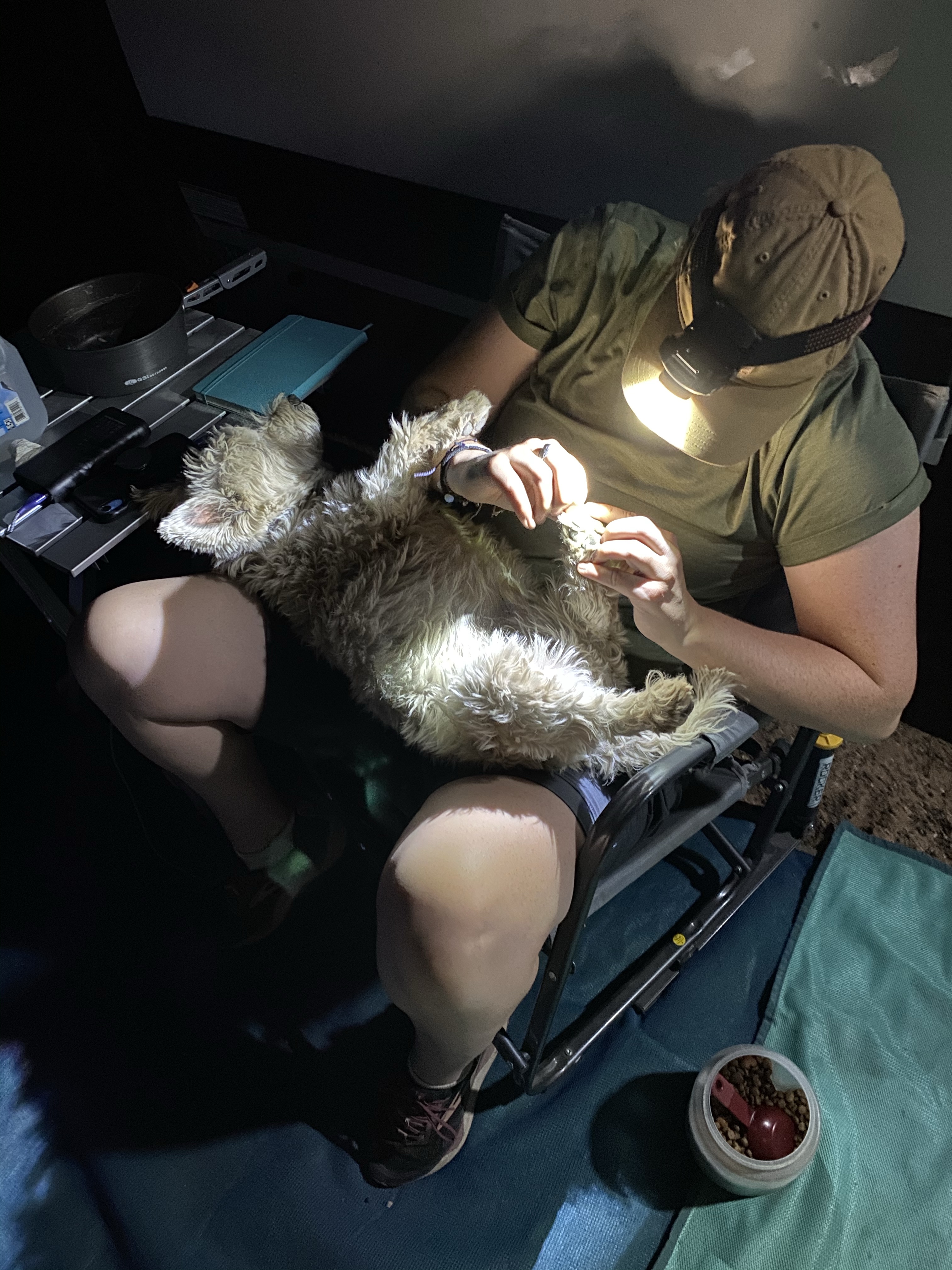
Happy with our quiet spot, we eased into the evening. As the fiery ball of orange set over the cliffs in the west, those in the east glowed a pale pink. Then the whole sky lit up, neon pinks and oranges like a disco party. When the sun finally disappeared, Crystal donned a head lamp and performed a pedicure on Max. These random, simple spots and nights are my favorite.
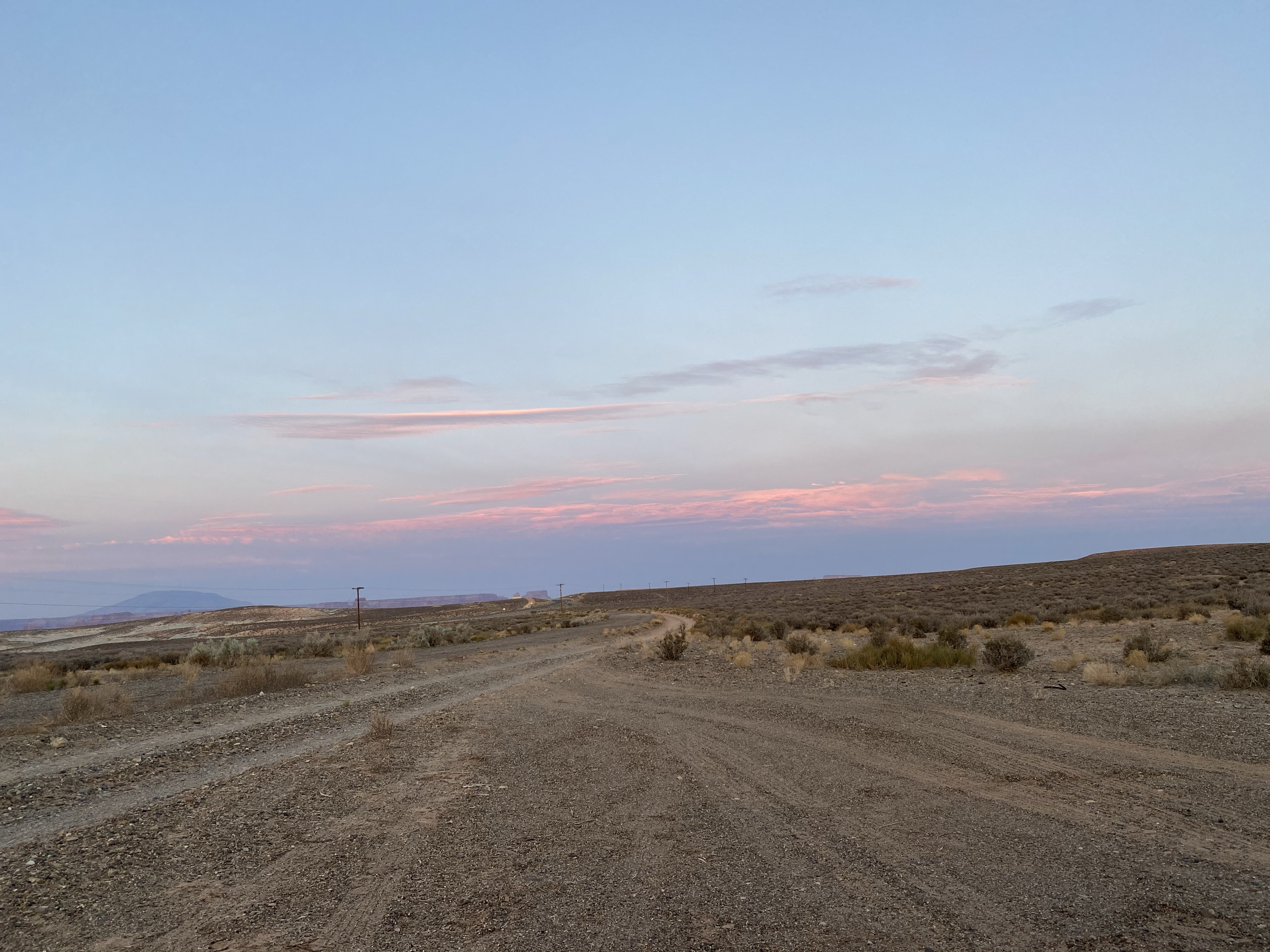
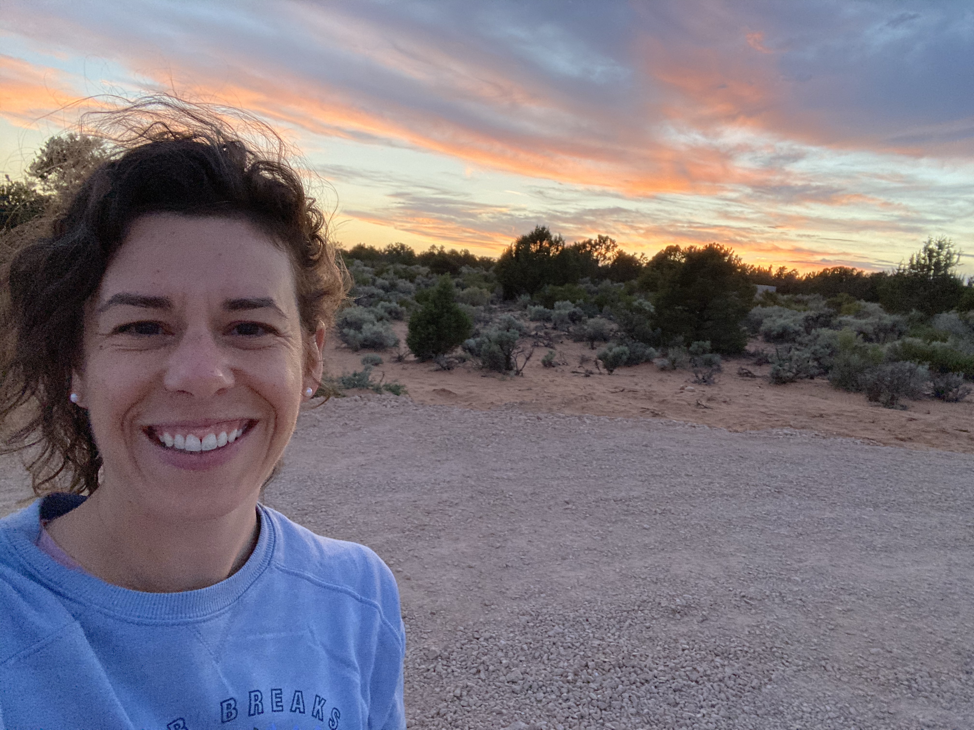
The next morning I awoke to a truck driving down the road, which at first was bothersome. But then I noticed the neon pink sunrise and I was happy for the distribution. I did sneak in another hour of sleep after that, but waking to see the sunrise is something special.
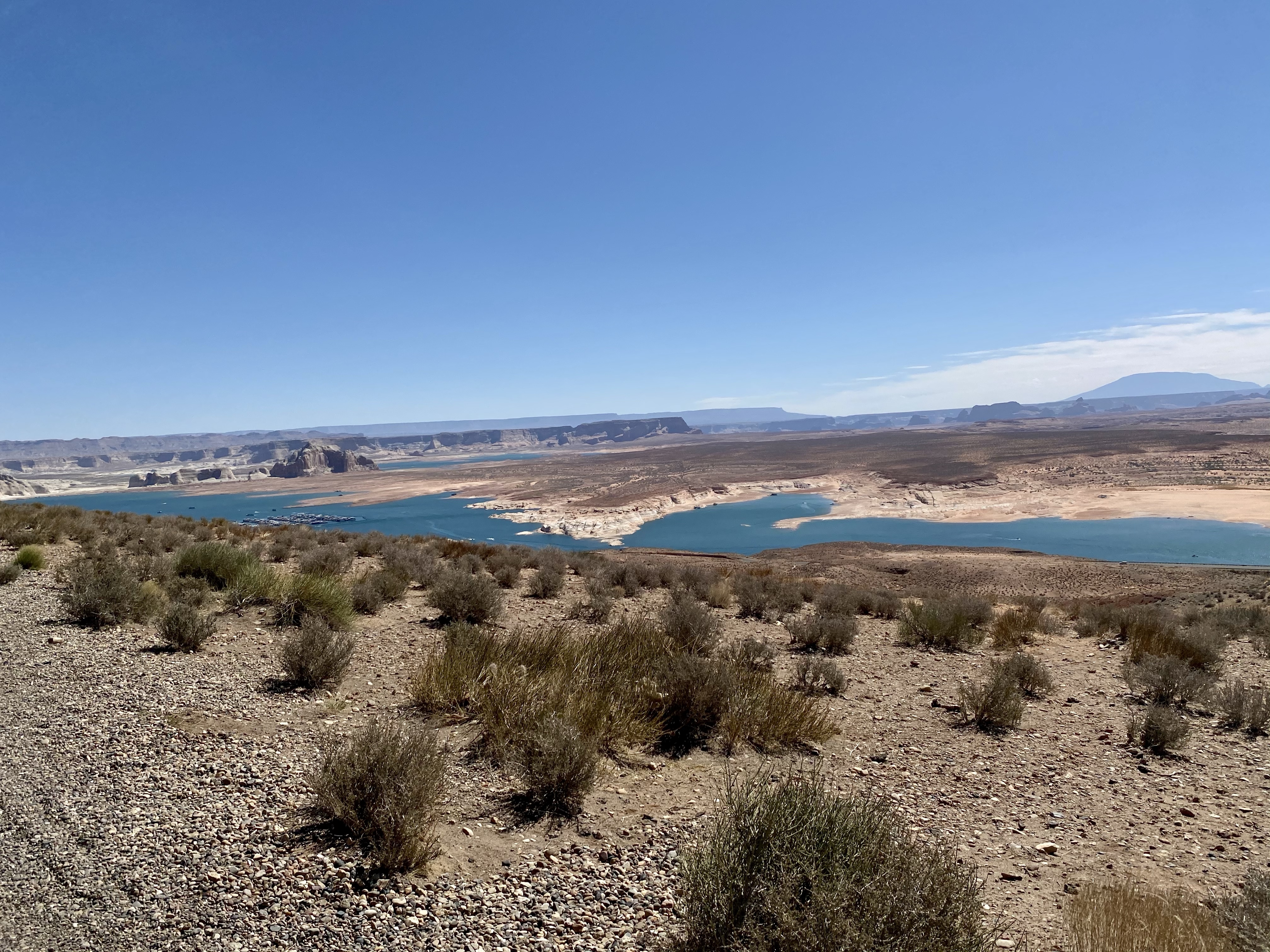
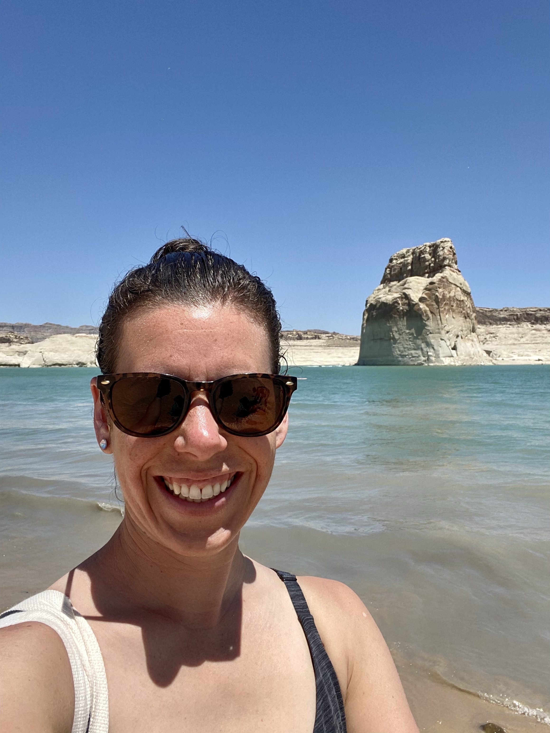
When we are all fully awake, we drove over to Wahweap Bay for some sand and sun. (Technically we crossed into Utah for this, but part of the bay is in Arizona.) We had planned on kayaking for our last day together, but strong winds deterred us. Instead, a day at the shore would do.
With the right vehicle, you can drive right down to the water and camp on the beach. I do not have such a vehicle, but I did make it down to the first landing. It was a little touch and go when I came upon some loose sand, and I got a little stressed when Crystal kept driving around looking for the right spot, but we finally parked with a view and walked the couple hundred feet down to the water.
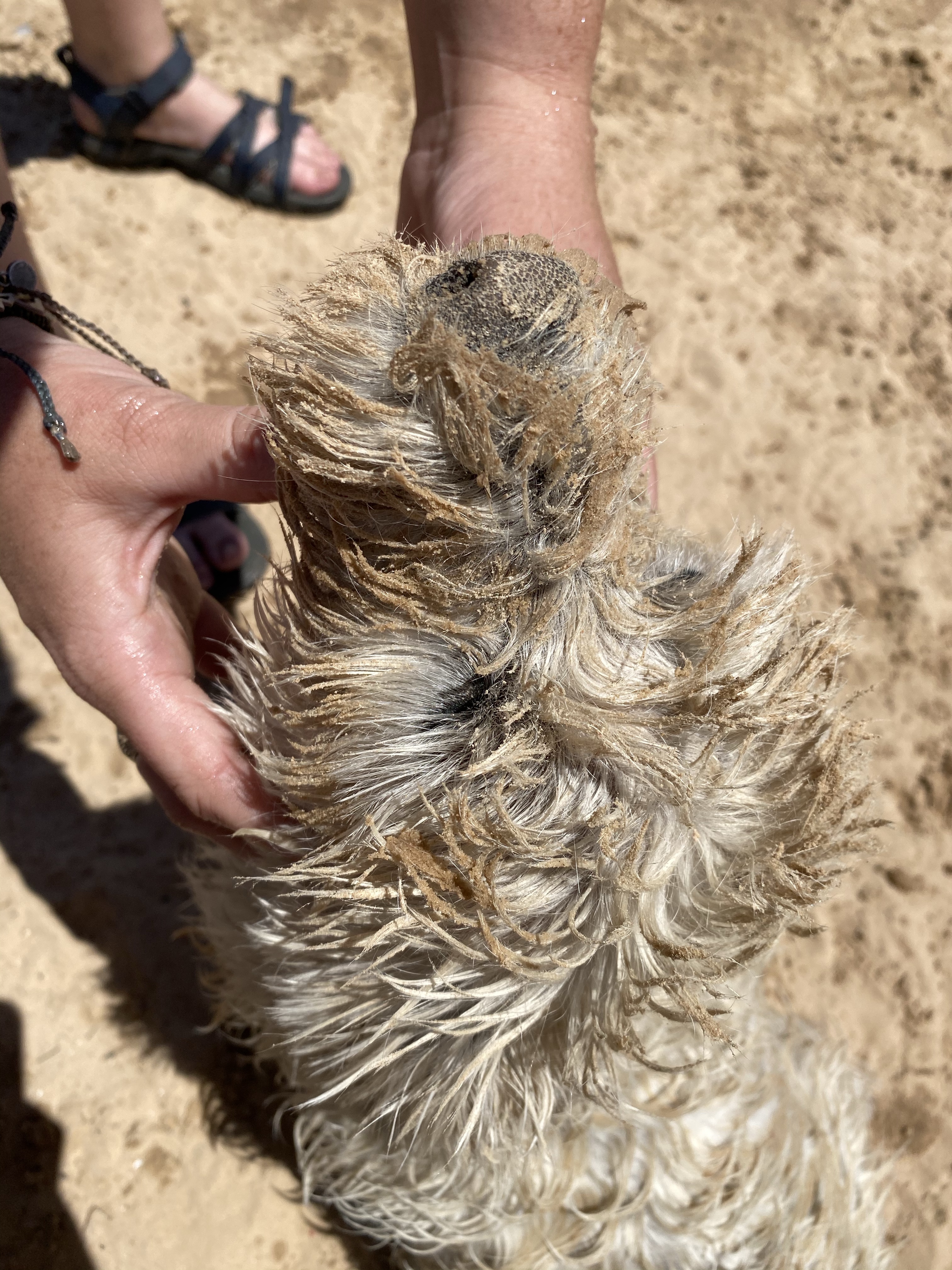
The bay was crystal clear and comfortable, great for a good dip and twirl. Max came in too, much to his disappointment. He’s a good swimmer, but did not appreciate being brought out deep by Crystal. He got his revenge though. Each time he swam back to shore he rolled around in the sand and had a muddy, muddy face. Glad he wasn’t riding with me!
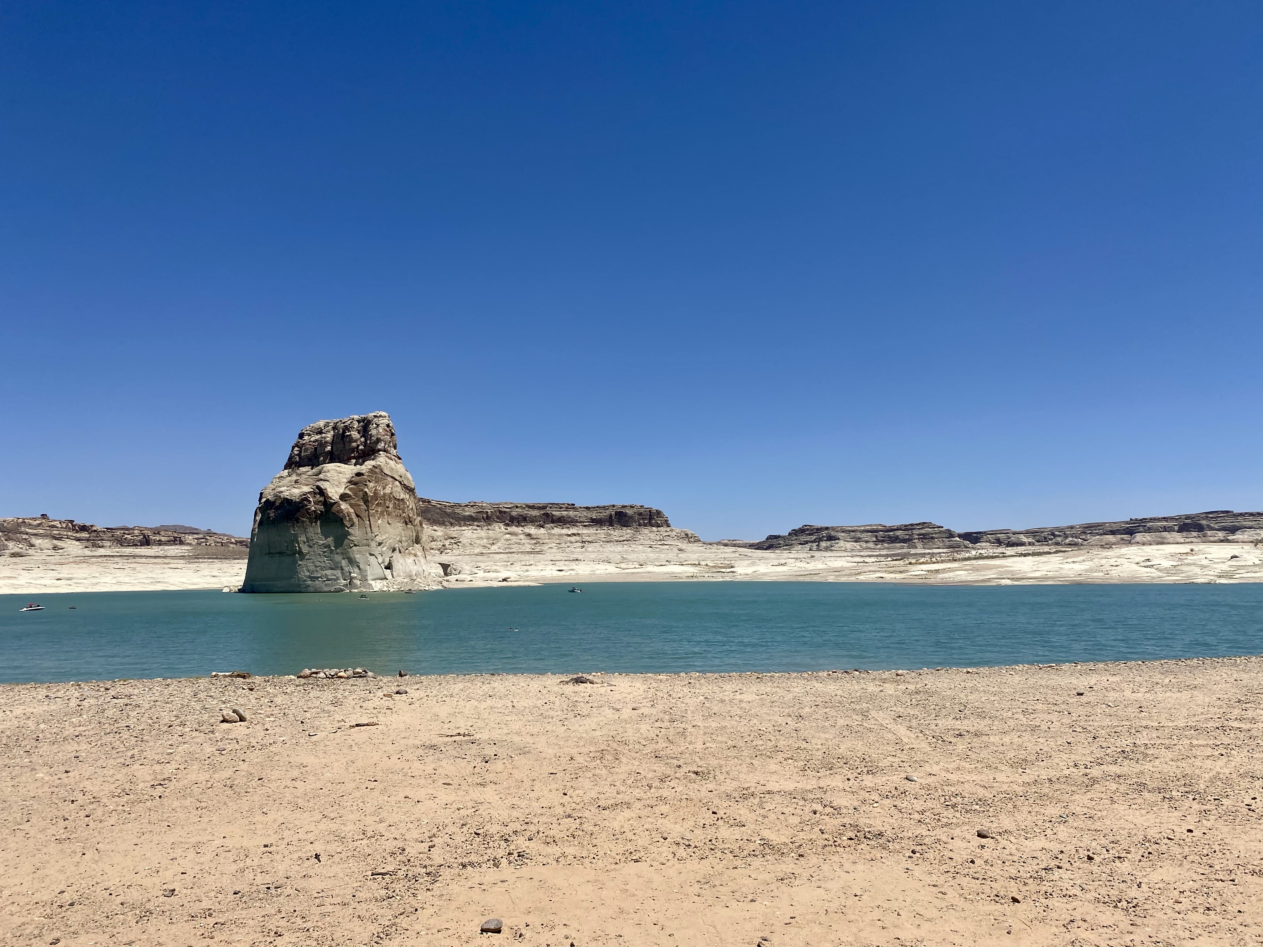
Then I saw girls jumping off the cliff and knew I had to partake! It wasn’t a high cliff, but looked so fun. Once I confirmed the water was deep enough for the plunge, I climbed up and gingerly stepped toward the edge. Then splash! Into the water I went. Awesome.
I convinced Crystal to go too and she conquered her fear. We can do hard things! Although still scared afterwards, she was glad she jumped.
Shortly after we cleaned up and said our goodbyes, full of hugs and promises to visit each other again soon. It was certainly nice to have company for a while! And just like that, I was off to my next park. Any guesses?
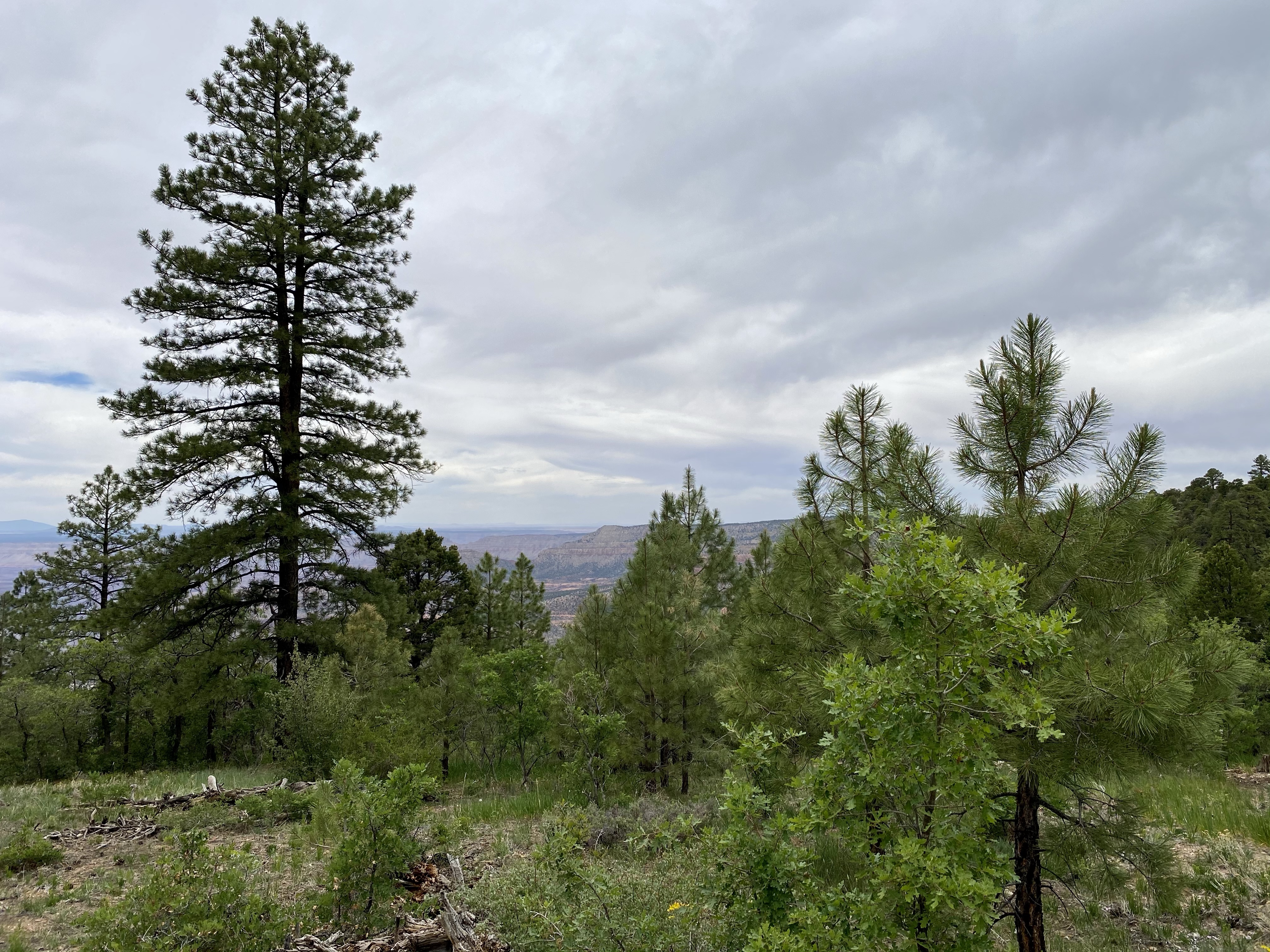
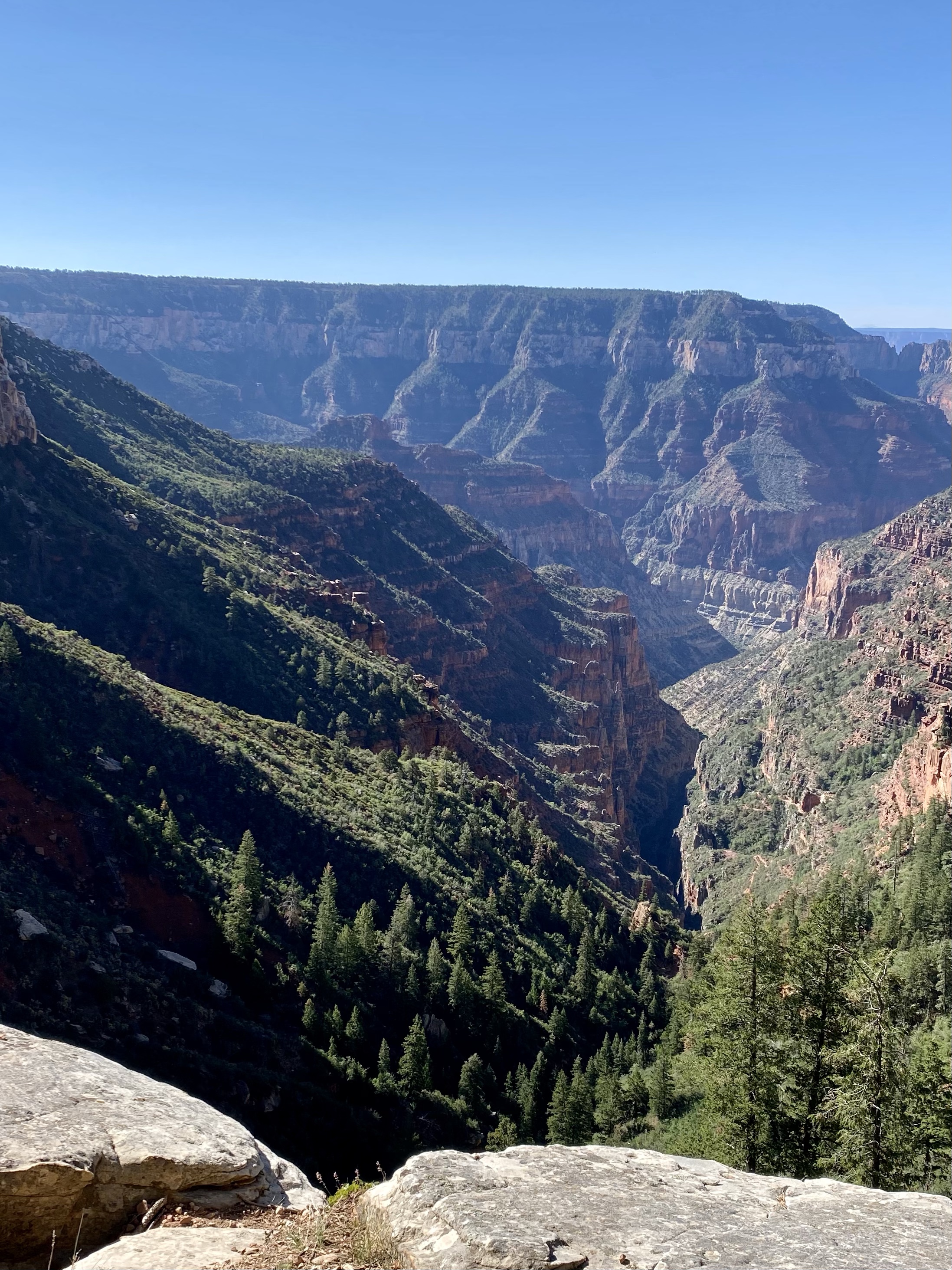
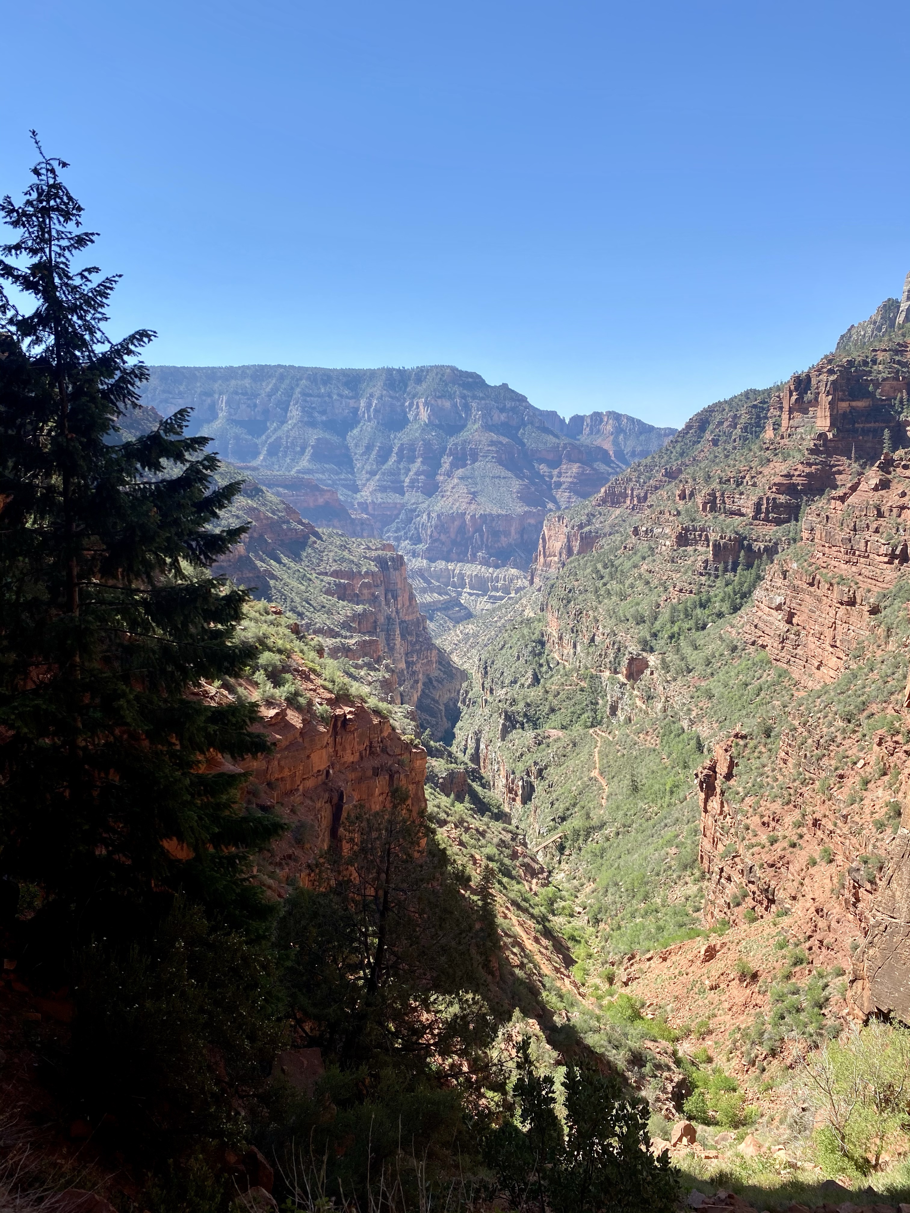
Our first full day at the park, we headed out to hike Rainbow Rim. Outside the national park land, but still part of the Grand Canyon, we had been told it was magnificent. So, despite a late start due to some morning mishaps, we drove the hour down dirt roads to the trailhead.
The North Rim of the Grand Canyon is surrounded by National Forest, full or trees, dirt roads, and dispersed camping. While the roads are well maintained, they are still dusty and bumpy, so I was glad Crystal offered to drive. Sunny would not have made it! We moseyed along, slowly but surely, following the few scenic point signs and mostly navigating by where we popped up on Google maps. No cell service. It was an adventure!
There were many options to get to the rim, many roads forking out and ending at the canyon. We chose to head to Timp, a random choice, hoping it would be good! The minute ticked by, the bumps continued, and our blue dot on Google maps inched closer to the end of the road. One mile at a time!
Eventually we made it, and guess what? We happened to be at the start of the Rainbow Rim Trail. Score! It was thickly treed at the parking lot, so while I waited for Crystal to be ready I walked out to the first viewpoint. Stripes of red, yellow, green, stretched across the cliff side out into the canyon. Rainbow Rim is a fitting name.
Once Max was fed and Crystal packed, we finally headed out. Lucky for us, the trail was mostly through the forest, the tree canopy protecting us from the sun and rising heat. The trail was easy, a winding dirt path with little elevation gain or loss, lots of flowers to admire. Max was having a tough time with the rocks and heat, so the going was slow for a while. Putting his booties on helped, but it was still slower than my usual pacing. I was learning to adjust.
Was the trail was full of nature, but without much view of the canyon. I was disappointed, but tried to shake off my negative vibes. I guess I hadn’t asked the ranger enough questions about the hike. I had anticipated walking along the rim the whole time. Oh well, you live and learn!
We were rewarded for our efforts though when we reached North Timp Point, three miles down the trail. The forest opened onto a rock outcropping and a spectacular view of the canyon lay before us. There the cloud coverage made the reds and greens and yellows pop, tall towers and cliffs in abundance. Swallows zoomed around us, dipping into the canyon and rising back up over the forest. We were alone on the rim for a while, eating a quiet lunch and soaking up the views.
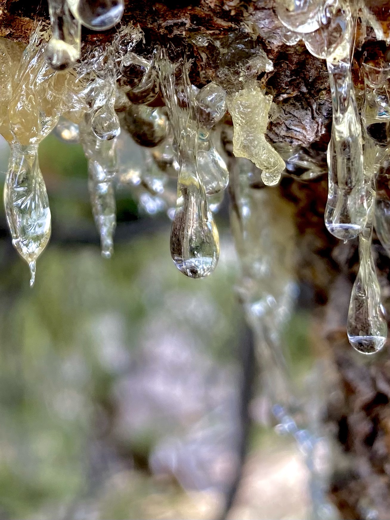
On the way back I was in a much better mood and able to stop and appreciate the tiny details of nature. Delicate flowers, the sap glistening as it dripped from the branches of trees, tall cinnamon red Incense cedars.
While the walk was easy, it was hot, and Max grew weary quickly. His booties were helping him overcome the rocky trail, but also trapping the heat in his body. Did you know dogs cool down through panting and out their feet? I did not until Crystal taught me! So, what to do for poor Max? Two miles still lay ahead. Well, into Crystal’s backpack he went for a rest and ride! It made Crystal’s journey harder, but boy was Max happy!
Eventually back at the car, happier and more tired, we headed out to check out one more view point. Fence Point, a 90 bend from our last stop, offered a new view of the canyon, more towers to admire. Then we were back in the truck for the long bumpy ride back to the campsite. That night we rested and enjoyed the cool temperatures as the sun sank behind the mountains. Max enjoyed a nap in my lap before I departed for bed early. A rough start to the day, but a great end.
The next day, our last day at the park, I headed out early for a solo hike. Having enjoyed the canyon from the rim for the last two days, I opted for something different. Any guesses? Well if you guessed down into the canyon, you were right!
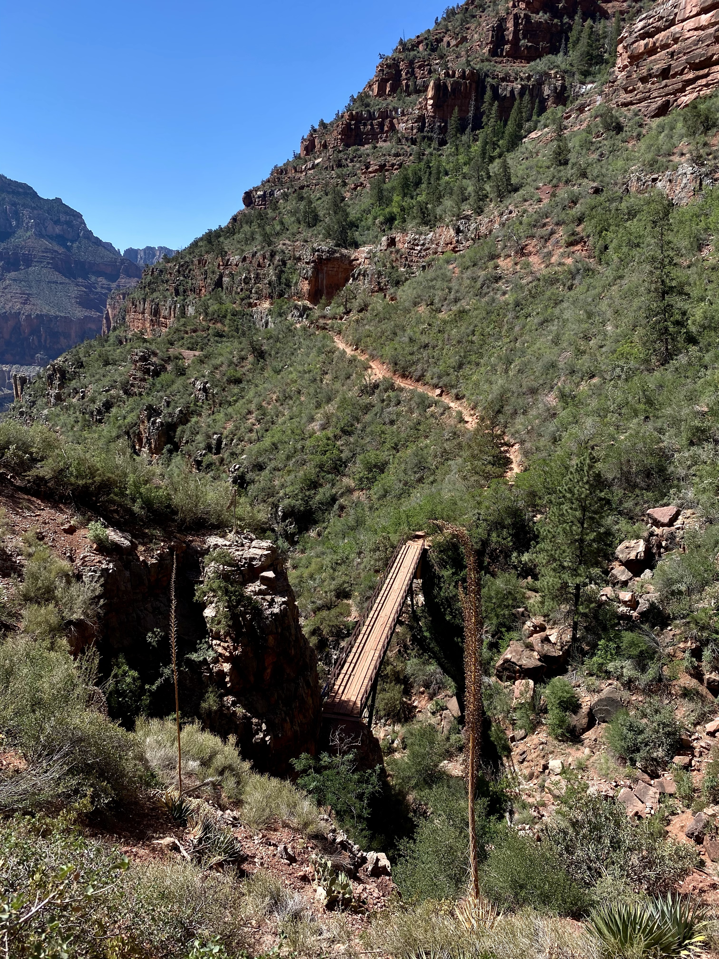
Leaving the North Kaibab Trailhead before 8:00AM, I began the steep descent into the Grand Canyon! While I would have loved to hike all the way to the Colorado River, and someday I will hike Rim to Rim, today was not the day. My goal was Redwall Bridge, 2,200 feet down in 2.6 miles. Off! But I was ready with supplies and had my hiking legs rested.
The trail heads down right from the start, through a sandy but wide path, switch backing into the canyon. I passed a group of visitors on mules, enjoying a ride to … Tunnel. It looked like fun, but I’d much rather hike. Being up so high and going downhill seems scary! On the way up it certainly would be nice though!
Having mules on the first few miles of the trail also means their bathroom breaks are on the trail. Piles of poop and puddles of urine were extra obstacles to overcome, and their smell less than desirable. They also attracted files. So when those spots came up on the hike, I hurried by!
The first stop, just 790 feet down was Coconino Overlook, a spectacular view into the expanse of the Grand Canyon. I lingered for a moment, but didn’t get too comfortable because I knew I had a strenuous hike ahead. The going down would we easier, but the return would be difficult. And hot! So onward I went.
Another mile and a half down, I reached Supai Tunnel, were most the the hikers lingered and the mule riders stopped. This point provided real bathrooms and running water, so I paused to take advantage! Then I passed through the tunnel and was rewarded with stunning view.
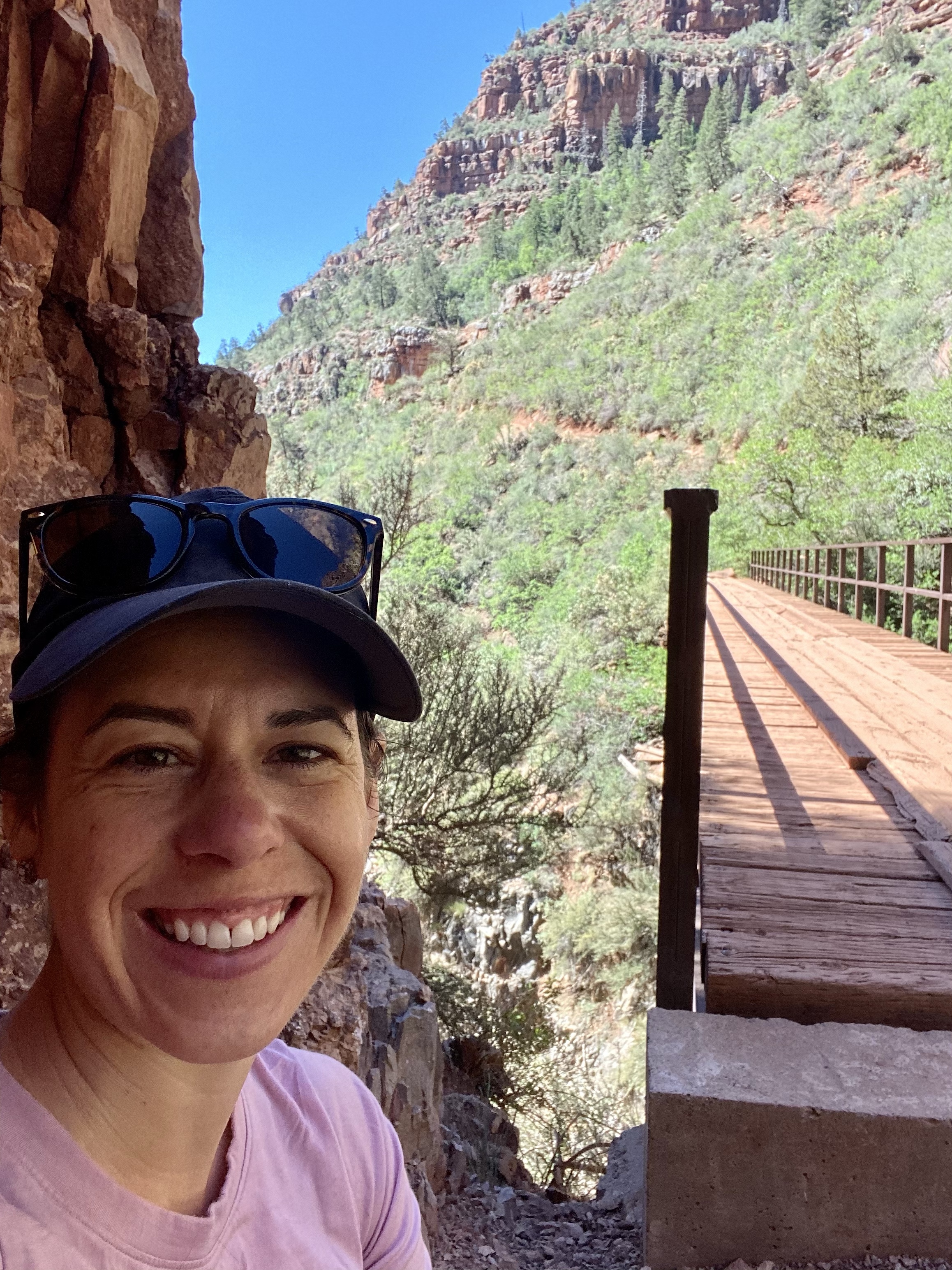
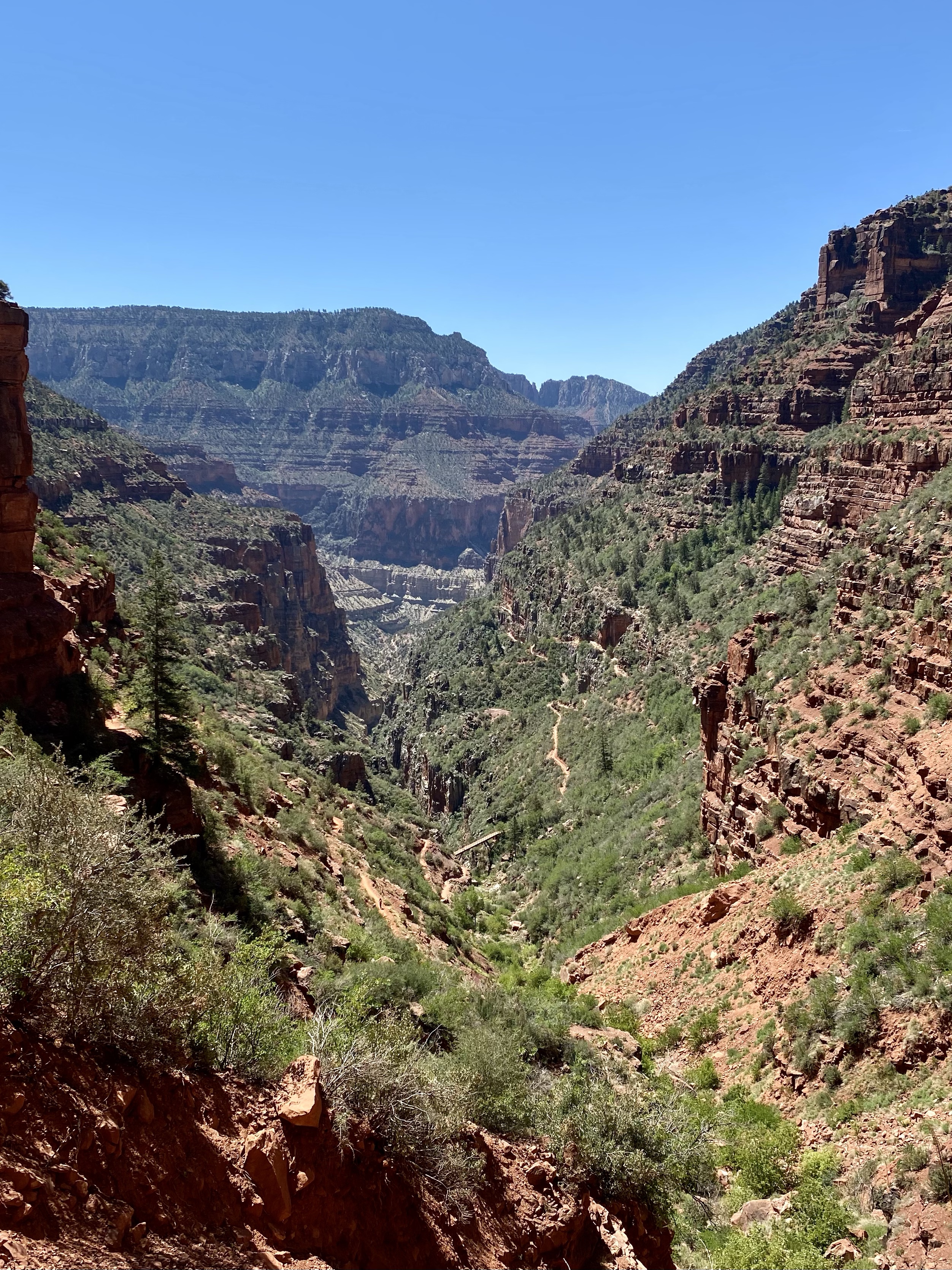
Then off I went, for the last 0.6 miles to the bridge, but another 800 feet in elevation loss. Oof! I was determined though, and have hiked more elevation this trip, so I felt confident in my abilities. From this point forward, the trail was more solid under my feet, making for quicker and easier movement, and free from mules (and their smells haha). The trail zig zagged steeply down, the walls of the canyon growing taller around me. I passed a few hikers on their way up, taking it slow and steady. But when I reached Redwall Bridge I was all alone, able to sit and soak up the view and relish my accomplishment. And rest before the ascent!
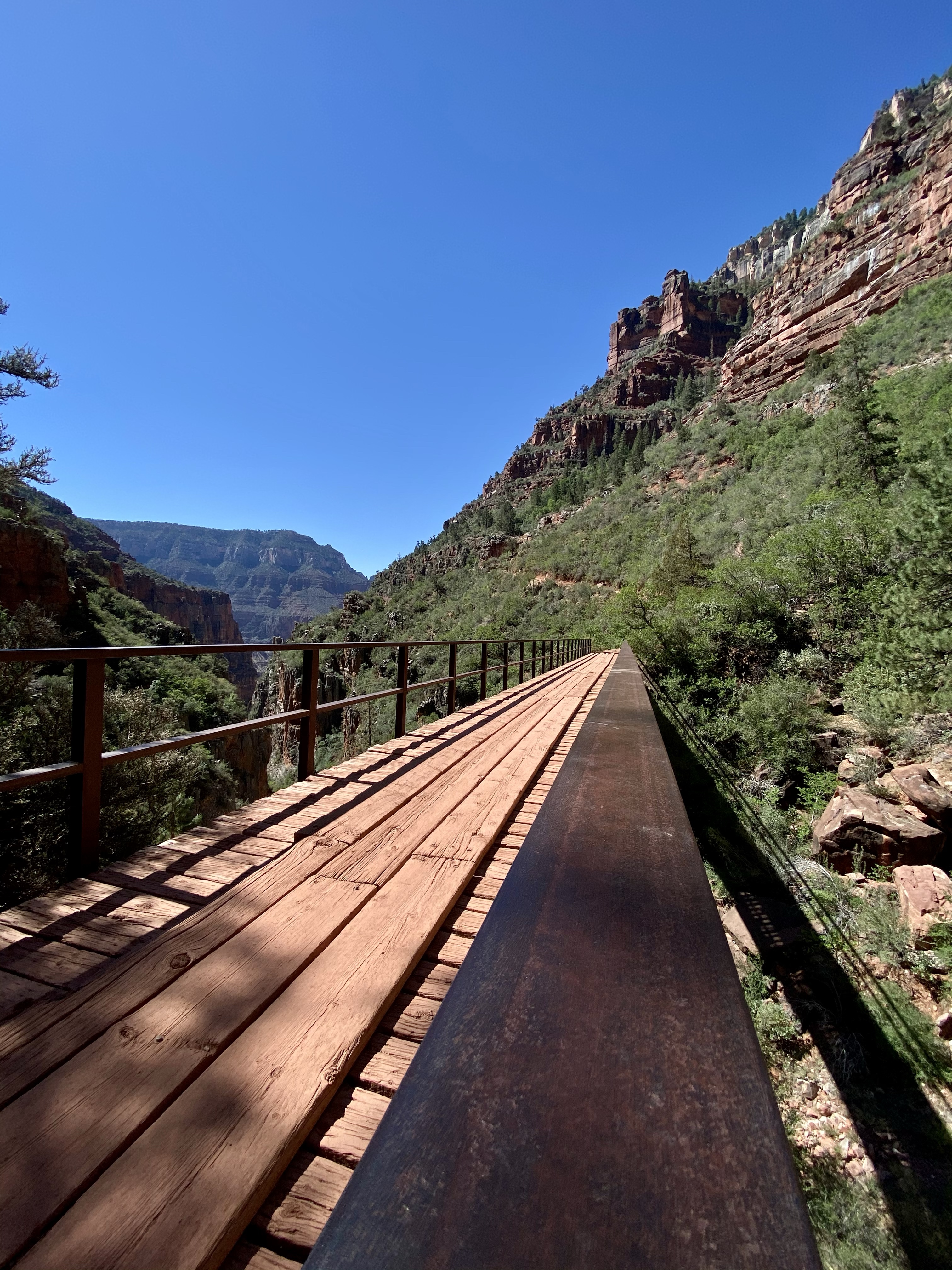
The bridge stretched across the canyon, connecting one cliff wall to the other. It allowed the path the continue down, as there was no more walking room on my side. Walking out on the bridge allowed you to see down the canyon, and look below to the floor. The power of water to carve out this place is amazing.
After enjoying my snacks, snapping pictures for some hikers who had made their way down, I was off, with pole in hand, for the climb. Those 800 feet in 0.6 miles, rough! The elevation gain tested my lungs and heart, although my legs felt fine. I made sure to stop every few switchbacks to rest, and admire the view. Each time there was shade from the cliff, I paused too to linger in its coolness. That’s the benefit of dry heat – so much cooler in the shade because no humidity!
I made it back to Supai Tunnel, refilled my water, and continued on up. Some people passed me, and I passed others, but it wasn’t about the time it speed, but about enjoying the journey. One foot in front of the other, each step taking me closer to the rim. As I looked around, I noticed the sand change color and I progressed. Red turned to coral pink, golden yellow, then tan, butter yellow and back to tan. It matched the walls of the canyon, the earth below having originated from the walls. I’d never had a path change so dramatically before and it was a welcome distraction. Flowers gave me something to attend to as well and before I knew it I was back at Coconino Overlook!
I tried to stop for a rest and lunch, but the wind had other plans. After trying a few spots and getting tired of being whipped by wind, I headed out and up for the final stretch. When I finally reached the car, I let out a big happy sigh. I did it! 5.2 miles, 2,200 feet down and 2,200 feet up!
I showered in the van, a nice reward for a big accomplishment, did a few errands in the park, and headed to the campsite to rest. The country store across the way was calling my name and I stopped for an iced mango lemonade and double scoop of ice cream with hot fudge. Yum! A delicious cool treat to end a wonderful day.
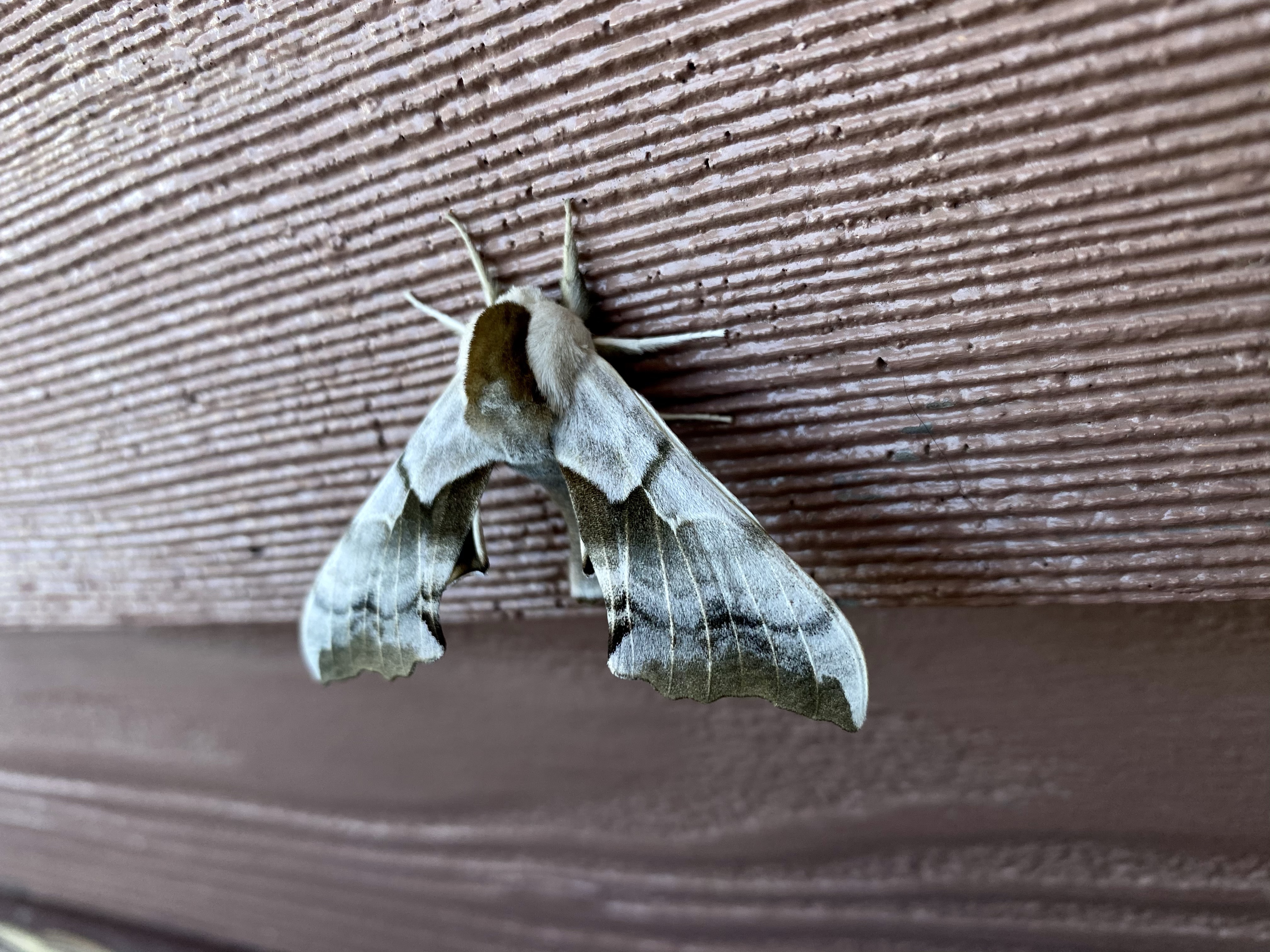
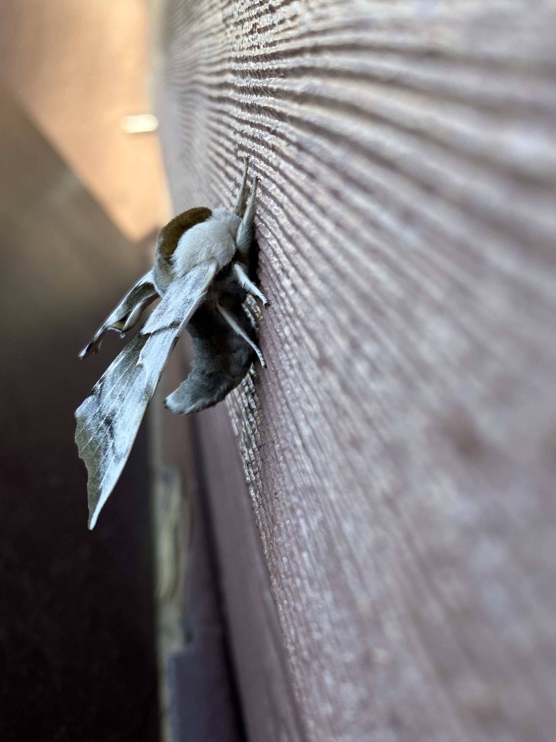
Sitting, writing, enjoying the shade was the rest of my day. A giant moth chilling outside the bathroom was my biggest excited of the afternoon, fuzzy and soft looking. Crystal returned after sunset and shared about her adventures, and then off to bed. I was exhausted! On to the next step tomorrow
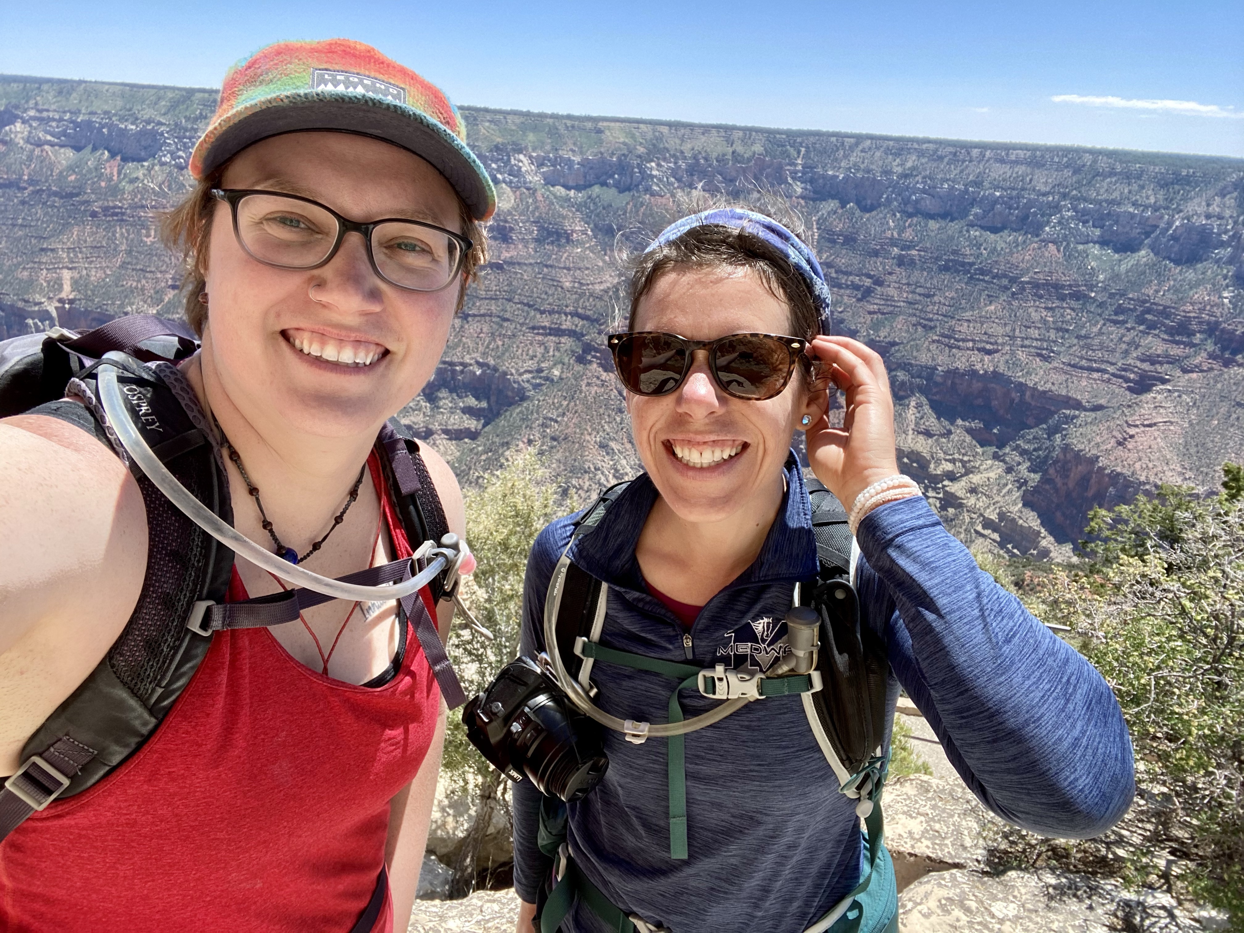
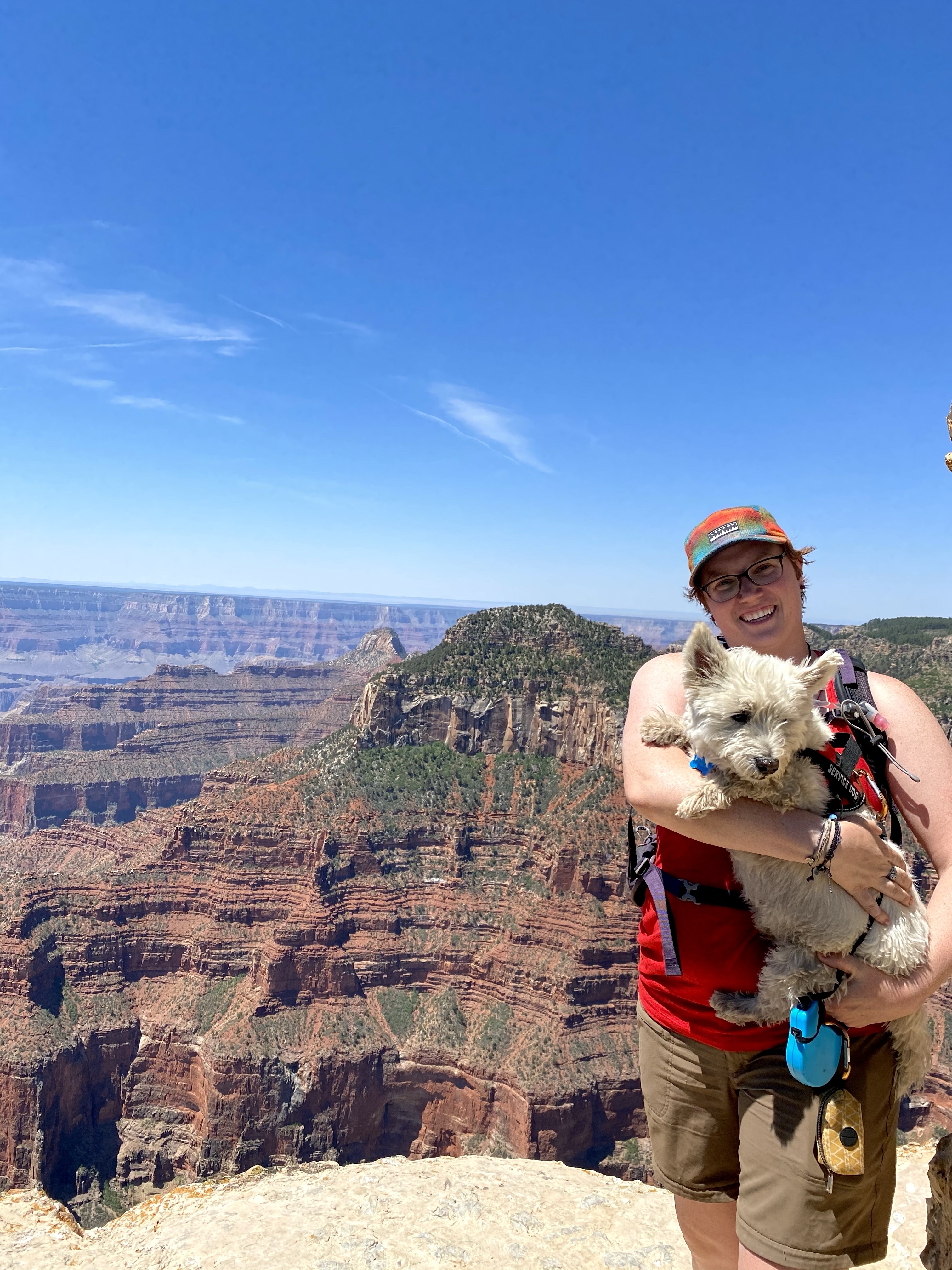
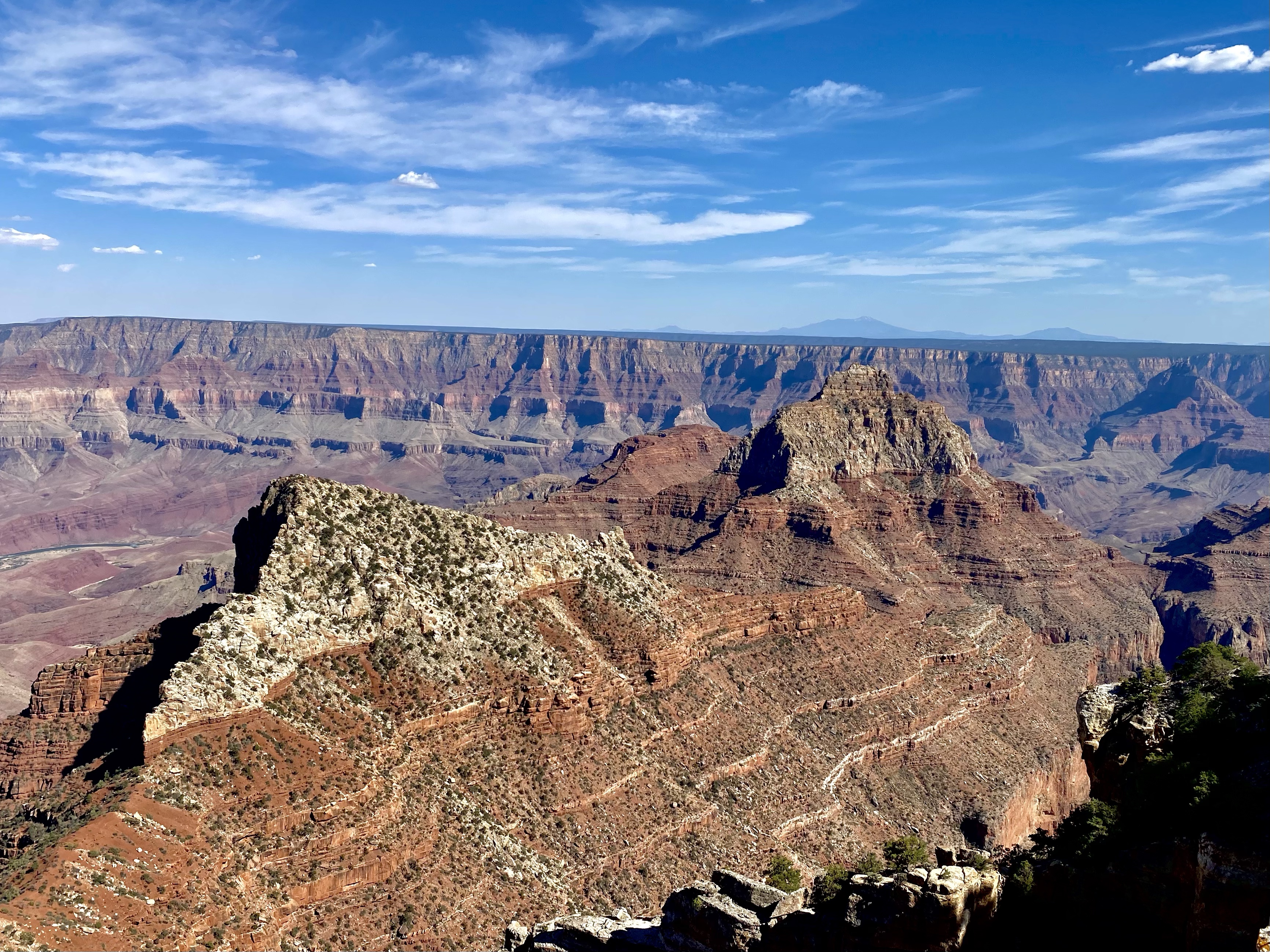
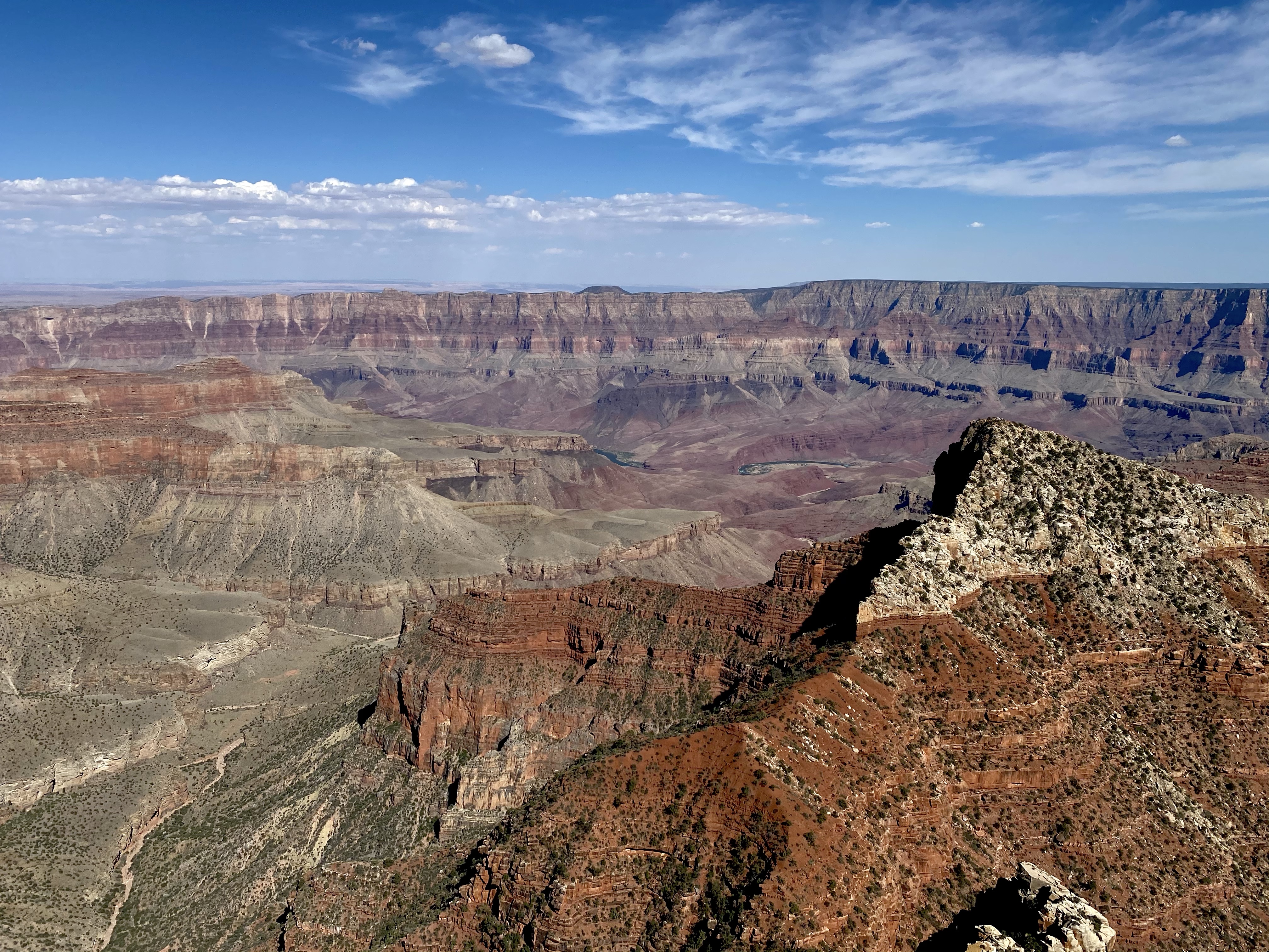
After our excursions in southern Utah, Crystal and I headed to the North Rim of The Grand Canyon! I heard about this place since I was little, seen pictures of it grandeur, and long awaited a visit. Here I finally was, getting to see it for myself. To say I was excited would be an understatement.
I drove in ahead of Crystal, van chores to complete, but promised I wouldn’t sneak any peaks of the main attraction without her. Gosh, was that hard! I did avert my eyes though as glimpses of the canyon came through the trees. And waited patiently at the visitors center for her arrival.
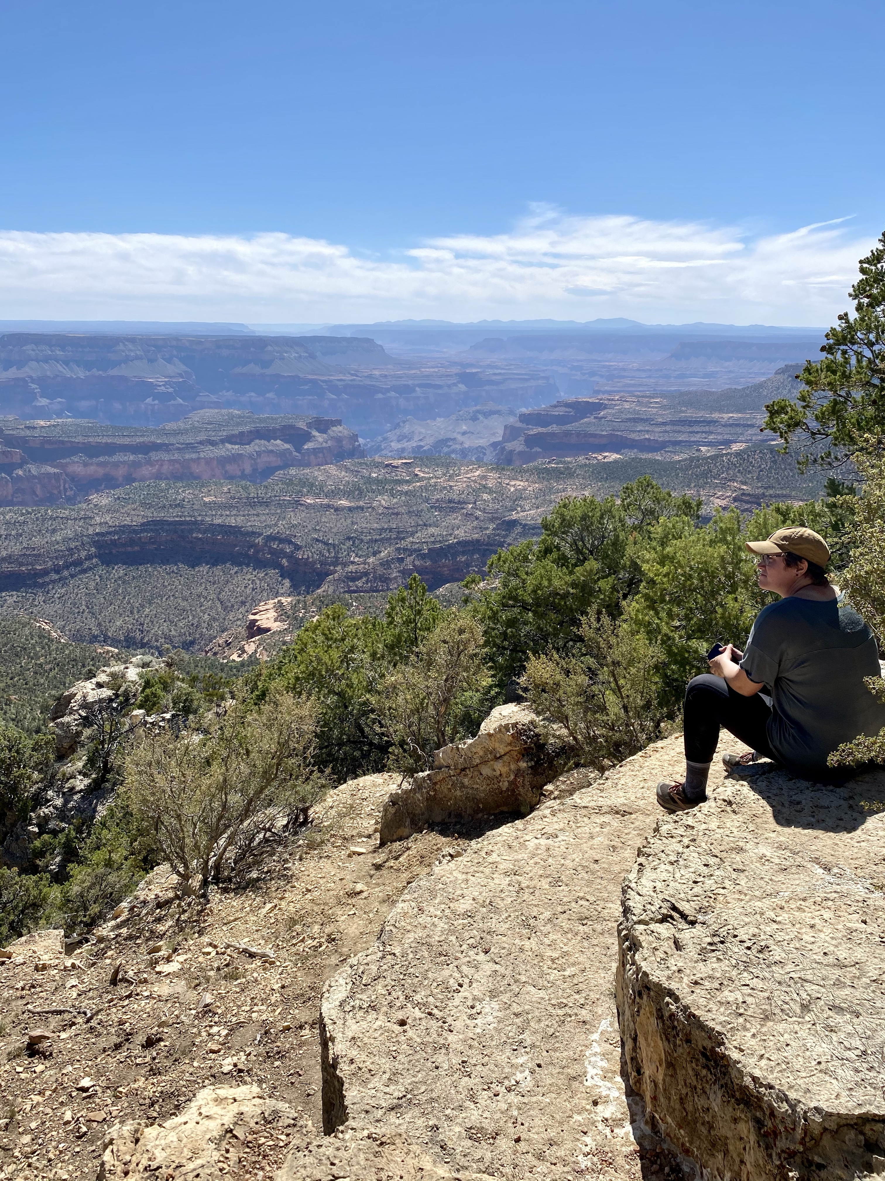
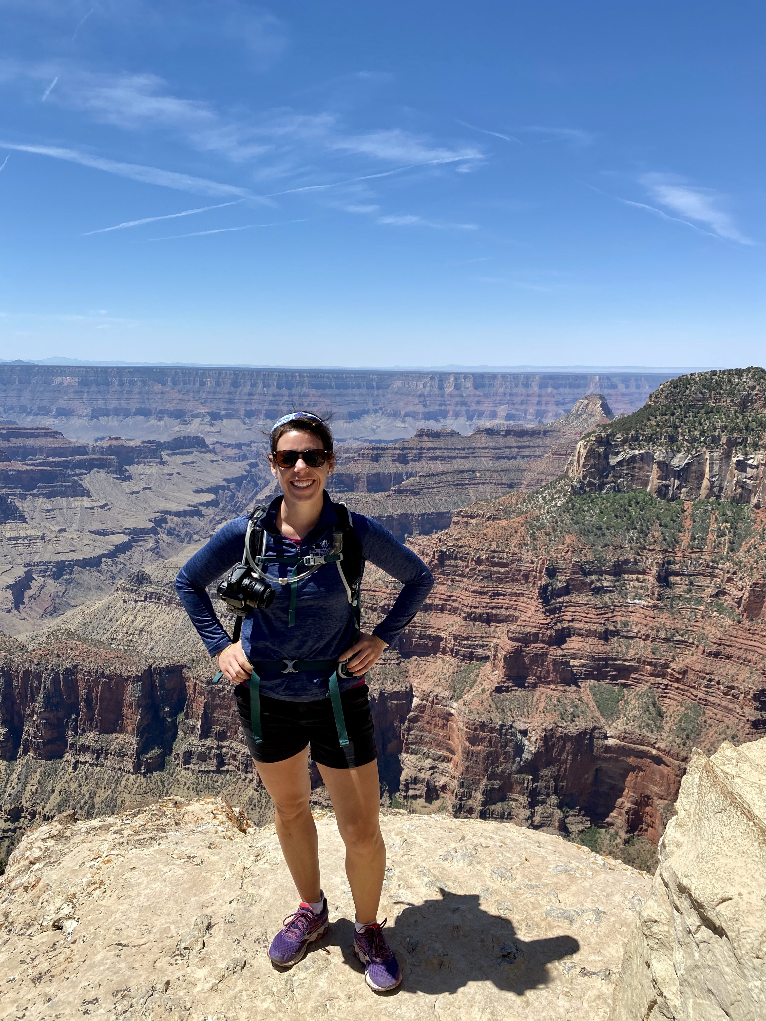
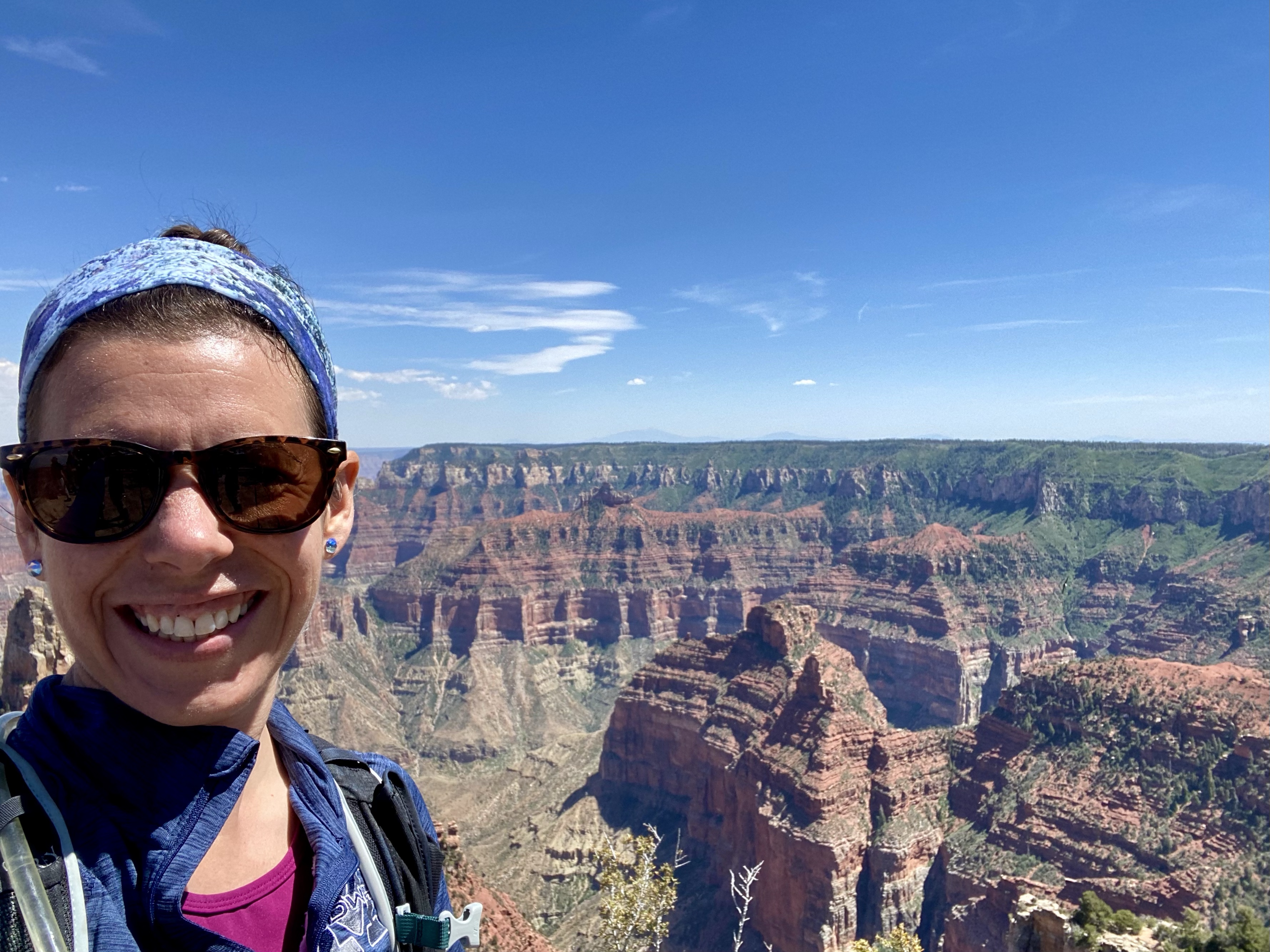
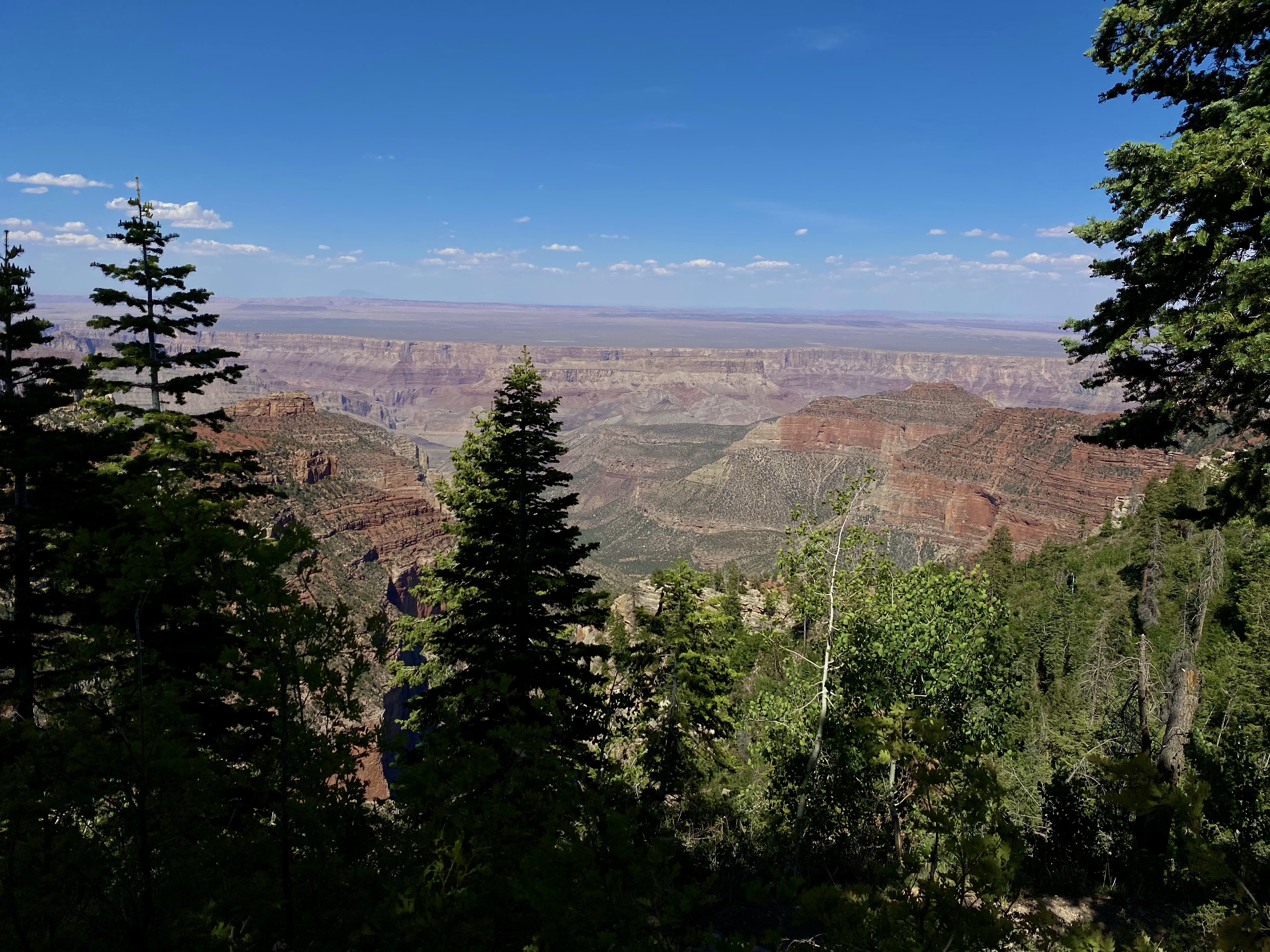
And then we were off! I hurried us down Bright Angel Point Trail to catch our first view. The paved path skirted rock outcroppings and descended down to the trail end. There the magnificent Grand Canyon stretched before us, larger than life. The smile on my face gave away my pleasure.
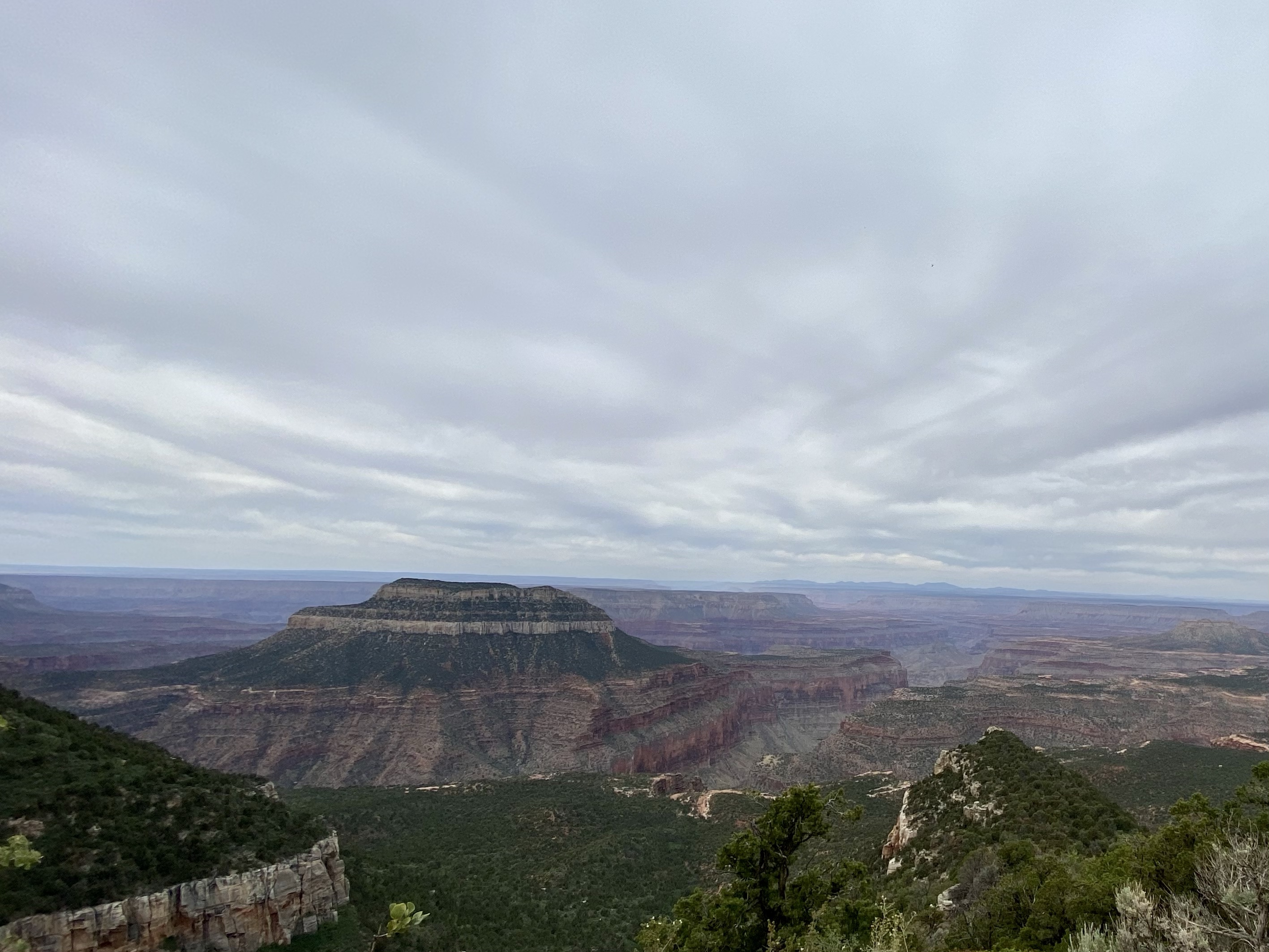
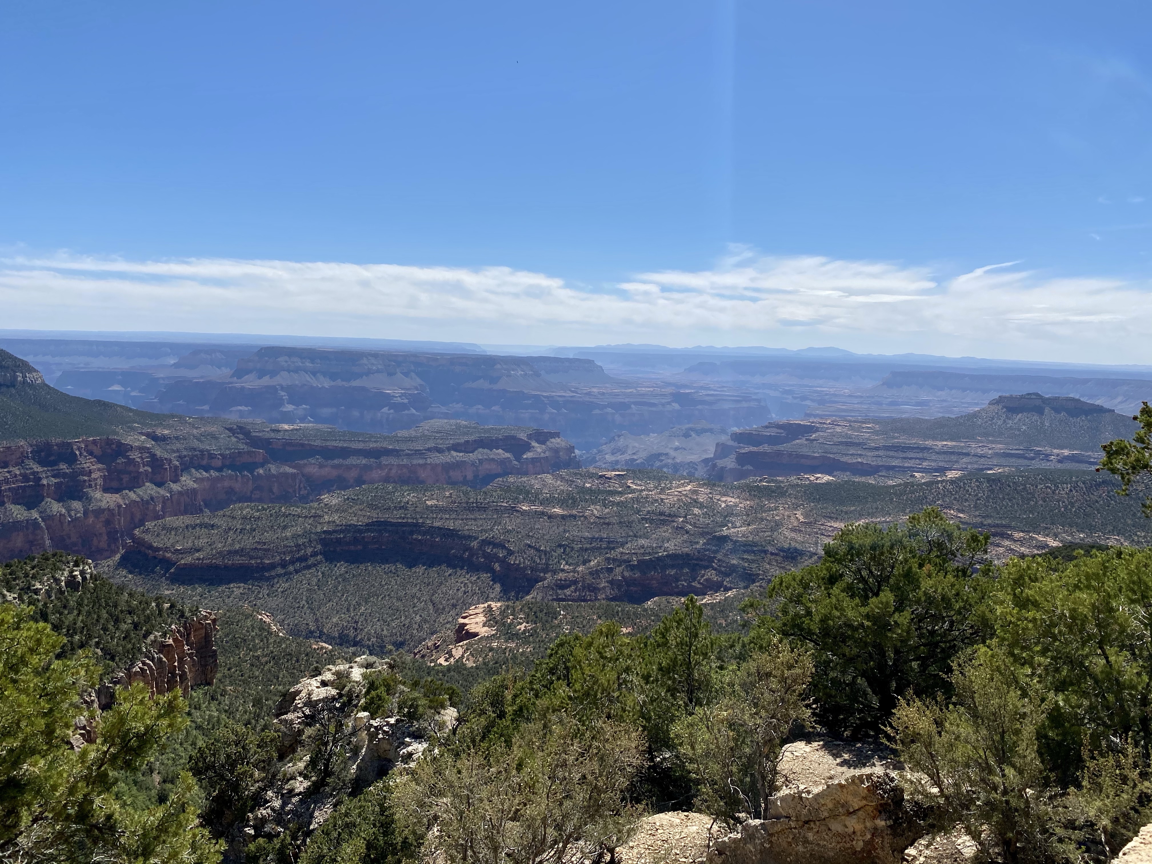
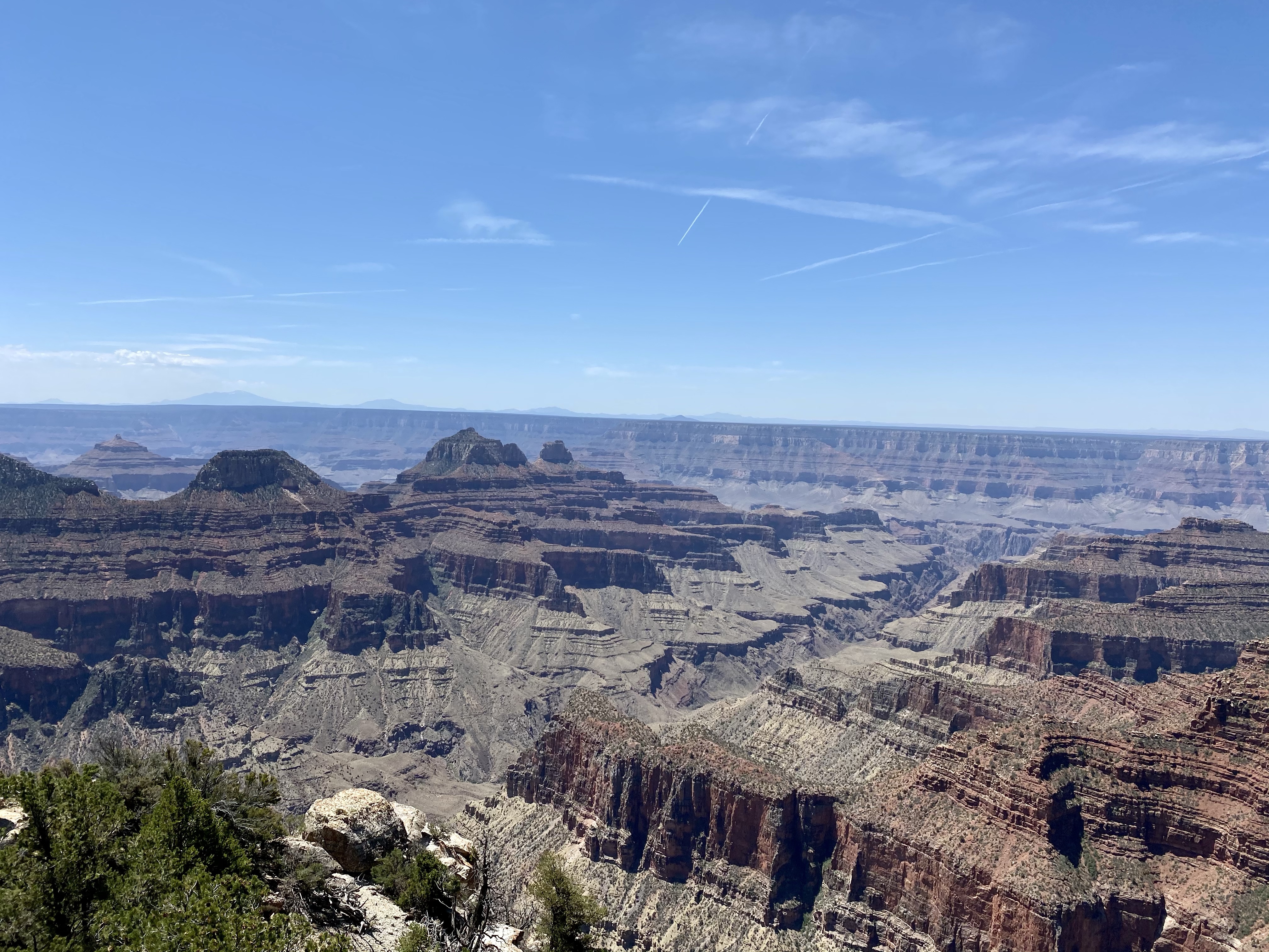
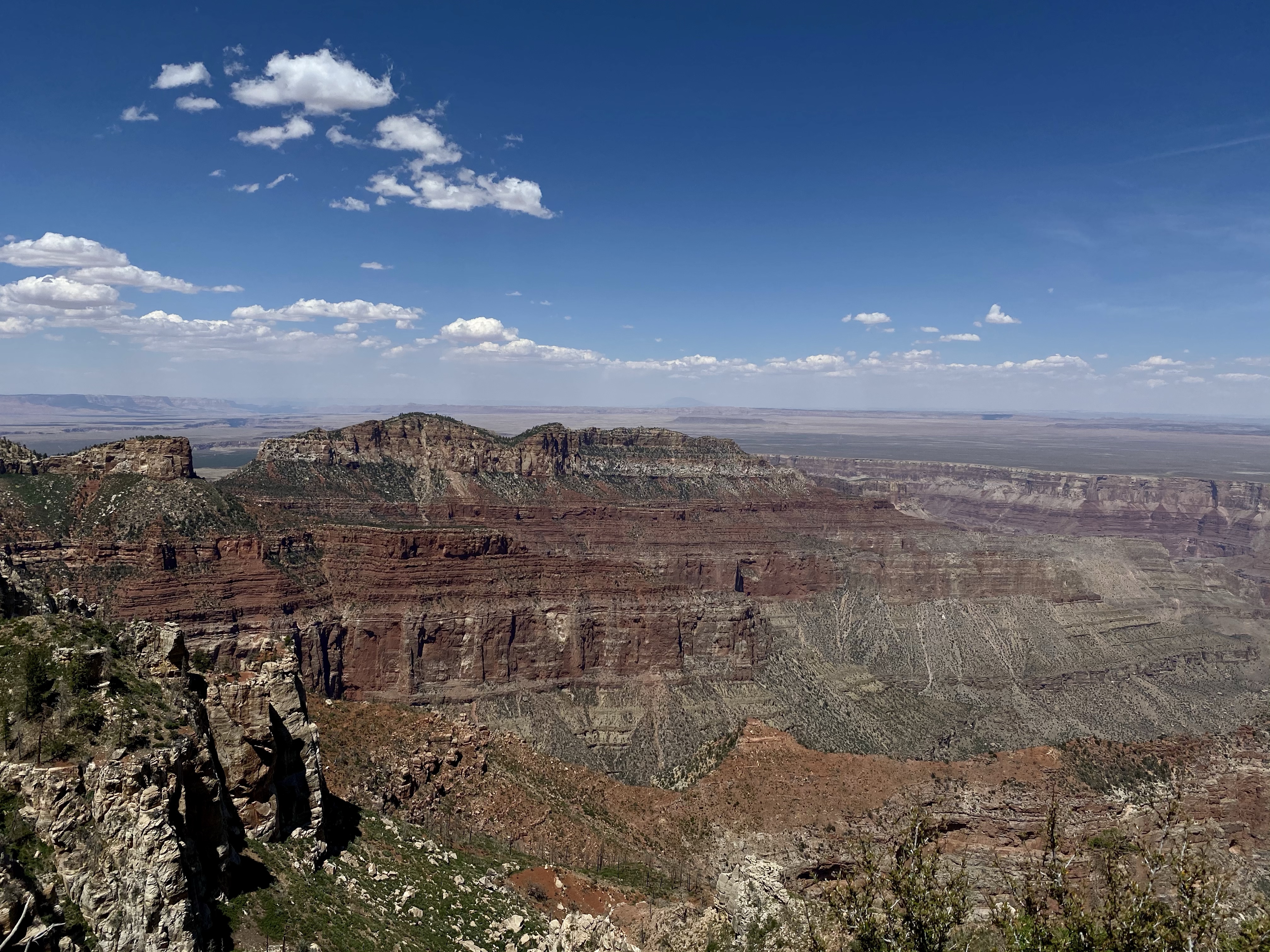
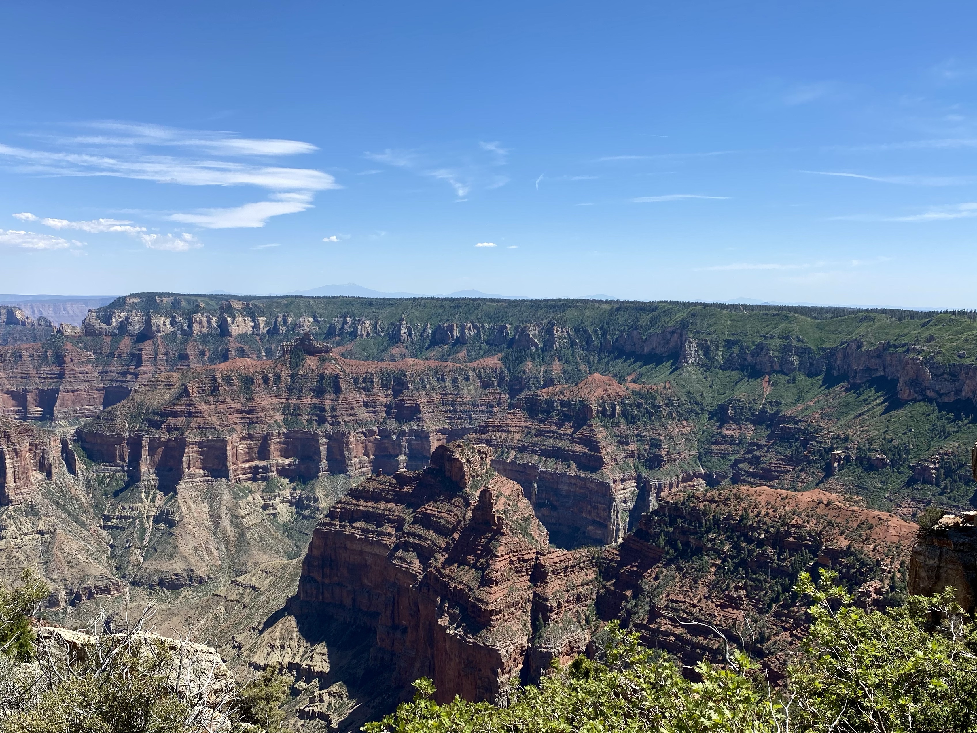
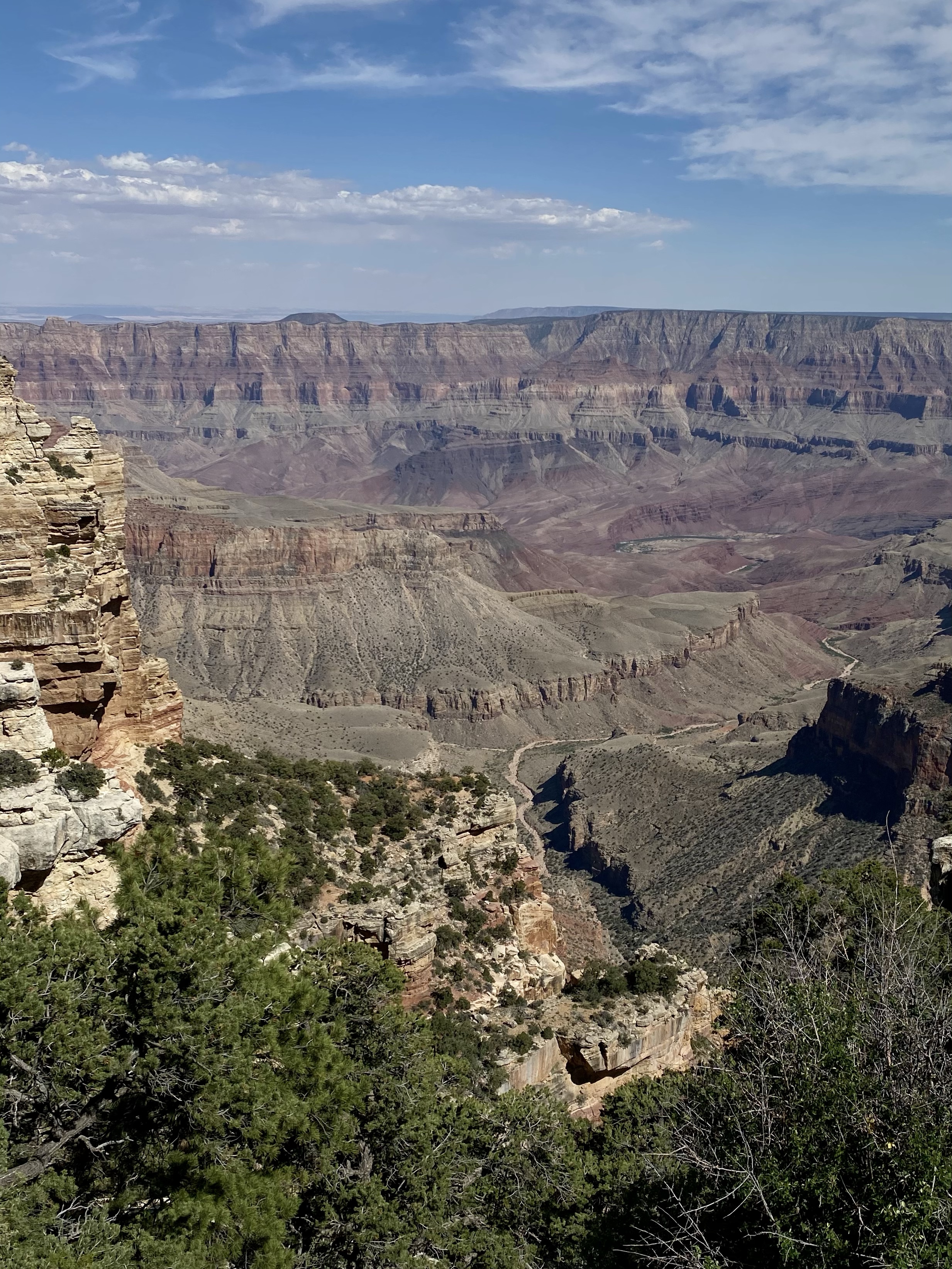
It was different than expected though. Almost all the photographs and pictures I’ve ever seen have been from the South Rim, the more accessible and popular side. I had the image of an arid, desert like cliff dropping straight down to the Colorado River below. The North Rim is seven miles removed (as the crow flies) from the Colorado River, the South only 2. That meant we couldn’t see the water, it was obstructed by the mountains and cliffs and islands dispersed throughout the canyon. And it is lush, green and tree covered over the rocky red cliffs. Spectacular, beautiful, and very different than anticipated. And I loved it.
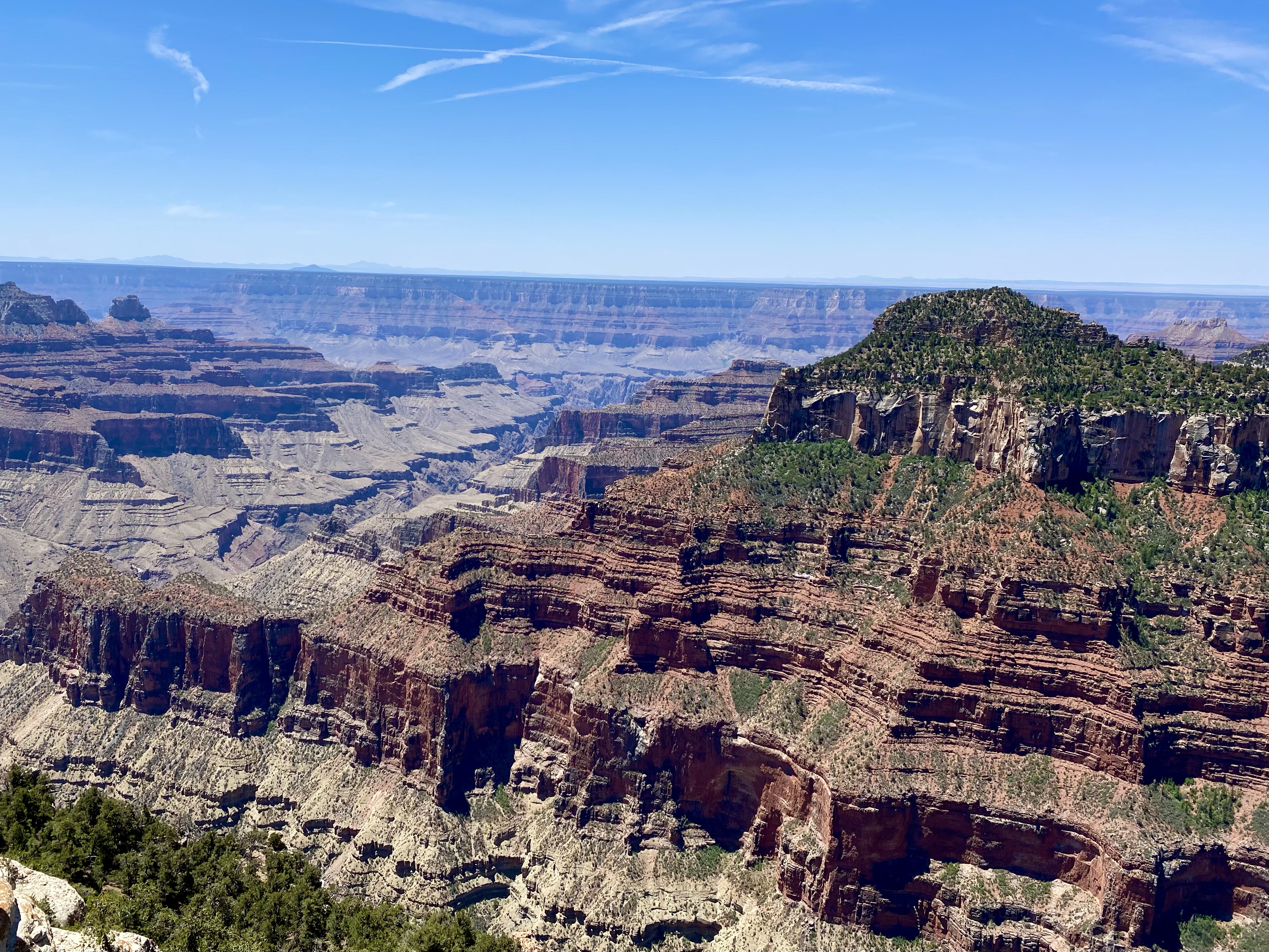
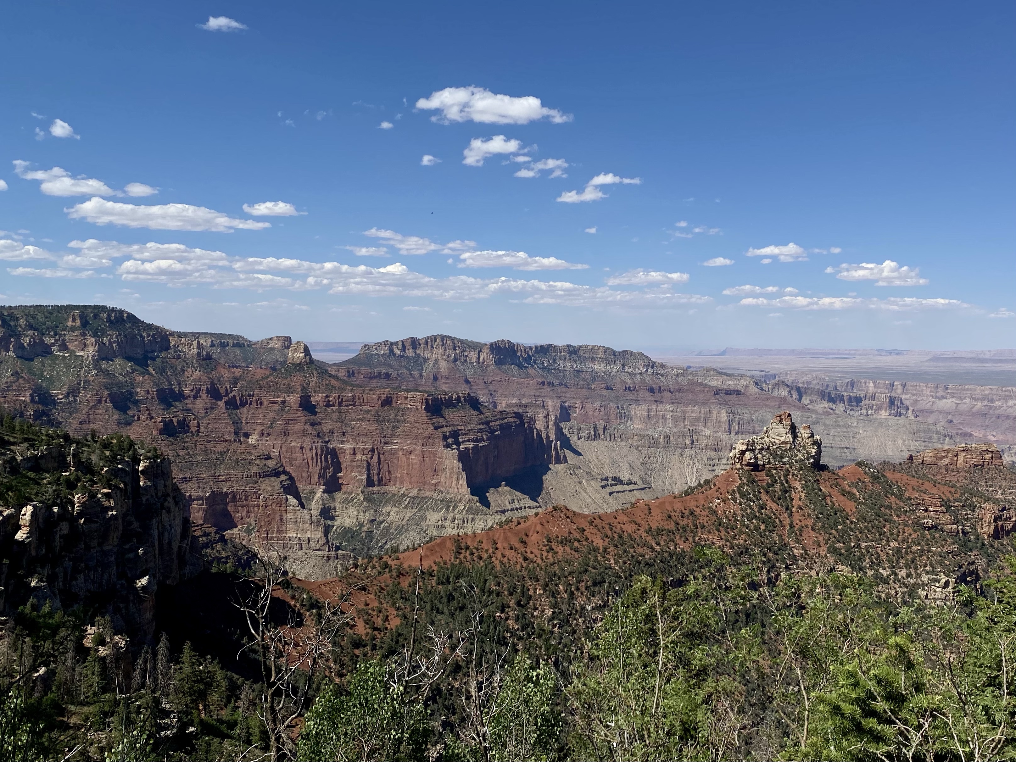
The layers of rock stood like large stairs along the canyon edge, steeply descending to the floor below. From the rim to the river is nearly 6,000 feet from this edge and a 14 mile trail, if you choose. We did not choose that, but instead to loop around the rim, catching different angles of the canyon, back to the car. What a wonderful start!
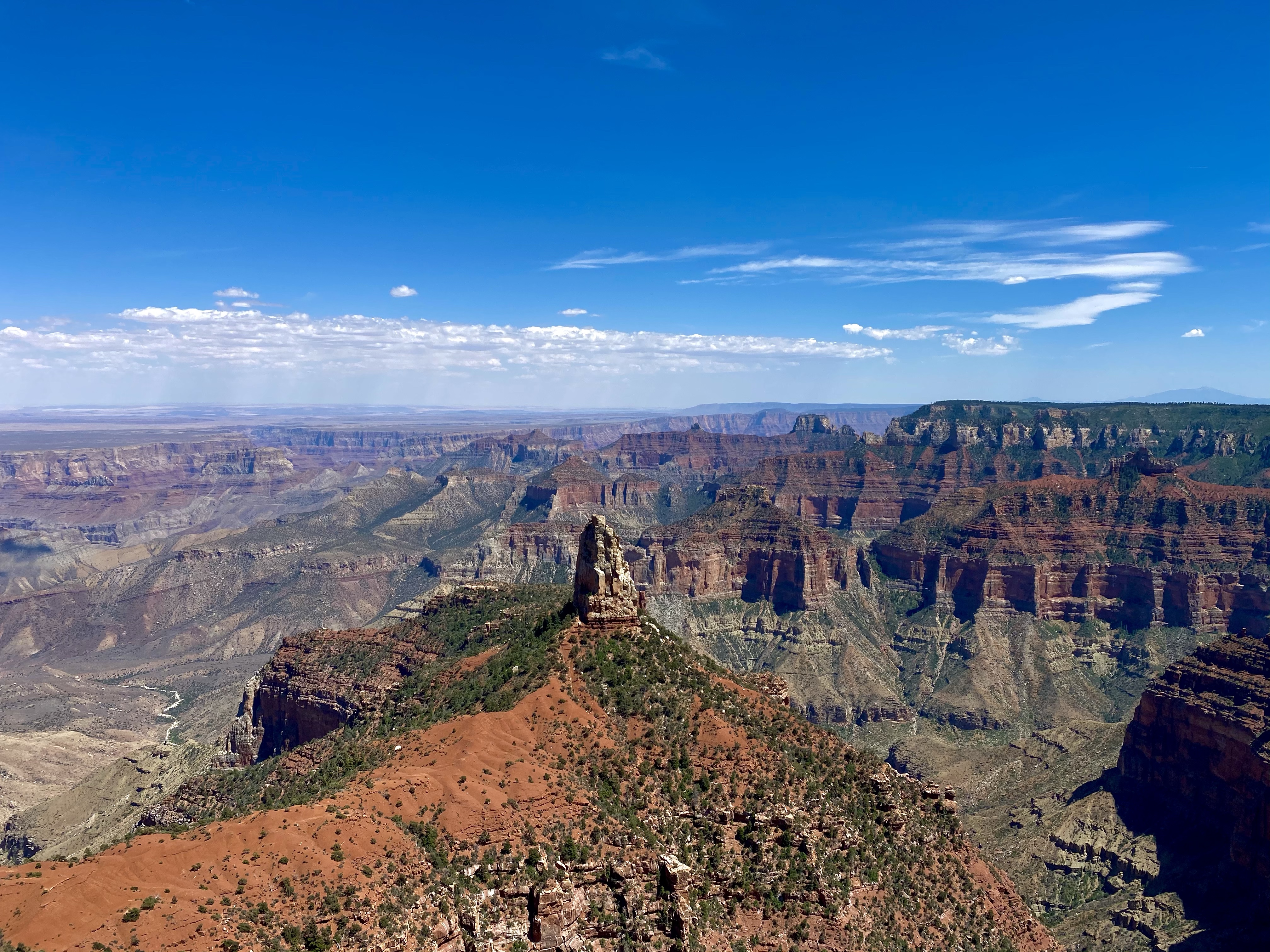
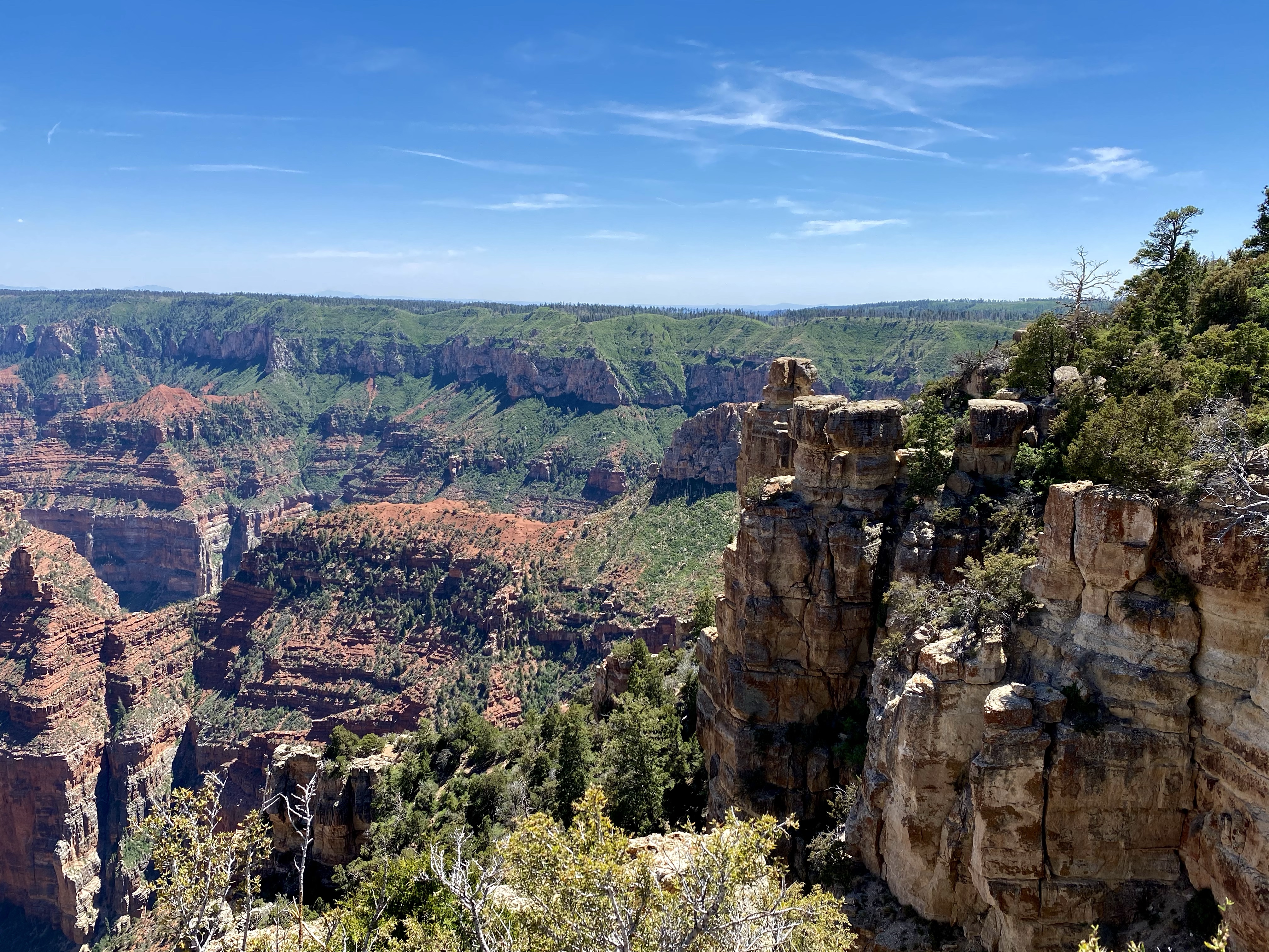
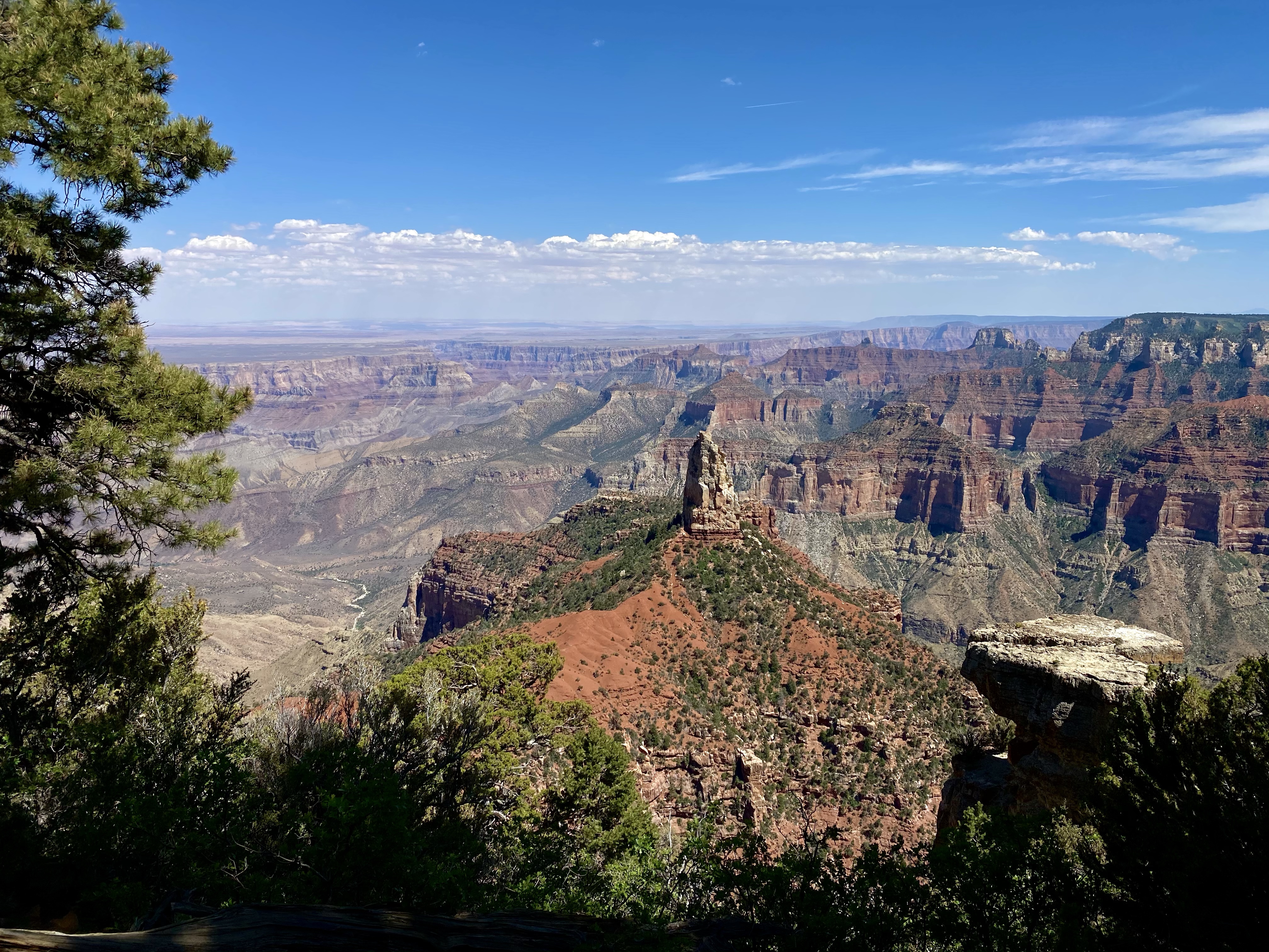
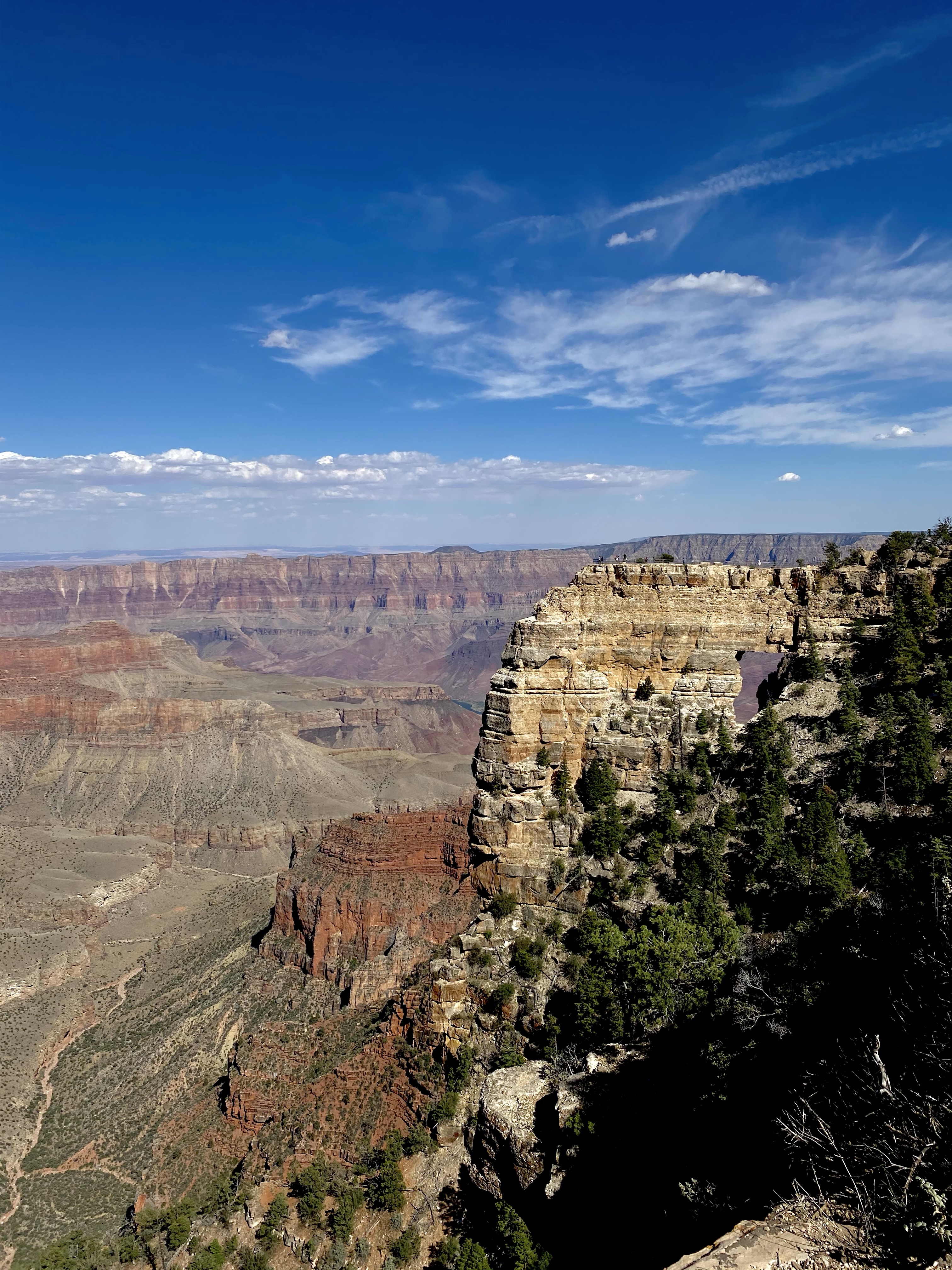
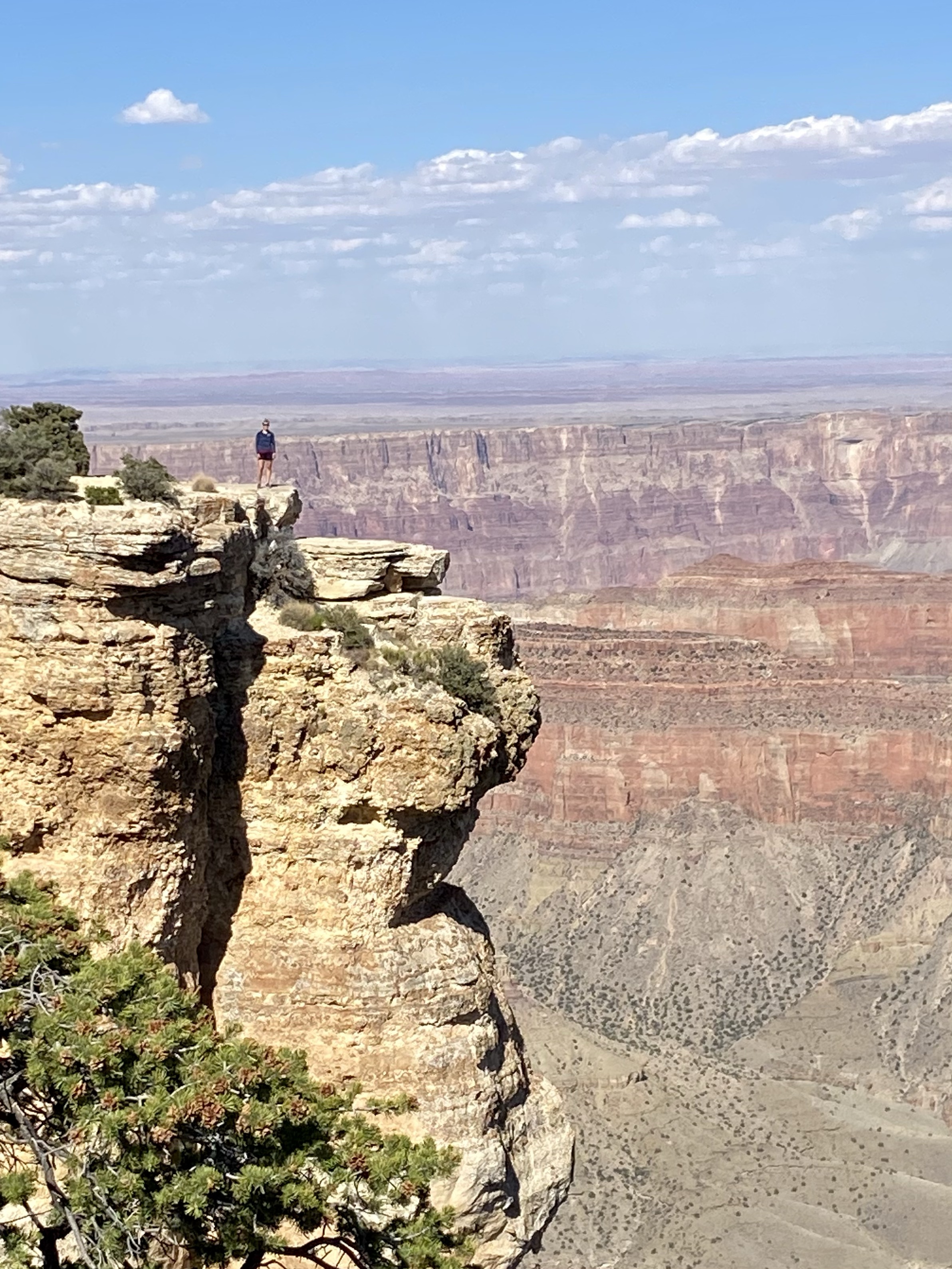
We spent the rest of the day driving the scenic road, stopping to enjoy different viewpoint. Point Imperial gave us the highest viewpoint, a look above the Supergroup rocks, the middle layers of the Grand Canyon, and the ability to walk right to the rim’s edge. Erosion has created various towers and other landforms throughout the canyon, a surprise at every turn. And the amount of forest green trees dotting the horizon and hanging on to the cliff stairs continued to surprise me. A beautiful contrast to the dry rusty rock.
About 900 years ago, this area was home to the Kayenta Anasazi, possible ancestors to the current Hopi people. These prehistoric people farmed beans, corn, and squash on the rim in the summer and took refuge near Unkar Creek in the winter. They also hunted and gathered goods for food, medicine, and clothing. They left the area around 1150, possibly due to declined rainfall. Evidence of their life has been found all around the plateau.
It must have been difficult to thrive here. The indigenous people are inventive, resilient, smart. They learned to adapt to the earth.
As Crystal and I continued our tour, we caught windows the in the rock, climbed out on rocks for spectacular pictures, and learned how the temples in the middle are formed. It was a spectacular introduction and I couldn’t wait for more!
After leaving Cedar Breaks, Crystal, Max, and I spent a day and a half enjoying Southern Utah. While the Mighty Five National Parks are close by, so are many other amazing geological features. Too many to visit on this trip, but you better believe I have a list going for my future trips. Let me know if you want to tag along!
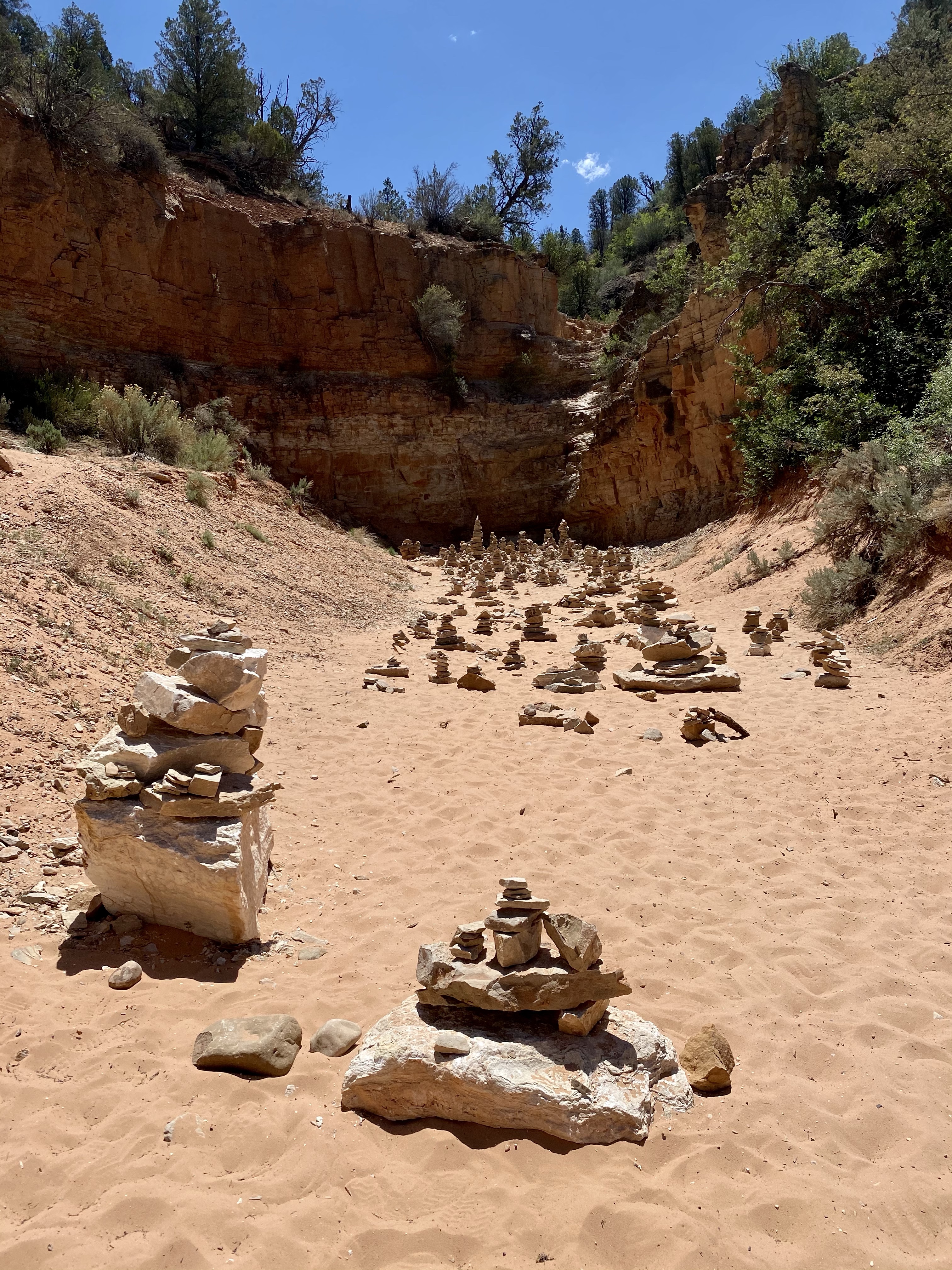
Our first stop upon arrival was Belly of the Dragon. A man made cave dug into the sandstone, Belly of the Dragon creeps under the highway and exits in the blazing sun on the far side. You climb down a steep embankment to enter, and the slowly meander through as the path is narrow and winding with shelves to climb up on both sides. People have carved their names and symbols into the soft walls, leaving their mark. While not a historic site, it still bothered me and I chose not to partake. But as you meander deeper, the light fades and a flashlight is handy, until you escape into the bright light and sand of the wash on the far side.
We walked a little farther, around the bend in the hot, pink sand, until the trail ended at a cairn forest. I climb up above to see if anything interesting existed further along, but not really, so we headed back to the cool shelter of the cave and took our time traveling back. Crystal was searching for our names, believing if she didn’t find them that meant “Crystals” or “Shannons” were good people for not defacing the sandstone. I’m proud to say no Shannon carving was found! (Crystal and Max were not so lucky, haha.)
By this point it was mid afternoon, and hot. We had planned to explore some more sand caves, but ended up at Moqui Caves Historic Site and were craving lunch. A food truck answered our needs and we relaxed under the shade of a big umbrella. We spent time trying to make last minute kayak or horse ride plans for the next day, but we didn’t have a safe place to leave Max, so ultimately we decided to stick to the original plan. For now though, the cool temperatures of the cave museum we’re calling to us, so we went in!
Moqui Caves is owned by the Chamberlain family, one of the original Mormon families to come to the Kanab area. Garth Chamberlain practiced polygamy and had six wives and fifty five children. His wives are what intrigued and impressed me the most. They were truly the heads of the households, maintaining the family and businesses while their husband was on trips for the church. His first wife became mayor of Kanab, long before women even had the right to vote, and all of his wives together served various seats on the the select board. That’s empowering.
As for the caves, they’ve converted it for different purposes over the years, once a bar and dance hall, now a museum. Inside you can observe artifacts … has collected. Some from indigenous people, others dinosaur tracks, and then a wide assortment of rocks and minerals, many that are even fluorescent!
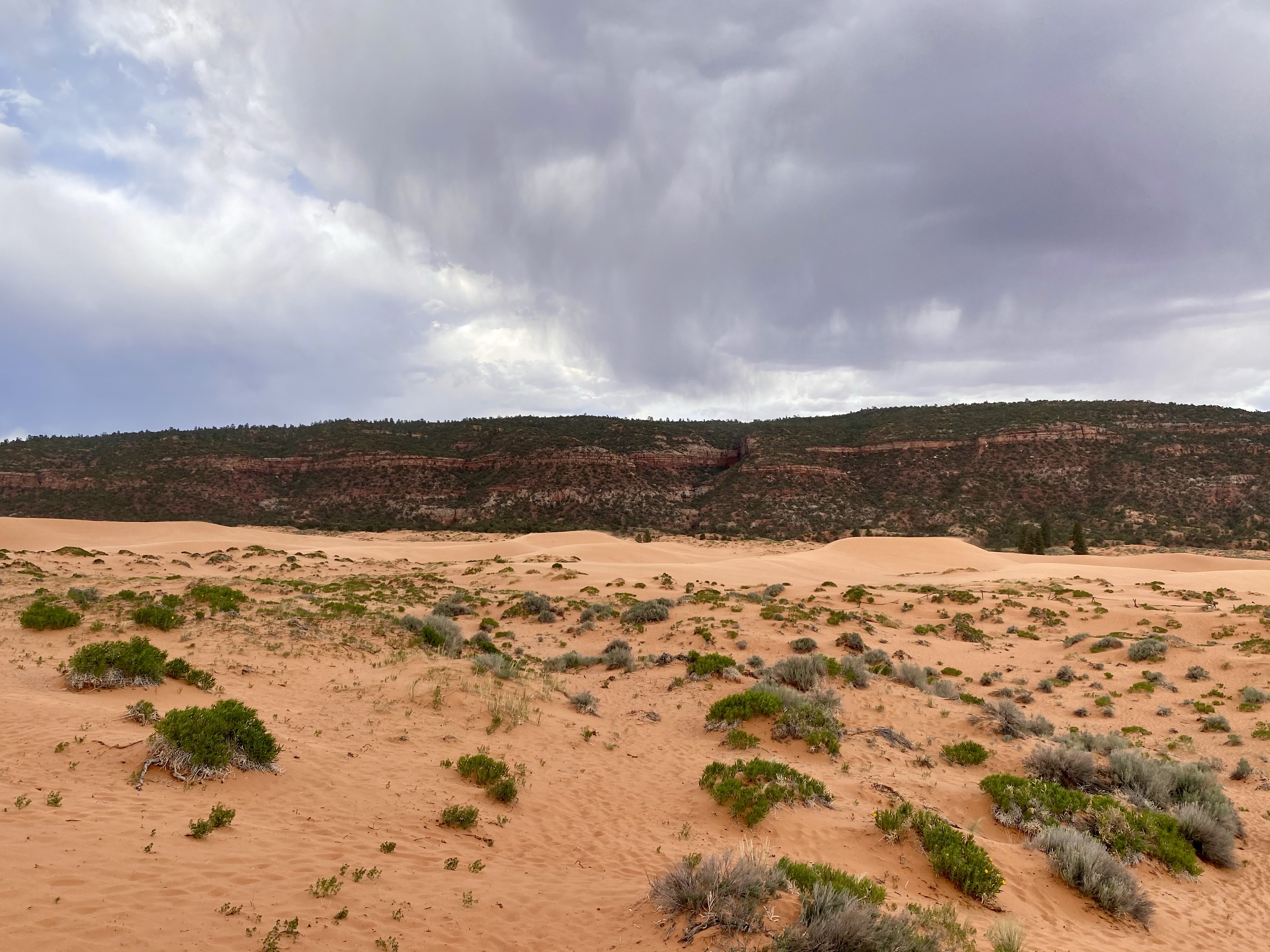
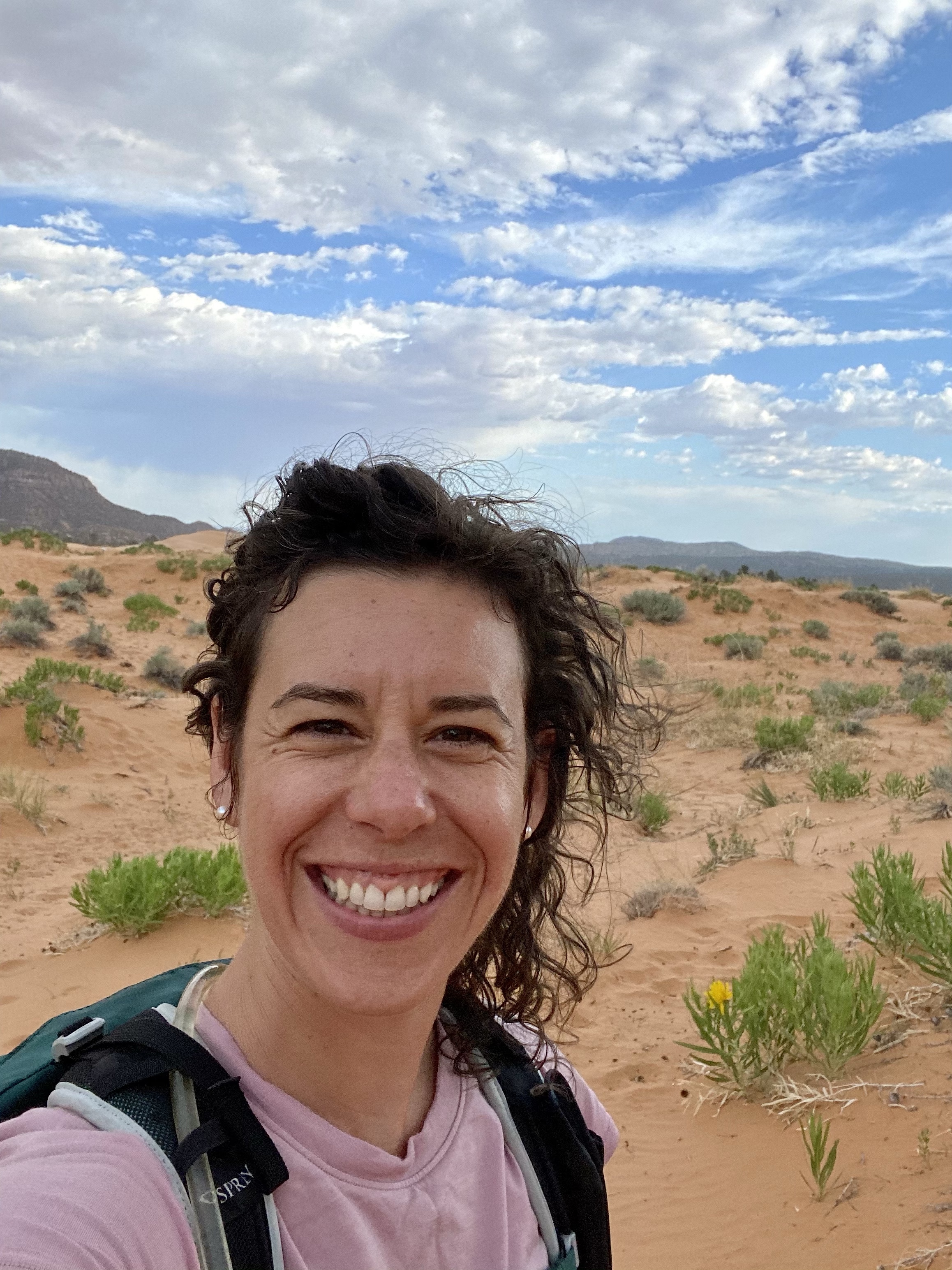
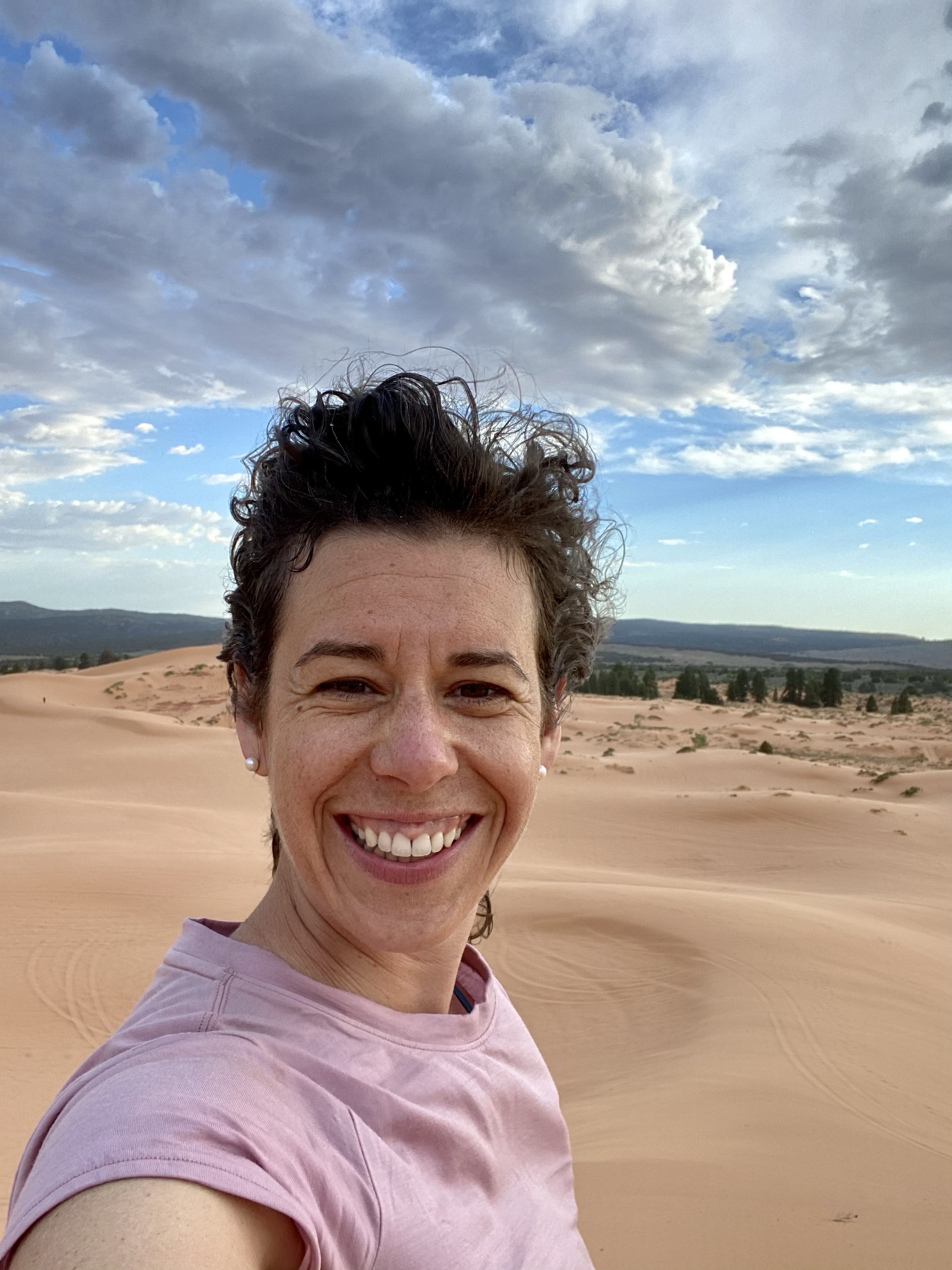
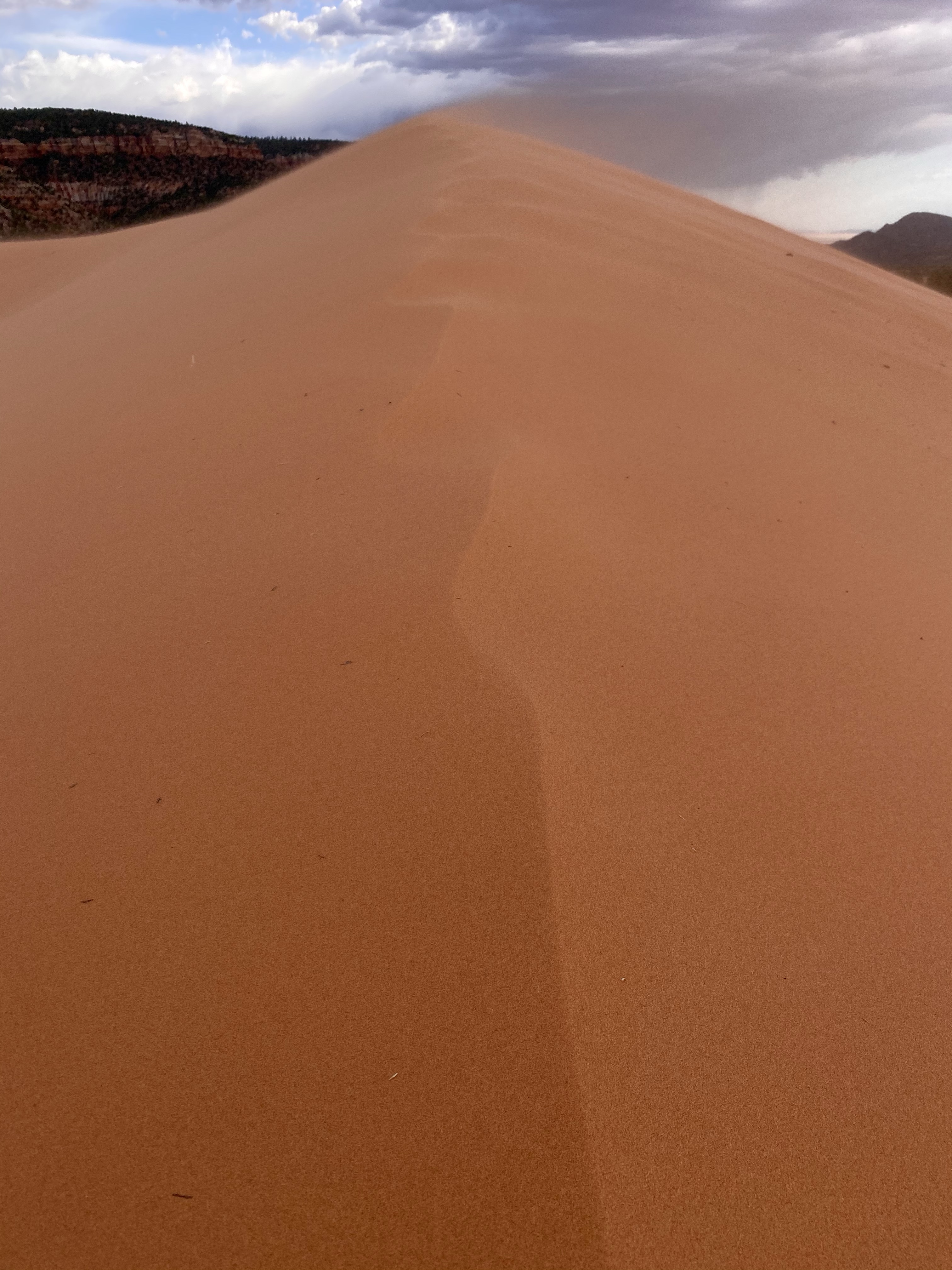
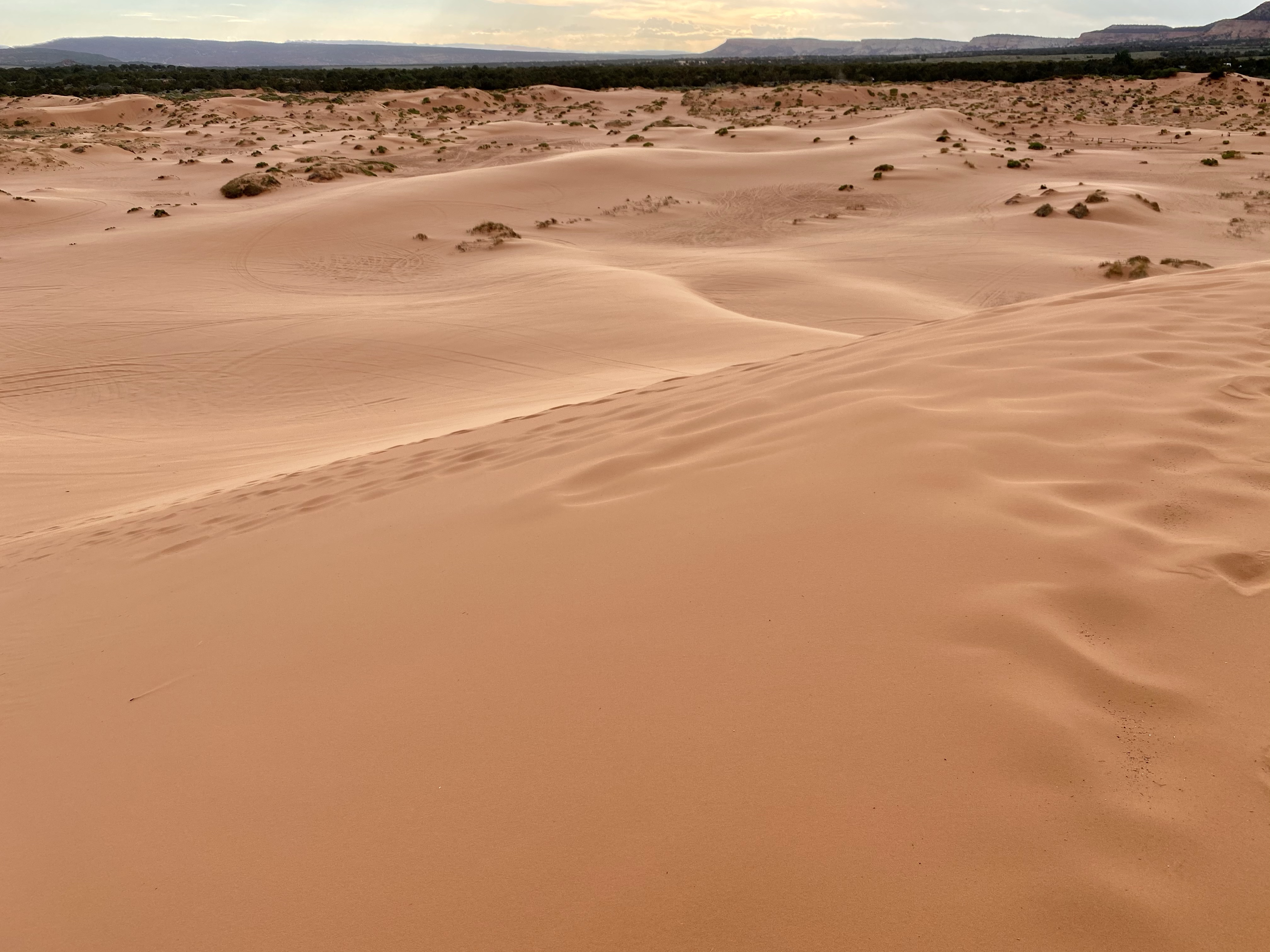
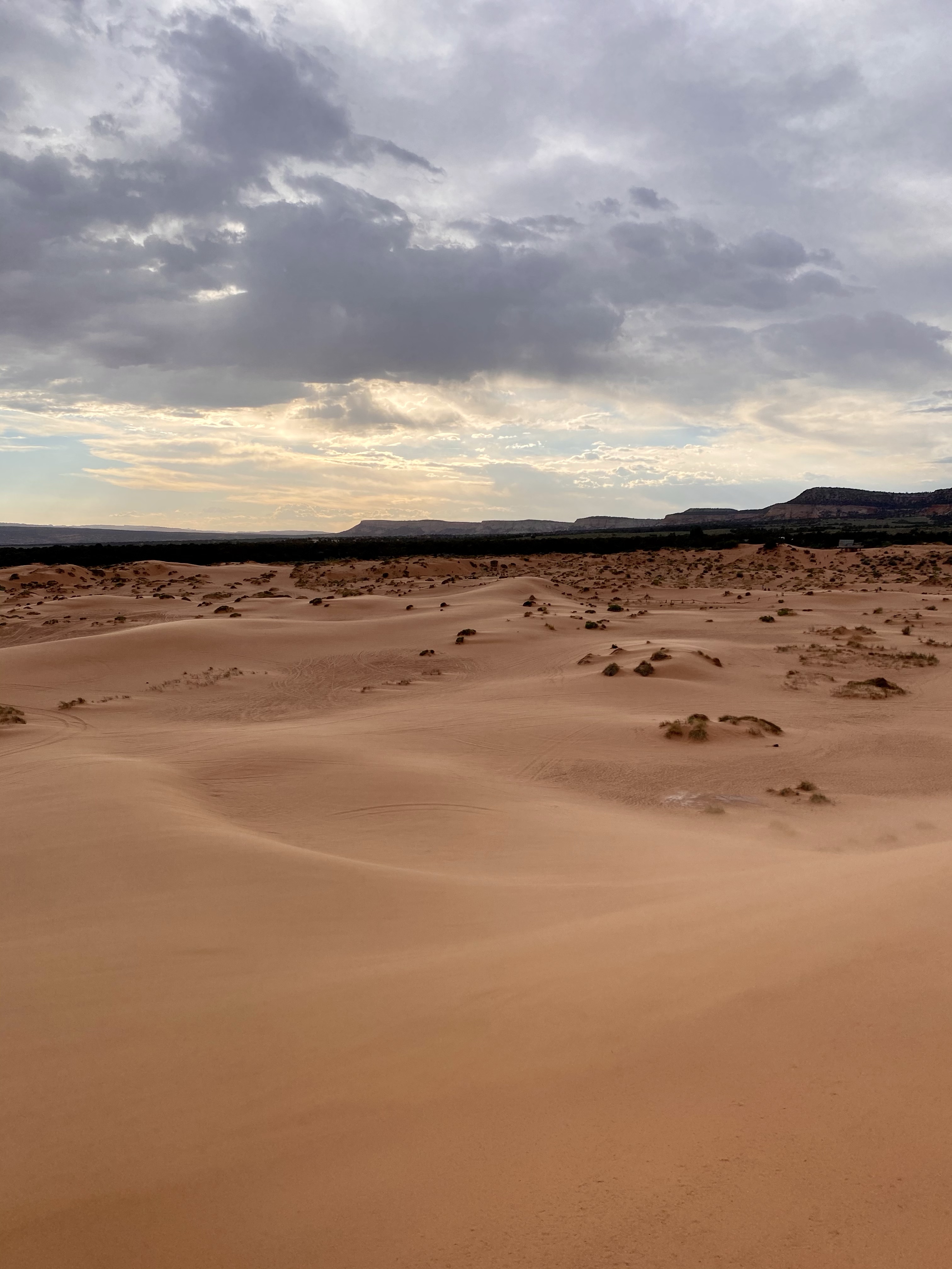
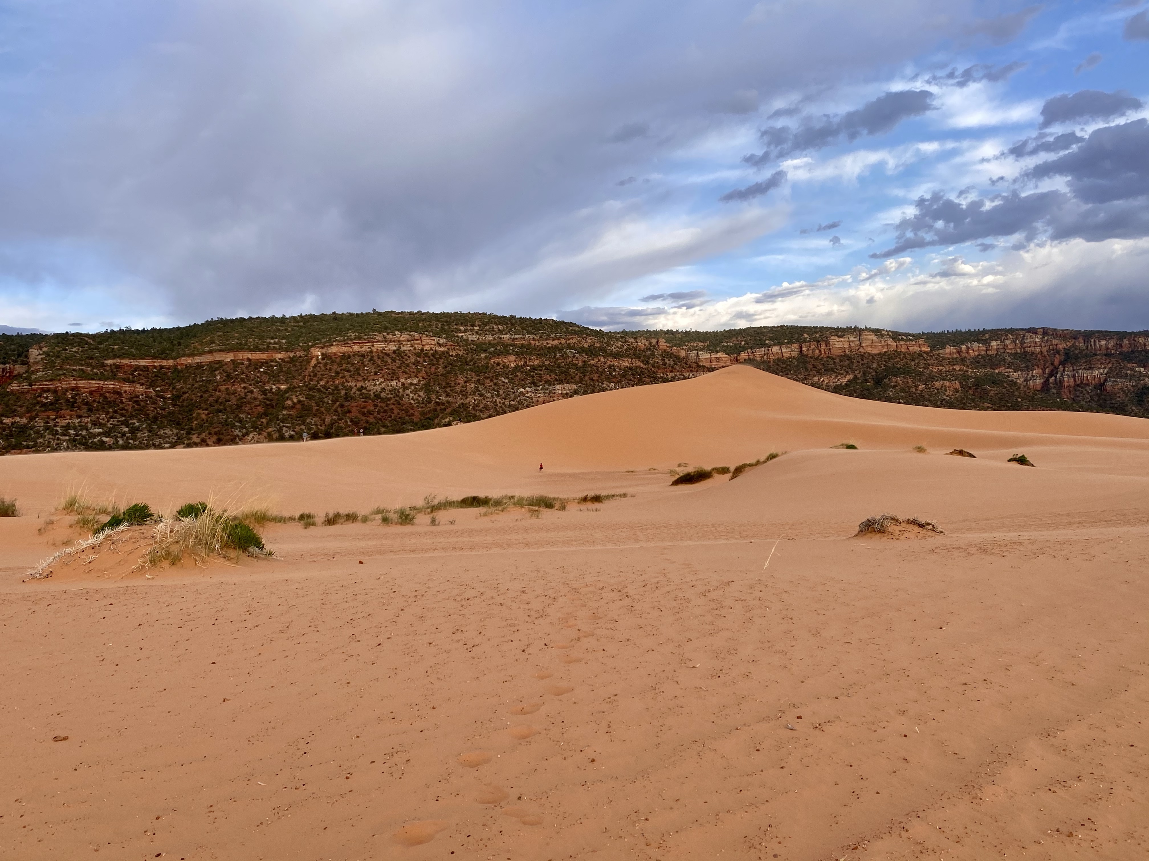
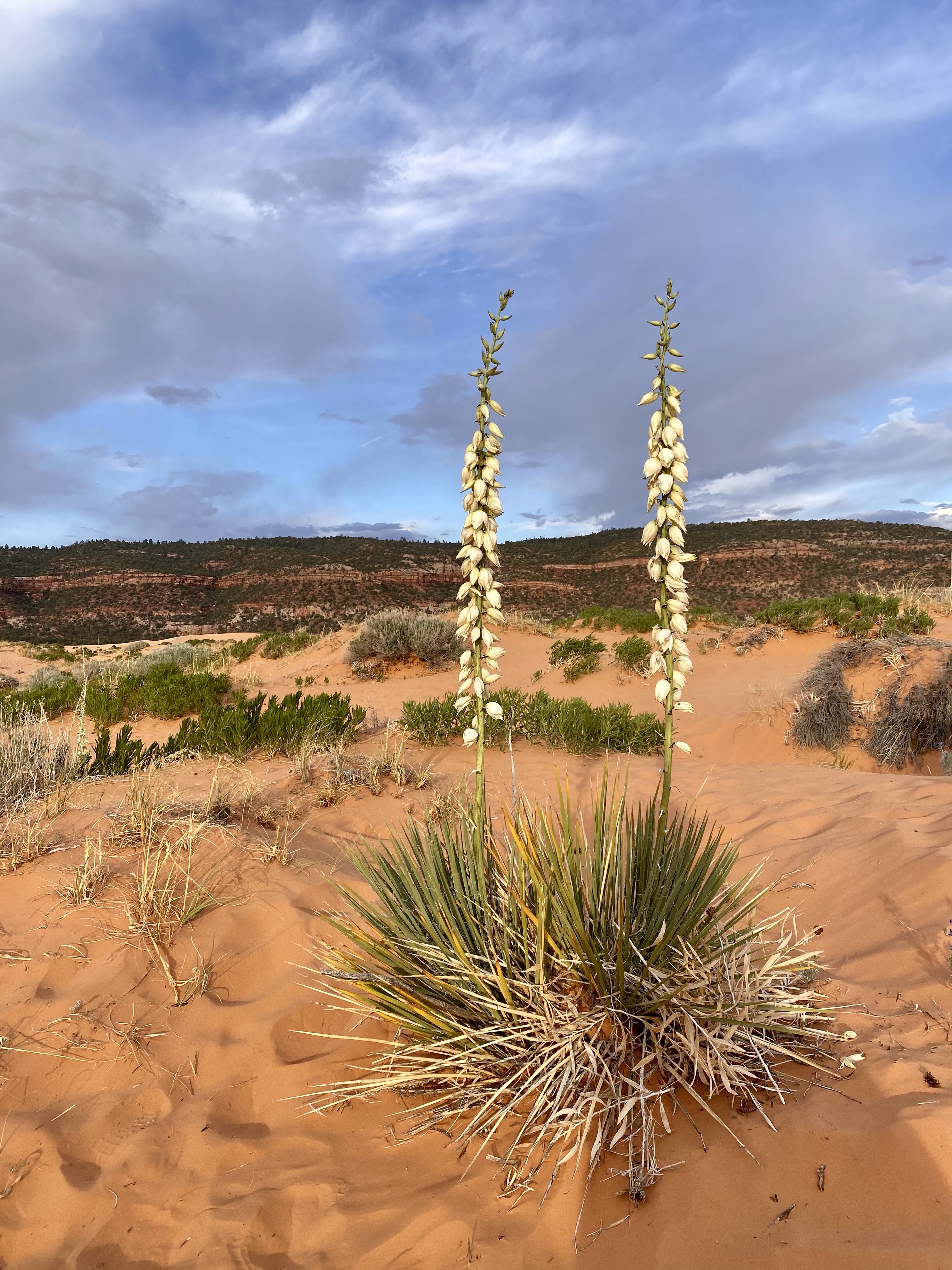
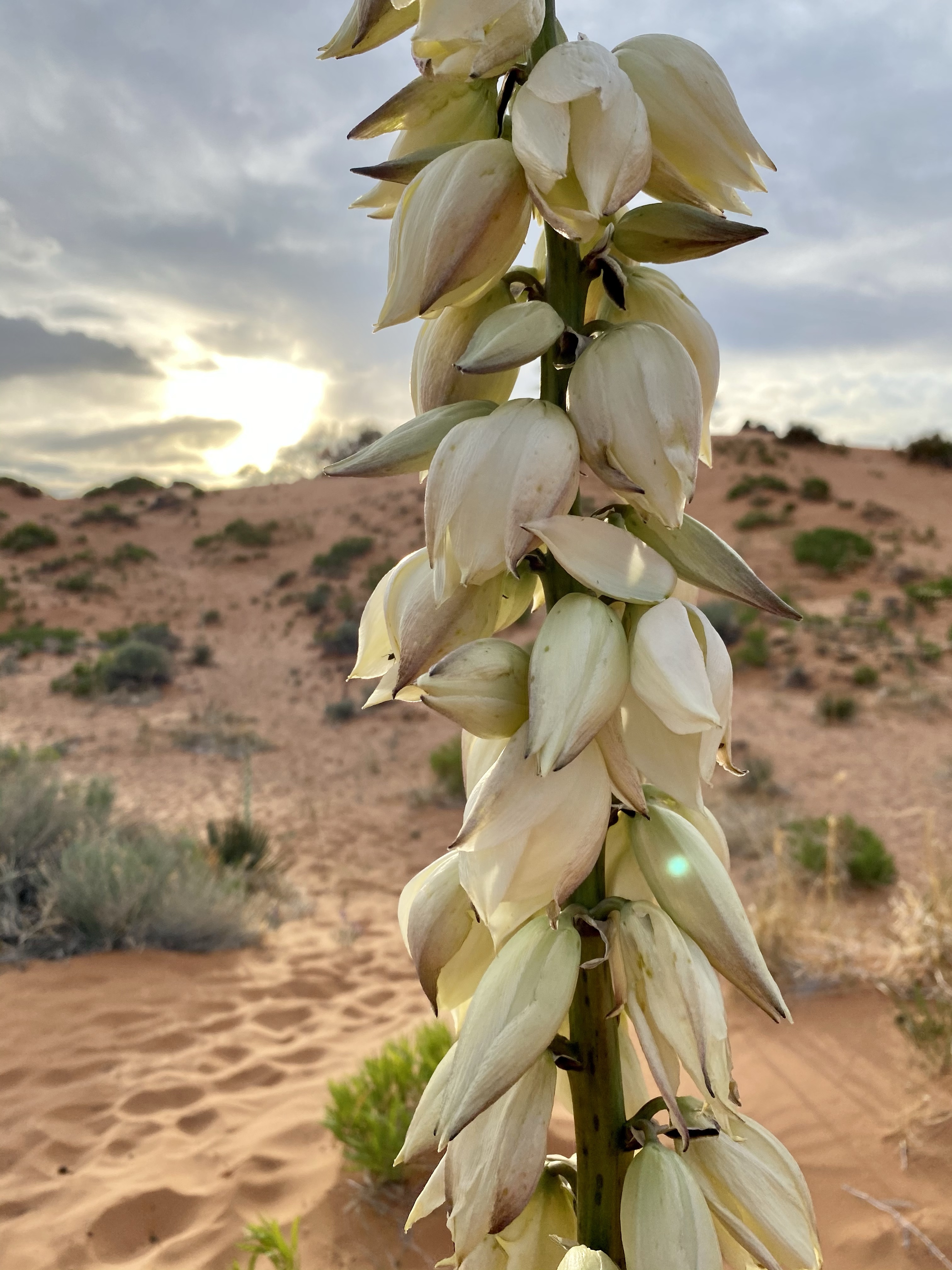
After enjoying the uniqueness of the museum, and the coolness of the caves, we emerged again and eventually found our way to our campsite outside Coral Pink Sand Dunes State Park, our last stop for the day! We rested at the campsite, ate dinner and relaxed, until the heat disapaited. Then we climbed in Crystal’s truck for our evening adventure on the dunes. I made sure to pack the sled for more sledding fun!
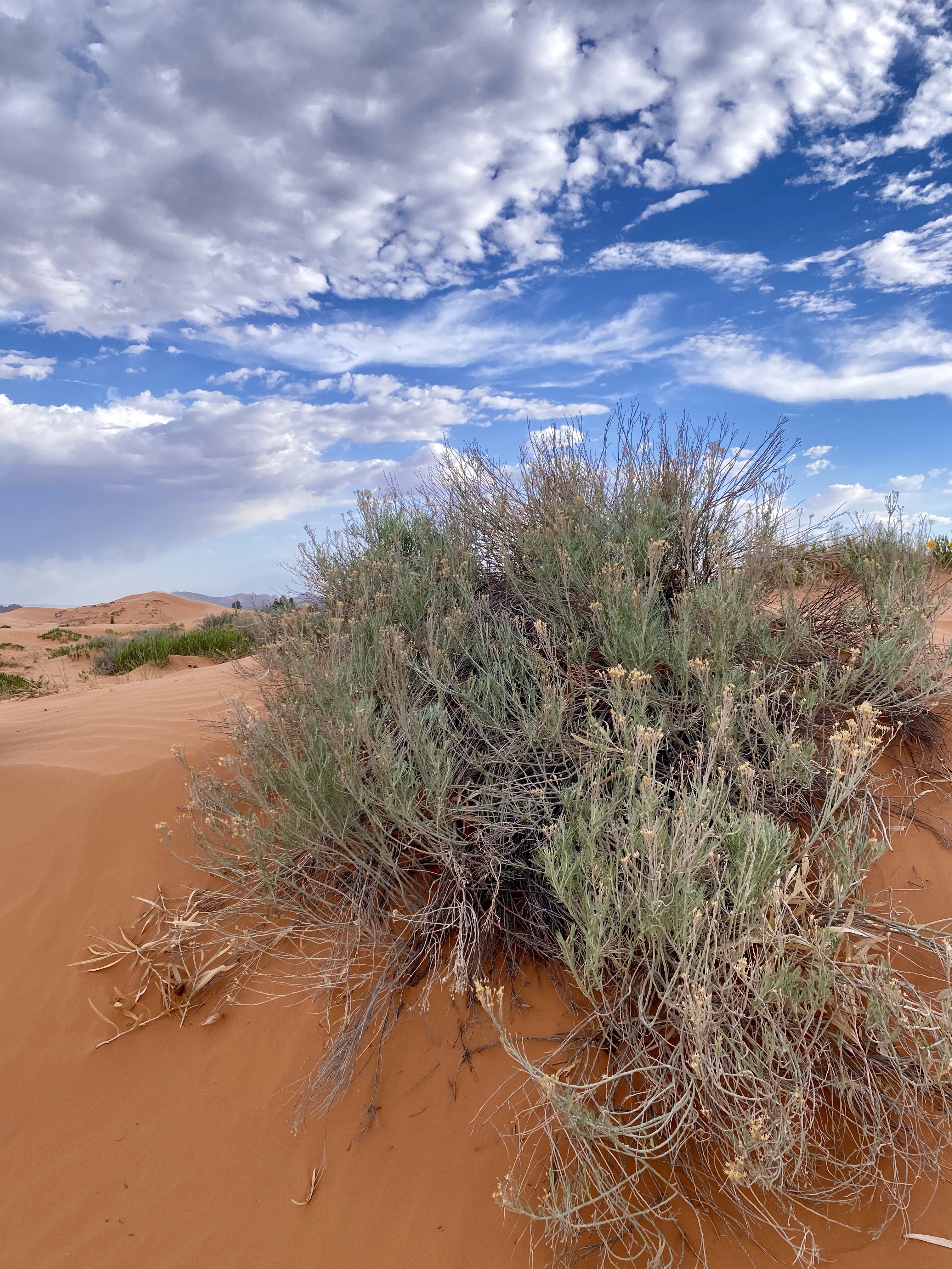
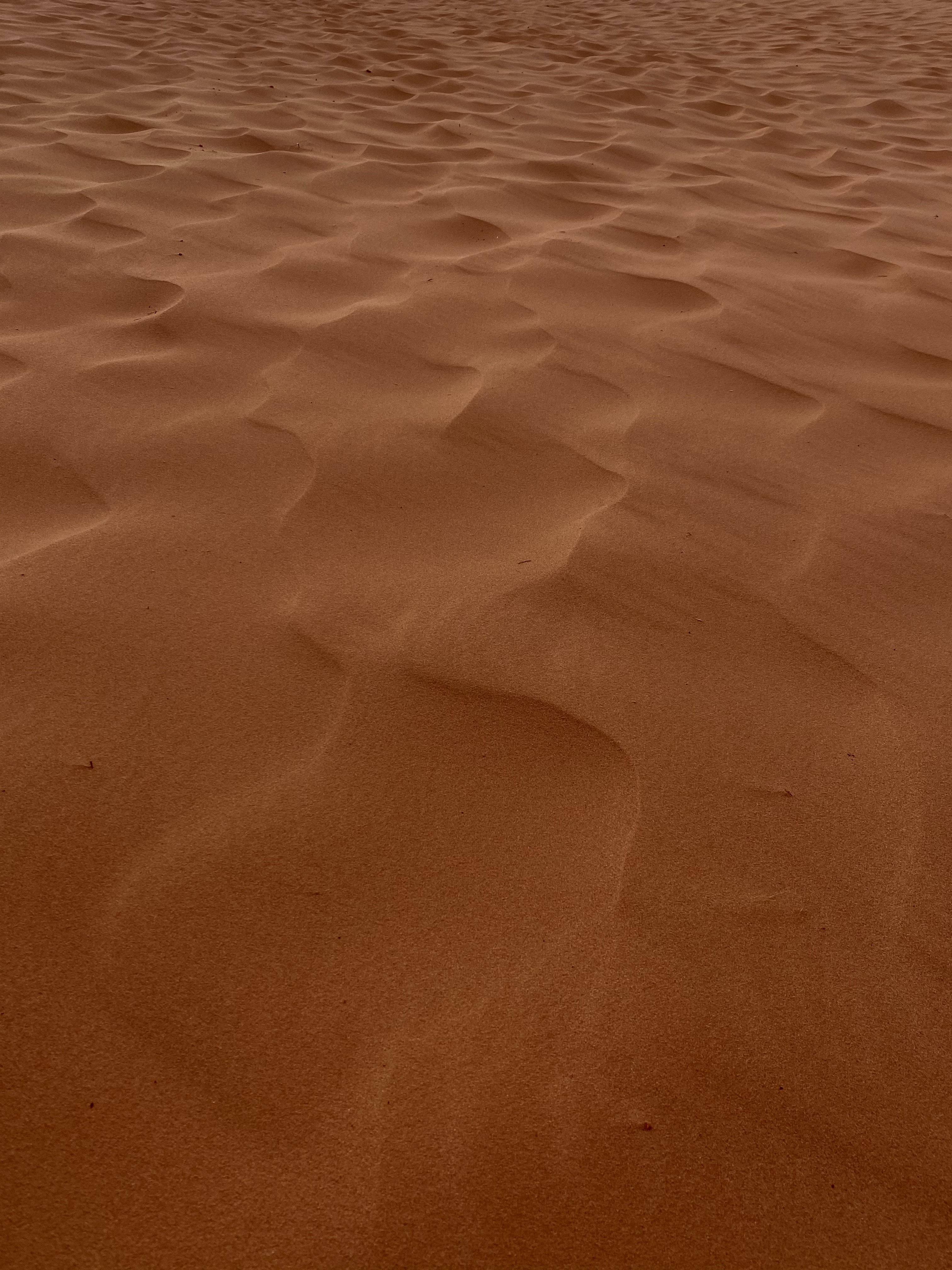
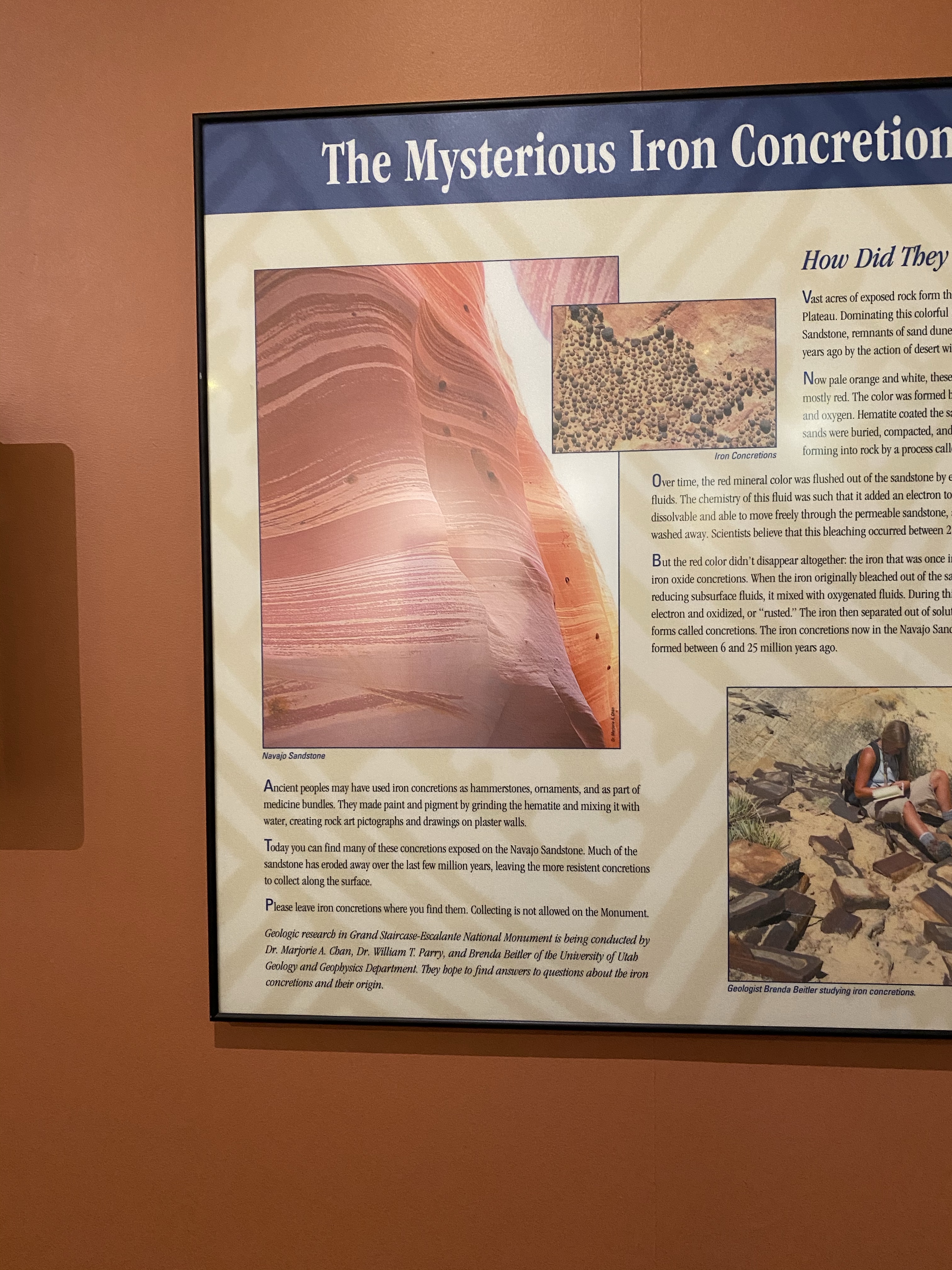
As we drove down the remote roads, the brush lessened and the sand appeared. Coral pink it truly was, as is someone doused the sand in food coloring. The sand originates from the erosion of the Navajo Sandstone beds nearby, the color from a high concentration of iron oxides. The right combination of landscape and winds create the dunes here, the only spot in Utah. Most of the sand moves from saltation, the bouncing of the grains along the dune field, creating uniform ripples on the surface.
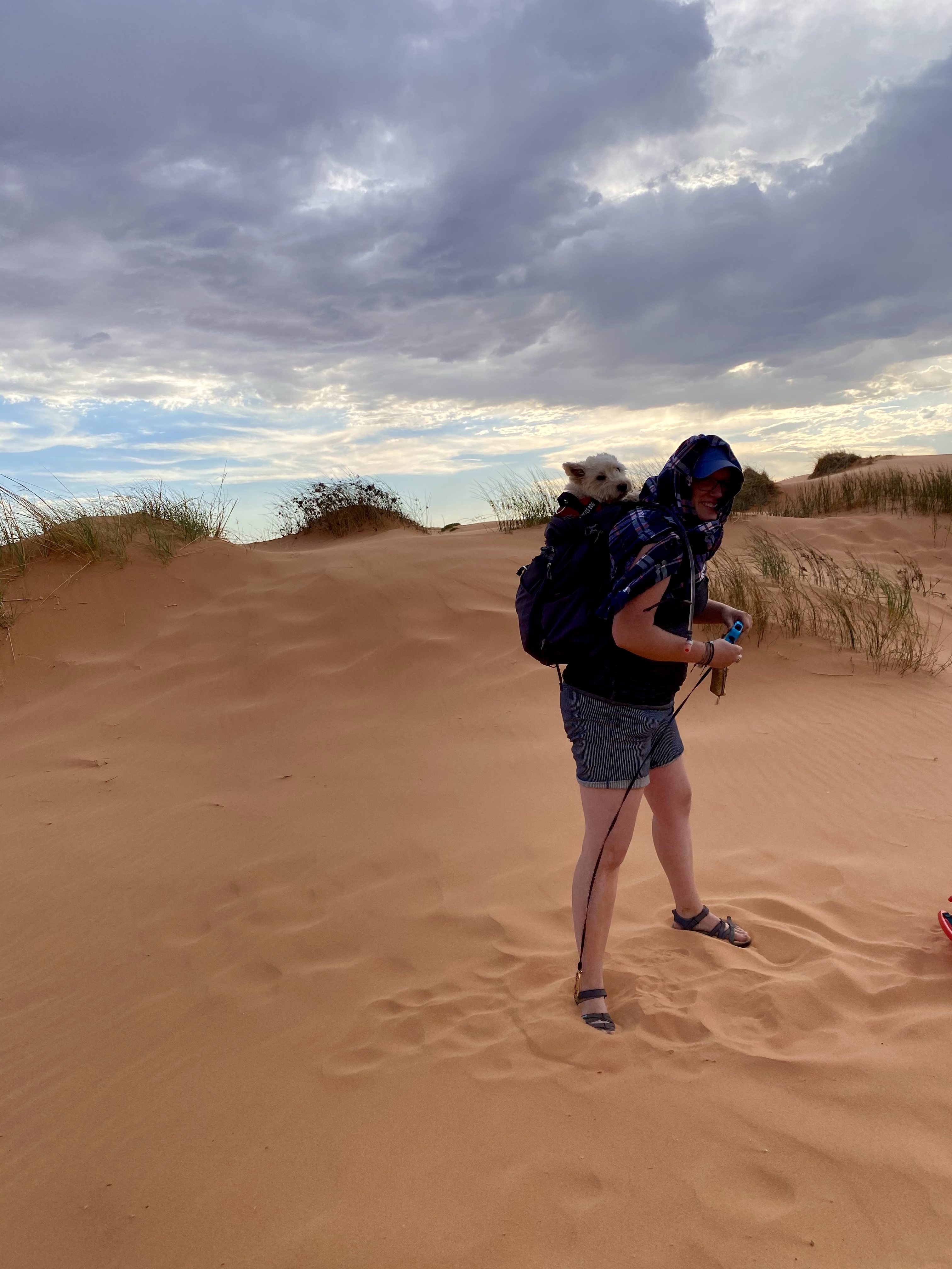
With childlike excitement, I popped out of the truck and grabbed my sled. Some wind pushed against us, but nothing was going to stop me from getting out there. I dragged Crystal and Max along, navigating between the hummocks (clumps of plant life), to the clear dunes. As we ventured farther, the wind picked up.
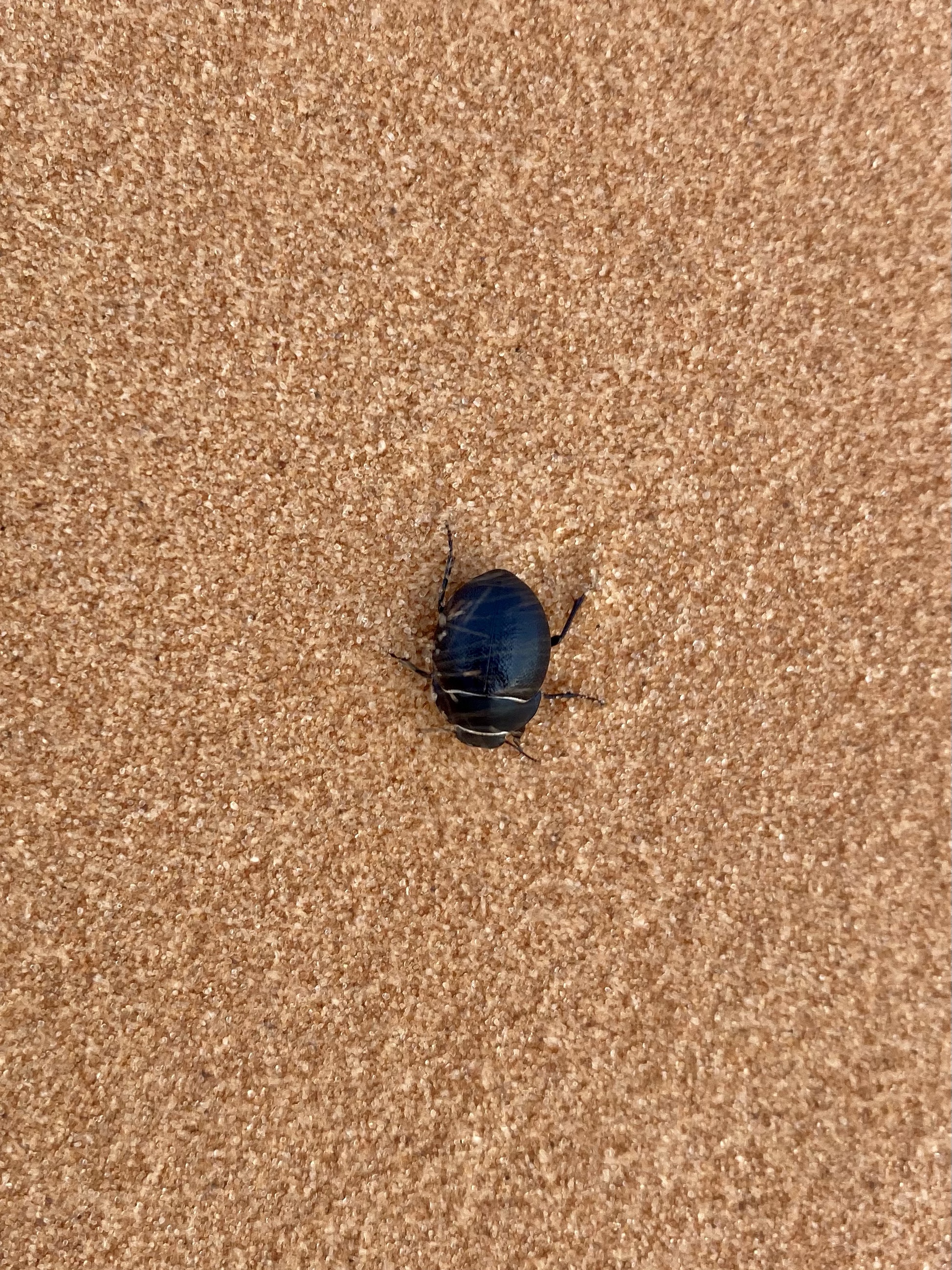
As we climb up on the dune ridge, the wind quickly escalated and whipped sand around. Each time a strong gust came, grains pelted our bare legs and arms, stinging like pins and needles. I attempted to use the sled as a shield, but it was little help. Soon we had sand everywhere – hair, ears, backpacks, even a few crunchy grains in our teeth. Crystal and Max ran down the dune to find shelter in the valley, but there was little comfort there either. I decided I wanted to climb up anyways, so I left my bag with them and headed up the steep embankment. I told myself I was getting a good whole body exfoliation service. Haha! A tiny black beetle, obvious among the pink dunes, also struggled to make it to his spot. Sand sailed over him and he slowly inched forward. What an inspiring creature!
I trekked my way to the top, one chunk of steps at a time, and sat down for my ride. Sand whipped at my back, but I really didn’t care. I started pushing myself forward and slowly slide down, catching speed as I went. But not enough wax meant I only made it halfway! So up I went again, this time with wax in hand. I offered Crystal a turn but she said no way! Probably the smarter decision.
Up I went again, getting my workout in for the day as the sand sank under my feet. At the top, I rubbed that wax on, layer after layer, making sure it was good and slippery. Then down I went, gaining momentum, gaining speed, having the time of my life. I still had to run down the last bit, but that was fun too.
Back at the van I did my best to rinse off at the faucet, but a Mac and cheese like powder clung to every surface. Thankfully there are showers at the park campground, so we took advantage of those to avoid bringing as much sand home as possible. Days later though, I’m still finding piles and grains. A souvenir?
At this point Max and Crystal had had enough. Max was packed up in Crystal’s backpack and Crystal made a makeshift head covering. Anything to try to protect themselves from the blasting sand! But I craved one more trip up for some picture taking. While the OHVs whipped around on the sand beneath me, from the top it was peaceful and gorgeous. Pink sand – I still can’t get over it! But eventually the wind did win out, and I headed back, scouting flowers and chunks of unbroken sandstone on the way.
We finished our showers in time to catch the end of the sunset over the Navajo Sandstone, then headed back to camp for the night. Energy was needed for more activities tomorrow!
The next morning, we left early and drove to the Sand Caves we had skipped yesterday. Across the street from parking, high up on the cliff, were a series of tunnels carved into the sandstone. I’m not sure of their history, but one local tale says early colonizers used them as shelter.
Crystal and I left Max in the car, temps still cool and the time away short, and headed across the street. A well worn path guided us to the cliff, then we slowly bouldered our way up to the ledge. Carefully, staying to the inside, we walked along the smooth sandstone , down and up, to the caves at the far end. When we arrived, we had the whole place to ourselves!
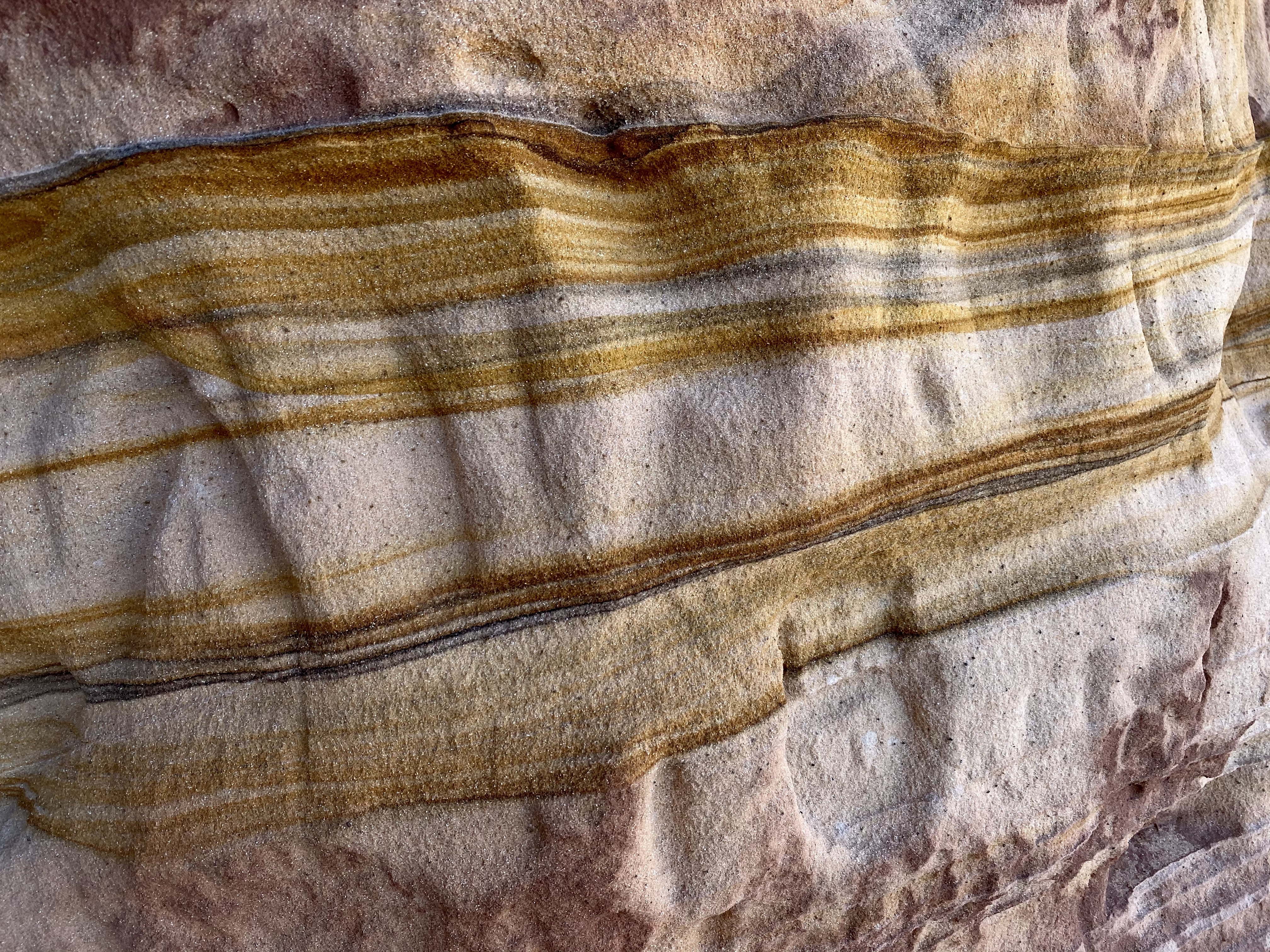
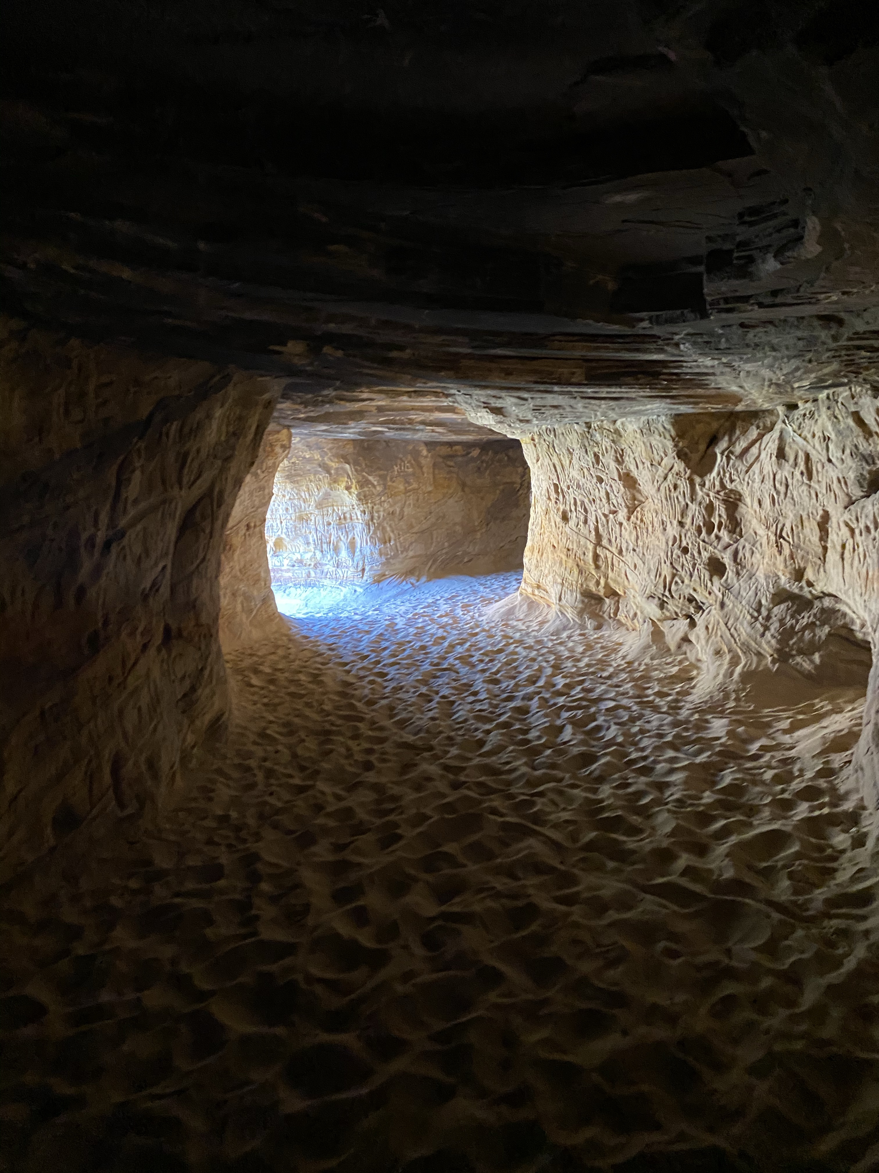
The cave openings face the road, and the tunnels reach back until no light reaches the walls. It’s one long corridor with a few rooms, several openings on the cliff side. We pondered where people might have slept (if the folklore is true), what might have been the kitchen, or bathroom. If families lived here, I have no idea how they managed children up on the ledge! Scary! More likely, if people did live here, it was men sent on missions by the Mormon church. No matter what the use, it was pretty neat! The colors are what captured my attention the most, brilliant streaks of yellow waving and circling over the surface. Large chunks of red and pink streaked with white. A work of art.
As people arrived, we headed out, but not back yet! Instead we bushwhacked up the cliff a little more, venturing into the rust red earth. Leading the way over rocks and by trees, I tried to get to a rock outcropping but it proved a little too tricky. Nevertheless, we had a spectacular view and I let out a loud “Wahoooo” that echoed down the canyon.
On the way down, we reconnected with our original path along the ledge. All was fine, until I thought I could make it across the slant. I quickly yelled back to Crystal, “Don’t come. Don’t come this way!” She listened and I crab crawled down the slant to the path below. Phew!
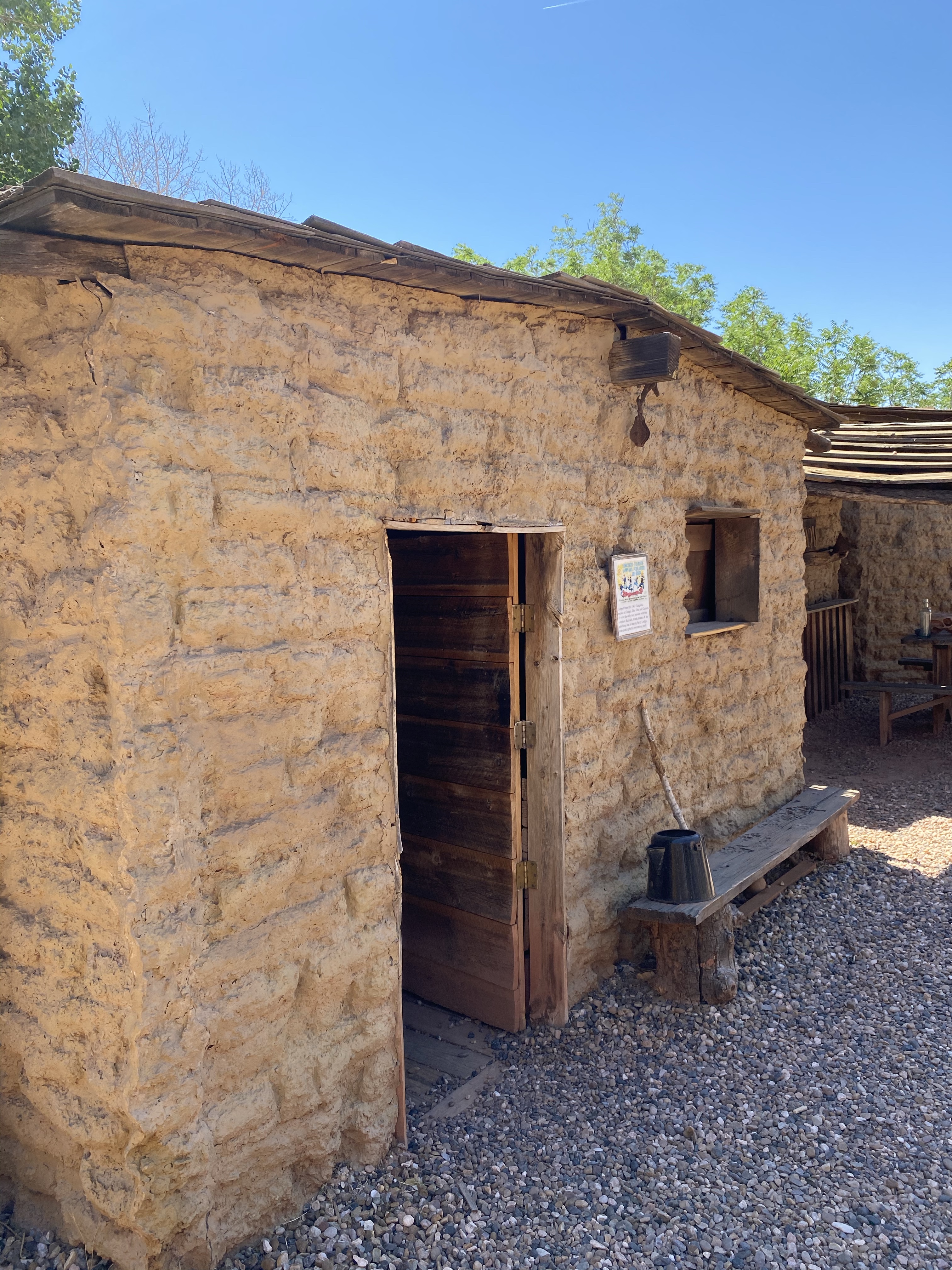
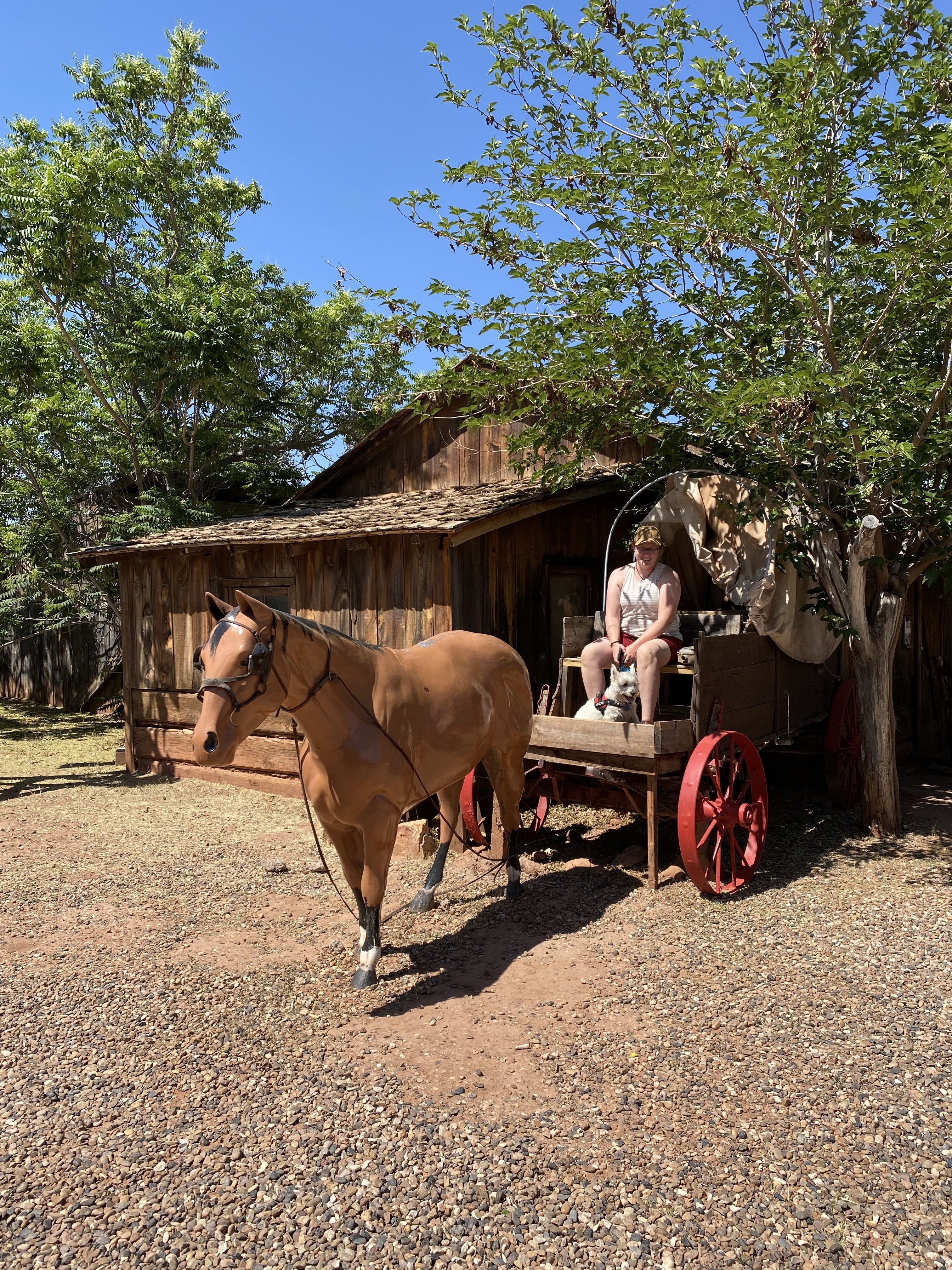
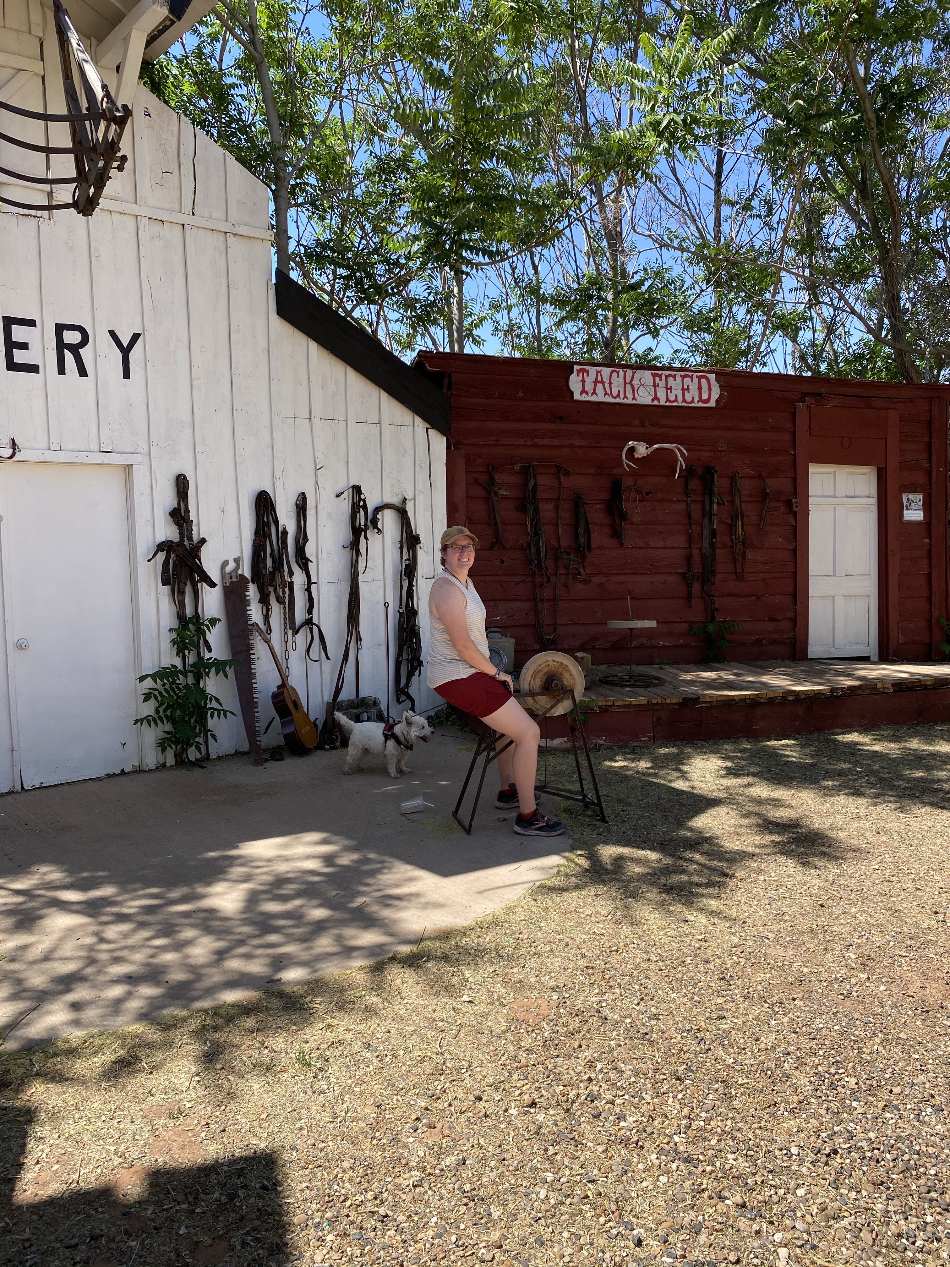
Our next stop was downtown Kanab, where we meandered among stores, got lunch and ice cream, and visited a Hollywood Western Movie museum. Apparently Kanab, Utah is famous in Westerns, many having been filmed here during their golden age. Stars walked the streets of the city and citizens served as extras in films. Unfortunately the portrayal of Native Americans was very discriminatory and the museum did little to acknowledge this. Hopefully with time we will continue to learn from our mistakes.
Our next stop on our Kanab tour was Heritage House, the first modern house in the built by a white colonizer. Henry and Mary Bowman had the house built in 1894 with many touches to the Mormon religion and culture. Henry Bowman was a teacher turned businessman who owned the first mercantile in the city. While it took them two years to build the house, they only lived in it for two years before moving on for another church mission! That’s when Garth Chamberlain bough the house, the original owner of Moqui Caves.
Garth’s first wife, Laura, and children lived in this home. Utah was a state at this point and polygamy was illegal, so each wife had to have her own home and residence. However, because Kanab had the only school in the area, all of the high school age children lived in the house. Sixteen kids! Apparently they mostly lived and slept outside, under the stars, except in the winter when they crowded together in the attic. The girls shared a room for some relative privacy while the boys were in the main area.
The house has only had two other owners in its entire history, so the majority of the furniture and fixtures are original! That’s pretty awesome. We enjoyed our tour and if you’d like to learn more, here is a link.
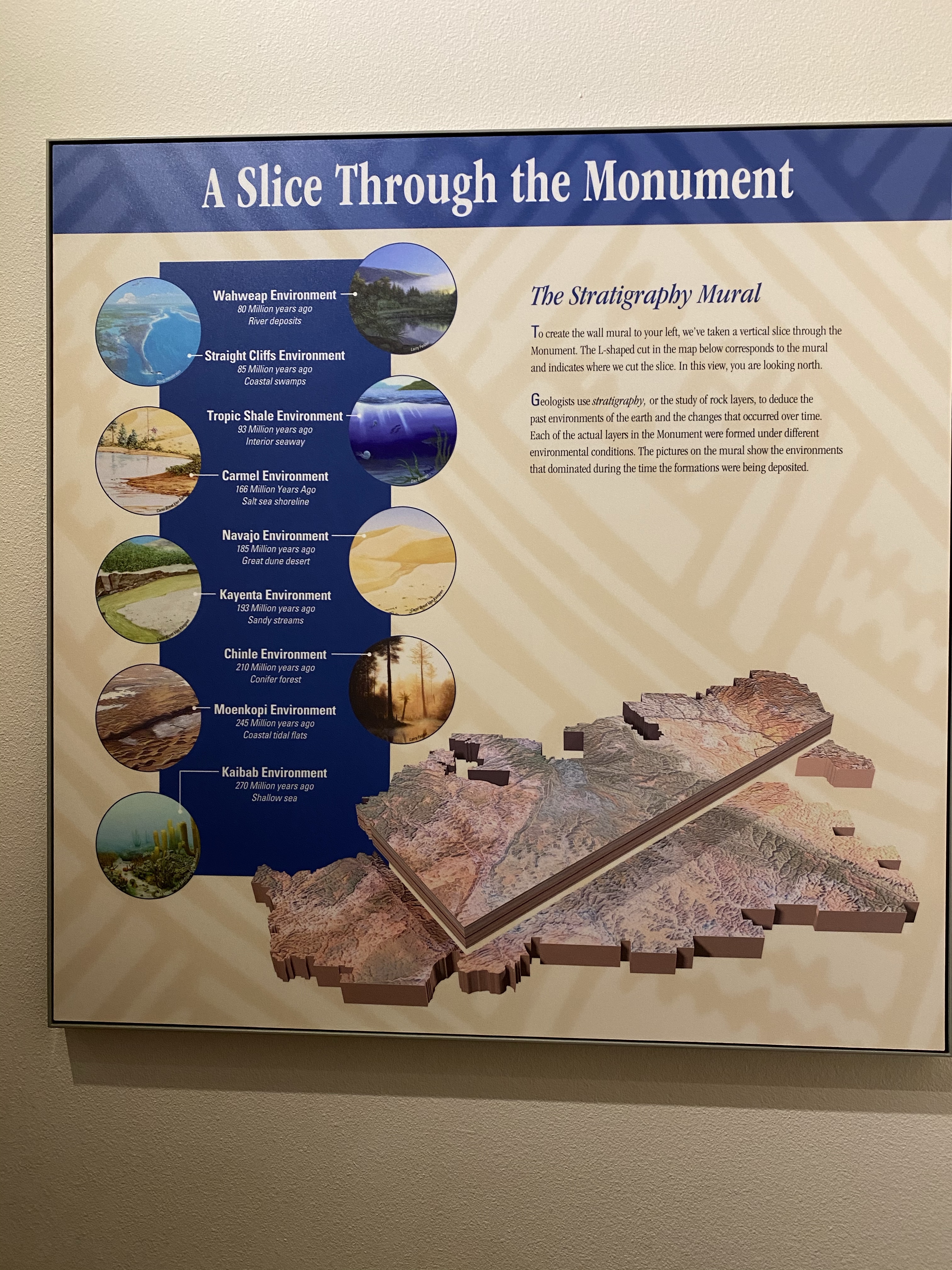
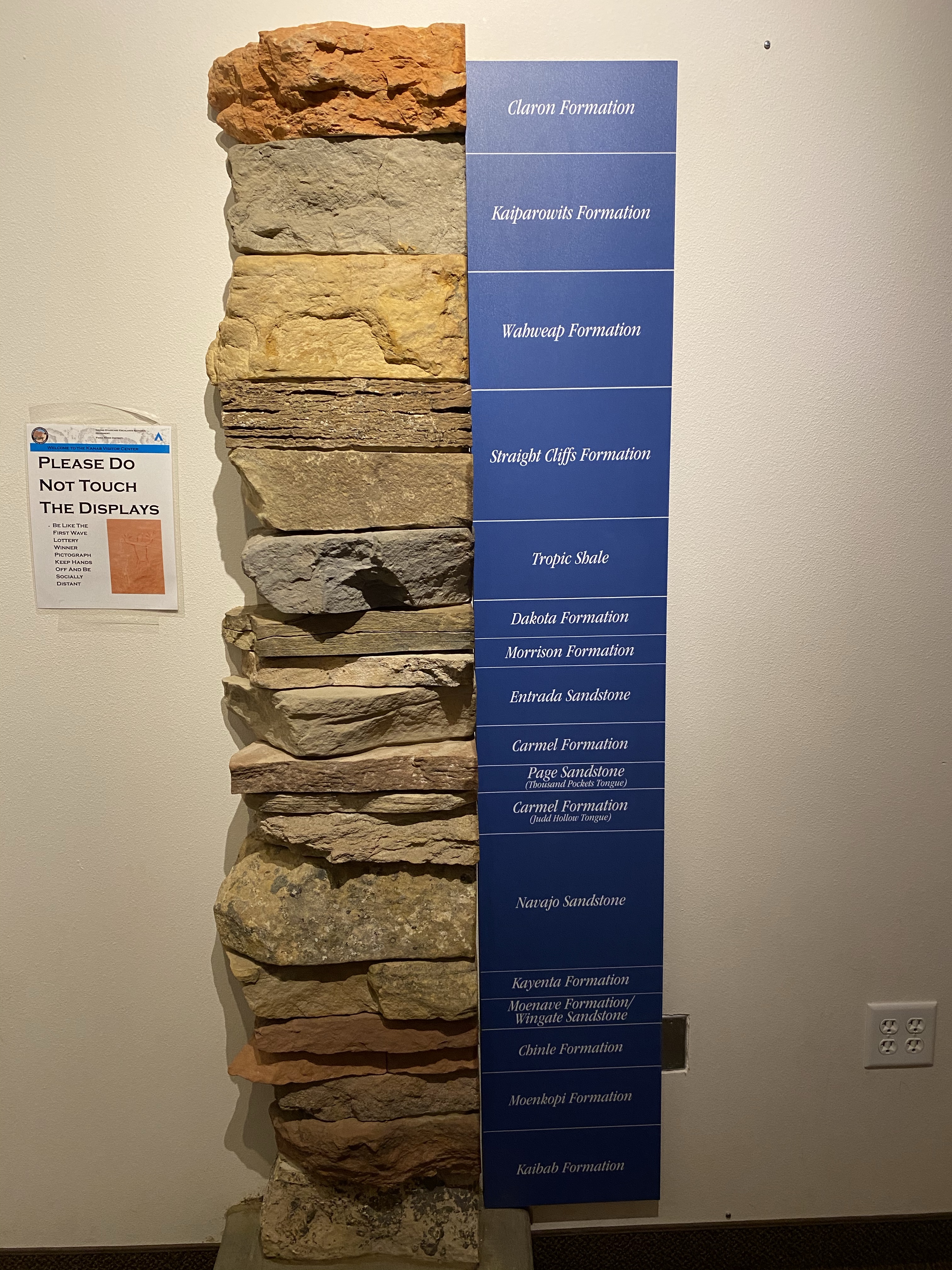
With daylight waning, we headed to the Bureau of Land Management (BLM) Visitor Center to enjoy the exhibit and get camping information. We learned about Grand Staircase Escalante and its many historic layers of earth, and the significance this area has to the ancient Anasazi farmers, Fremont people, and present day Hopi and Paiute people. Additionally, we learned that the vibrant red color of the stone comes from concentrations of iron.
Then we headed to our camp spot, on the way to the North Rim of the Grand Canyon! We found a beautiful, private, quiet dispersed spot down a forest road and settled in to enjoy the late afternoon. Hammock strung up, I laid down to relax and rest. A very full day complete.
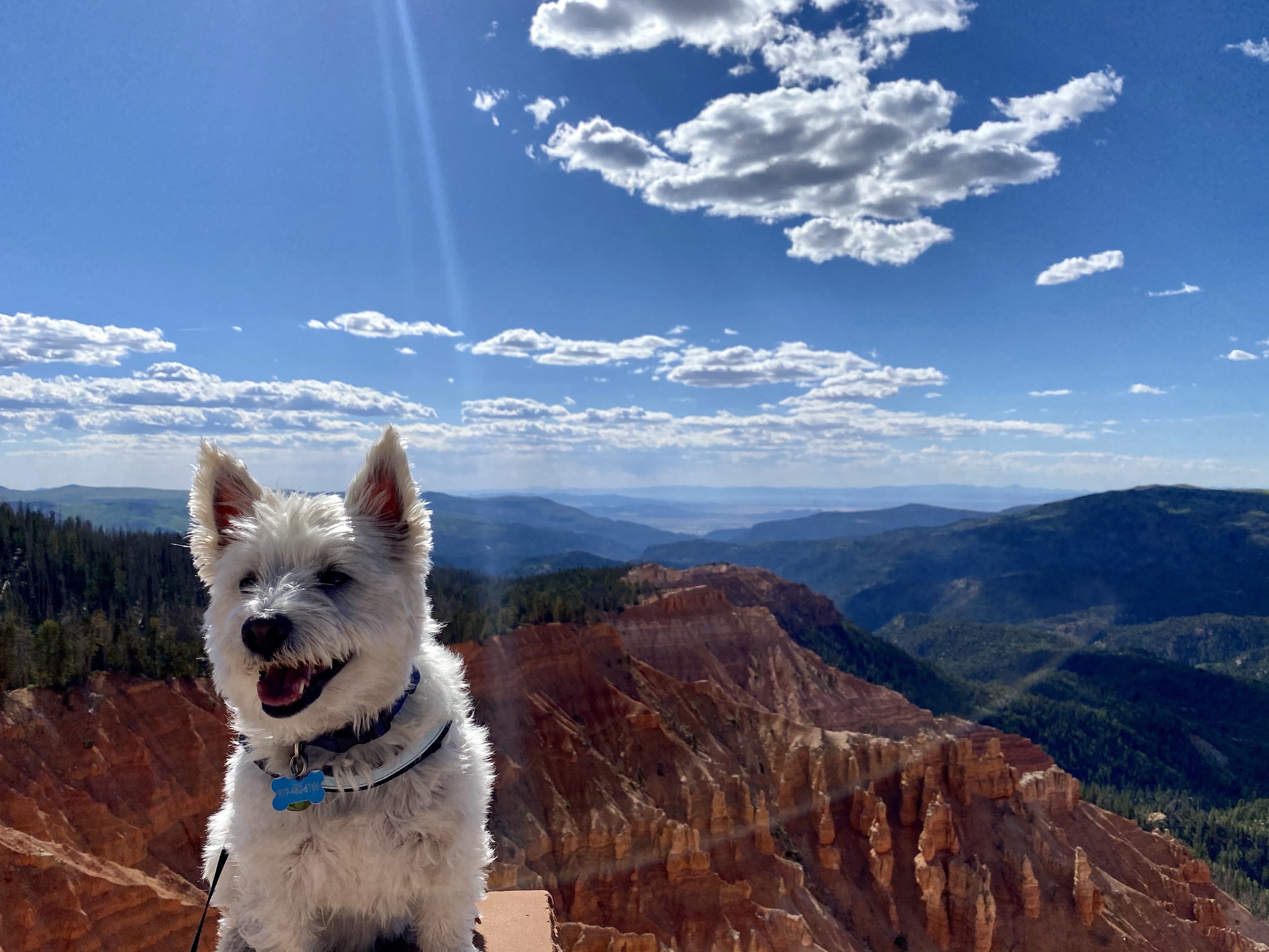
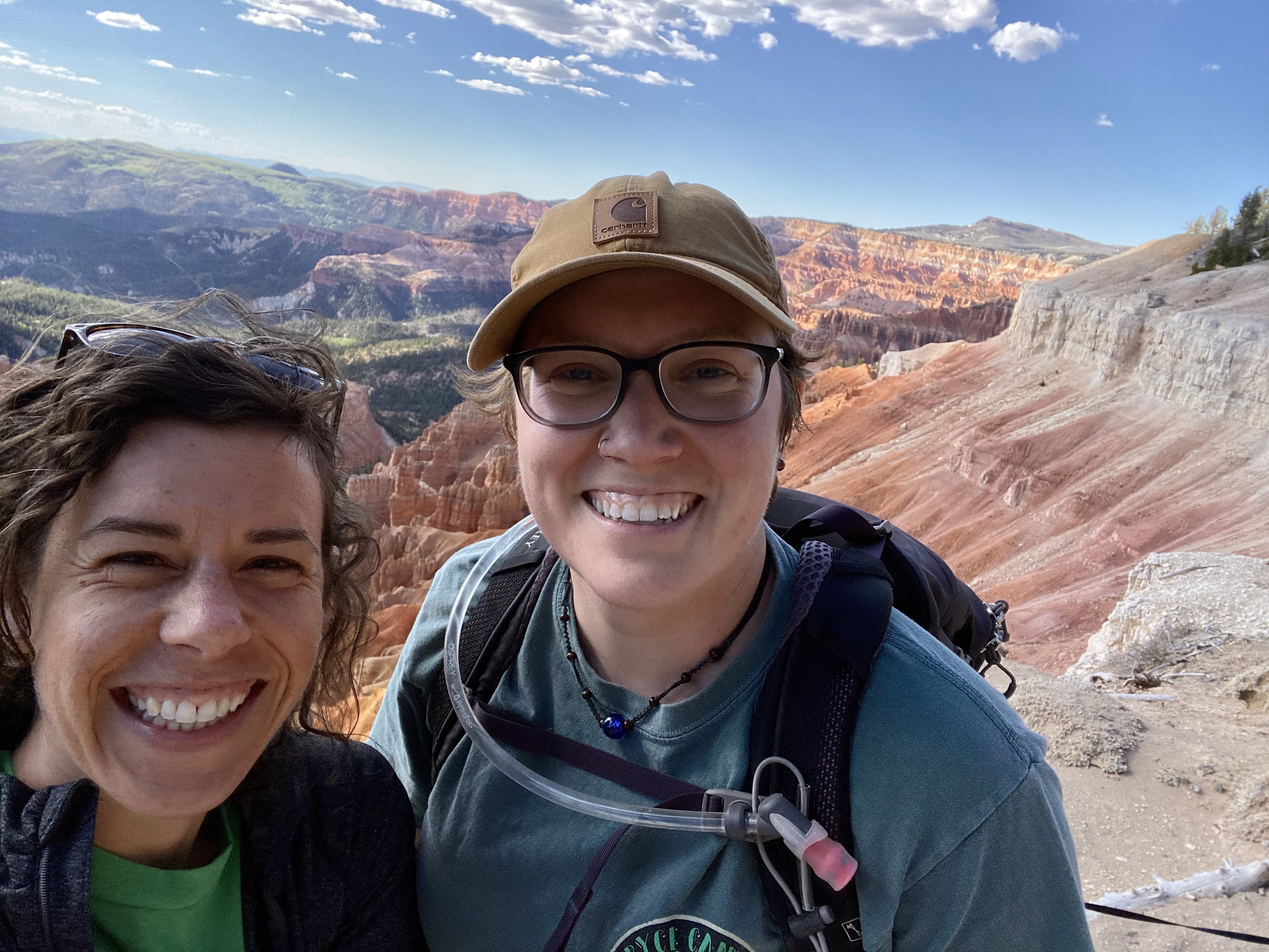
When I rolled into the parking lot on the Southern Paiute and Pueblo land, Crystal and Max were ready and waiting. We embraced each other in a warm hug, happy to be together again. Happy to have company on the road.
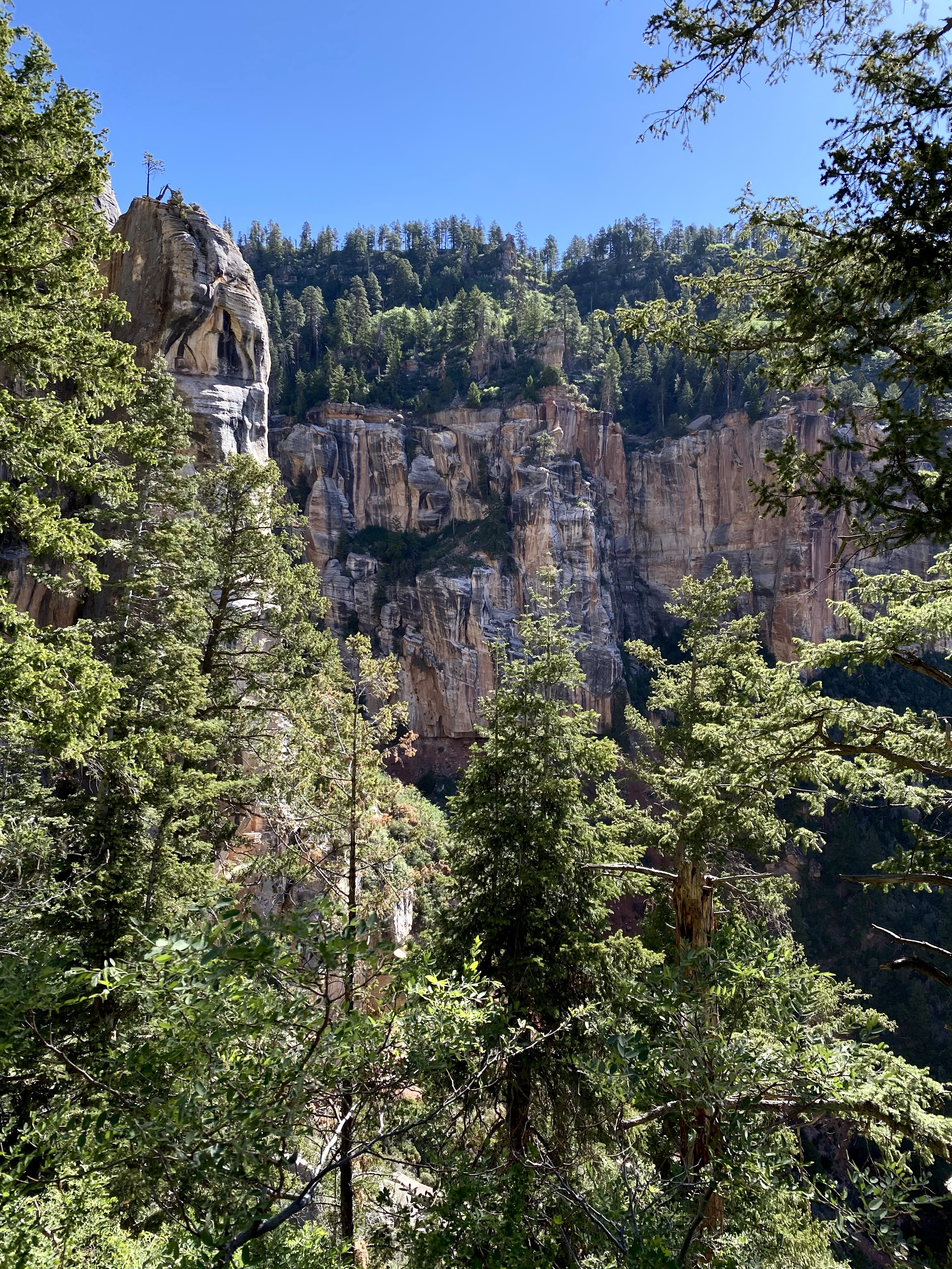
While it was late afternoon, we made time for a short hike, the red cliffs calling our name. I had snuck a few peaks on my drive in, and was eager to see more. The rust red rock and green pines along the rim set the stage for a perfect Christmas backdrop. And in many ways it felt like Christmas – the colors, the excitement to see a new place, the pleasure of being with people you enjoy, the gift of another beautiful day.
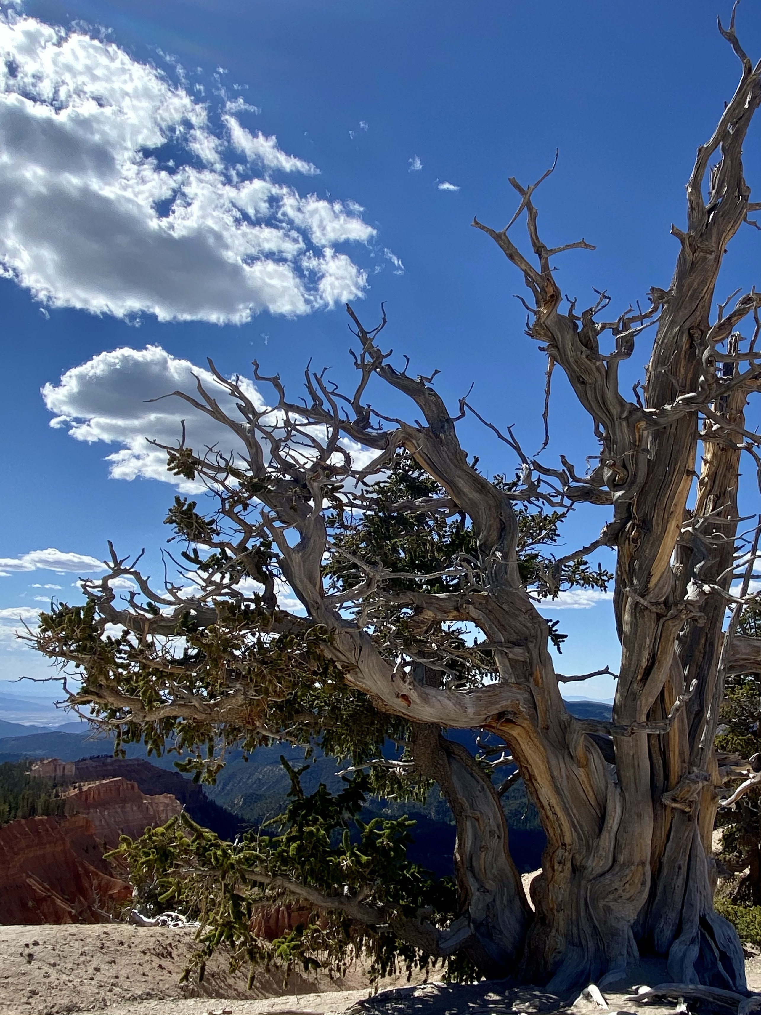
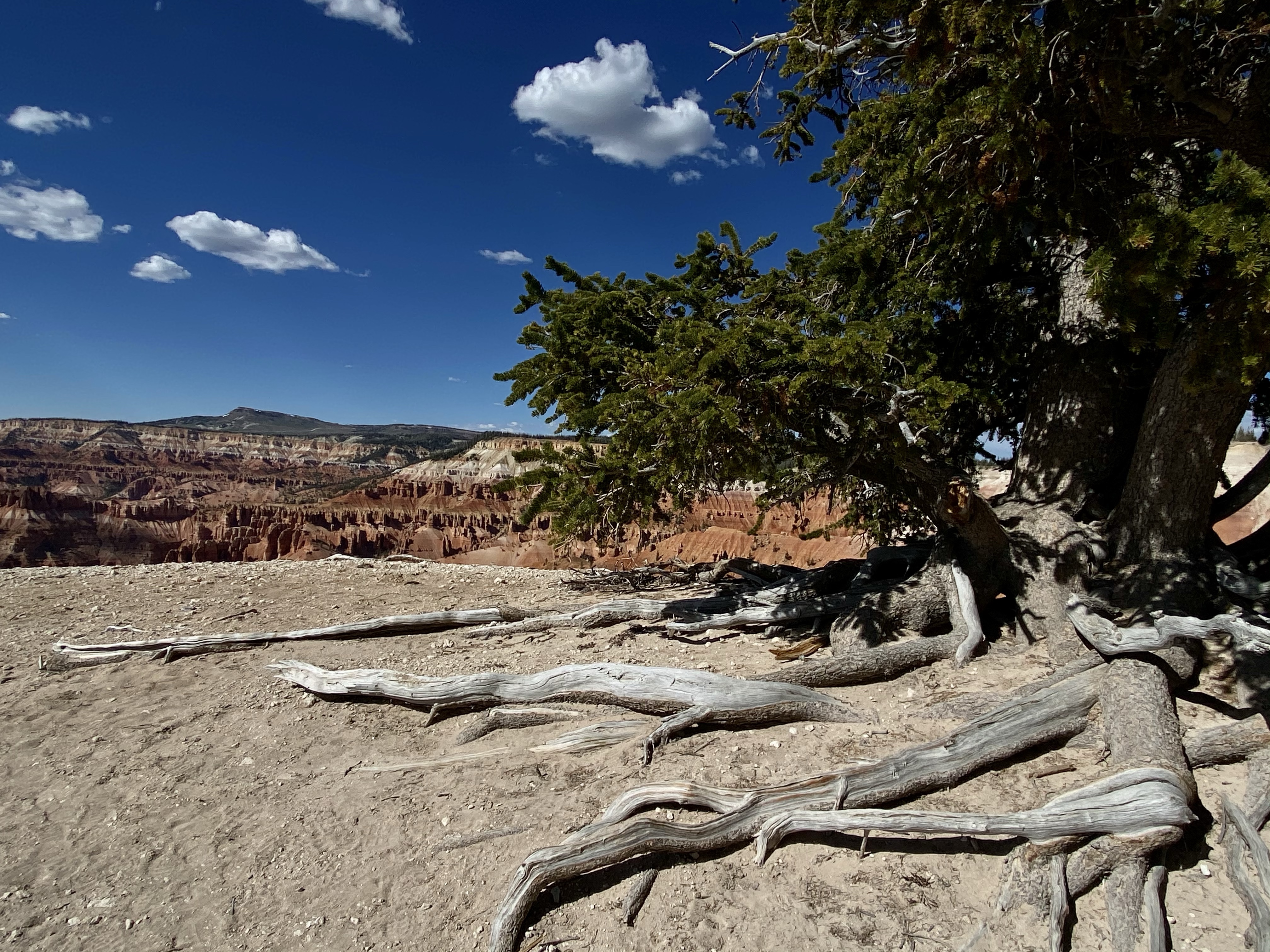
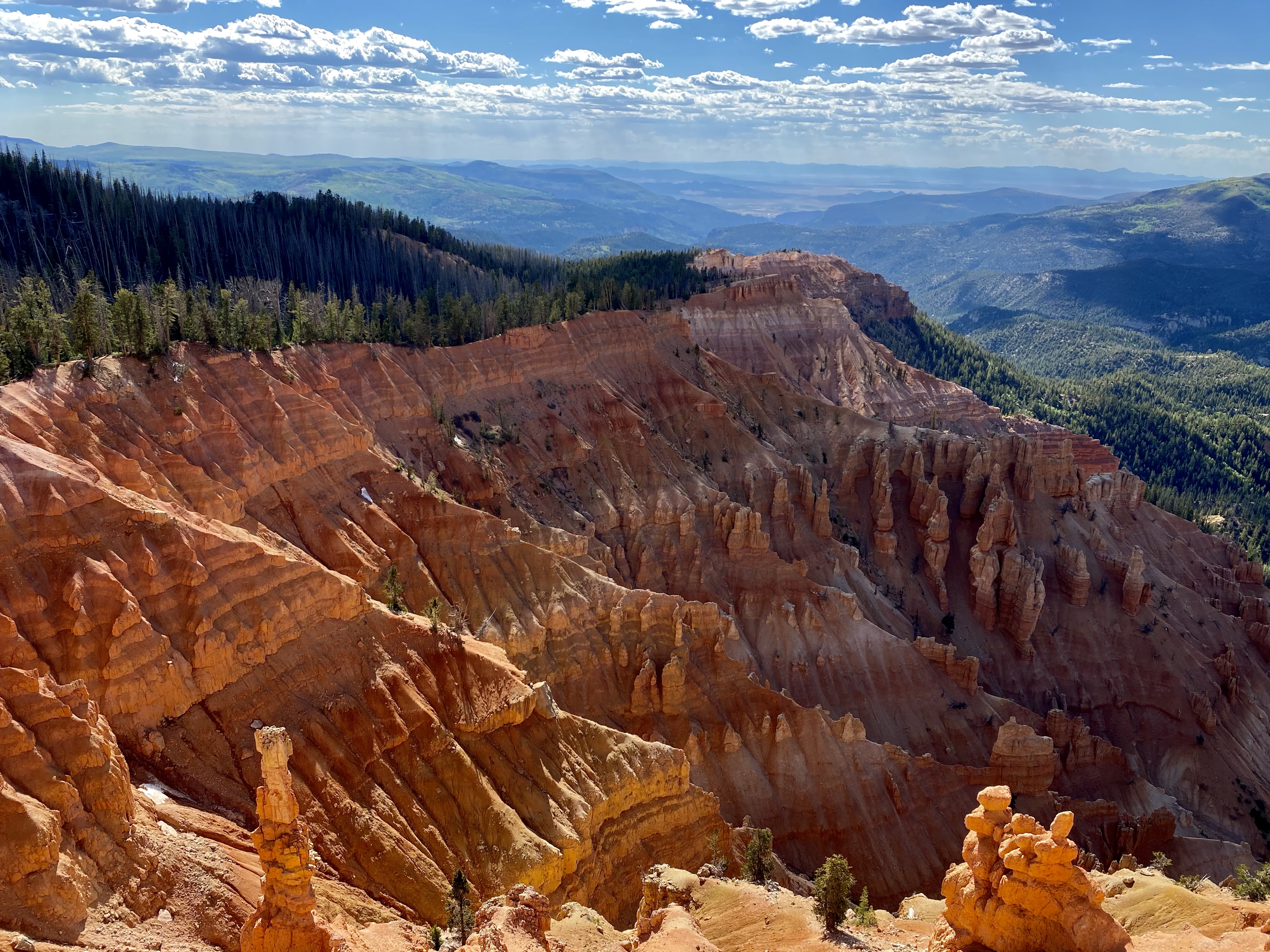
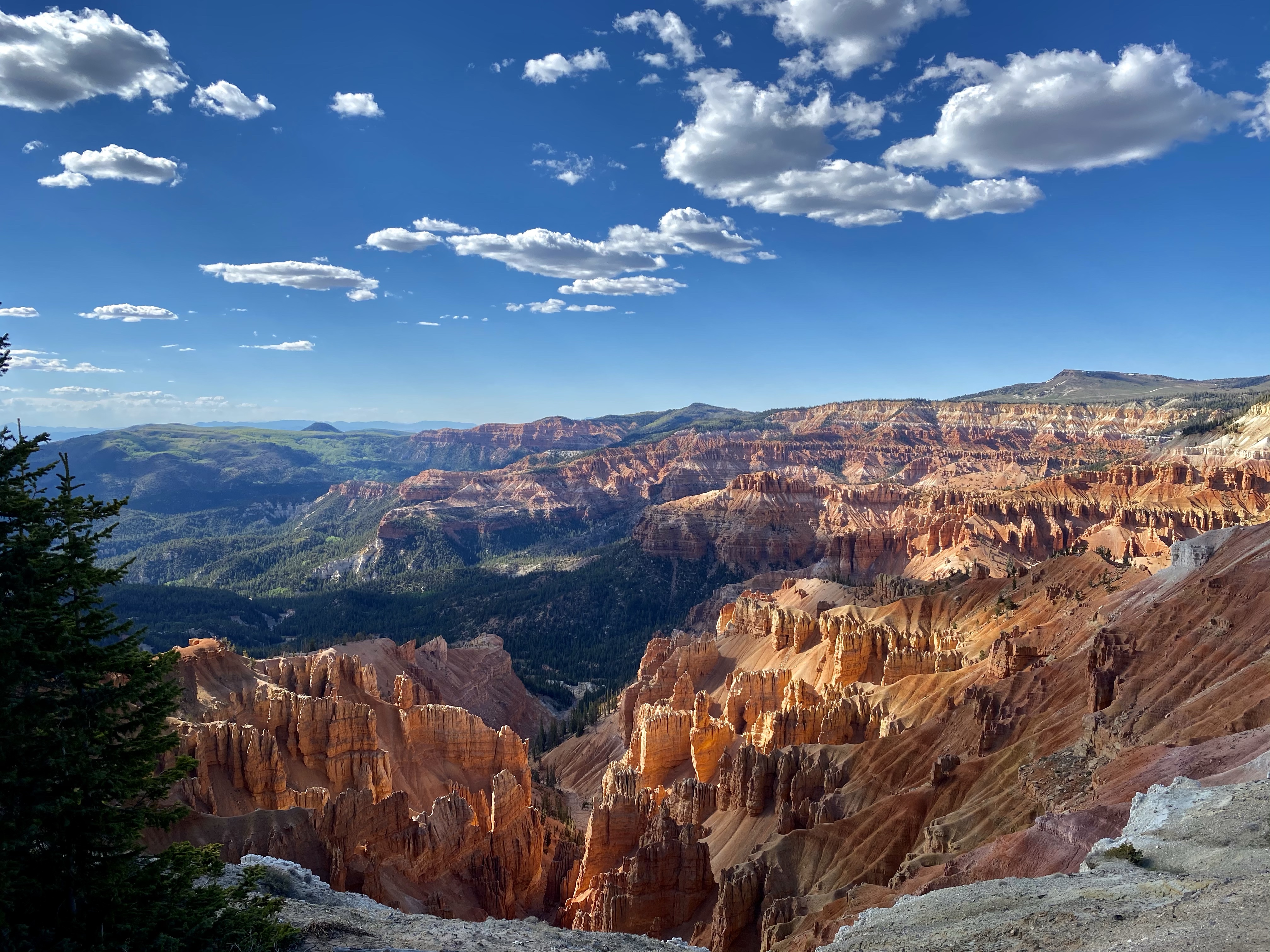
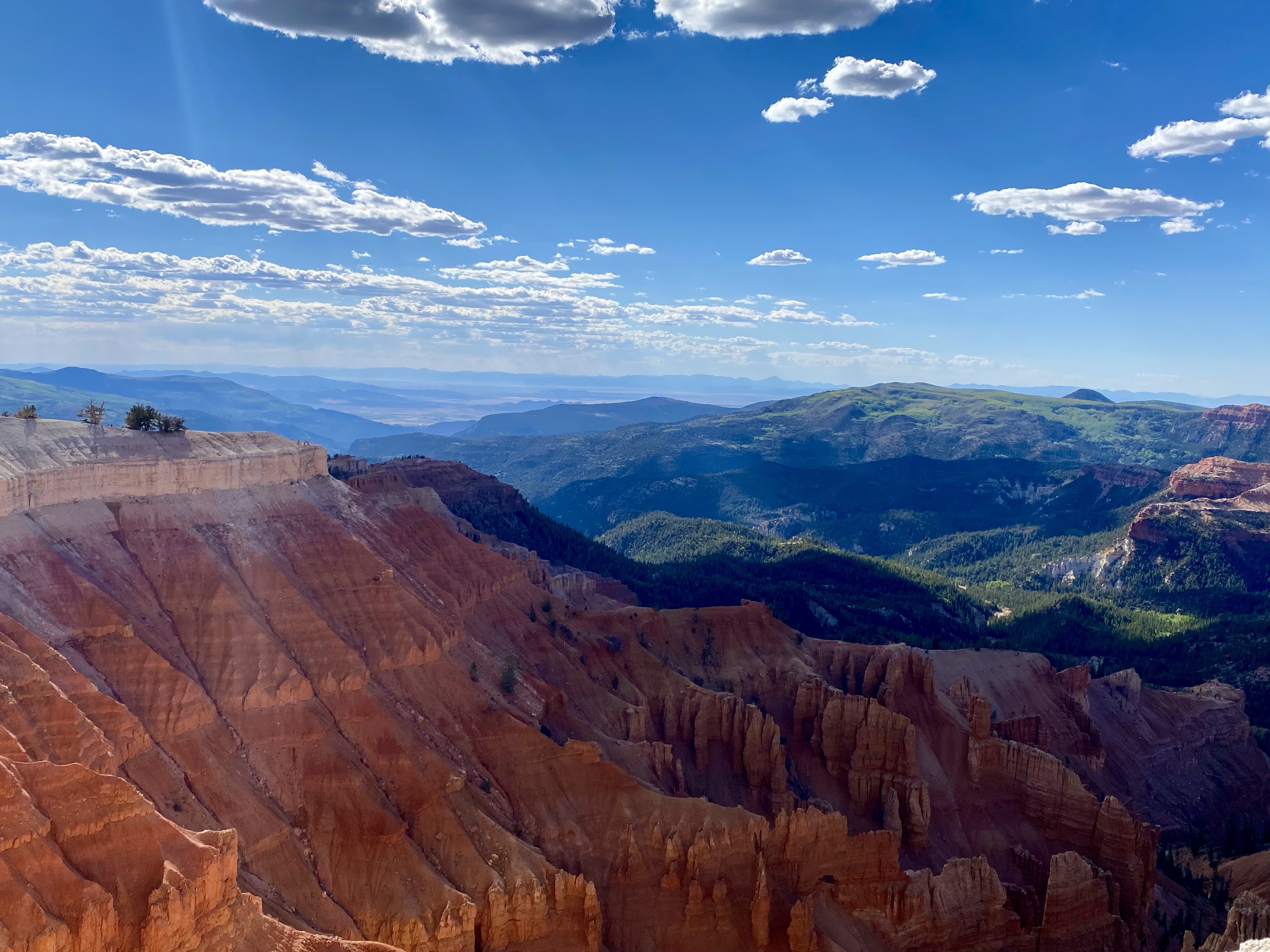
We headed out on the South Rim Trail to Spectra Viewpoint, a relatively easy walk. The sun was slowly setting, and the clouds were puffy and white, creating beautiful shadows on the red cliffs. In places the rock was painted in various hues, transitioning from white to pink to red, sometimes even a dash of yellow. As we approached the scenic viewpoint, we passed a few more magnificent Bristlecone pines, holding on tight to the rocky, sandy soil.
Out on the point, the wind whipped around, but didn’t detract from the stunning view. Glowing red in the forefront, black green in the background where the cedars took over the hills. The cliffs were eroded into various triangles, some full hoodoos down in the valley. It was hard to take your eyes off of the beauty.
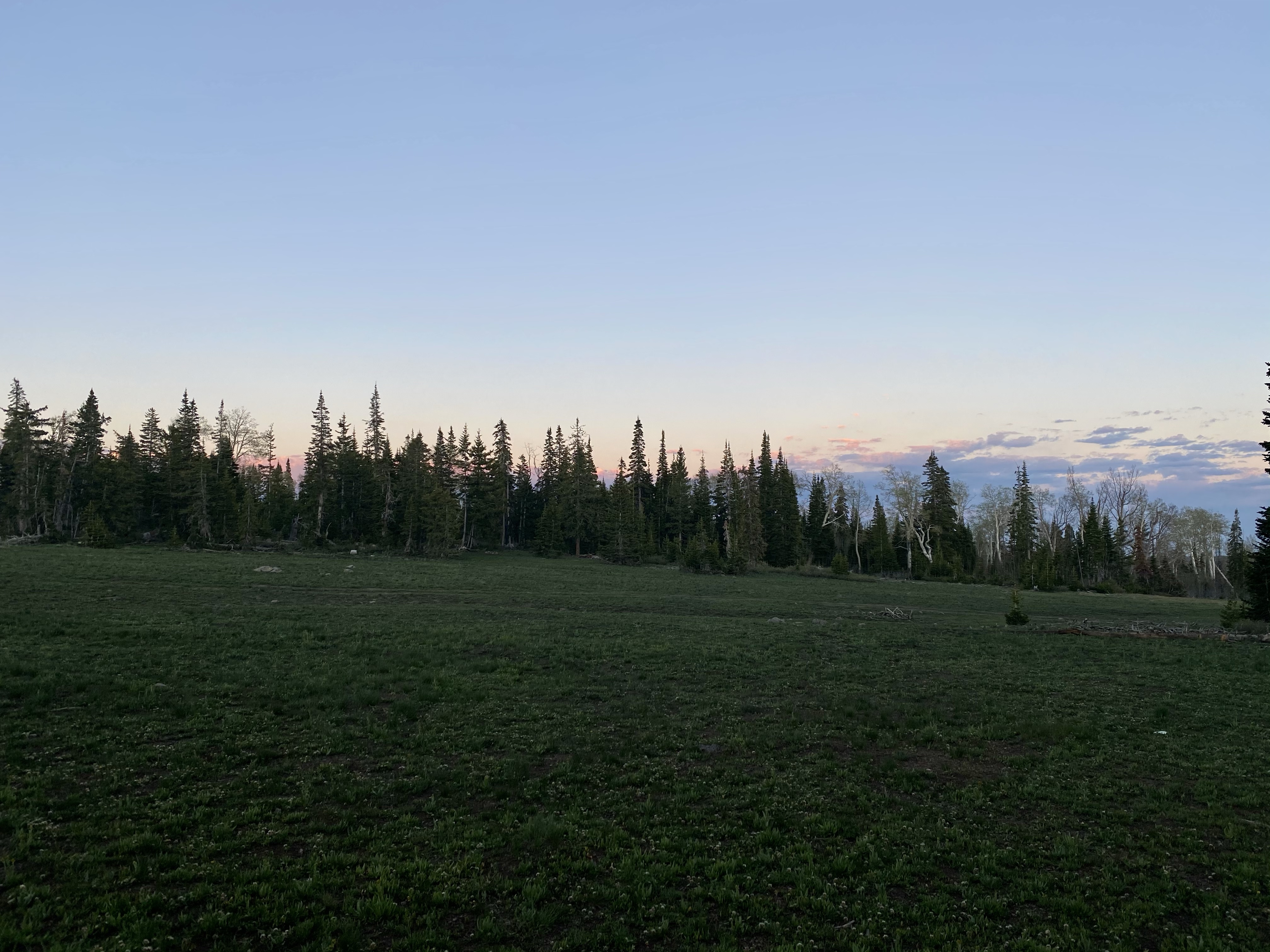
Eventually we did return to the cars, camping spots needed to be found and dinner cooked. We drove just outside the park to a dispersed camping spot in the woods, and had the place all to ourselves. We watched the sky turn pale pink over the trees, had important life chats around the fire, and enjoyed a slumber party in the van with the top popped. A great first day of our reunion.
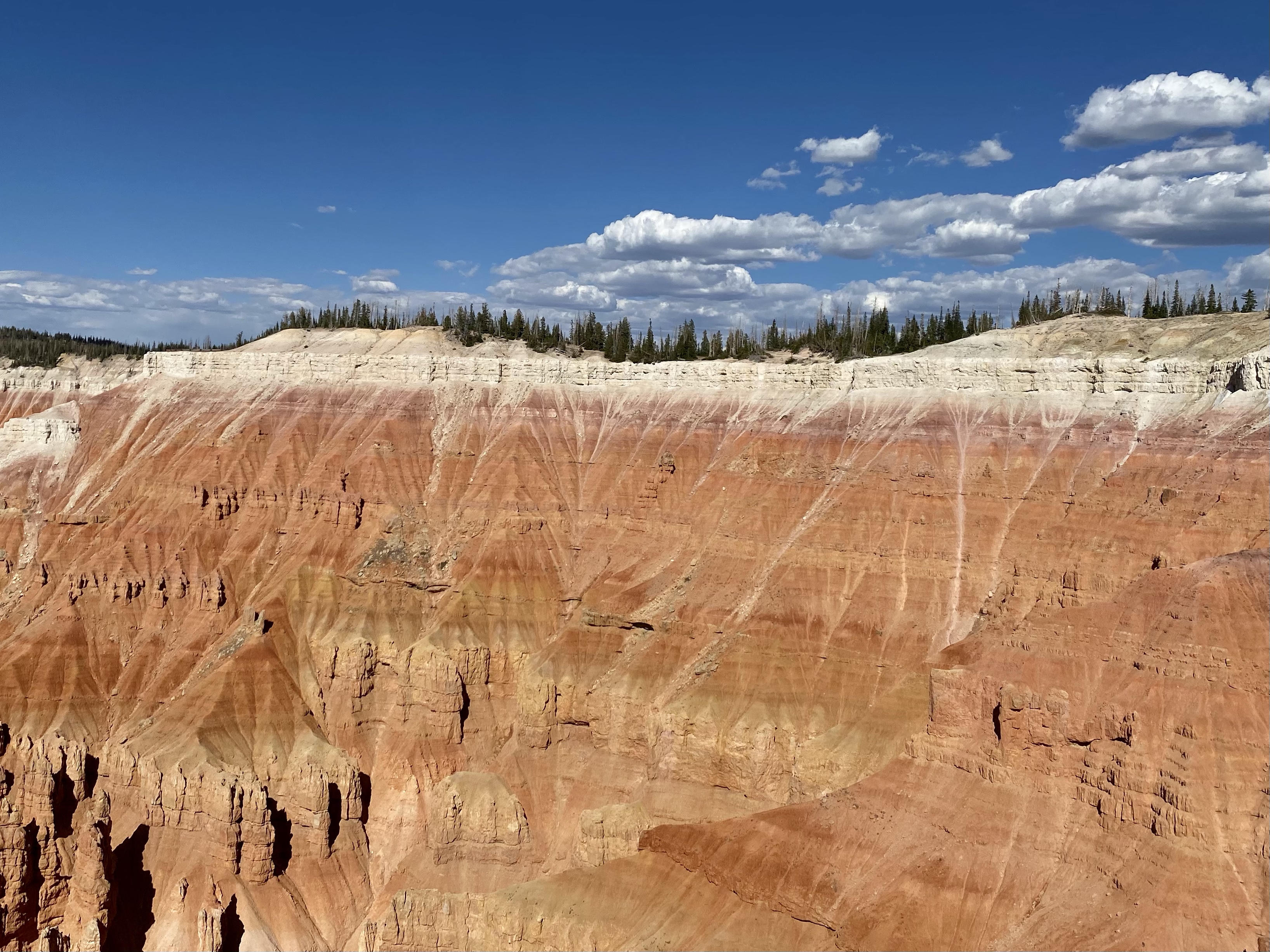
The next day our goal was to head to Southern Utah, to enjoy all Kanab had to offer, but first a few more glimpses of Cedar Breaks. We drove to several viewpoints, each more stunning than the last. I’ll never get tired of the vibrant colors Mother Nature shares with us.
When we had our fill, we hit the road going south to continue our day and adventure!
My new friend Crystal was on a route that was about to intersect with my travels again, so we made plans to caravan for a while. I should have know we’d be great, long term friends (and really, I did), when I agreed to watch her dog Max after knowing her for five seconds. Life brings people together when they need each other. Crystal and I were excited to reconnect after nearly a month apart. I can’t believe it’s been that long!
So as I left Great Basin, I headed southeast towards Cedar Breaks National Monument, entering another new state for this trip, Utah! While I didn’t have far to go, there was much to do. First the typical chores – gas, dump and fill tanks, groceries. Then, a few fun stops that I stumbled upon while investigating my road atlas. Yay for maps!
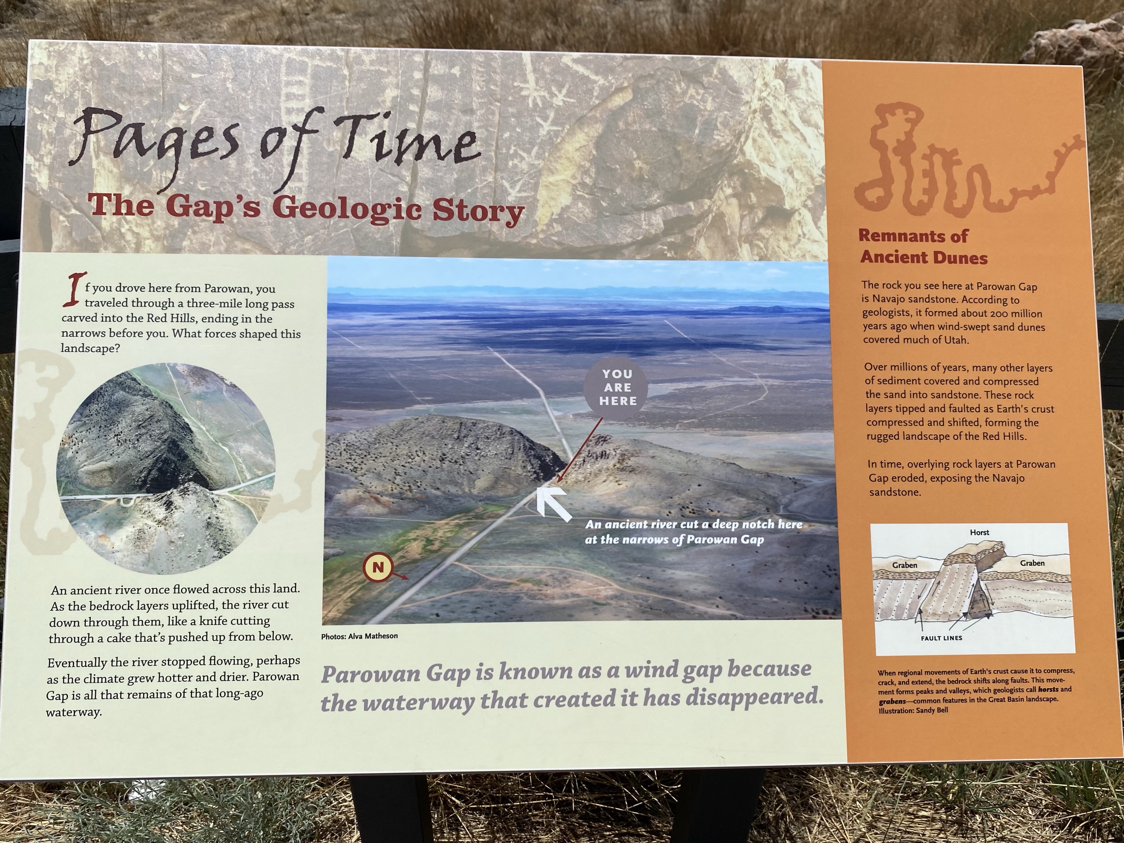
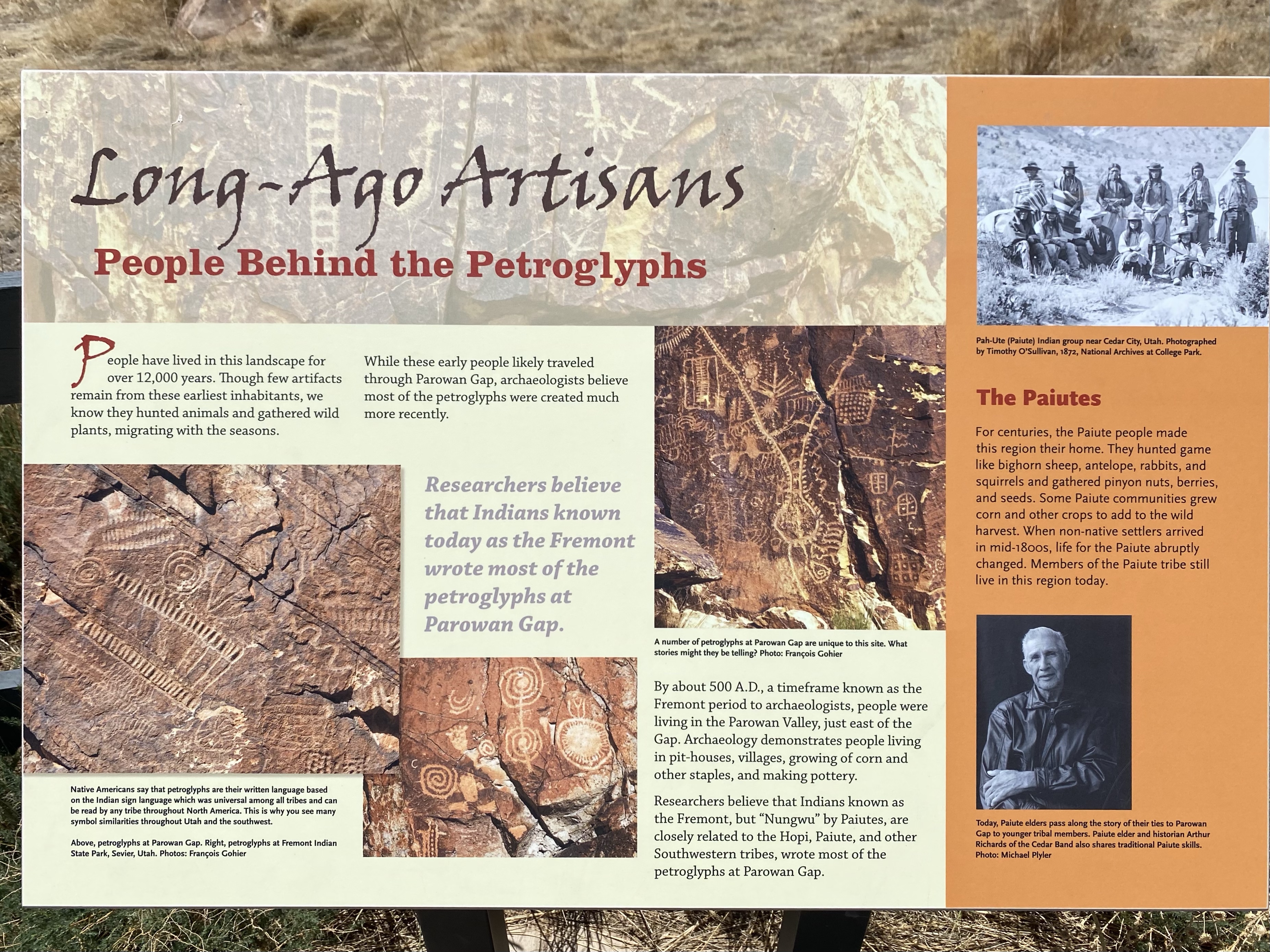
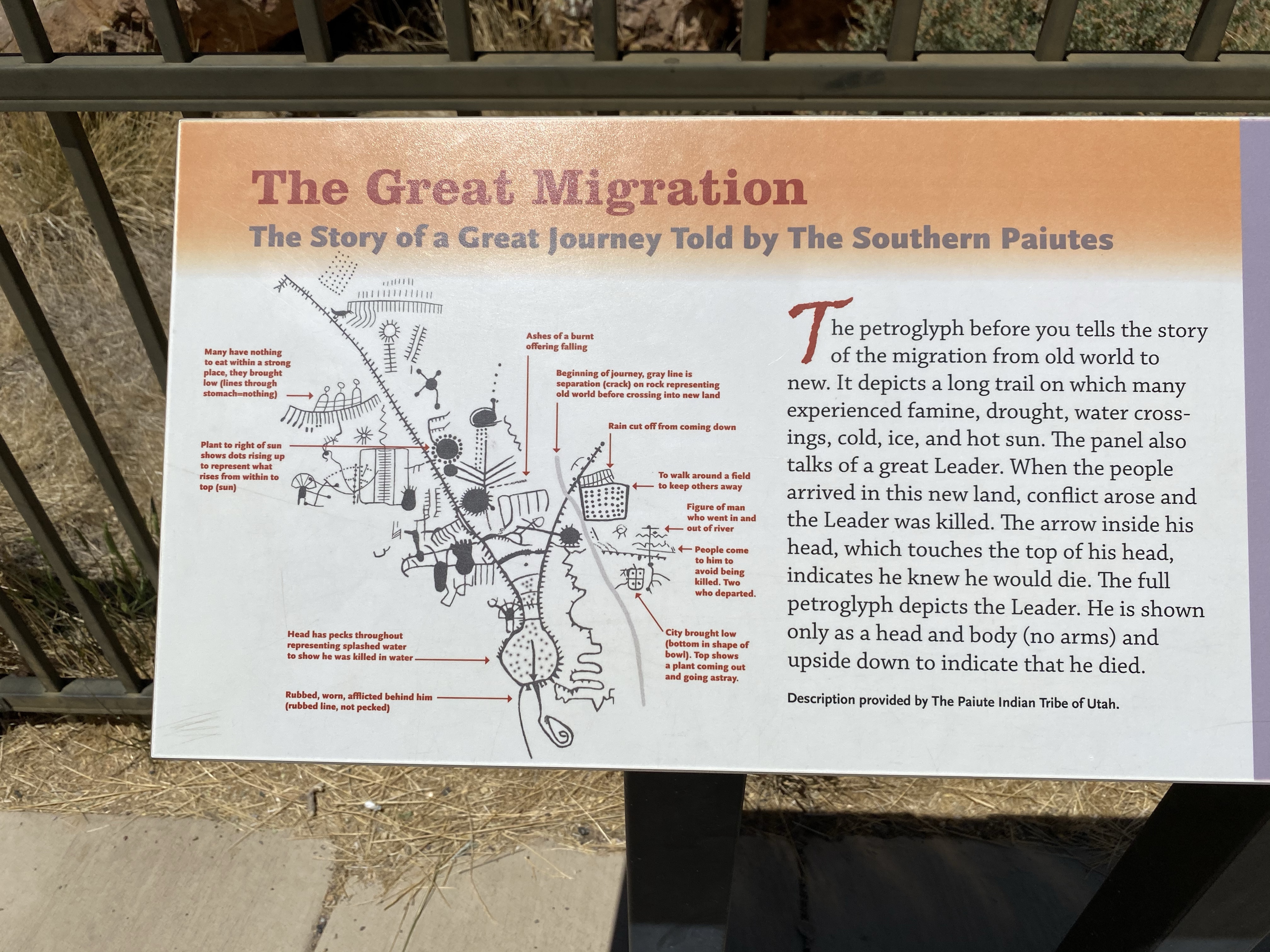
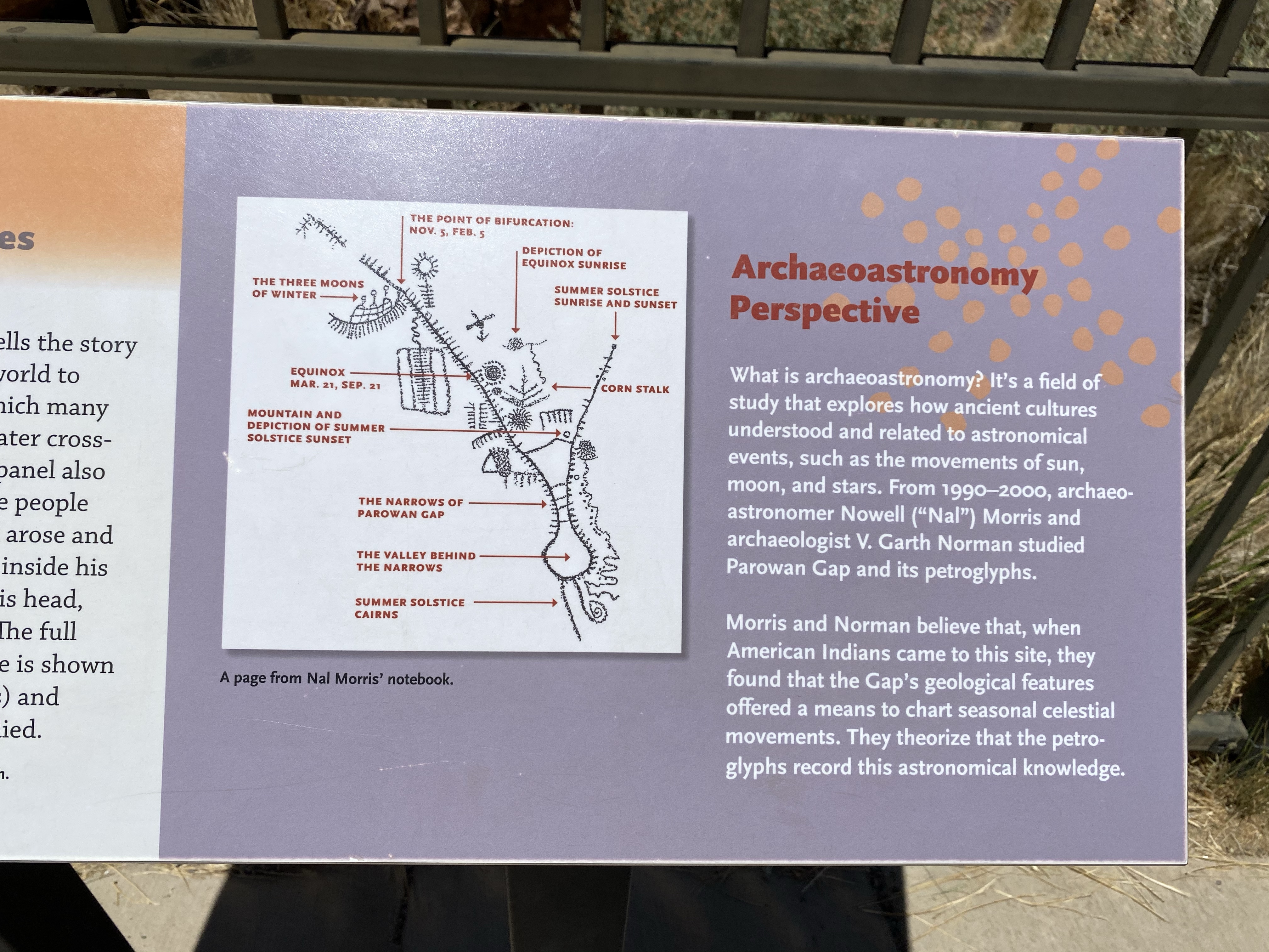
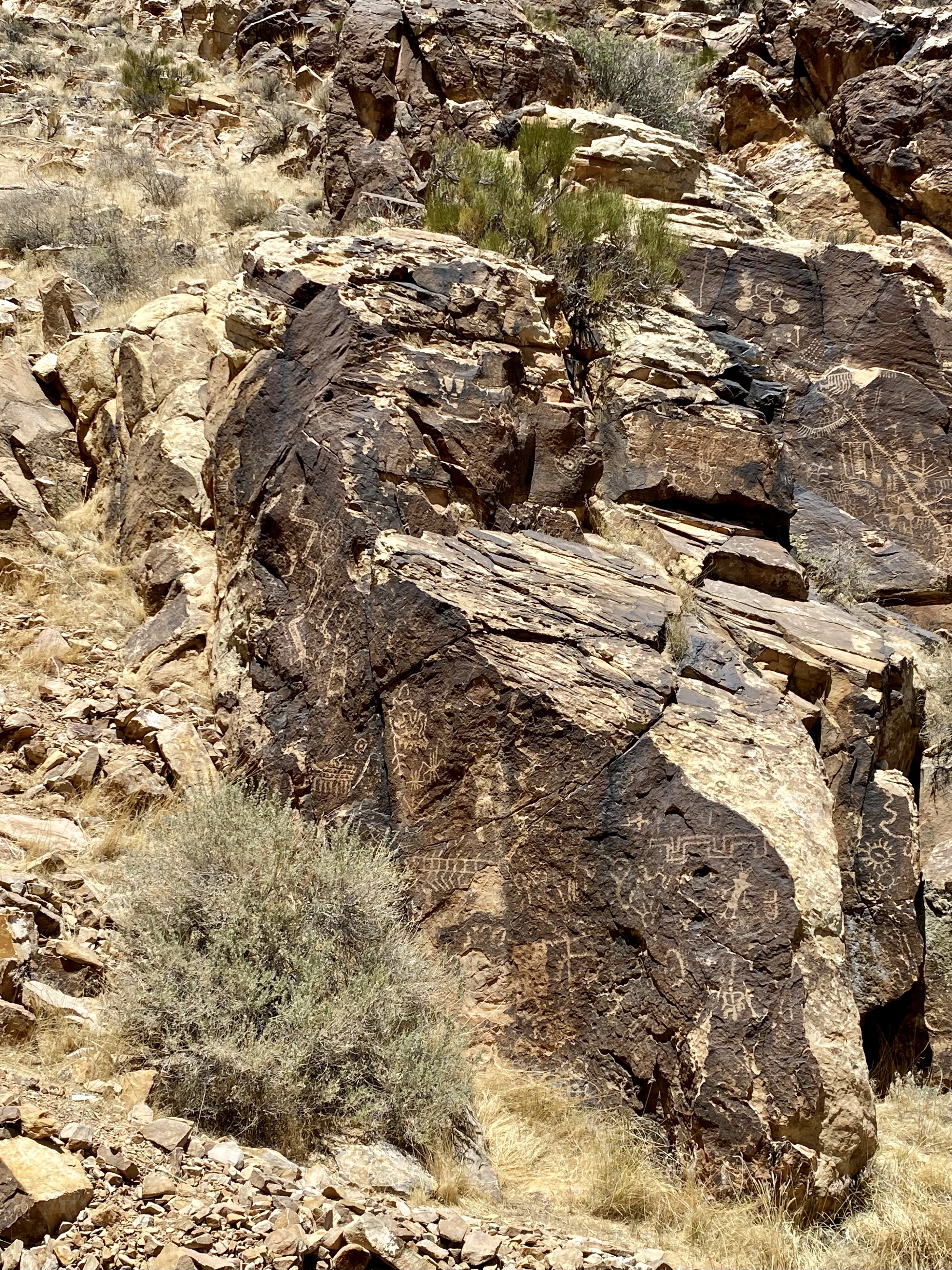
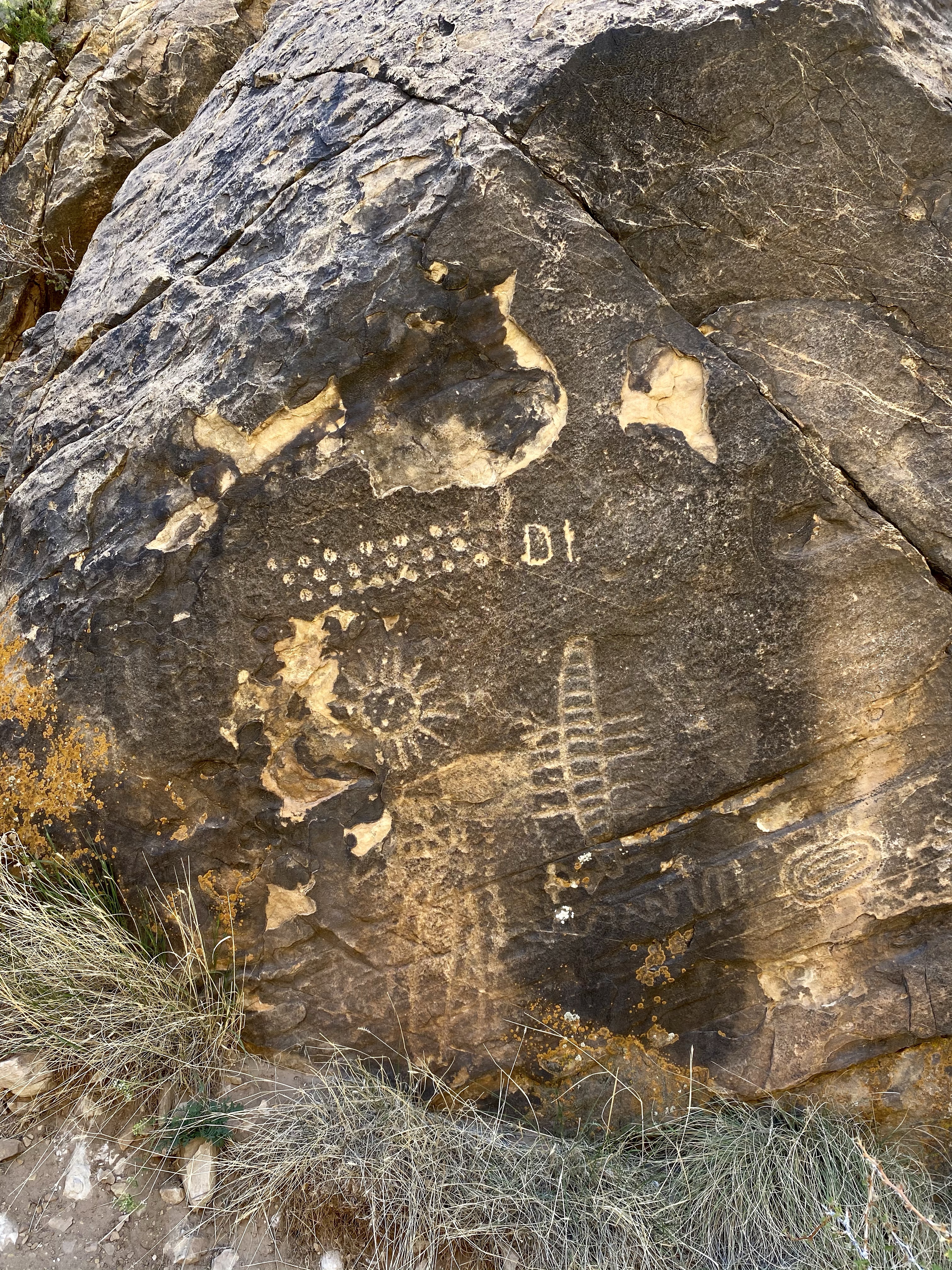
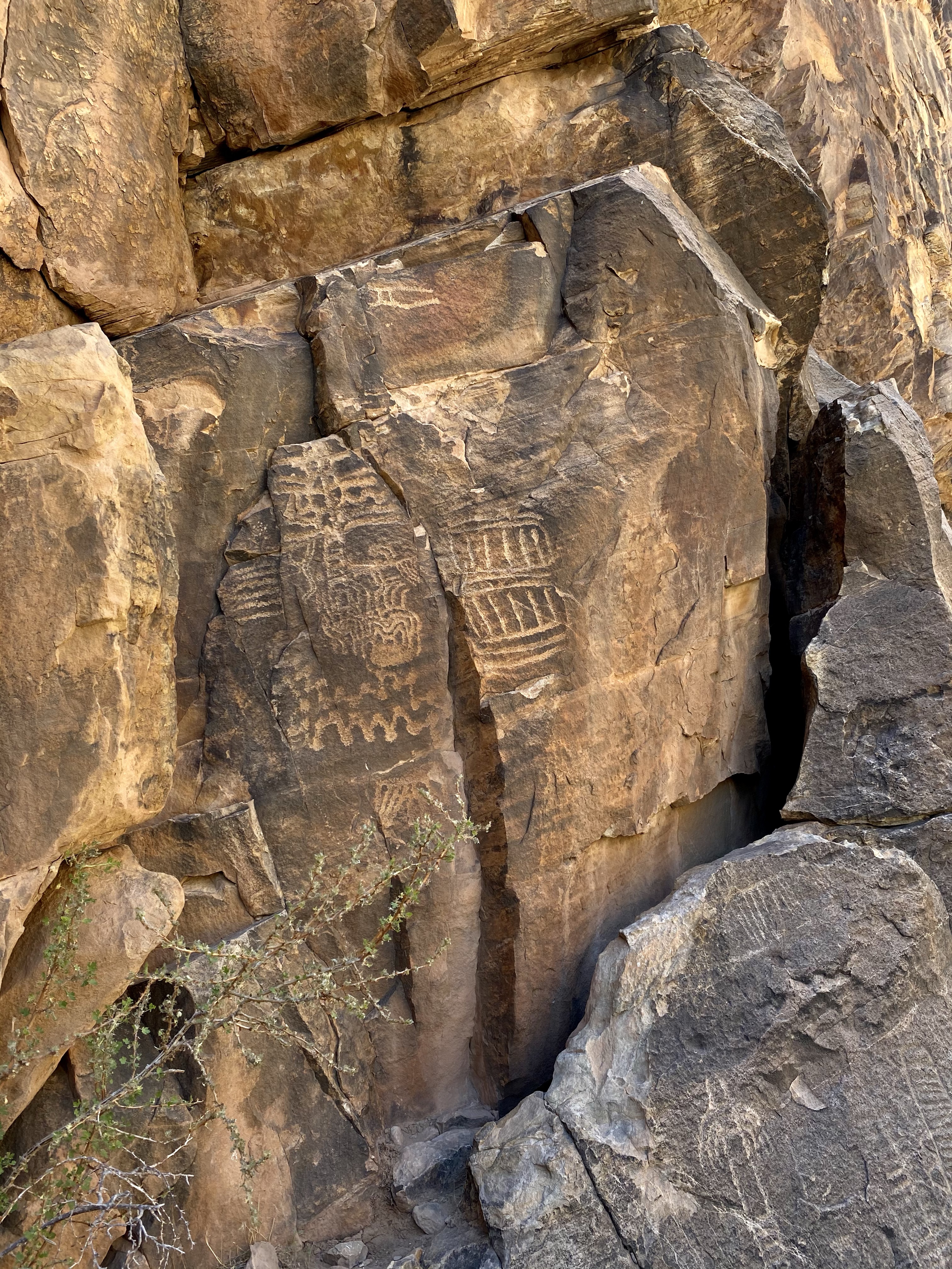
Parowan Gap Petroglyphs was my first pit stop. While only place on the national register of historic places in 1969, this sacred site has existed for thousands of years. The stories depicted on the rock are the histories of the prehistoric Fremont and Southern Paiute tribes, and with possible additional contribution from other indigenous cultures. Collaboration with the current local tribes has helped reveal possible interpretations of the petroglyphs, but their true meaning may never be known. Religion, hunting and gathering, family history, farming, and travel are among the believed story themes.
There is historic evidence that people have lived in this area for more than 12,000 years. The Fremont people were likely the first to live here, arriving around 500 A.D. Later the Paiute, Hopi, and other Southwestern tribes used this land. Many of them are probably descendants of the early Fremont tribe. Each group used this land to hunt bighorn sheep, antelope, rabbits and squirrels and grow crops like corn. They also foraged from the local landscape, using pinyon nuts, berries, and seeds for a variety of purposes. The Paiute people lived peacefully here until Mormon settlers arrived in the 1800s and invaded their land.
Current Paiute elders keep the history of their people alive, sharing how this area was once lush and green, providing fertile soil. The tribes traveled through the gap in various seasons and make home here when appropriate. Parowan Gap is a sacred site to the Paiute, and also to the Hopi. Each set of petroglyphs tells a different chapter in the past of these people. Specifically for the Hopi people, this site is also where they entered a sacred agreement with Maasaw, the Earth Guardian, and promised to care for and respect the land.
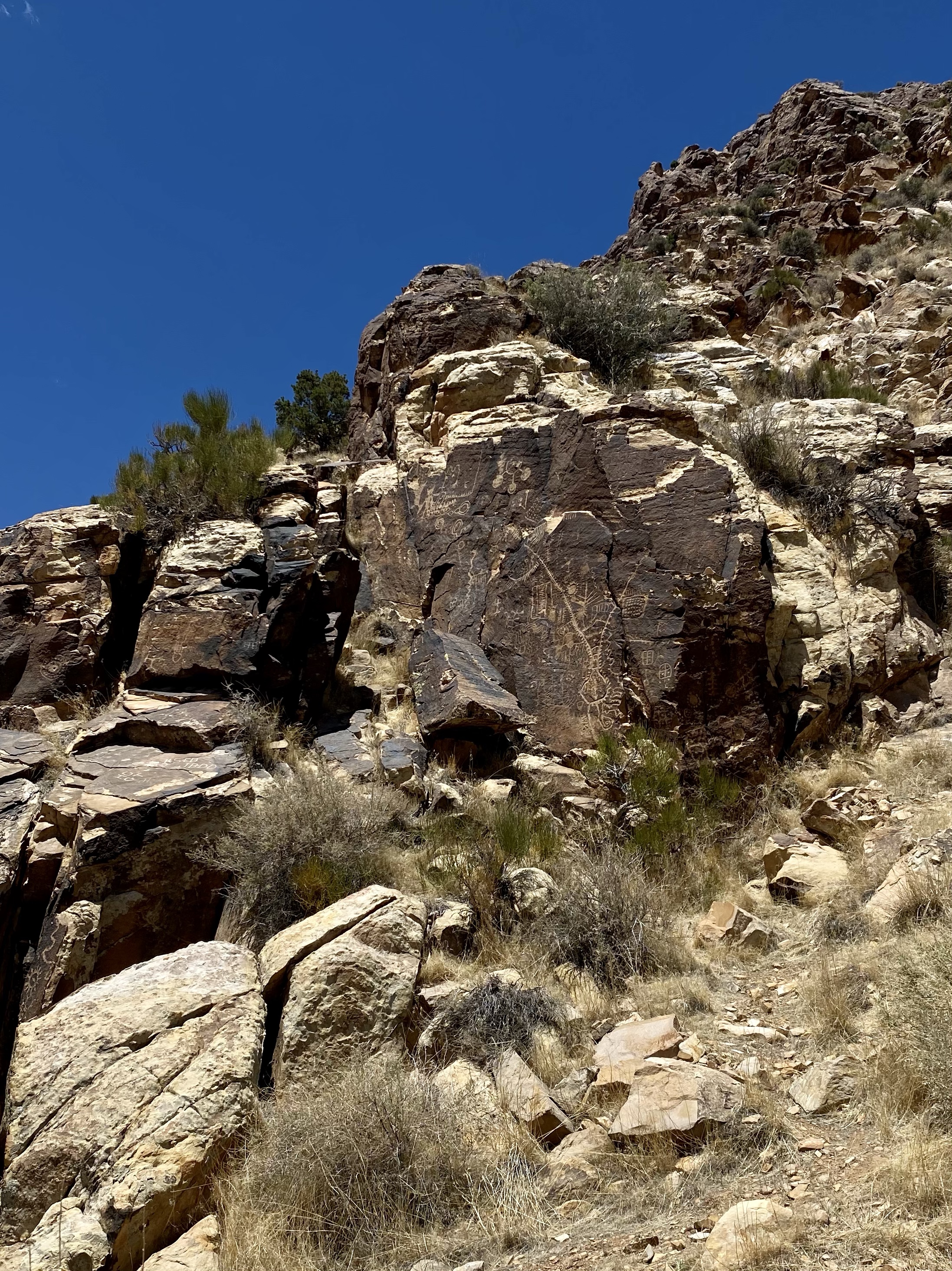
As you walk along, the delicate symbols are etched into the stone. Some are at eye level, other high up the rocky mound. Some you can get close to, but you must be careful not to touch. They are fragile and should be respected. There is some evidence of graffiti, other visitors thinking it fun to leave their mark. Or old, but still newer, initials from the white people who took over the valley. Fortunately, before too much damage was done, many recognized the importance and sacredness of this place and sought to protect it. Hopefully there will be protectors so we can all continue to benefit and learn from these cultural artifacts. Walking among history was very powerful and humbling.
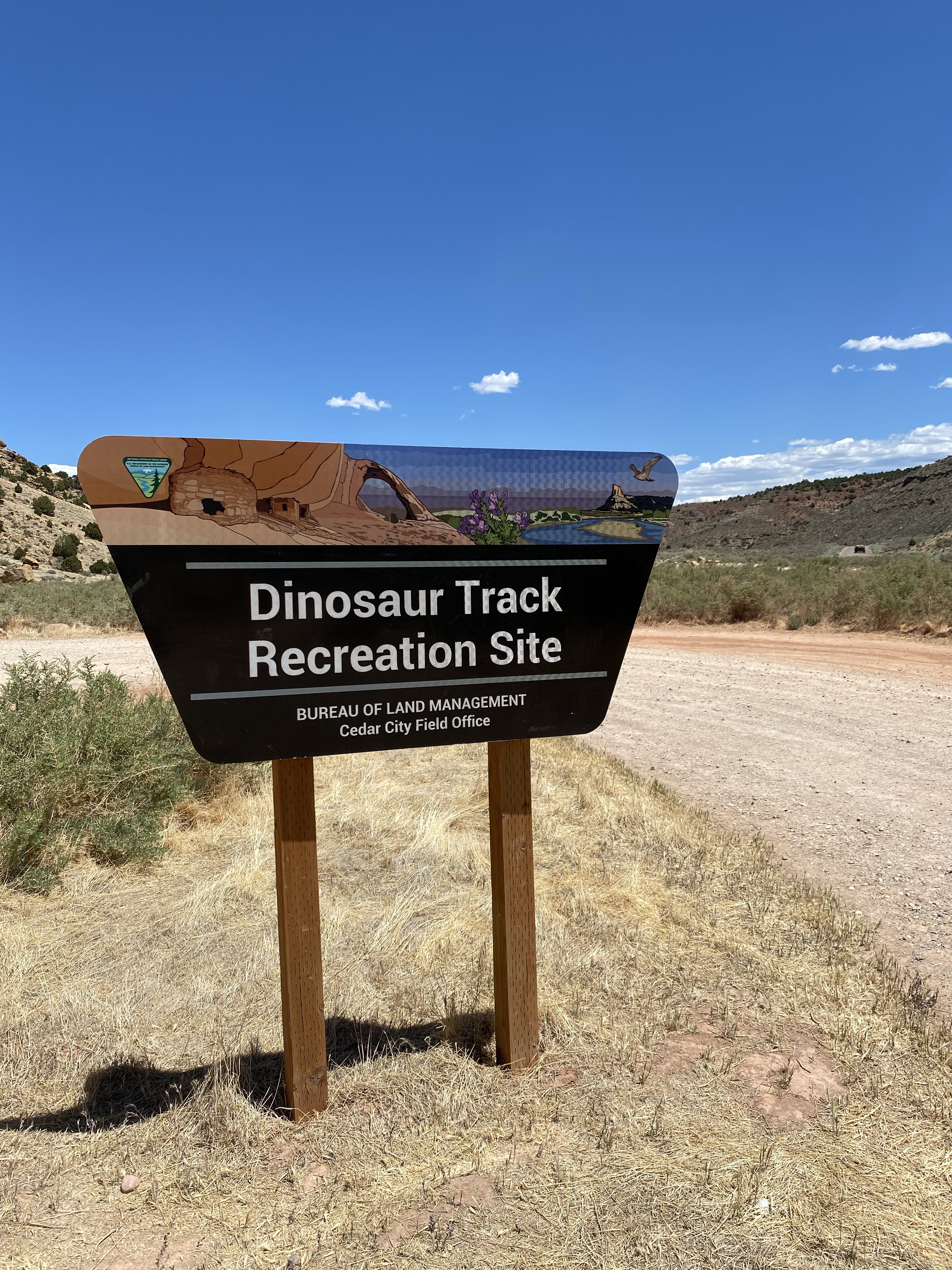
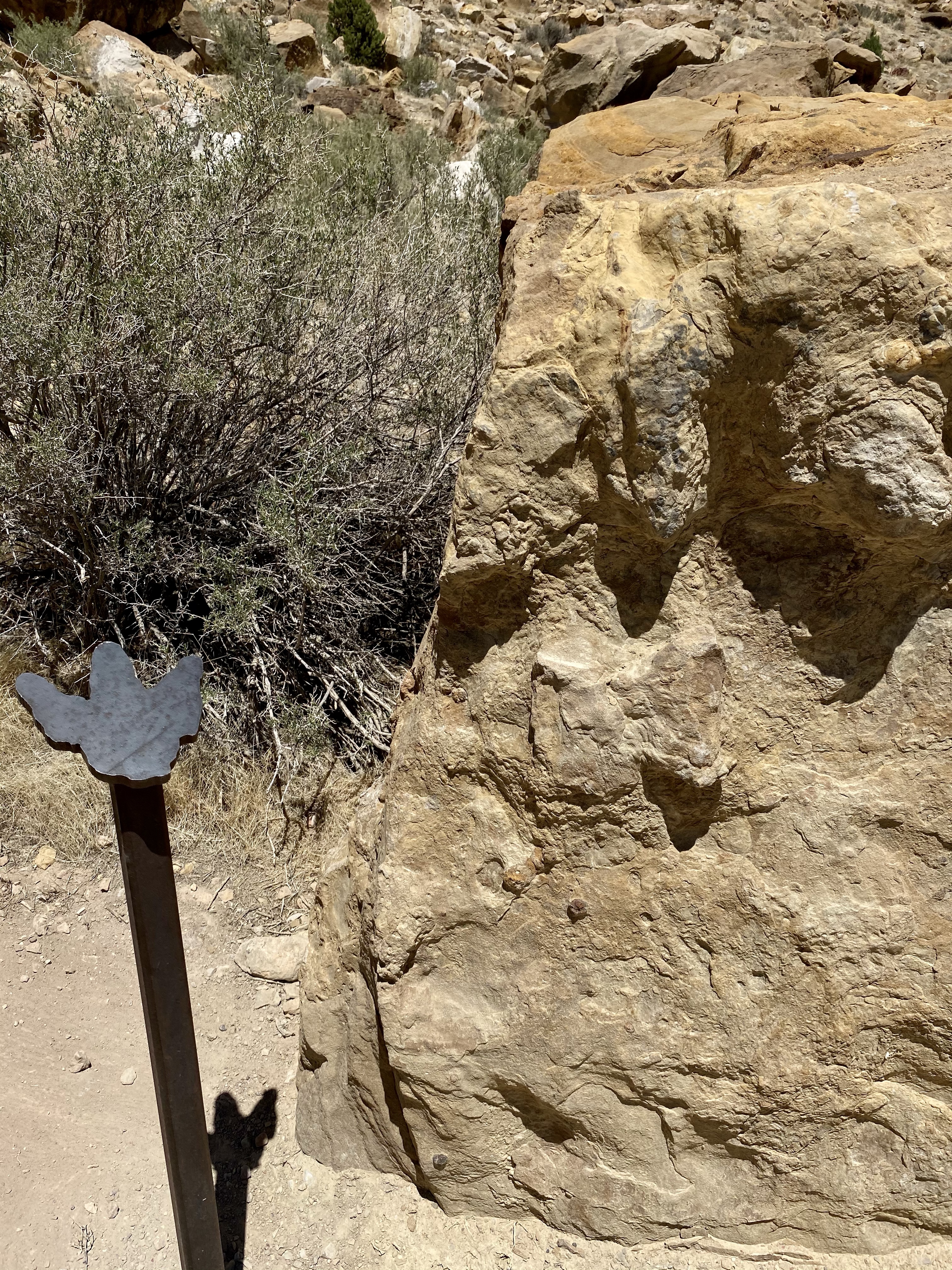
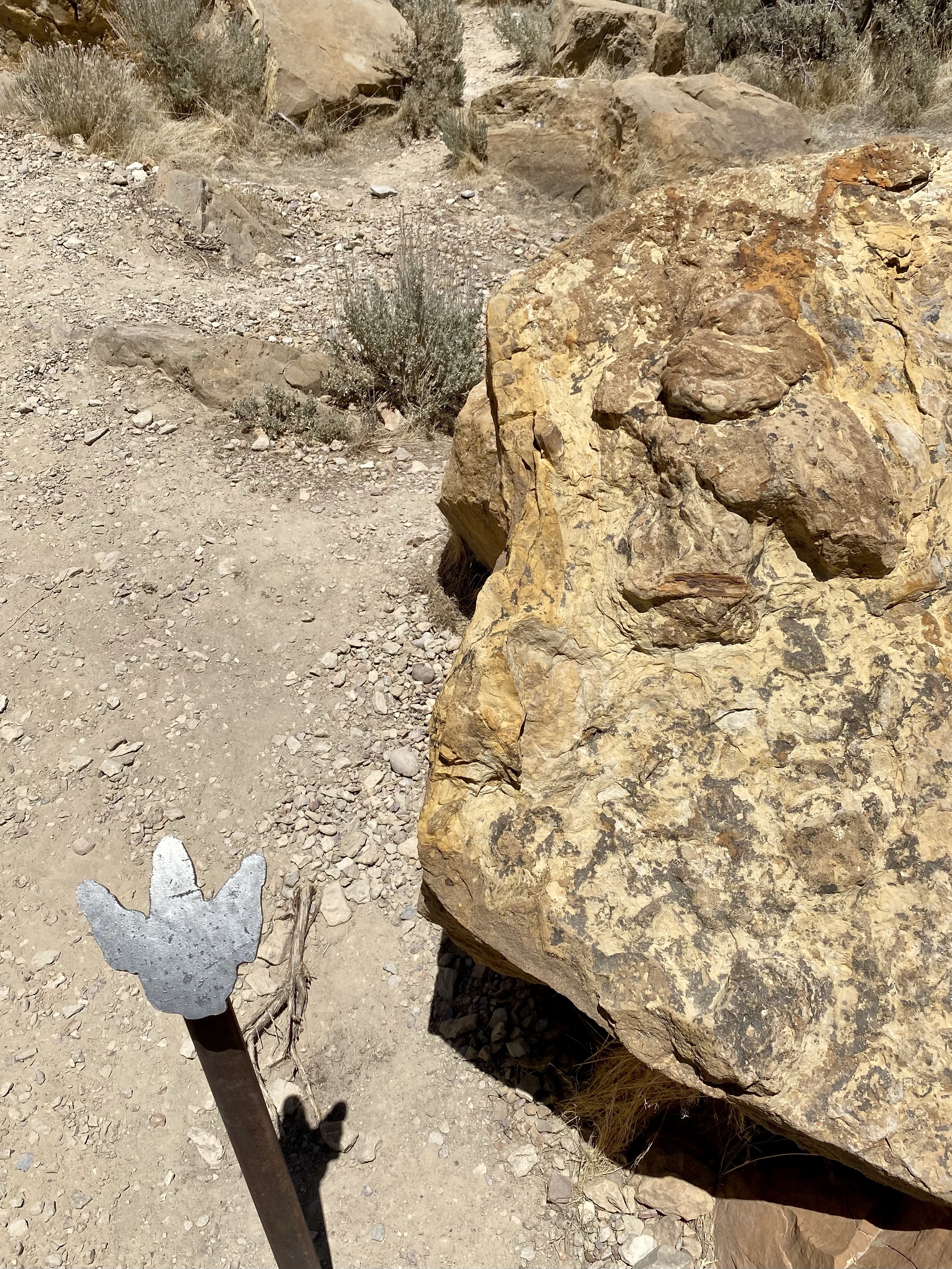
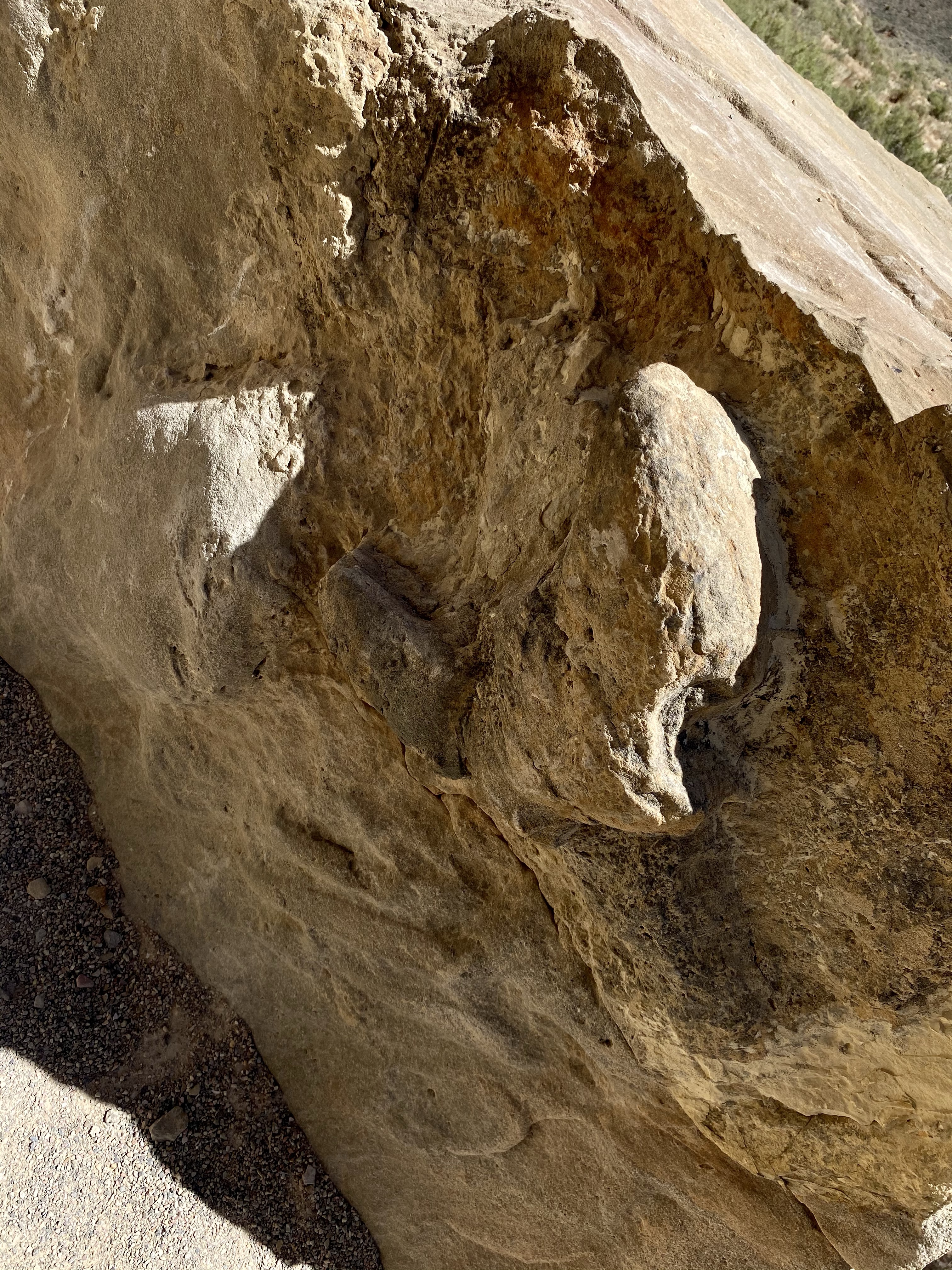
After I learned from the native heritage, I headed down the road to the preserved dinosaur footprints. A short path allowed me to walk where the extinct creatures once stood. I hunted for their fossilized steps, some difficult to identify because weathering and erosion has taken its toll. Every now and then though I spotted the raised impression, on the side of a rock or a hole in the ground. To know I was stepping where dinosaurs once stepped was very cool.
A lizard captured my attention as I walked. Then a skinny snake startled me as it climbed a bush and slithered through. A few cacti stood still for a photo. Then I was off again, ready to meet Crystal at Cedar Breaks!
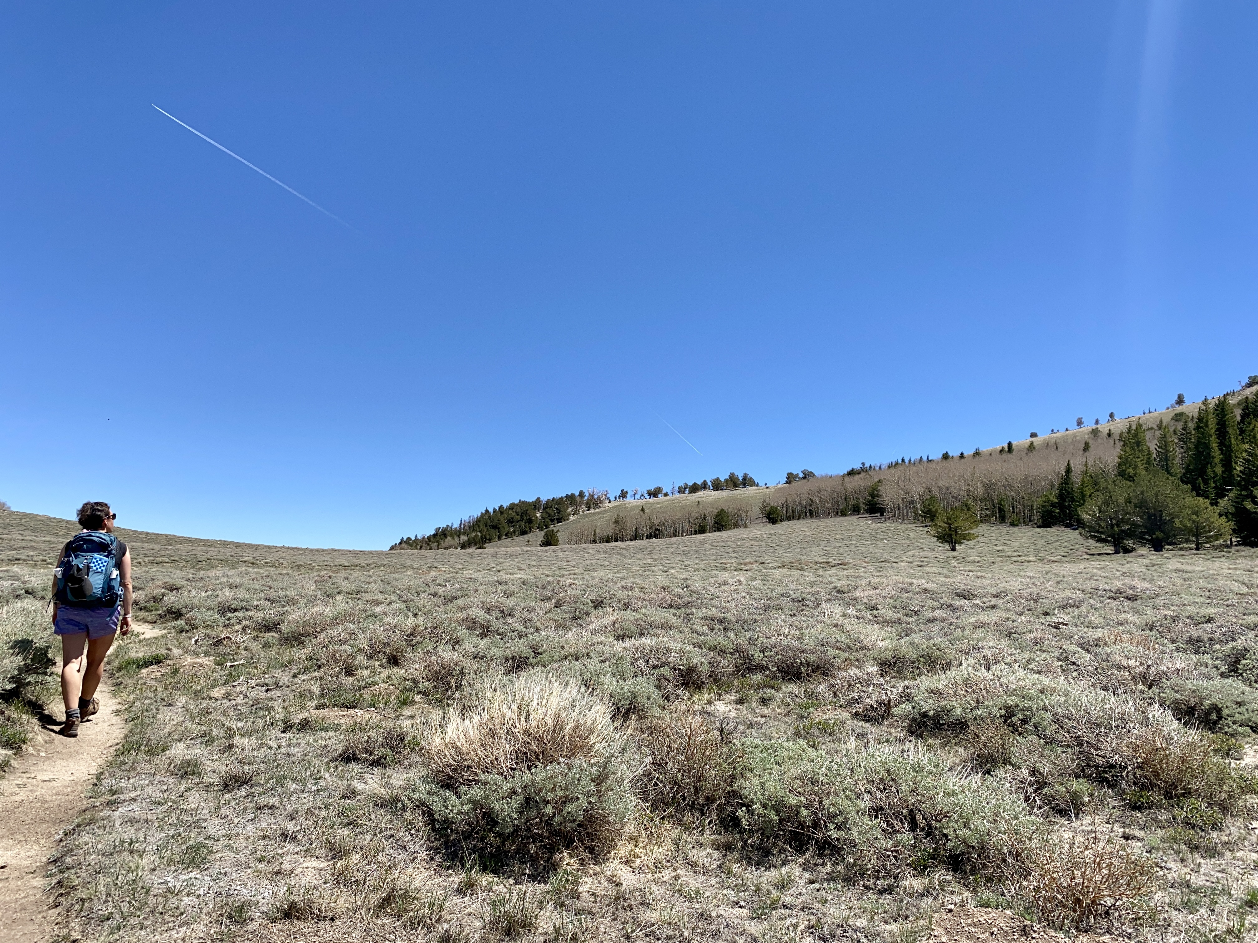
My second day at Great Basin, I took advantage of hiking right from the campground. Sunny stayed parked, resting, while I hit the trail. A short walk to the back of the campground, then along the creek and meadow, brought me to South Fork Baker and Timber Creek trails. Planning for a loop, I headed up Timber Creek first.
A narrow dirt path brought me through the woods to alpine meadow. A rainbow of green greeted me, gray green sage brush, deep forest pine, vibrant grass, lime aspen leaves. A gentle breeze made the tiny leave dance, shimmying in the sunlight. Heaven.
Soon the path reentered the woods, and canopy providing shade for my walk. And soon the trail began to climb. And climb. And climb. A series of steep switchbacks caught me off guard and carried me higher and higher across the terrain. Every time I thought I was done, another rise around the bend. I guess I choose the difficult direction for my loop hike!
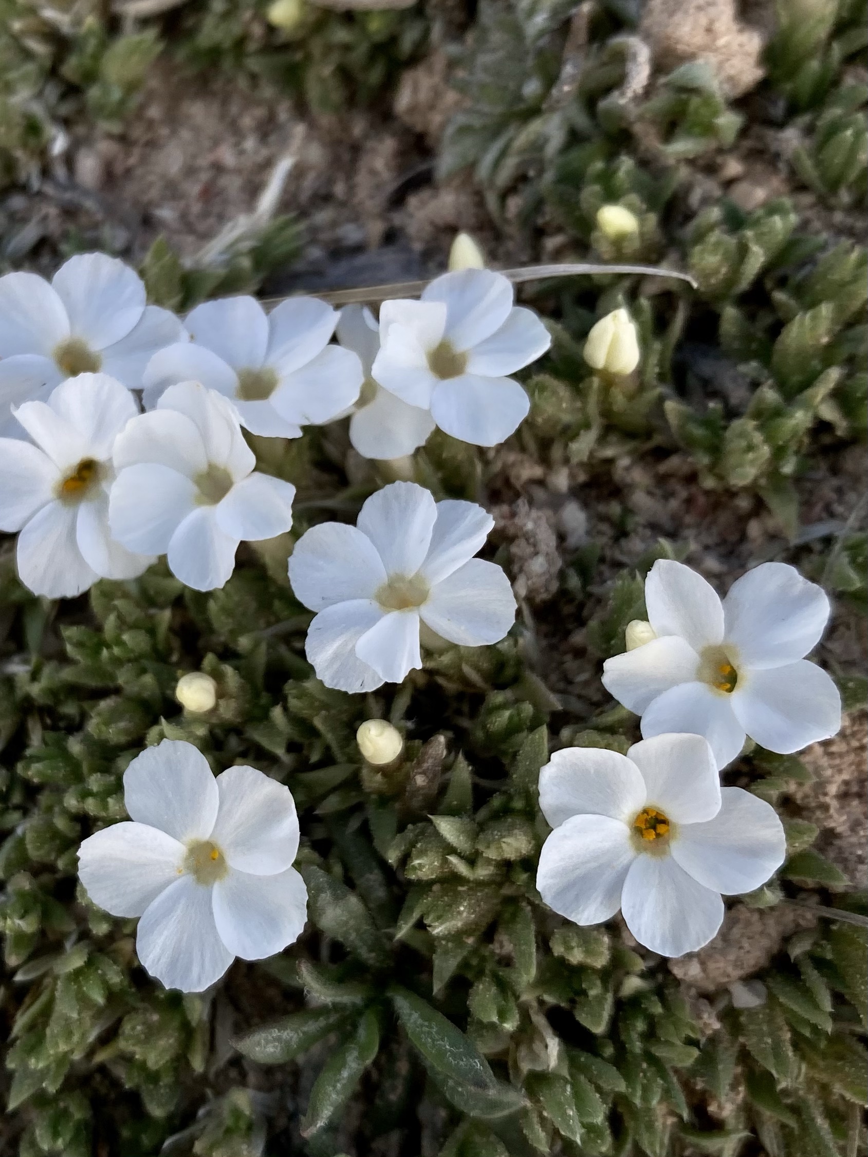
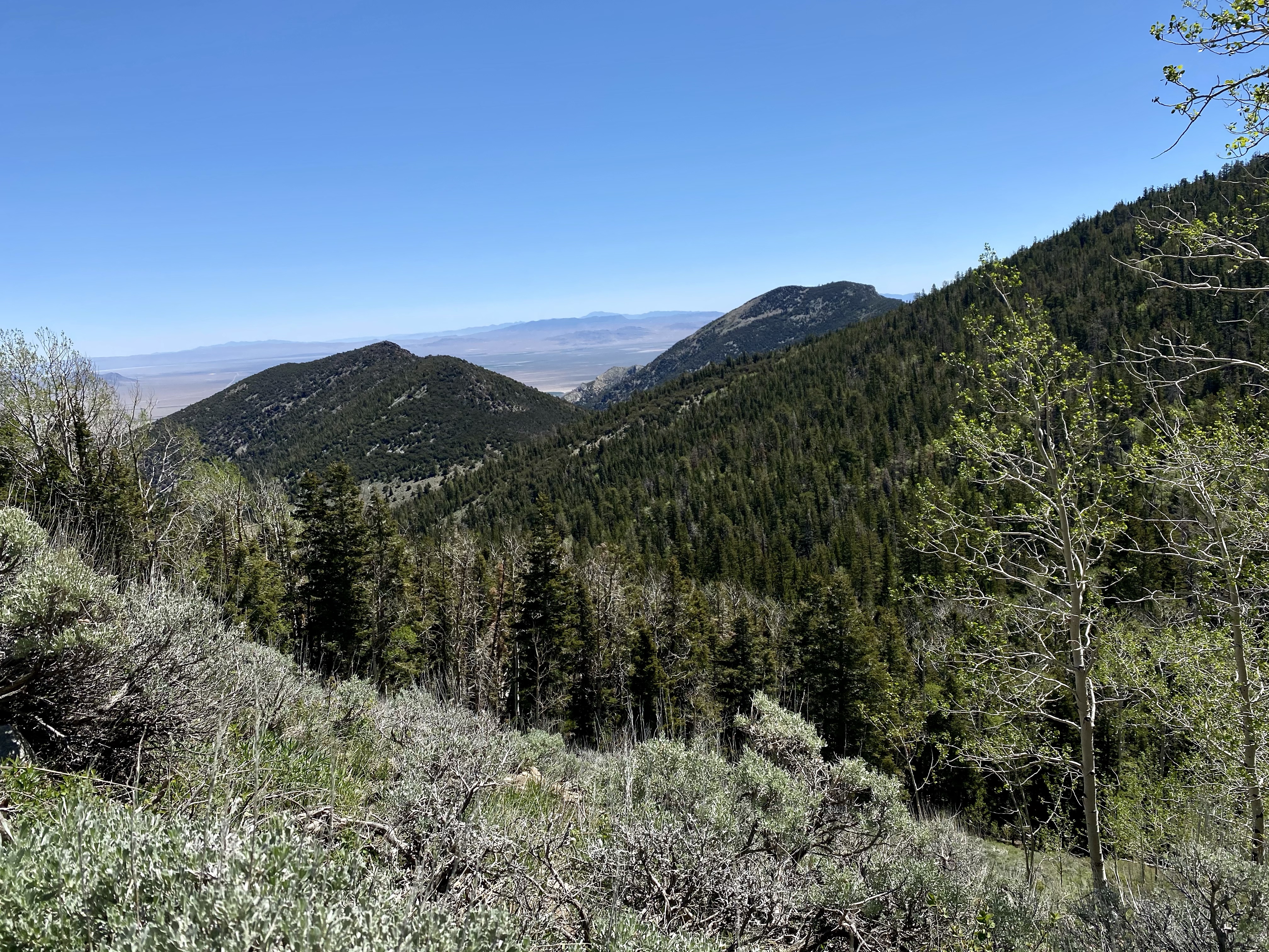
The need to pause to catch my breath allowed me to enjoy the view though. Each switchback offered a better view of the Nevada mountains in the distance, a beautiful contrast to the meadow before me. Tiny wildflowers dotted the sides of the trail too, providing more excuses to stop and rest.
Then the trail entered the forest for a long time. No views other than the trees towering above me. The dirt path now wide, but still climbing. I really can’t complain though, I had the whole place to myself.
Just when I was about to quit, the trail existed the forest and entered another magnificent alpine meadow. Now at nearly 9,000 feet high, the sun was warm but the temperatures still comfortable. Piñons and Junipers were scattered about, White fir, Douglas fir, and ponderosa pine became more plentiful. The dramatic changes in elevation allow Great Basin to be home to five distinct growth zones. How cool is that?
Alone in the meadow, I tried to capture the beauty of the mountains and meadow. Two sharp contrasts to each other. I staged my own photo shoot with my timer, which mostly went well. Minus the multiple times my phone fell off the pole where it was carefully balanced when a gentle breeze passed through. Haha. I captured as many pictures of my backpack, the ground, and the pole as I did myself. And it was fun.
As I continued, the trail connected to the South Fork Barker Trail and I began to loop back. The mountain views larger disappeared and much of the trail from here forward was forested, but I walked along the creek and the running water was relaxing. I spotted my first fellow hikers then, about 4 miles from my start. But they turned back and stayed ahead of me, so I continued to enjoy solitude on the final stretches.
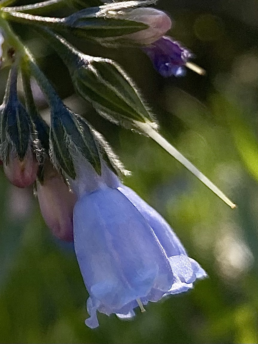
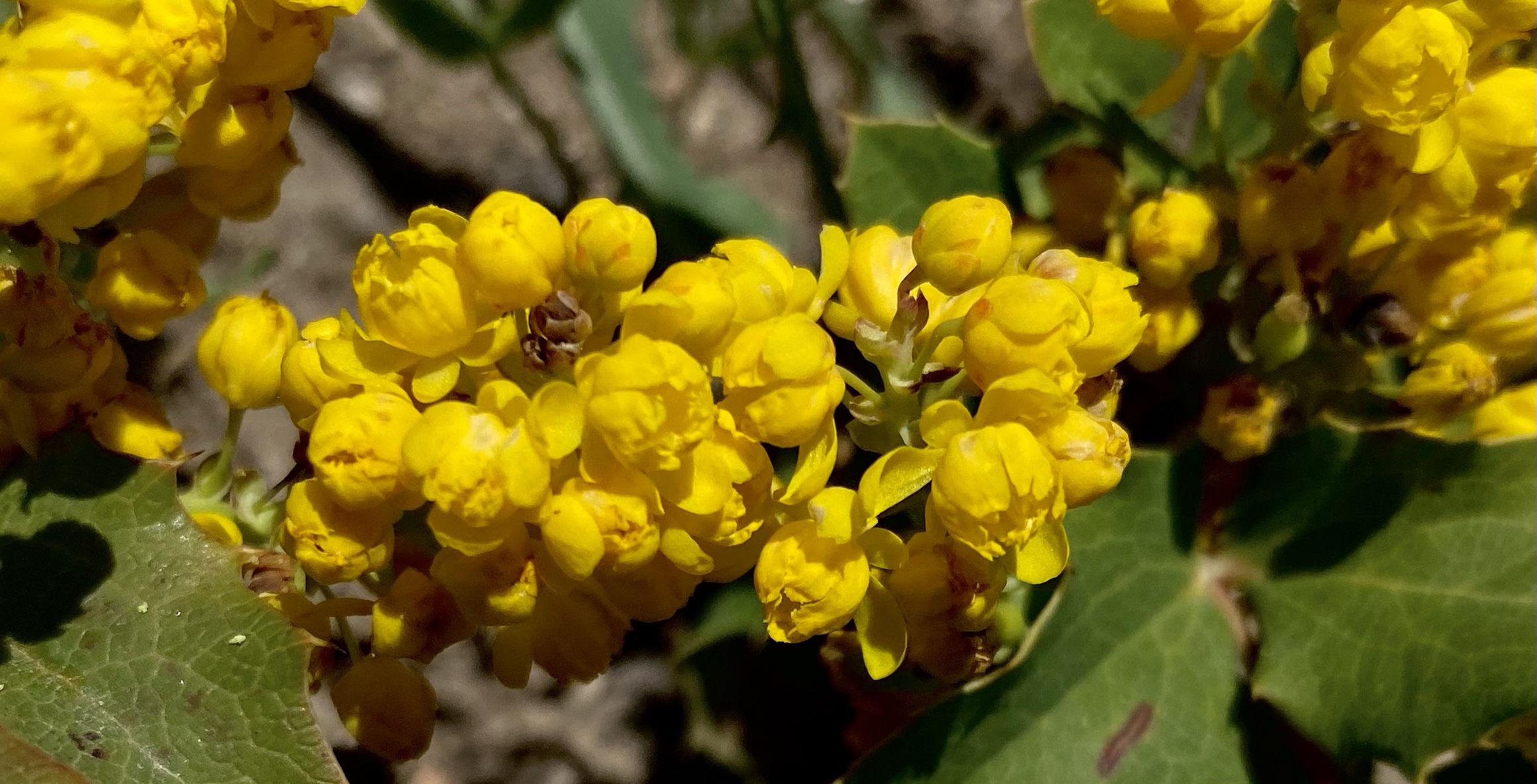
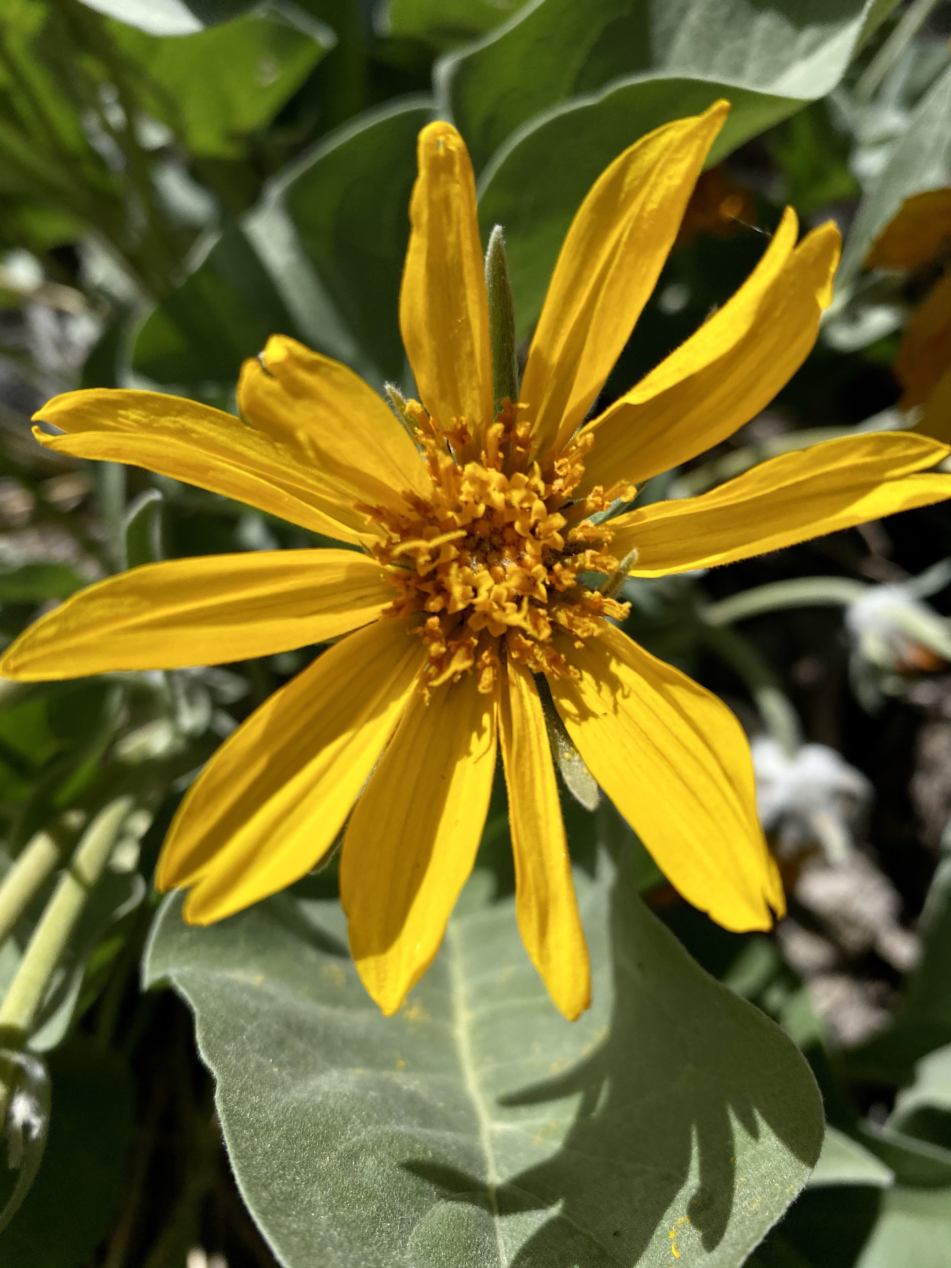
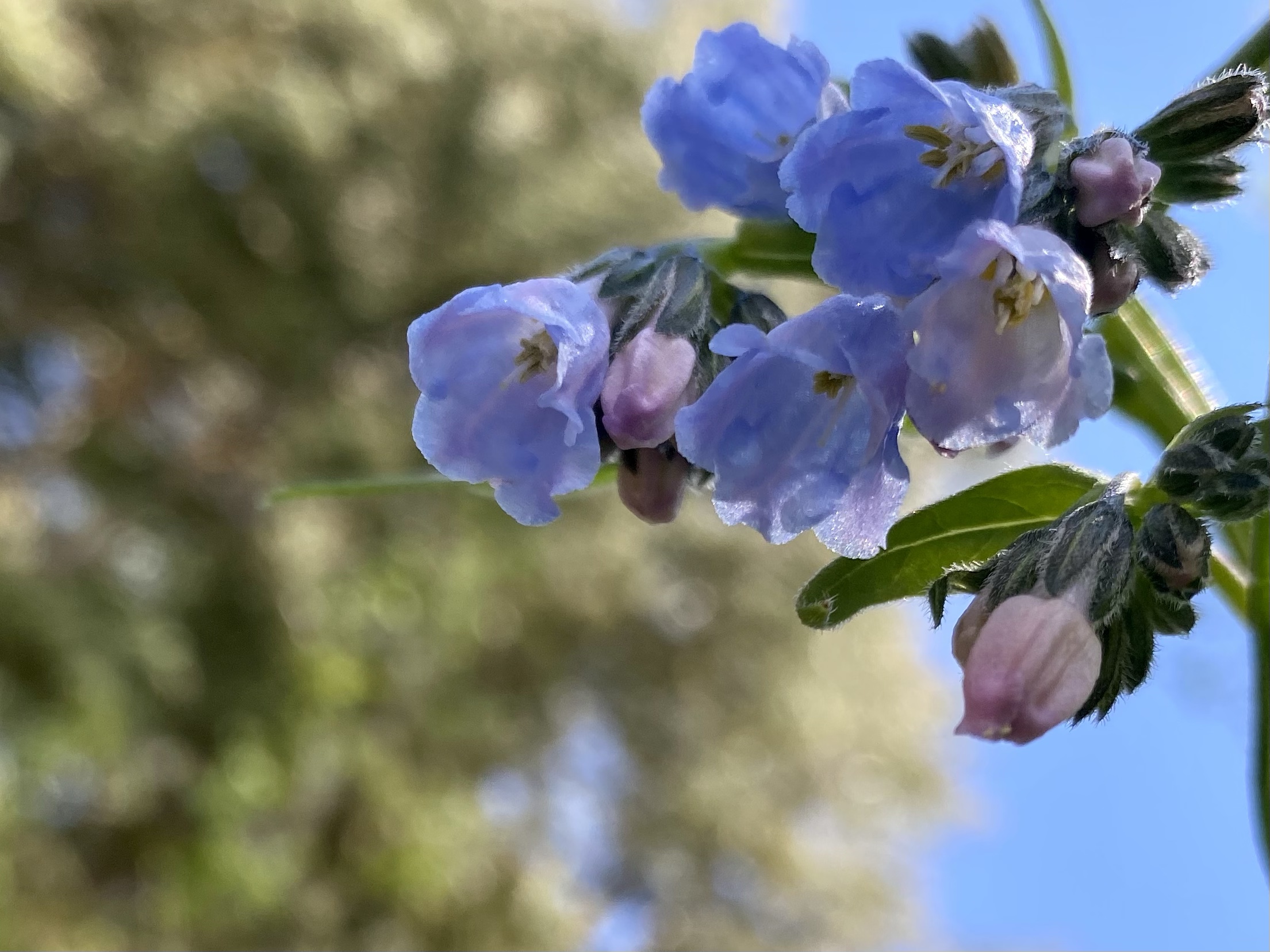
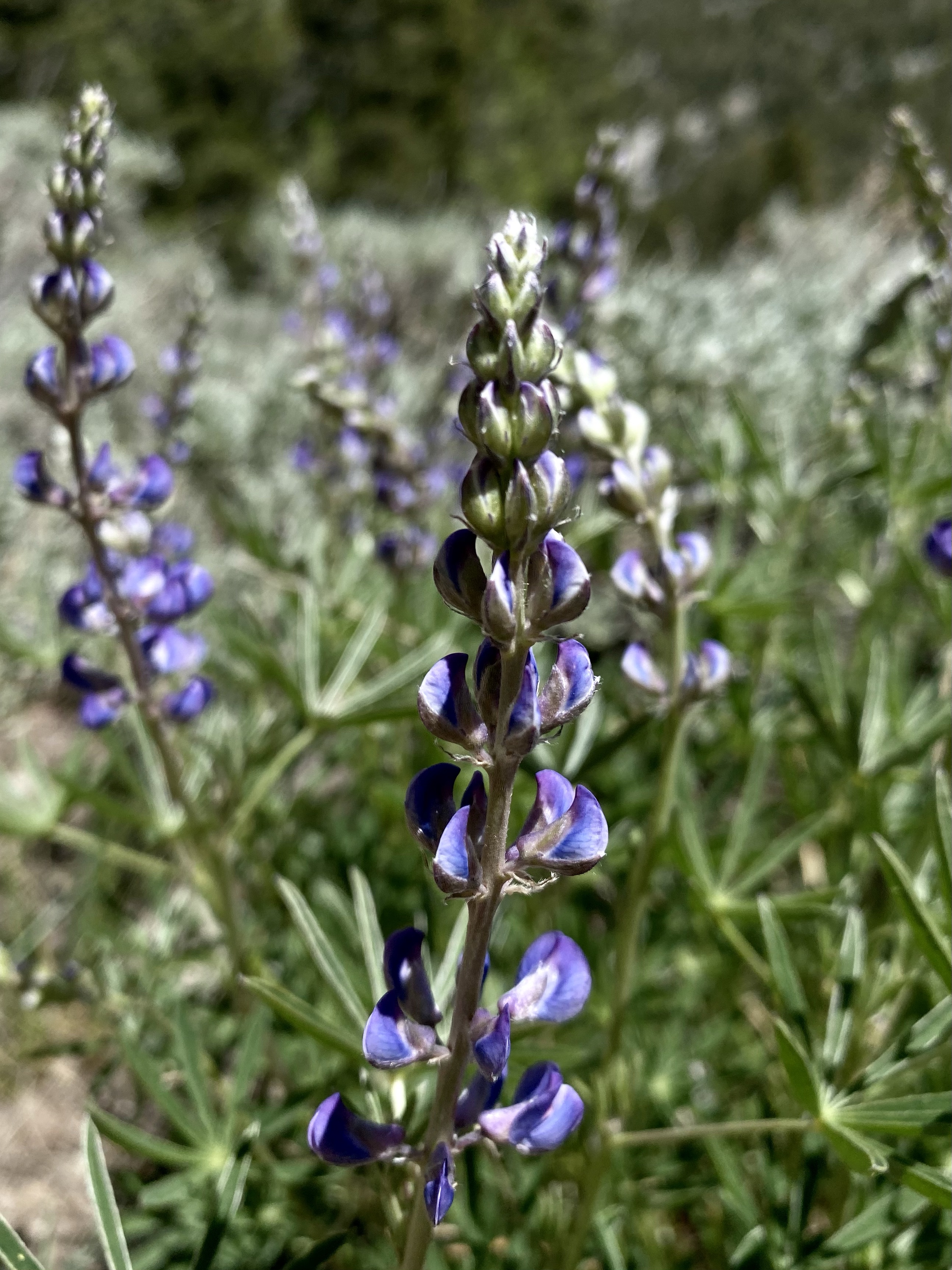
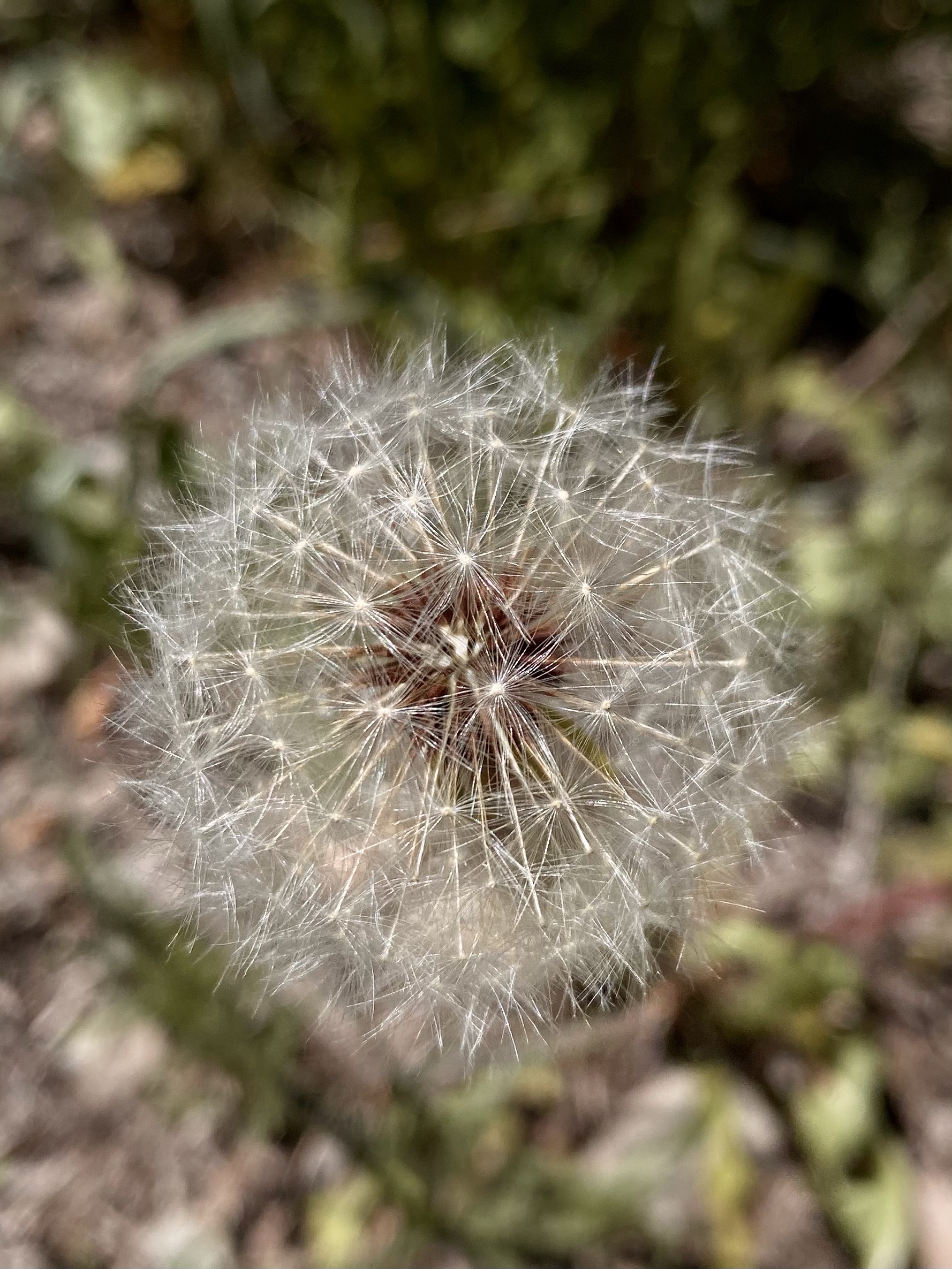
Without views, I spent more time admiring flowers, water, and trees. Some patches of snow still lingering. June first, and snow! Contrasting the snow, sending signals that it was time to change seasons and melt, were blooming wildflowers. Lupine provided pops of purple, tiny bluebells shook in the wind, and dandelions past their prime provided good subjects. I always remind myself to look down as much as I look up. And sometime turn around too to see the view from a different angle. There is usually a surprise!
After the gradual descend brought me back to the parking lot (this side would have been way easier to climb!), I made my way back through the meadow to the campground. No where to drive, I was home for the night. What a great feeling.
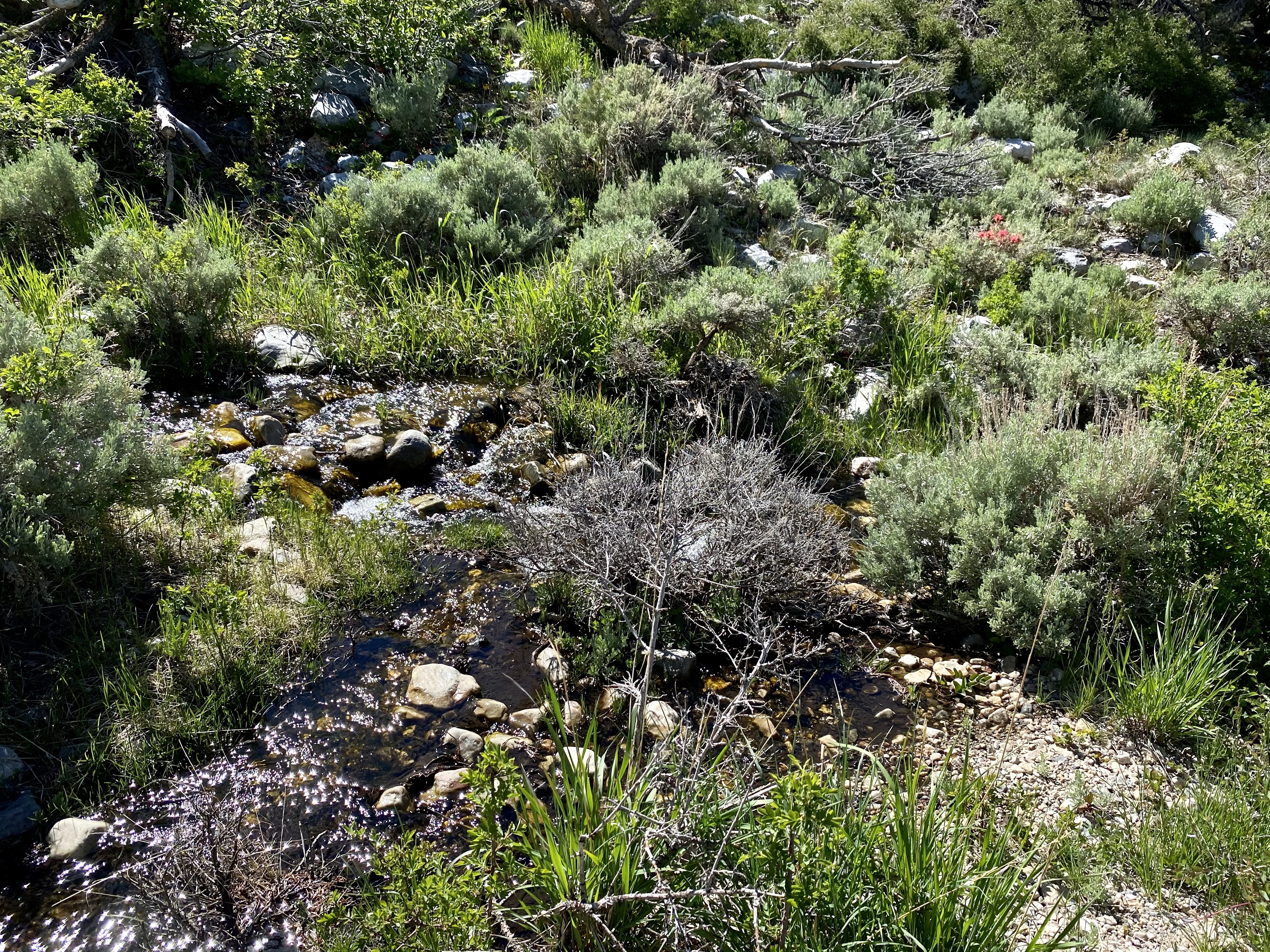
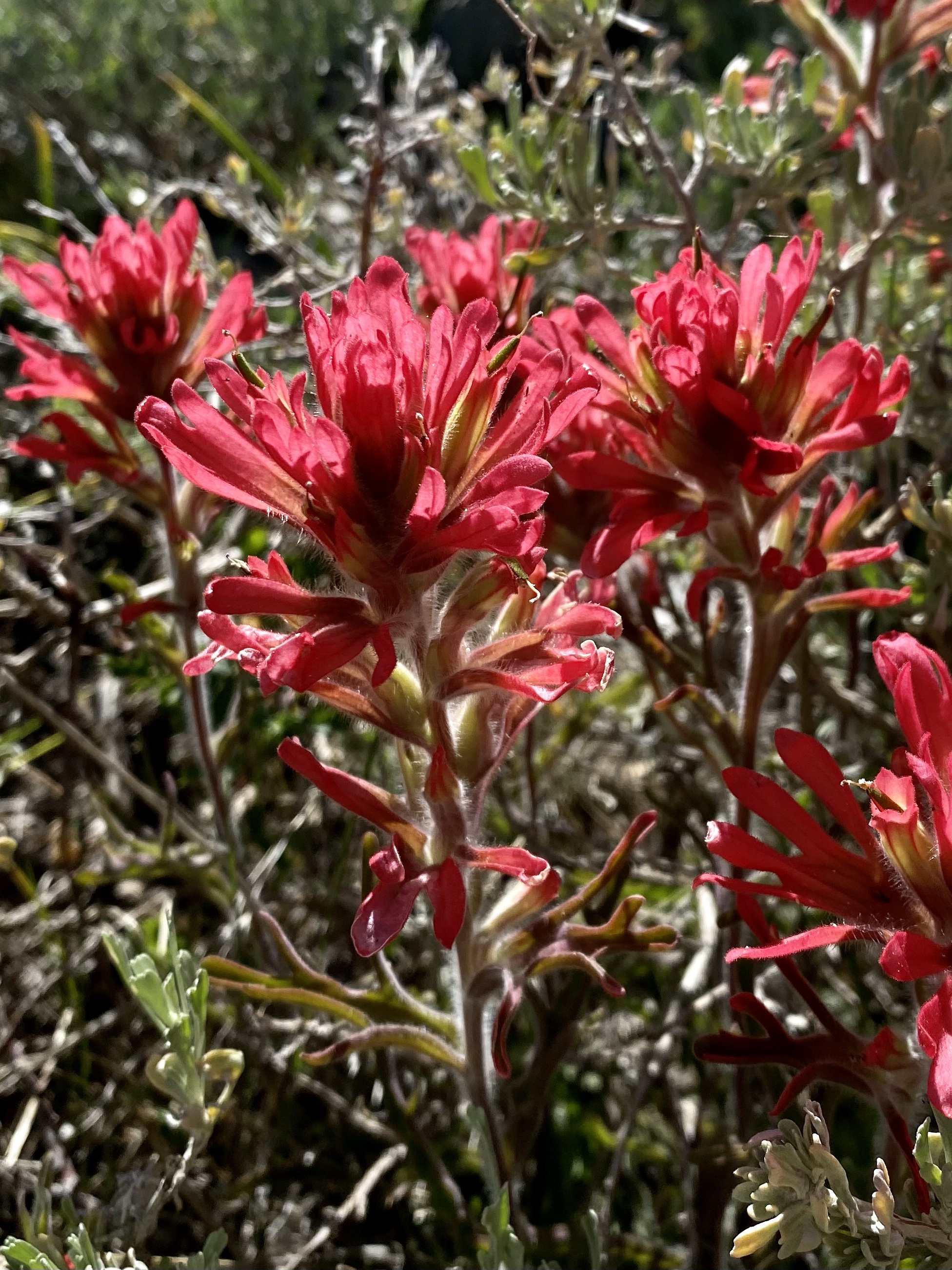
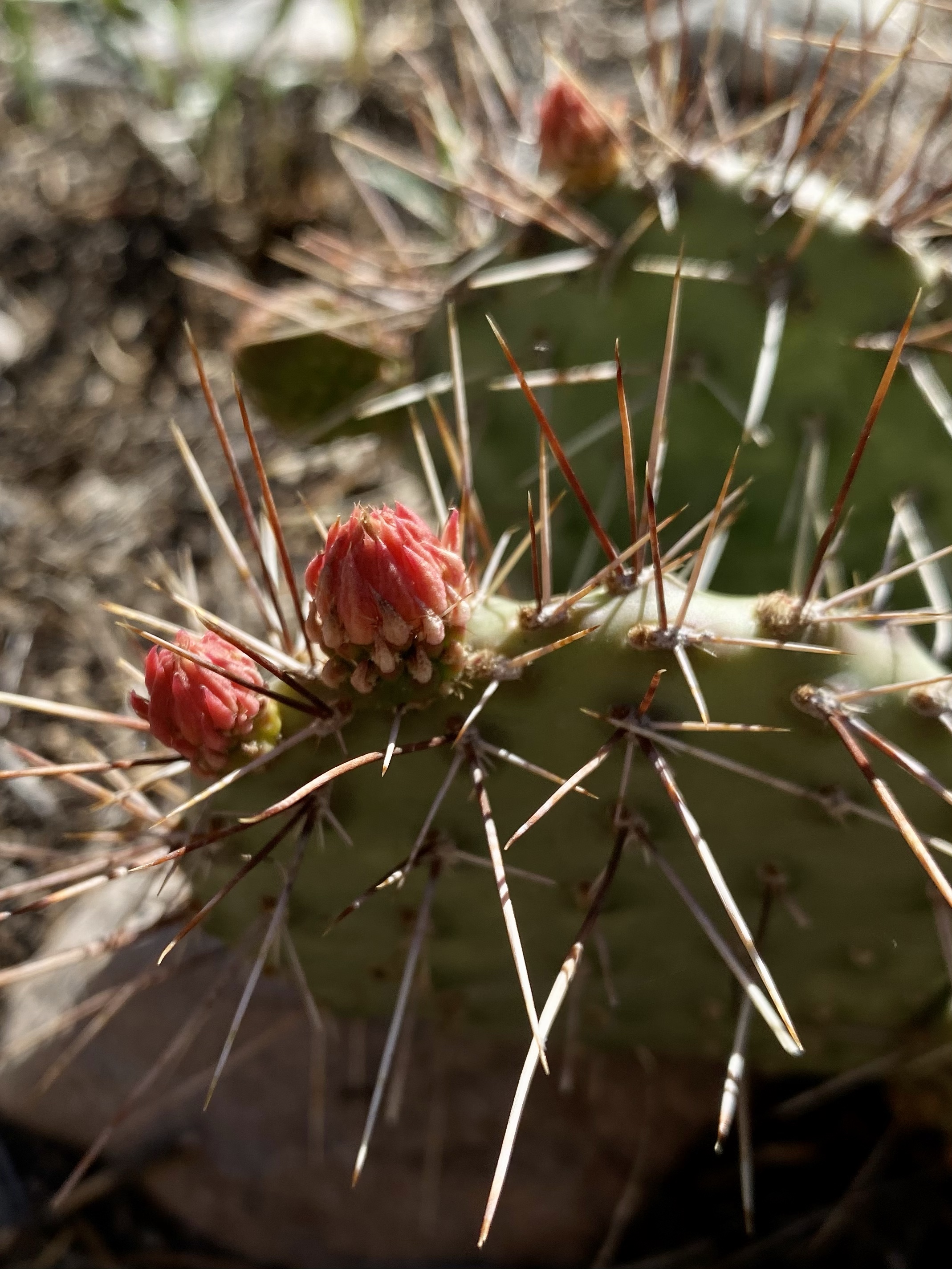
After a lovely surprise phone call from a dear friend and colleague, I was filled to the brim with happiness. I sat at my campsite by the creek, enjoying the golden glow the sun cast on the water and plants. I ventured down to the edge to capture the brilliant red flowers on the far side, and snuck pictures of the cacti about to pop too. The idyllic seen was lovely.
Another fantastic day on the road. I’m counting my blessings and soaking it all in. This trip and time is such a gift.
After Yosemite, my original plan was to visit Death Valley in California as I start my journey home. However, it’s about 110 degrees in Death Valley these days, so that plan got mixed fast. My dad happened to stumble upon Great Basin National Park in his own travel research and sent along the suggestion. Due east of Yosemite, and at high elevation, it sounds like a great alternative. So there I went!
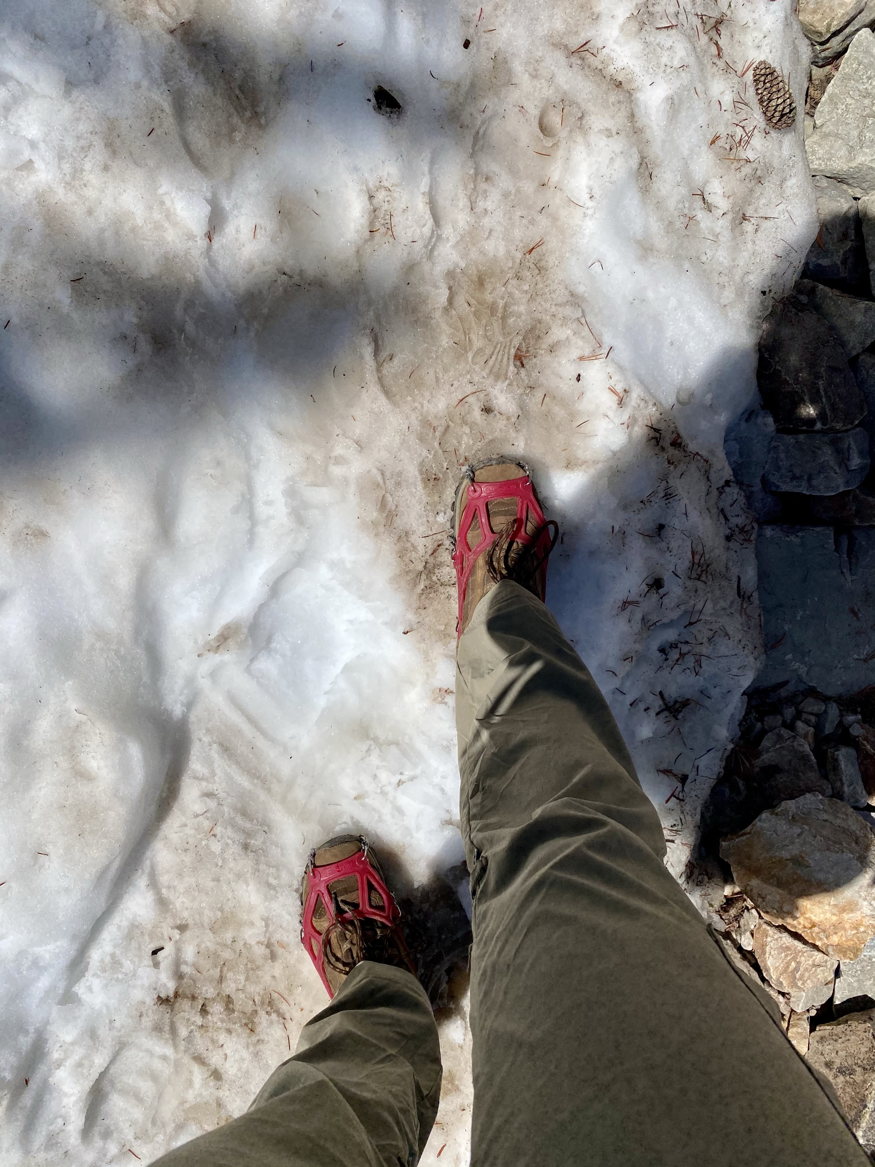
As I researched hiking options the night I arrived, almost all the reviews mentioned snow on the trails. Snow, with May approaches? Maybe people we’re exaggerating I thought, perhaps a few patches here and there but it couldn’t be significant. Right? Well, I decided to pack my micro spikes in case. Better prepared than sorry.
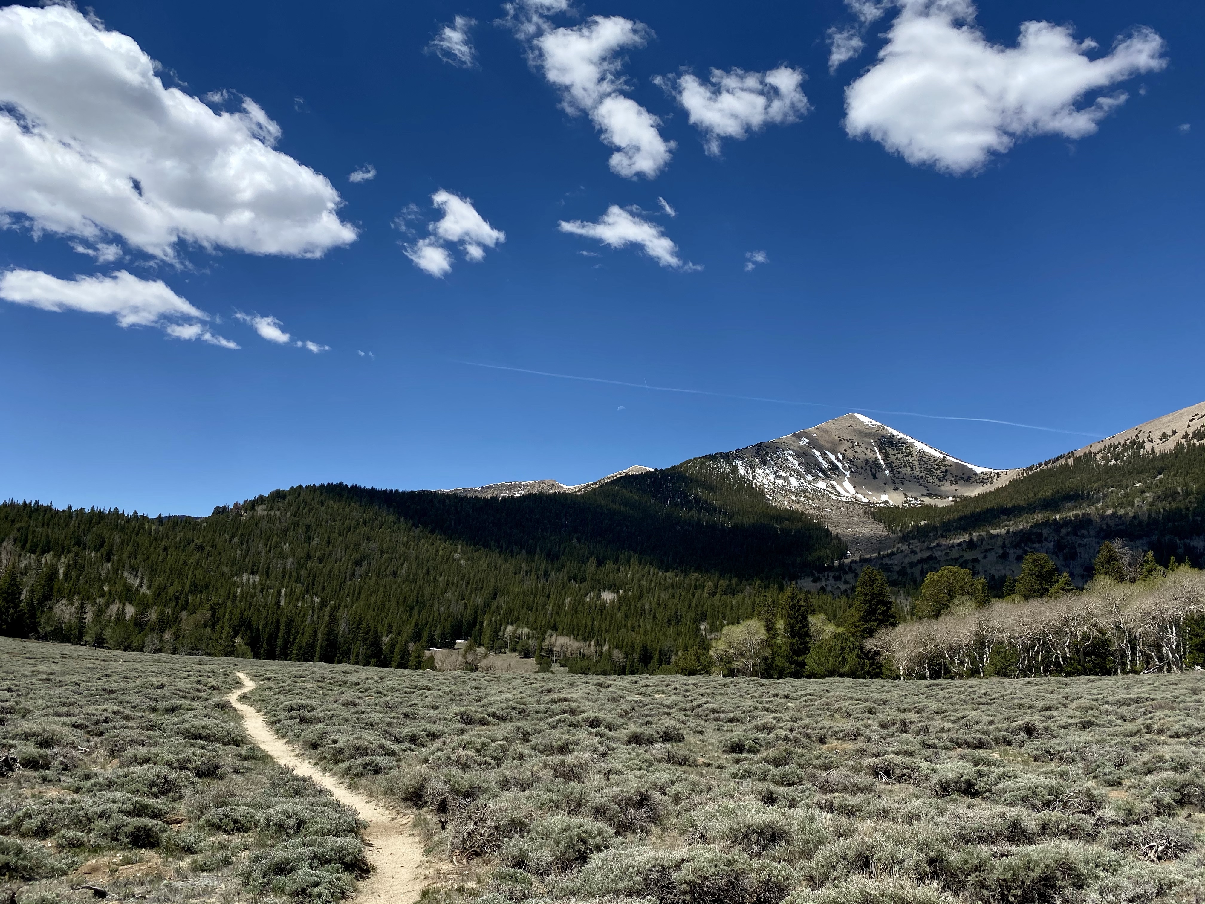
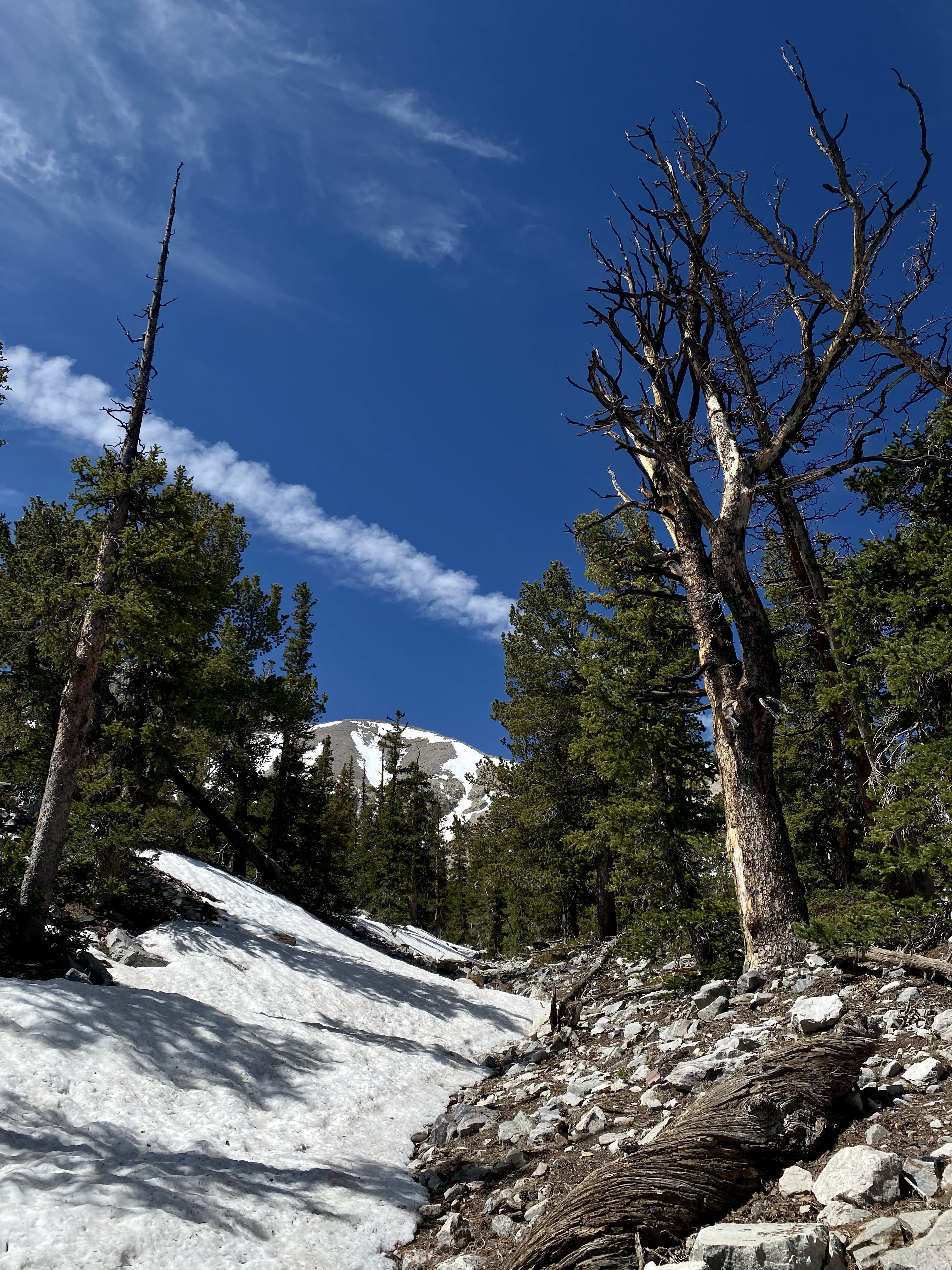
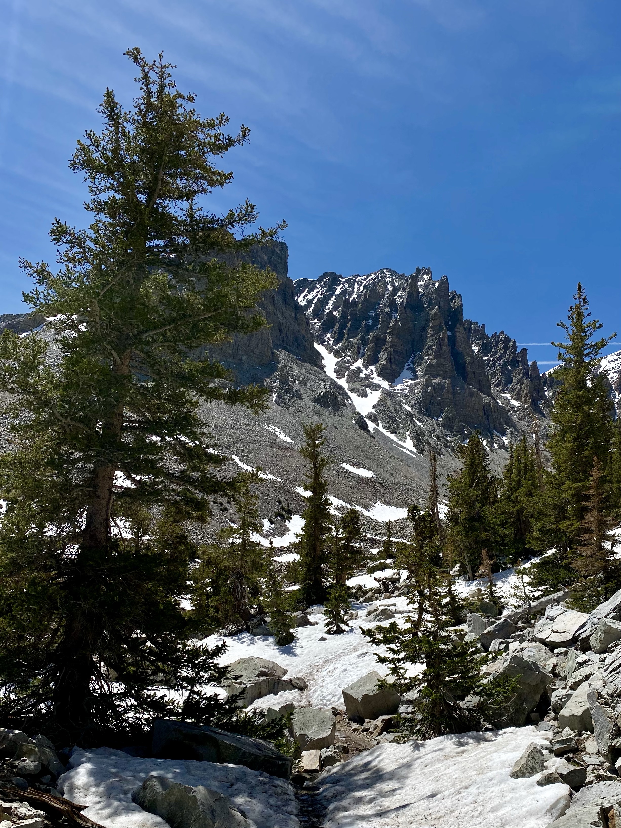
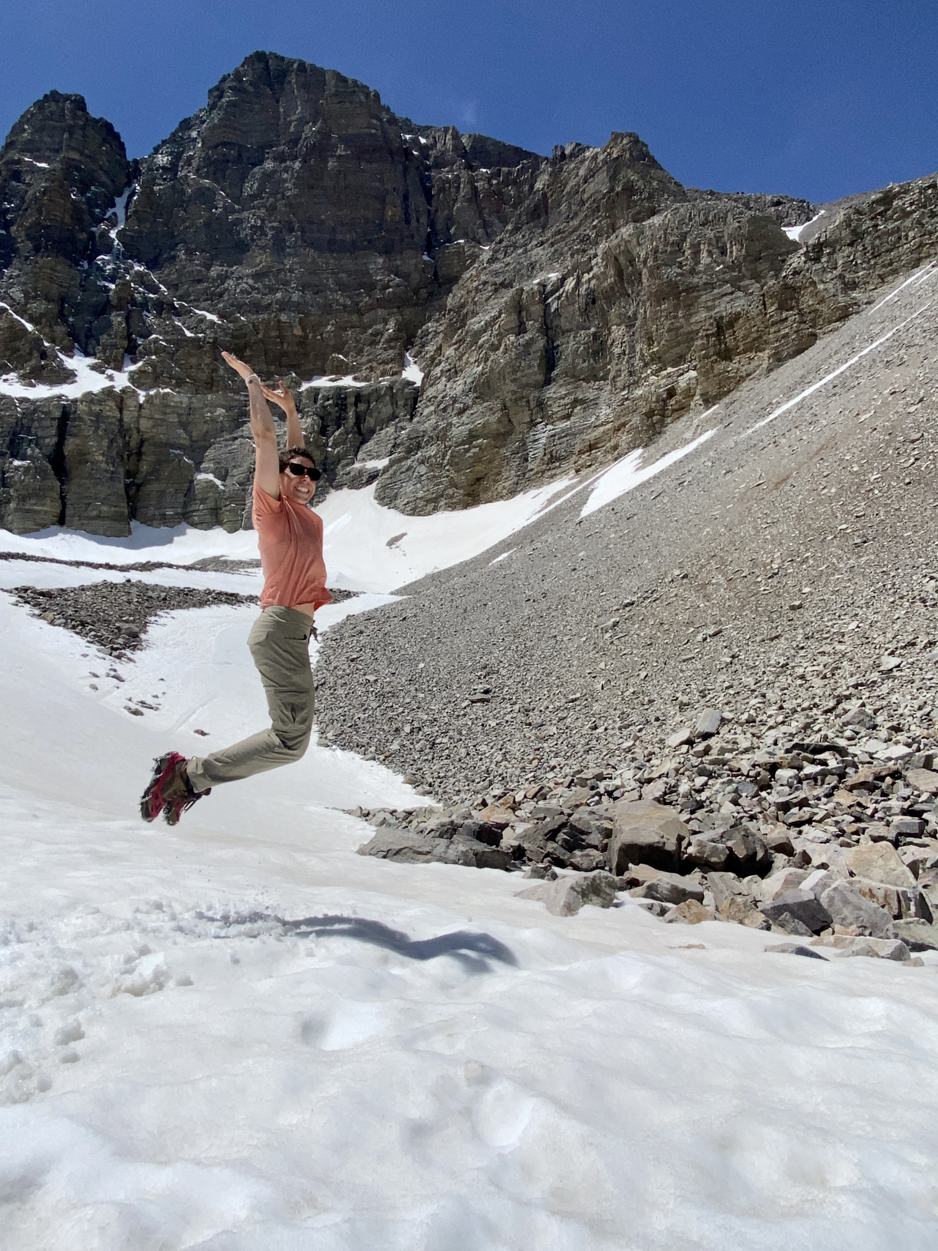
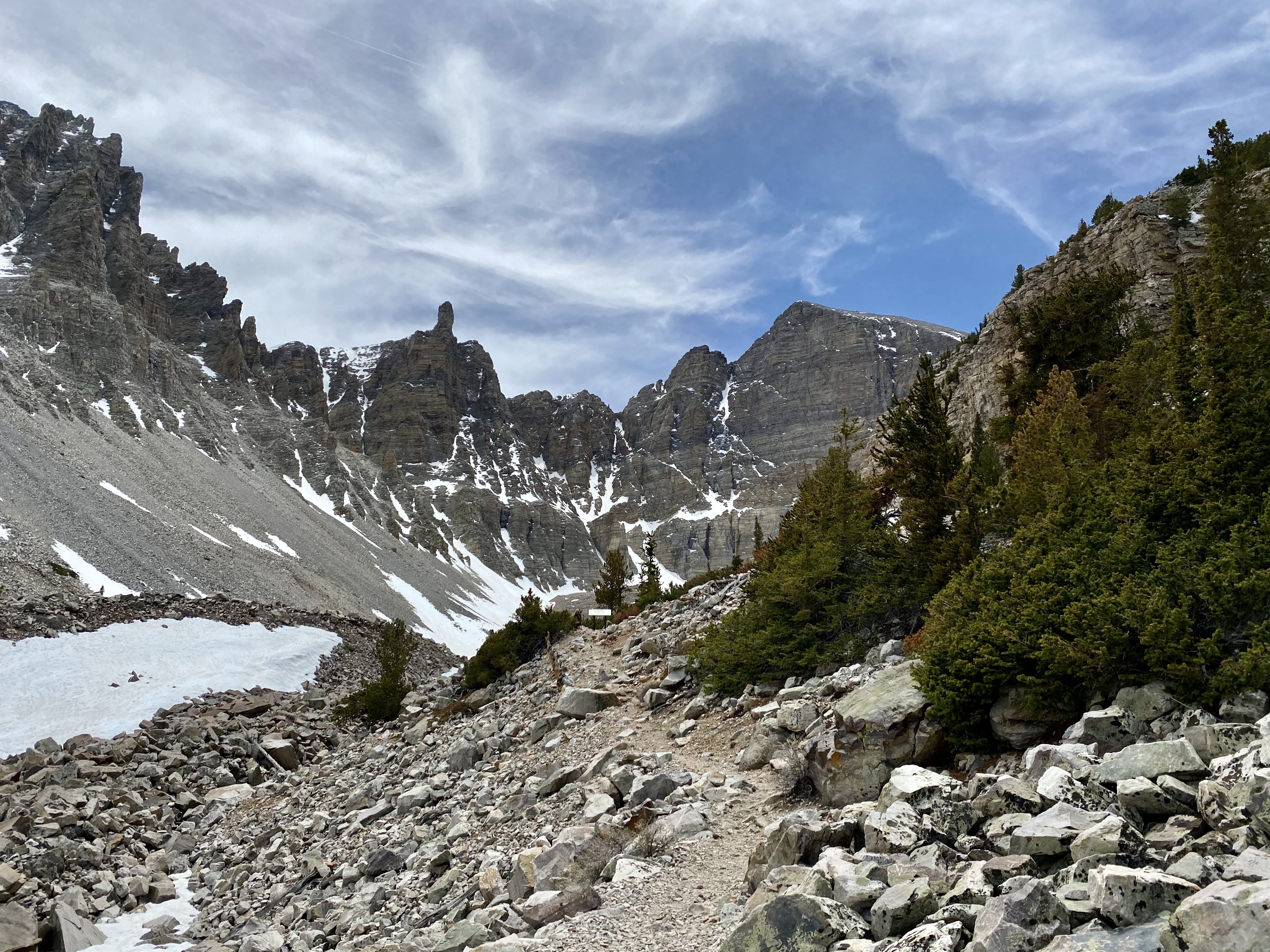
My first morning at Great Basin I drove into the park and up the scenic drive. The road starts at 7,000 feet above sea level and quickly climbs the mountainside 3,000 feet. Oh, that’s why there is still snow! I passed the trailhead for Wheeler Peak, wanting to climb it but knowing I didn’t have the proper gear. Instead I drove to the end of the road and chose to hike to Rock Glacier.
Labeled a moderate trail, I’d travel about 6 miles round trip and gain 1,200 feet of elevation. Sounded good to me! Off I went, and was quickly reminded of what hiking at high altitude feels like. Woof! It was like I hadn’t been hiking at all for 6 weeks. It was hard to breath and I started to have a dull headache. Slow and steady was the hiking advice, lots of water and snacks, so I did just that. I relaxed my pace and paused often to enjoy the thickly trees forest.
As the trail slowly climbed through the forest, patches of snow began to appear. At first they were small, easy to step around or take a few paces to cross, but then they became larger, on the slope side and I found myself grateful for having pack my spikes. I dug them out and pulled them on, appreciative of the extra grip they provided on the slick morning snow. While there was a lot of taking off and putting on of micro spikes as I passed from snow to mug to rock to snow, it was worth it.
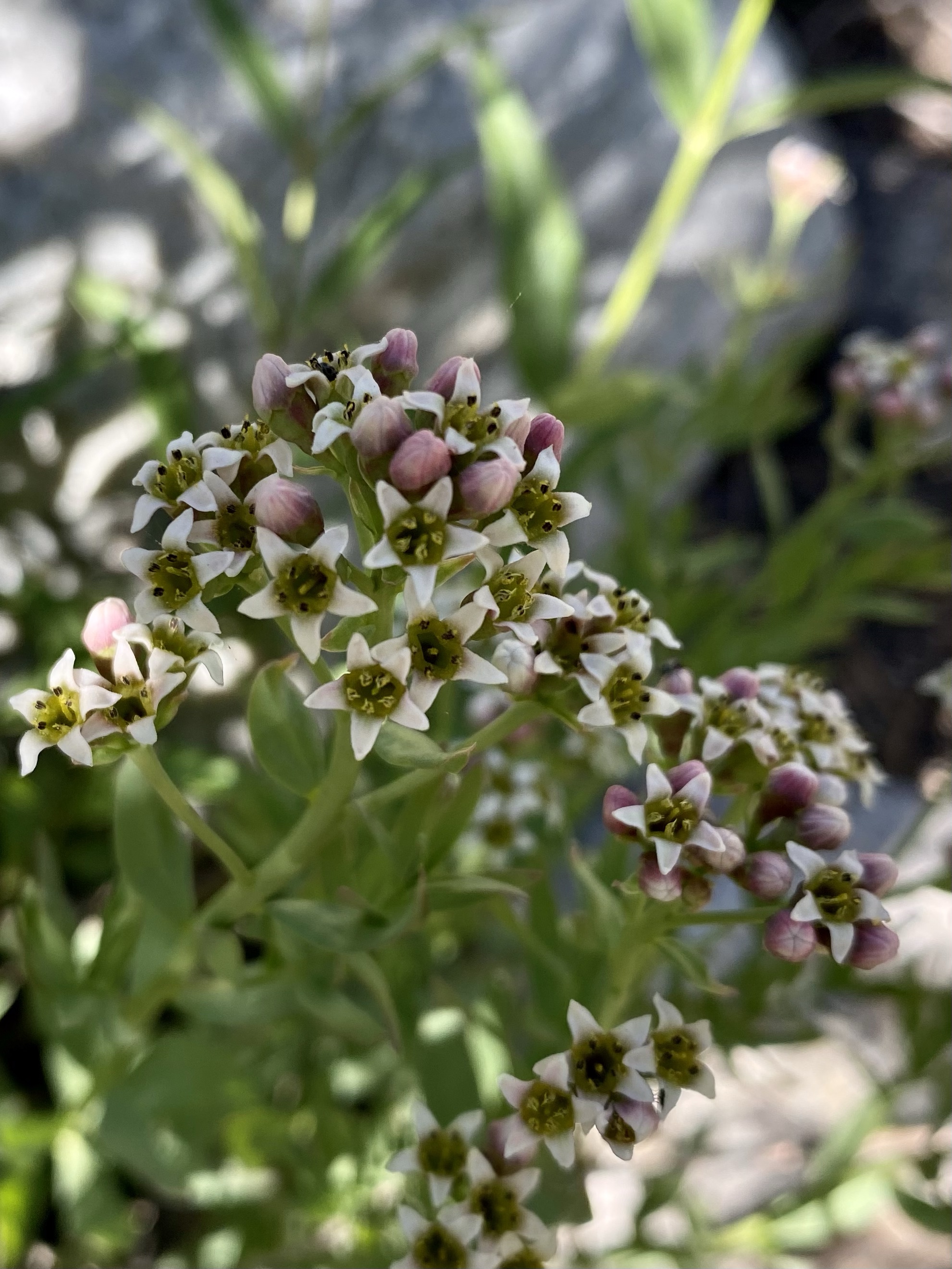
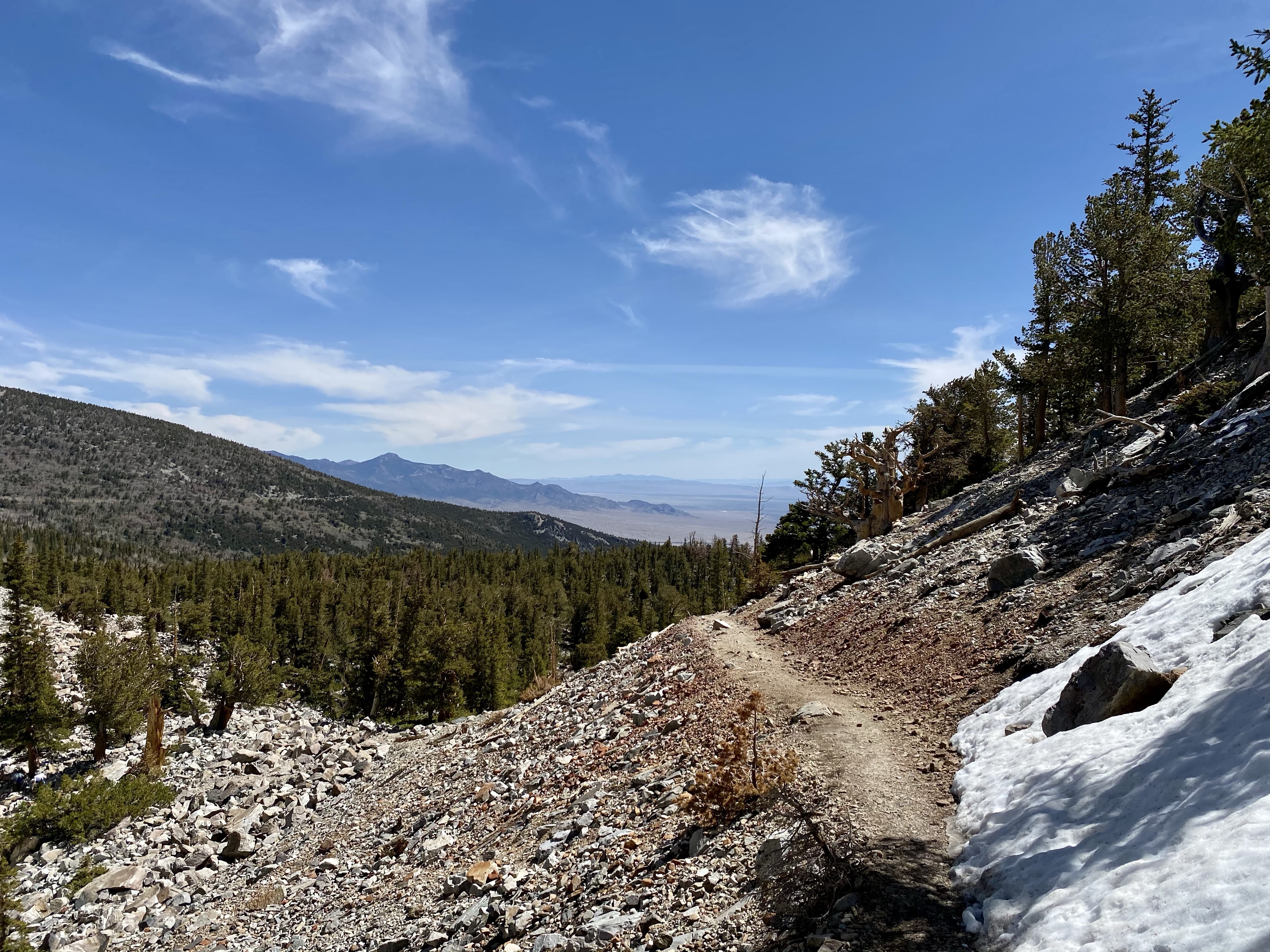
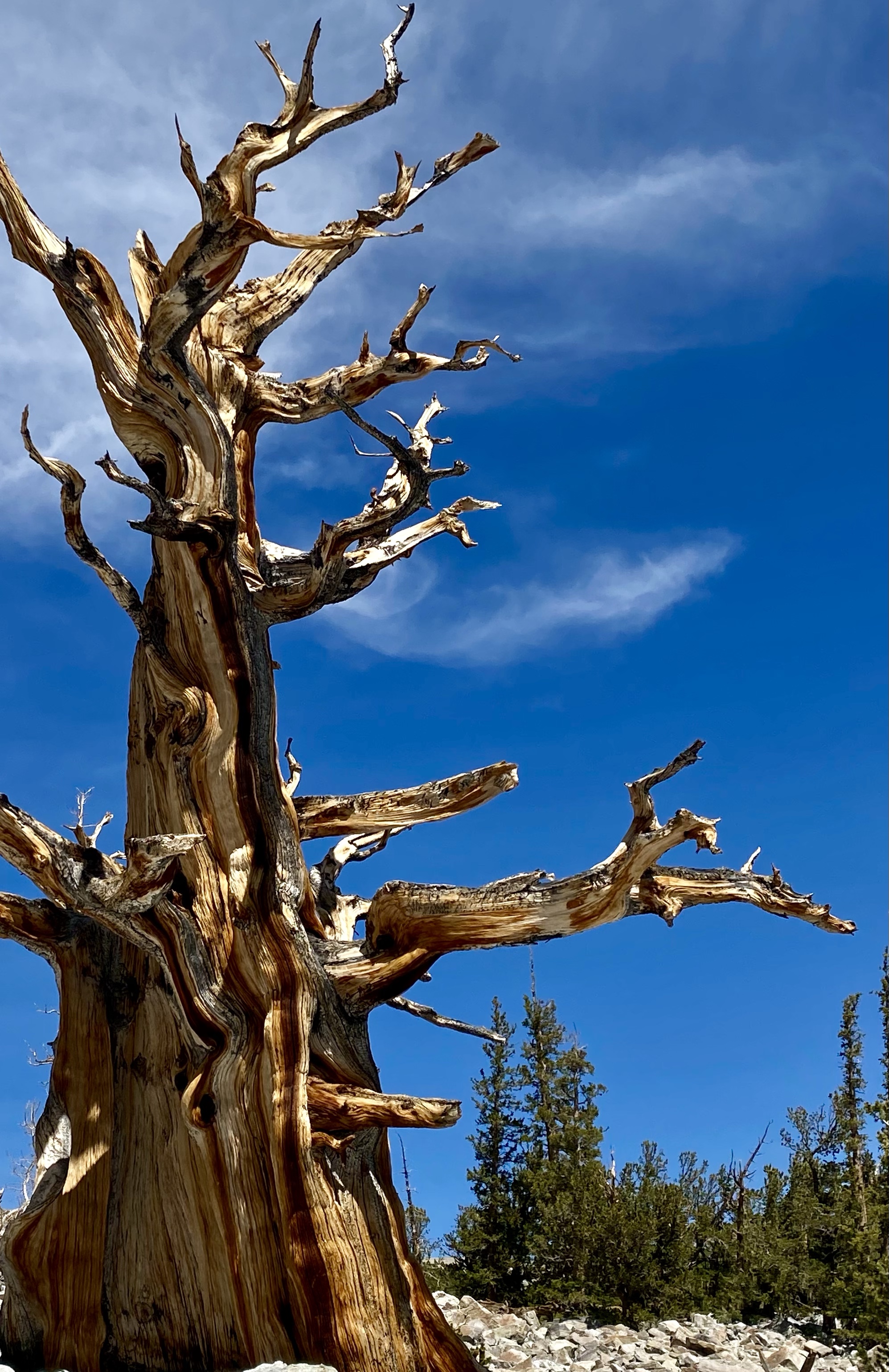
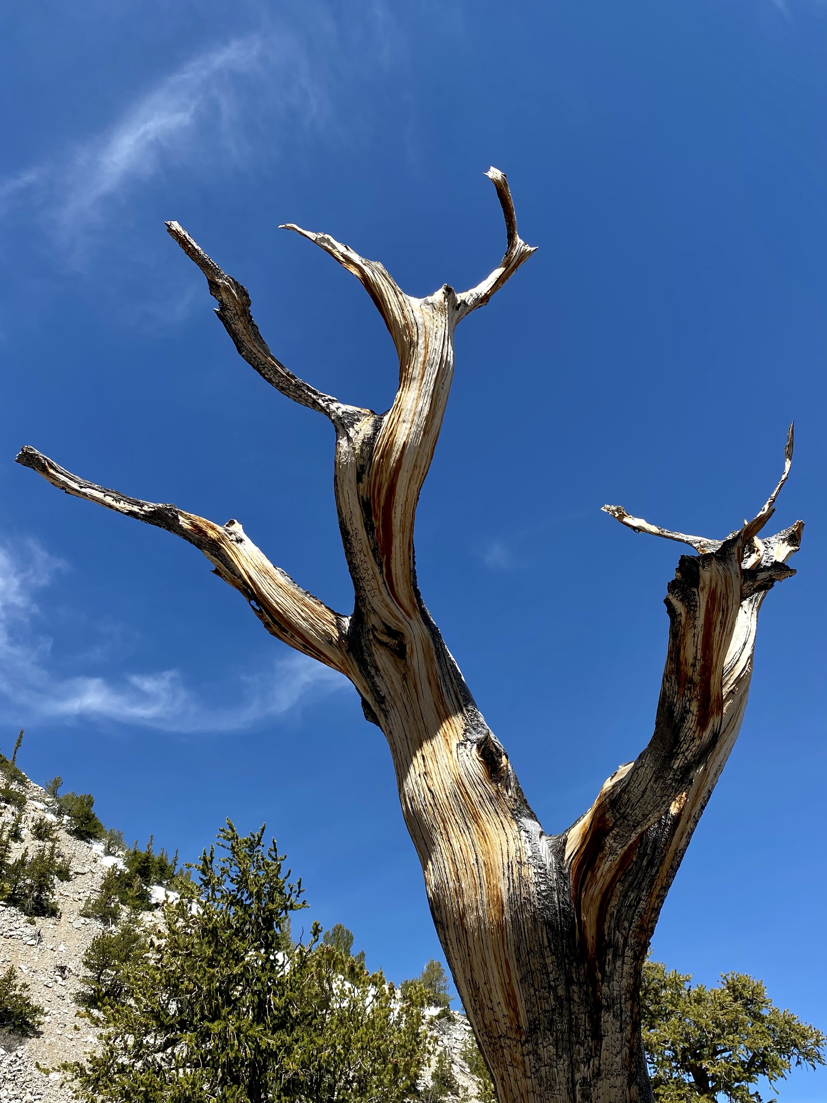
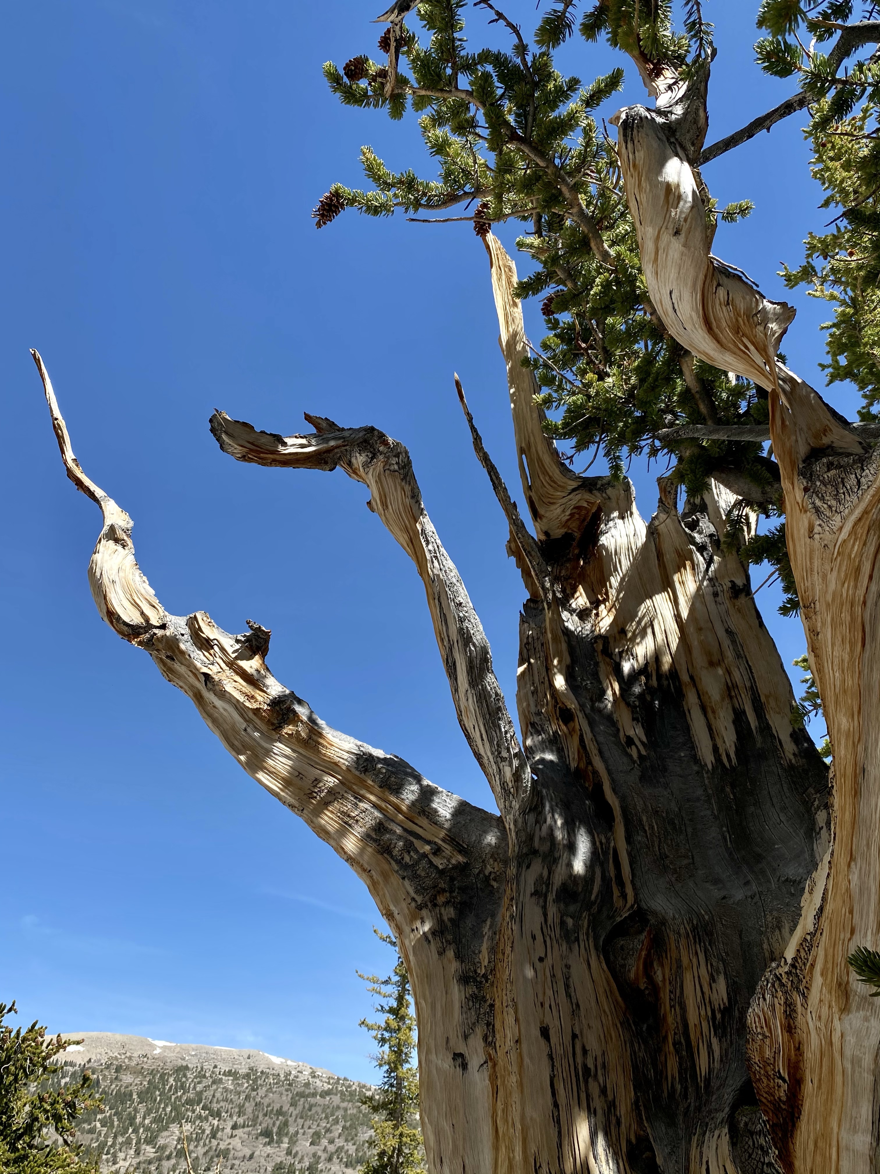
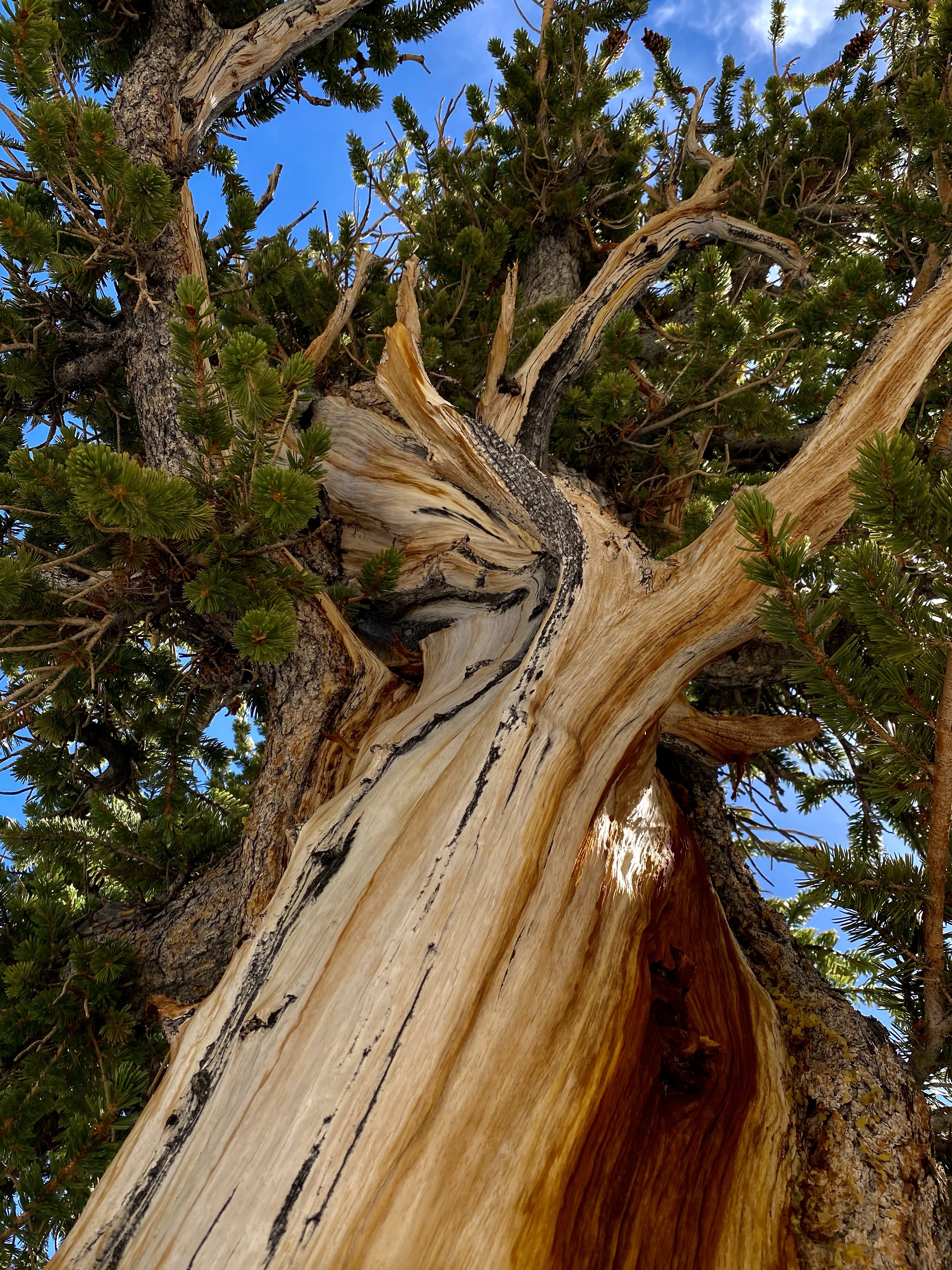
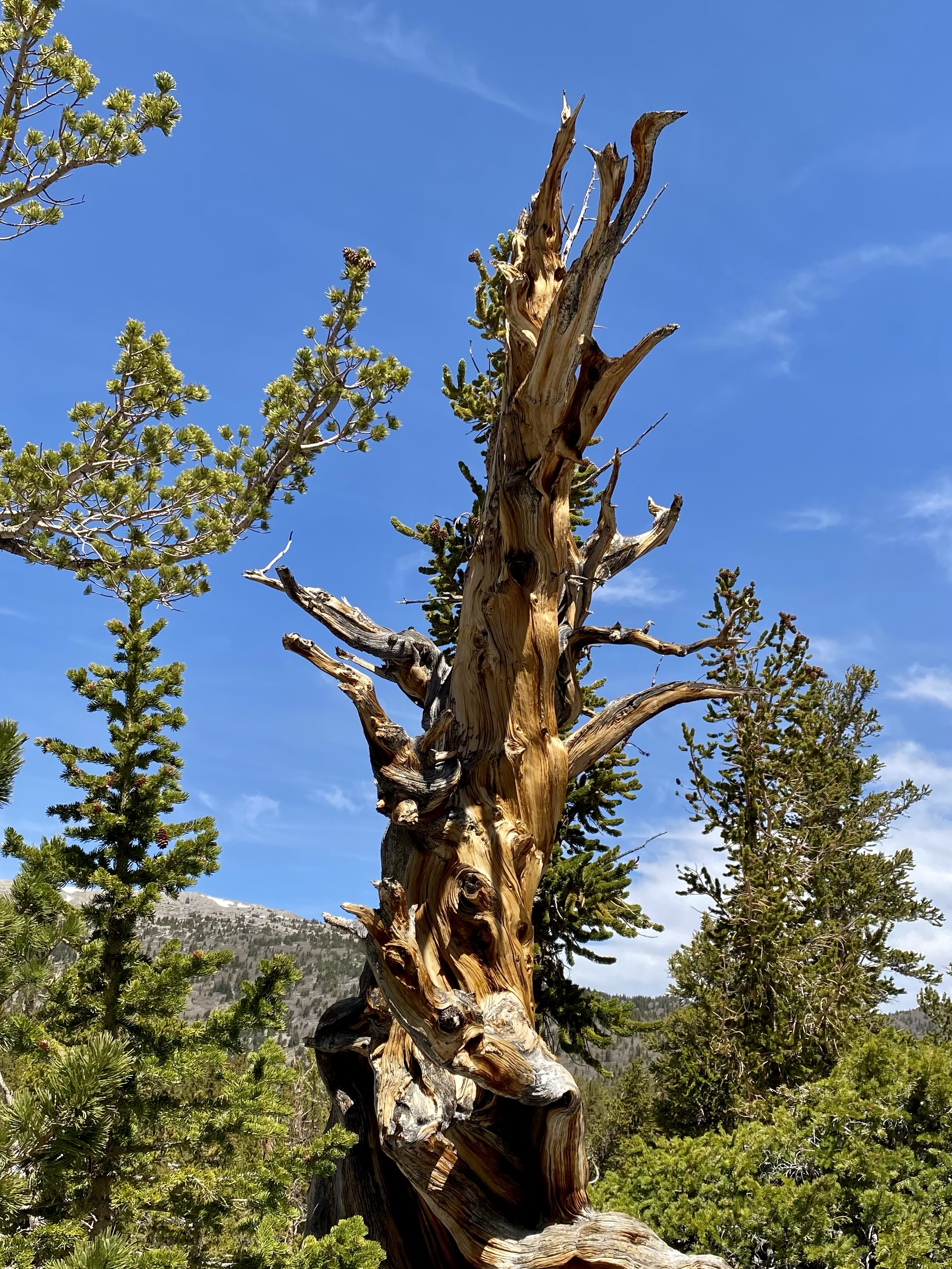
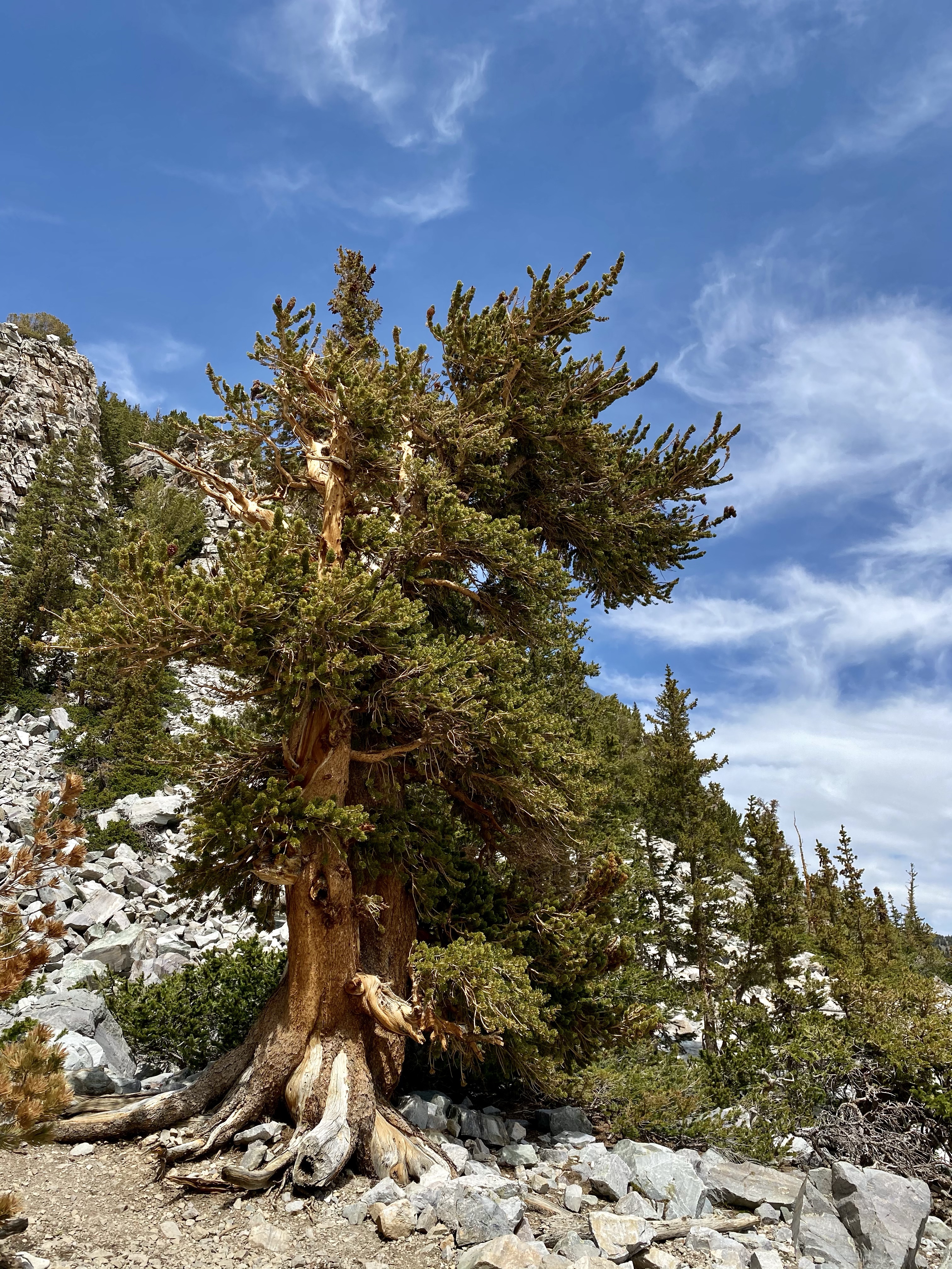
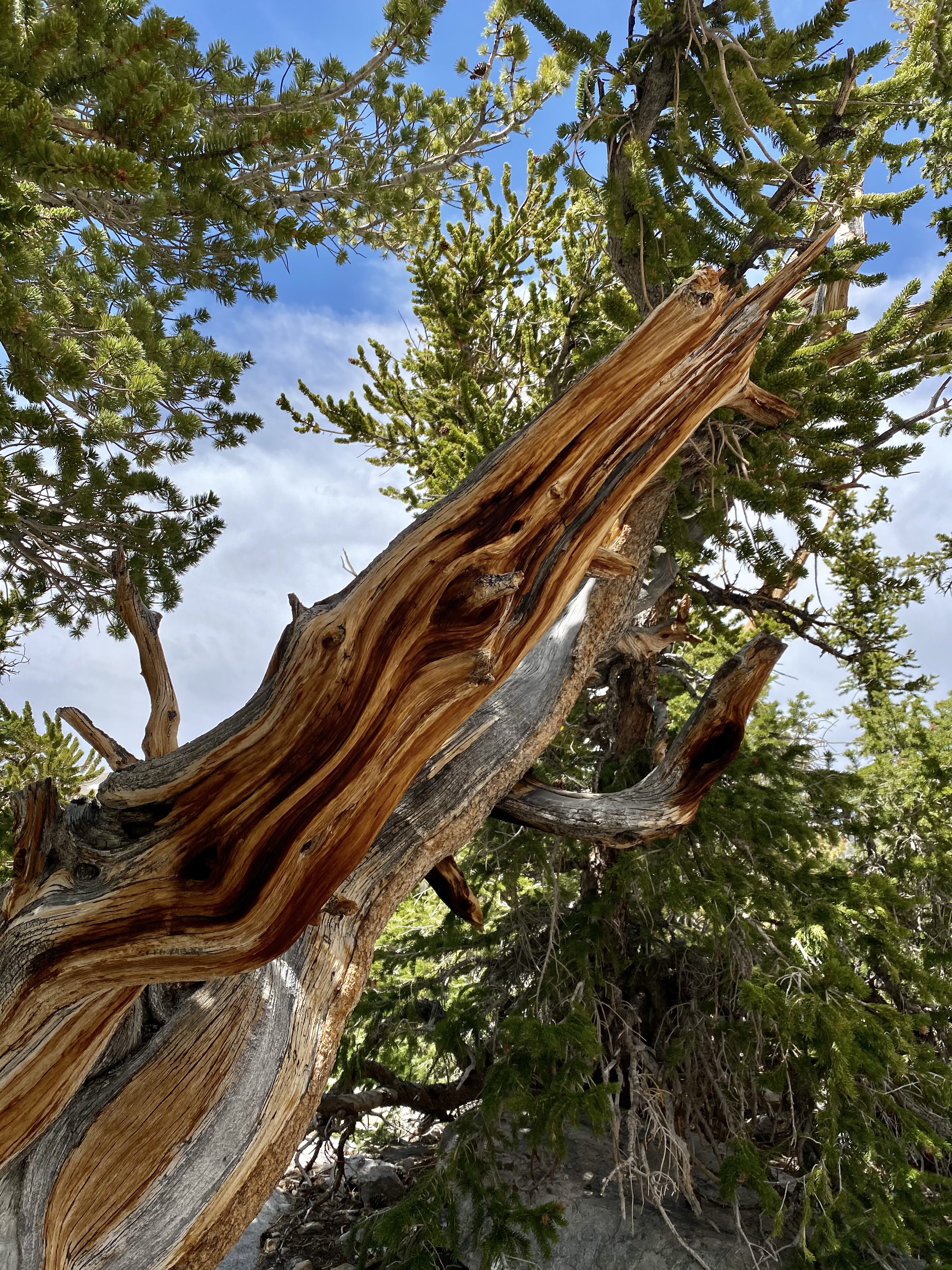
At the end of the first two miles, I entered the Ancient Bristlecone Pine grove. Hardy, gnarled trees grew from the rocky, dry soil below. Their trunks, shades of yellow, orange, and brown, twisted skyward. Sparse branches were decorated with bright green needles, sometime just a small bunch on one limb. These trees are the definition of ancient, many having been growing since the Egyptians built pyramids. Thousands of years old, they require little water and are tenacious, fighting to survive even when one part has fallen over and died. The oldest Bristlecone Pine here is 3,200 years old! That certainly puts age into perspective. True fighters, full of stories to tell, capturing their beauty was a joy.
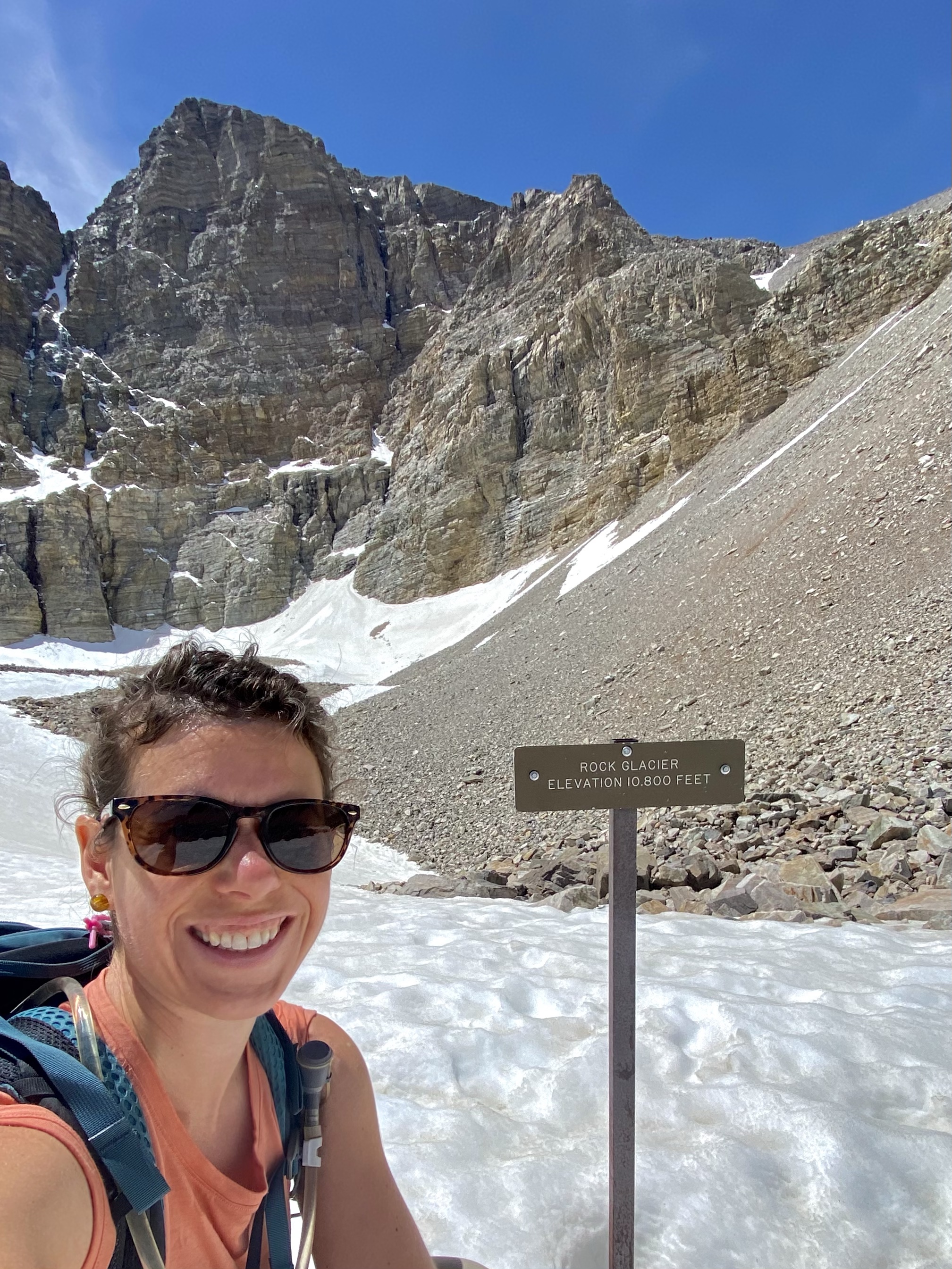
After marveling at these historic wonders, I continued on the trail to see Rock Glacier. About half a mile ahead, the white blanket came into view, nestled at the base of Wheeler Peak’s backside. Even from a distance, it was sparkling and beautiful.
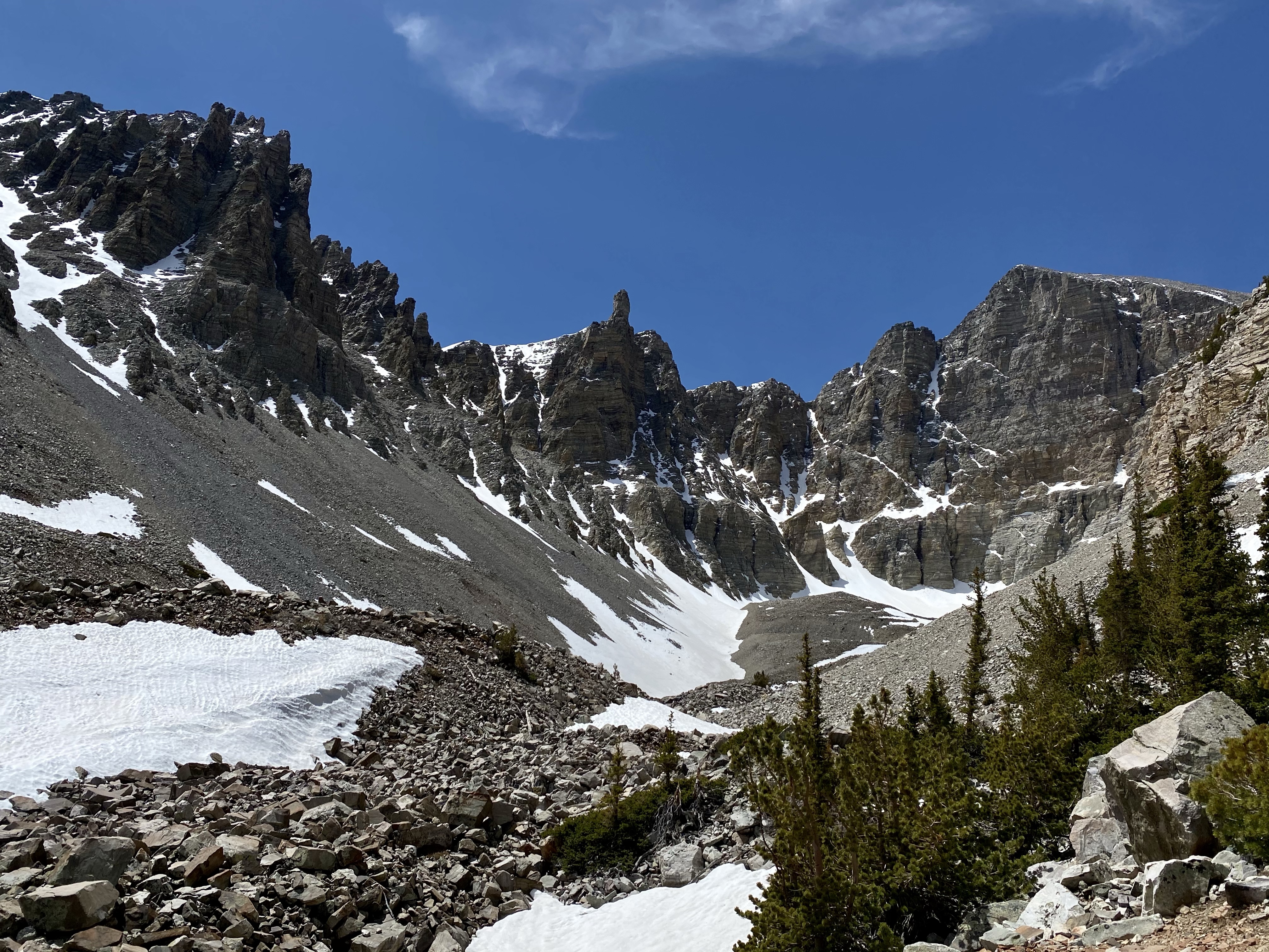
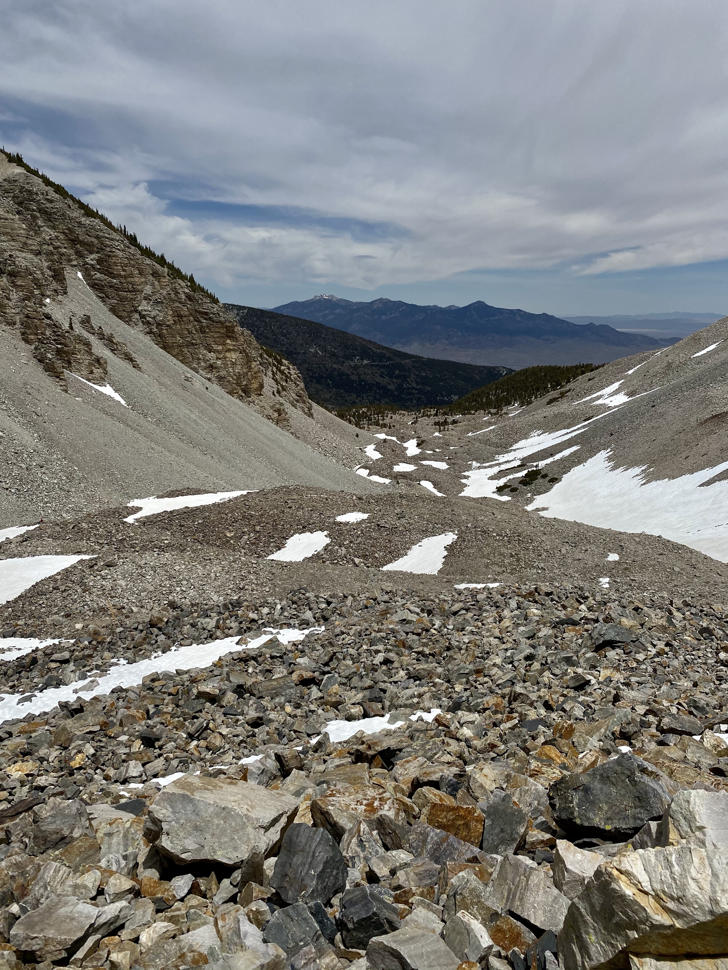
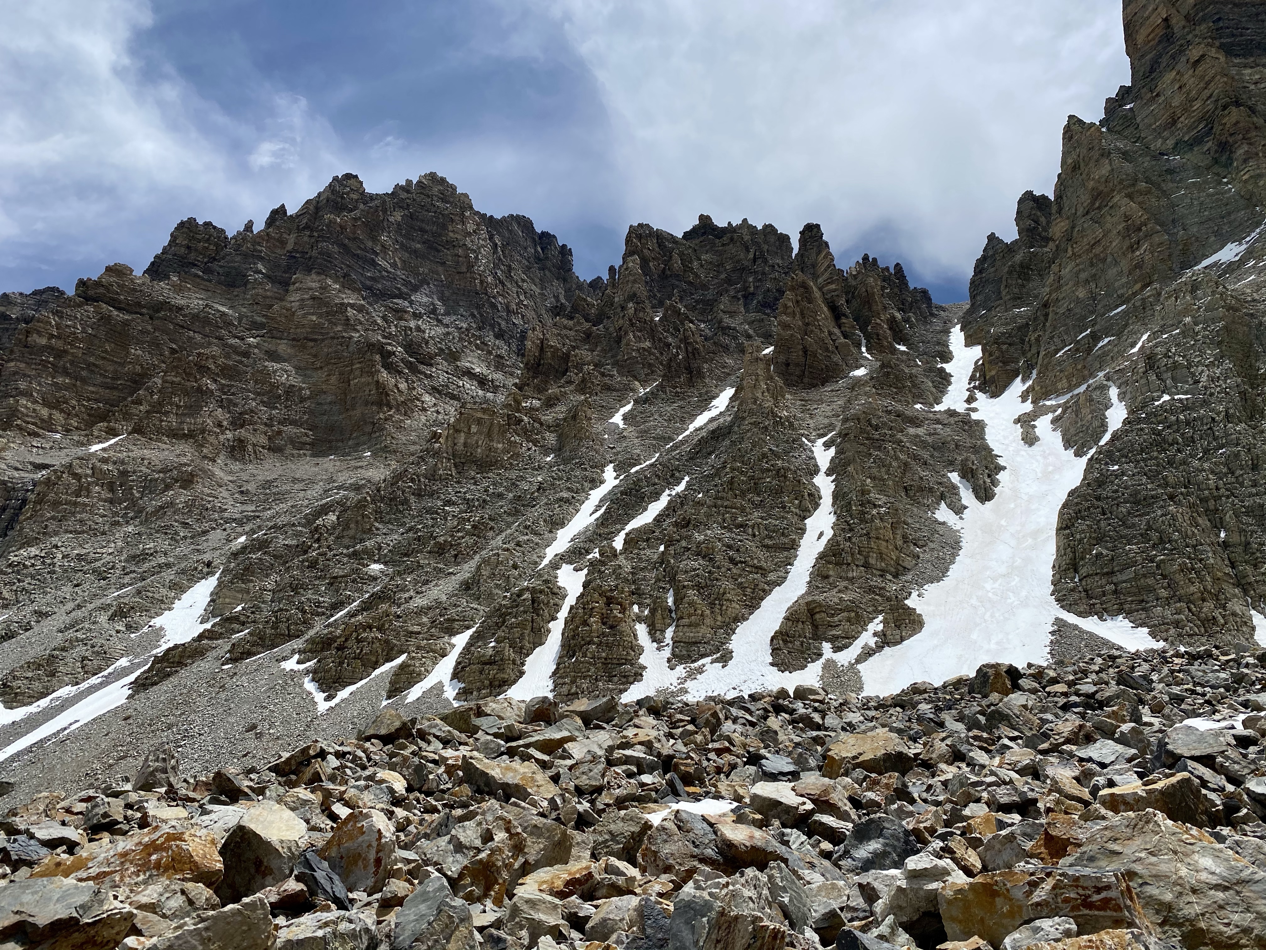
The trail switched back and forth a few more times, then headed out onto the rock field littered with patches of snow. On and off when the micro spikes again as I traversed larger and larger patches of snow. The trail became tricky, loose rocks that cracked against each other as I stepped. Determined to reach that glacier though, I continued on.
I reached the trail end, a sign marking Rock Glacier at 10,800 feet high, but wasn’t satisfied. The rock pile across the snowfield looked like a good view for lunch, so I followed some melted snow prints to the top. Most of the way was hard pack, but with the sun beating down it was warming fast. A few times I stepped in just the right spot and post holed up to my knee. Oops! And yikes! It was easy to get out, but I figured I shouldn’t push my luck too much. I found a good rock to settled down on and enjoy the blissful quiet in the bowl, surrounded by dark stone mountains, the whole place to myself.
The sun reflecting off the snow was warm, and I sat comfortably in a t-shirt and pants. Snow on May 31st. I never would of thought I’d be hiking in that. Pretty cool.
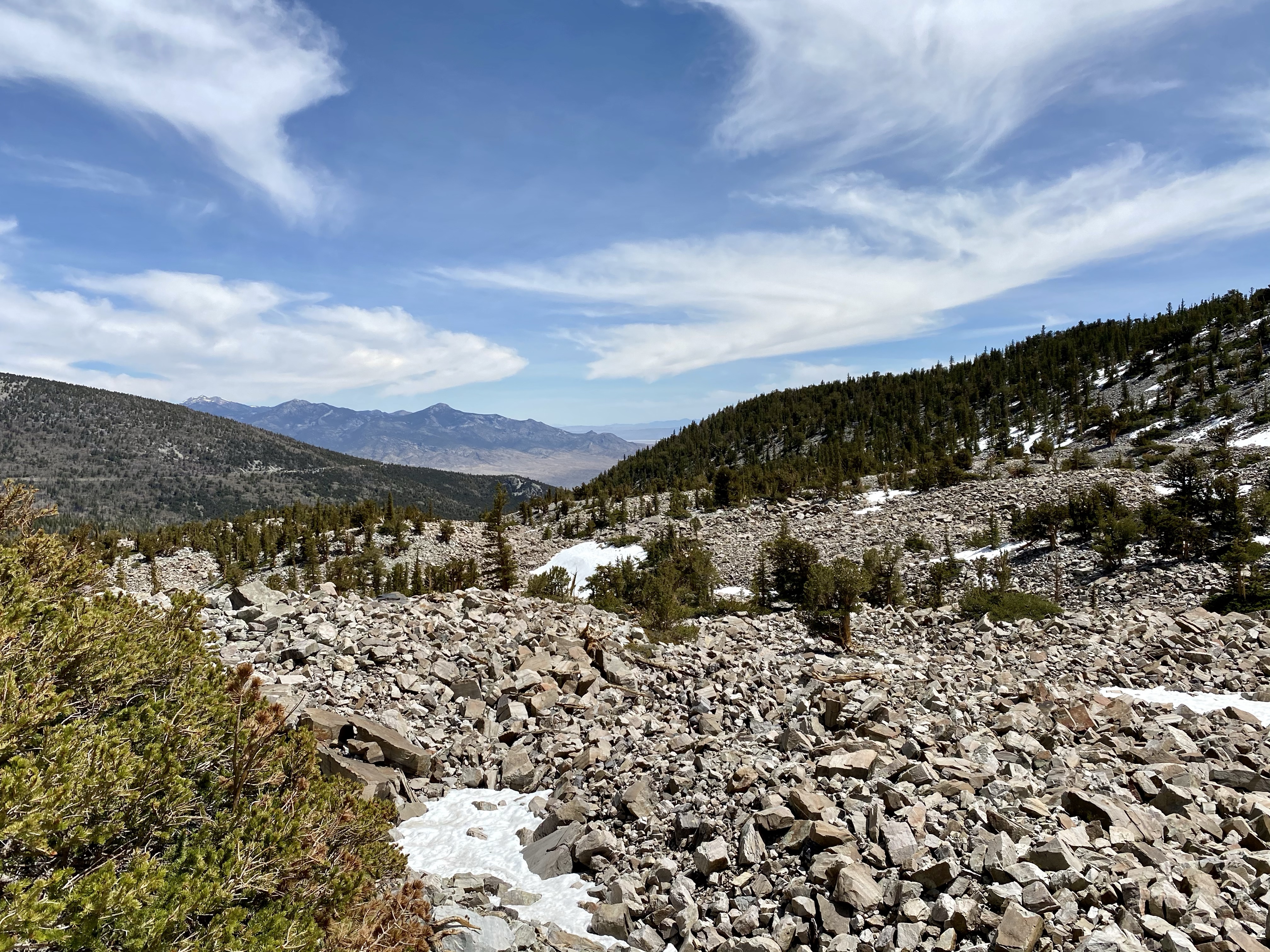
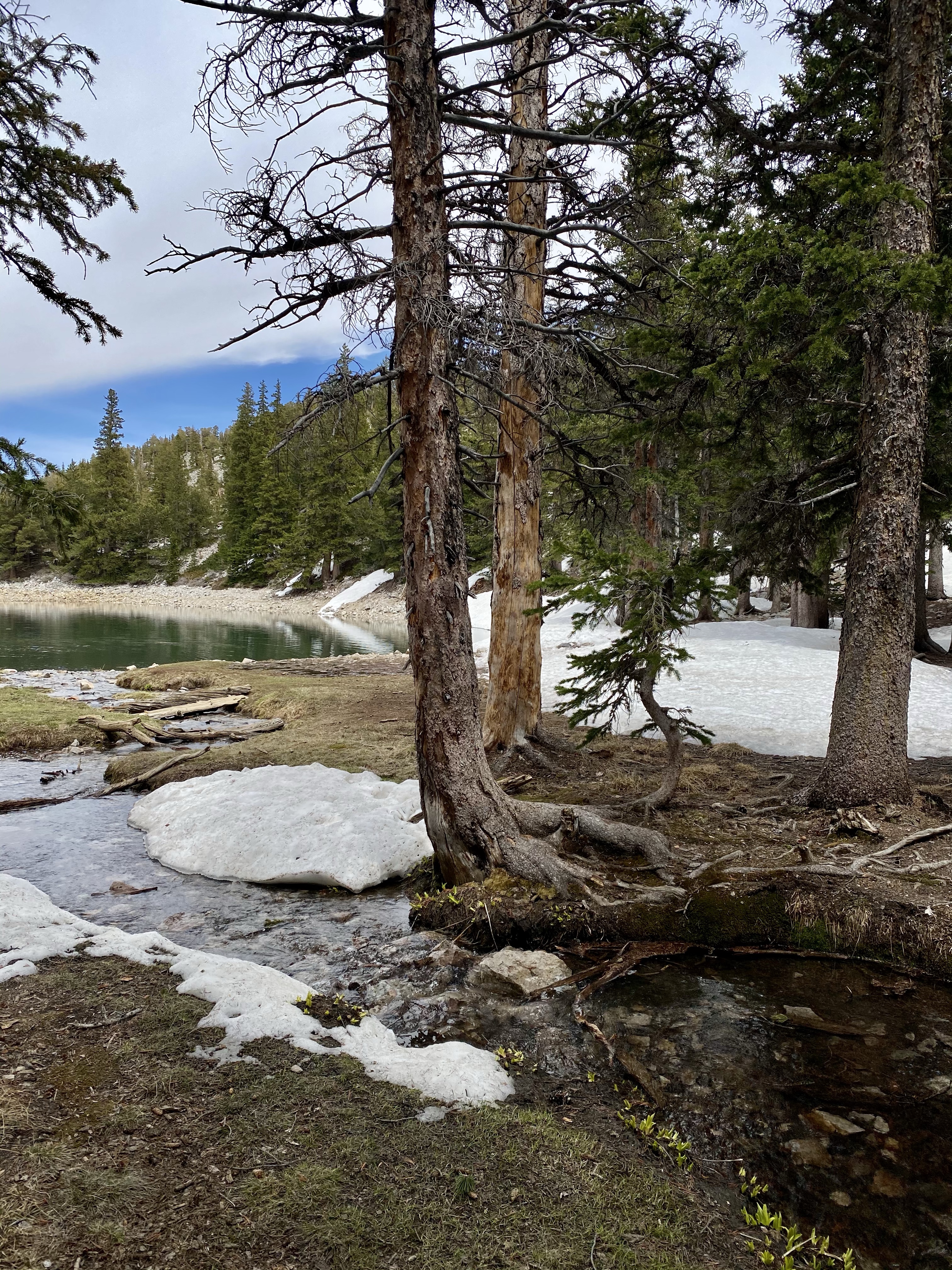
After a good rest, others started to arrive so I took off, back to the bristlecones and then van. The steps back were easier, mostly downhill, and quicker. I was almost back to the final stretch when a few fellow hikers convinced me to check out the glacial lakes. A few extra miles wouldn’t hurt, right? Might as well do it while I’m here!
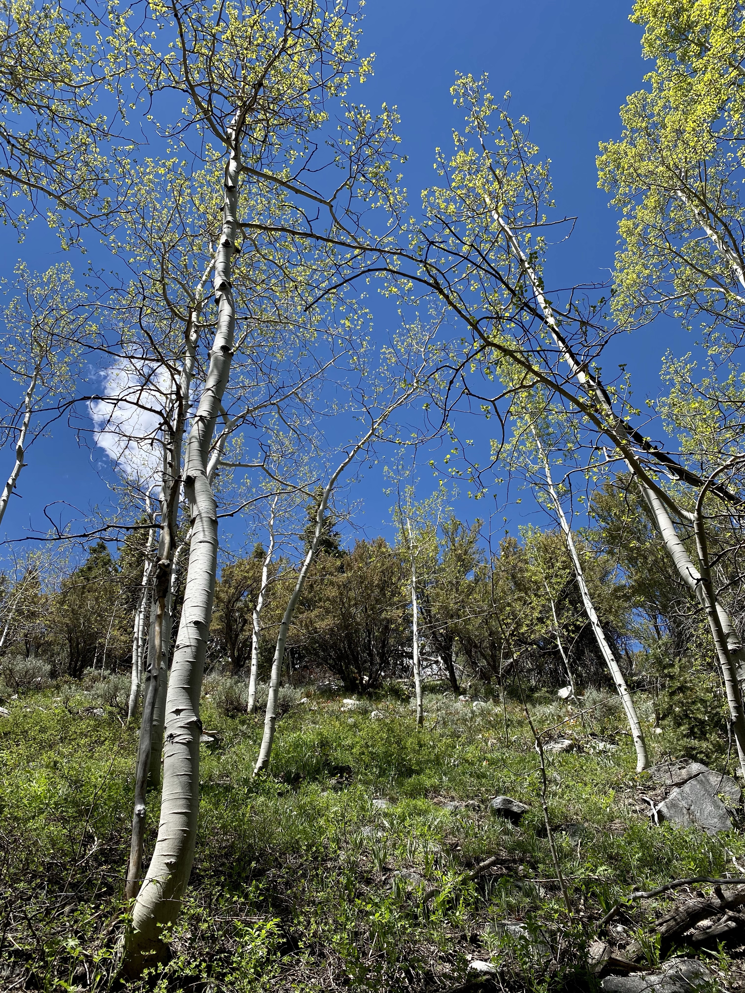
So off around the loop I went, first admiring Stella Lake then … Lake. Both emerald gems beneath gray mountains, snow lingering in the crevasses. I enjoyed each as I passed by, then entered the forest again, flanked by white aspens with lime green leave fluttering in the wind. Deer grazed in the meadow and a stream trickled by, a peaceful way to end the day.
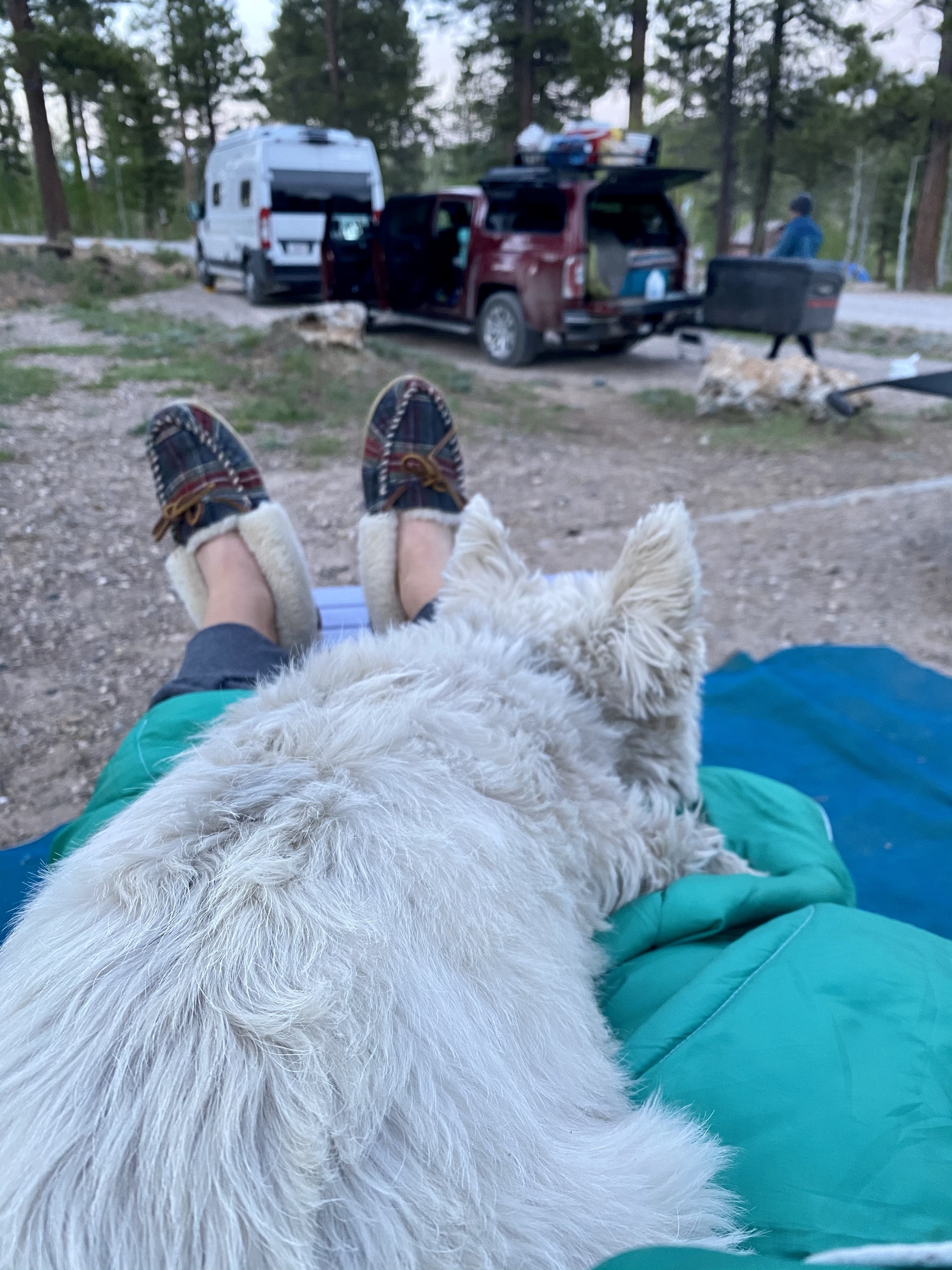
Sunny and I then wound down the mountain, my ears popping as we quickly dropped elevation. I lucked at grabbing a camping spot in the park at the first come first serve Baker Campground, and settled in for the evening to enjoy chats with friends and family.
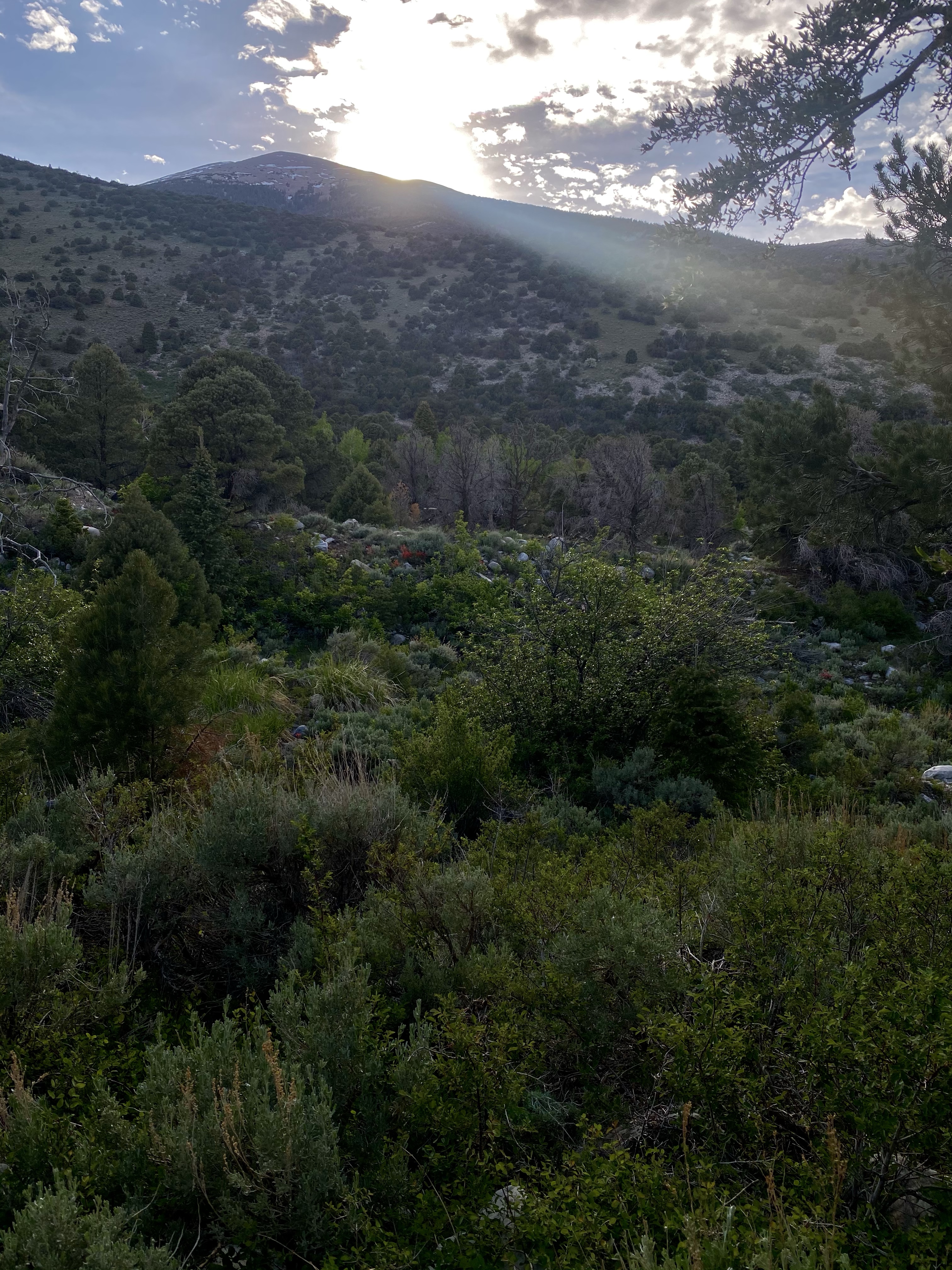
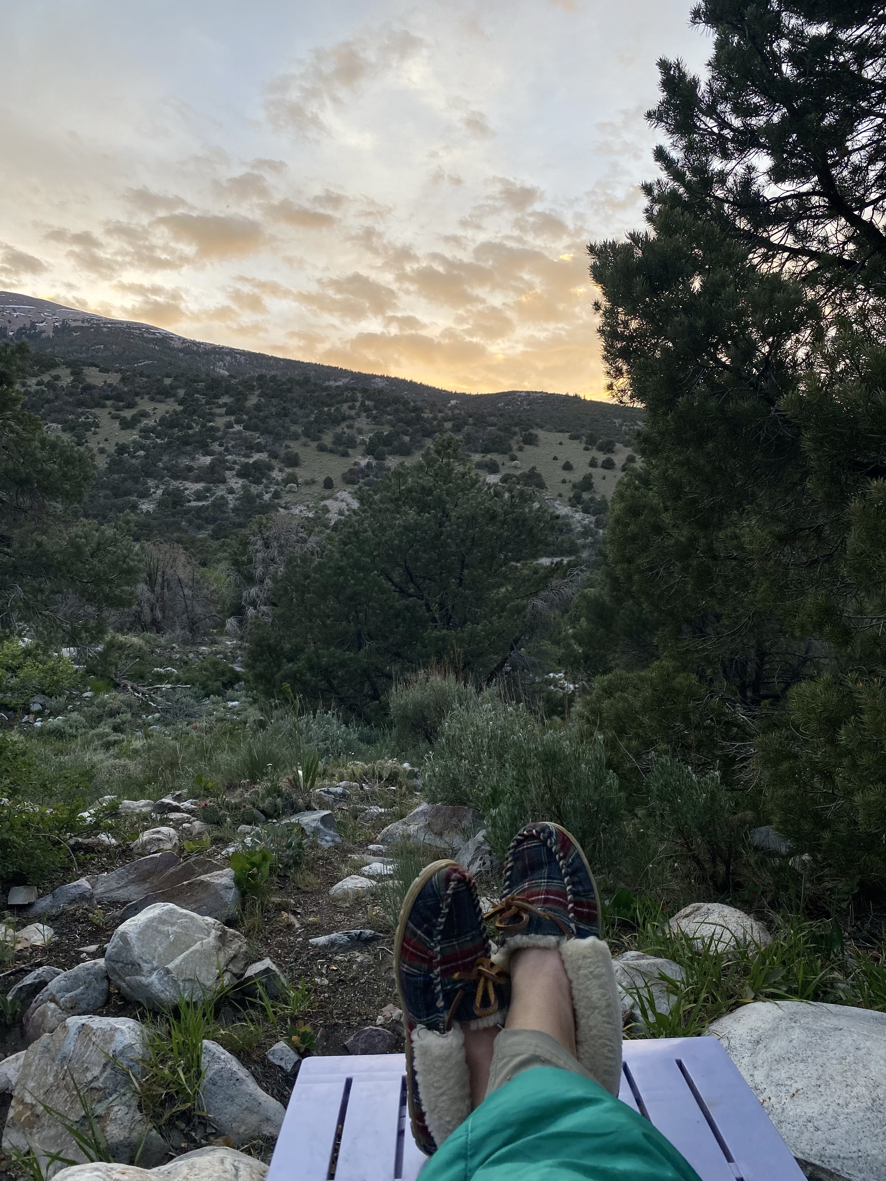
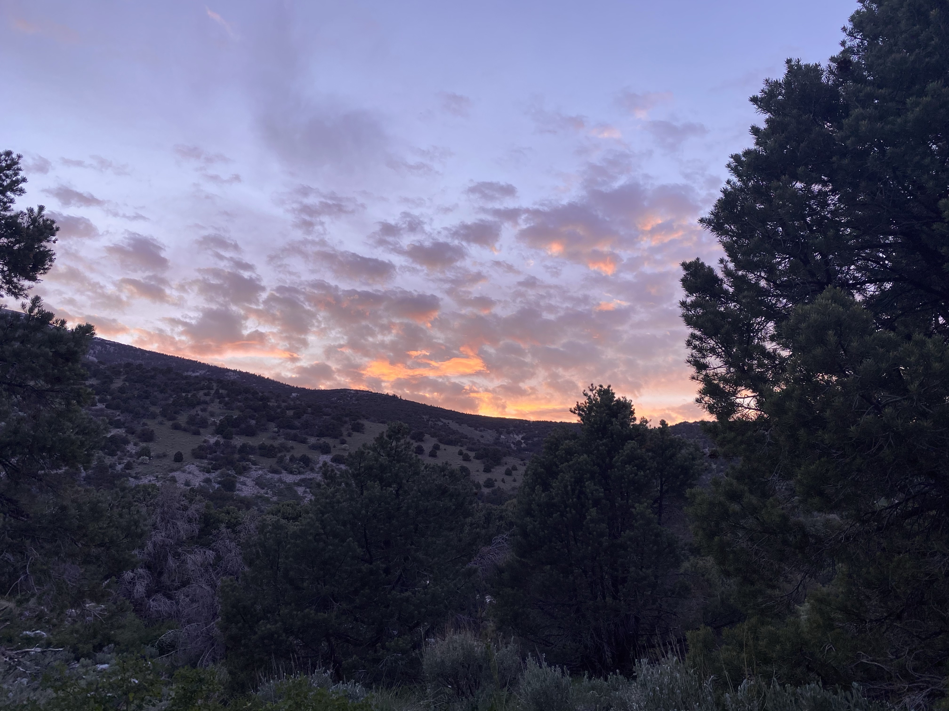
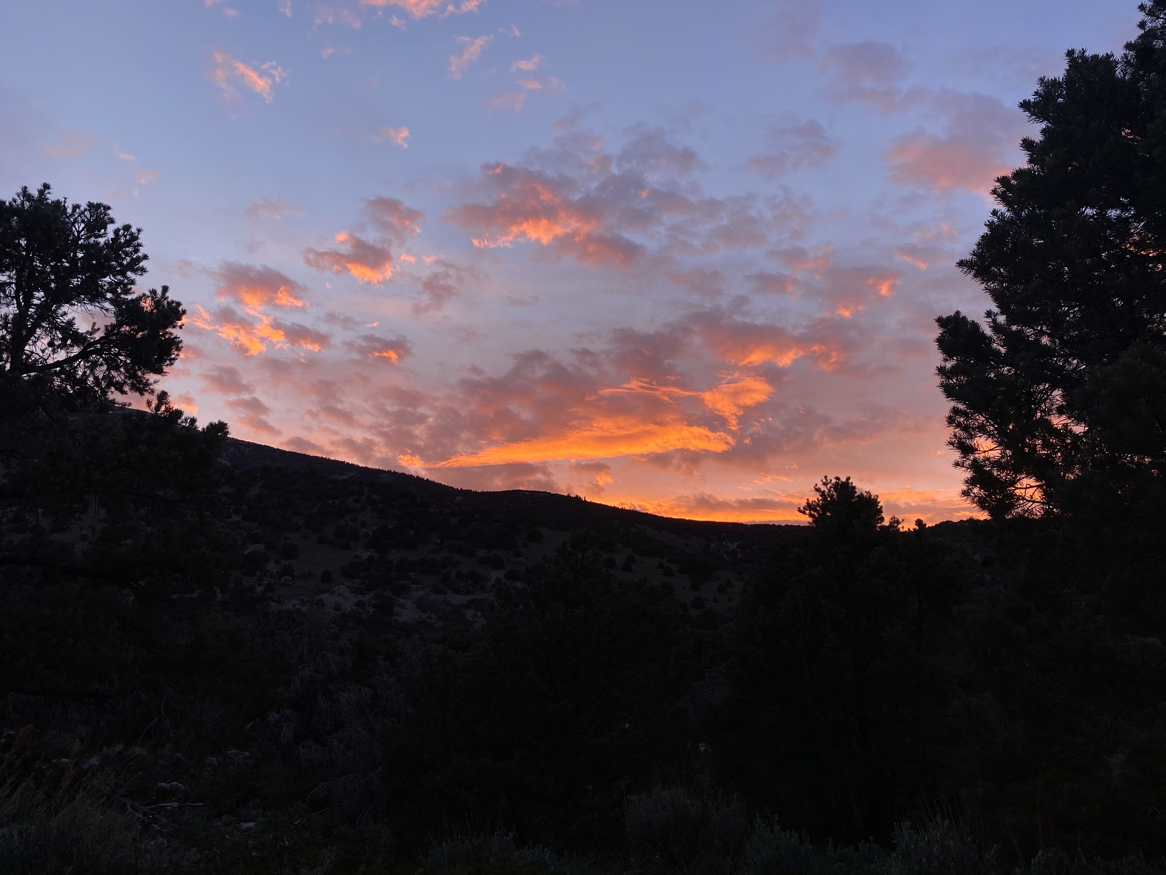
I’d already had a marvelous full day when the sun began to set and it beckoned my attention. The never ending sunset, it morphed for two hours, well after the glowing ball of sun had dipped behind the mountain. I couldn’t pull myself away from the pinks, purples, and oranges, dancing on the clouds above. I sat wrapped in my blanket, toes inside my slippers, enjoying the show. Stunning. A gift at the end of a spectacular day. I’m so glad I came to Great Basin. One more day of enjoyment ahead.