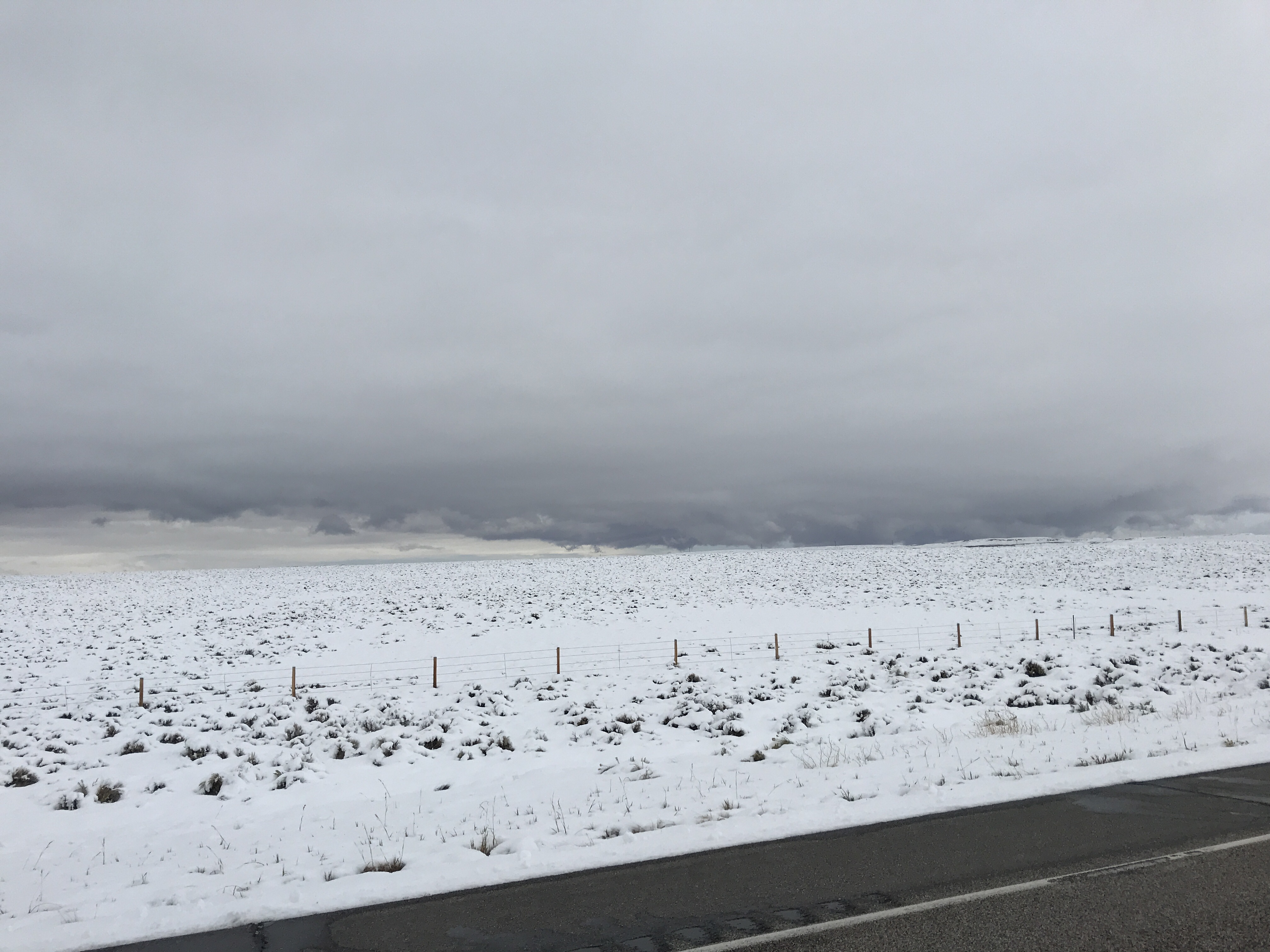
After leaving The Grand Tetons, we set our sights on covering ground and finding an RV Park with full hookups. The weather prediction for the night was freezing temperatures and snow. Yes, snow in September. As I said previously, summer in Wyoming is, well, different.
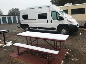
As we drove down the highway, we had plans to make it all the way to Casper, WY, but wind gusts of 30-40 miles per hour left us drained and ready to settle down about 100 miles short. So we got groceries, gas, and other supplies and found camping in Riverton, WY. It wasn’t a fancy place, but it had water and electric hookups – good enough for us and to ensure heat for the night! As soon as we settled in, the temperatures began to fall and before we knew it, we were running back and forth to the laundry room in wet heavy snow. It continued overnight and we woke up to an inch or two piled on the motorhomes and picnic tables. My first snow storm of the season! Haha
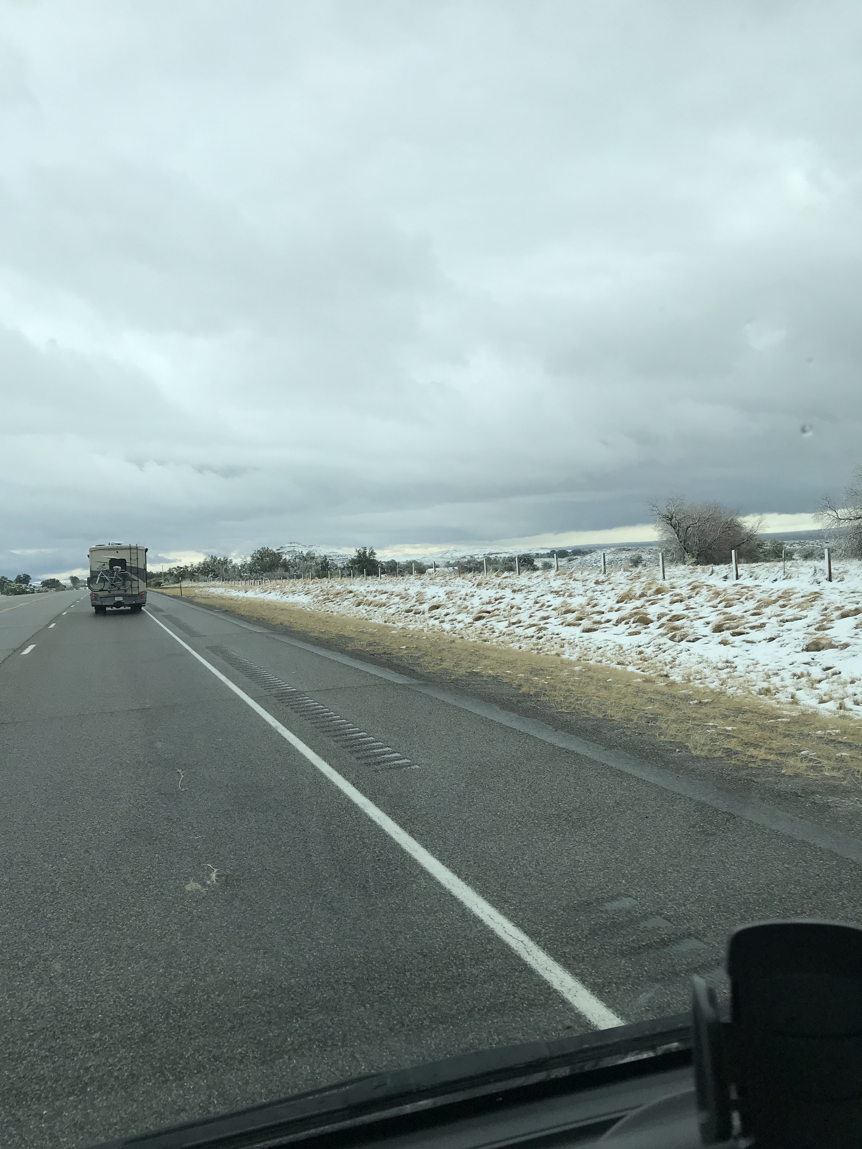
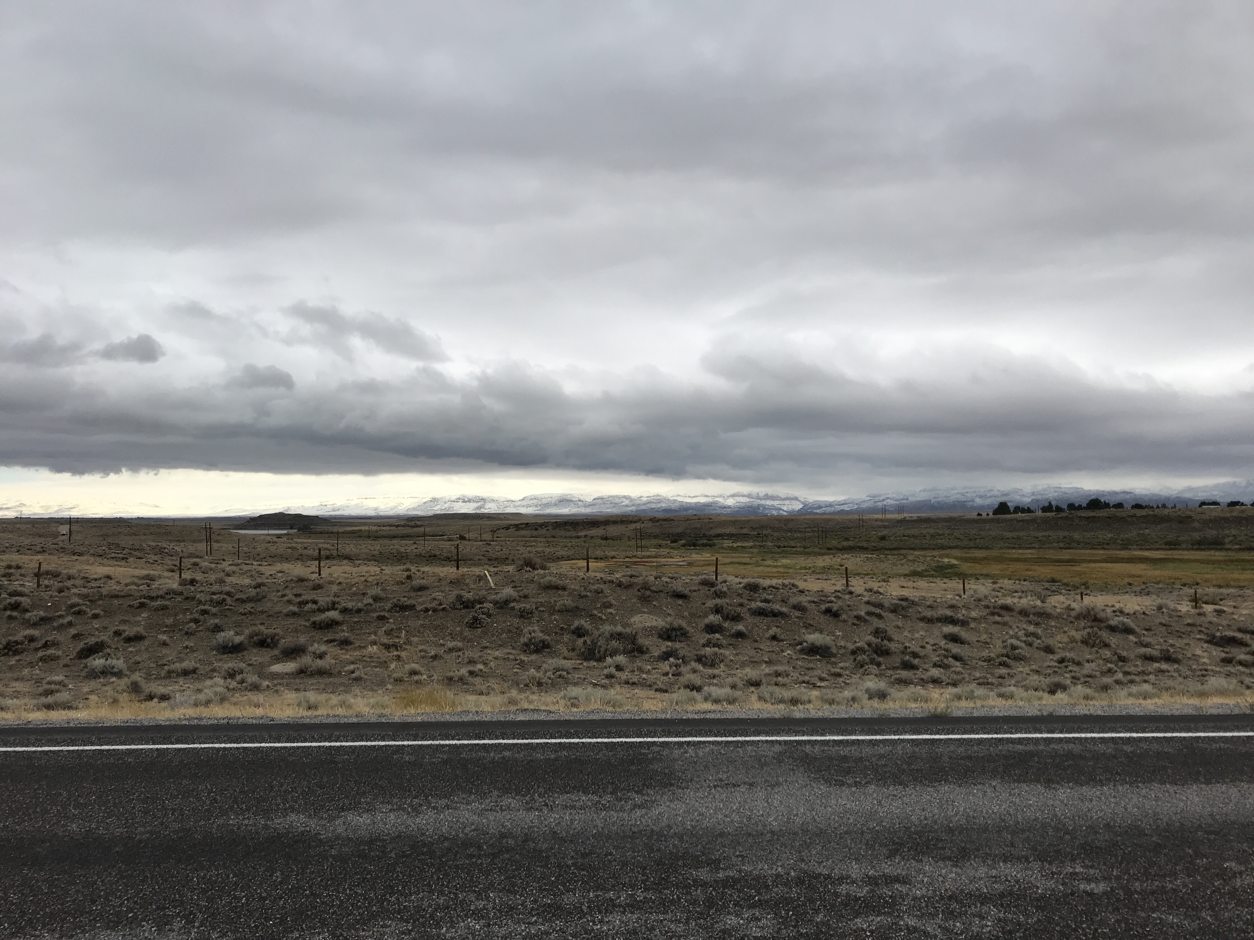
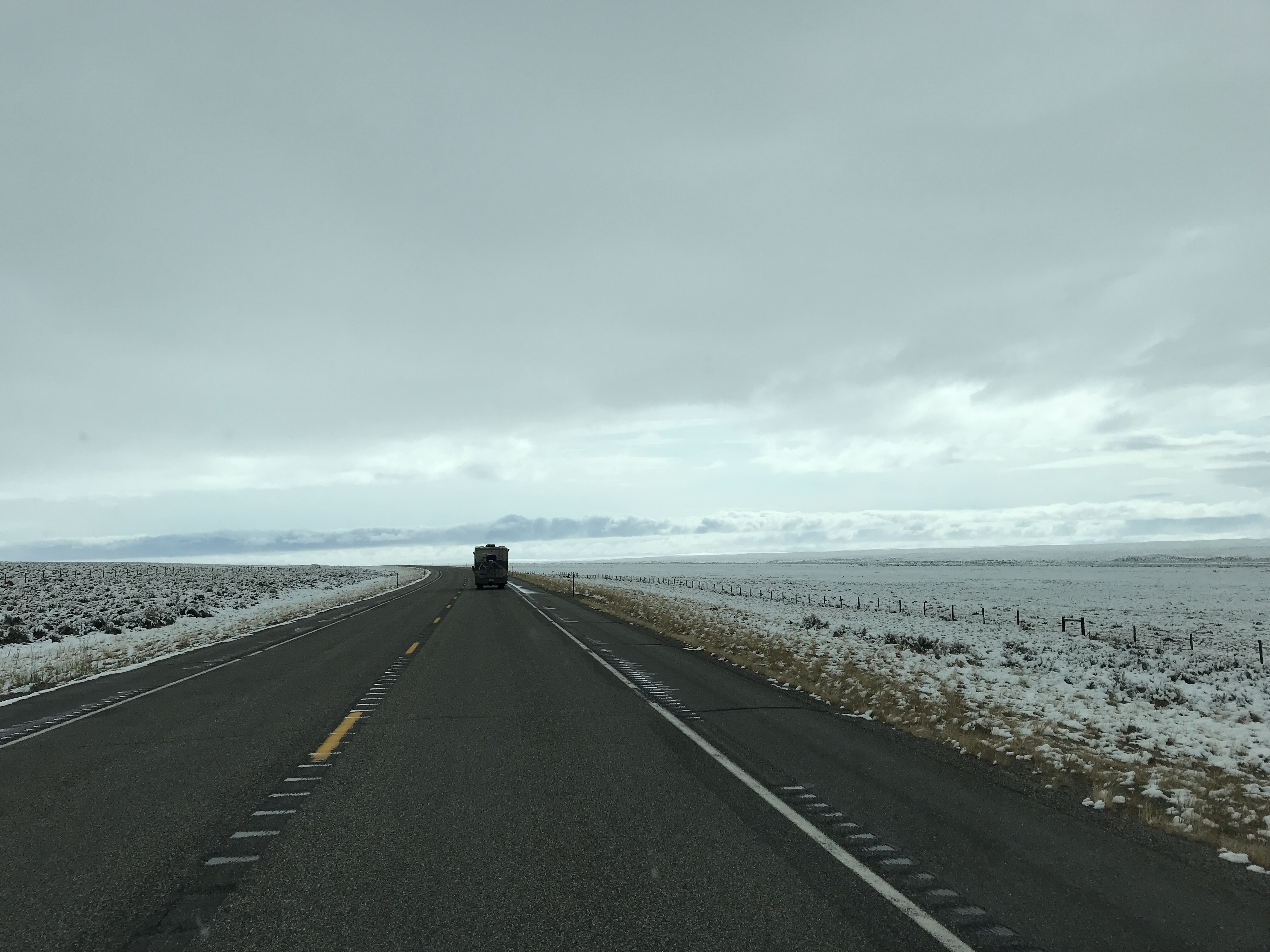
That morning we waited for temperatures to rise before driving, but the high of the day was somewhere around 38. So eventually we set off on another driving adventure through partially plowed roads where the speed limit is 80 miles per hour. We did not do that – more like 50 mph for us. The scenery was beautiful – a blanket of snow covering the land. In one direction the snow covered mountains glowed in the sunlight, in the other they were topped by ominous dark clouds. It would have been enjoyable to admire, if the roads were in better condition. After seeing a few cars skidded off the road (everyone was outside their vehicles and ok), getting splashed by tractor trailers, and having ice chunks thrown at us by plows, we opted drive to the interstate and rerouted. Another driving “adventure”. So far, the Solis has now withstood curving, narrow roads, hail, high winds, and snow. It’s a beast. 😍
Exhausted from the stressful driving, we settled in Gillete, South Dakota, our 12th state of the trip. We ended the day with pizza and drinks. Well deserved. (Although I accidentally got served gluten-FULL pizza and ate a slice before the waitress realized the mishap. Luckily I am not allergic. I did suffer a few days of discomfort and tiredness, but am fully recovered now). It was an, interesting (?), introduction to South Dakota.
The following day we moved on, me a bit cranky from the gluten, to Spearfish, SD. I did my best to make the best of the day despite not feeling well.
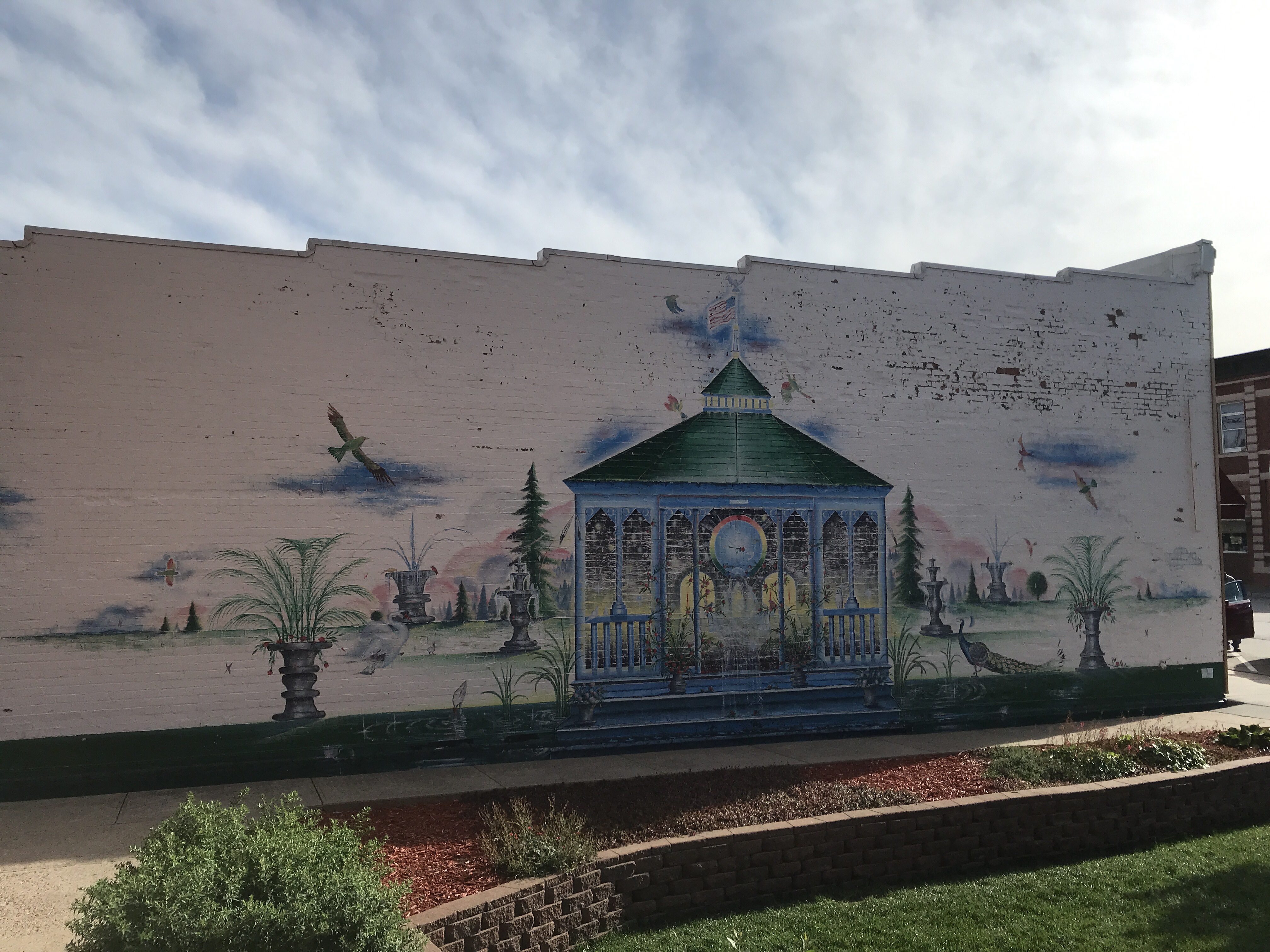
Spearfish is a great small town with a vibrant downtown area, beautiful city park and campground, and historic fish hatchery! We walked around the shops, which were very quiet, and made a few purchases to support local businesses. I bought myself a new pair of strap sandals since my old ones had been falling apart since North Dakota, week one. The gorilla glue I used to hold them together was working pretty well, but they’d certainly seen better days. So, I treated myself to a new blue pair of Chacos. They are working out very well, although I still can’t seem to part with my Merrells – maybe it’s because I’ve had them since middle school. Haha
That night we settled into the green, quiet campground at the edge of the city and enjoyed a peaceful night of rest. Tomorrow we would continue the path east, slowly making our way home.
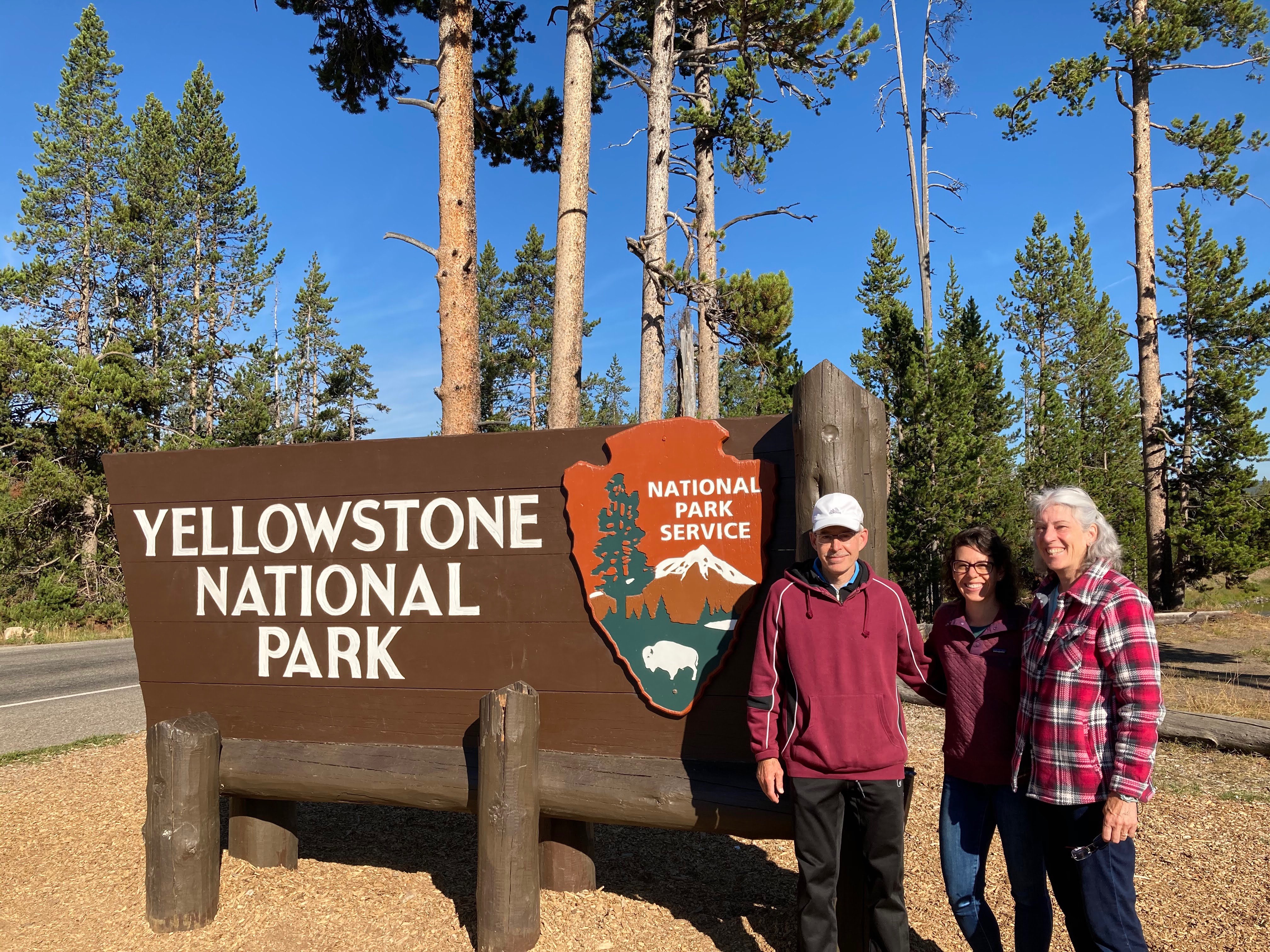
Thursday before Labor Day Weekend, we checked out of Yellowstone and made the short drive to our next national park, The Grand Tetons. Leaving Yellowstone a day early was a great idea as it secured us a camping spot in the park for the next four nights. We snuck in right before the holiday rush. Kuddos to my dad for the suggestion and encouragement!
Goodbye Yellowstone, hello The Grand Tetons!
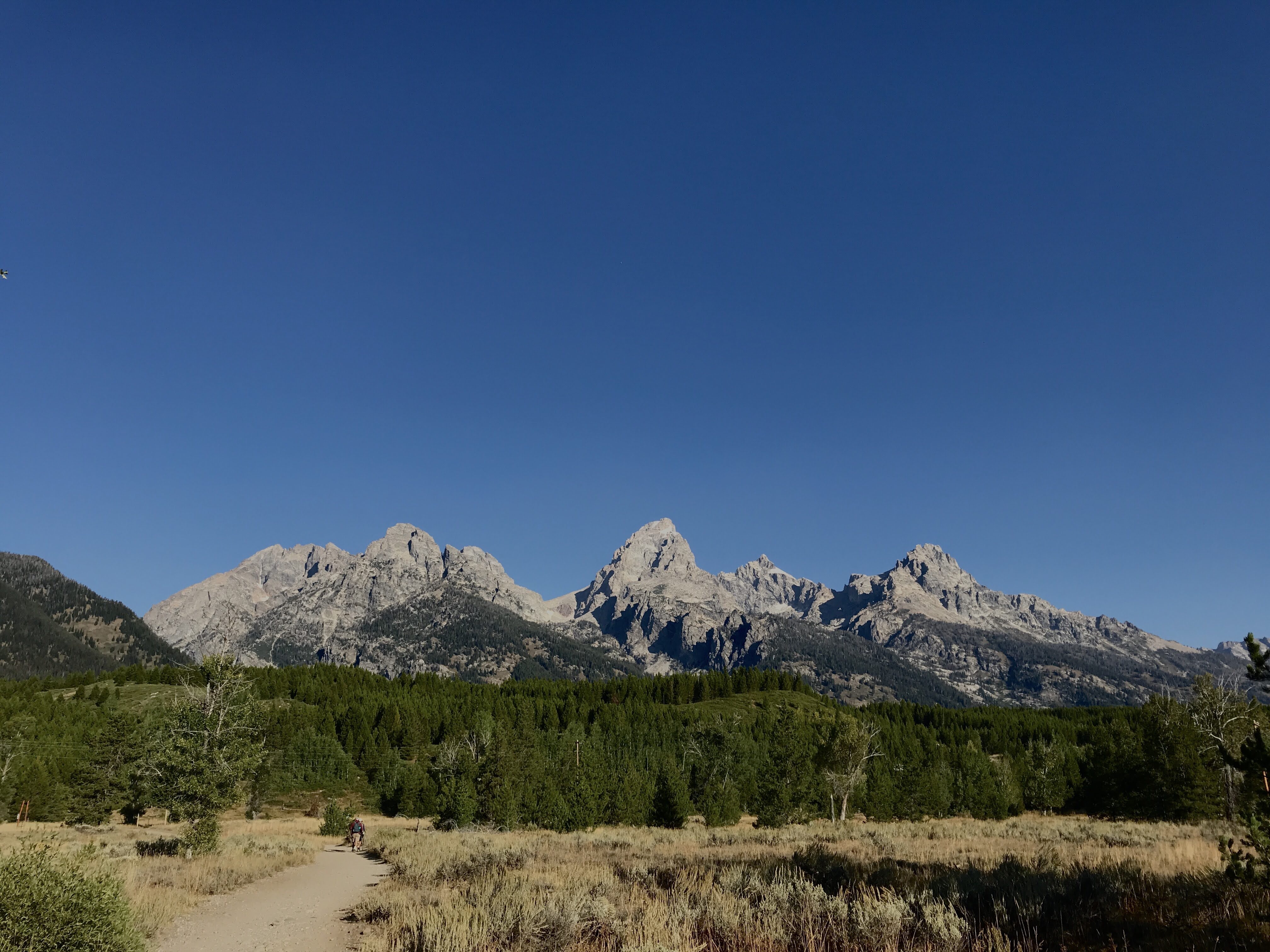
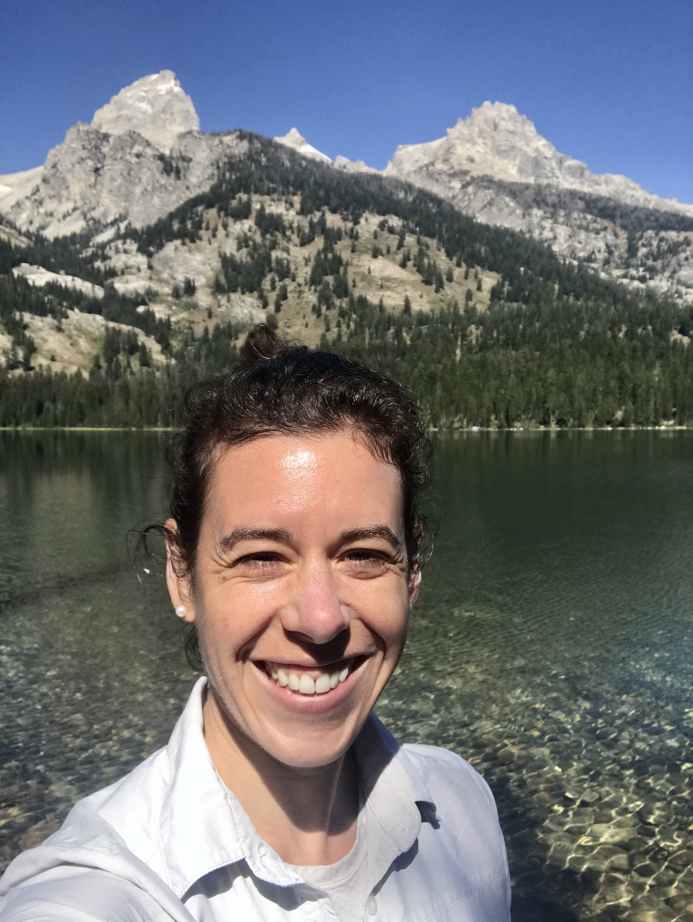
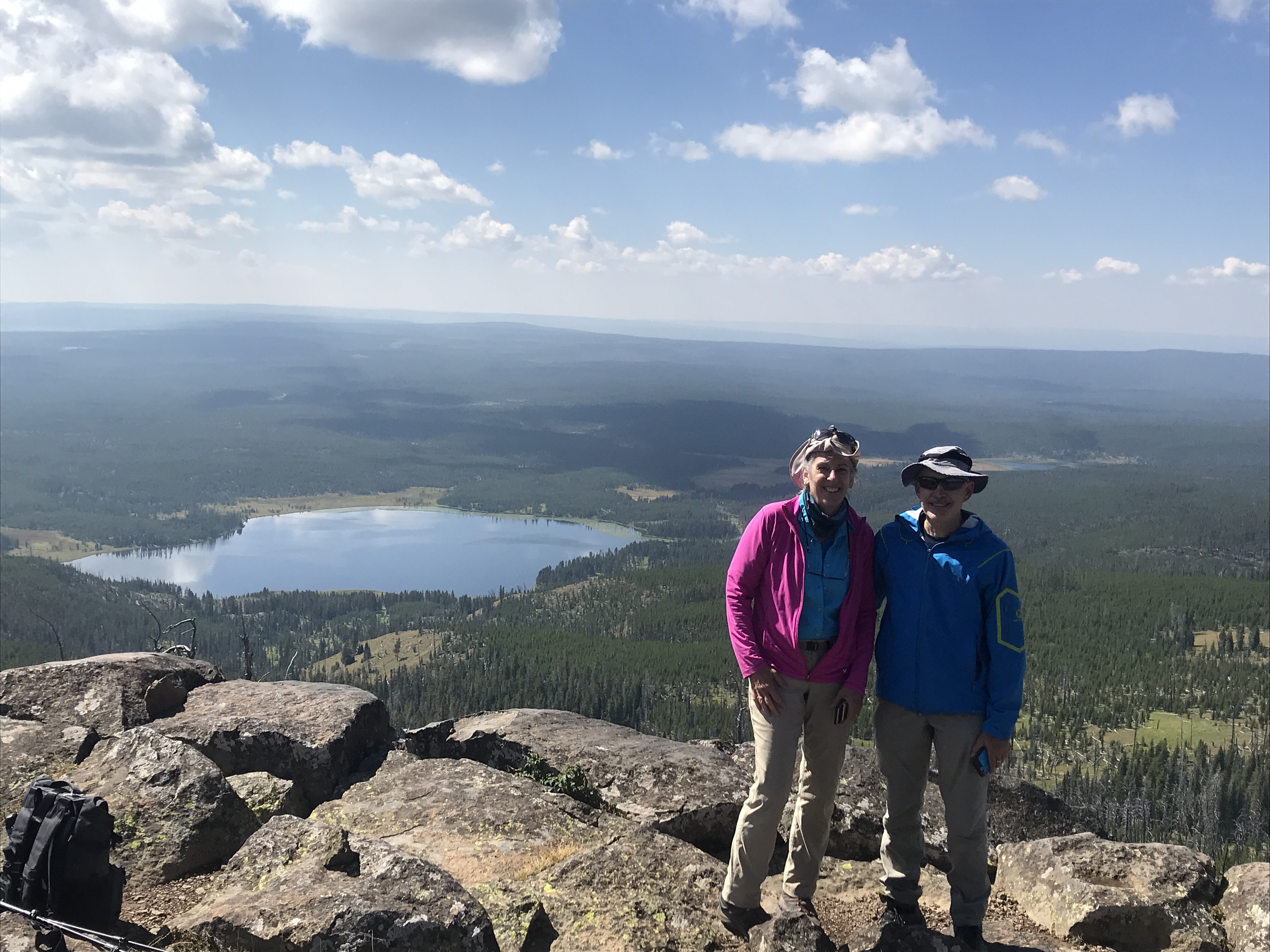
We spent the next three days exploring the park and admiring the marvelous mountains that erupted from the land. The Grand Tetons certainly live up to their name. Gigantic steel gray mountains, topped with white tufts of snow and glaciers, set behind the serene Jackson Lake. They were so big, they seemed on top of us in Colter Bay even though they were miles away. The first afternoon in the park my dad and I walked down to the lakeshore and hugged it’s edge, soaking up the sun bouncing off the water and mountains. It was easy to get distracted and have time slip away. Hunger eventually got the best of us, and we continued on the Lake Foot Trail back to the campground and up the hill to my parents’ camping site. We ended the day with dinner at the picnic table and a friendly grouse visitor.
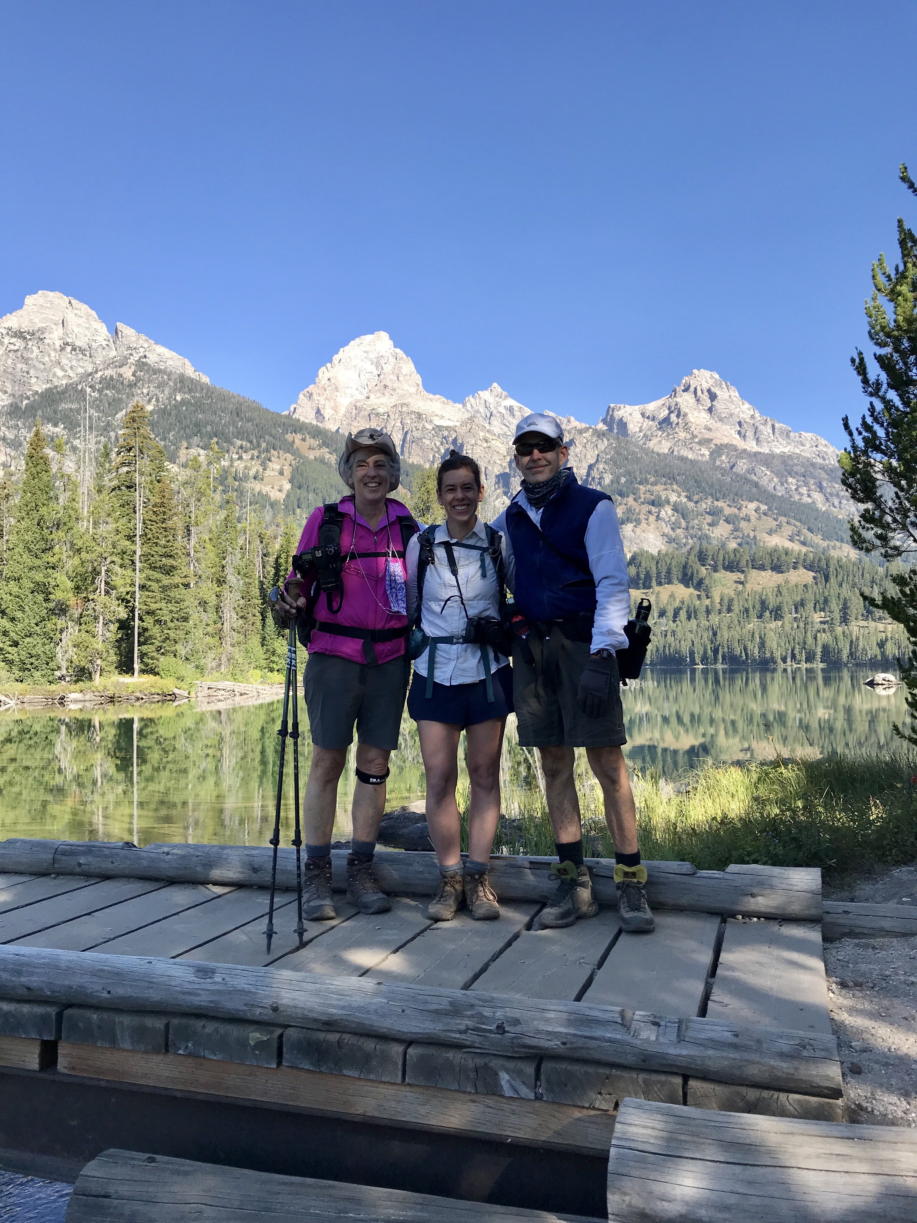
The next day I picked my parents up in the van and we set out for Taggart and Bradley Lakes. As we were leaving the campground at 7:30AM, a long line of hopeful campers were parked at the entrance. Everyone was vying for a spot in the campground, which is first come first serve. The line had to be about 50 vehicles deep, lined up two by two, stretching past the stop sign and curving down the main road. Boy, were we happy we had come in yesterday! We sent good luck and positive vibes to the waiting campers and continued on to our hike.
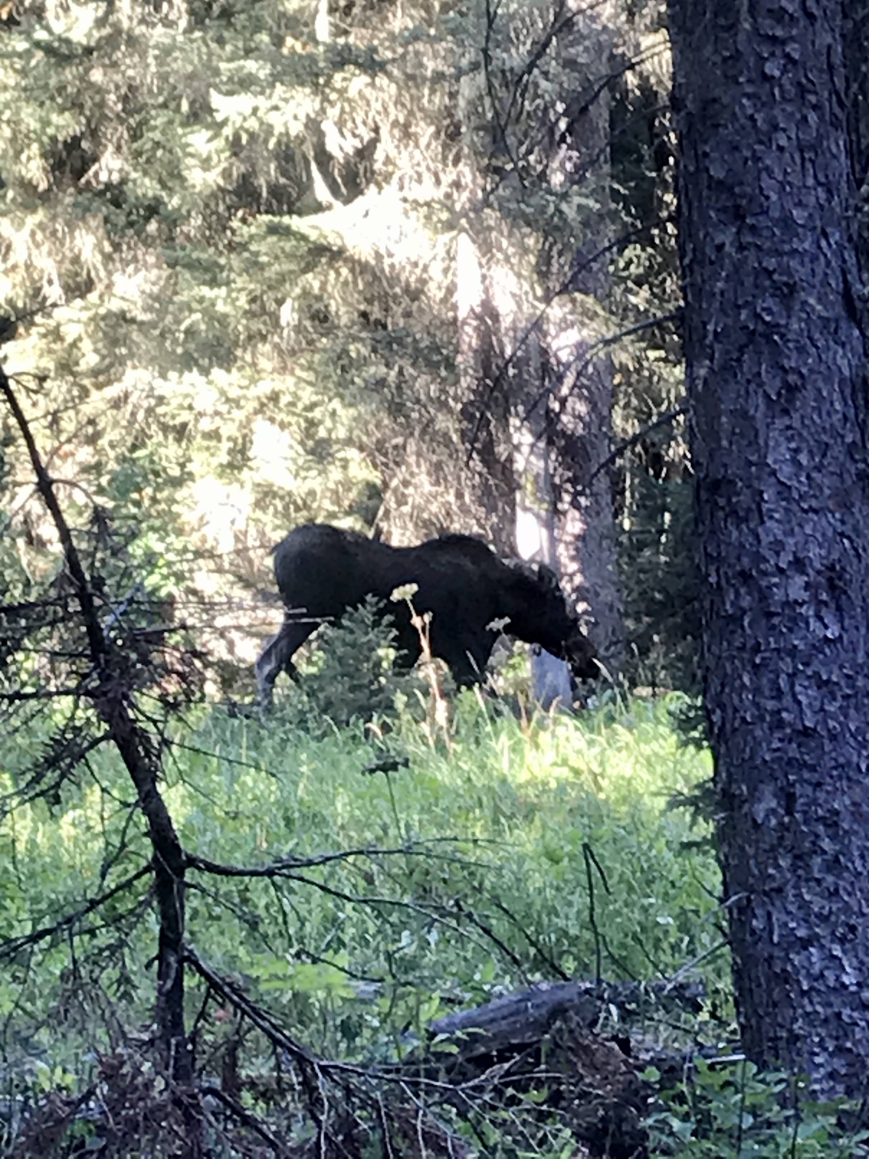
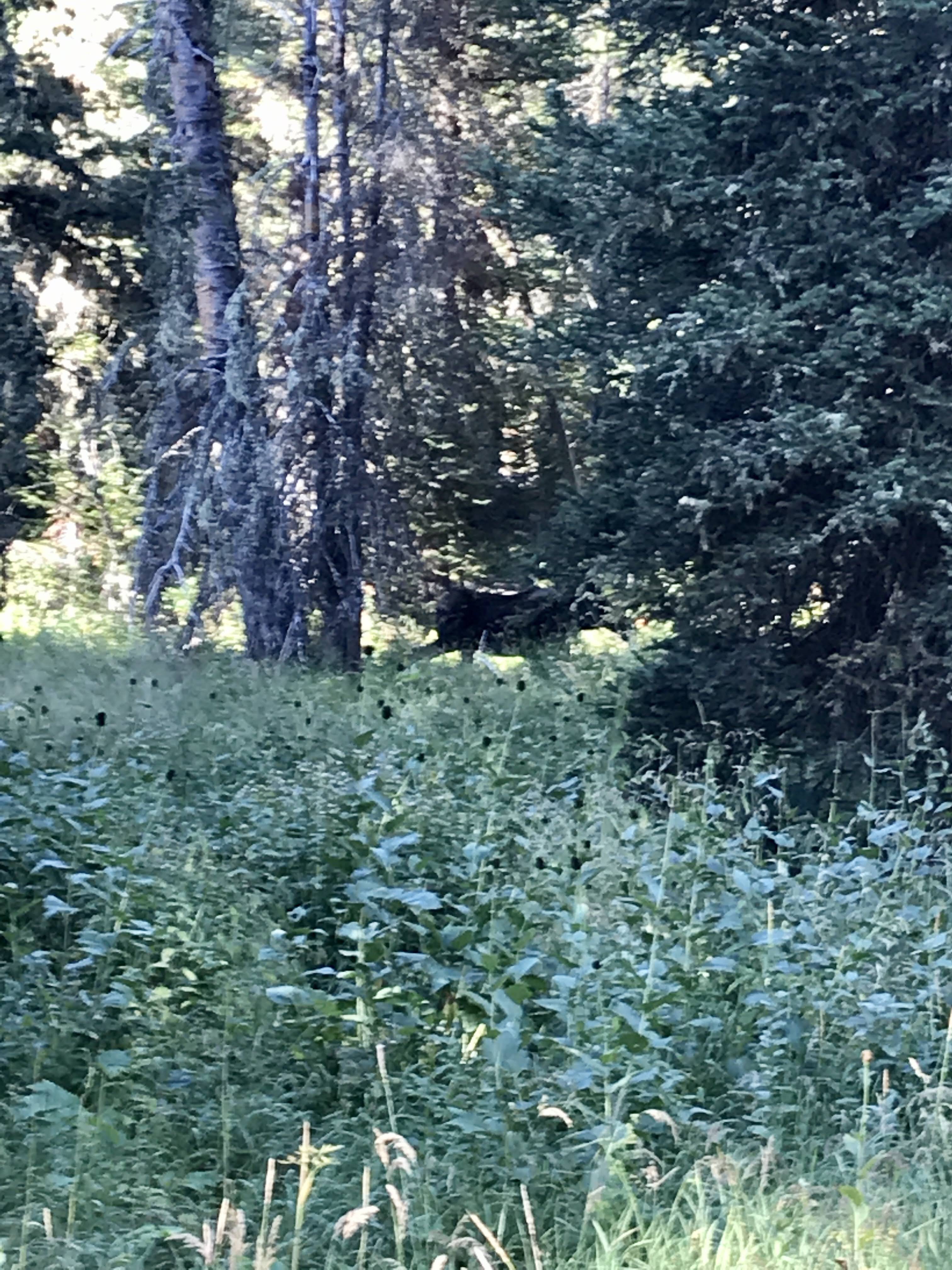
The trail to Taggart and Bradley Lakes is a popular one, so we were motivated to get an early start. The two lakes were formed by melting glaciers and dammed by moraines – the earth the glaciers pushed ahead and left in large hills as they melted. the lakes were hidden in the rising and falling terrain. As we started out, there was a chill in the air, but the shining sun gave us life. We hustled along, until we stopped abruptly. There was a moose in the forest! It was moseying long, paralleling the trail as it chewed on grasses and shrubs. What a great morning gift! We followed it for a while, trying to snap the perfect shot, before it drifted away into the thick vegetation. They are such large, gentle looking creatures. It was the closest I had ever been to a moose, but still far enough away to be safe.
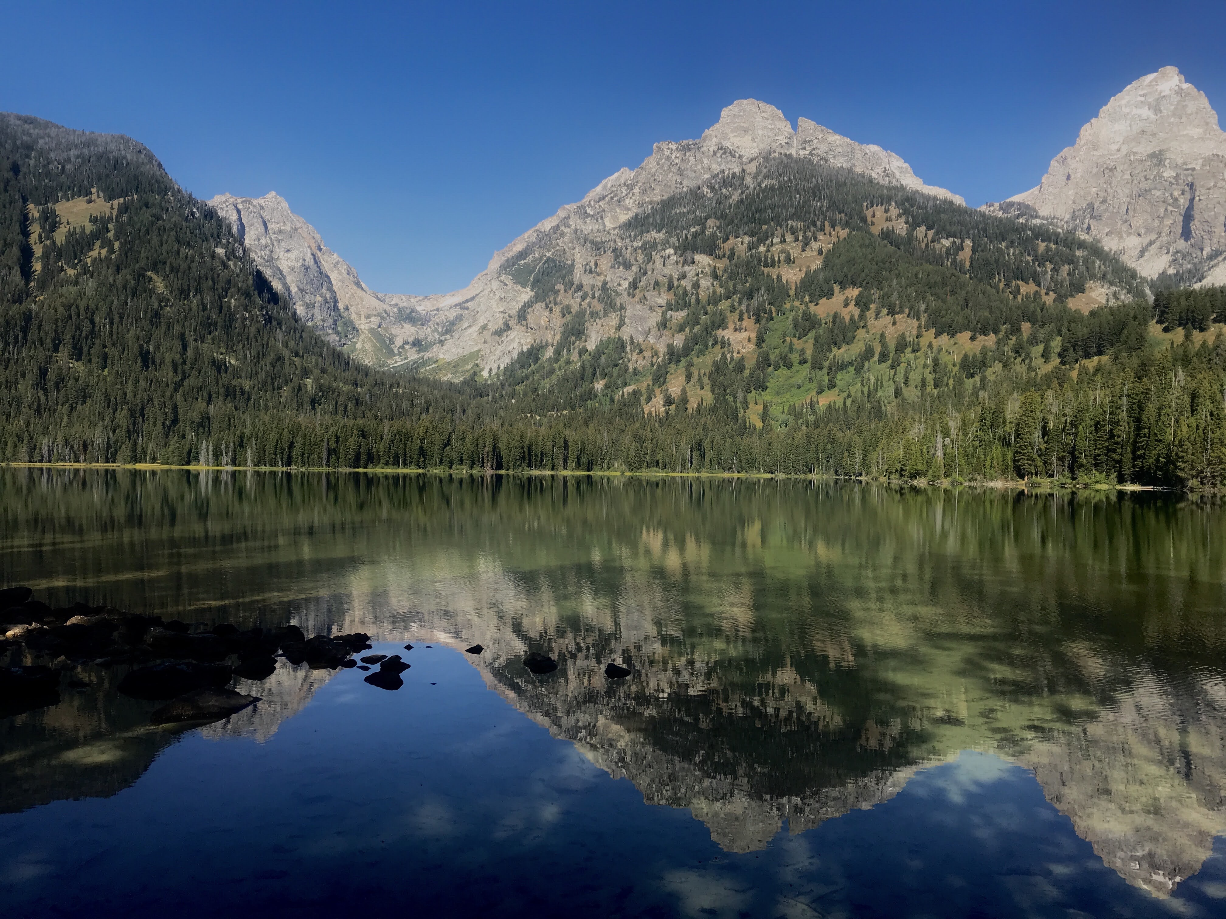
The excitement of more wildlife sightings encouraged us forward and we proceeded to Taggart Lake. Quiet and peaceful, nestled in the woods, It did not disappoint. The sun was perfectly placed in the sky so that it created a reflection of the massive Tetons in its waters. We admired it for a while, enjoyed conversation with some people from Alabama and Dorchester, MA (!) and continued on.
Bradley Lake was our next stop, another spectacular setting to admire the mountains. We found a quiet spot down by the water and enjoyed lunch. While we didn’t see any more animals that day, the mountain views satisfied our souls.
Back at the campground later that afternoon, we enjoyed delicious scoops of ice cream and then I plopped my chair down on the stone beach of Jackson Lake to bask in the sun and enjoy some alone time. It was a good way to end a great day.
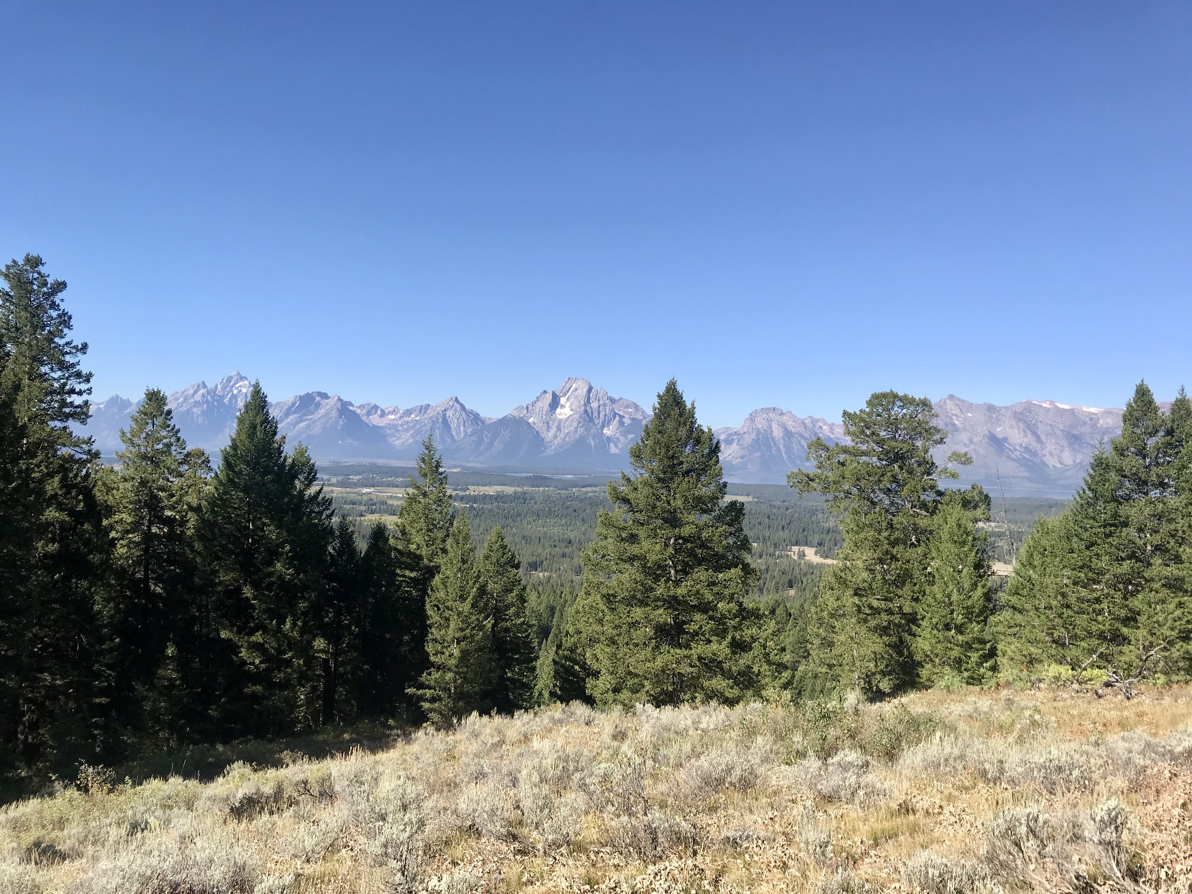
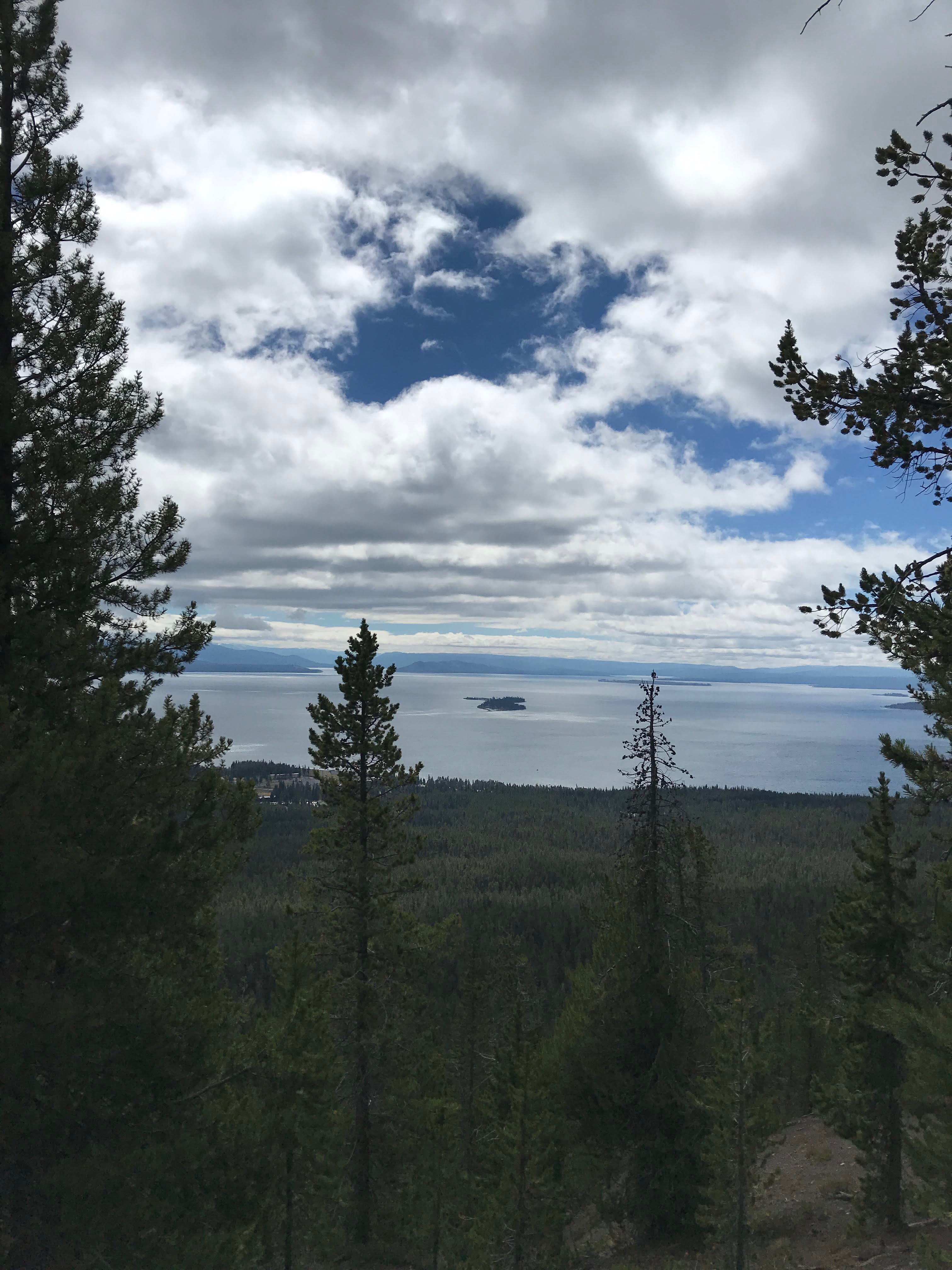
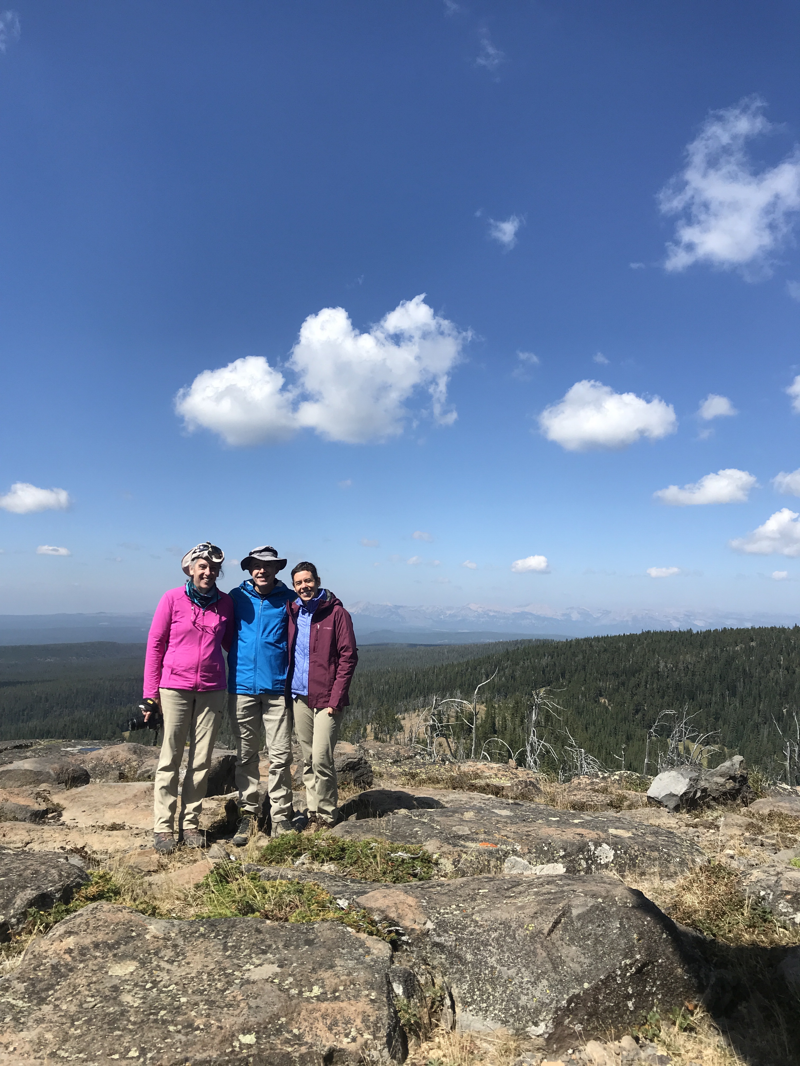
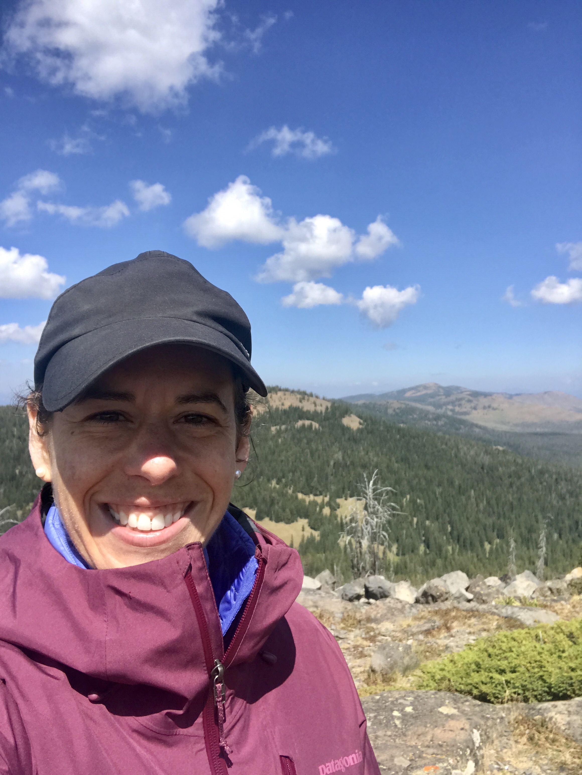
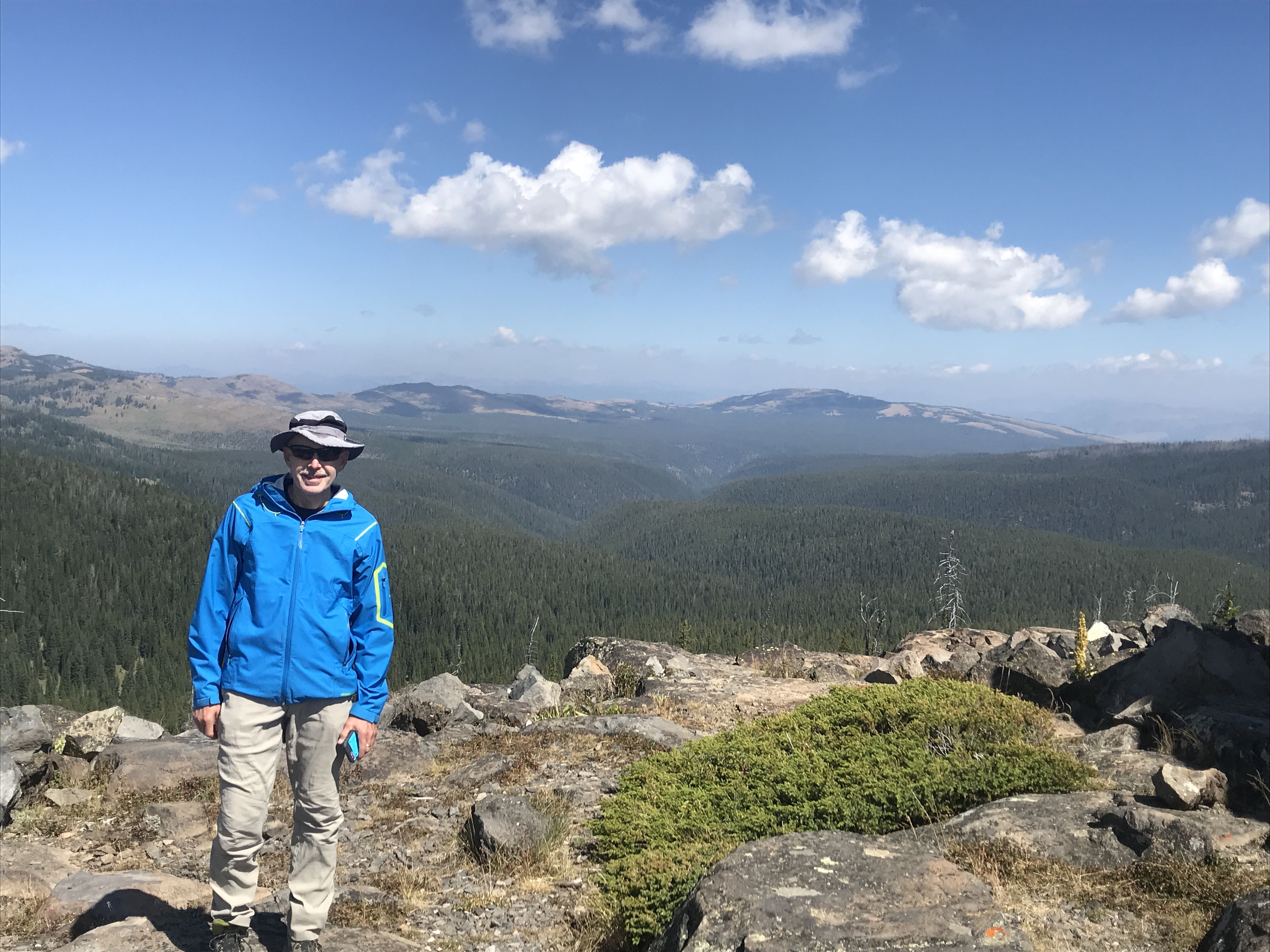
The next day, Saturday, we opted for another hike to see The Tetons. We had to capitalize on the smoke free views while we could. So we found the trailhead to Lookout Point and Two Oceans Lake down an unlabeled dirt road, parked in the nearly empty lot (win!), and set out for the 600 foot climb.
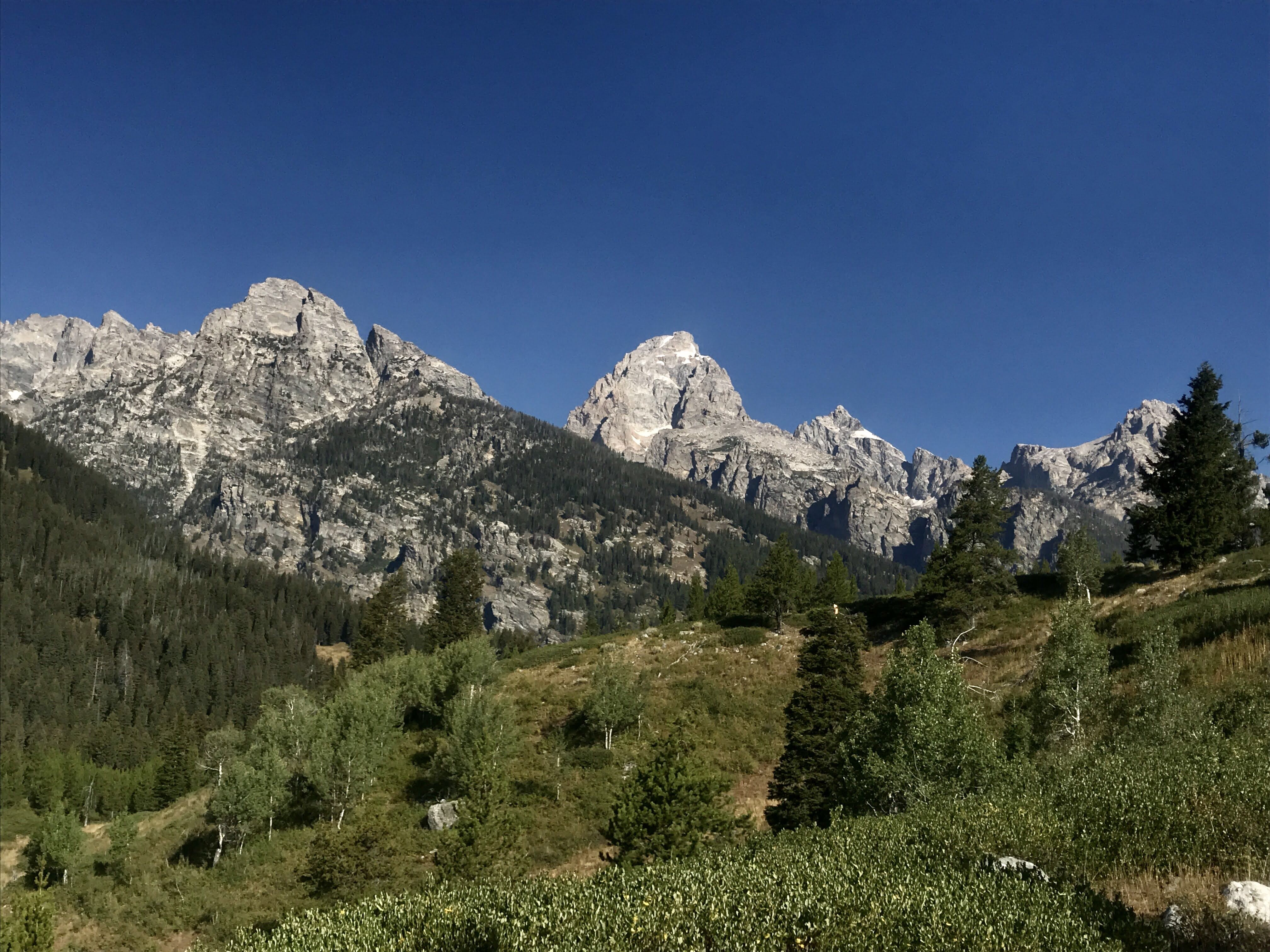
Up at the lookout, we had a picture worth view of the line up of mountains in the park. They were crystal clear in the distance, putting on a show for us on this lovely morning. When we got to the top, a few other hiking groups were there, but they quickly moved on and we settled in to enjoy the scenery. I’ll let the pictures speak for themselves.
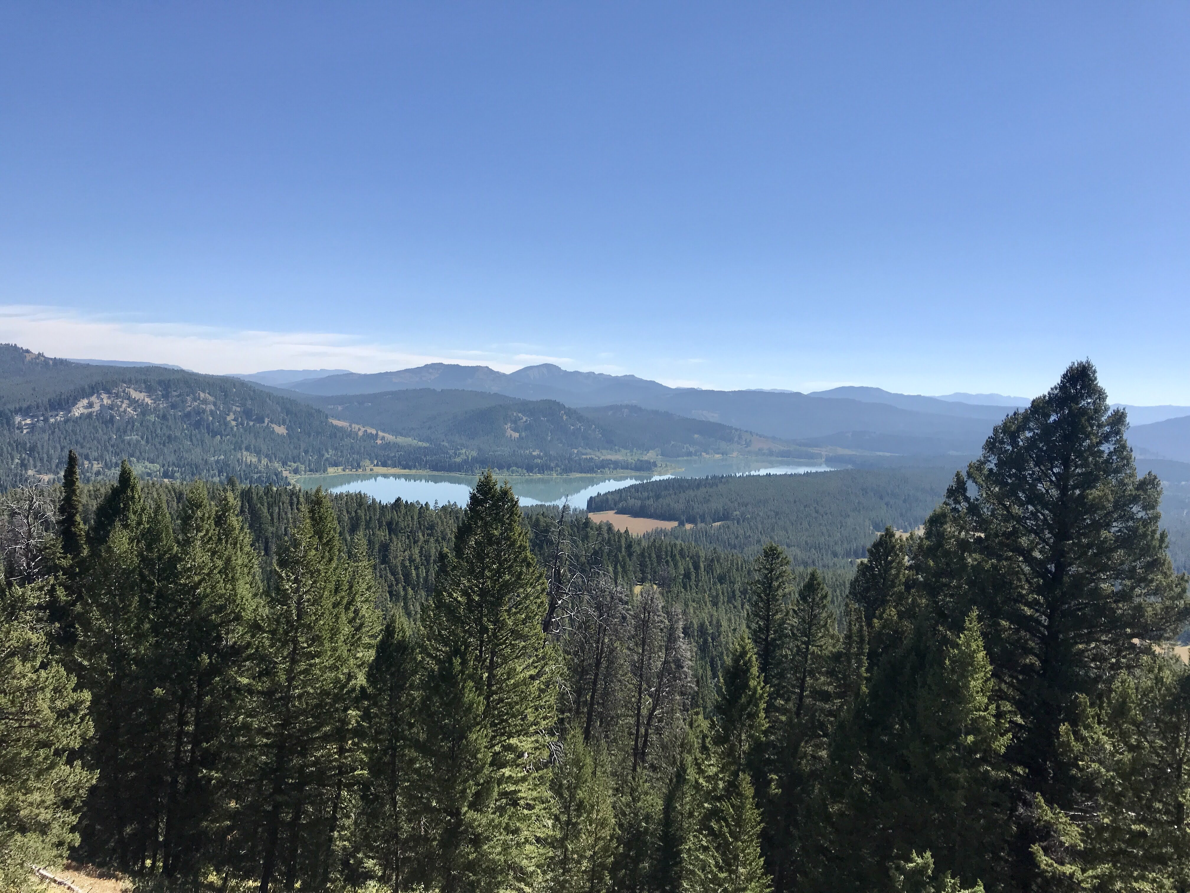
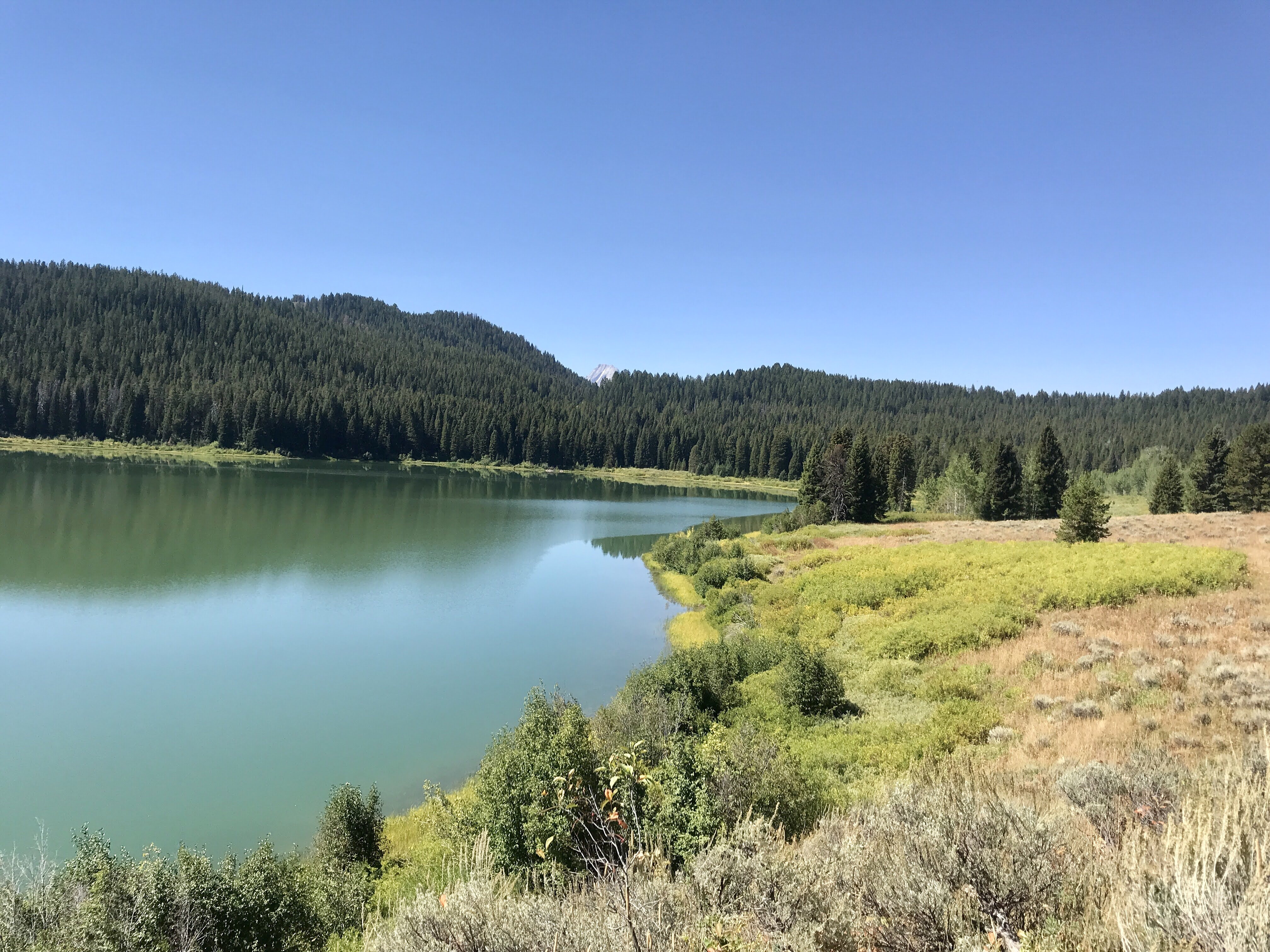
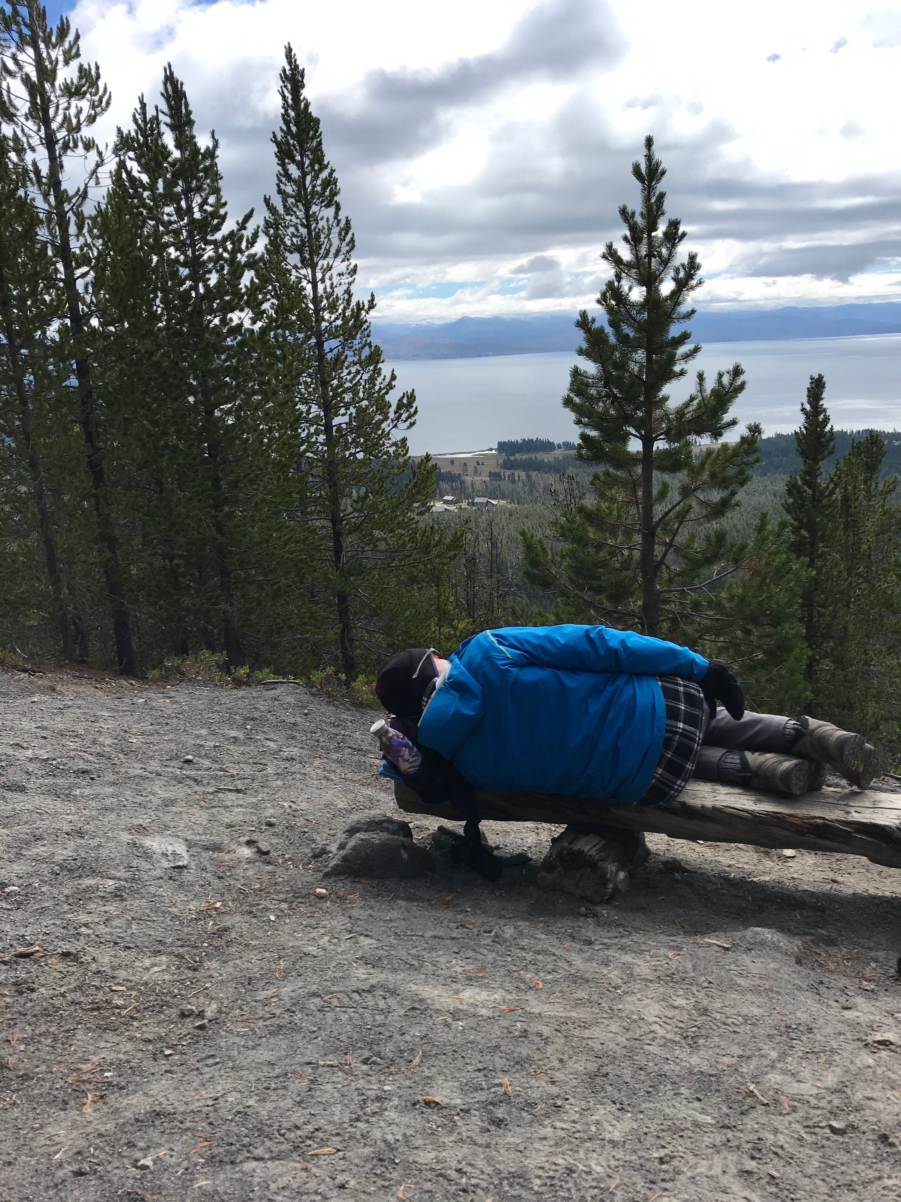
We spent some time chatting with a couple from Idaho, socially distanced of course, and then proceeded down the other side of the trail. A few miles ahead, through the woods, lay Two Oceans Lake. A green blue gem stretching long through the hills. We walked for a while down the path, but it soon grow narrow and grass-lined without much of a view. We knew we weren’t going to loop the whole lake anyways, so we turned around to backtrack to a good lookout spot for lunch. I found a great log to sit on and propped myself up to soak in the sun. Got to get that vitamin D when you can! The still waters of the lake were peaceful to admire.
Eventually we made our way back to the car, completing our seven miles for the day. That afternoon I caught up and reconnected with friends via the phone, which always makes my heart happy. Later, with my parents, we finished the day with a campfire. It was relaxing and warm, quiet and soothing, until a fox snuck into our campsite looking for a snack! It came right up behind us, about four feet away, put it’s paws on the picnic table, and sniffed around for scraps. Very bold, and not a good thing – too comfortable with people! It quickly scattered though when I gasped, and slunk away through the trees. Never a dull moment!
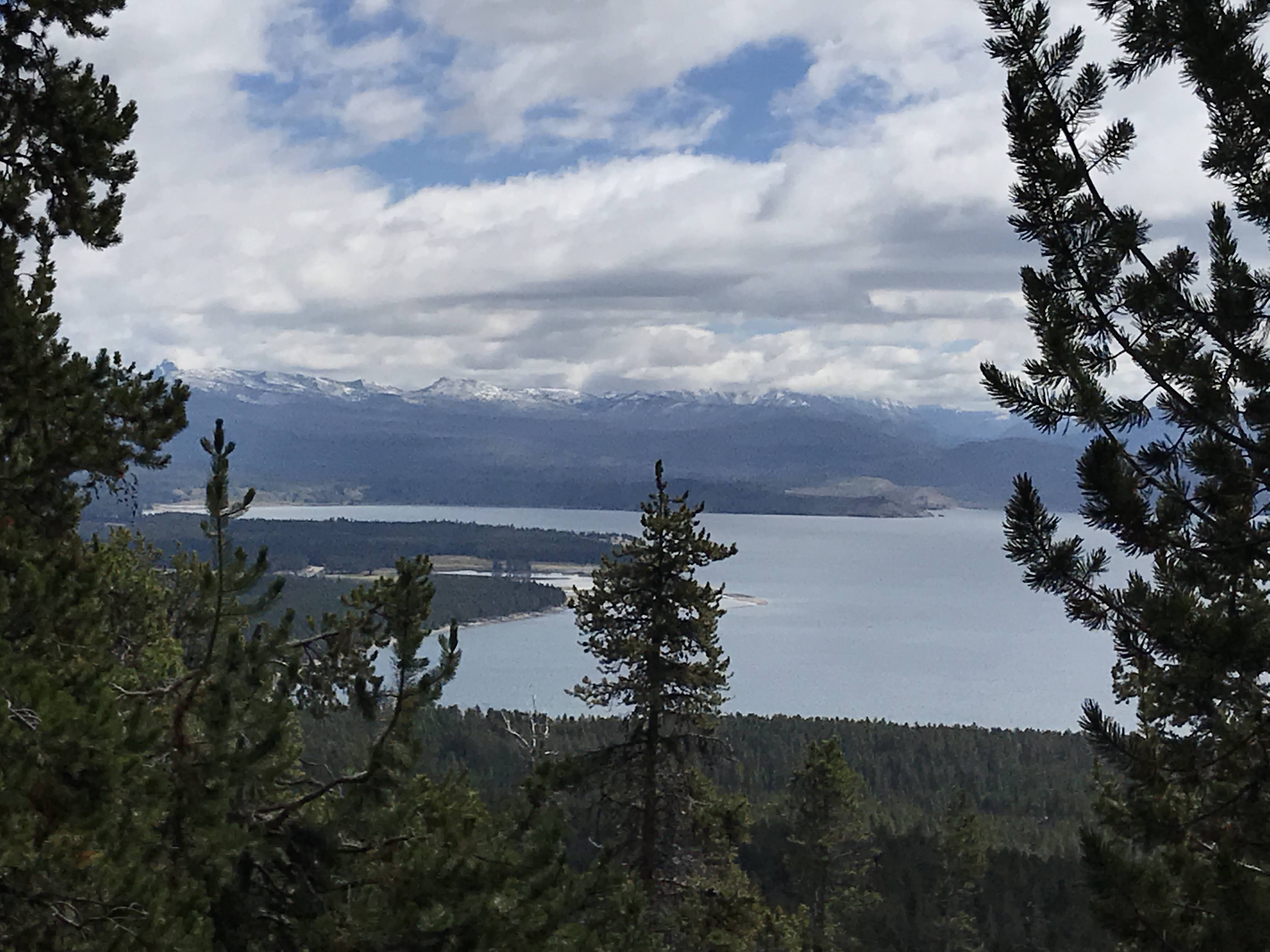
The following day, knowing it’d be busy as it was Sunday of LDW, we figured we’d avoid hiking the trails and instead find a quiet spot near Jenny Lake to plop down our chairs and relax. Well, Jenny Lake was packed with no parking anywhere safe or legal, so we headed to the far side of the lake and tried out a dirt road that led down to the Snake River. There were people there, but far less, and we were able to find a spot to claim for the afternoon.
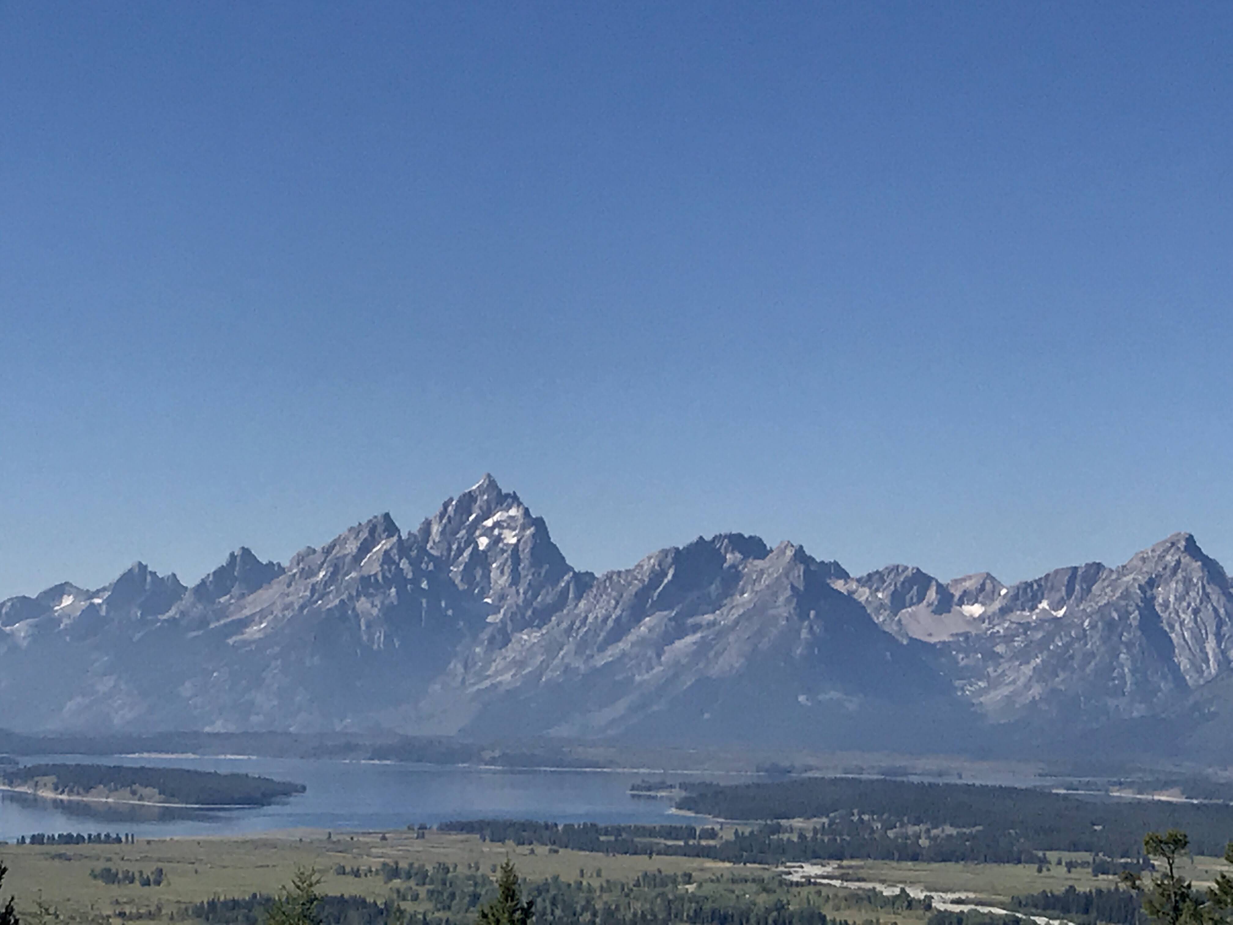
Unfortunately, the smoke had blown back in and the Tetons, so massive and unmistakable, were barely an outline across the river. We felt fortunate we had had two previous days of clear skies. Nevertheless, we enjoyed the spot and watched the river and marsh in front of us.
After a while my dad and I walked down to the main part of the river to explore. While it was a nice walk, by this time the mountains were hidden behind a gray curtain. It was almost as if they were saying, “Sorry everyone, we are feeling camera shy today.” Sadly it wasn’t that funny in reality as this was the effects of the devastating fires raging in California and the newly ignited fire in Yellowstone National Park. I read, and hope sincerely, that new plans and efforts to work with native peoples are coming into effect to combat these horrific wildfires i the future. Sending love and support to all those affected.
Can you see The Tetons in from of my dad?
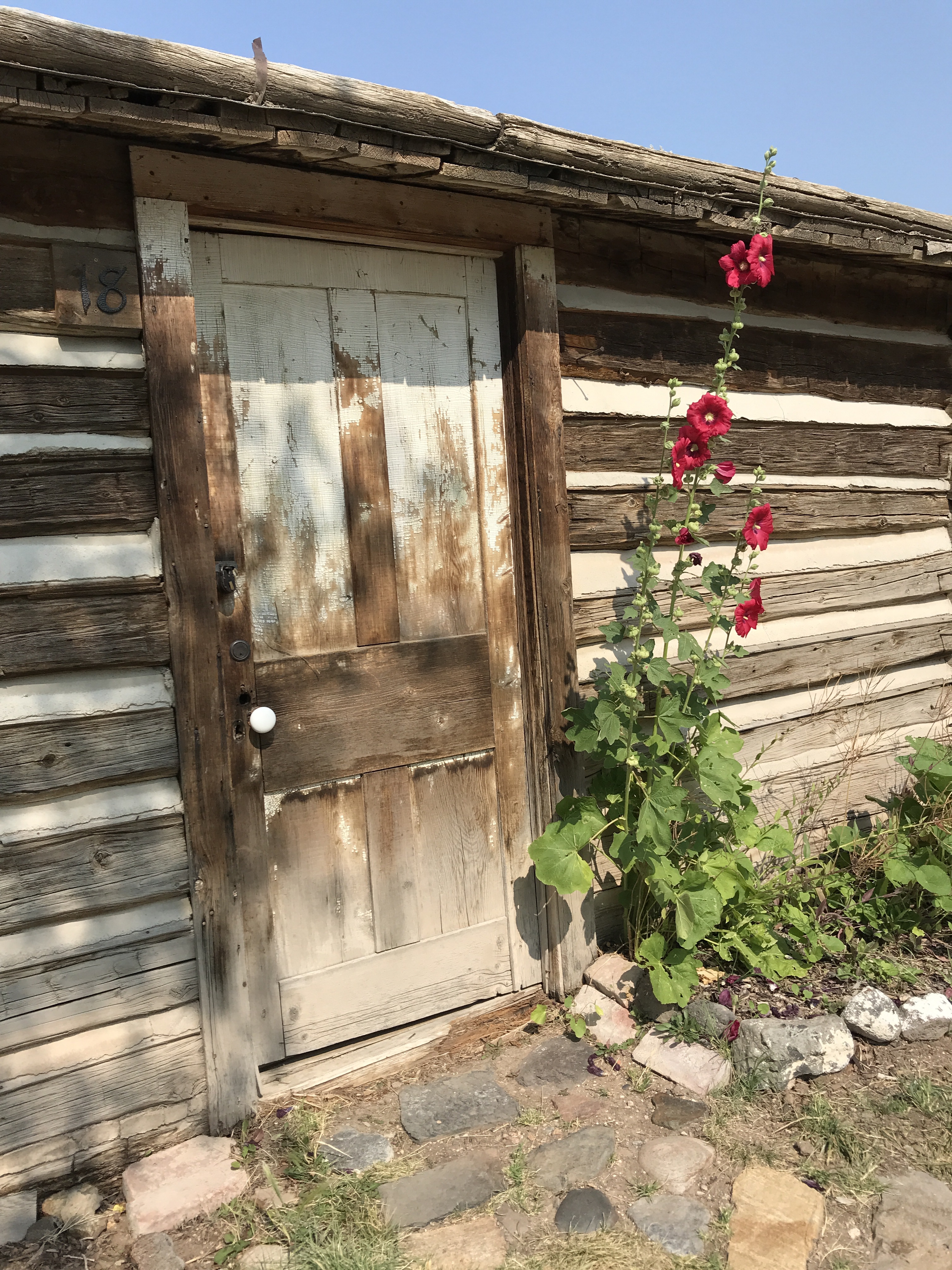
Overall, we had a lovely three days at The Grand Tetons, land native to the Shoshone and Cheyenne people. On Monday morning, we packed up and headed east in search of a campsite with full hookups. Snow was coming!
Sadly, today marked our final day at Yellowstone. We had to make trails before Labor Day Weekend to (hopefully) get a camping spot in The Grand Tetons National Park. Before we left though, we had two last stops to make. A trip to Yellowstone wouldn’t be complete without visiting Old Faithful and The Grand Prismatic.
We set out late morning with the intention of completing a hike and heading over to Old Faithful after dinner, when crowds and hopefully died down. We’d park somewhere along the way and make dinner in the van. It sounded like a great plan, so off we went.
Well, hike choice number one was closed due to a recent forest fire in the park. Ok, no problem, we understood. So we drove a little farther down the road to Lone Star for hike option number two. We felt lucky, nabbing a parking spot in the small lot, geared up and headed out. Only to be disappointed again – this hike also went towards the wildfire area and was therefore closed. “Ok, deep breath. We can do this,” I thought. We are flexible people, right?
Well, unfortunately we continued down the road only to miss several poorly marked trailheads. We finally turned around and stopped at one, but it was a 14 mile roundtrip hike to a small lake. Nope – not enough energy nor excitement. However, we did use the map to plan out a tentative Plan D. We’d drive over to Black Sand Basin, hopefully park, and hike around that area before going to Old Faithful in the evening. We all had our fingers crossed this would work – frustration was running a little hot at this point.
Fortunately, we did find a parking spot. I took a few deep breaths, tried some positive self-talk, and headed out with my parents. We crossed over the road to another poorly marked trail and hoped for the best. We walked down a barren trail into the unknown and were pleasantly surprised.
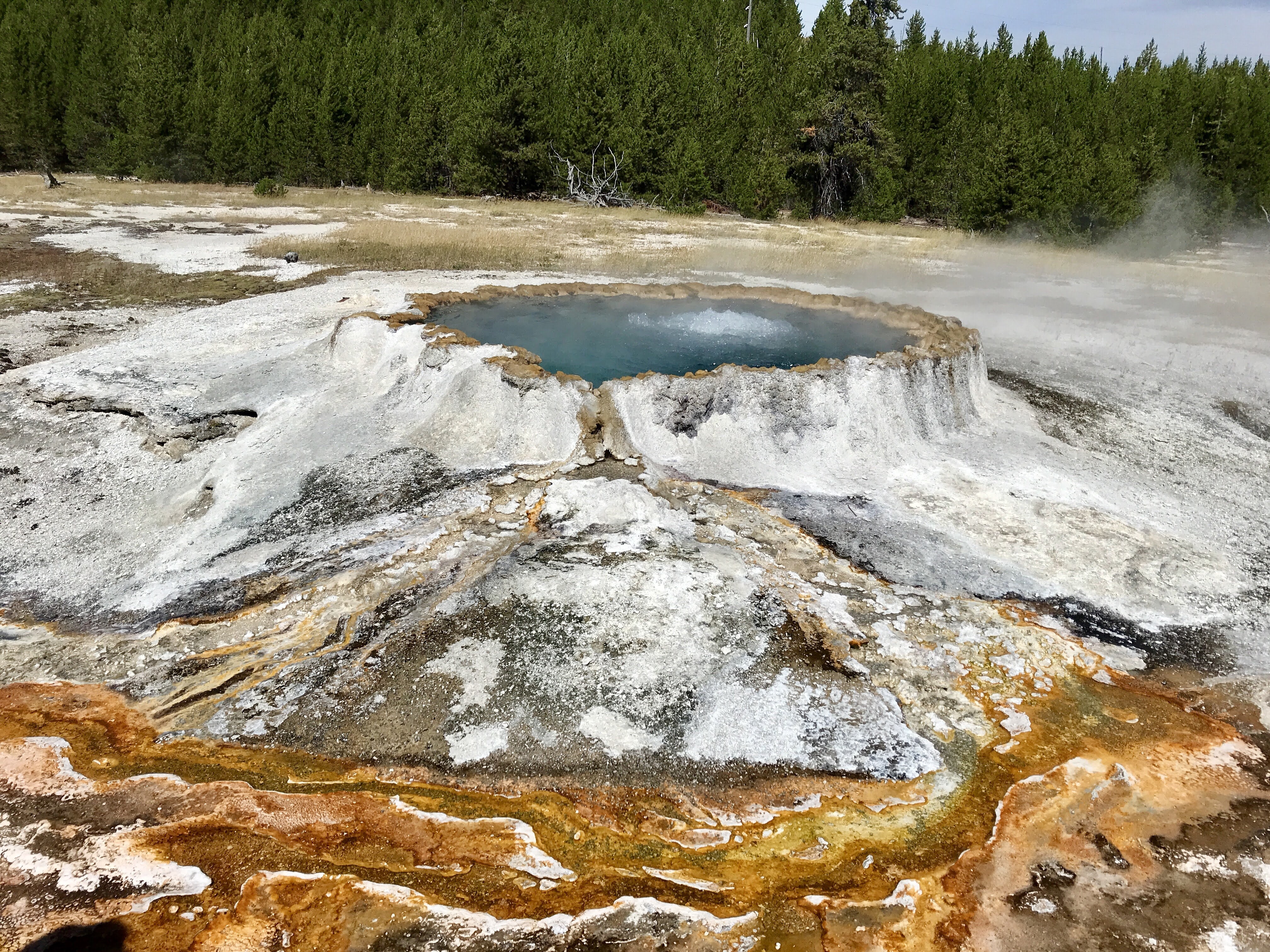
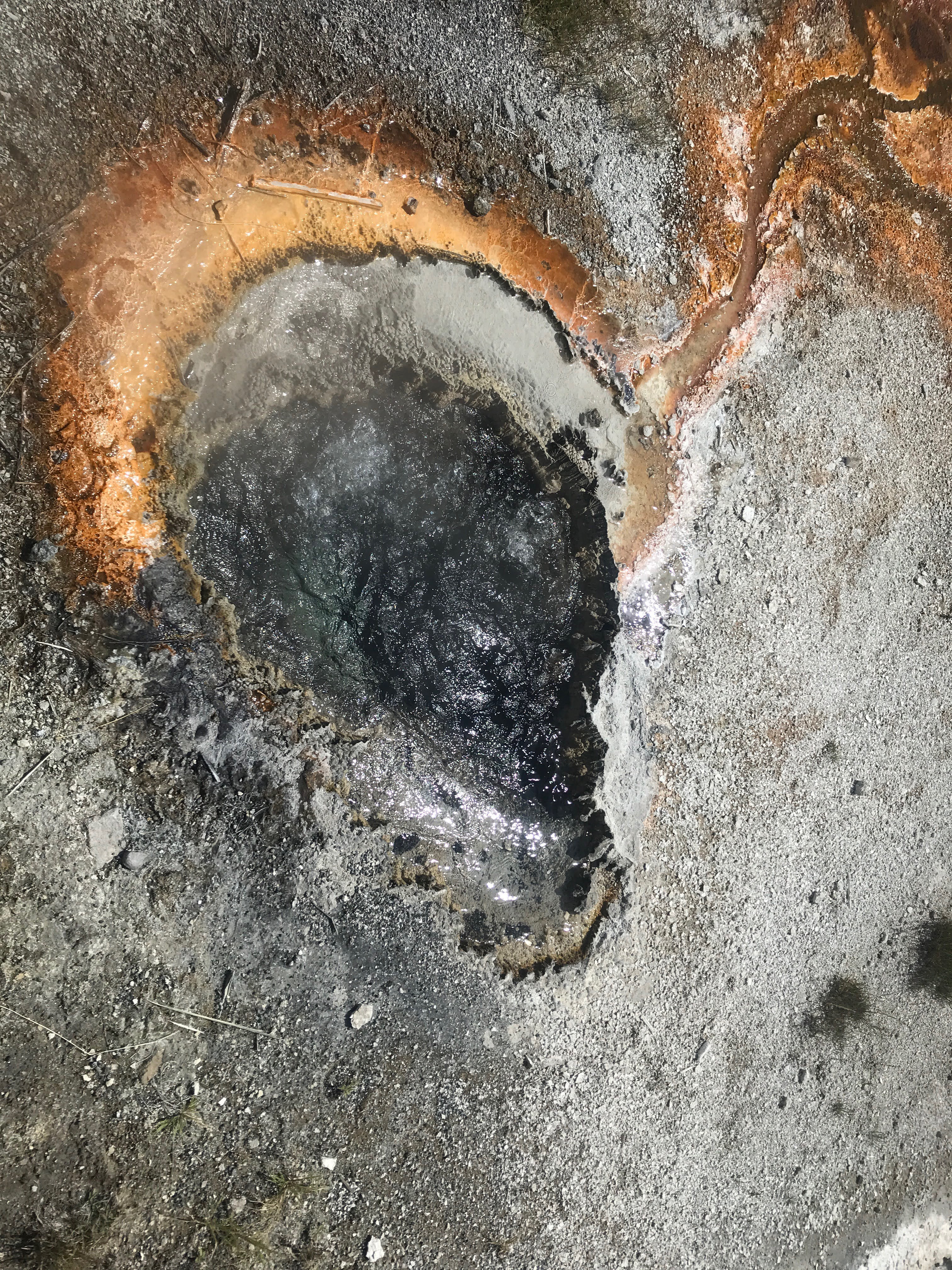
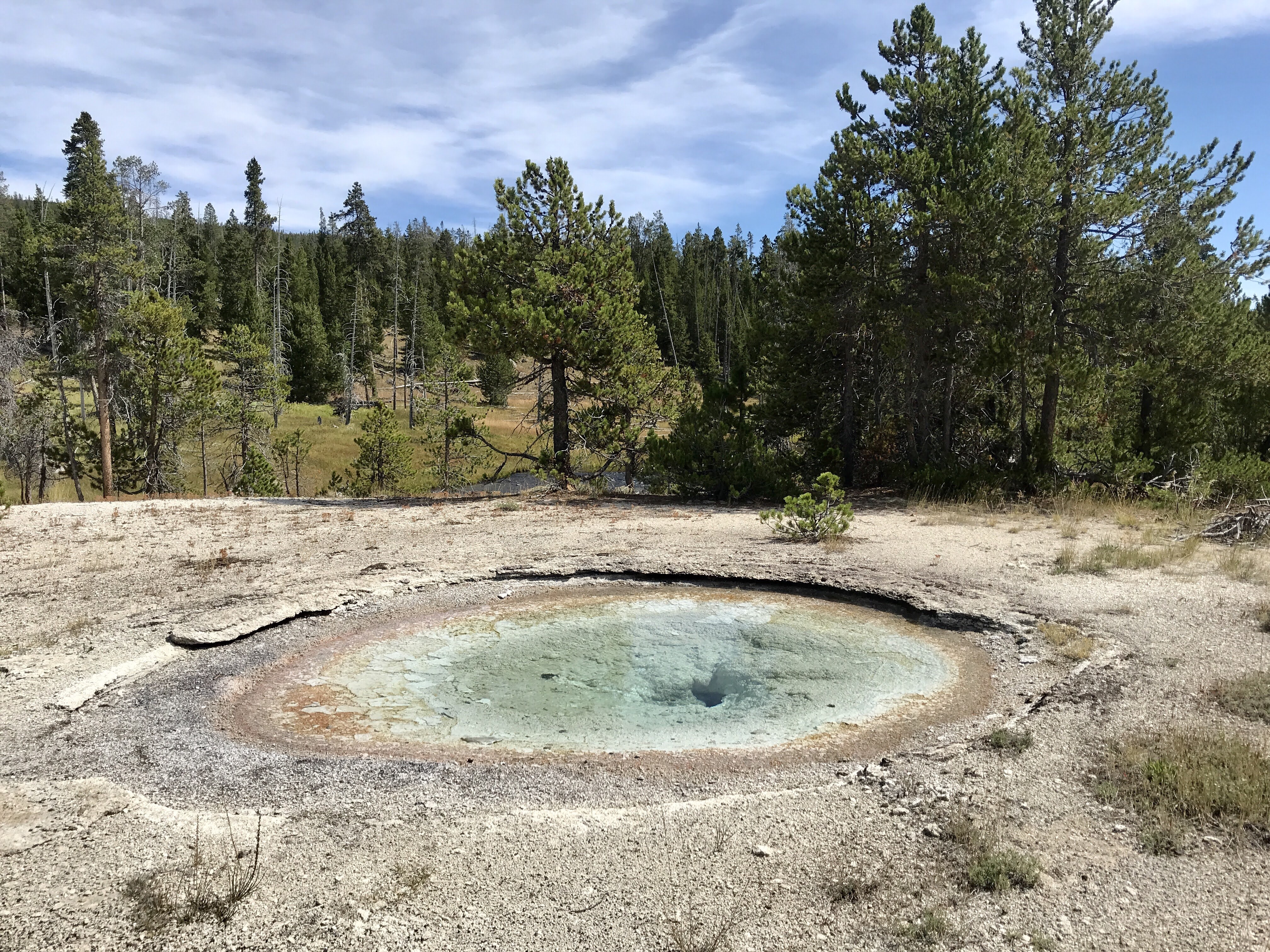
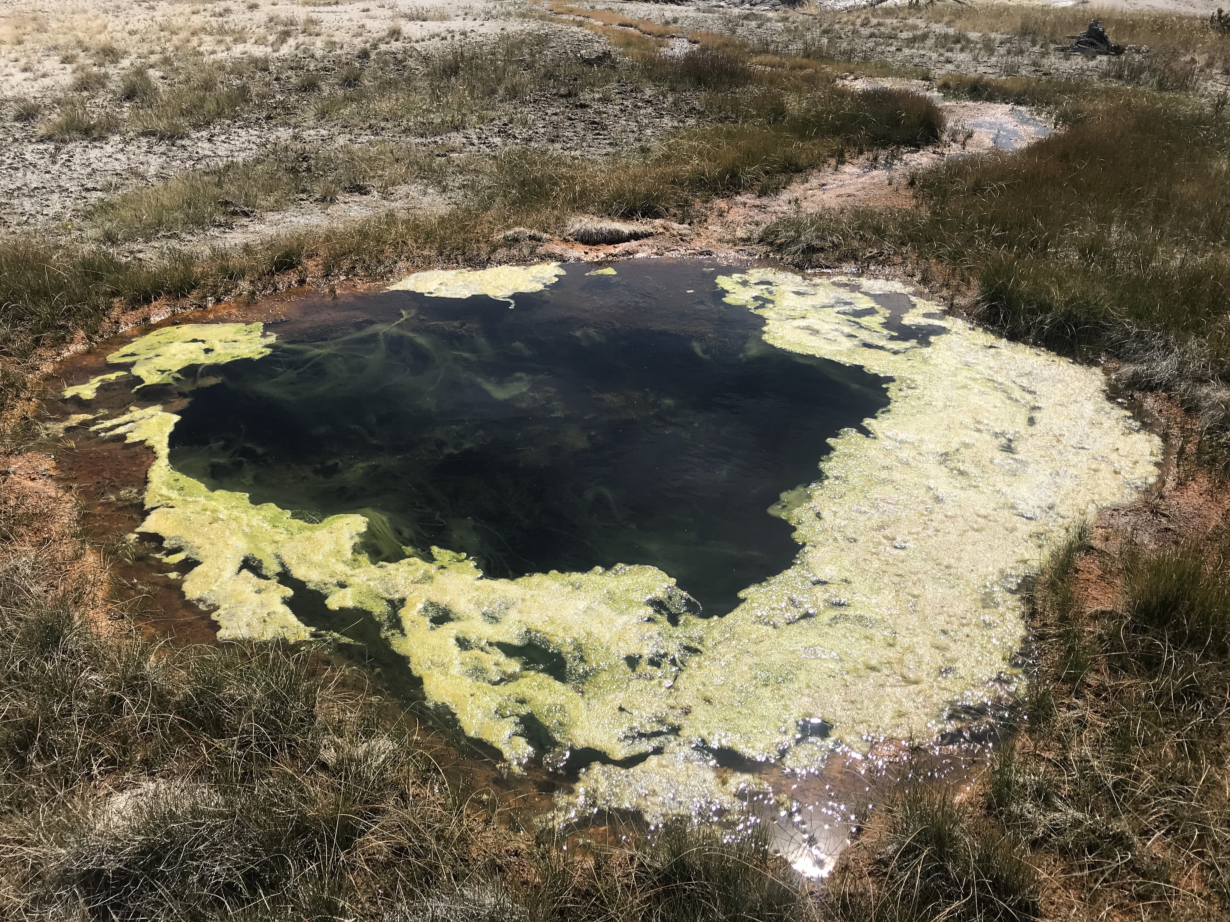
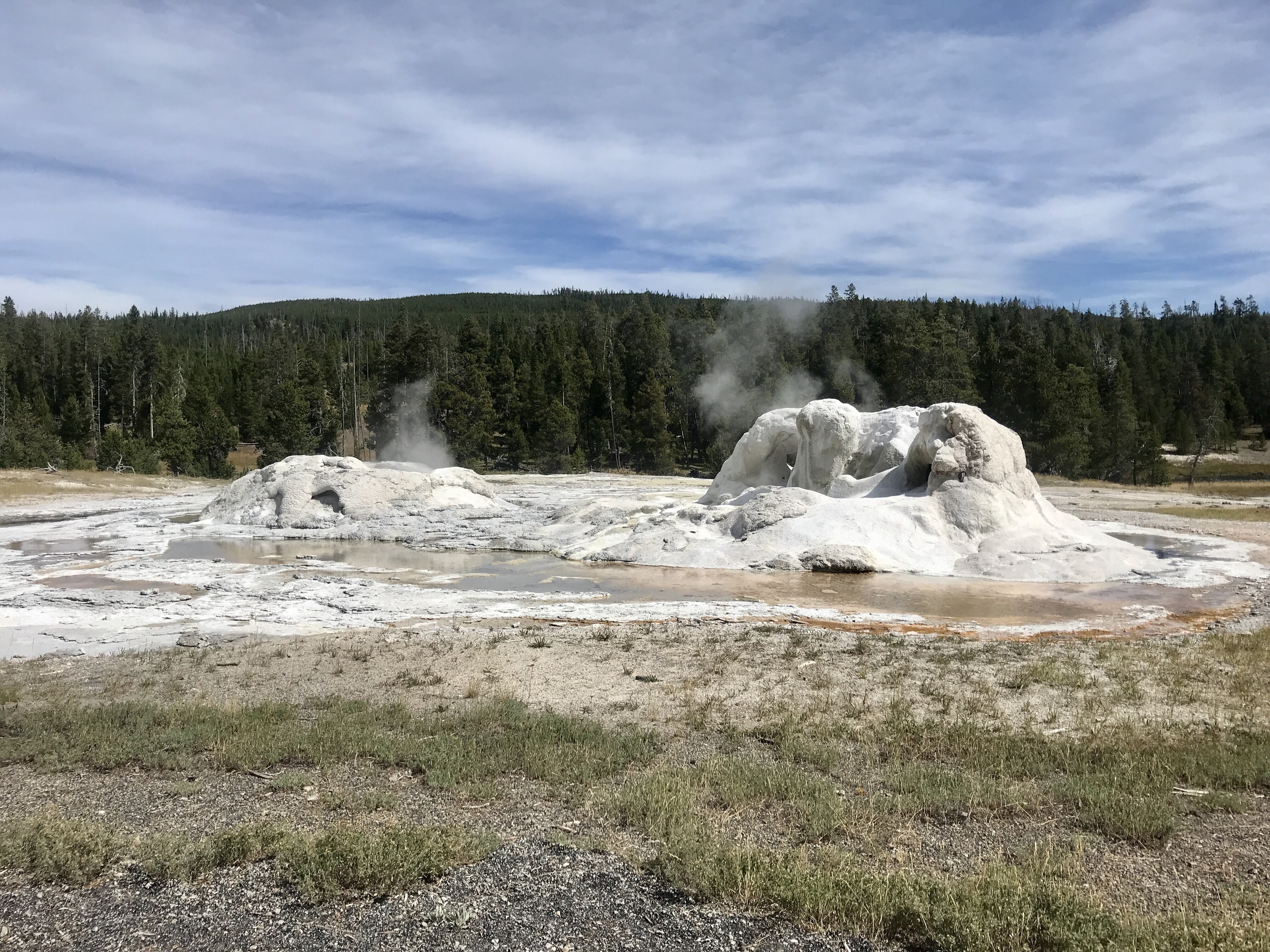
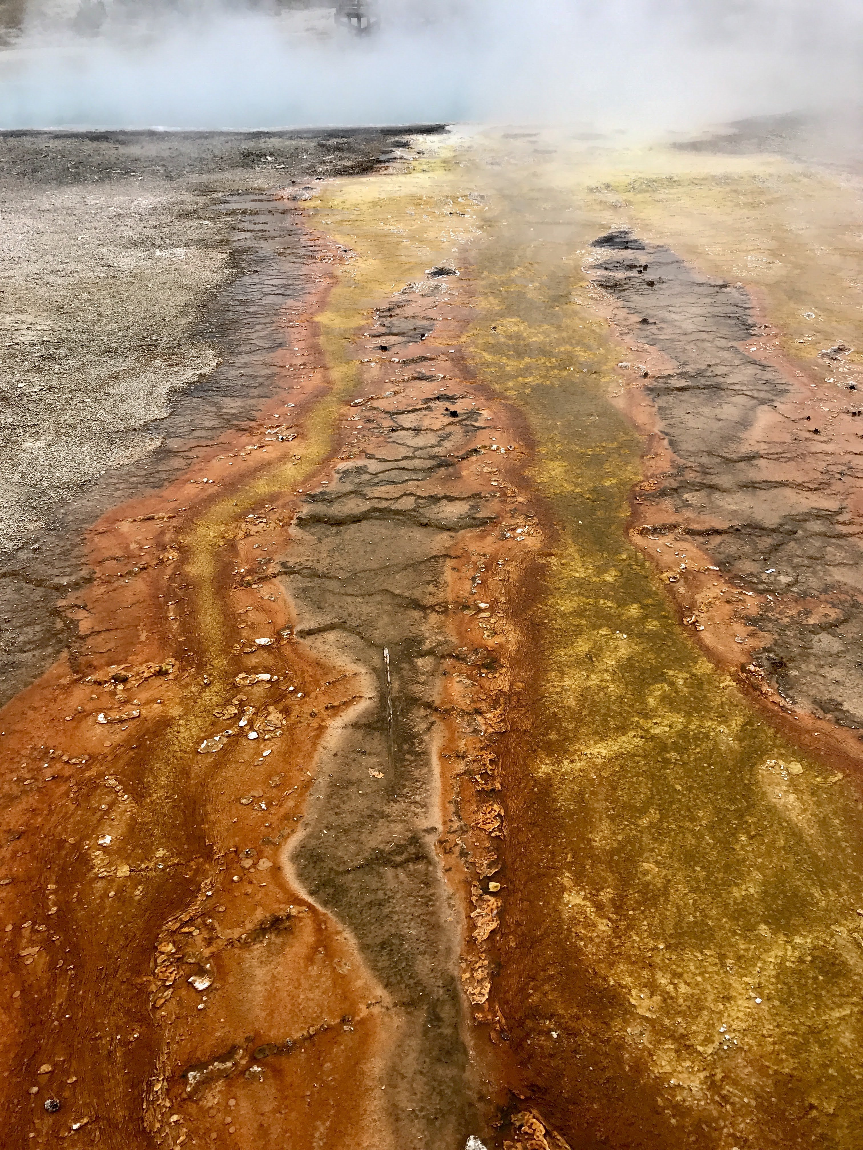
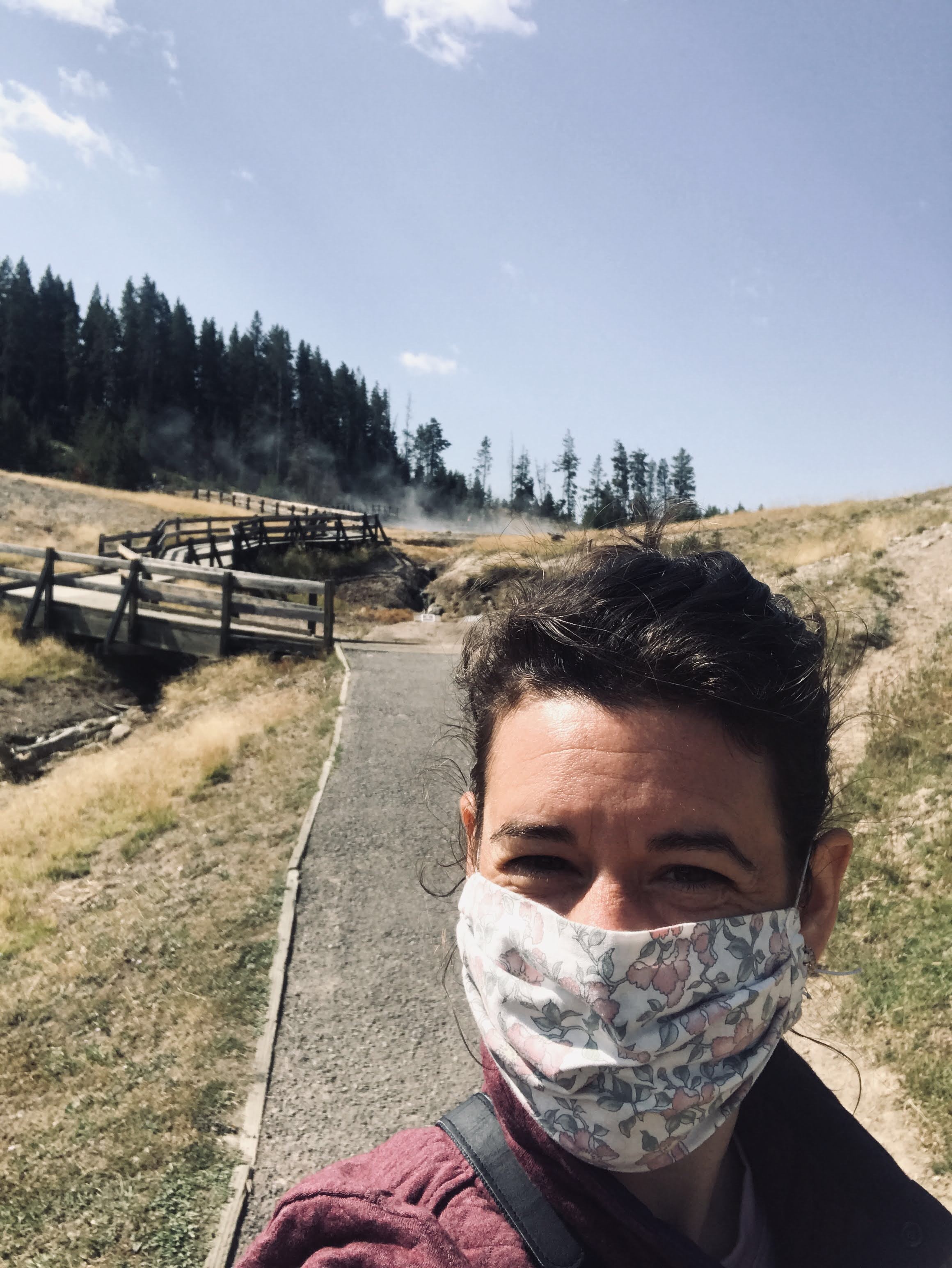
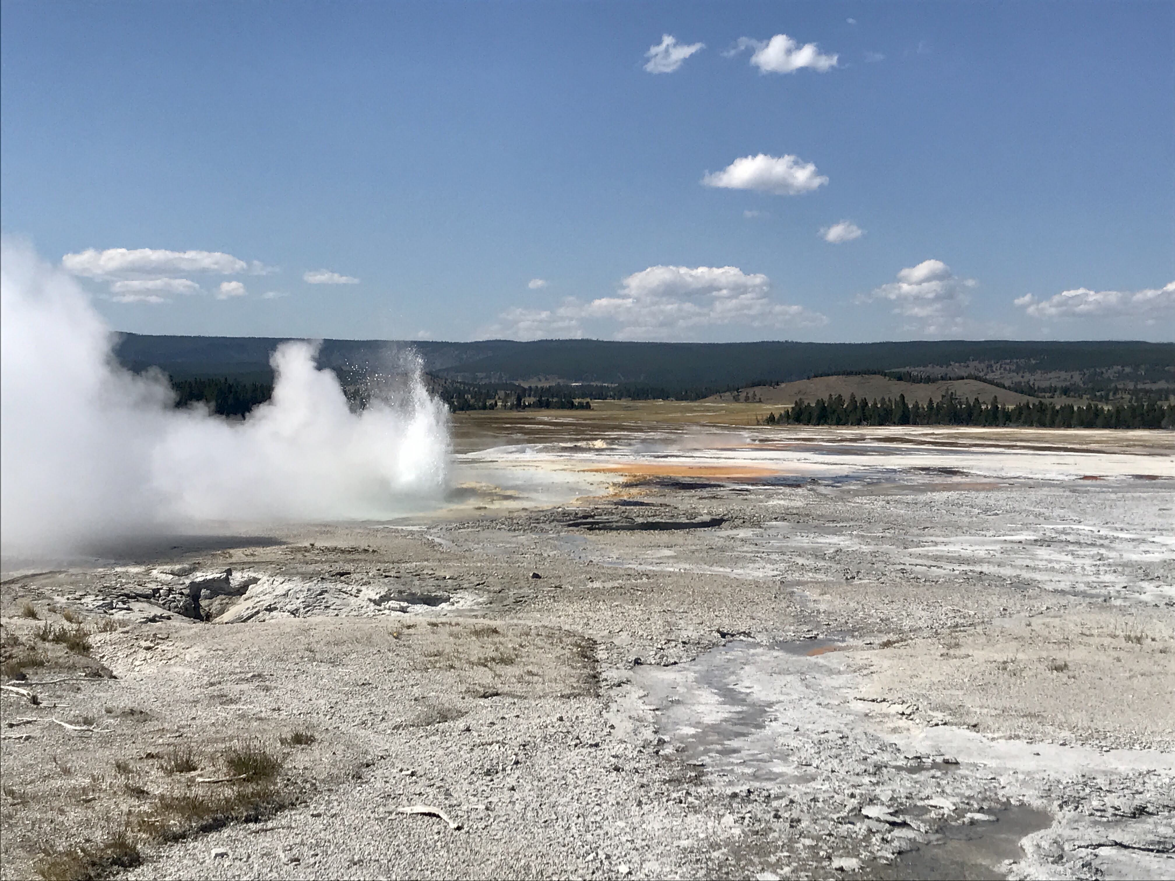
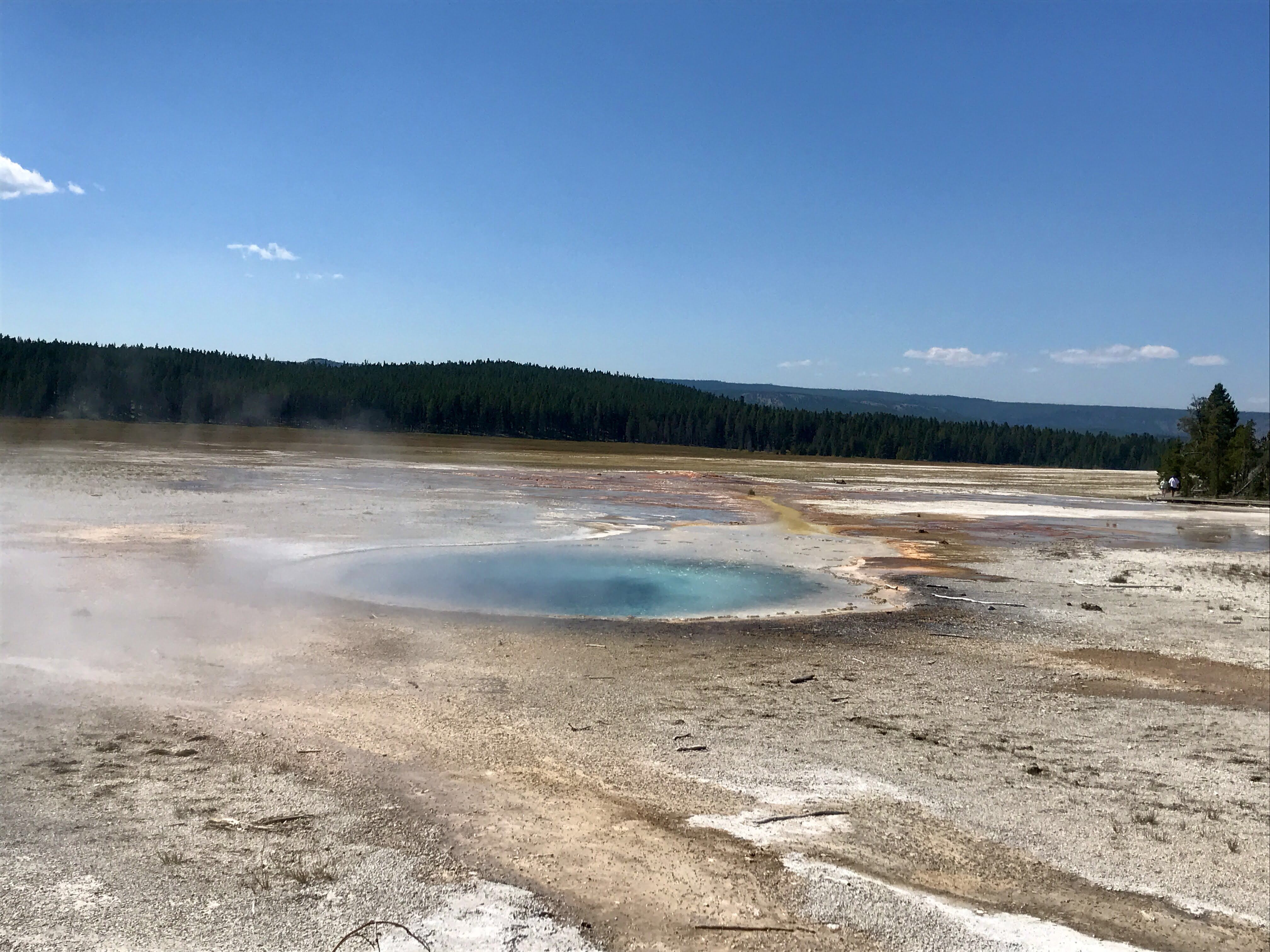
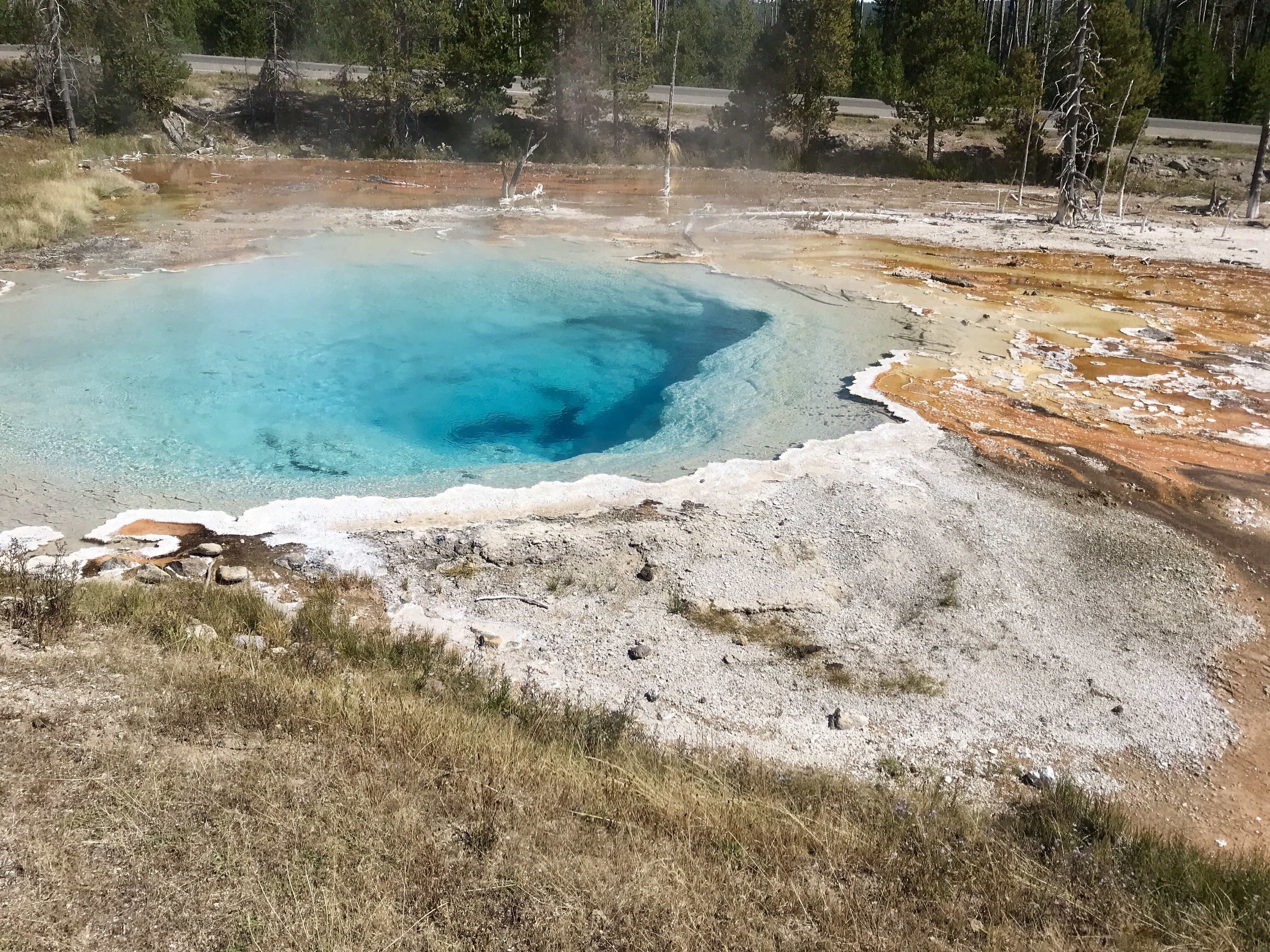
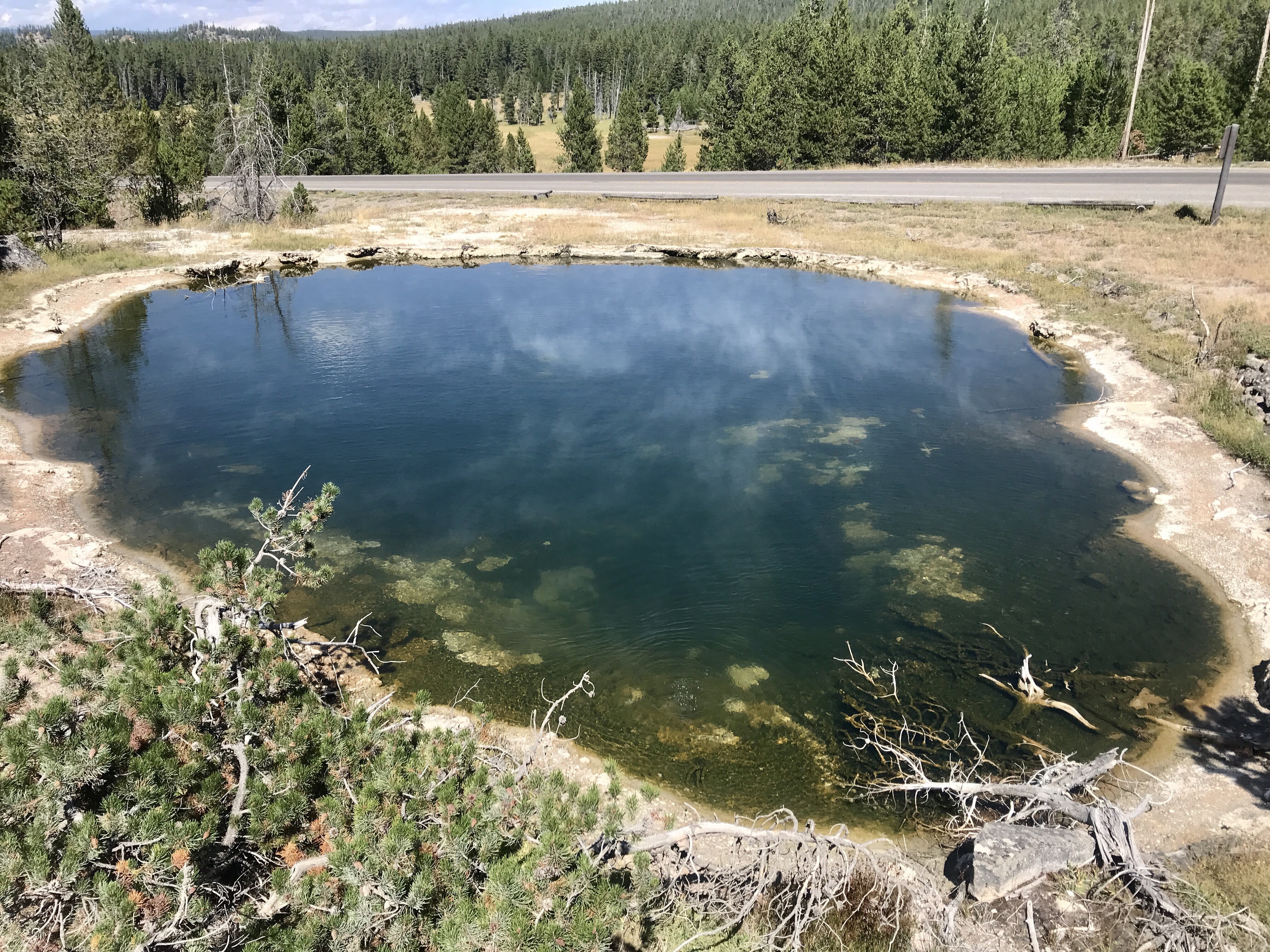
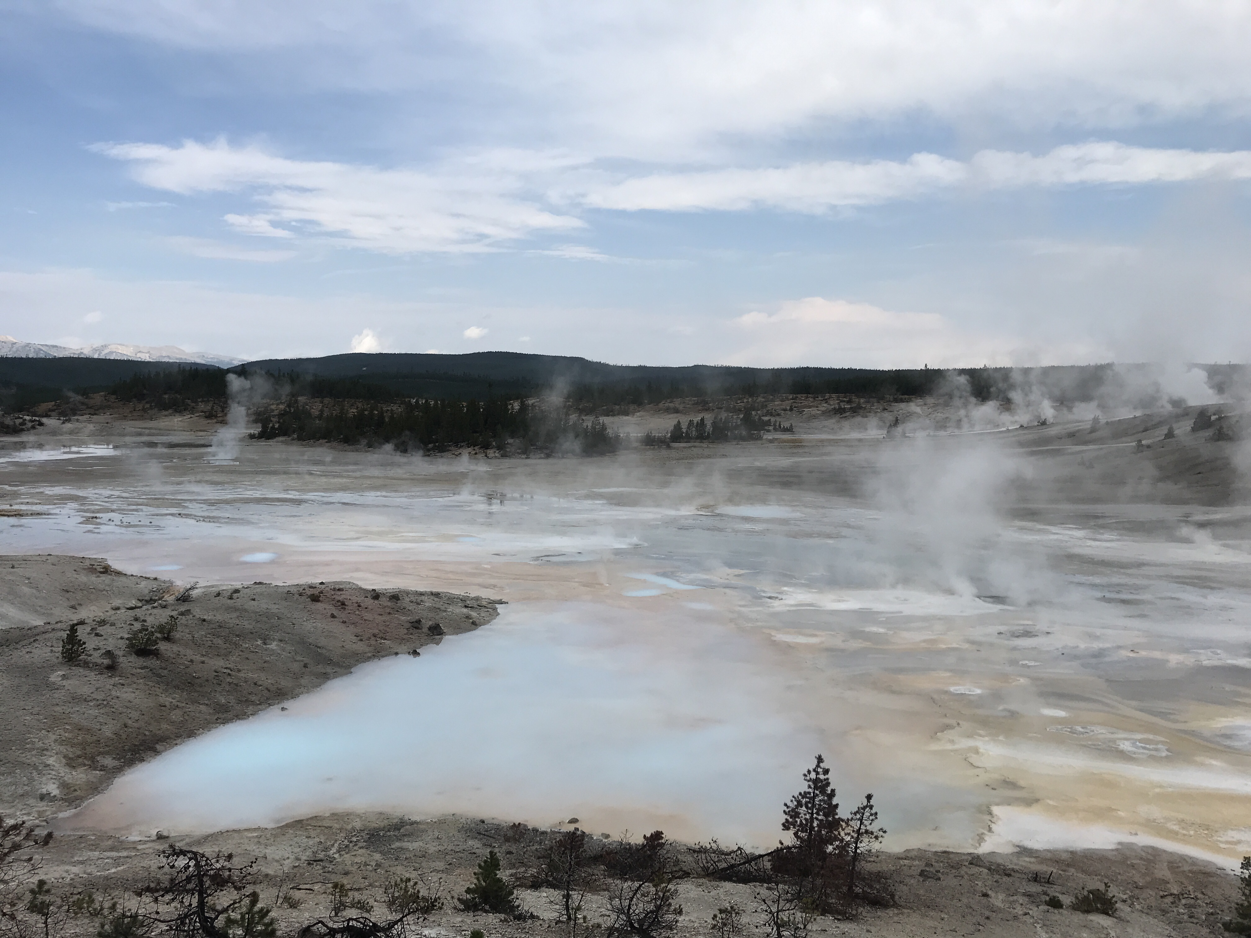
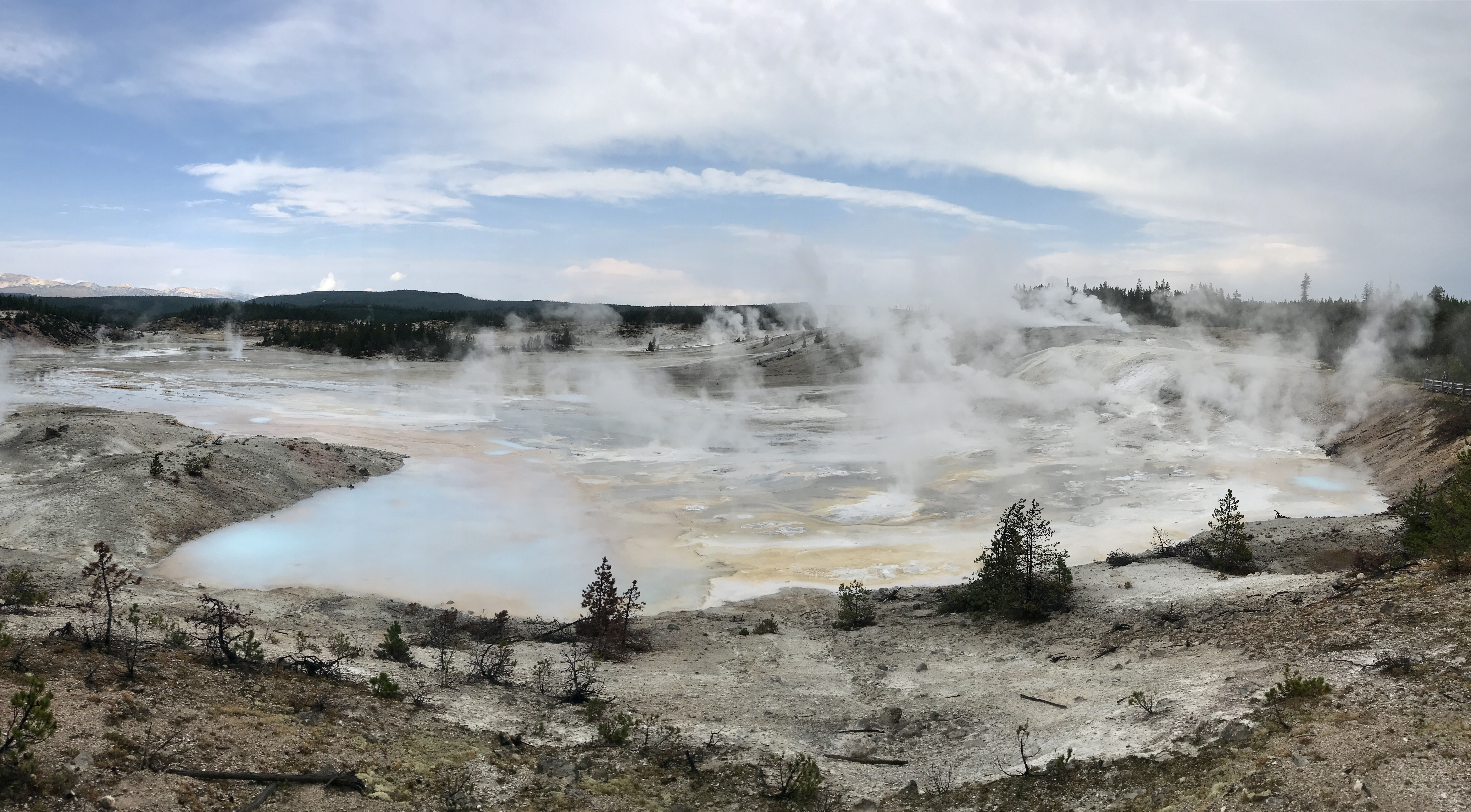
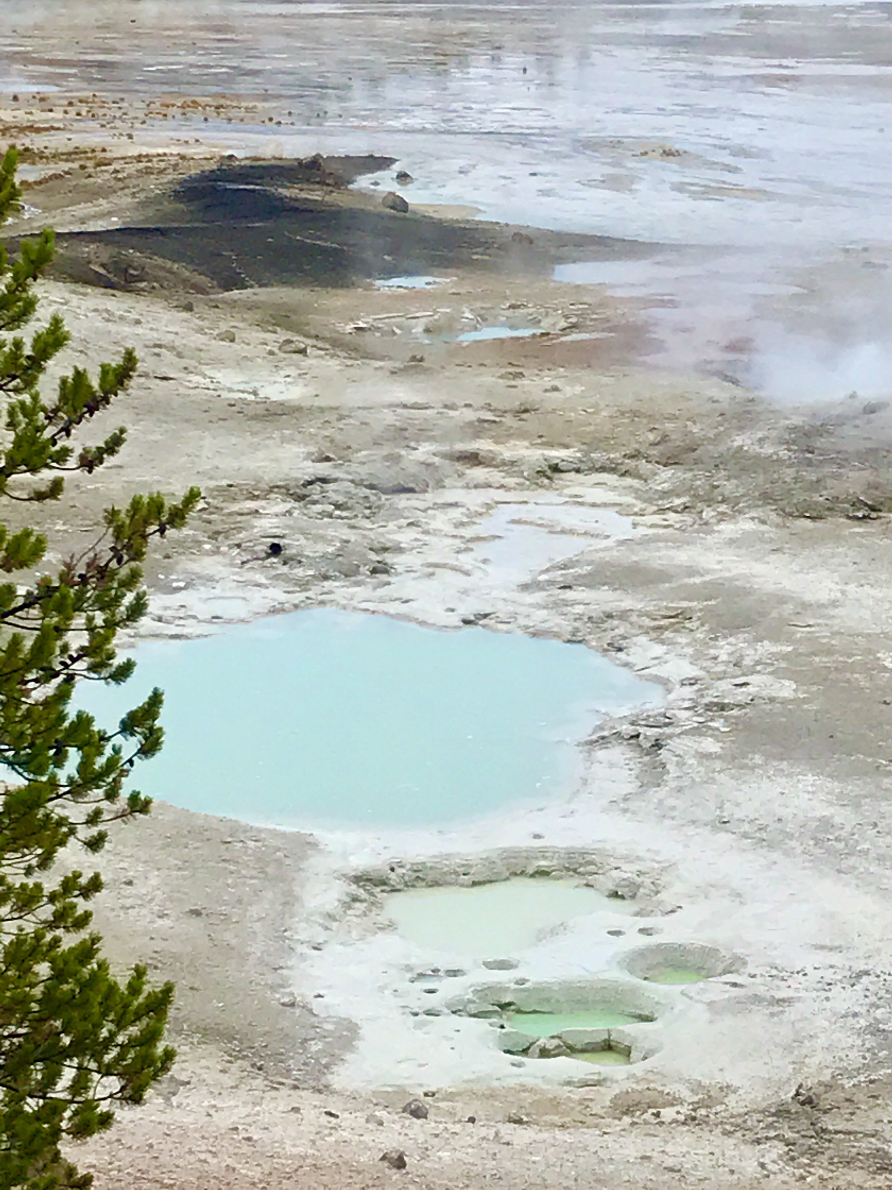
First, we came across Black Sand Pool, a hot spring steaming seemingly in the middle of nowhere. Ok, Plan D was off to a good start. Then we stumbled across Punch Bowl geyser, set atop a small hill with water spilling over and down the sides. With the steam rising and floating across the top, it looked perfect for a spooky Halloween party. With spirits lifting, we continued on and came across a boardwalk circling several small, interconnected geysers. They weren’t spouting much at the time, but they were still intriguing. From here we realized we had wandered into the geyser basin that was home to Old Faithful. Funny how things work out sometimes!
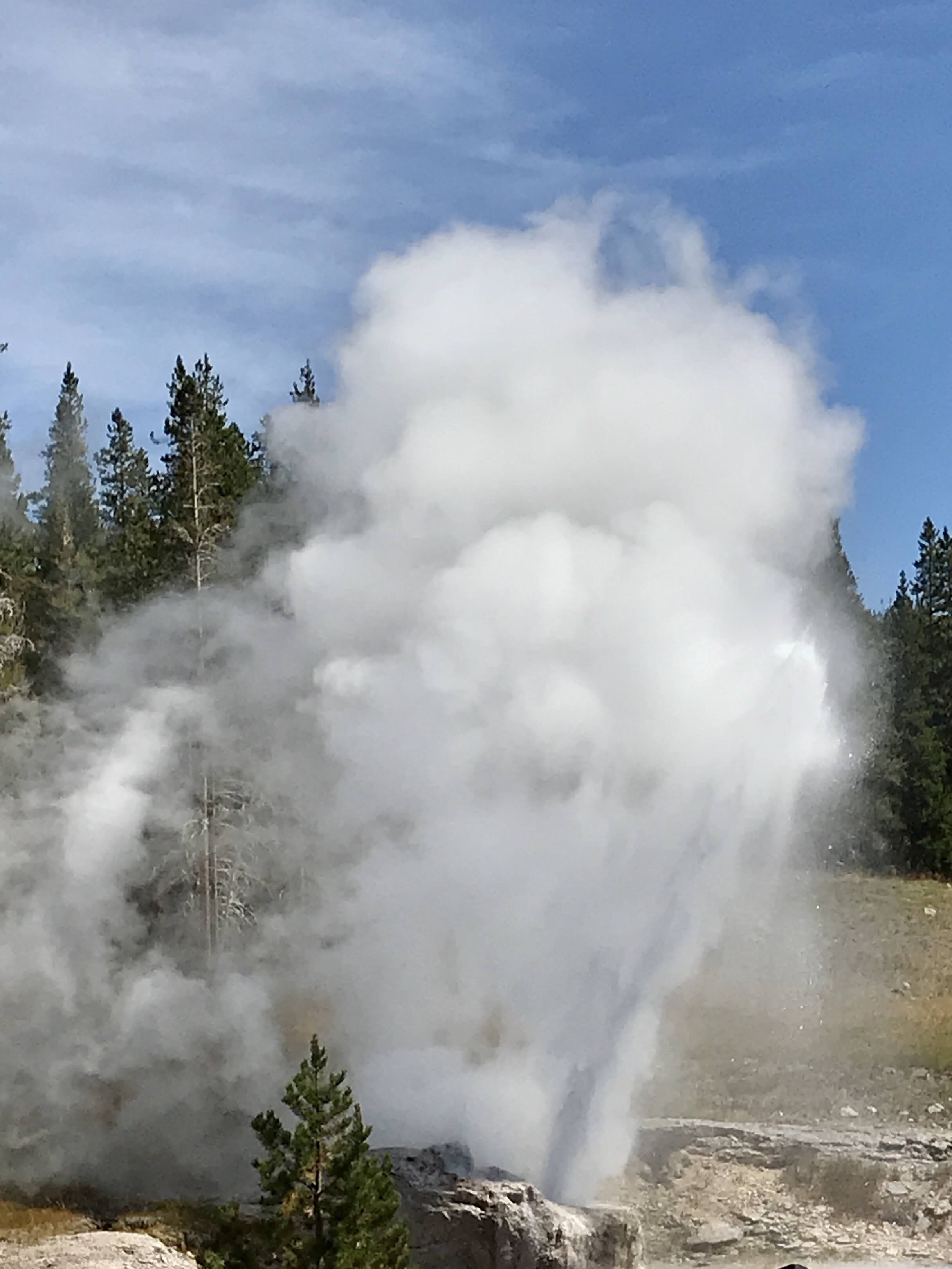
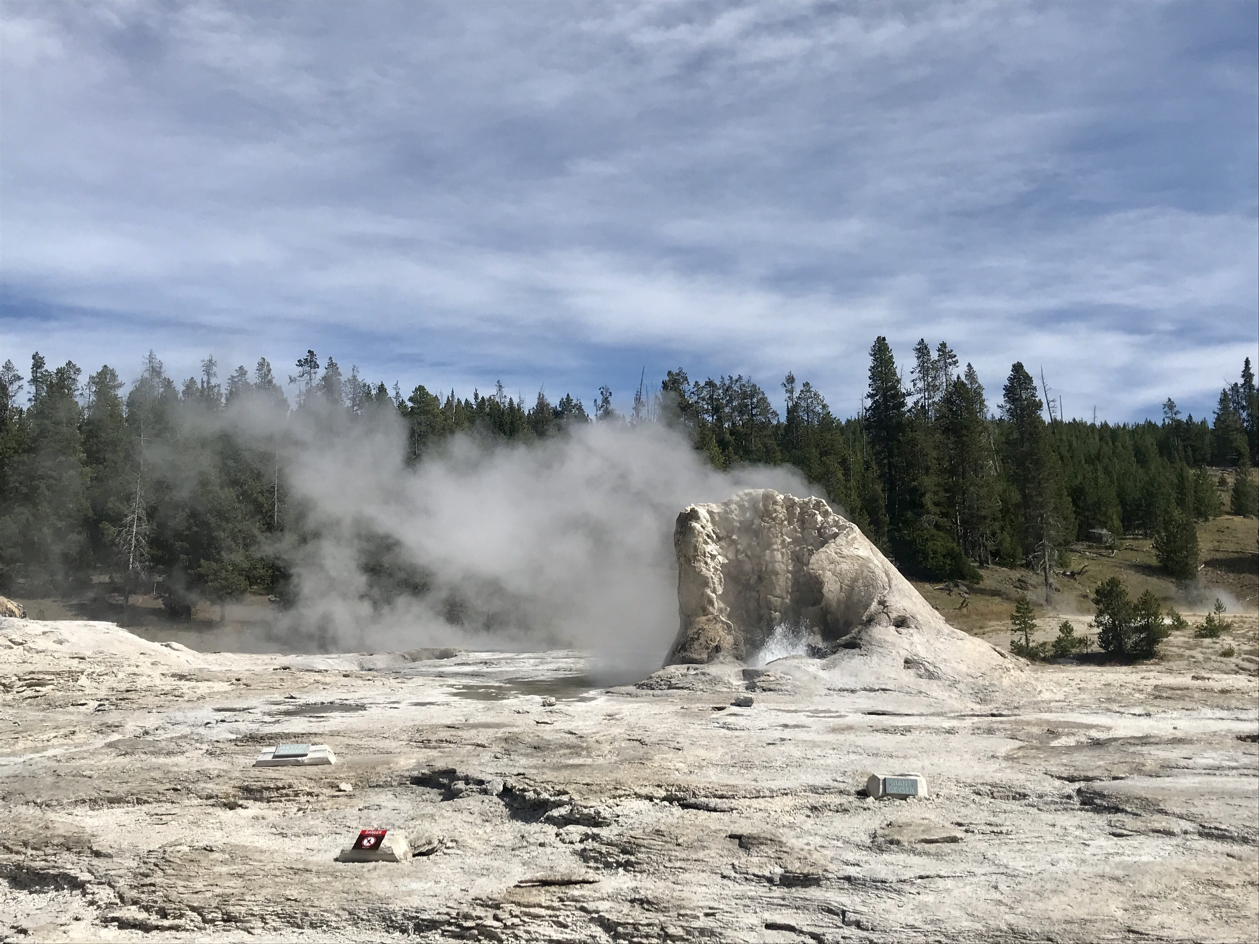
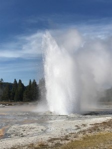
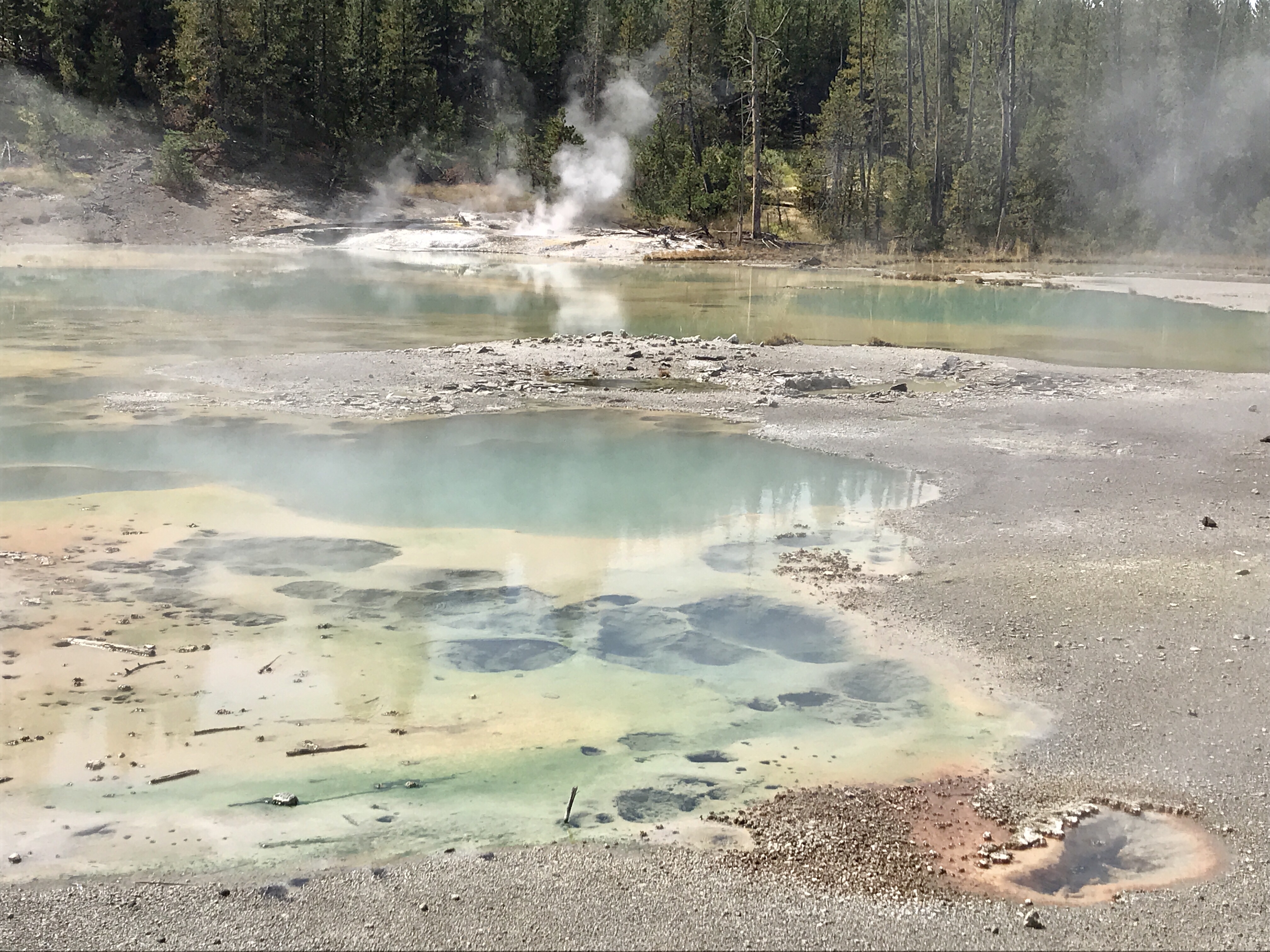
We meandered around for a while, not really sure exactly where we were headed, until we came across Riverside Geyser. This is one of several geysers in this area that erupt with some regularity and it was set to erupt within the next 30 minutes. Score! We found a spot to settle down and wait. Our patience (and earlier flexibility) was rewarded. Riverside geyser erupted powerfully, throwing hot water and steam into the sky again and again for nearly 20 minutes. It hissed and bubbled and sprayed, releasing all the pent up heat and energy from the magma below.
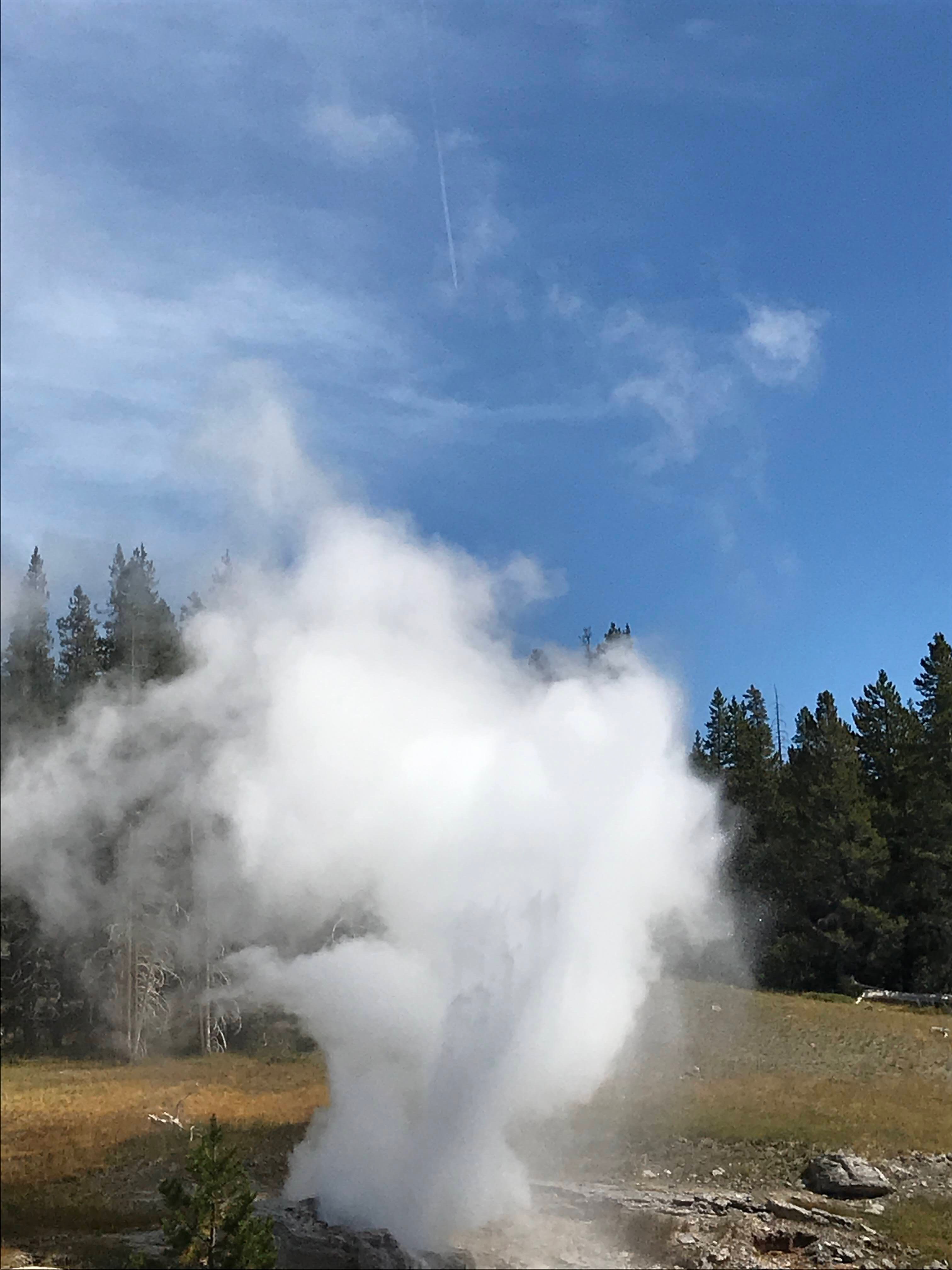
Energized and excited, after the eruption we moseyed through the rest of the area, exploring other geysers boiling, sparkling pools, gurgling mud pots, and floating steam. Soon we found ourselves unintentionally at Old Faithful with eruption about 20 minutes ahead. Despite fairly large crowds, we decided to stay, with masks on, and spread out over a bench to do our best to socially distance. We waited patiently, happy to rest our tired legs. Well, Old Faithful wasn’t entirely faithful. Its predicated eruption time passed, and passed, and passed. About 10 minutes later, the show did finally begin with a big blast straight up into the bluebird sky. It was another powerful display of nature (although I think Riverside Geyser was more impressive). We admired the show and waited for the crowds to disperse afterwards before moving on.
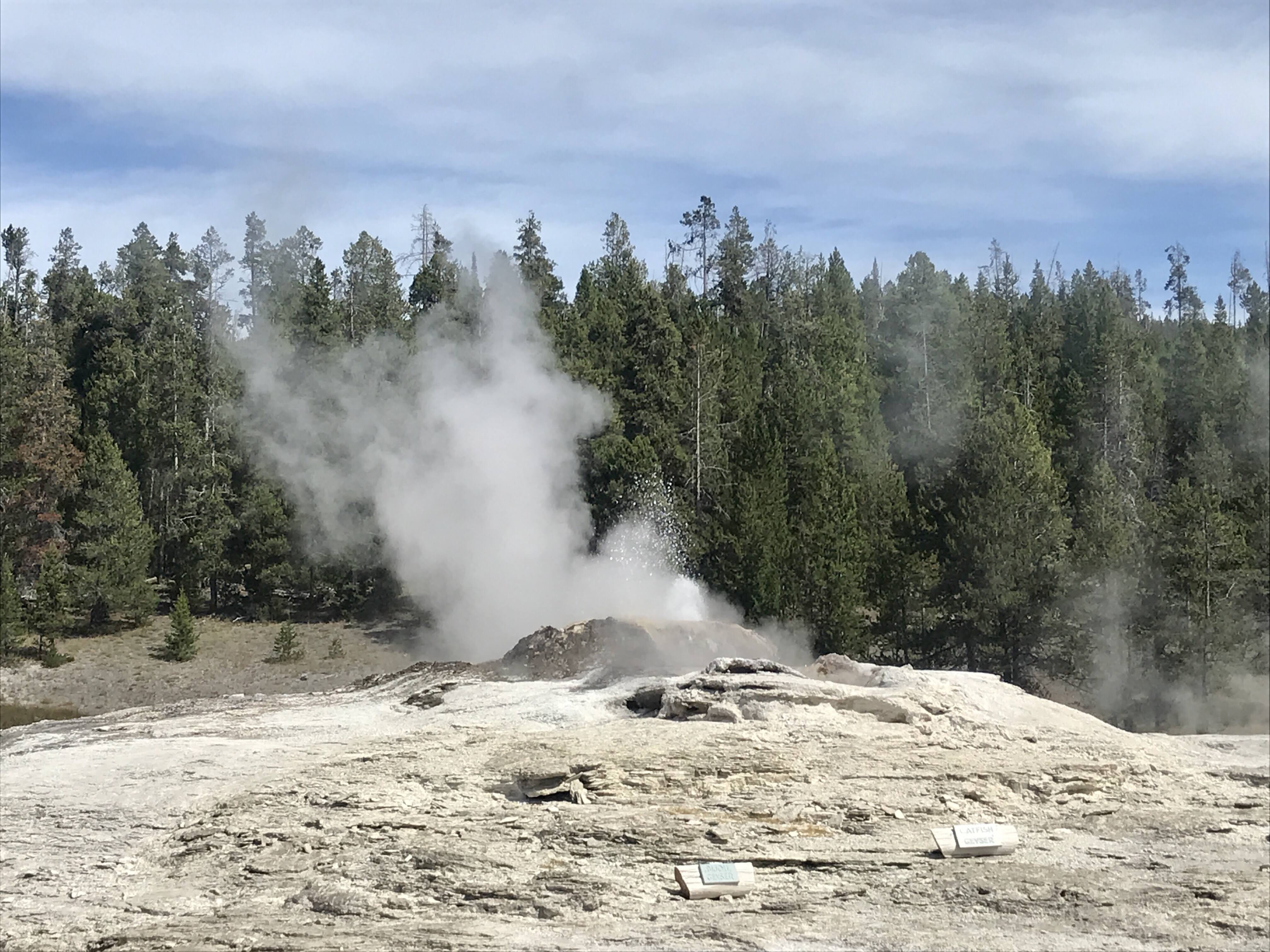
Eventually we started to retrace our steps to the car, and as we passed by Daisy Geyser, she began to erupt! We were the only ones around and enjoyed a private showing of this interconnected geyser system. Our Plan D was turning out to be a pretty wonderful day.
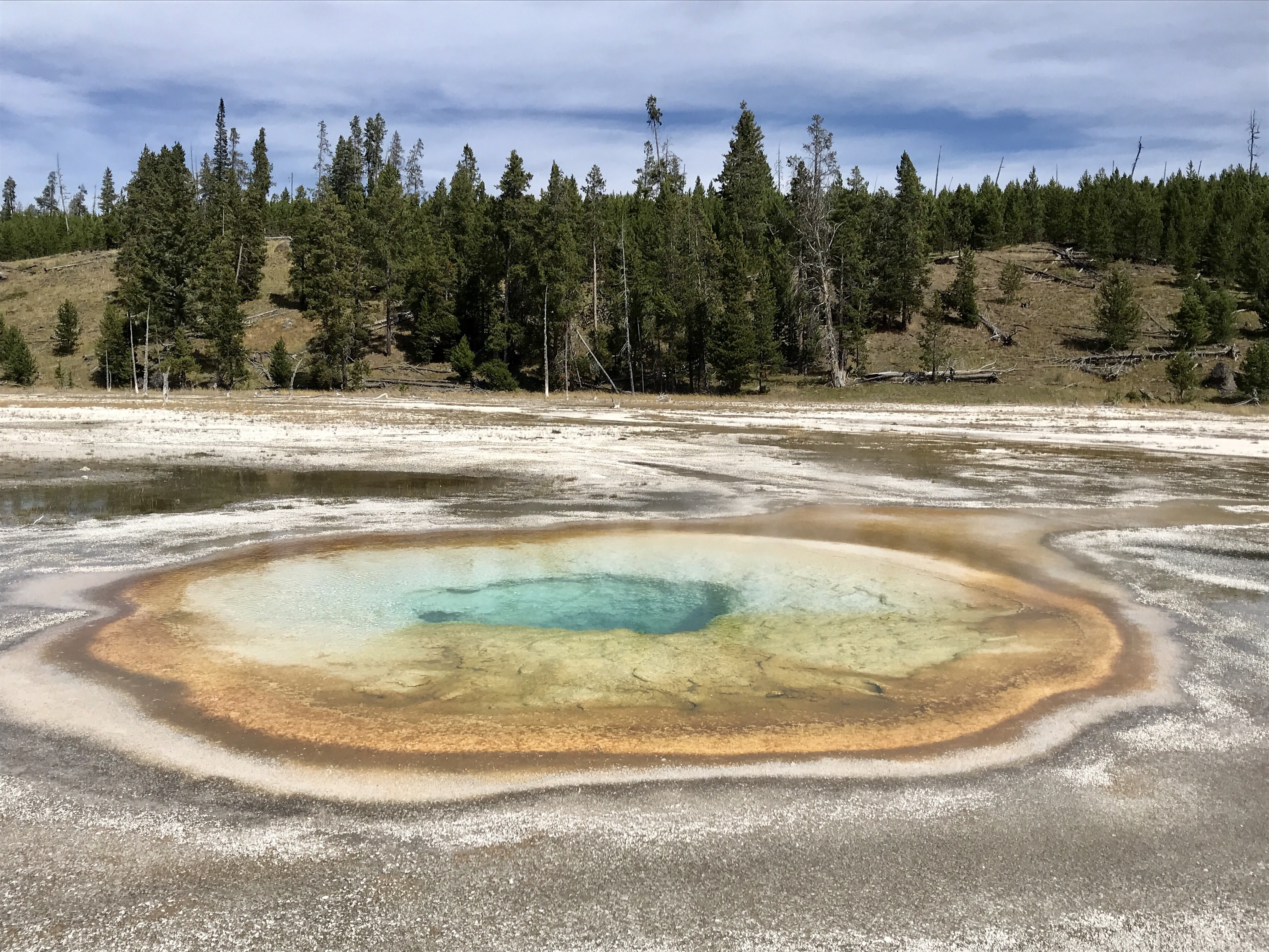
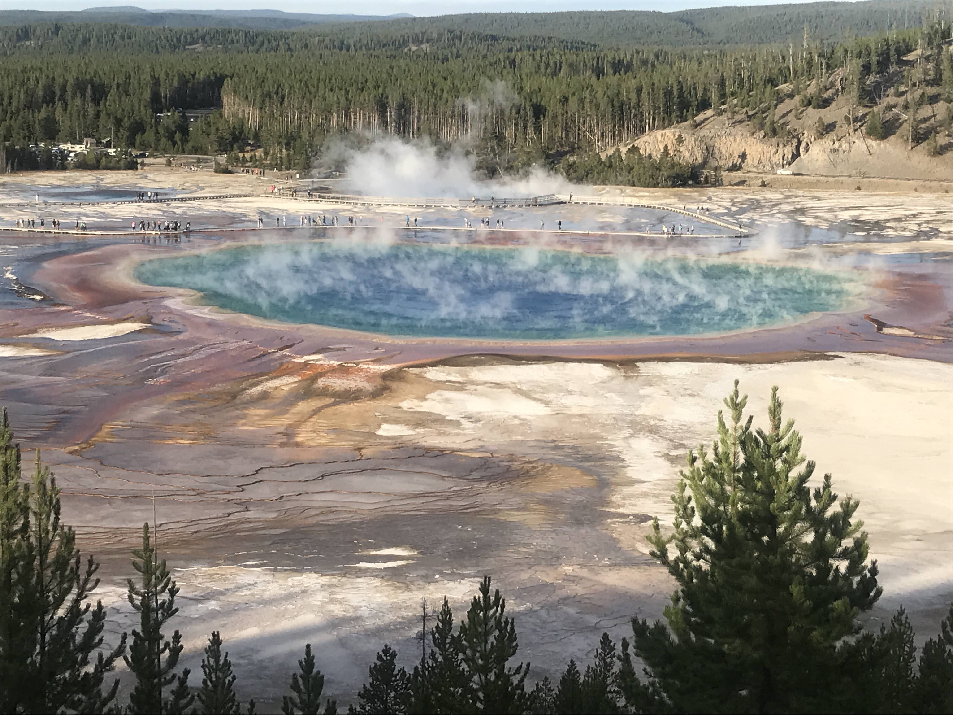
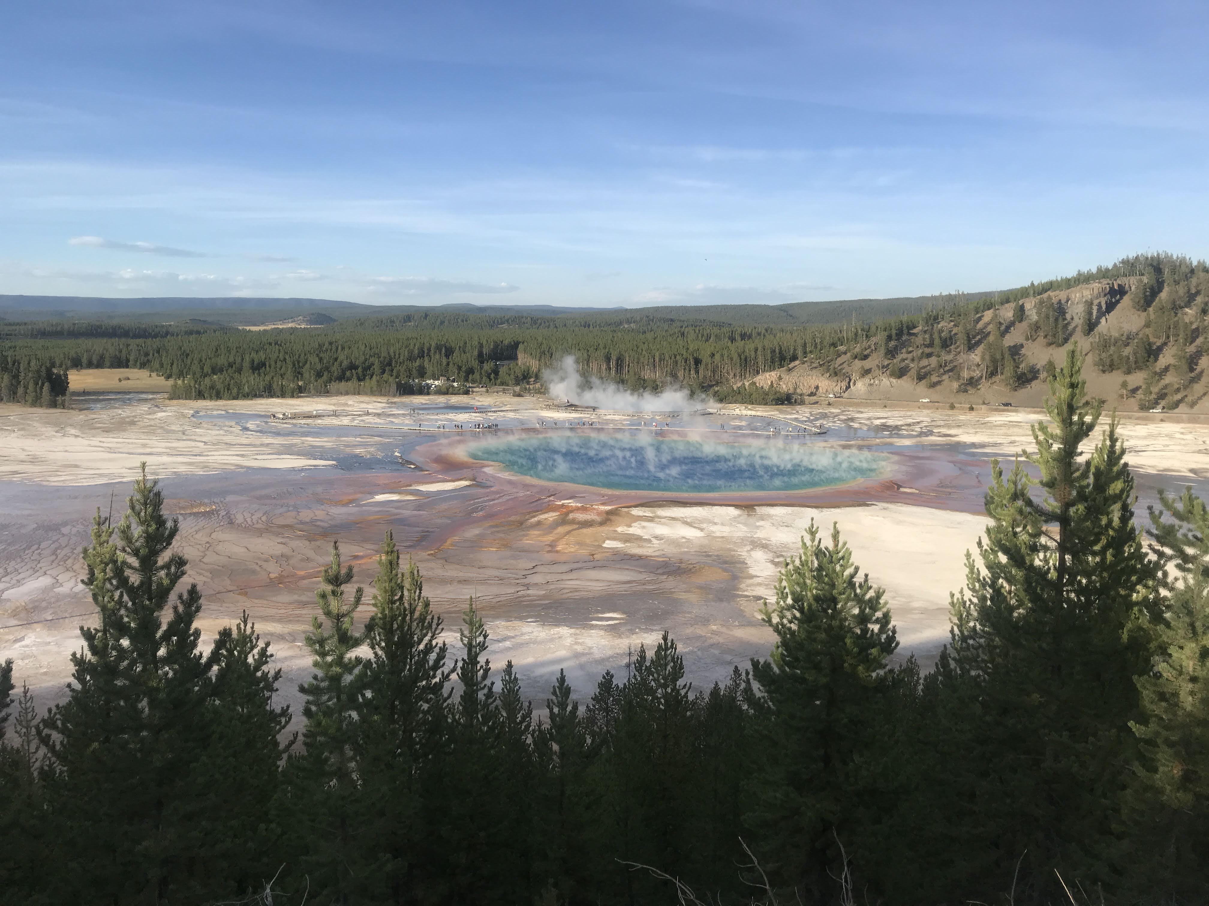
Back at the car we rested in our chairs for a while, enjoying the sun off to the side of the parking lot. Then we ate dinner and drove over to Midway Geyser Basin to catch The Grand Prismatic before the sun disappeared behind the mountains.
My mom and I hiked up to the overlook, racing the setting sun. Up top, we had a bird’s eye view of the largest thermal pool in Yellowstone. The center, a deep blue transitioned into a cerulean blue, then electric yellow, and finally fire orange around the rim. The circular rainbow was one I could have admired all day. The steam rising off the top gave it an extra special other worldly look.
Well, for a day that started off quite frustratingly and tested my flexibility, it wound up pretty darn wonderfully. A good reminder for me to embrace a little spontaneity now and then and embrace the journey.
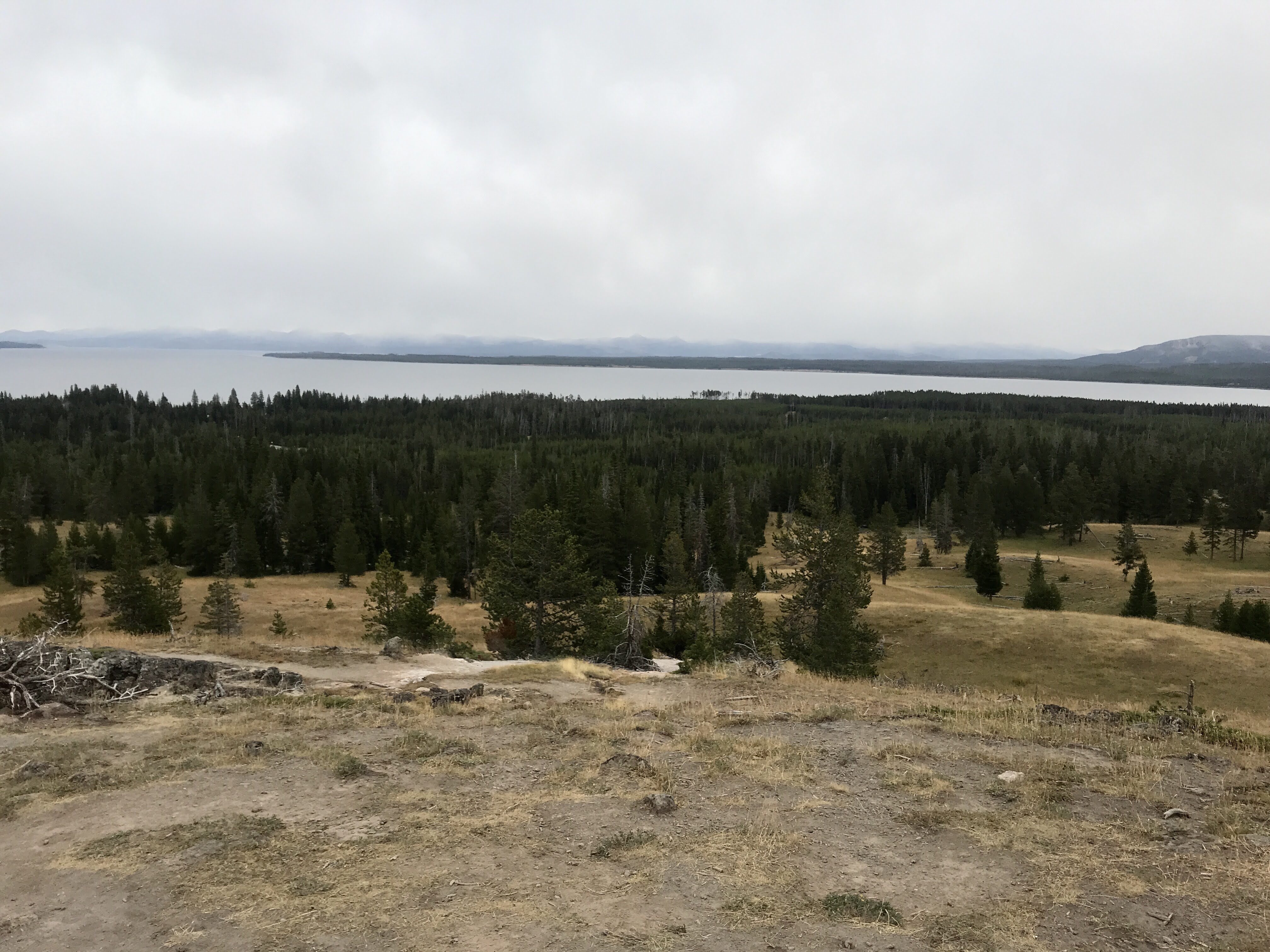
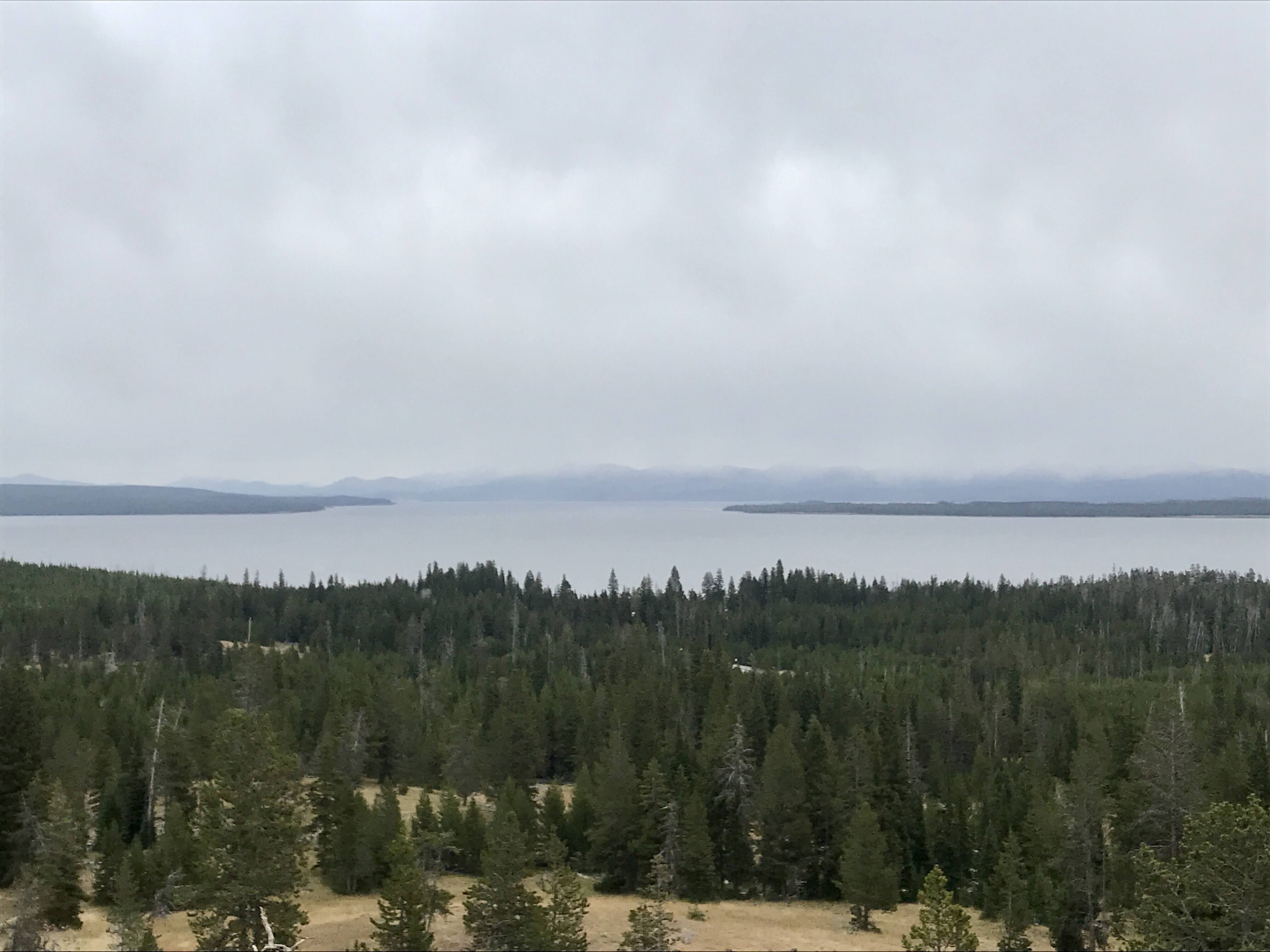
With only two days left at Yellowstone, we had to make sure we explored every area. Eager for another view of Yellowstone Lake, when the sun was shining, we headed toward Fishing Bridge to hike Elephant’s Back.
The quiet trail started on the side of the road and led us through thick forest. A mile or two in the lollipop trail, we veered to the right to start our climb. Switchback after switchback zigzagged us higher and higher up the mountain. We went slow, and stopped a few times as the altitude was bothering my dad. As they say though, slow and steady wins the race. It gave us time to soak up the peace and quiet and relish in views of the lake below as it peeked through the trees.
At the top, the trail flattened out and we made a big arc around to the viewing spot. Gosh, was it worth the effort. The sun was peaking through the puffy white clouds, shining down on the navy blue waters of Yellowstone Lake below. The water was calm, with only a few white lines stretching through it from early morning boaters. Two long wood logs, placed perfectly toward the opening, called our names and we sat down to soak it all in.
A few people came and went as we snacked and relaxed, but largely we had the place to ourselves. The temperatures were slowly rising and the sun on our faces felt happy and warm. Bundled in our layers, we admired the snow capped mountains on the far side of the lake. They added a lovely background, but I was glad we hadn’t encountered snow yet!
Eventually we gave up our spots to some new hikers and began the hike down. We came across several hikers just beginning their adventure and wished them a good day. This part of the hike went down switchbacks (so much easier), but was certainly longer and steeper. We were thankful we had gone the other direction at the split!
Back at the car, we drove over to the Storm Point trailhead for one more short hike. This trail led through the forest to the shore path along Yellowstone Lake. As we walked through the forest, a Ranger was teaching his sons how to do trail maintenance by sawing through some trees that had fallen along the trail. As we passed, he commented to us that trees in Yellowstone like to fall down more than they like to stand up! This seemed very true, not only on this hike, but in many parts of the park. The forest floor was often riddled with fallen trees, blown over by strong winds. They pile up and weather until they are gray and brittle because the climate is so dry here. No quick decay like in the damp forests back East.
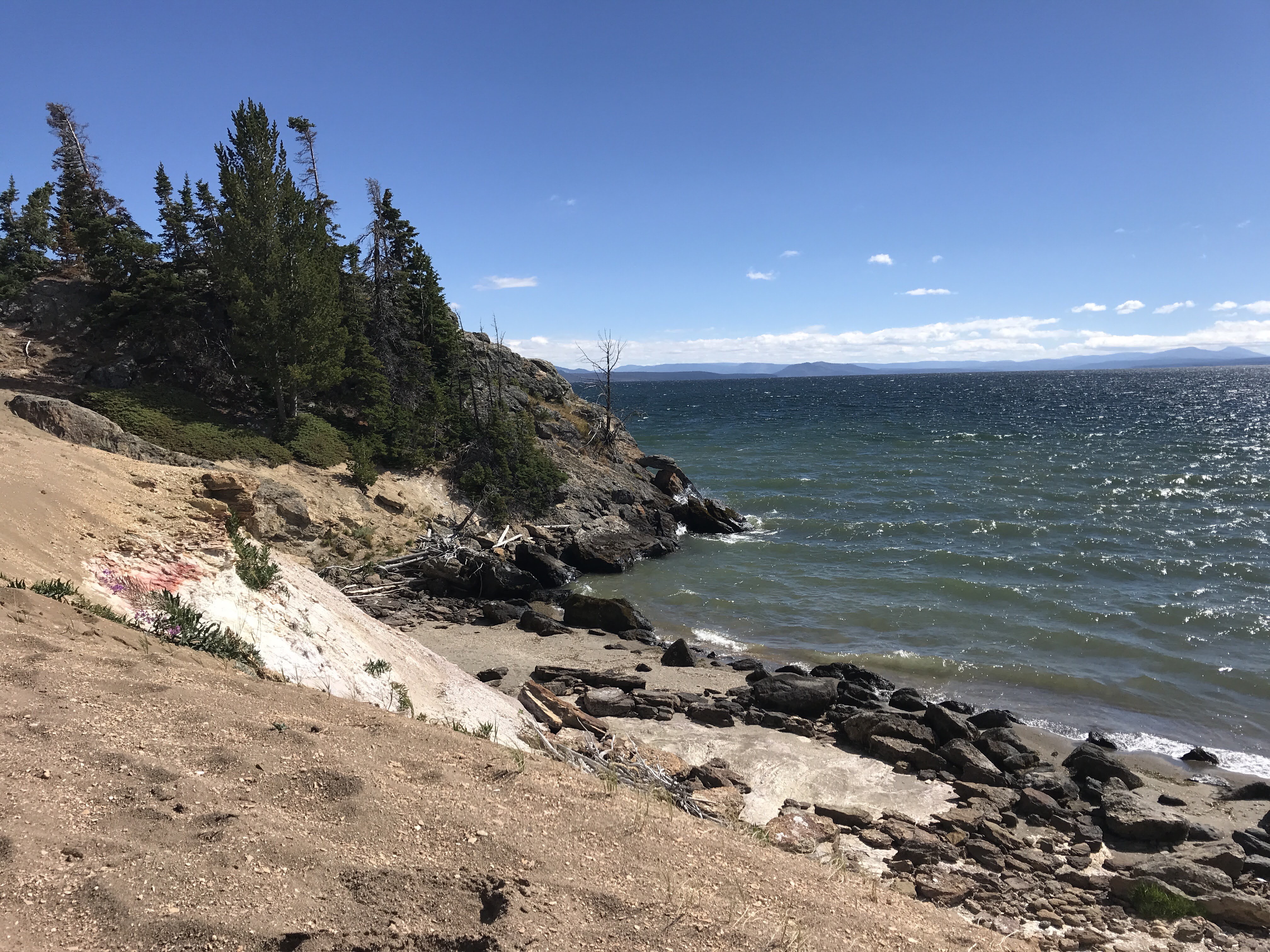
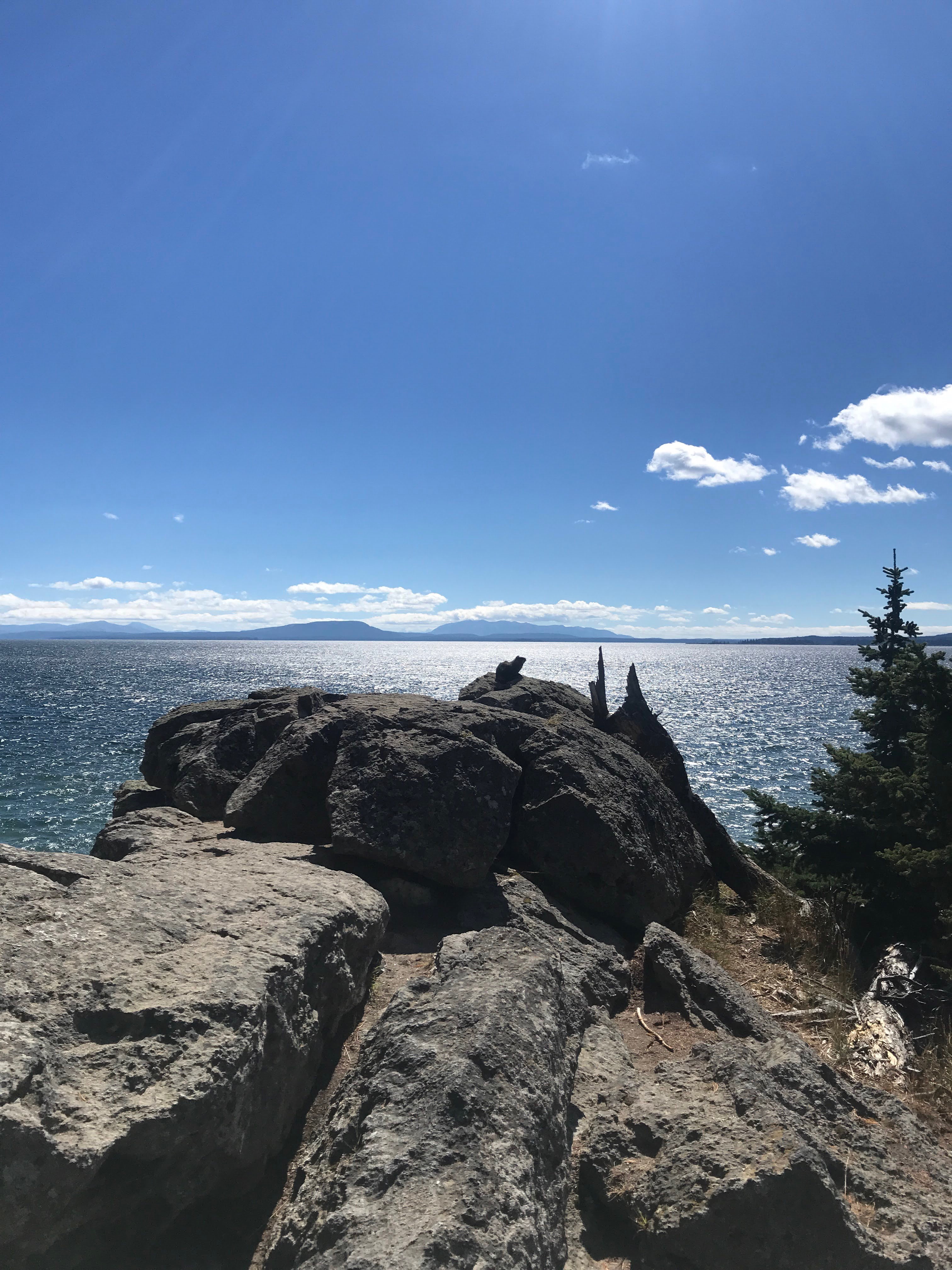
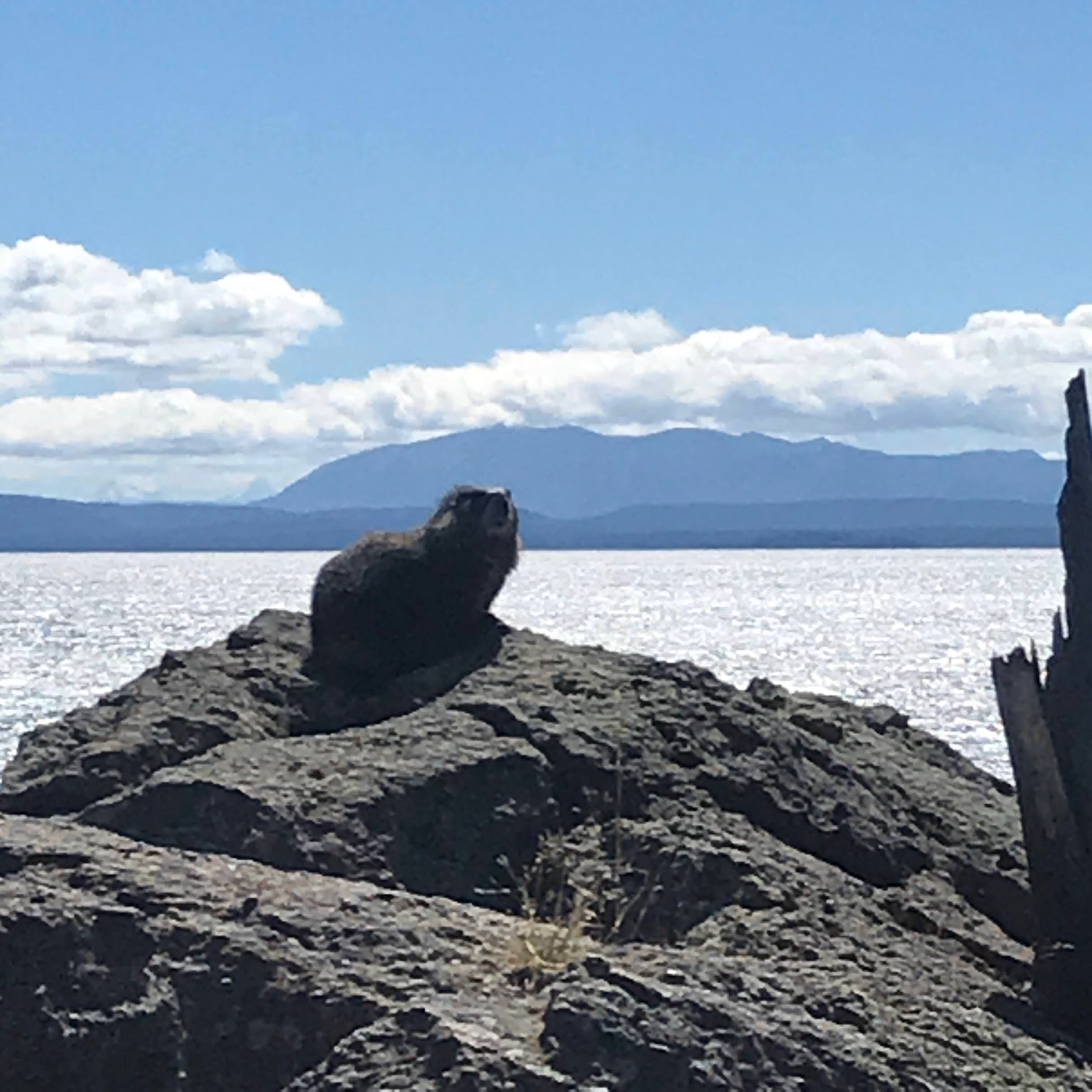
Eventually we emerged from the woods and walked along the path onto of the cliff by the shore. Storm Point lay ahead, an outcropping giving a spectacular view of the lake. My mom and I were caught up taking pictures when my dad spotted a yellow-bellied marmot sunbathing on the rocks! We quietly but quickly hurried over to capture it in its glory, but we needed have hurried. The marmot seemed to love the camera and posed for us for a long time, making sure to have the scenic lake behind as a beautiful backdrop. Another animal to check off the list!
We then wound our way back to the car, practicing some leprechaun heels clicks/jumps along the way. I’m very good at the left side, but the right side needs some practice. We goofed around, trying different strategies, until I finally nailed it. With some coaching, my dad got it too. Finally, due to peer pressure, my mom made an attempt as well. The laughter and play was fitting end to a lovely day.
On this August day, we woke up to temperatures in the 40s accompanied by rain and wind. Summer in Wyoming is certainly interesting! The high elevation, coupled with the mountain landscape makes for some not so pleasant days. This was one of them.
Still eager to explore, I though we’d check out the nearby West Thumb Geyser Basin. Being good sports, my parents accompanied me bundled in their winter hats and puffy jackets. We drove the short few miles to the parking lot and started up the Lake Overlook Trail.
It had sounded really exciting to me – walk through backcountry geothermal features to a view of Yellowstone Lake. Cool right? And it was, minus the frigid, damp weather. We did make it to the overlook and were greeted by a few steaming pools on the sides of the trail. The lake was beautiful, just waking up as the day began, but we didn’t stay long to admire it. It was cold!
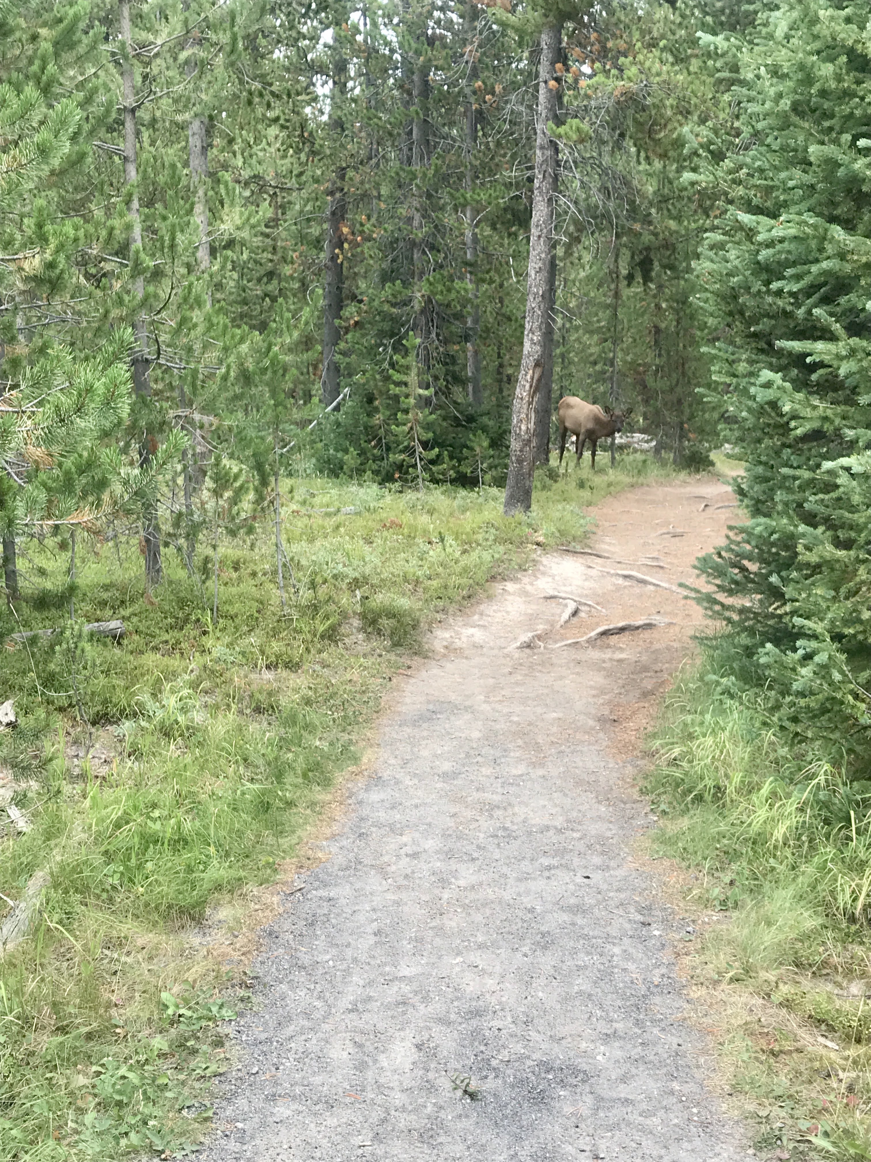
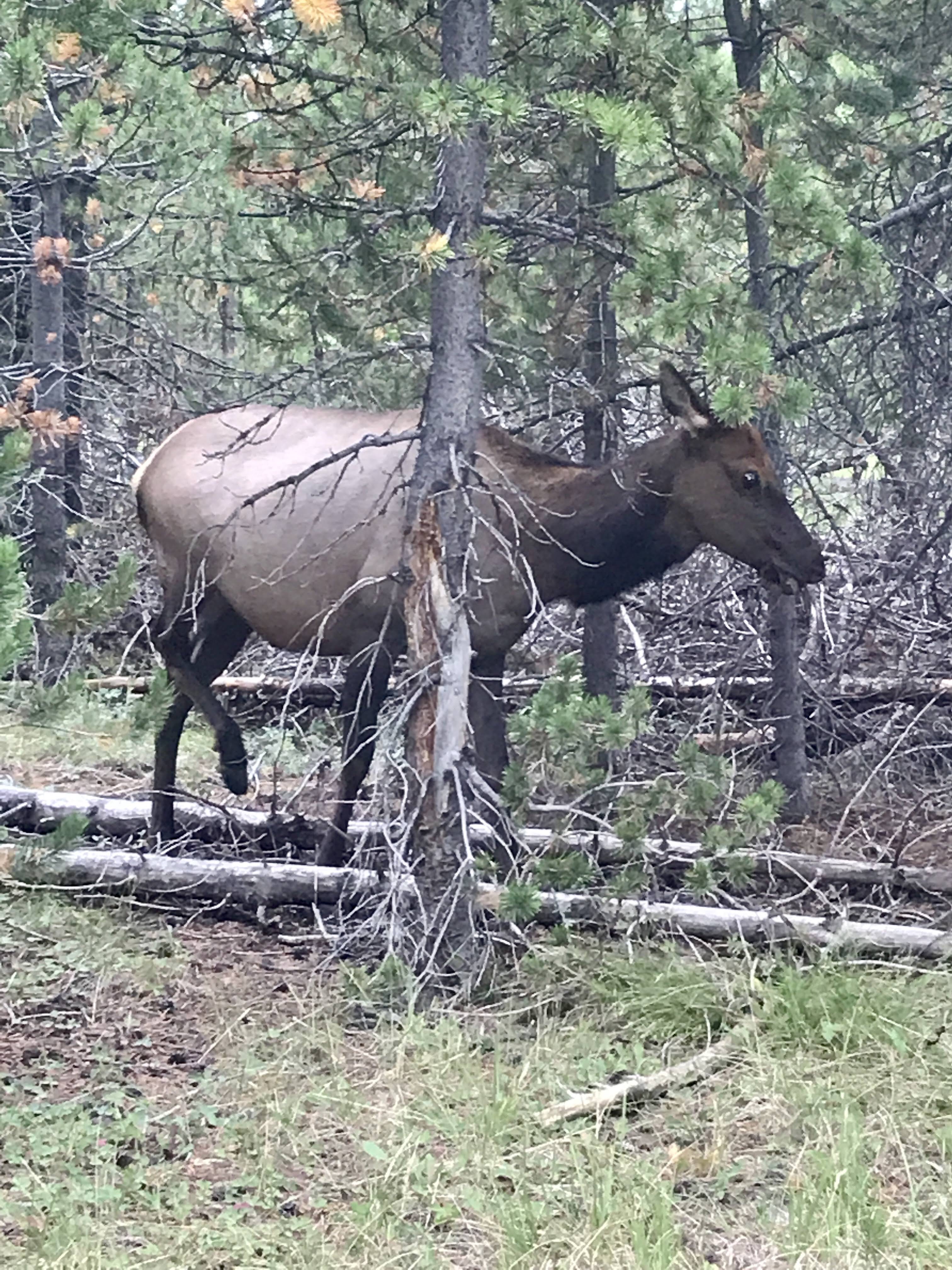
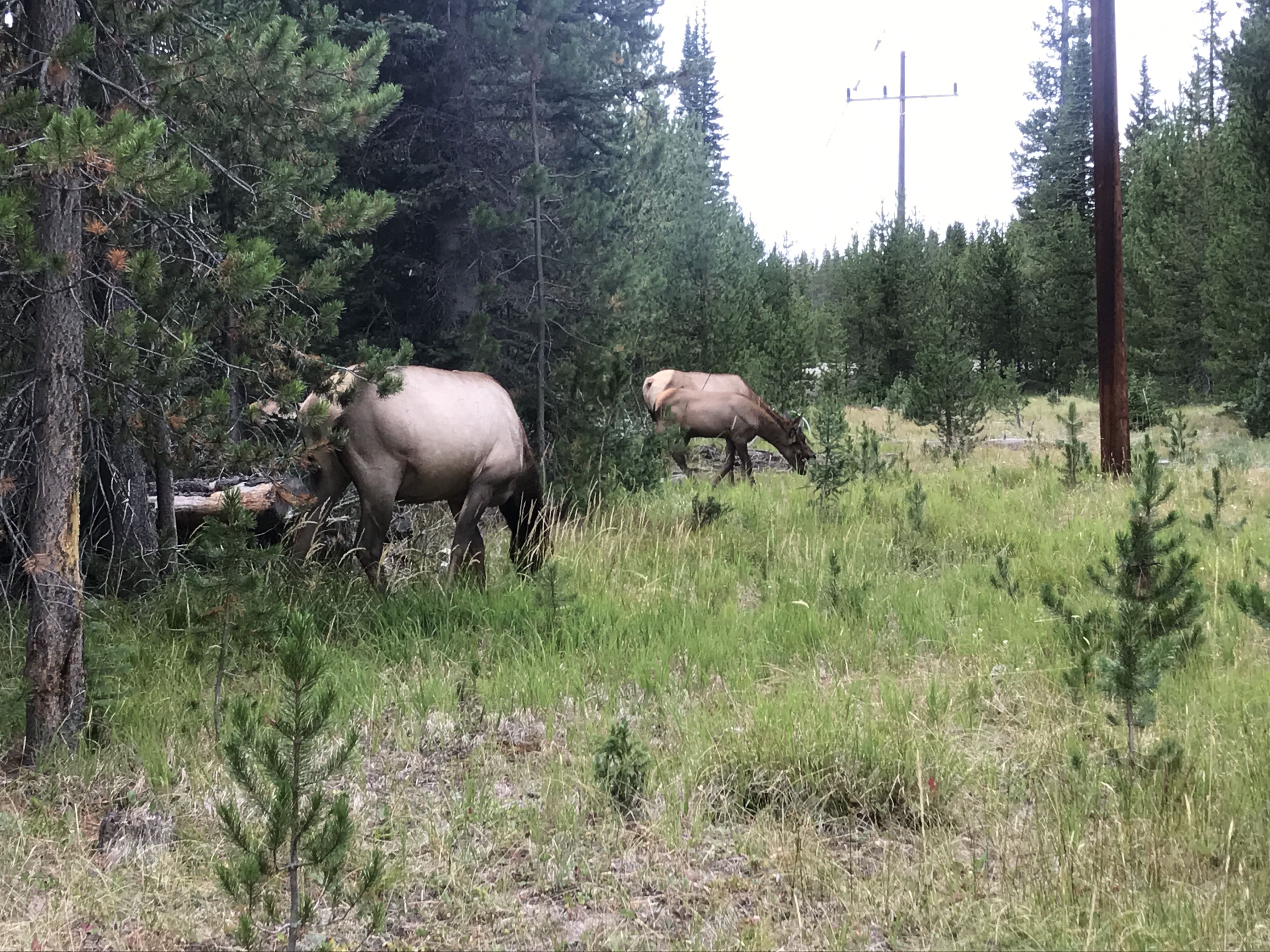
My dad began racing down the trail to get back to the warm, dry van. We couldn’t walk fast enough to keep up! Not too far from the parking lot, he did have to stop though and let us catch up. A few elk were grazing in the forest ahead of us on the trail. It was clear they were familiar with humans as they didn’t spook and let us take a plethora of pictures. My mom and I could have admired them for a while, despite the cold, but my dad was itching to get back. And I couldn’t really blame him.
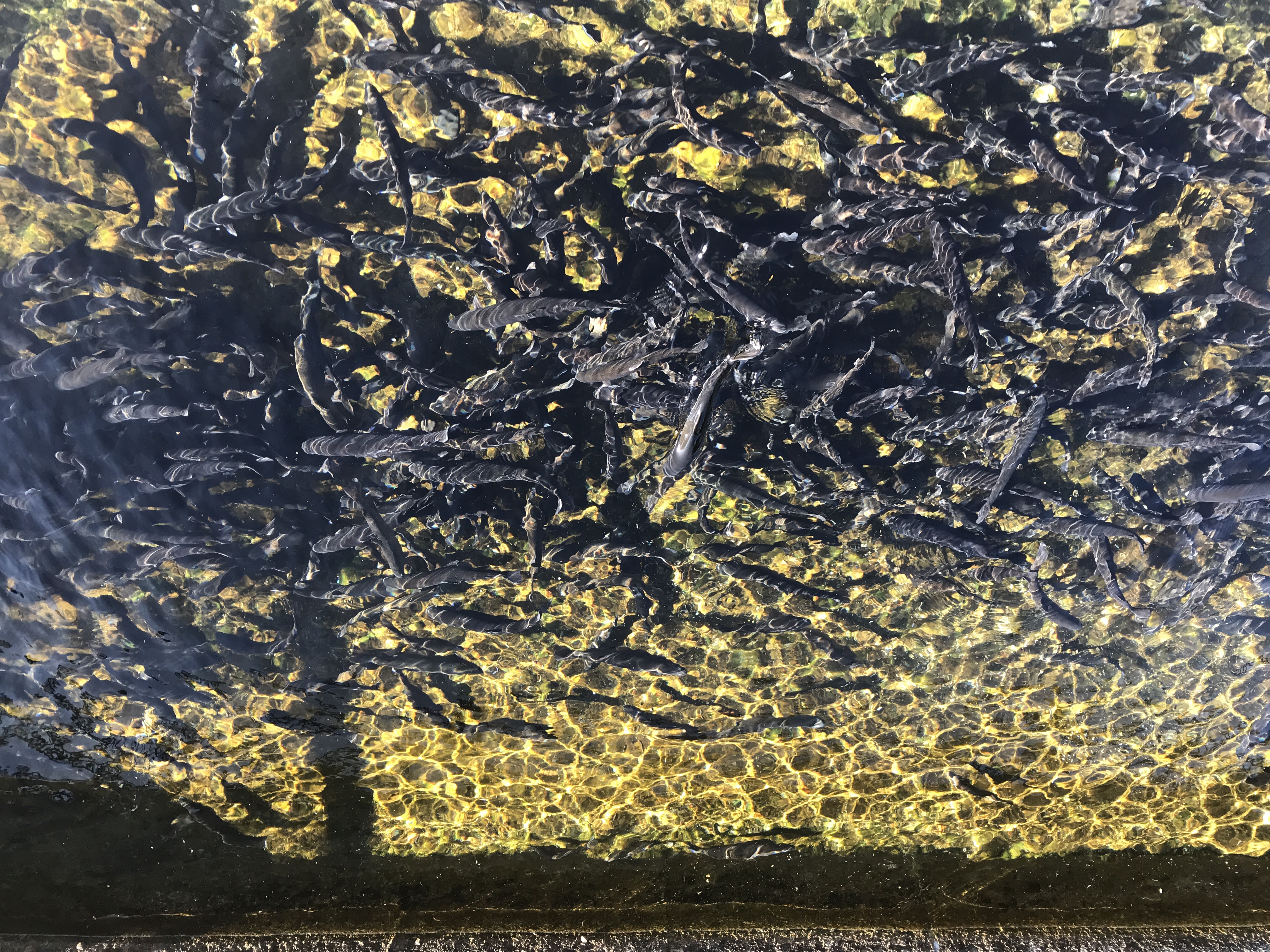
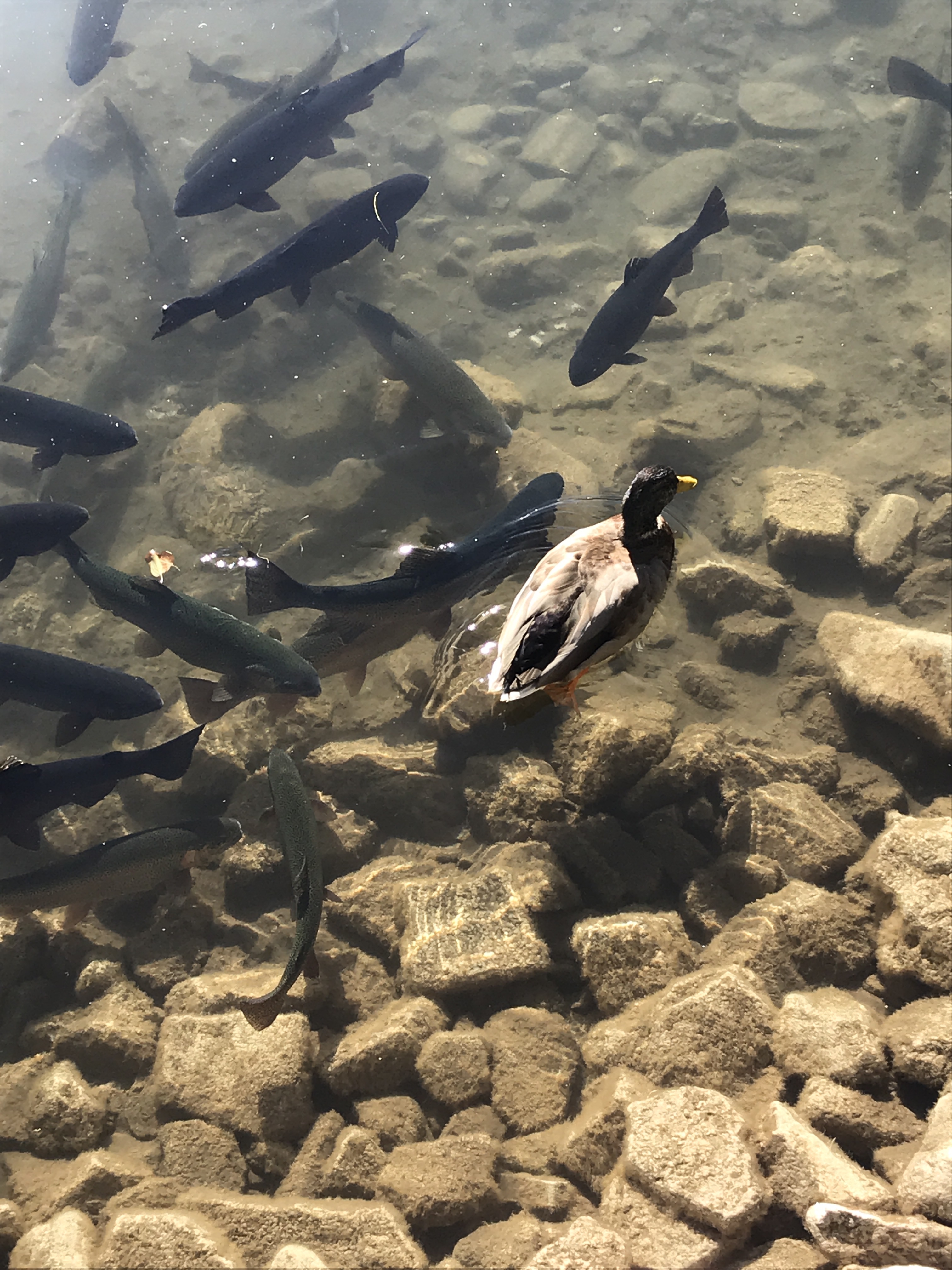
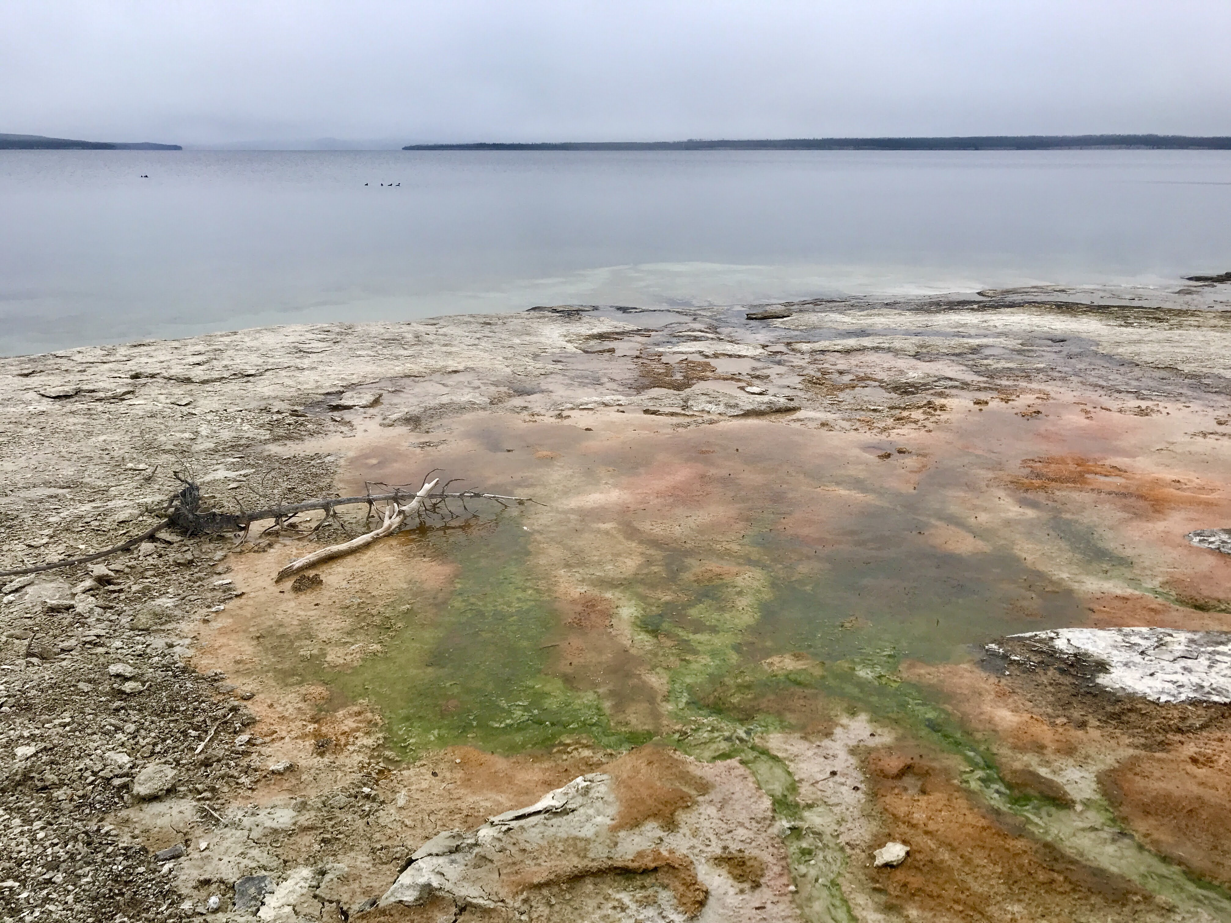
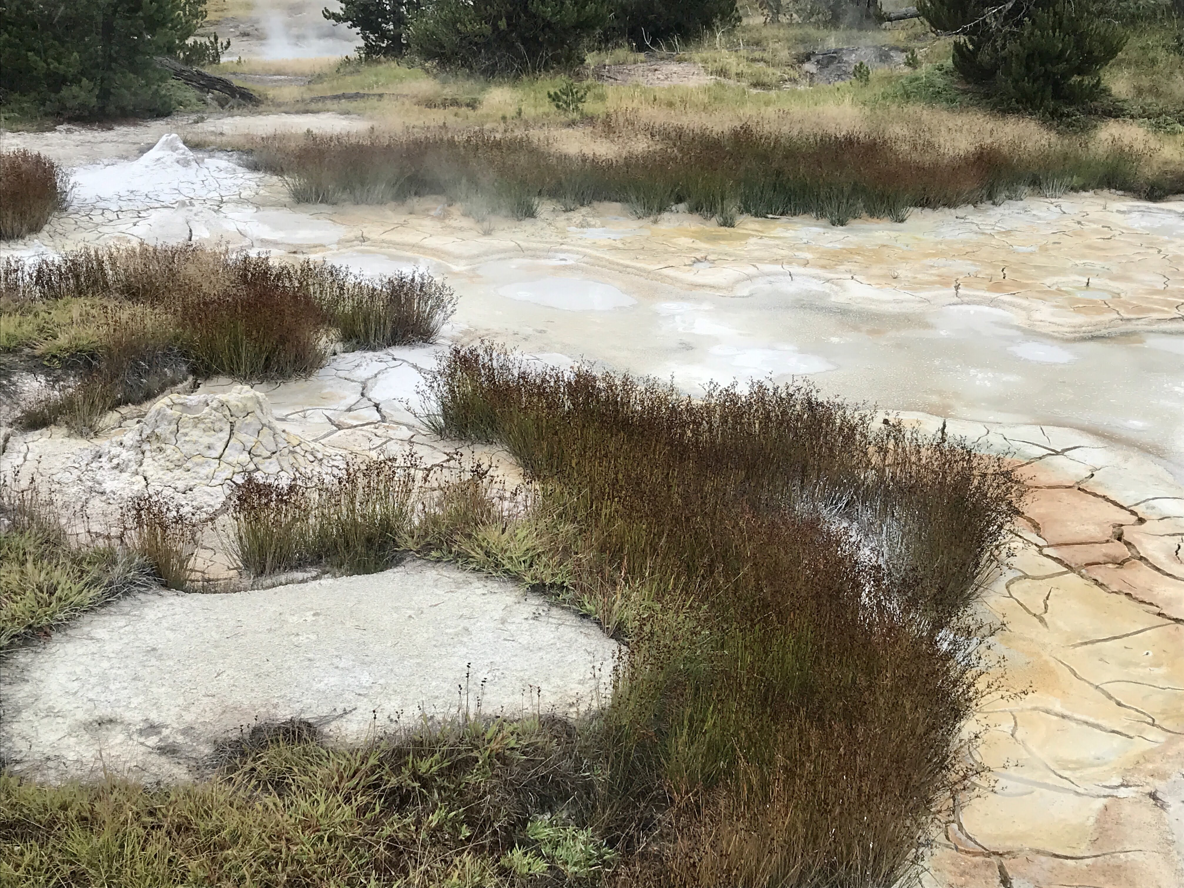
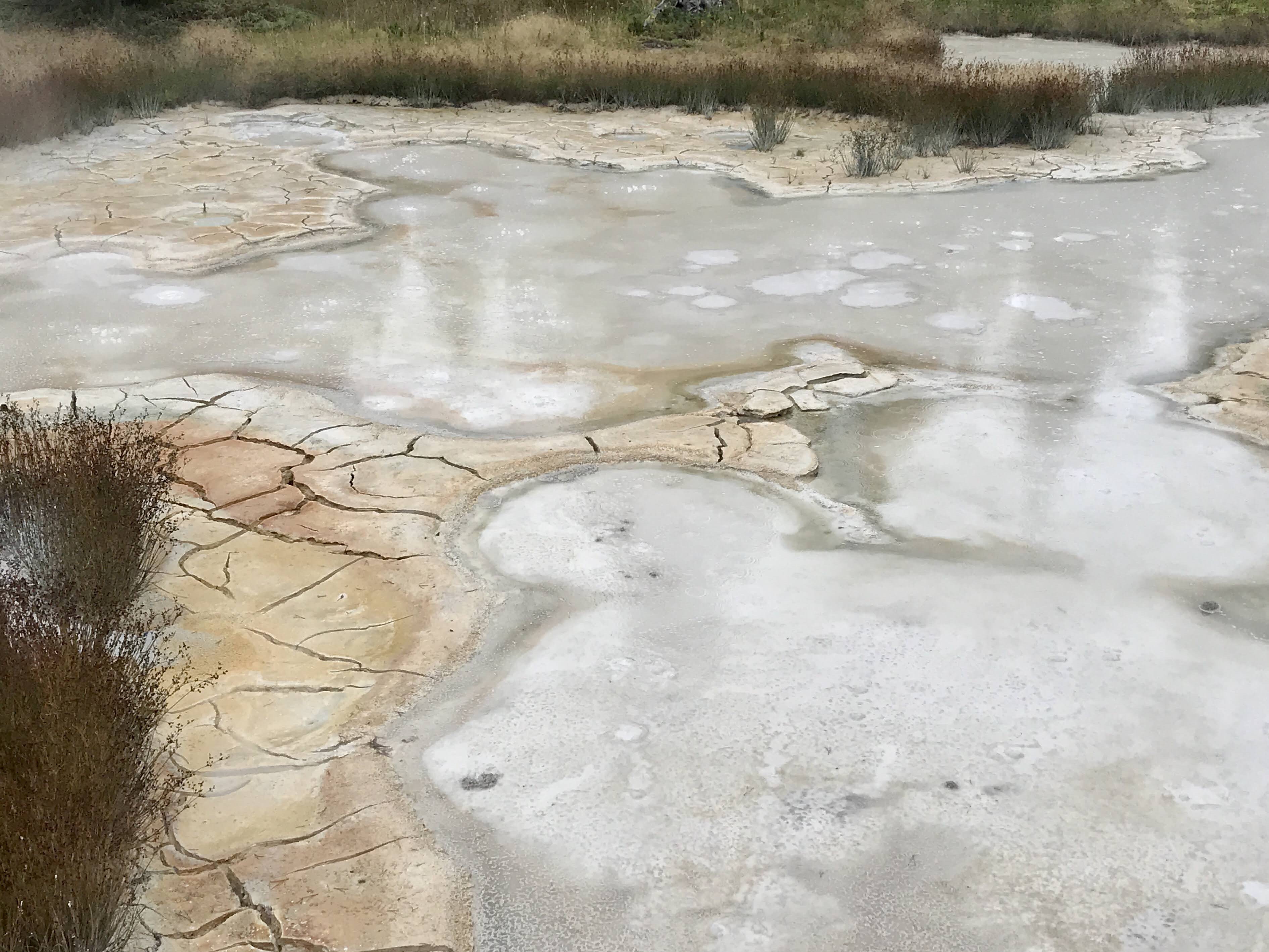
We warmed up in the car with the heat cranked up, and then braved the weather once again to walk the boardwalk of West Thumb Geyser Basin. It was a speedy trip around, but the special thing about this geyser basin was that it extended out to the shores of Yellowstone Lake. The steaming water from the geysers and hot springs trickled under the boardwalk out into the vast expanse of the deep blue lake. The waterfowl really enjoyed this as they swam close to shore, huddled together. Small geysers also rested atop cliff outcroppings, bubbling and spouting with the calm lake as a backdrop.
The colors of the thermal pools popped against the gray, dreary skies, giving us a little warmth as we hustled along. Each is named, some according to their shape, some for the person who discovered them, other by park rangers or visitors with interesting ideas. There are so many though, I think at some point they started to run out of ideas. Names like “collapsing pool” and “ledge pool” were some that lacked originality here. Haha
After our tour, we drove back to the campground and parked ourselves inside our motorhomes for the rest of the day. I had a lovely nap, journaled, and cooked dinner. Thank goodness we weren’t tenting! I felt extremely grateful to home my van this day. 😉
After a great few nights at Canyon Campground in the middle of Yellowstone National Park and exploring nearby areas, we set off for Grant Village in the southern part of the park. It was a brisk and windy day, but the sun was shining, so we were ready for new adventures.
Our first stop was on the side of the road to admire a bison herd far below. The powerful creatures were gently grazing in the prairie grasses, enjoying the open land and fresh air. Bison were sacred to the Crow and Cheyenne tribe. These majestic animals were revered and respected. When hunted, the Crow and Cheyenne people strove to use every part of the animal. Clothing and teepees were made from bison hides and fur, meat was eaten for nourishment, and tools and weapons were made from bones. As observers, we respected the bisons’ space and snapped a few pictures from more than 100 yards away and continued on down the road.
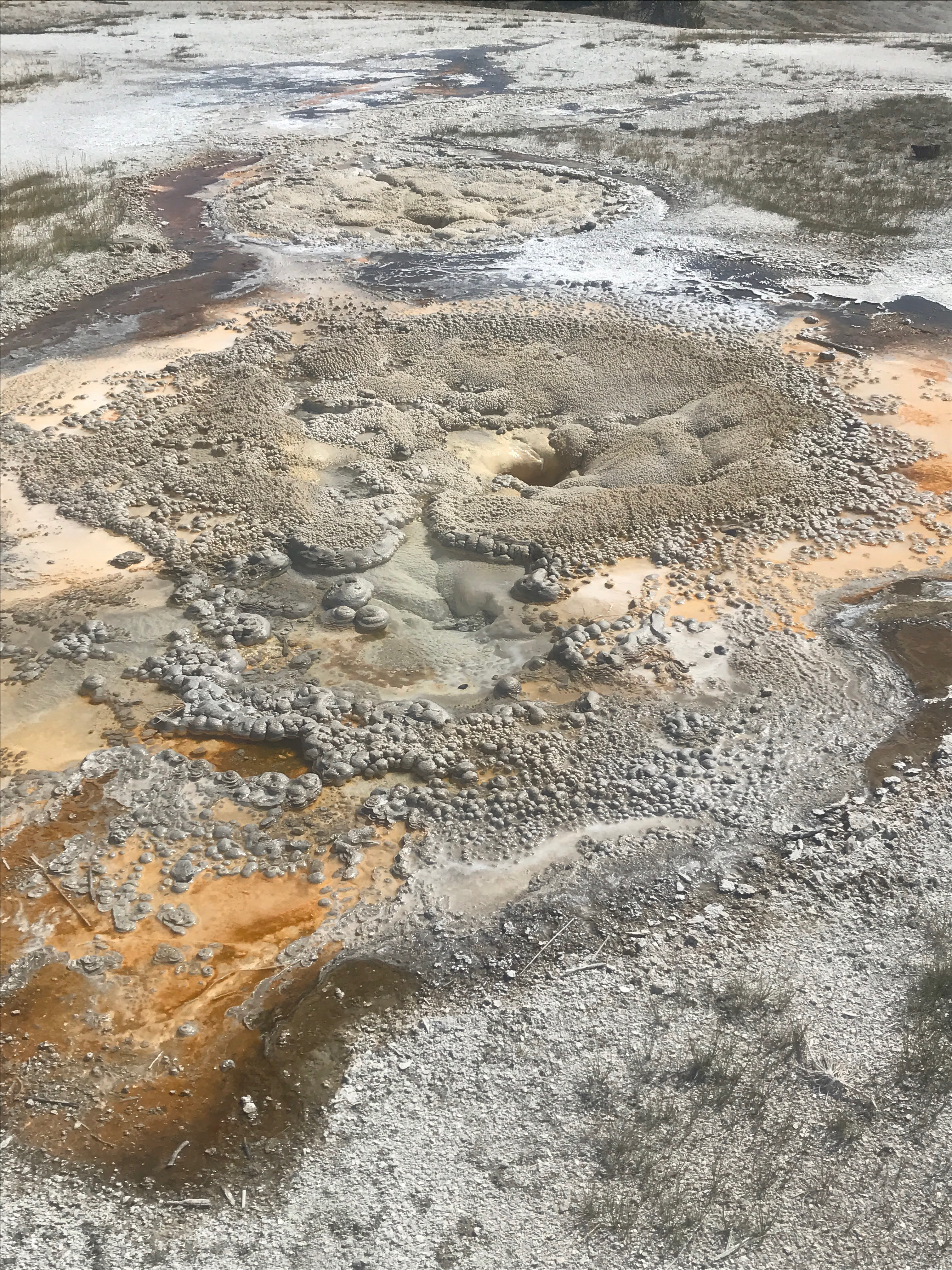
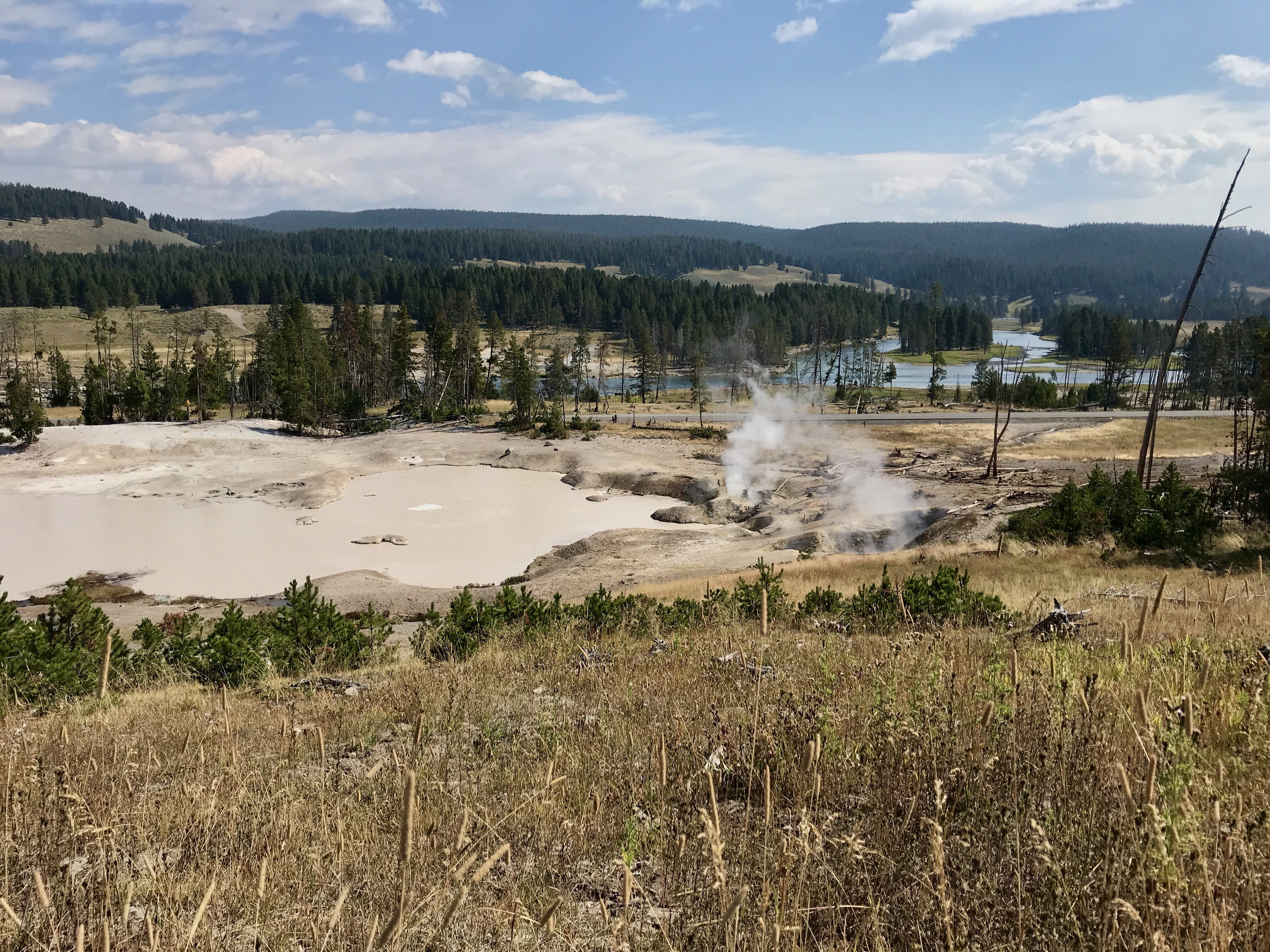
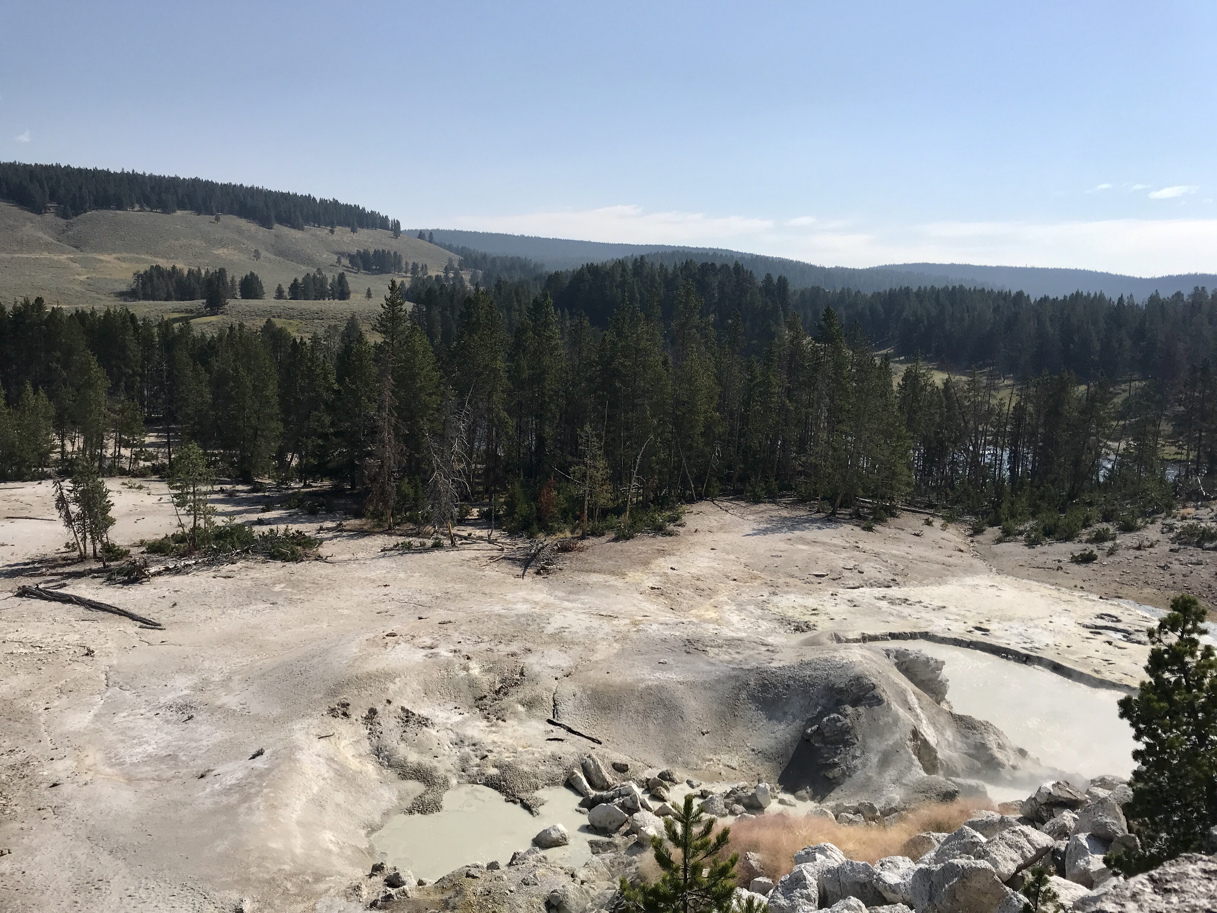
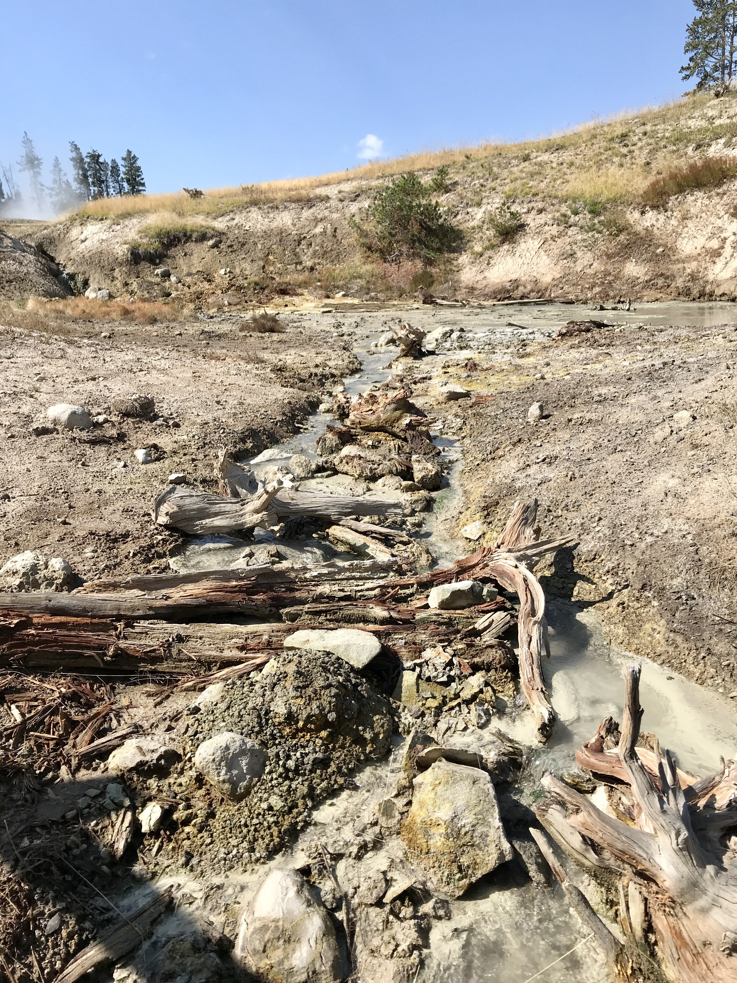
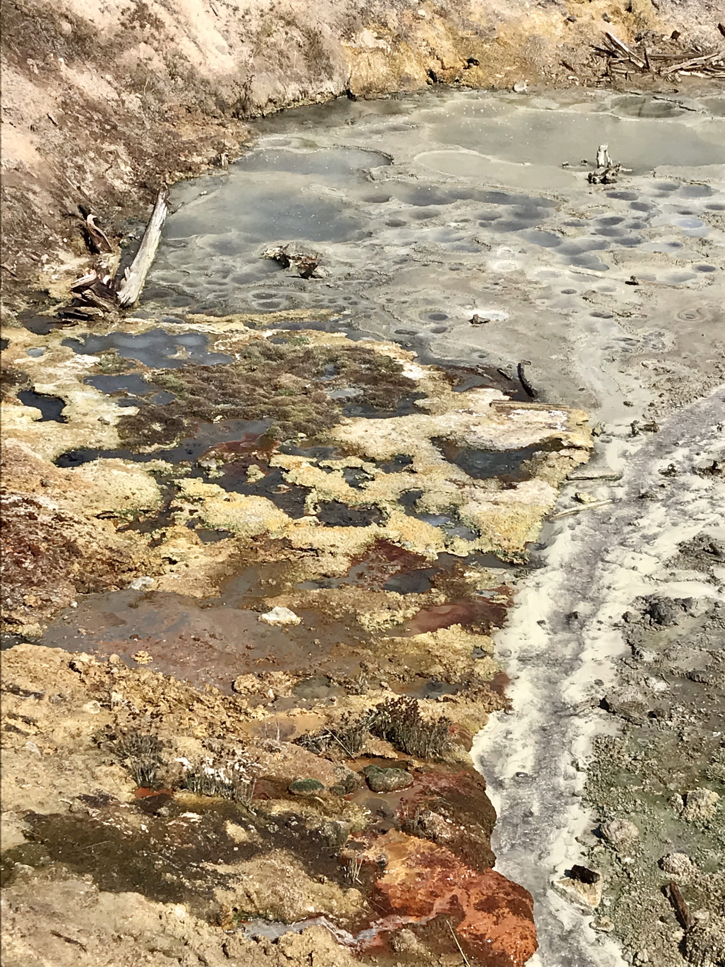
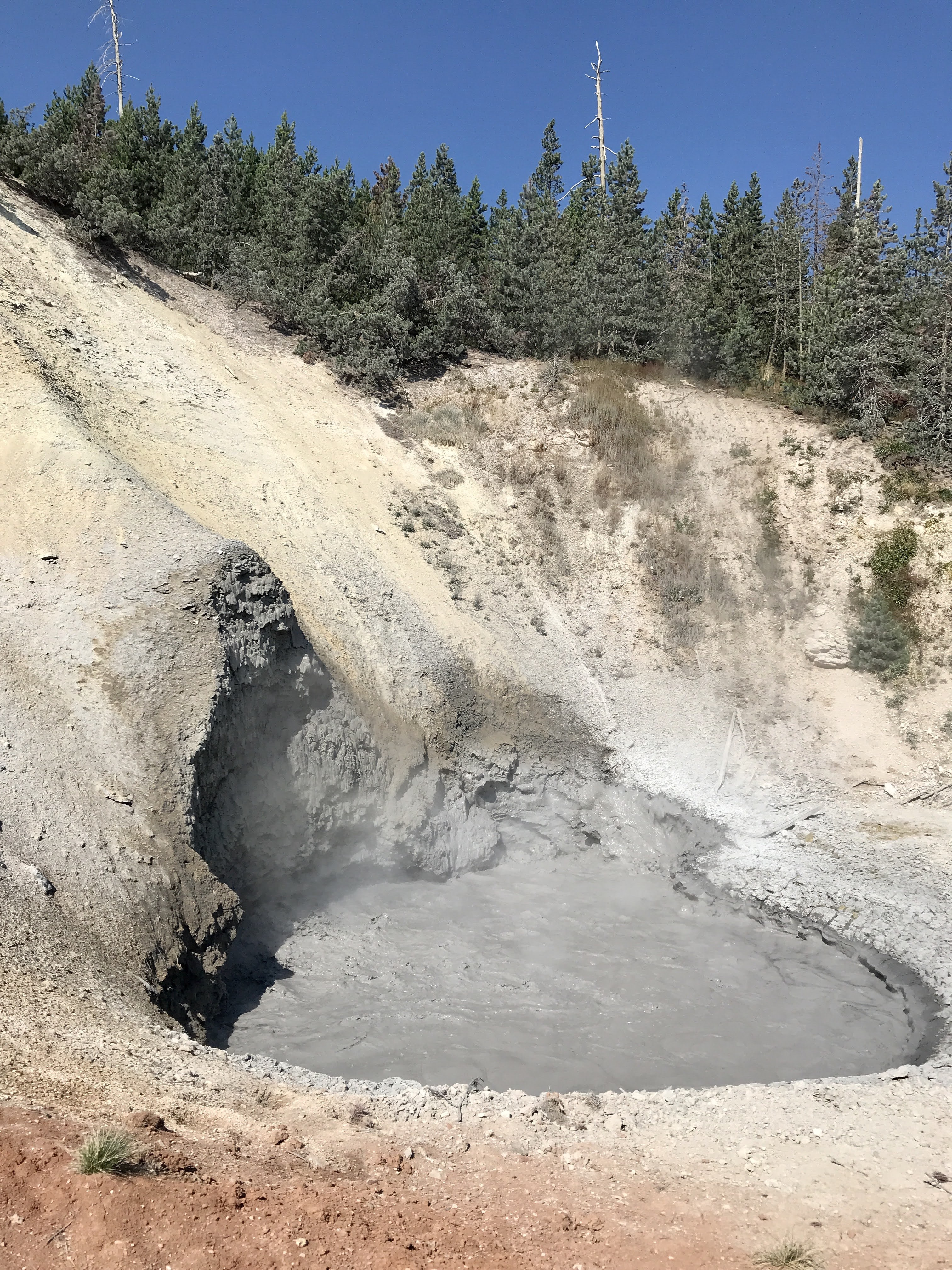
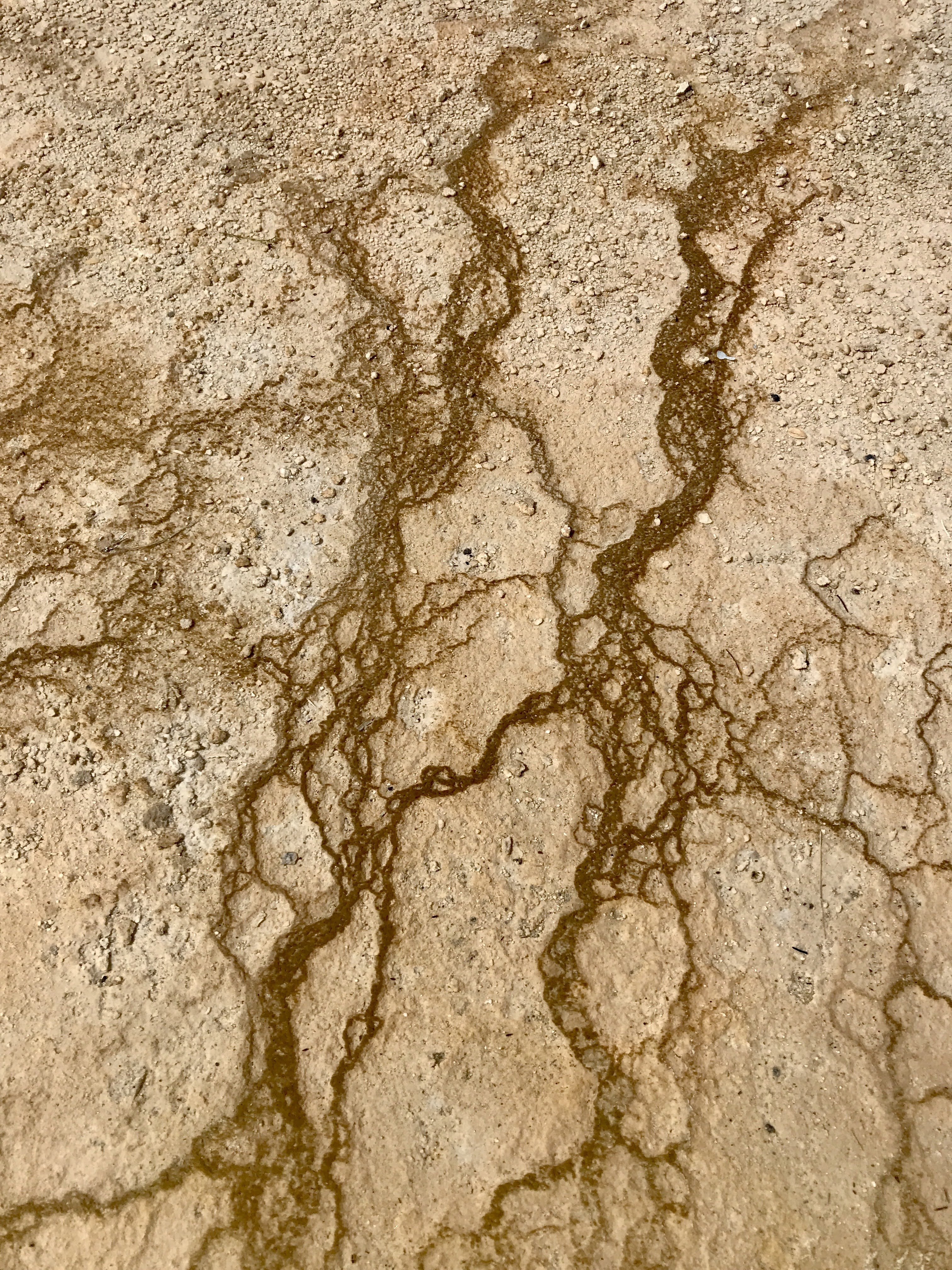
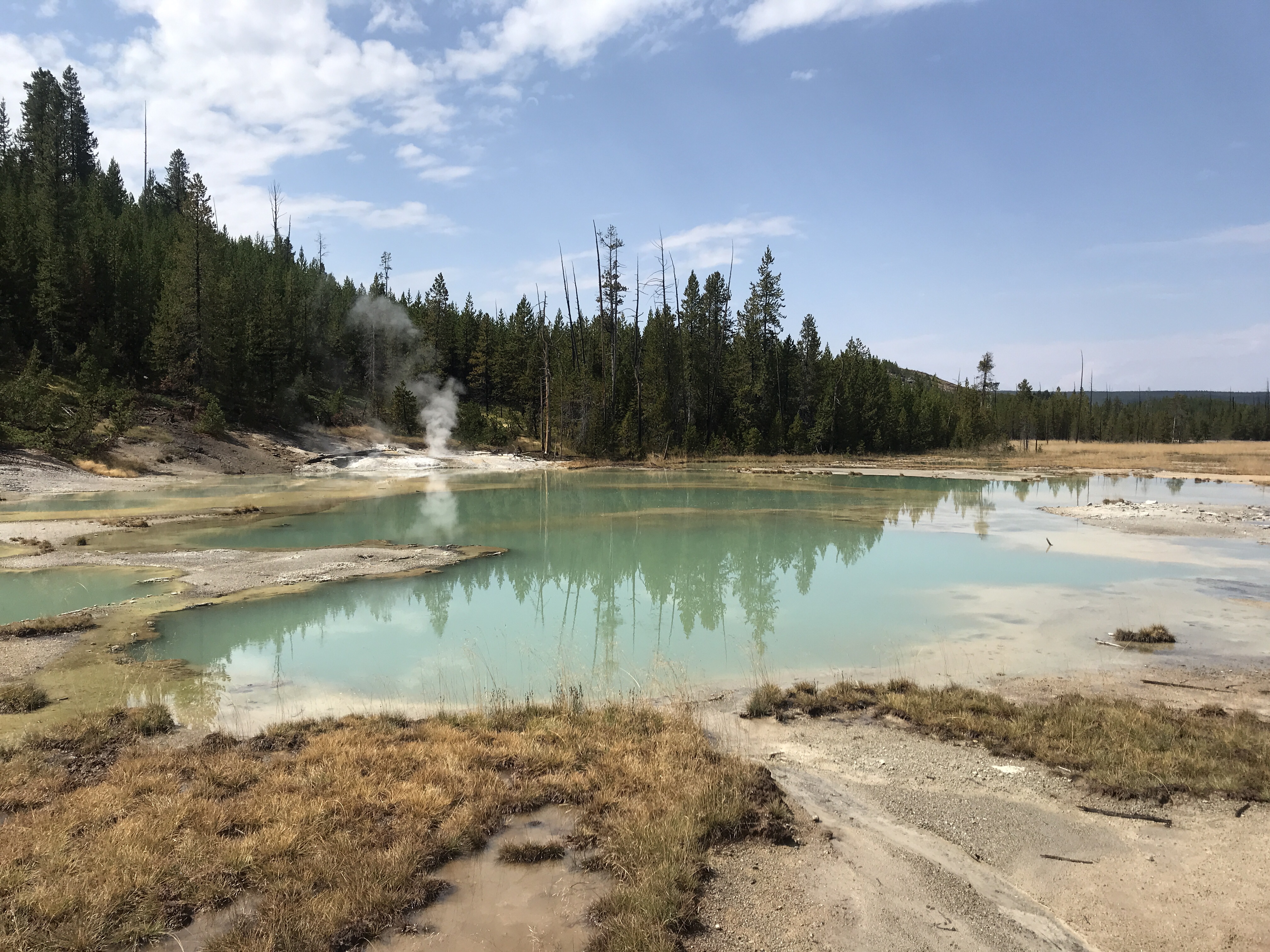
We then stopped at Sulphur Caldron, with greenish gray pools bubbling and vents steaming out hot air from the super volcano below. The nearby trees are coated white from the minerals released through the gases floating upward. The whole area is remarkable, minus the rotten egg smell. Sulphur Caldron certainly smells like sulphur! According to interpretive signage, the area is ten time more acidic than lemon juice. It is one of the most volcanically active areas of the park! Despite its hot temperatures and high pH levels, microorganisms called thermoacidophile still grow in this environment. They work to break the pools’ hydrogen sulfide gas into sulfuric acid with changes the soil and rock into mud!
From this area you can look beyond to see the caldera, which is the earth behind the caldron that is rising due to magma moving and pushing underground! Geologists mark and measure the area to track its growth. Some day they predict the super volcano under Yellowstone National Park will erupt again.
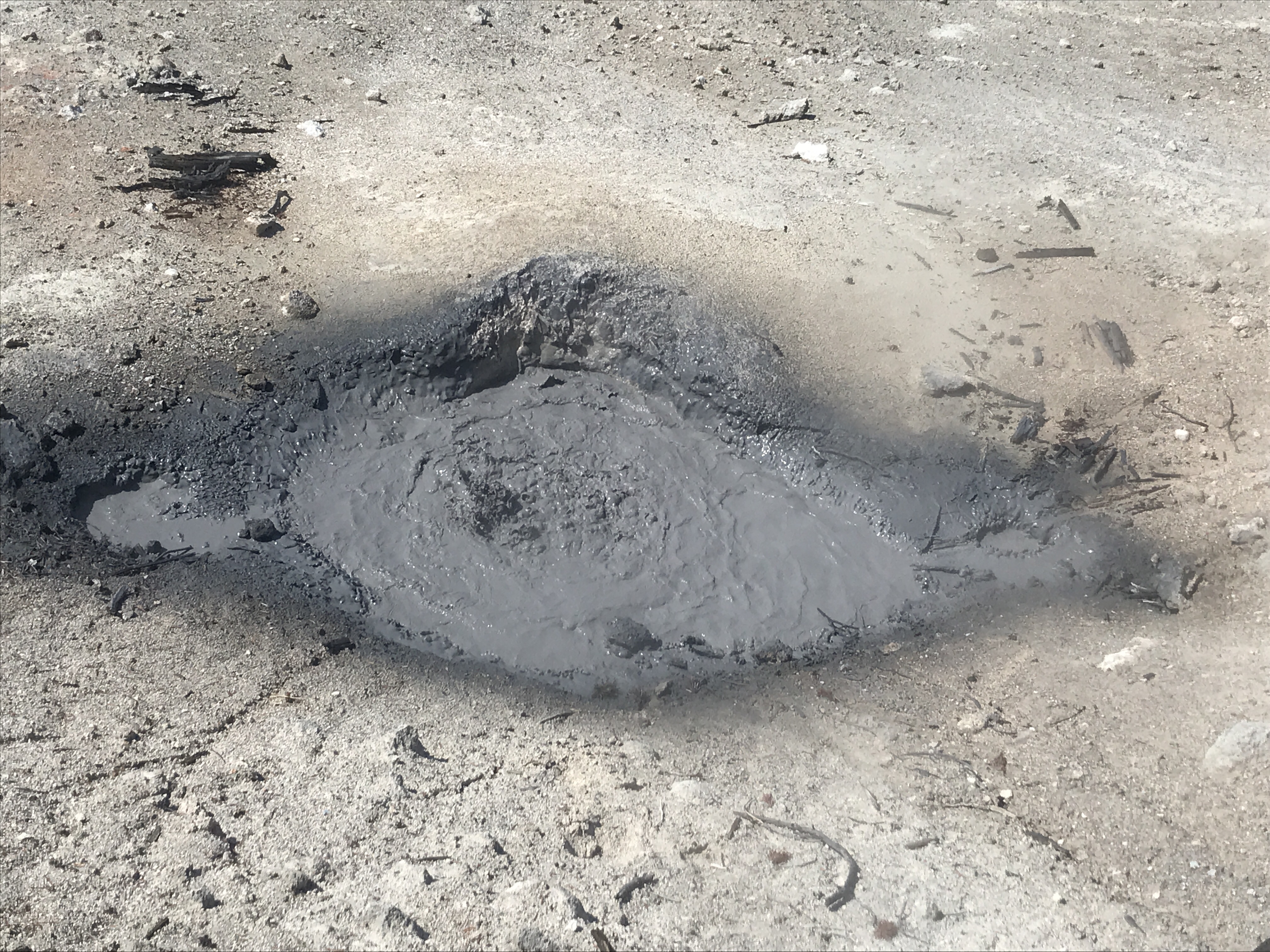
When done here, we walked over to the nearby Mud Volcano area to see more boiling pools, sizzling rivers, and of course, Mud Volcano! This feature erupted in 1870 covering everything nearby with layers of think, gray mud. It spewed mud mud so hard, that two years later is was simply a pool of bubbling muddy water because it had blown itself apart. This land is constantly changing! Can’t wait to come back in a few years and see what is different.
Our next move was to continue down the road to Grant Village, but we were disappointed to see that the road ahead was still closed from a massive gas spill earlier in the week. We later learned that in order to properly clean the area and ensure the Yellowstone River hadn’t been contaminated, crews had to dig a whole 100 feet wide by 100 feet long and 10 feet deep to remove all the dirt that soak up the gas. What a mess! So far, the Yellowstone River is reported to be fine. So, we weren’t getting through that way. We turned around and drove the long way to Grant Village, through Madison Junction, past Old Faithful, and beyond West Thumb.
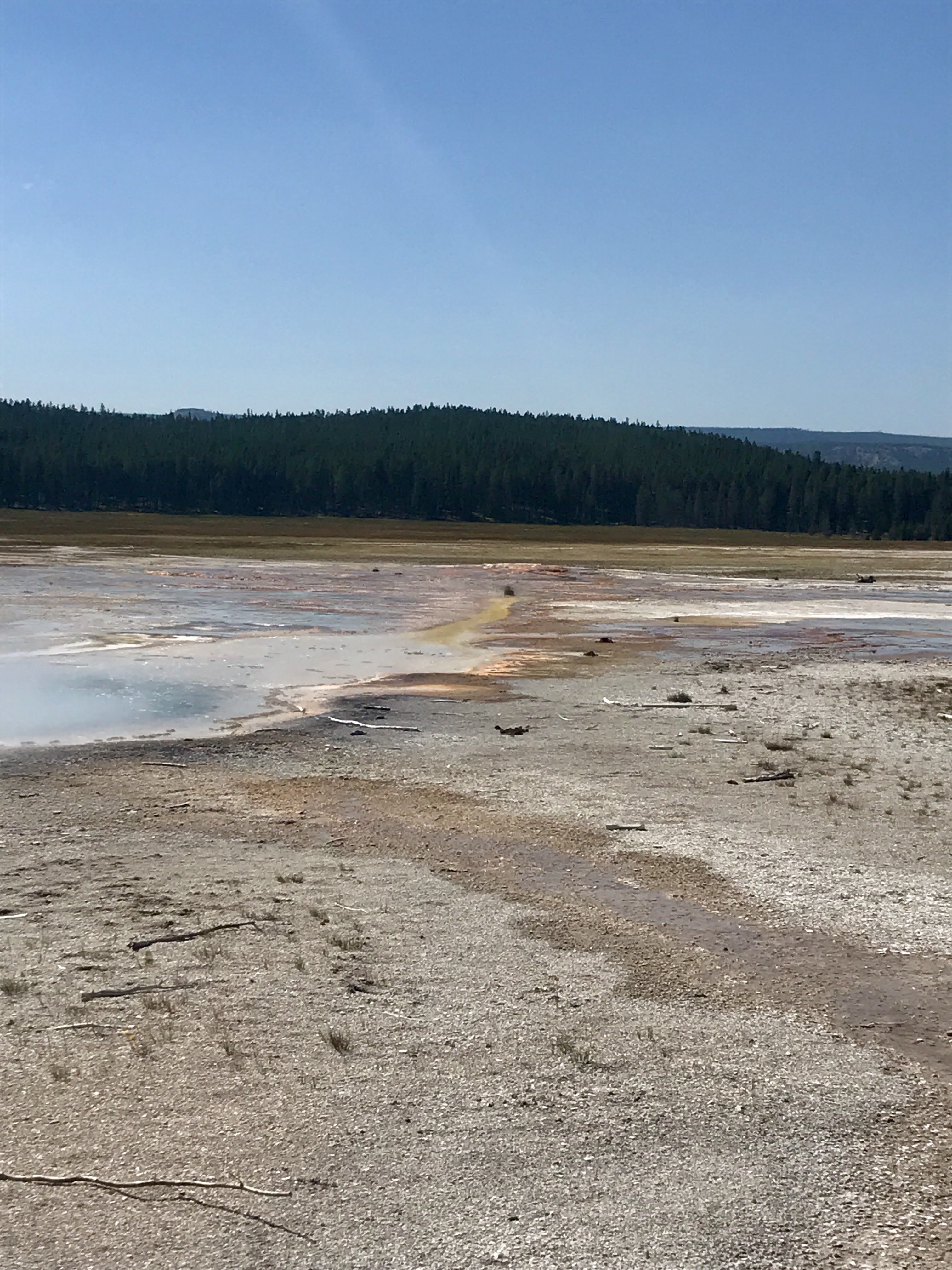
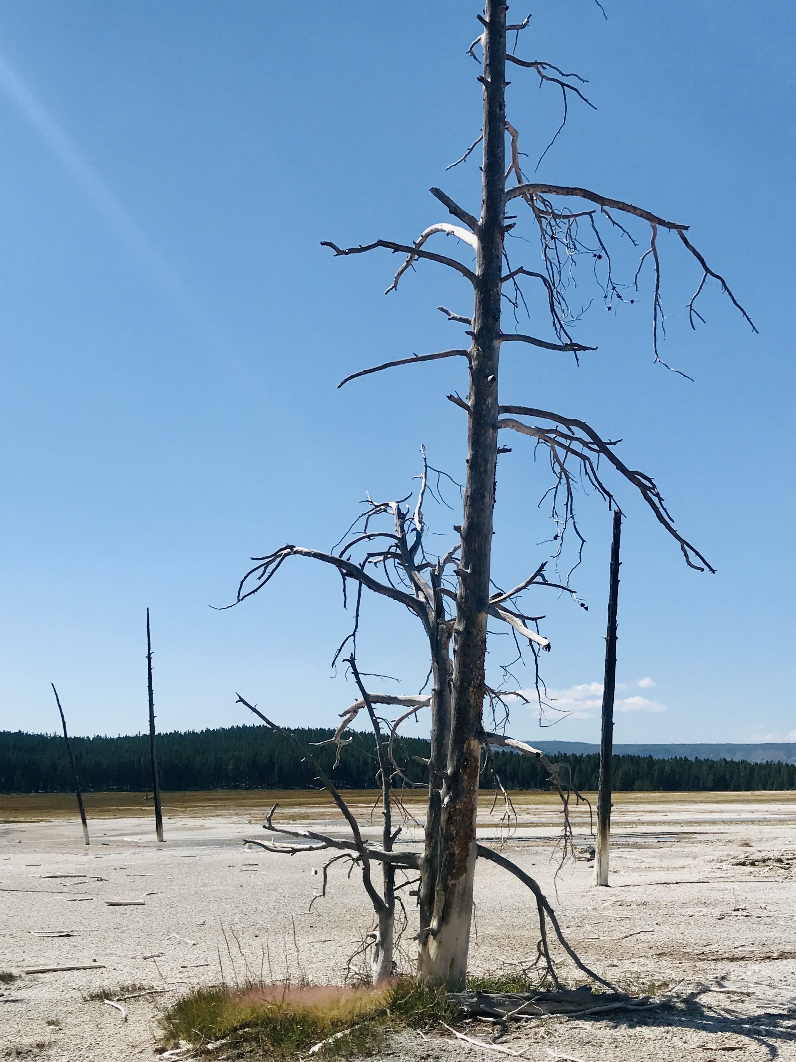
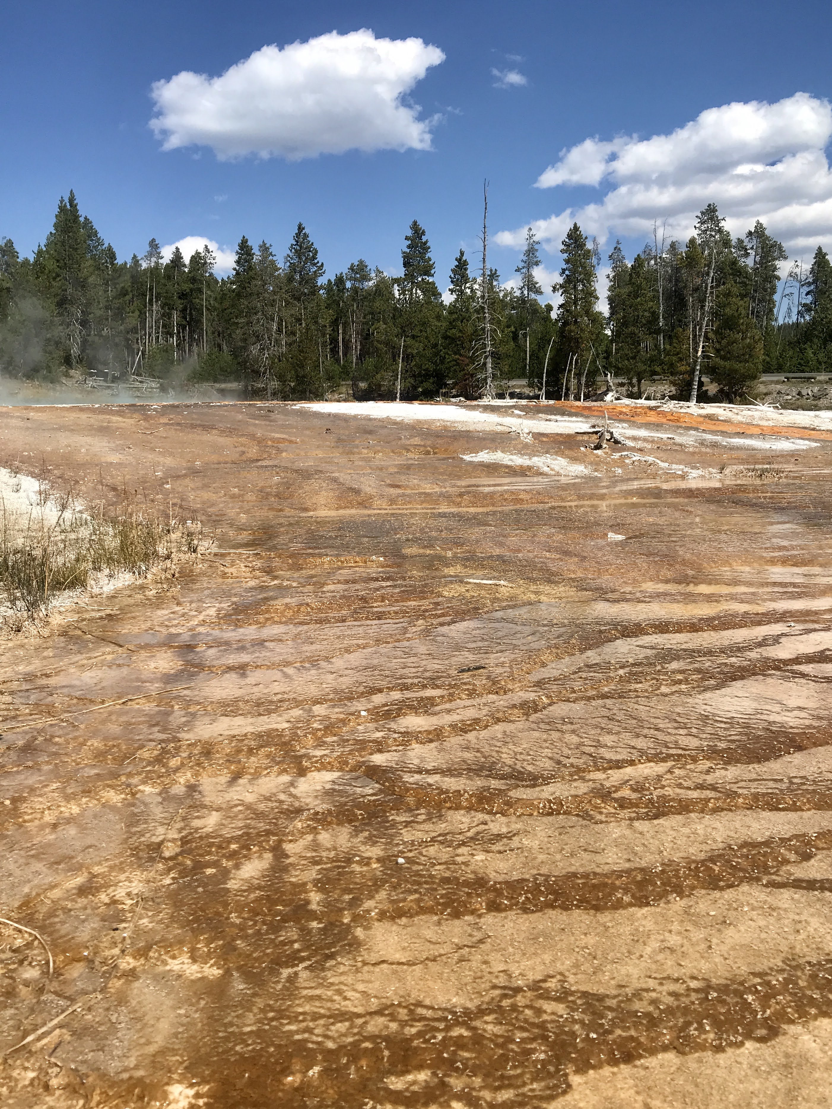
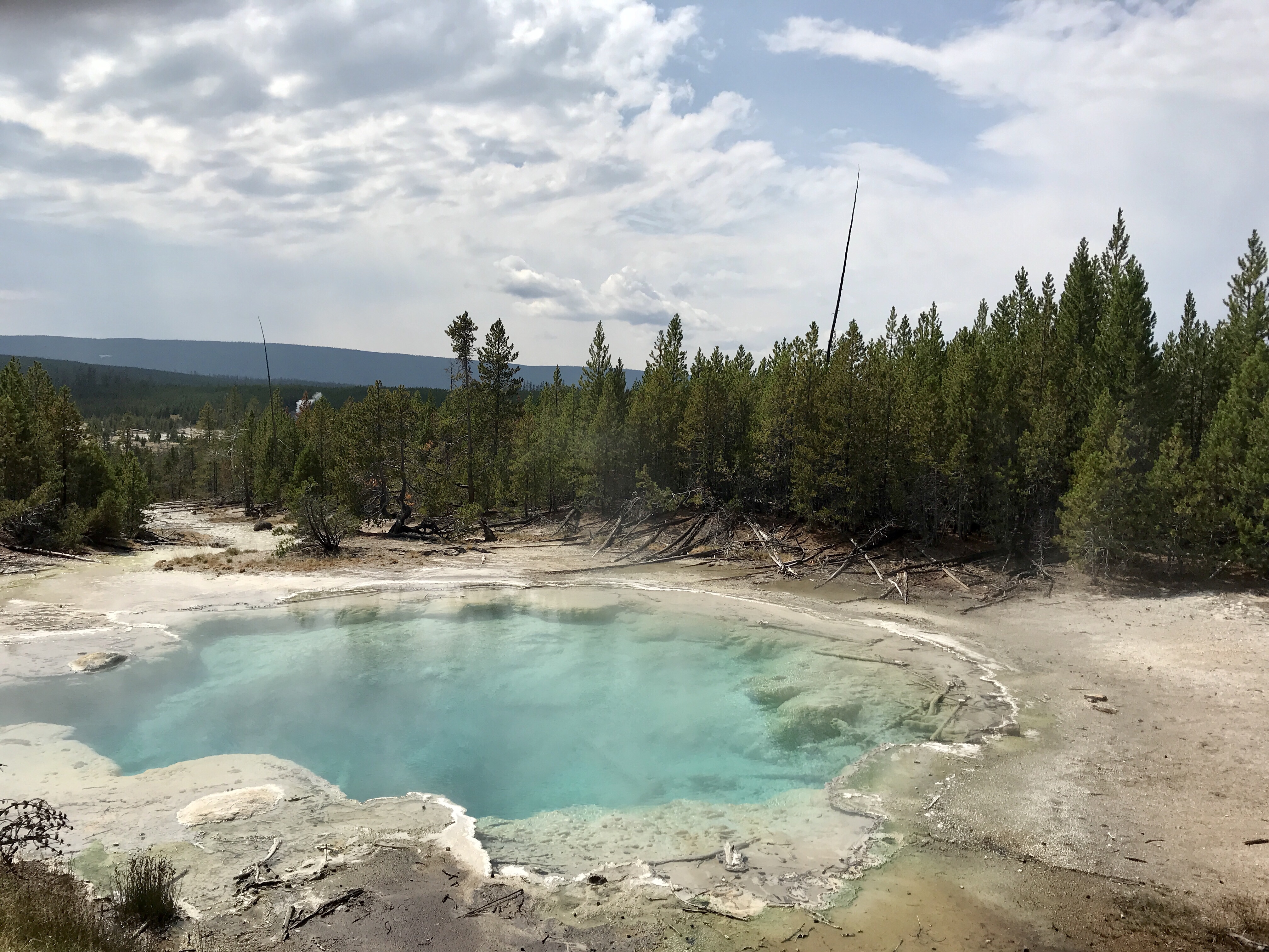
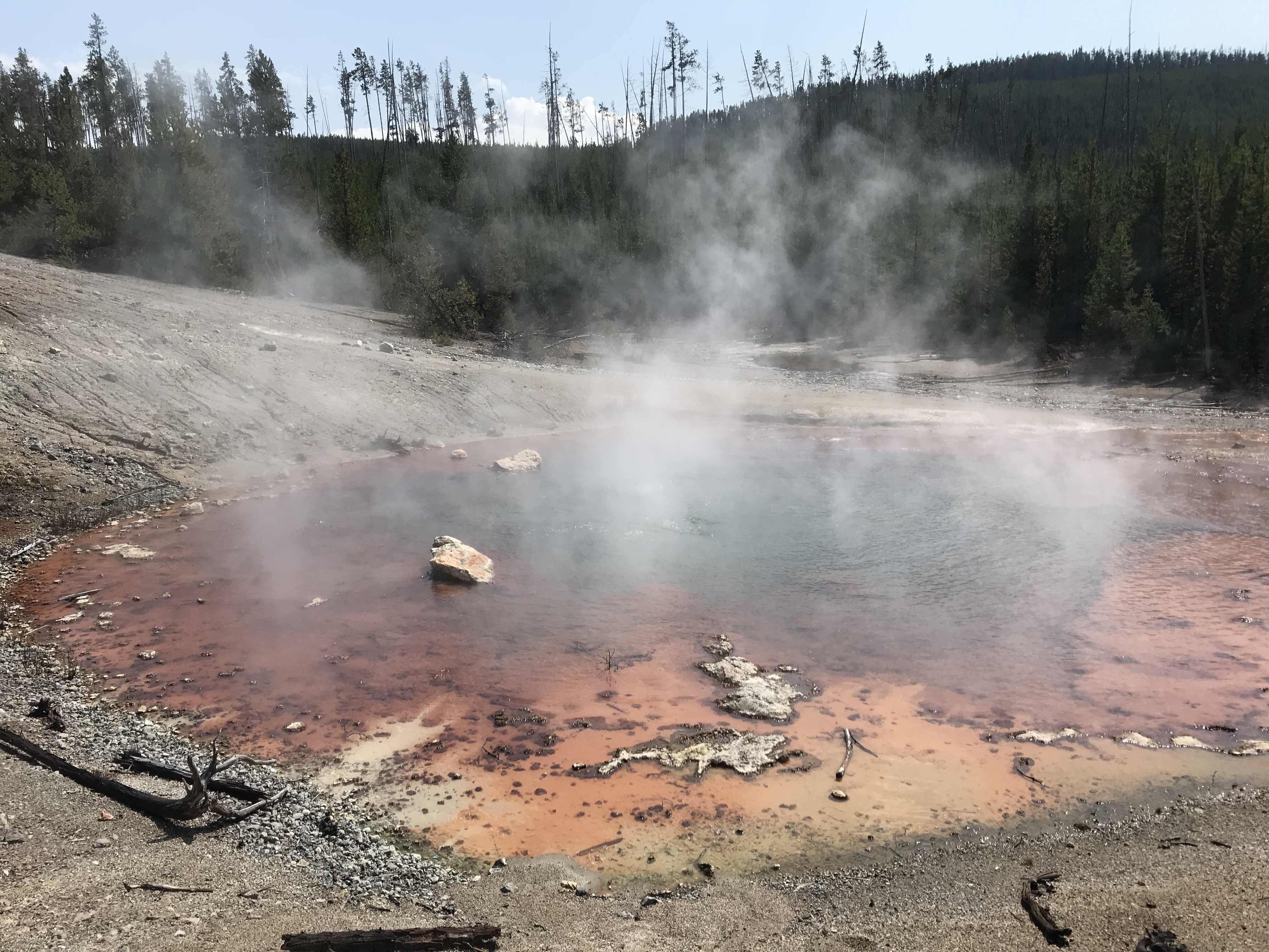
It was a long drive, but we stopped along the way to enjoy the Fountain Paint Pots. Crystal clear steaming pools of electric blue water, smoking pink-brown vents, spouting geysers, and neon orange bacteria mats delighted our eyes. You could see markers of how the lang has changed through dead trees standing and laying across the barren gray land in between.
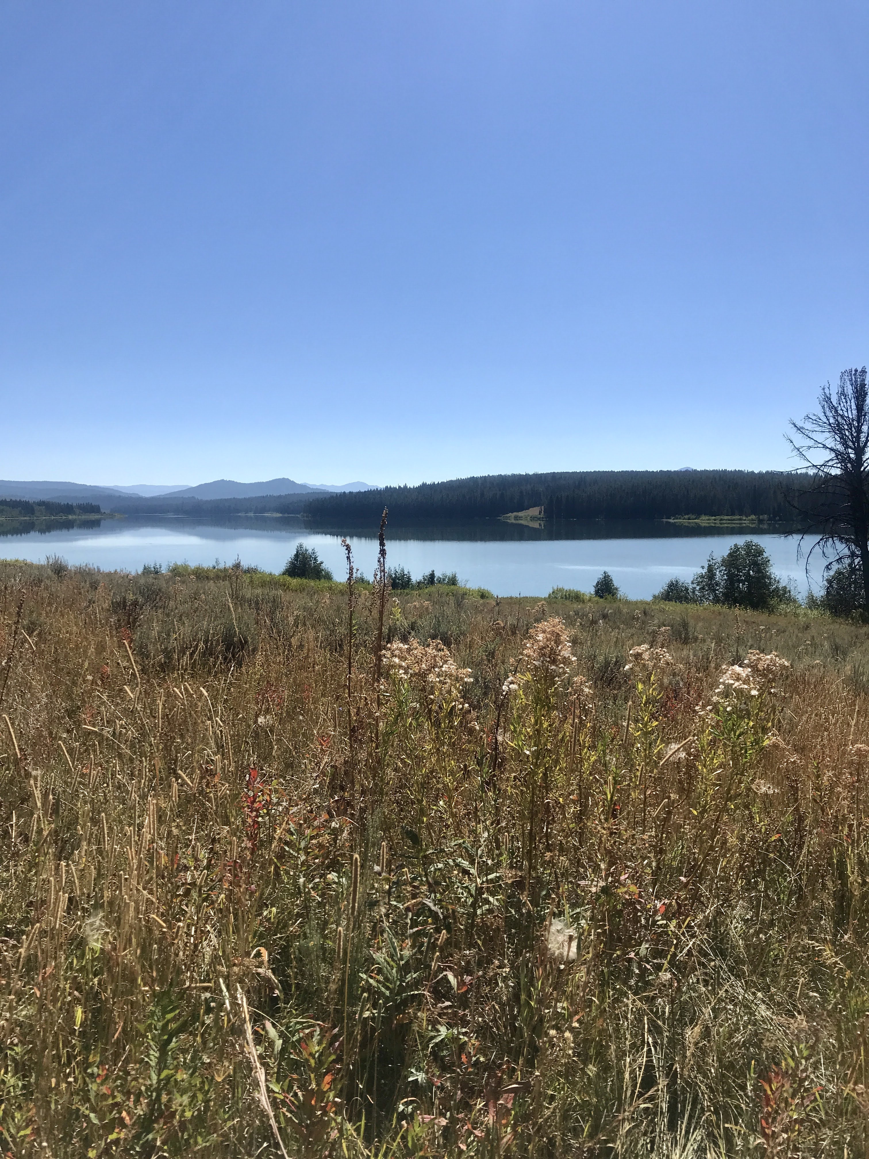
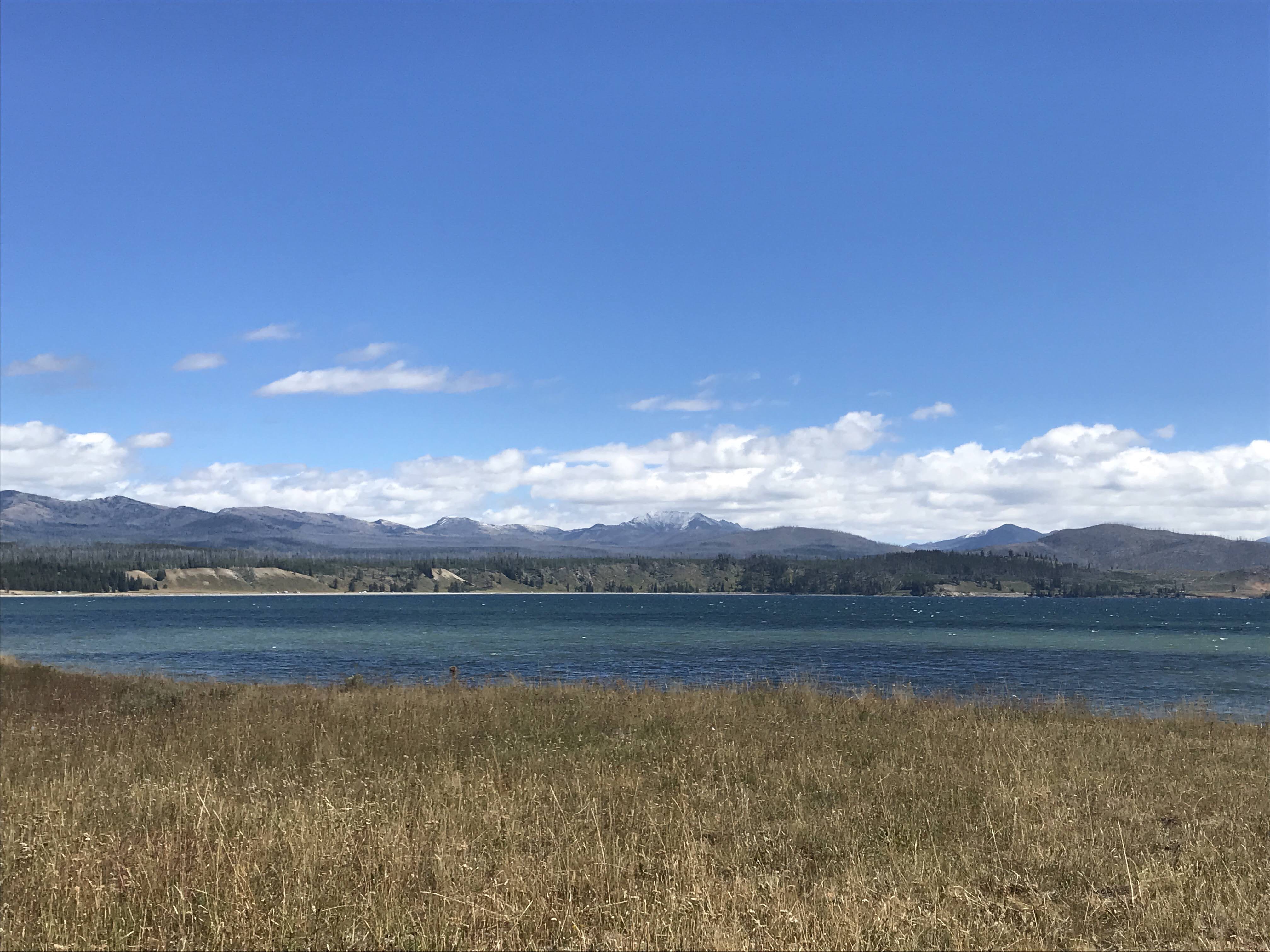
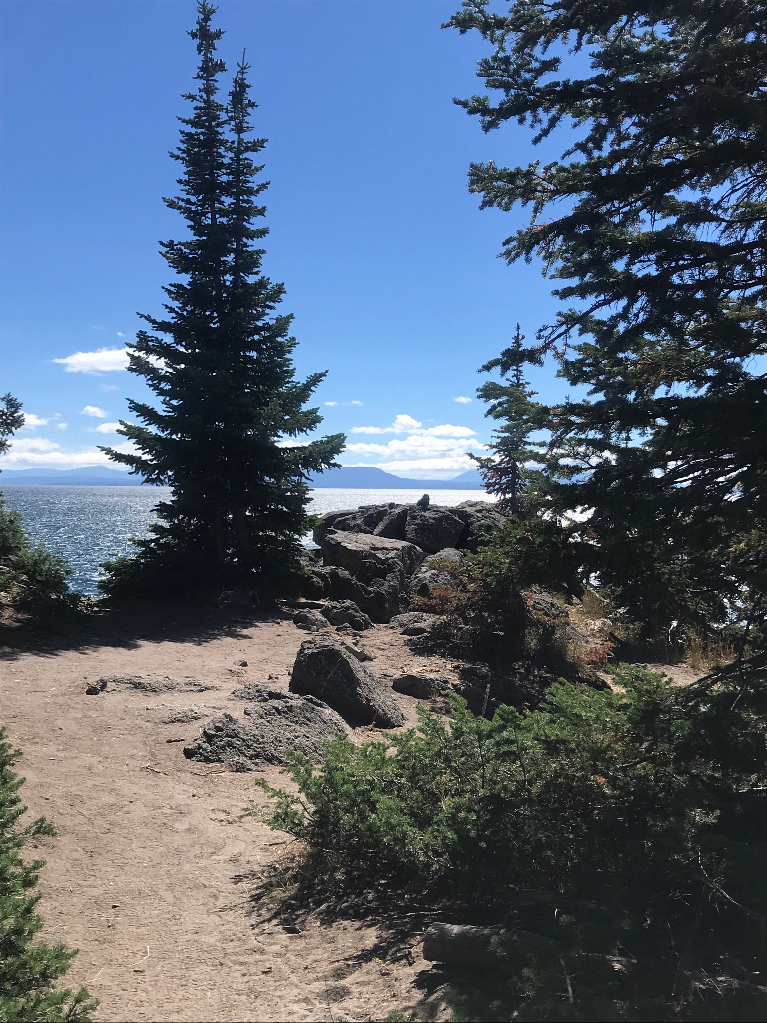
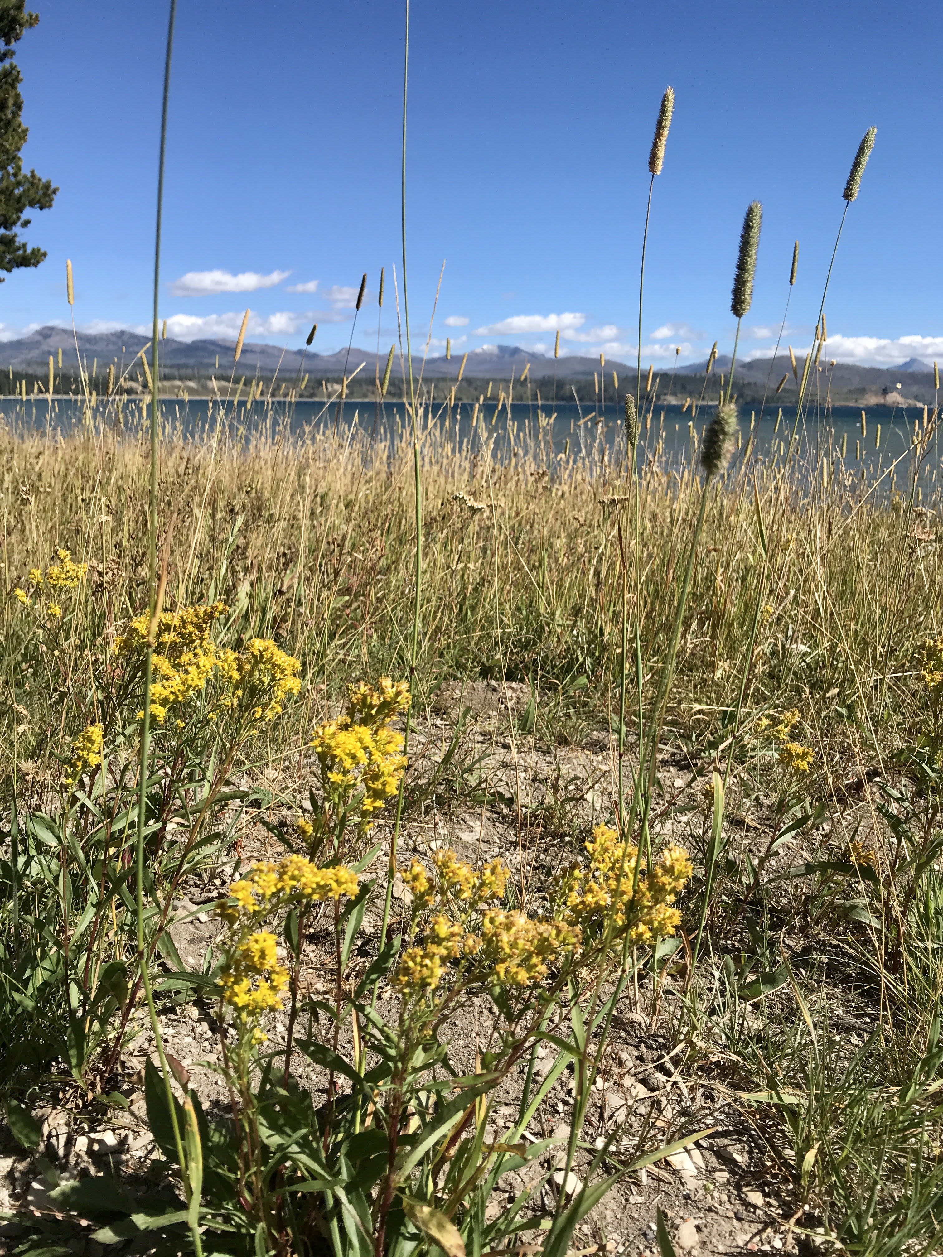
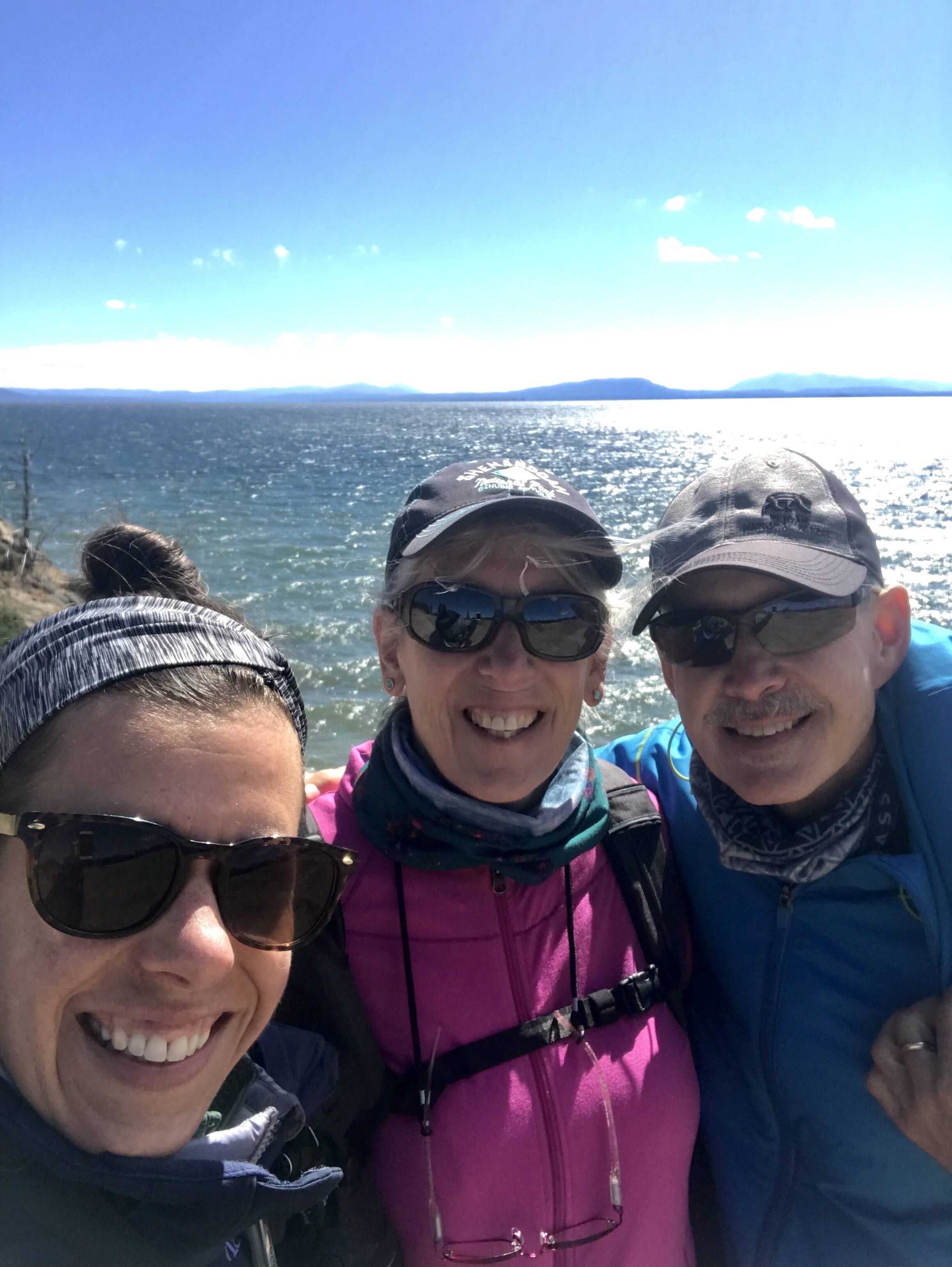
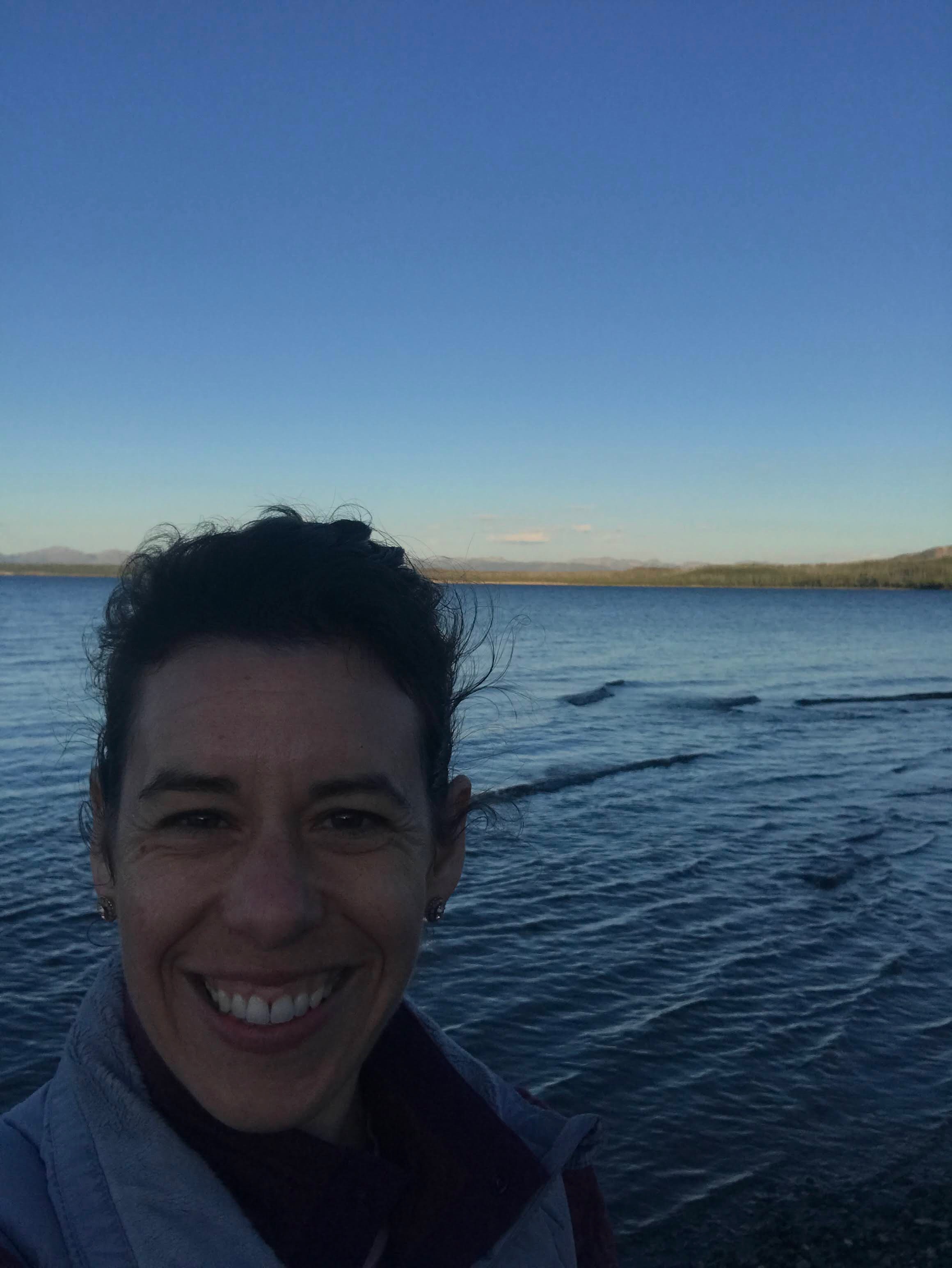
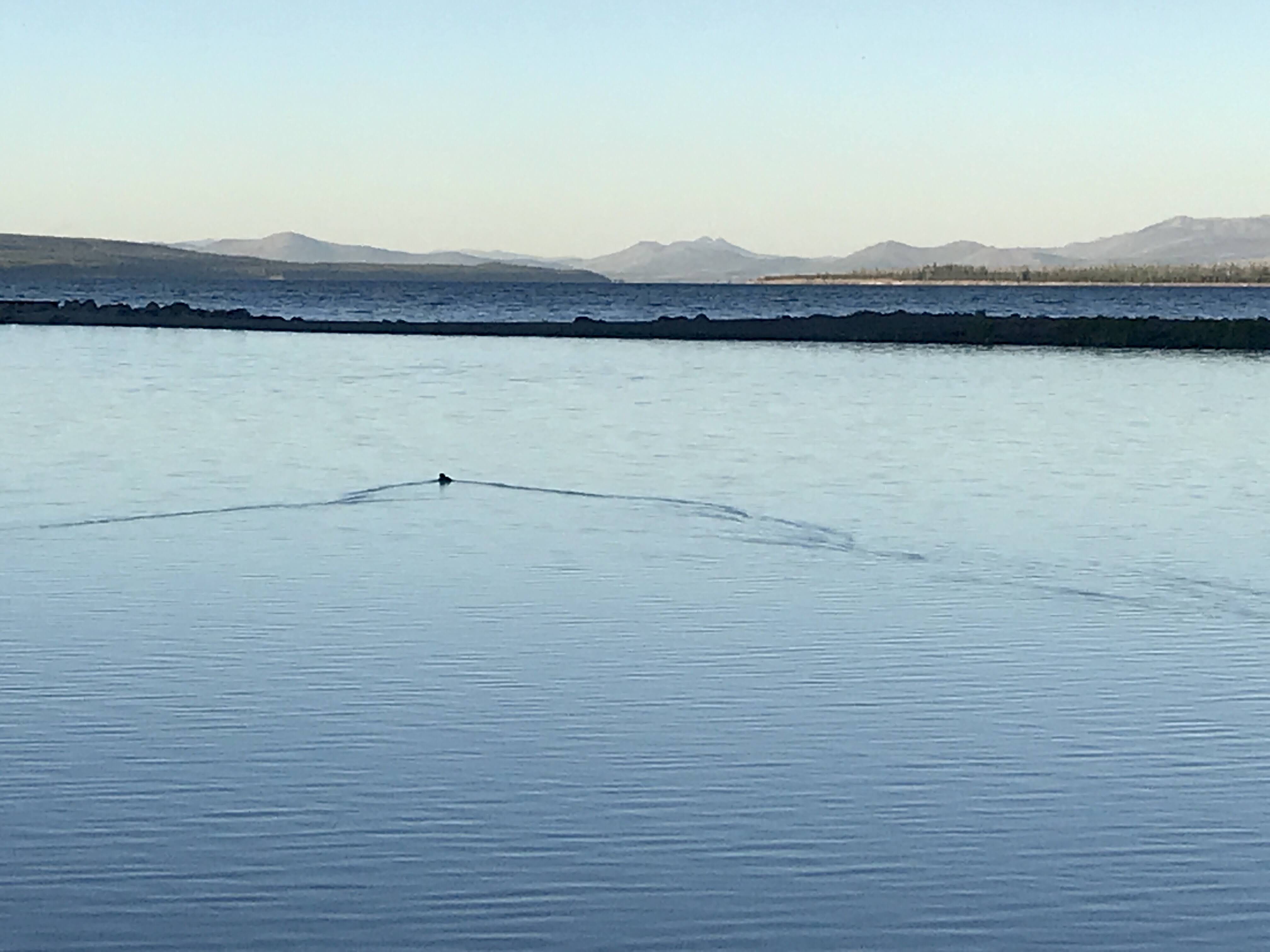
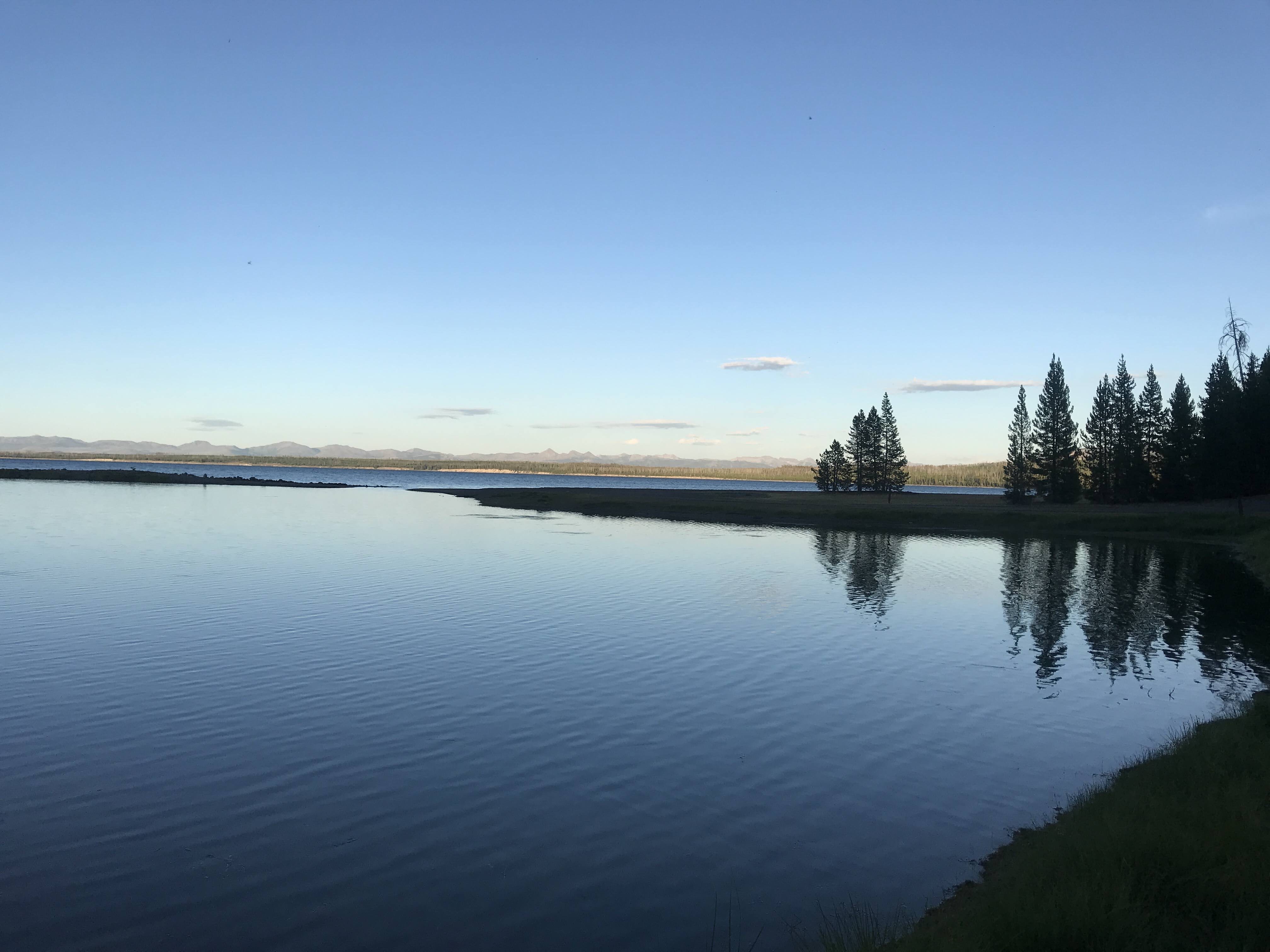
Eventually we arrived at Grant Village, checked in, and set up for dinner. Later that evening we walked down to the shores of Yellowstone Lake, just out the back of the campground, to enjoy the beauty of the highest elevation lake in the lower 48 states of the United States of America. A relaxing way to end a day that required some flexibility.
To be honest, we left Yellowstone about a week ago. It was wonderful and busy and active, and I was too tired most days to blog. Plus, we had no cell service or internet access. I enjoyed being disconnected and took time to enjoy each day, journaling about my favorite memories. Don’t worry, I’ll still update you about all the adventures – just know they aren’t in real time. Hopefully you’ll cut me some slack. 😉
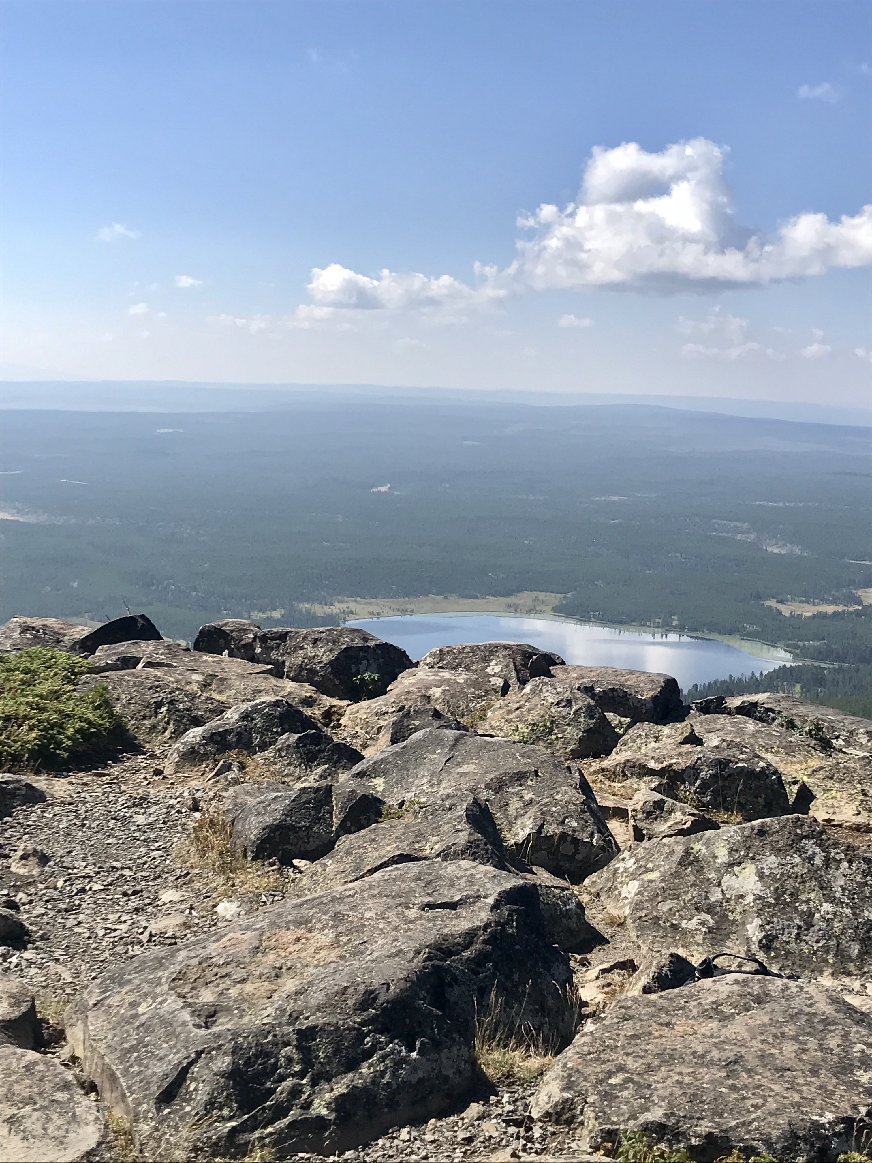
After summiting Observation Peak, climbing 1,400 feet in 2.6 miles to a 9, 406 foot peak, we were tired. Hiking at high elevation is no joke! So, the following day we decided to take it easy. Or, as easy as we know how.
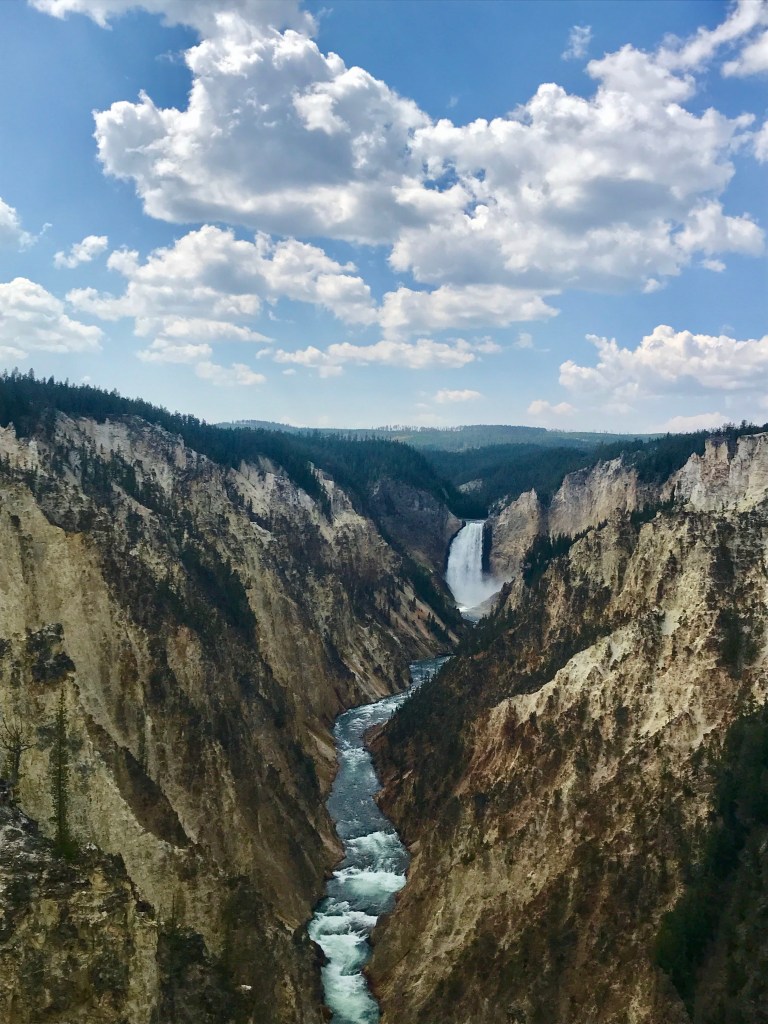
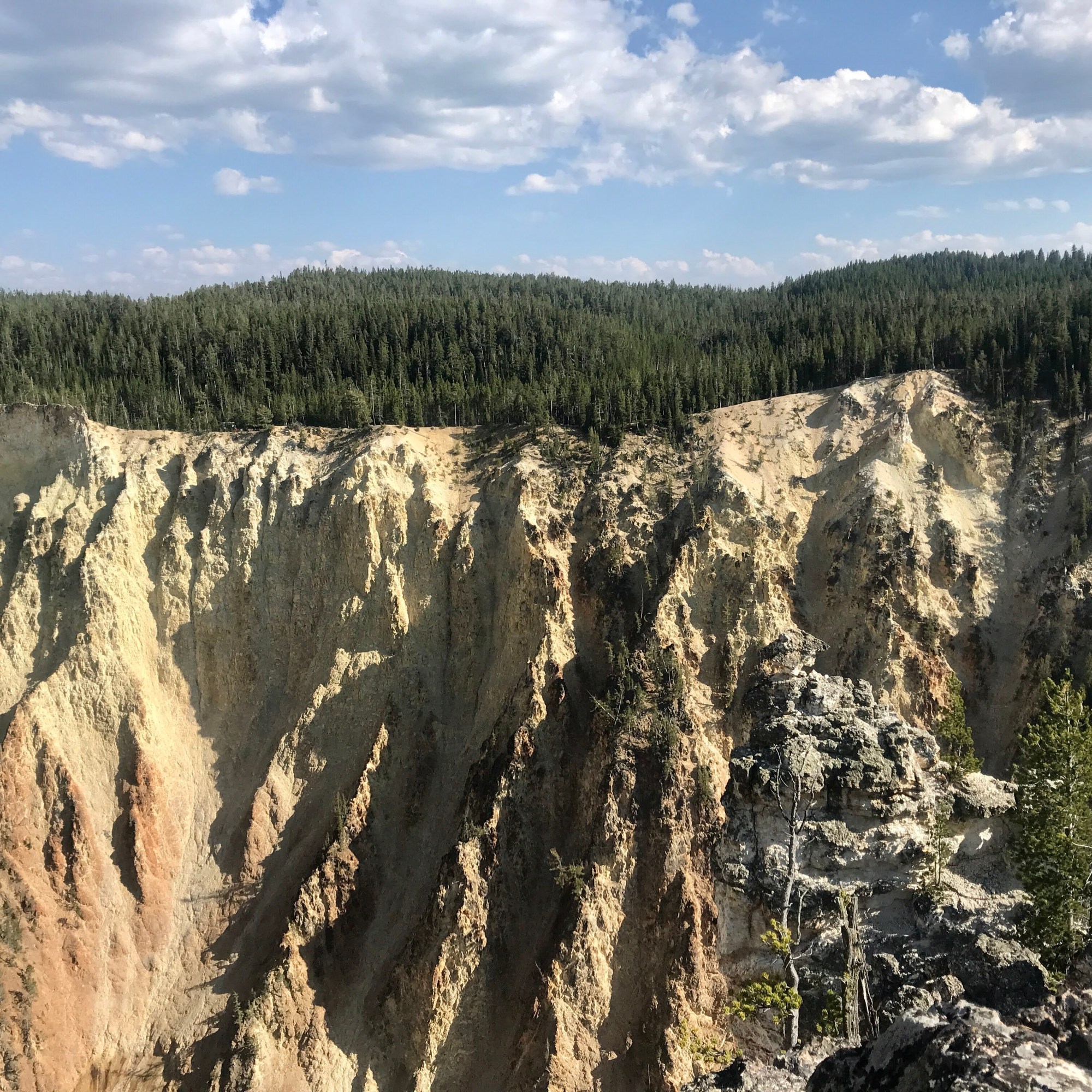
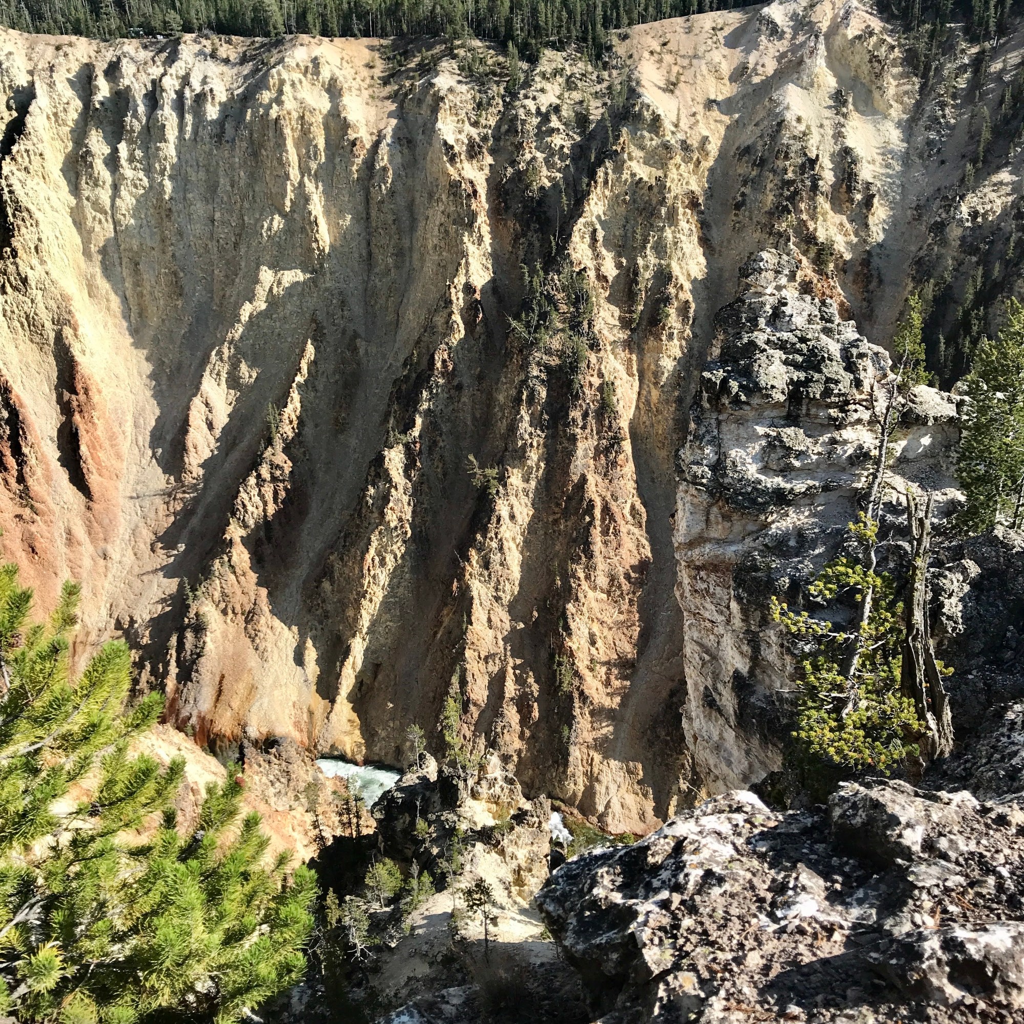
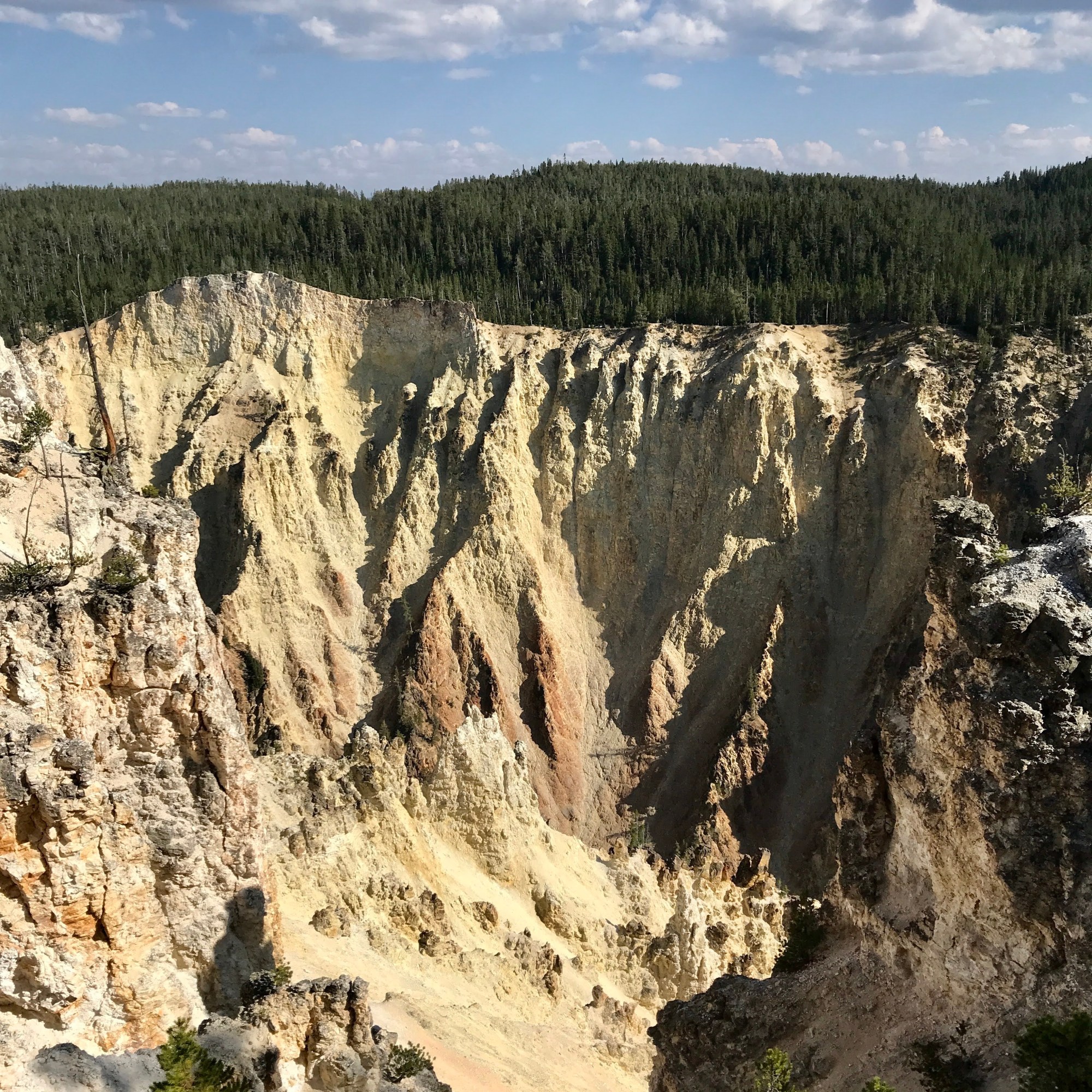
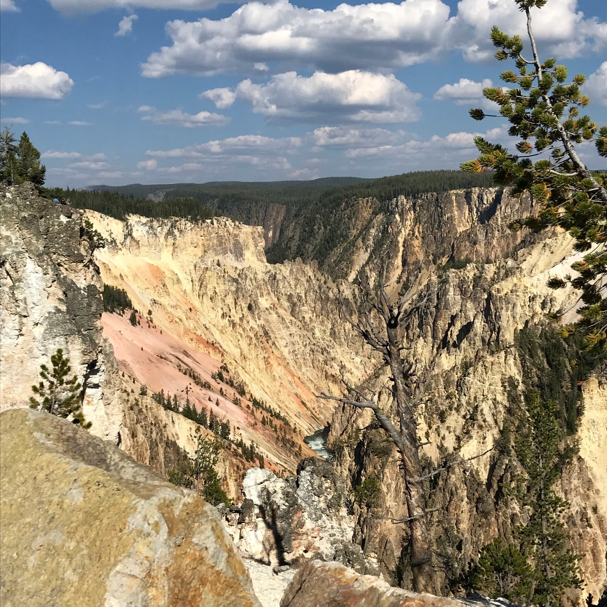
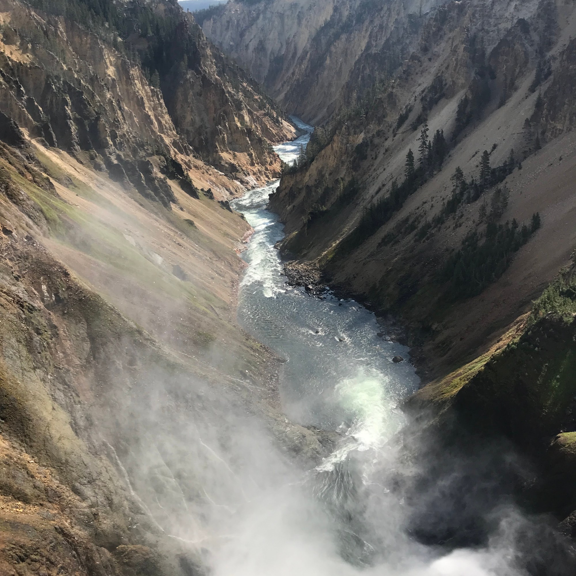
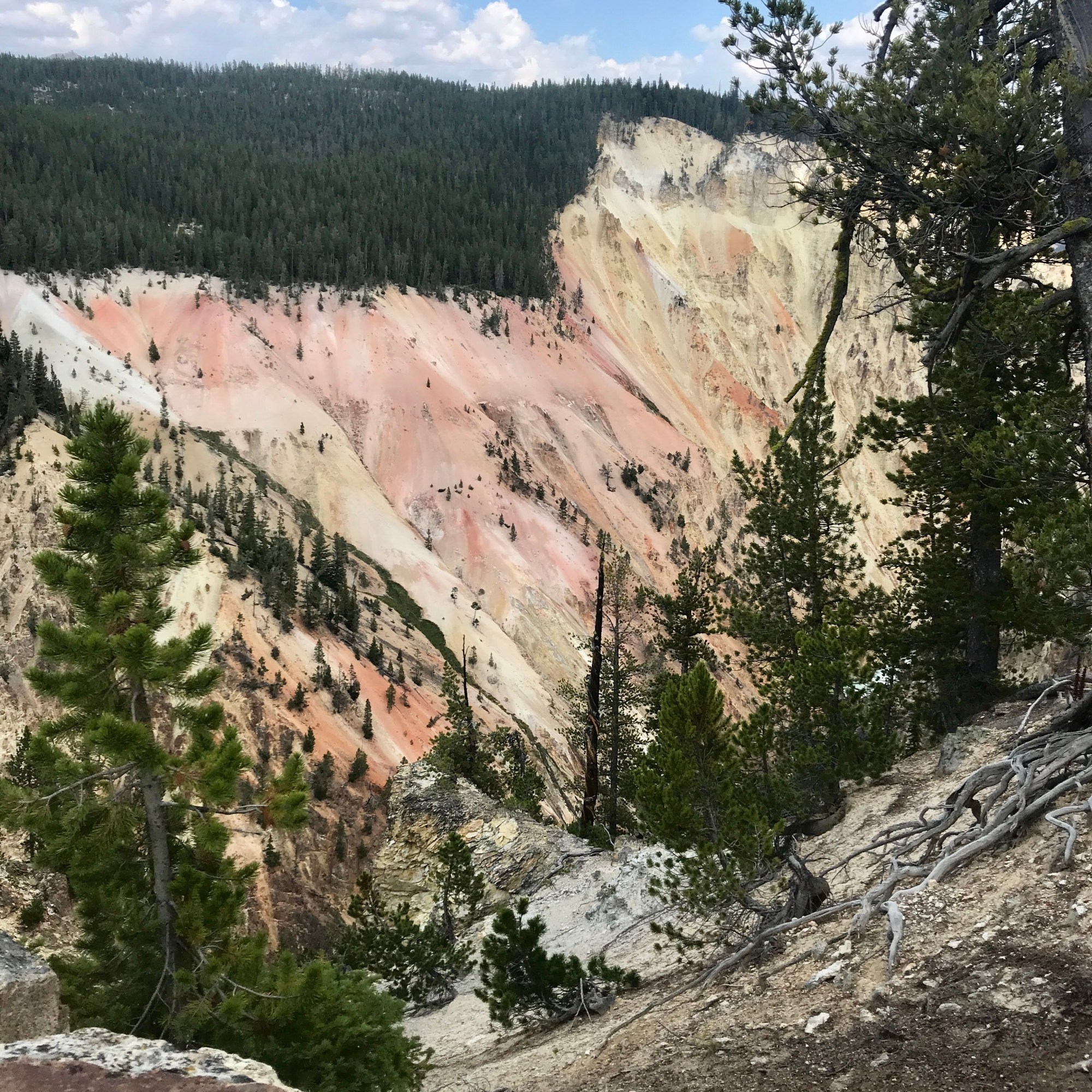
We drove out to the beginning North Rim trail along the Grand Canyon of The Yellowstone to a “light walk” to capture views of the beautiful colors and raging river below. The canyon has been evolving over hundreds or years as the water racing through erodes the soft, decomposing rhyolite lava rock. At points the canyon is 4,000 feet wide and 1, 200 feet deep. It all, it is about 24 miles long.
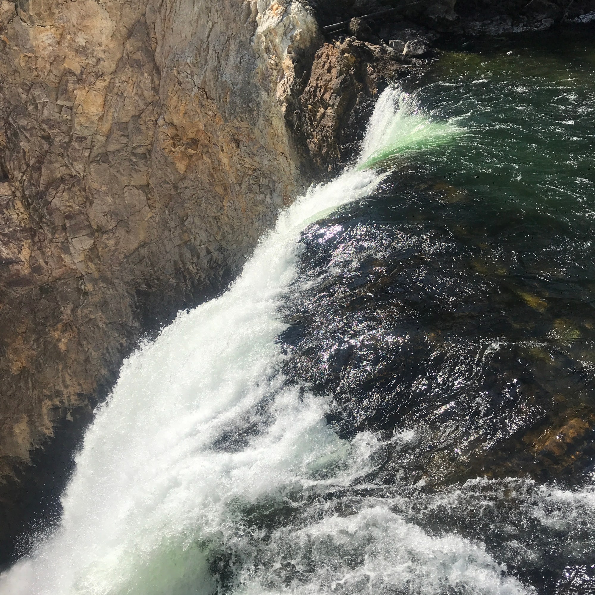
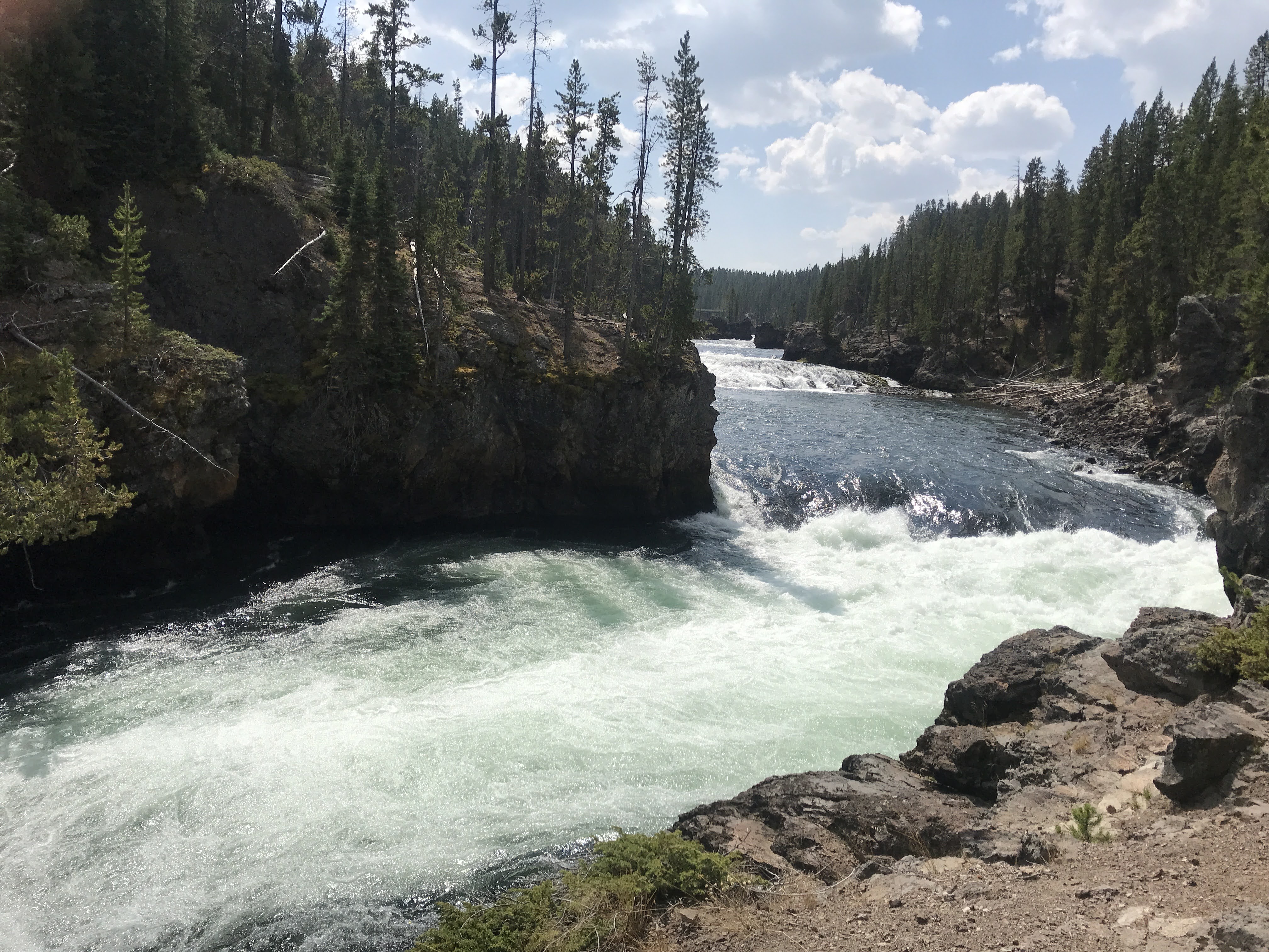
We parked at the Upper Falls lot and headed out to Crystal Falls, the smallest of three waterfalls that has helped shaped the canyon. The sound of rushing water was relaxing. Continuing on, we walked down the mostly paved path, curving down and around to the top of the falls and then climbing back up to the roadside. So far, not too bad.
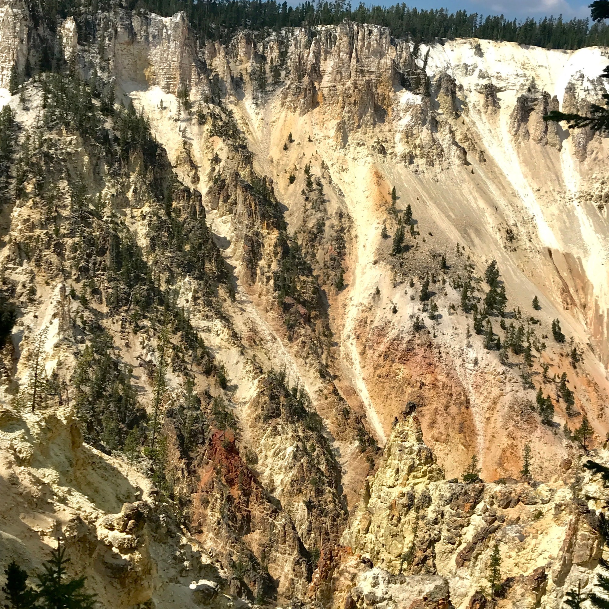
On our way, we pulled over to admire the glowing yellows, oranges, and reds of the weathered canyon walls. Across the top, pine trees sat comfortably, all the way up to the very edges. Below, the canyon sides dropped dramatically, rippling here and there down the corridor. At points hoodoos, tall rock towers stood strong marking the hardest rock that had yet been chipped away. Far, far below the turquoise water flowed downstream.
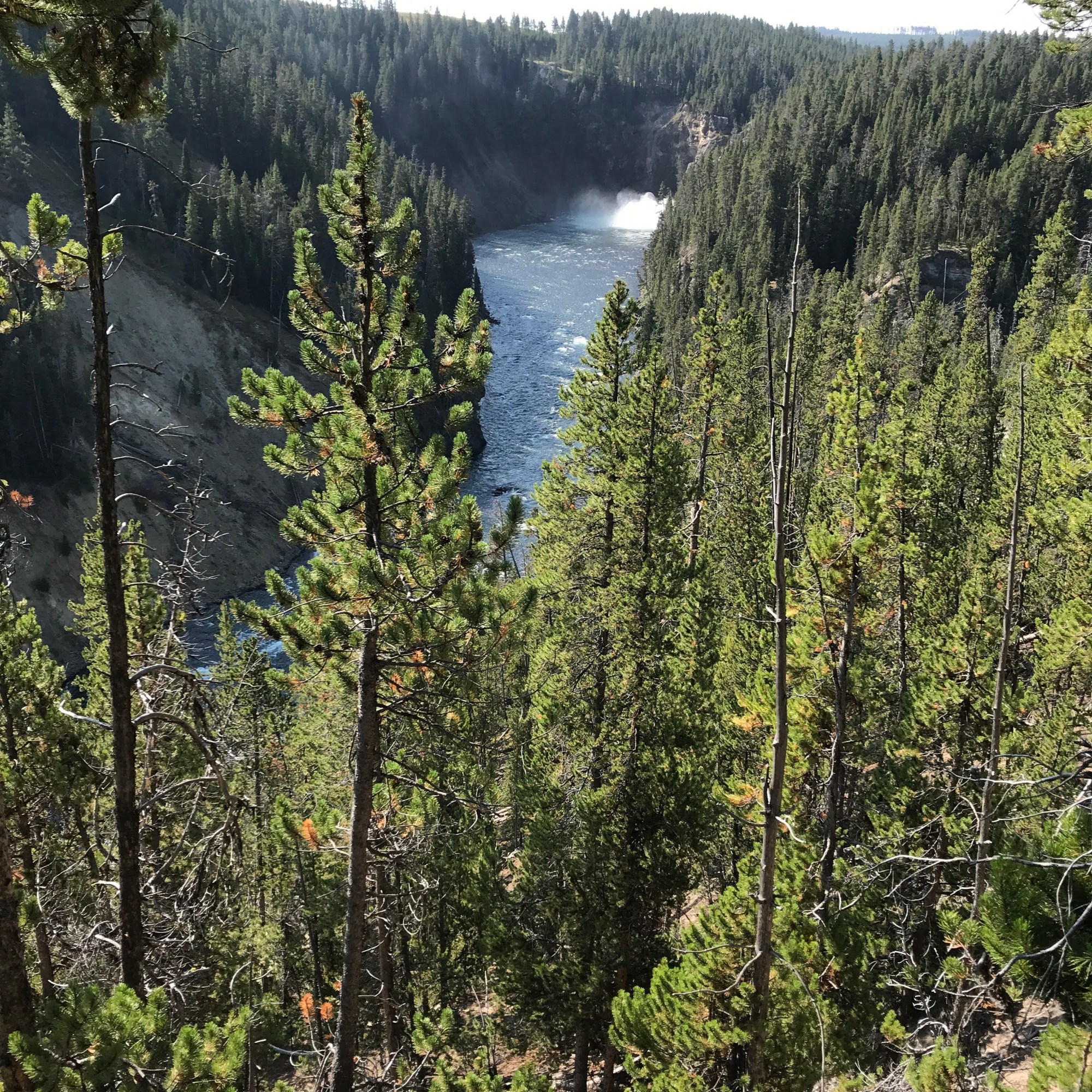
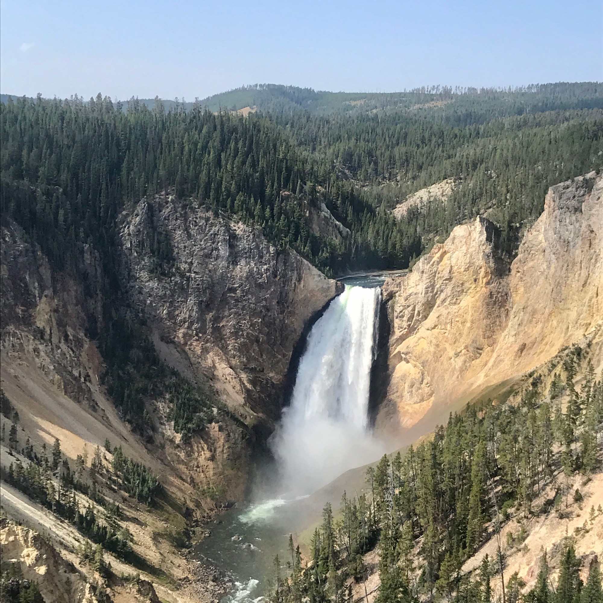
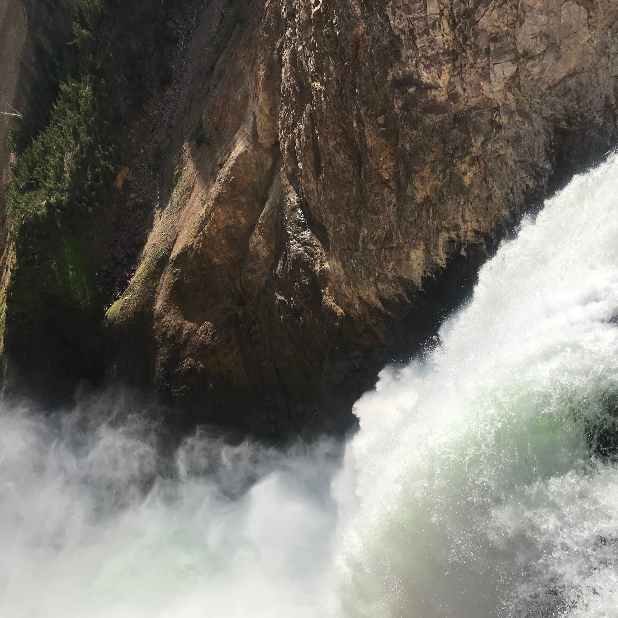
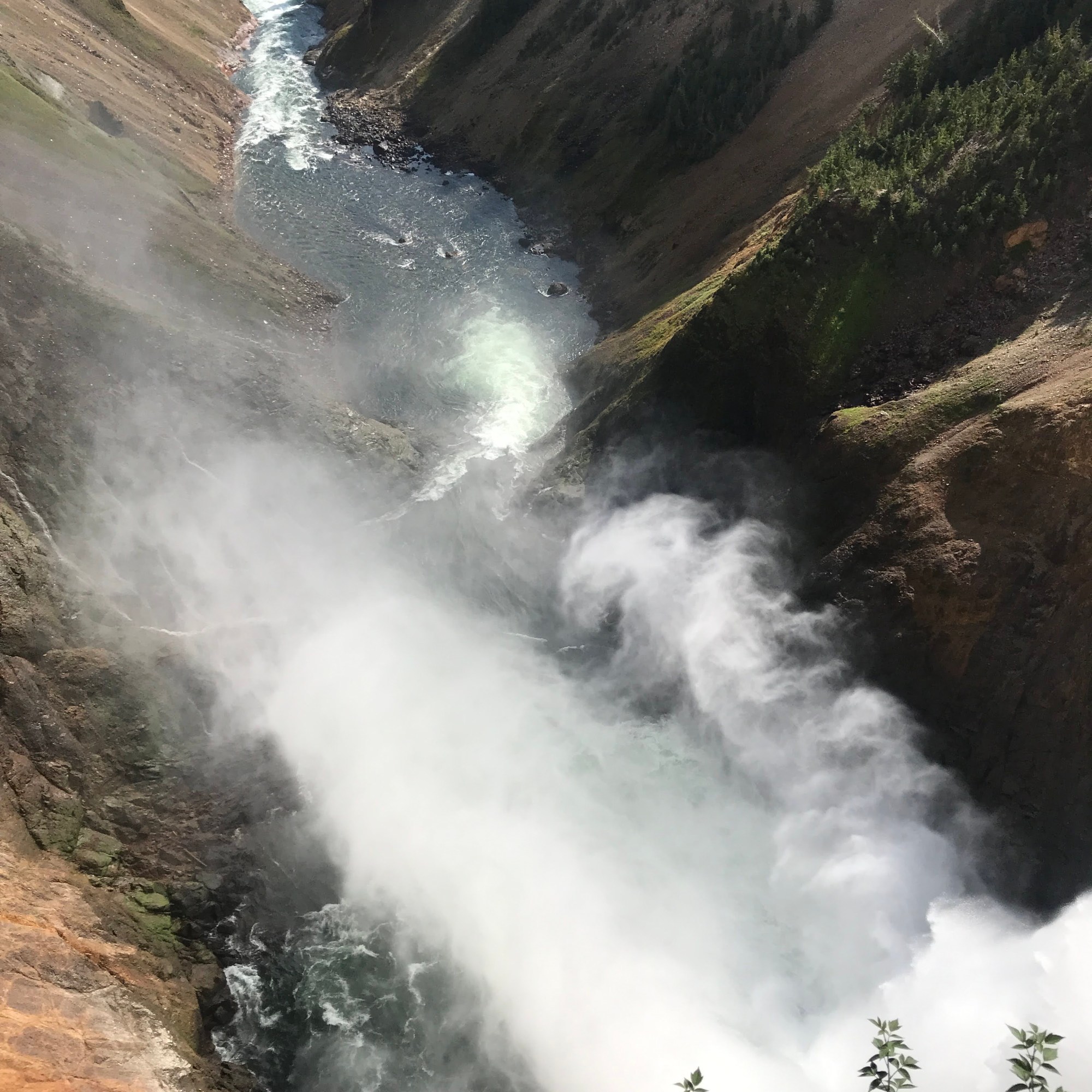
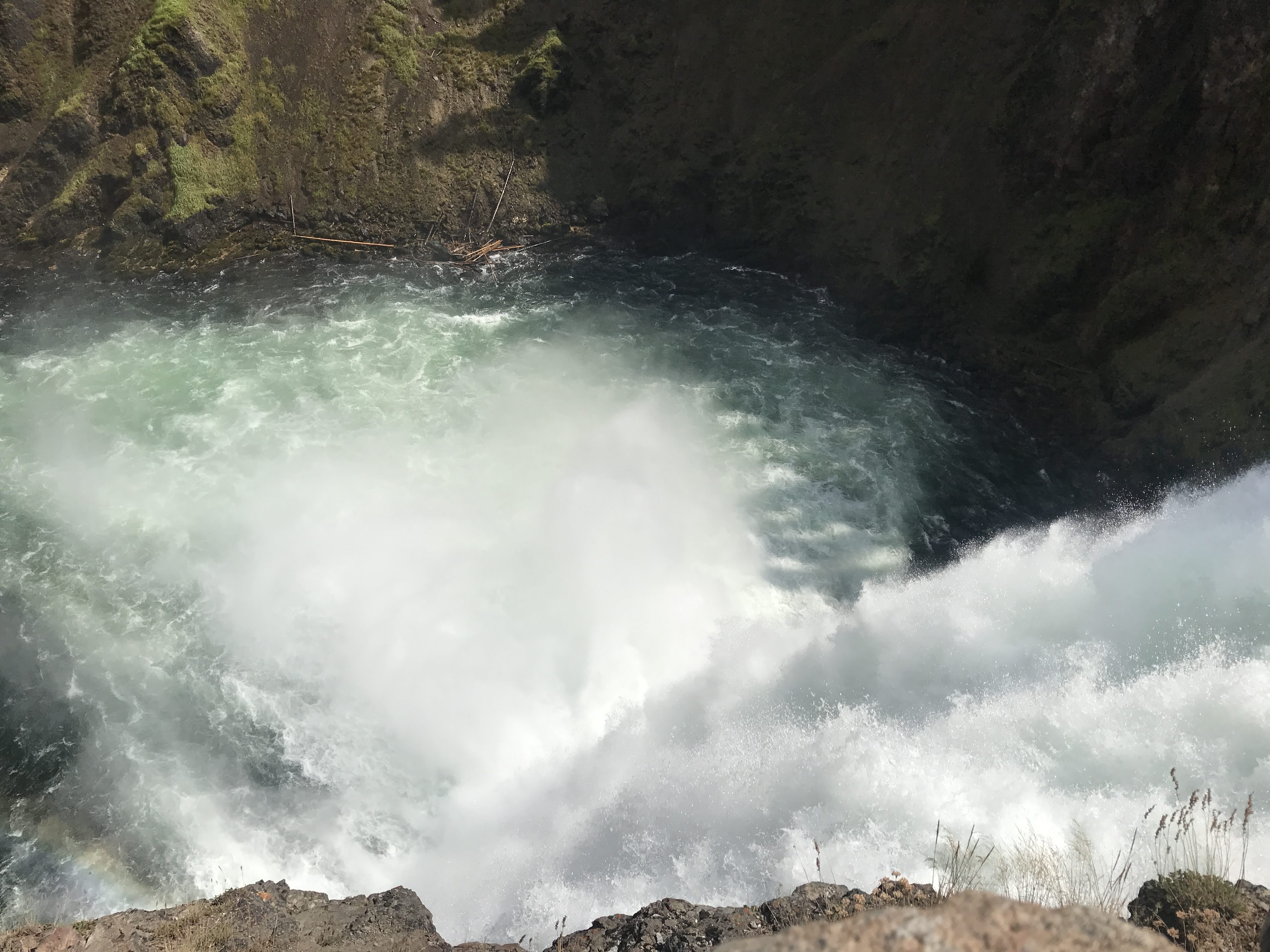
Eventually we came to the Lower Falls area and I decided to head for the brink of the falls, the top of the waterfall where the river rushes over the ledge. Little did I realize it was down, down, down in the canyon. About 10 switchbacks later, we finally reached the lookout area. Down wasn’t too bad, but up was another story. Sorry Mom and Dad! However, we were rewarded with a powerful display of nature. The water roaring over the edge, falling into the river below, was magnificent. The glimmering blue green water turned white and frothy as it pounded the rock below. It sprayed it all directions, creating mist that cooled our faces and created a lush garden on the canyon walls below. I would have watched it all day.
Eventually we did make the effort-full hike back to the top and explored farther down the canyon. When we felt we had gone far enough, we turned around and headed for the car. But we weren’t done yet! First we checked out the Upper Falls – a much easier place to access – and again saw the beauty of the Yellowstone River up close. Then we piled in the car and drove over the the South Rim.
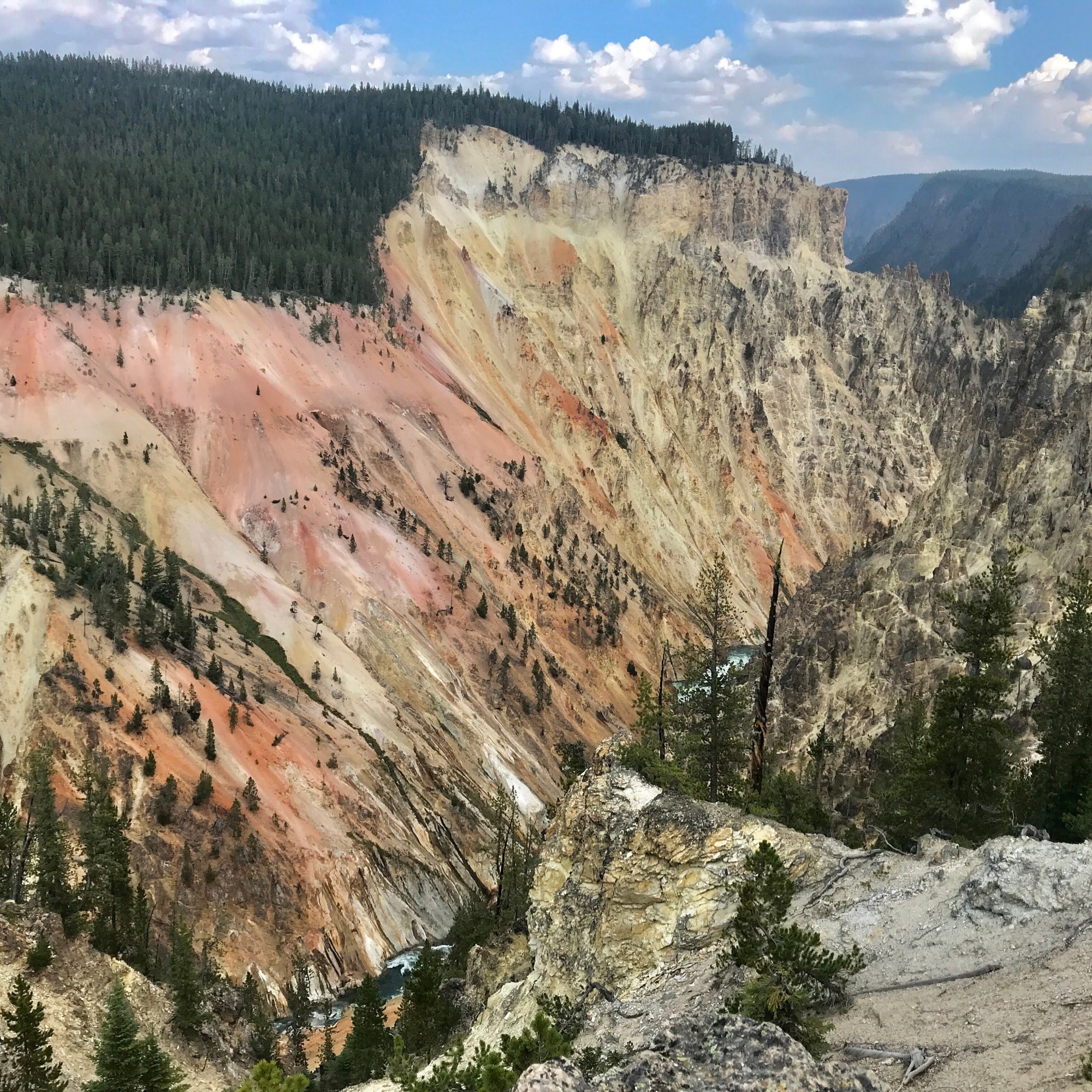
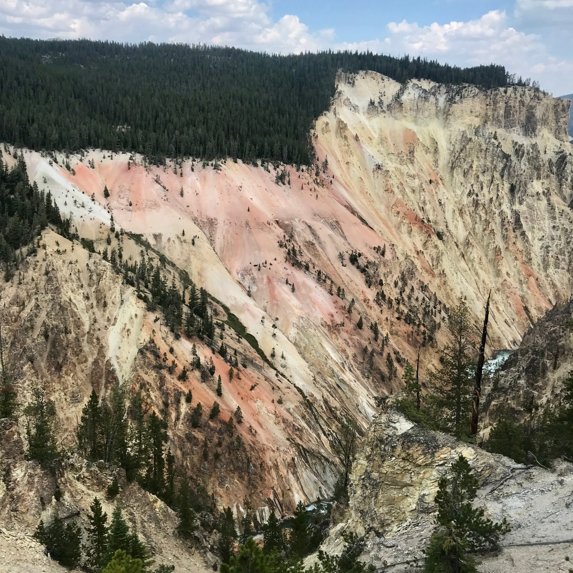
We decided to drive this point. 😉 We got out at one lookout – Artist Point – and weren’t disappointed. The colors here were even more brilliant than before, like a pastel morning sunrise. The yellow lava from an ancient eruption was golden in the sunshine. And the Upper Falls glistened in the background.
It was another full day, more energetic than planned, but well worth the effort. I can appreciate why the Apsáalooke (Crow) consider this land sacred. The National Museum of the American Indian recorded this quote from a letter to Custer National Forest from George Reed, former Chairman of Crow Cultural Committee, 2007, which captures it perfectly, “All the mountain ranges in the territory of the Apsáalooke (Crow) Nation are sacred because that is where First Maker travels as he watches his creation.” The Yellowstone River was crucial to the tribes culture and history. To learn more, check out this website.
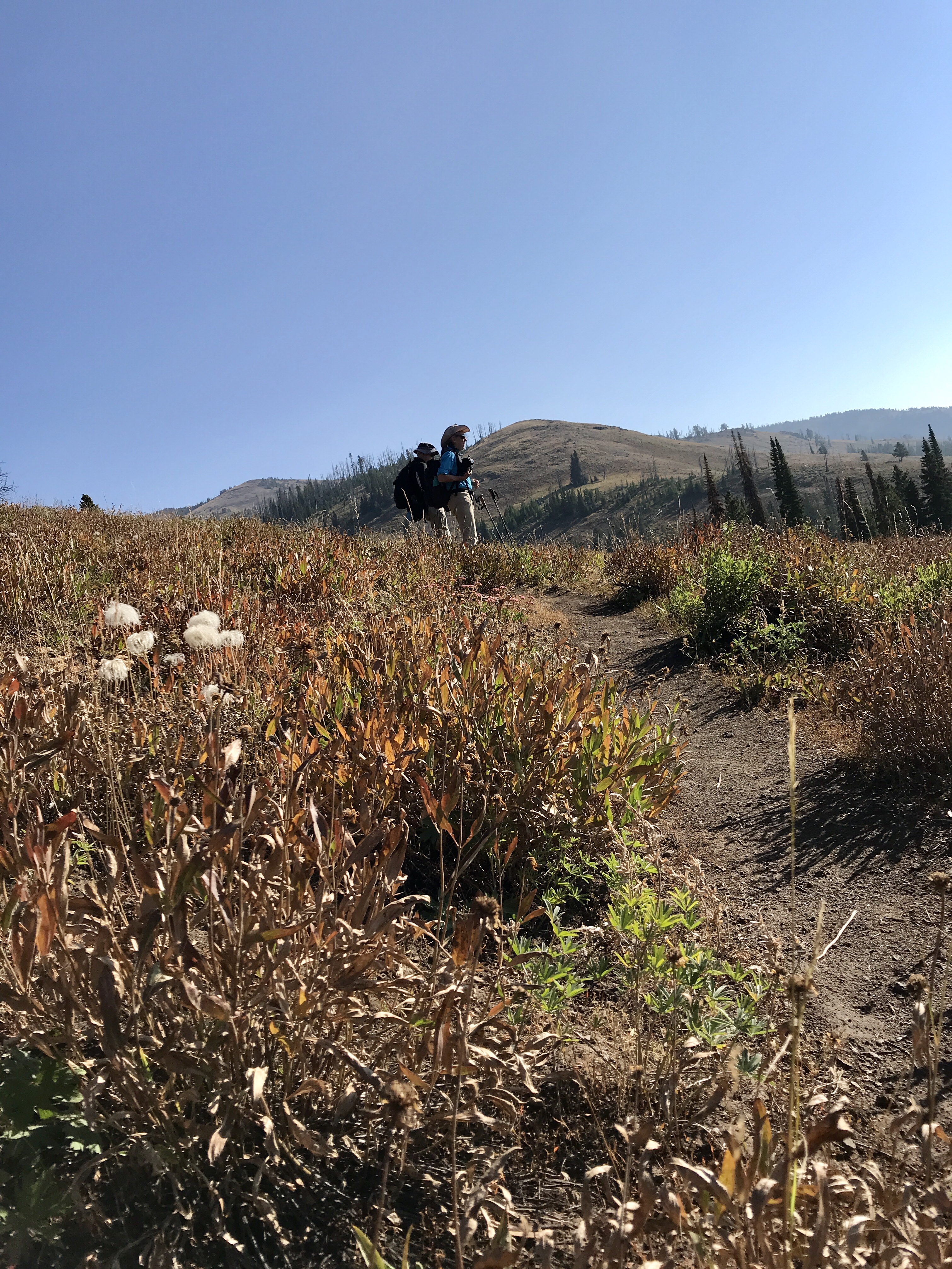
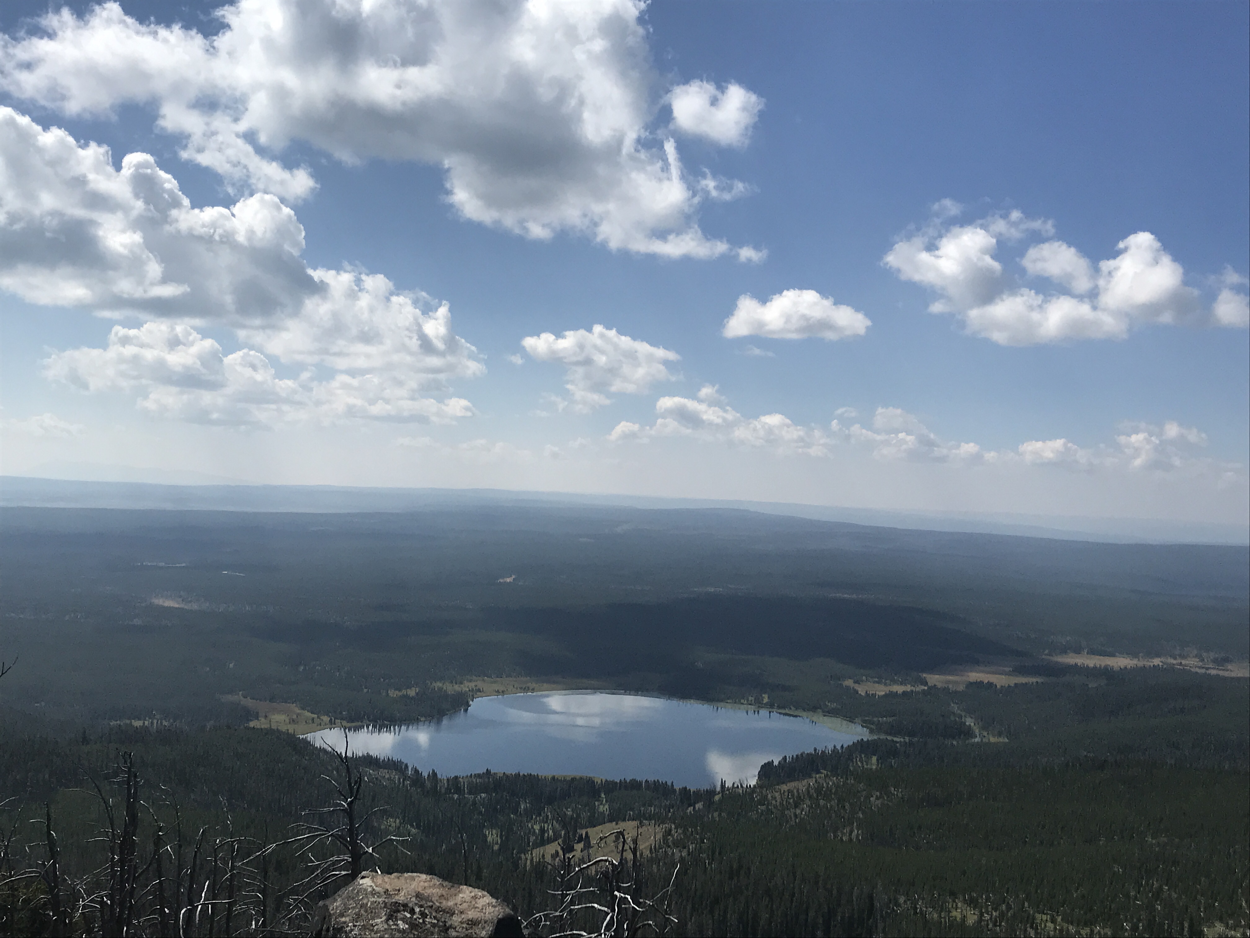
On this Friday morning we woke up early, bundled up (it is chilly in the mountains at high elevation!) and headed for Cascade Creek Trailhead to hike to Observation Peak. In the parking lot there was only one other car, so we knew this was going to be a great hike! We like to find ways to find some solitude in nature, away from the crowds.
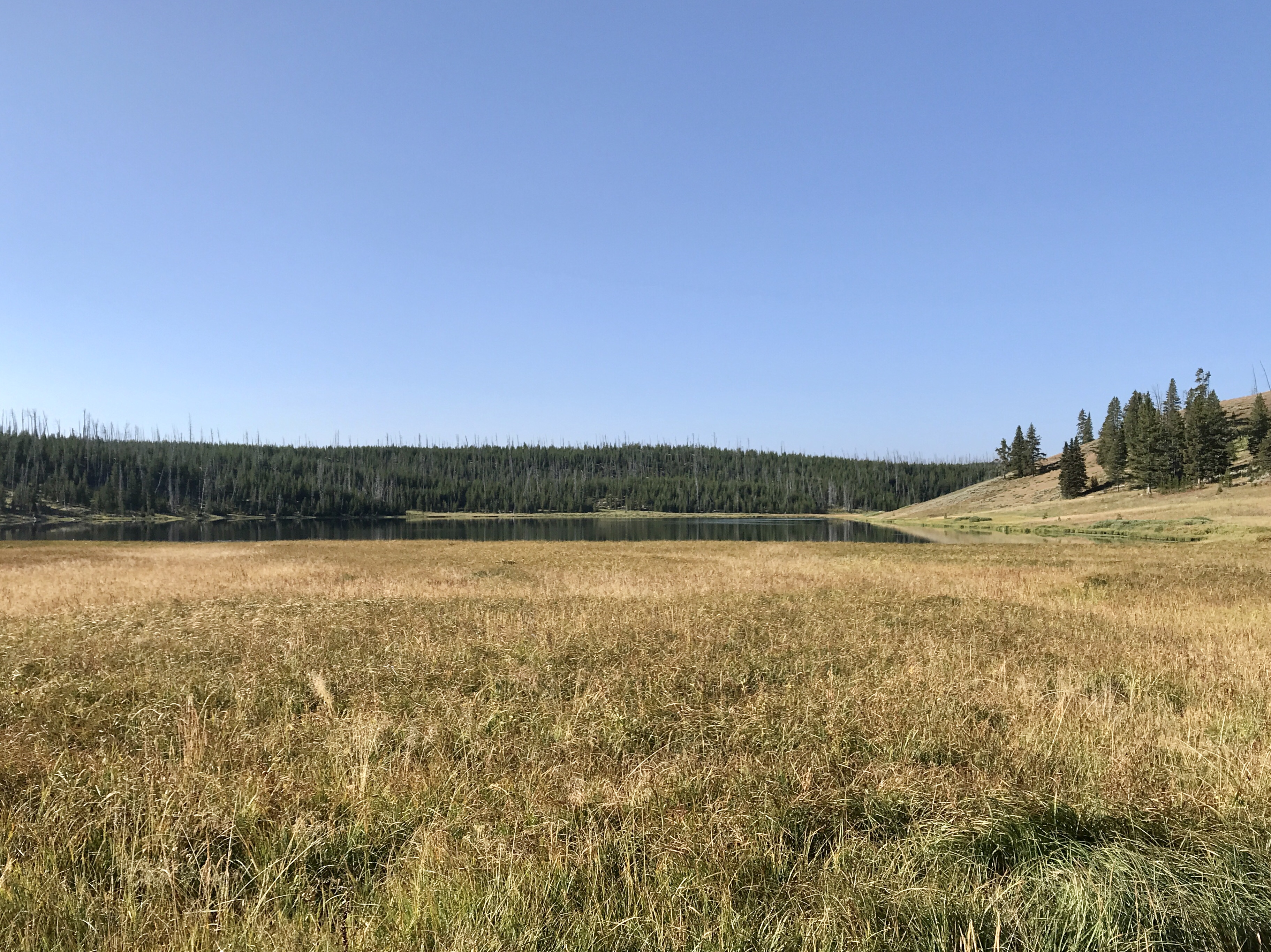
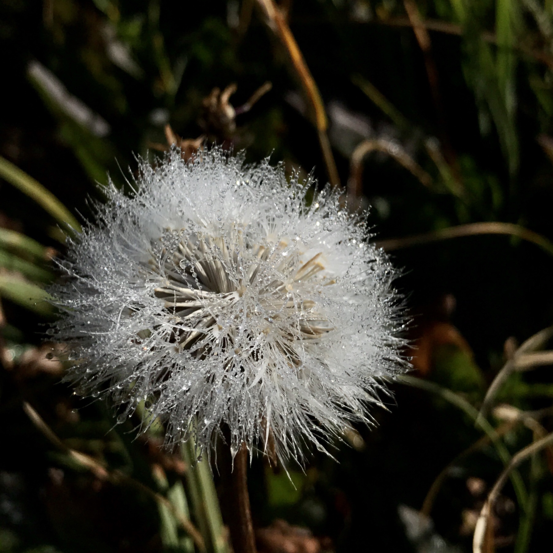
As we started down the forested trail, fog crept along the ground and through the meadow. Dew drops hung on leaves and flowers, signs that the earth was still waking up too. A few miles down the trail, we came to a large clearing with Cascade Lake ahead of us – the first of three alpine lakes on our path. We stopped to admire the pair of swans enjoying the frigid water, adjusted our layers of clothing as the warm sun greeted us, and started up the path to Observation Point.
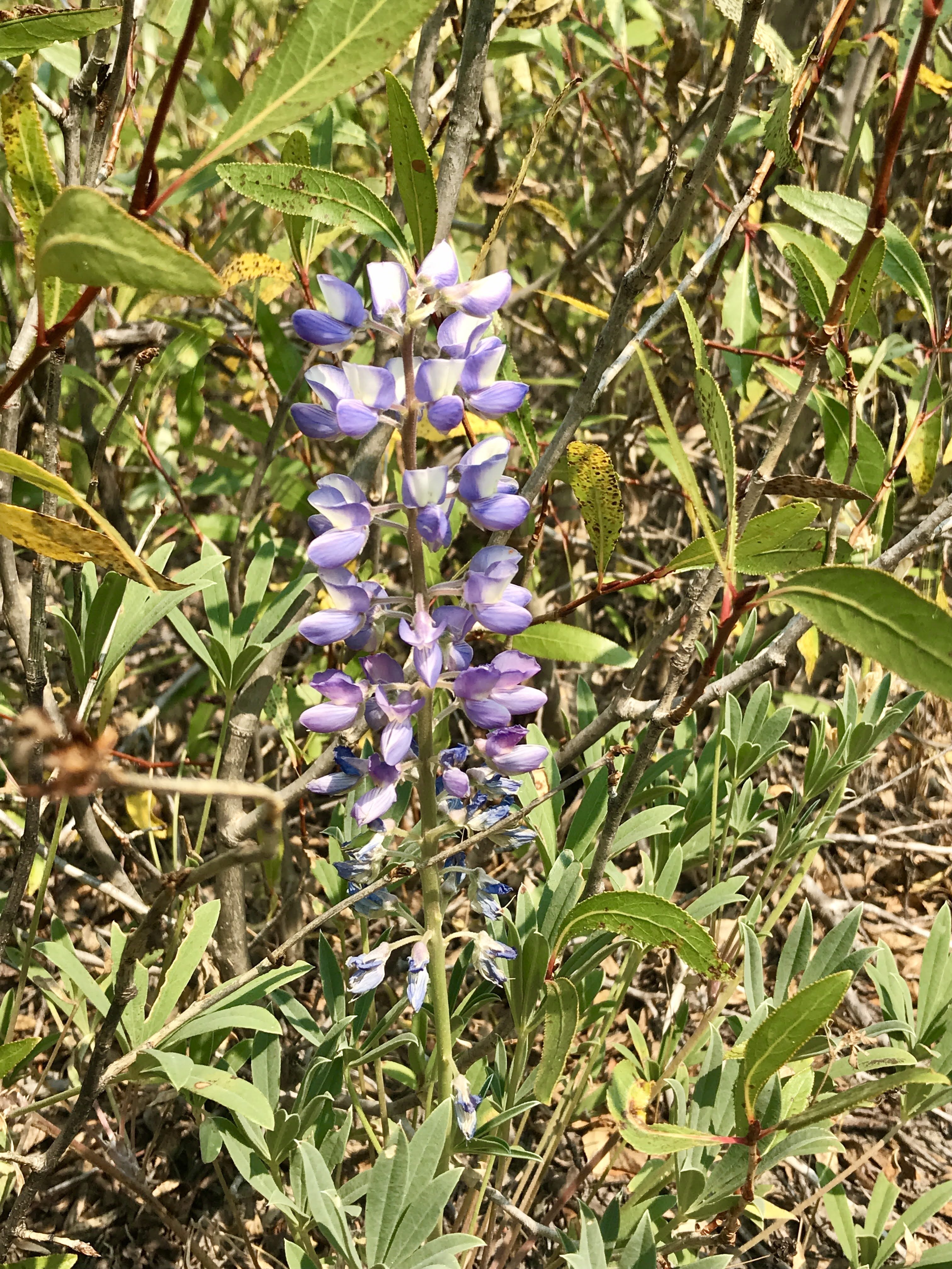
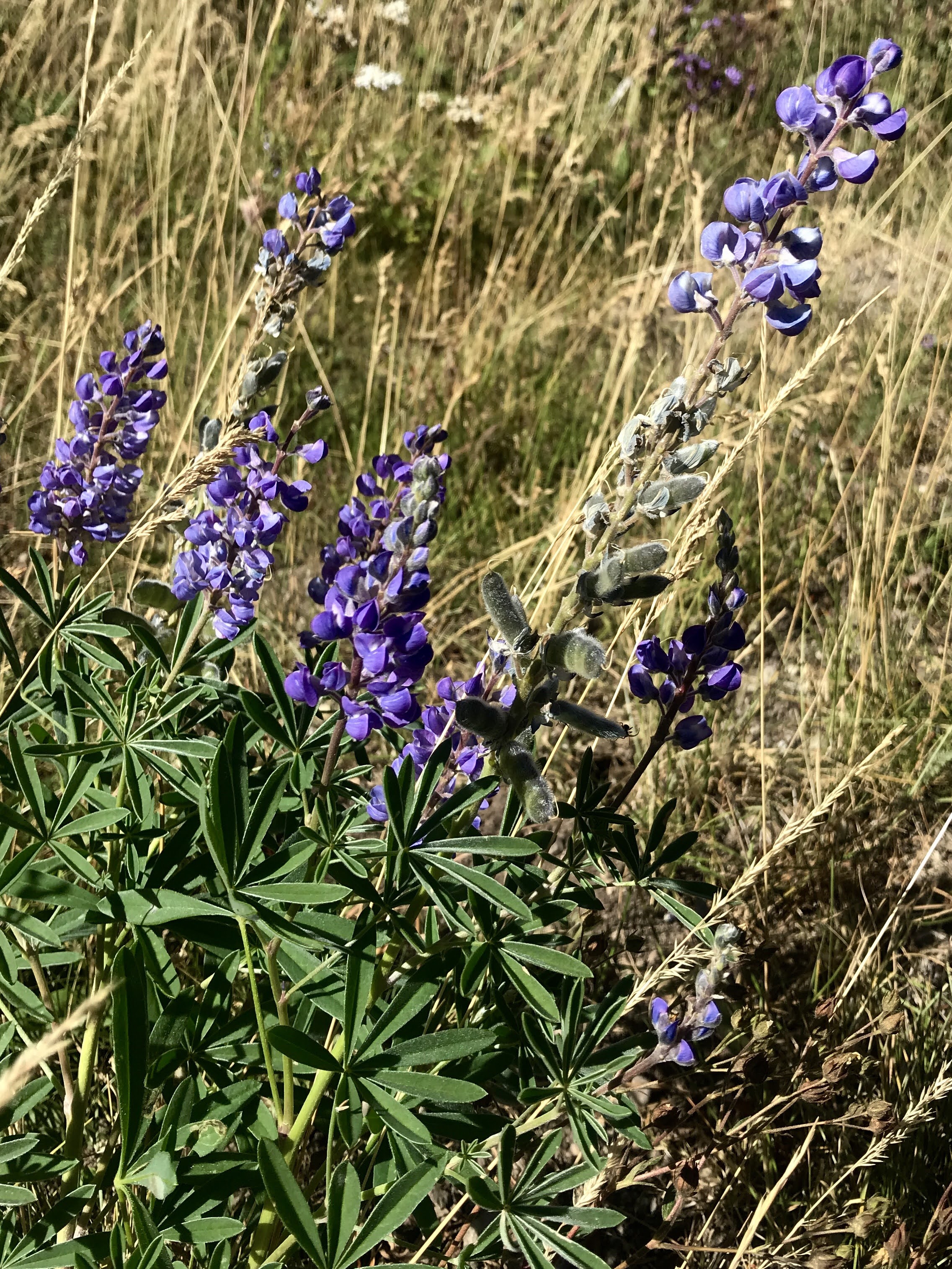
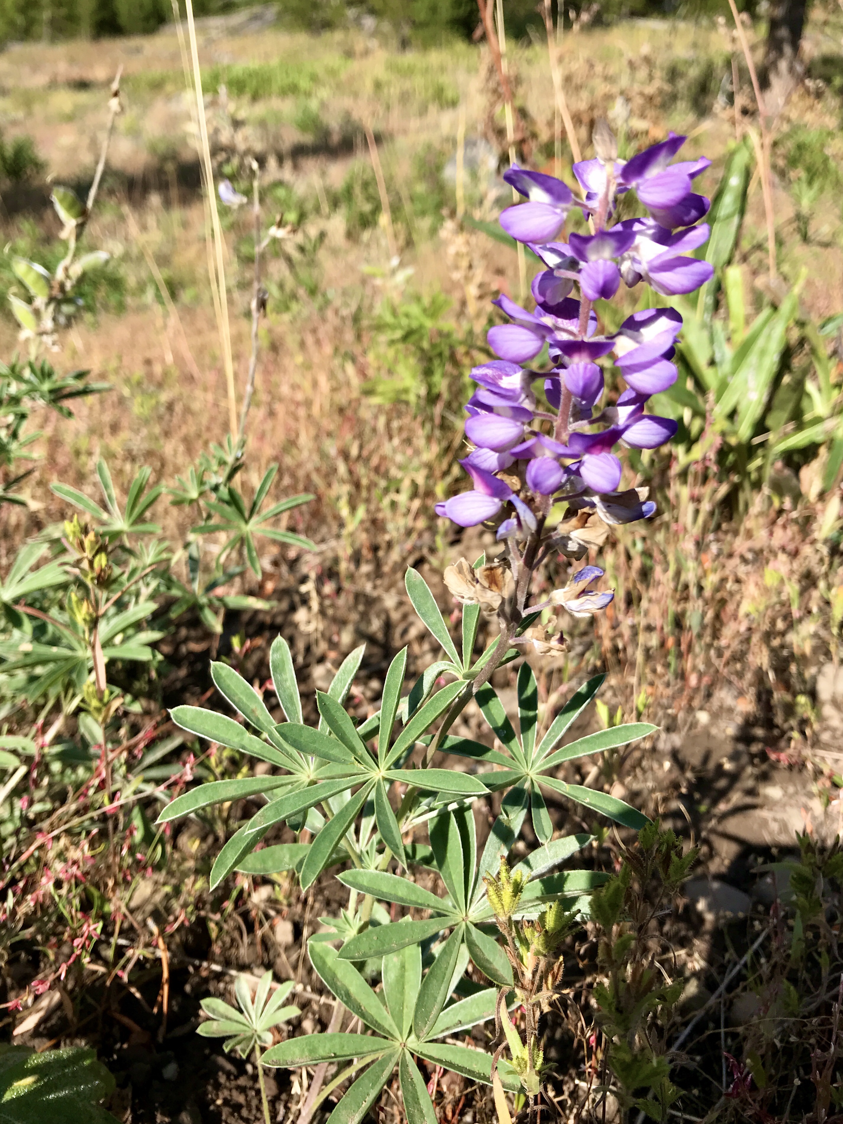
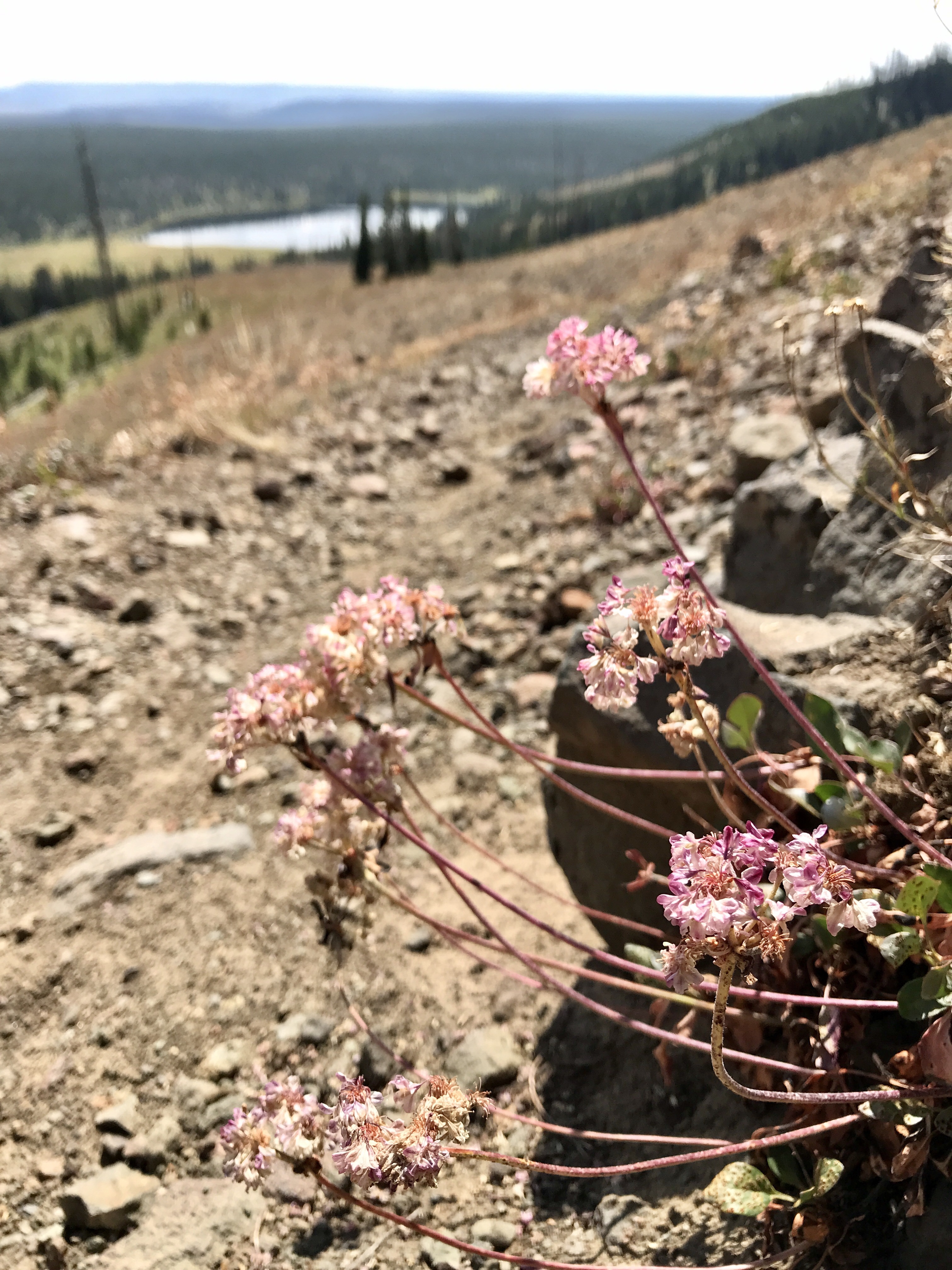
As we slowly started climbing the 1,400 feet to the top, we wound our way through dense tree areas, sage brush field, and some lingering wildflower meadows. Purple wild lupines poked through here and there, adding a pop of color to the mostly green, yellow, and brown dry landscape. The hail and rain from the night before came in handy though, because it cleared out a good deal of the smoke from distant wildfires and gave us a spectacular view the whole hike.
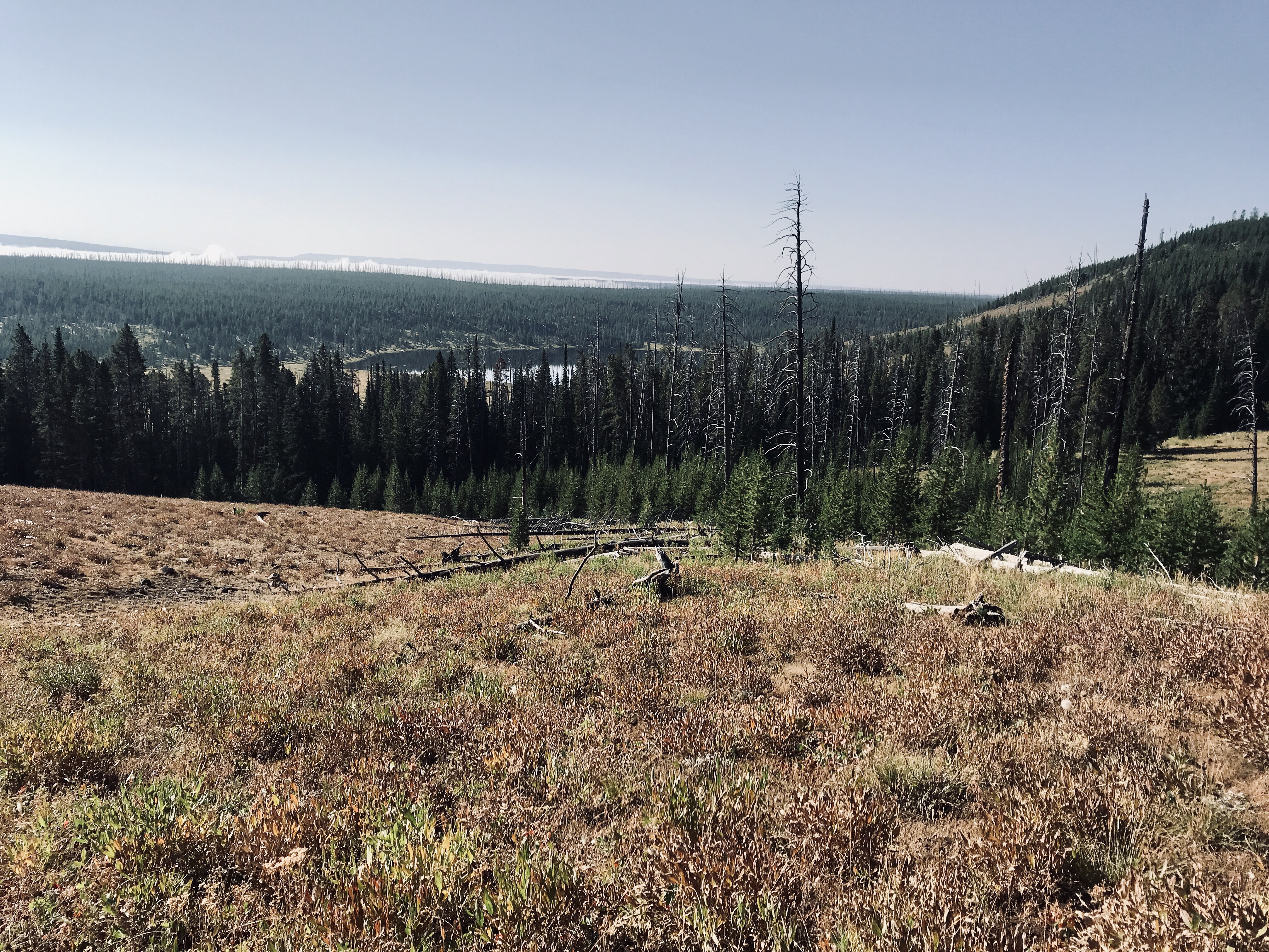
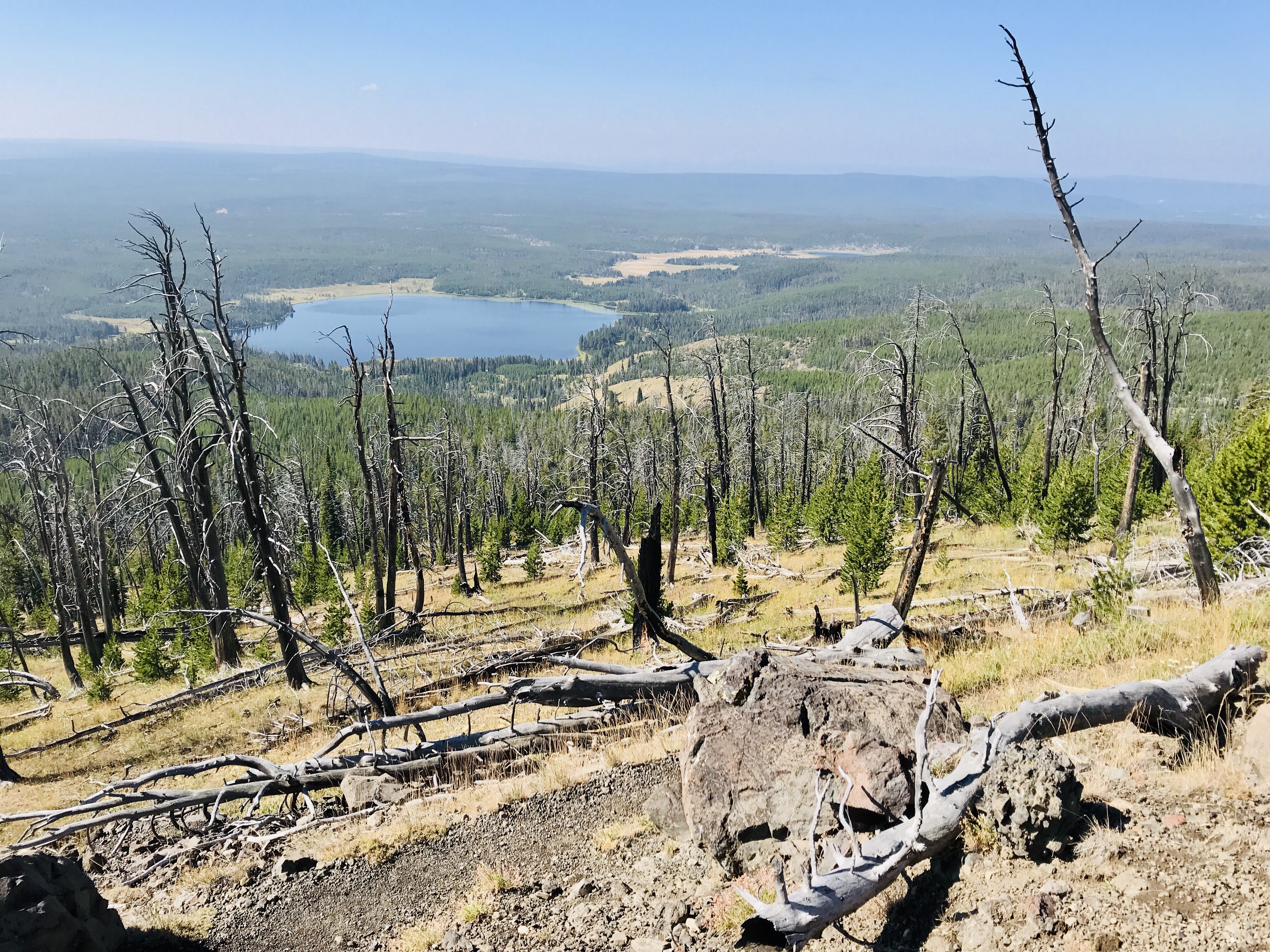
As we hiked higher, we were treated to views of mountains all around. For about as far as you could see, the land rose and fell with different mountain ranges. We also had a bird’s eye view of Grebe Lake and later Wolf Lake, formed by glaciers that had melted years ago.
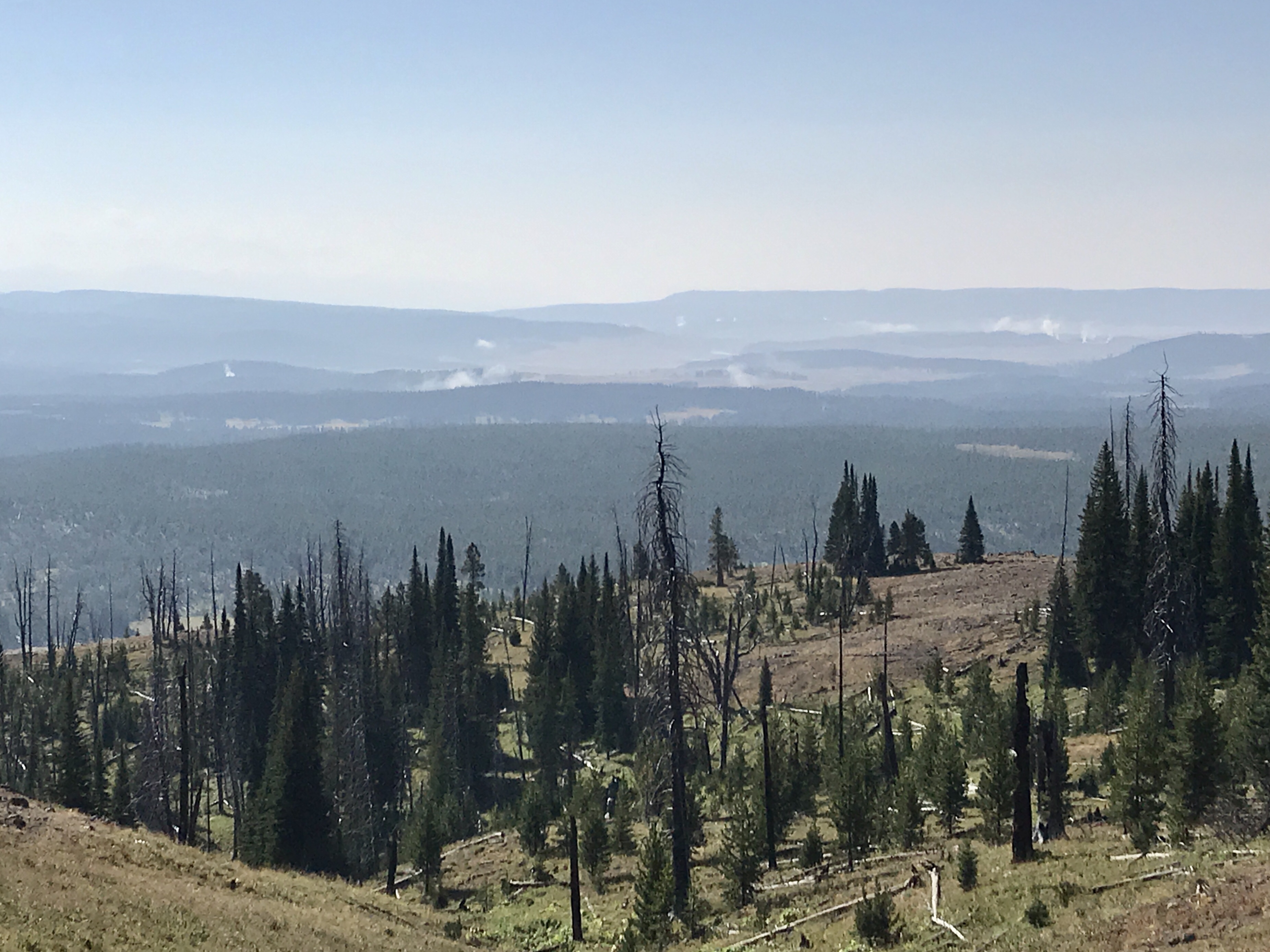
Eventually we made it to the summit, the first clear view of mountains since leaving Glacier National Park nearly a week ago. Although windy and chilly at the top, we hunkered down to eat lunch and enjoy the view. We weren’t going to let the temperatures keep us from soaking in all this beauty. Every time I reach a mountain top, I have this overwhelming sense of accomplishment and happiness. This is one way I know taking this year to explore was the right choice.
Eventually we did have to descend, but we took our time and continued to enjoy the beauty. As on so many hikes out here, we were serenaded by grasshoppers hidden on the trail in the grasses. Together they make a powerful choir that sounds like high-voltage power lines. They are good at surprising you too as they are so well camouflaged – I often jump a little as we walk down the trail because grasshoppers seem to leap out of nowhere with each step that I take. Sometimes it feels like the parting of the Red Sea.
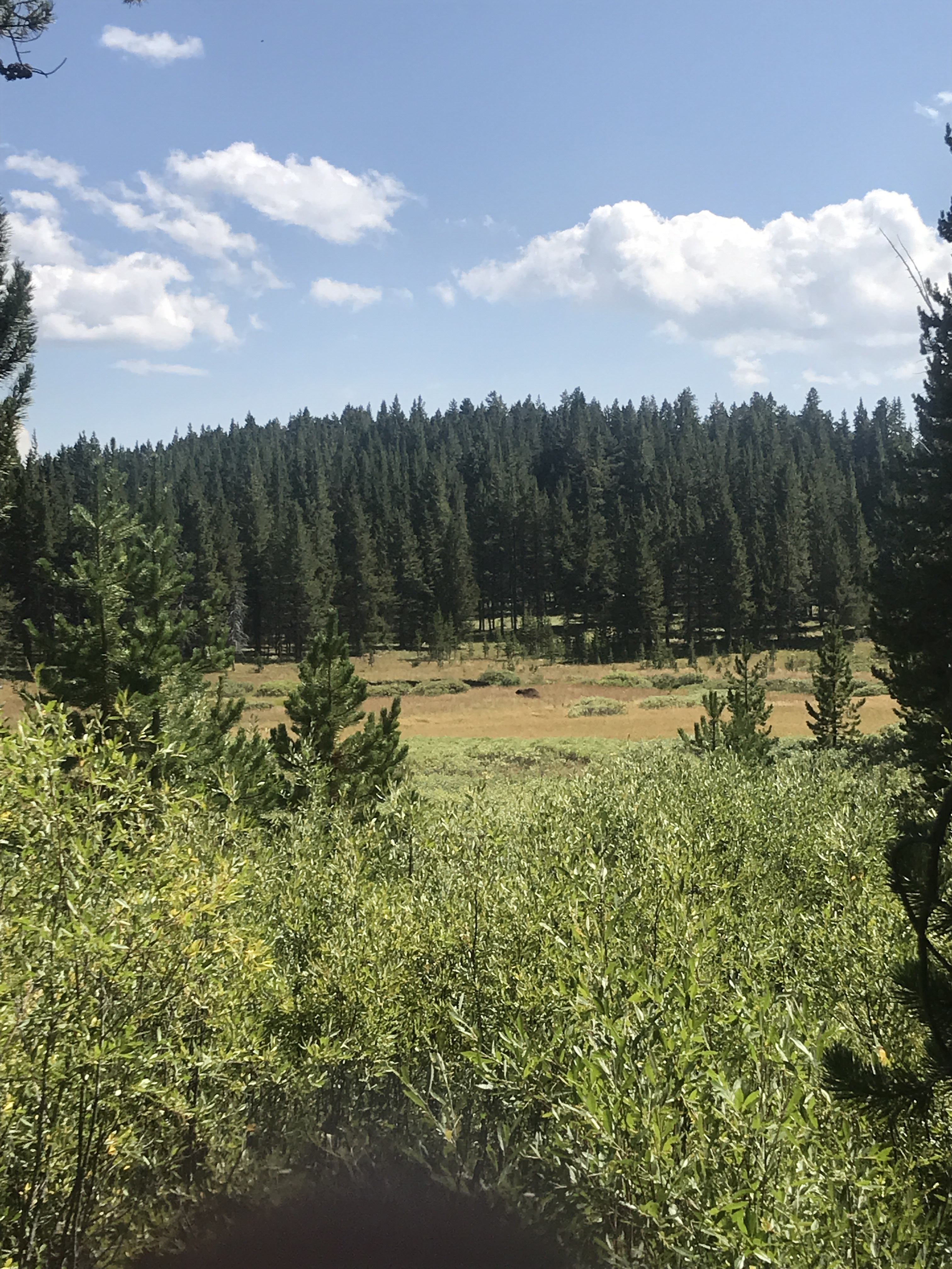
The last few miles of our hike through the forest seem to be taking forever as we had tired legs, but a bison sighting but a little pep in our step. Way out in the meadow, below the trail, a lonely bison was grazing on the greens and rolling around in the dirt, giving itself a good back scratch. We watched it for a while until it too became tired and laid down to rest.
Back at the car we dropped our gear, packed up, and headed to Canyon Village for a post hike treat. While sitting outside, socially distanced of course, a huge raven kept pestering us. Apparently it wasn’t explained the 6-foot rule. Eager for scraps of dropped food (which we didn’t have), it eventually moved on to other unsuspecting visitors. Never a dull moment!
Another wonderful day in the books, enjoying the land native to the Crow and Cheyenne tribes, we went to bed happy and tired, looking forward to the other sights Yellowstone had to offer tomorrow.
Our arrival at Yellowstone National Park was certainly a memorable one. It hailed, twice. August in the mountains at more than 7,000 feet above sea level is certainly something else. I guess “summer” is a shorter season around here. As we pulled into West Yellowstone to enter the park, small pellets gushed down on us as a cold “hello!”
The storm was short though, and we drove through the majestic wonderland, native land to the Apsaalooké (Crow) and Cheyenne peoples. On our way to Canyon Village, we were welcomed by tall lodgepole pine forests sprouting up on both sides of the highway, rolling over mountains far ahead. Soon the forests opened up to the Madison and Gibson Rivers, rushing along beside us with alpine meadows along their shores. Waterfalls roared over dips in the river, areas carved out by the pounding water through the soft rock. Then we came upon what makes Yellowstone so very special, the steam rising into the cool blue sky from a variety of spectacular geothermal features right along the highway. Steam floated across the road, sometimes spouting from springs or vents just a few feet from the side of the road – the activity of the super volcano below the surface poking out and reminding us it is still alive.
The 40 miles to our campsite at Canyon Village, in the middle of the park, were marvelous. Yellowstone is gigantic, three times the size of Rhode Island, nearly 2.2 million acres. The explorers, artists, and photographers who captured the sublime features of the park in 1871 convinced President Ulysses S. Grant and Congress to make Yellowstone the first National Park in 1872. It is home to geysers, hot springs, mud pots, fumaroles, travertine terraces, countless hiking trails, rising mountains, and abundant wildlife – wolves, moose, bears, elk, deer, bison, and more.
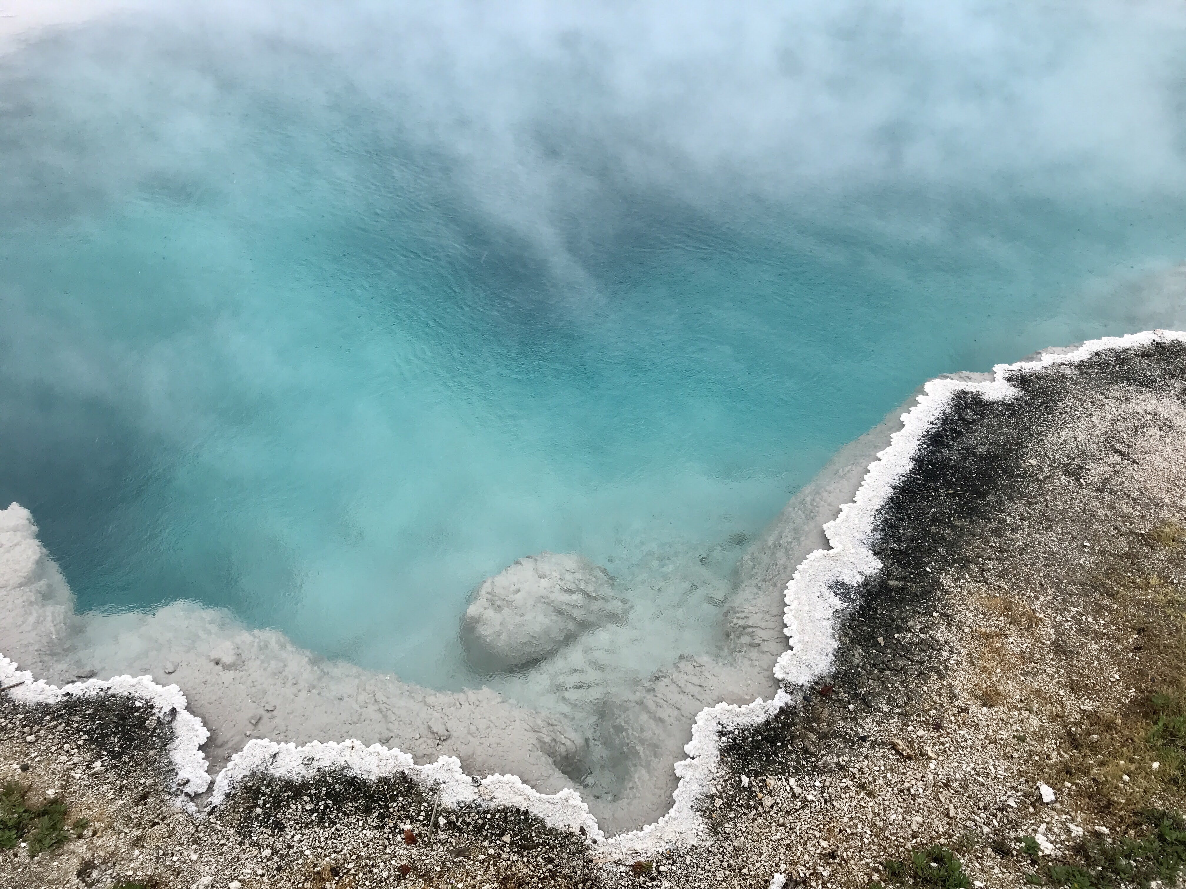
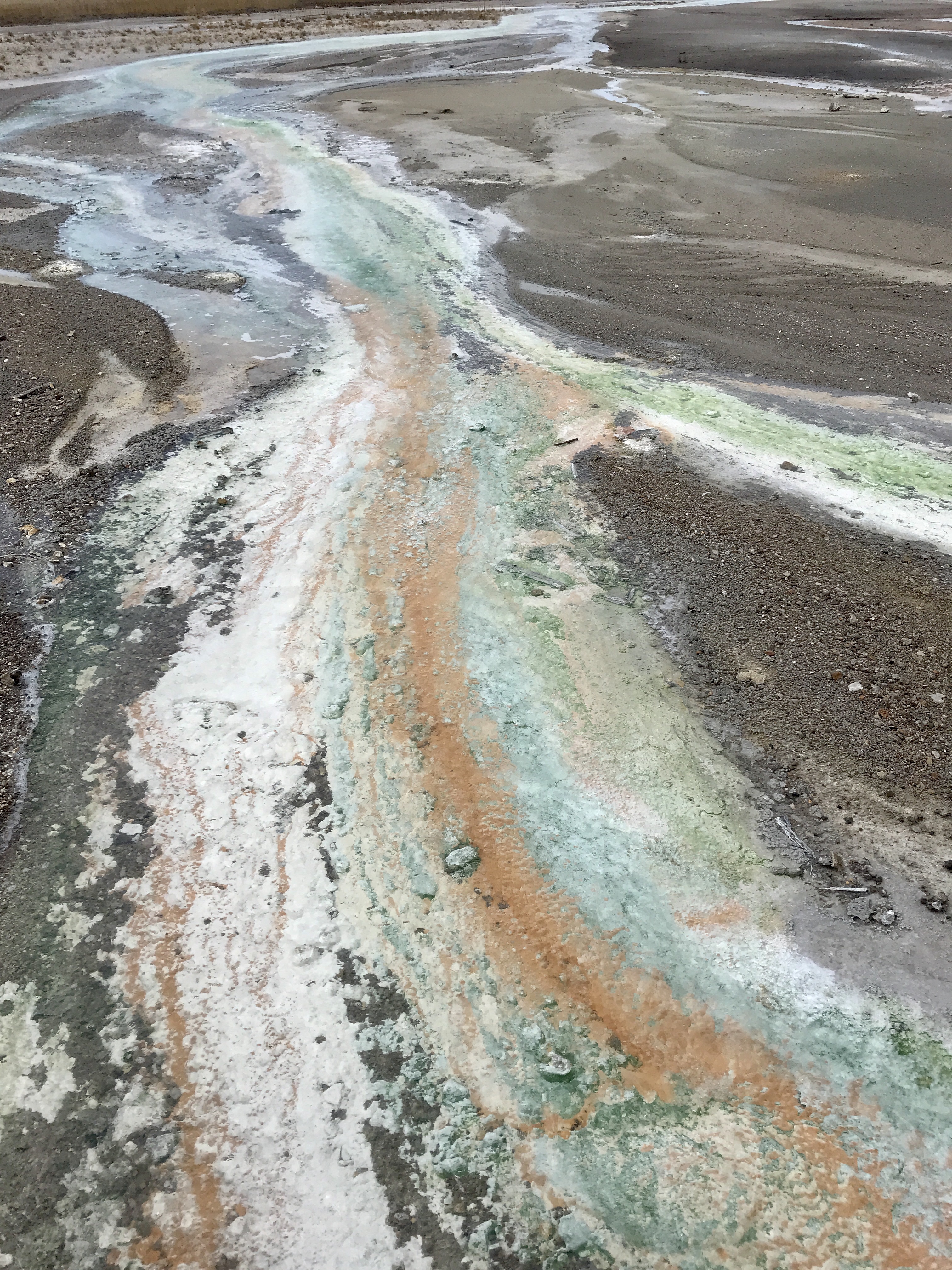
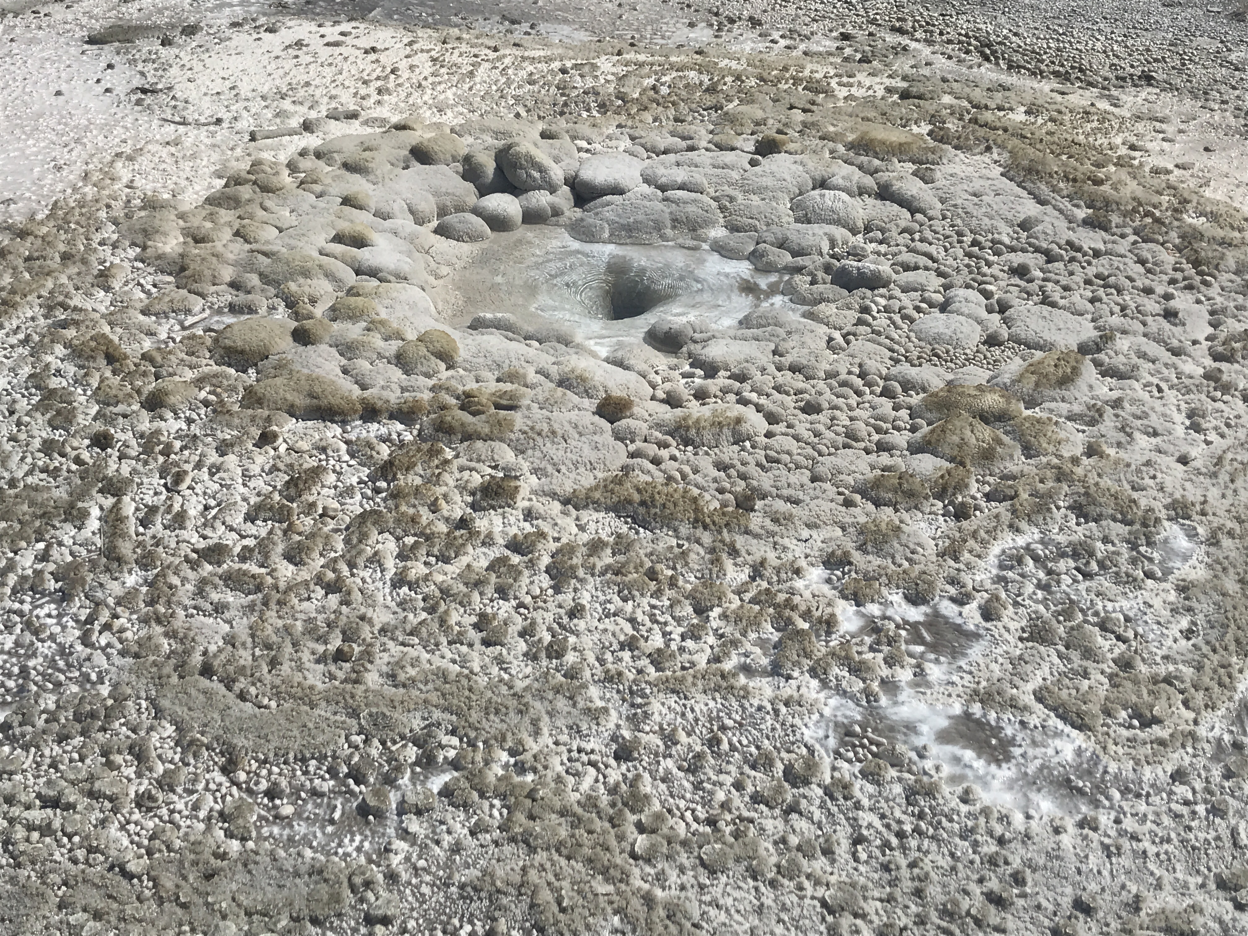
As we neared our campground, we pulled over for our first up close inspection of the park – Norris Geyser Basin. We headed out on the Porcelain Basin trail, an interconnected system of raised boardwalks that bring you close to the different features. Underneath is solfatara, unstable ground above the volcanic activity deep below. The sulfuric acid, gases, and steam that escape from the vents create a thin layer of delicate covering (solfatara) above the decomposing rock below. The boardwalks are very safe and stable, but it is important to stay on them, which we did. And when you do, you are treated to spectacular sites.
Steam rises around you, peaking up through trees or dancing across the earth ahead. Small holes here and there are gurgling with boiling water bubbling at their surface. Turquoise springs rimmed in oranges and yellows delight your eyes. Vents splash out scalding water and send steam clouds into the air. The sizzling of water bubbling across shallow bodies of water makes you think bacon is cooking on the stove. And then the rainbow rivers of greens, oranges, whites run across the land, under the boardwalk, to the next pool on down into the ground. It truly feels like you have stepped into another world.
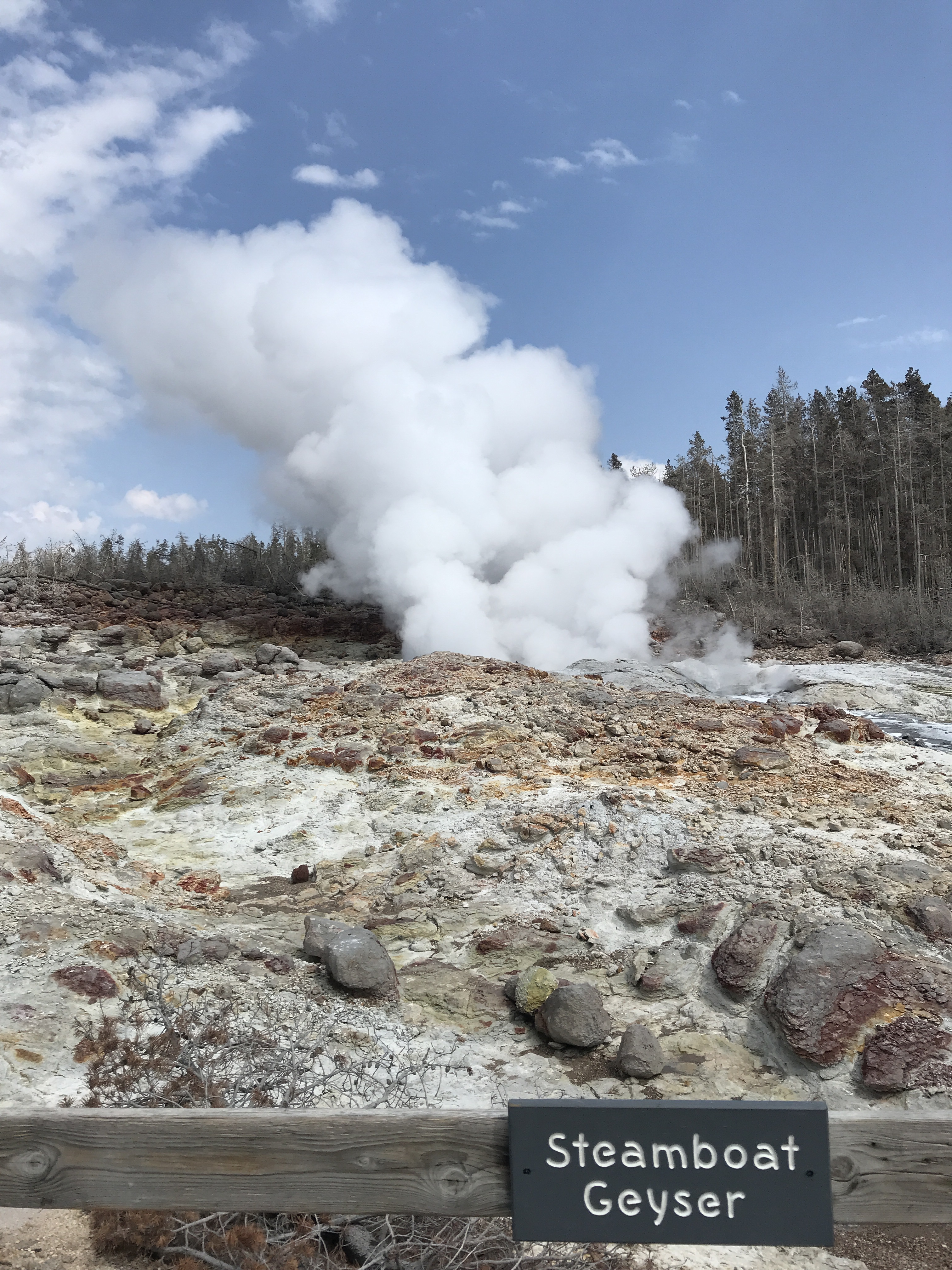
On the upper trail, across the basin, small spouting geysers erupt erratically. Bacteria living in the boiling water create patterns all around. Some look like cauliflower, others like stones, and still others circling in rings like crystals. Mud pots gurgle and bubble and hot springs sizzle. We made out way around to Steamboat Gesyer on the upper loop. This geyser erupts erratically, either every 6 days or every 50 years. And when it does, the minerals spraying out can apparently damage paint and glass on cars – so beware where you park! We did not have the privilege of seeing Steamboat Geyser erupt, but the constant plume or steam that escapes from its vent was still pretty spectacular.
After a full morning of exploring, we headed over to Canyon Village to check in at the campground. My spot was nicely tucked into the woods, but at a severe downhill slant. We level the best we could, but lets just say gravity helped me easily get to the front of the van. Haha. And no sooner had we settled in that a hailstorm and thunder swept through again! We ate dinner indoors that night and prayed from warmer, sunnier weather in the morning for our next adventures.
As we inched closer to Yellowstone National Park, we traveled to Dillon, Montana and a few more ghost towns.
Dillon, Montana is a quiet city nestled in the southwest corner of Montana. Home to Montana Western University, a brewery, and a few shops, it is a nice stop over on travels to other destinations. We found a cozy place to rest right in downtown, Southside RV Park, and settled in for two nights. (It was meant to be one, but we soon realized we were a little ahead of schedule for our reservations at Yellowstone. Oh well!) While my dad and I did spend some significant time shopping in the Patagonia Outlet downtown (who can refuse 50% off of already reduced prices?), these two days were more about resting and catching up on chores. Ahh yes, RV life and traveling isn’t always so exciting and wondrous. Haha. So we used the laundry facilities at the campsite, filled up our water tanks, dumped our waste water, and planned the next leg. We enjoyed the (limited) WiFi and spend a few leisurely days enjoying just being.
After our second night, we headed towards Virginia and Nevada City, two former mining towns along the Ruby River and area know as Alder Gulch. It was mistakenly named the Ruby River by miners because the red stones found along the shore were actually garnets. The Shoshone-Bannock who originally inhabited the land called it the Passamari.
As you drive down the road which was once the main thoroughfare for gold prospectors beginning in 1899, both sides of the road are flanked by large piles of rubble and rock – the aftermath of the gulch and river being dredged, or dug up by large boats that literally turned the land inside out. Little more than short, stubby trees and straggly scrub brush grow here today, 121 years later. It is a desolate scene. Most of the gold taken from these Shoshone-Bannock lands was used to establish Harvard University.
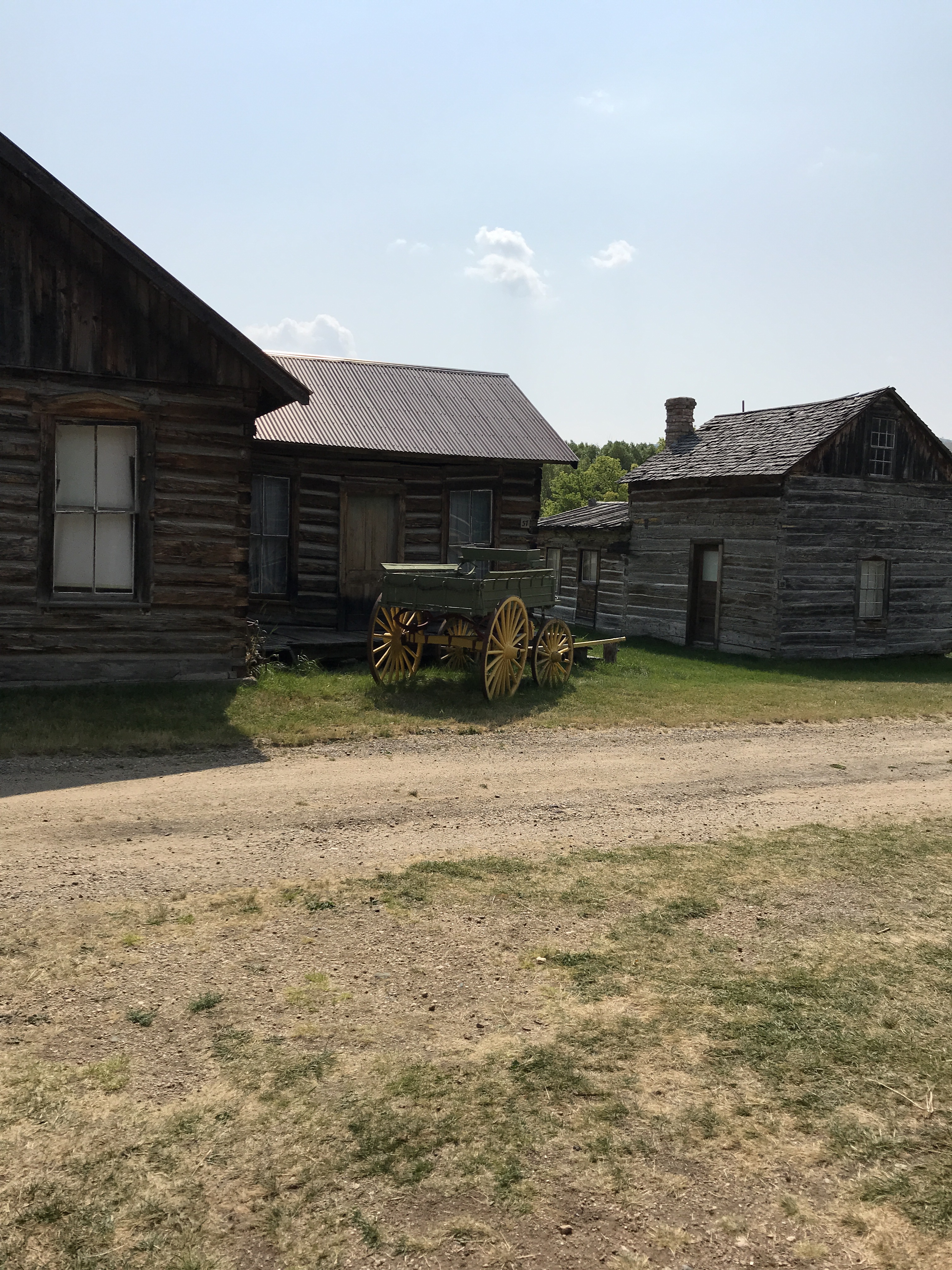
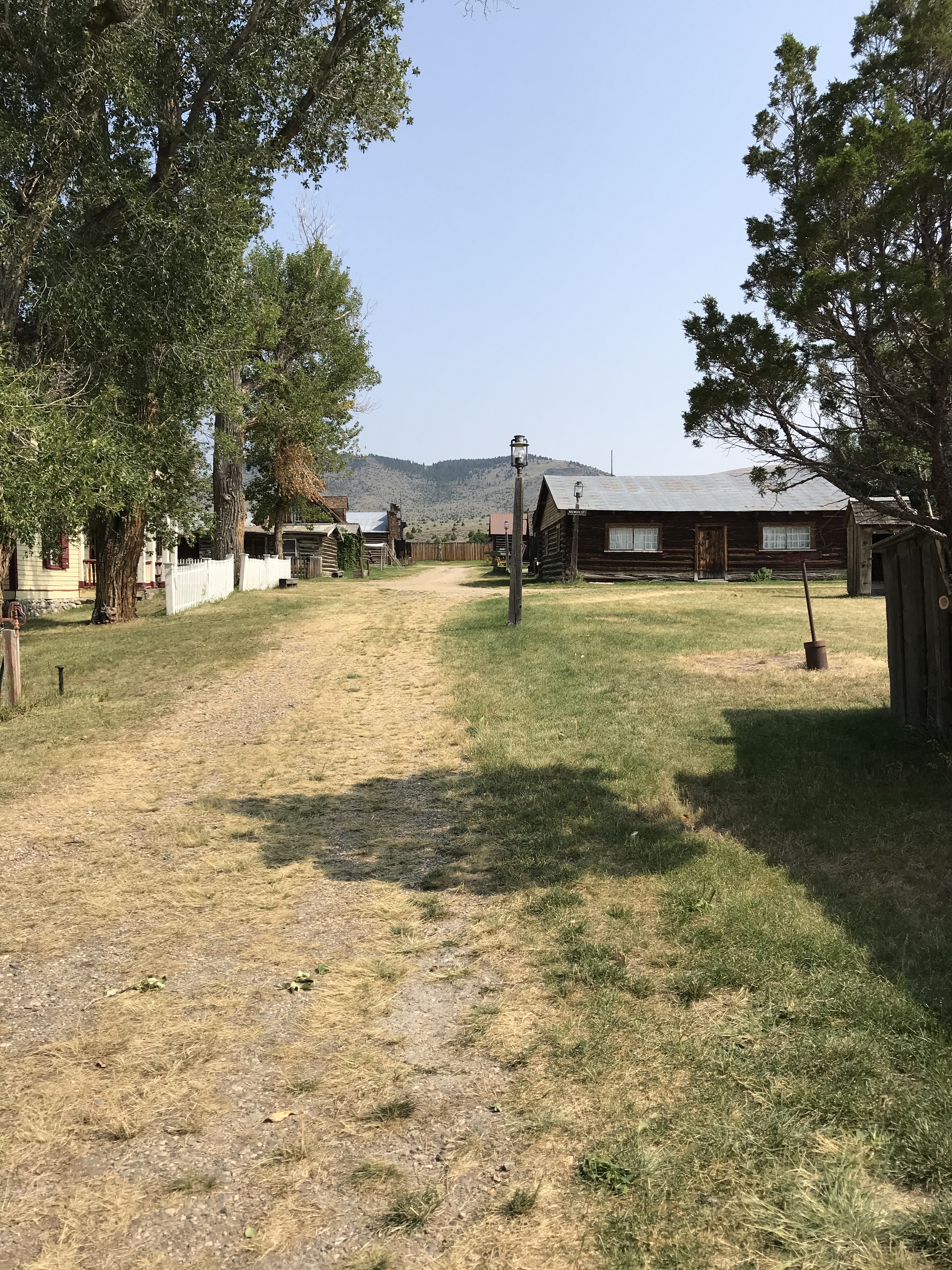
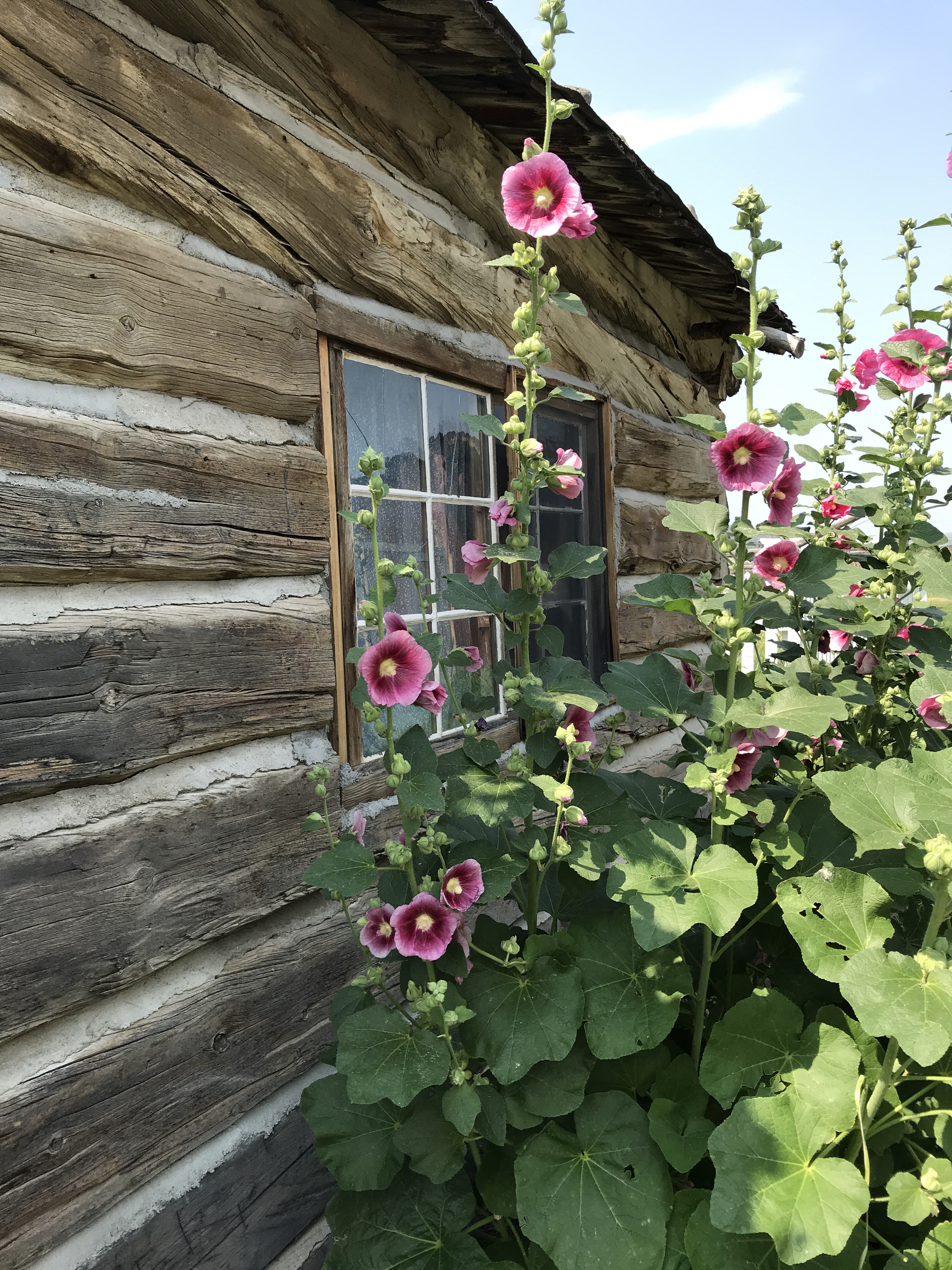
Eventually, further down 287, you come to the location of two ghost towns – Virginia and Nevada City. Now, this is a rather interesting place. Unlike Coolidge, a true ghost town untouched since it was abandoned when the mine failed in the 1950s, Virginia City and Nevada City are actually a museum of preserved structures from all across Montana. Mr. and Mrs. Bovey, a wealthy white couple who loved history and were passionate about saving it, invested a significant amount of money to buy, move, and restore important buildings from different stages of Montana’s history. The ghost town does exhibit some buildings original to Virginia and Nevada City, but is mostly a hodgepodge of interesting architecture from the later 1800’s through mid 1900’s.
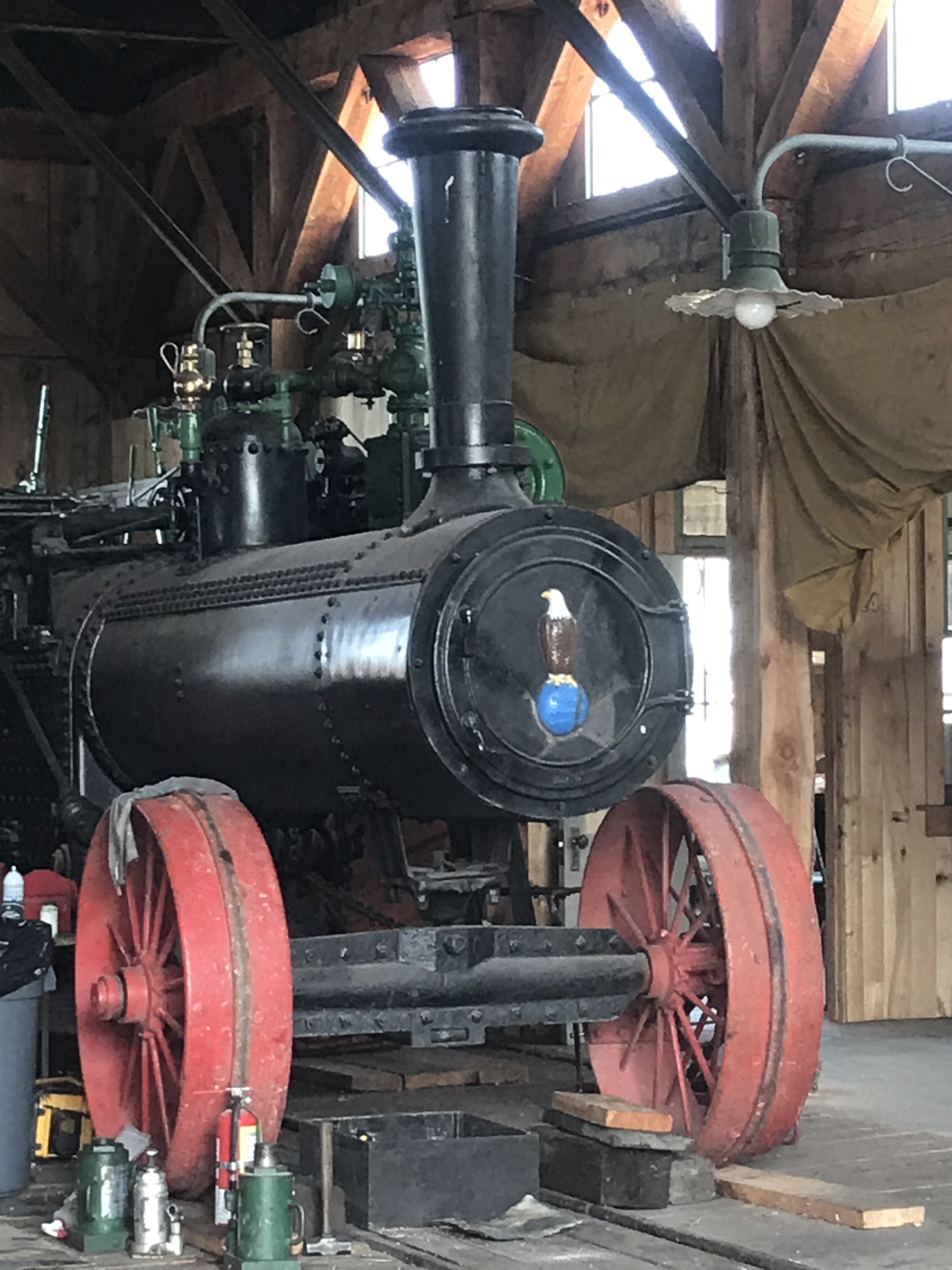
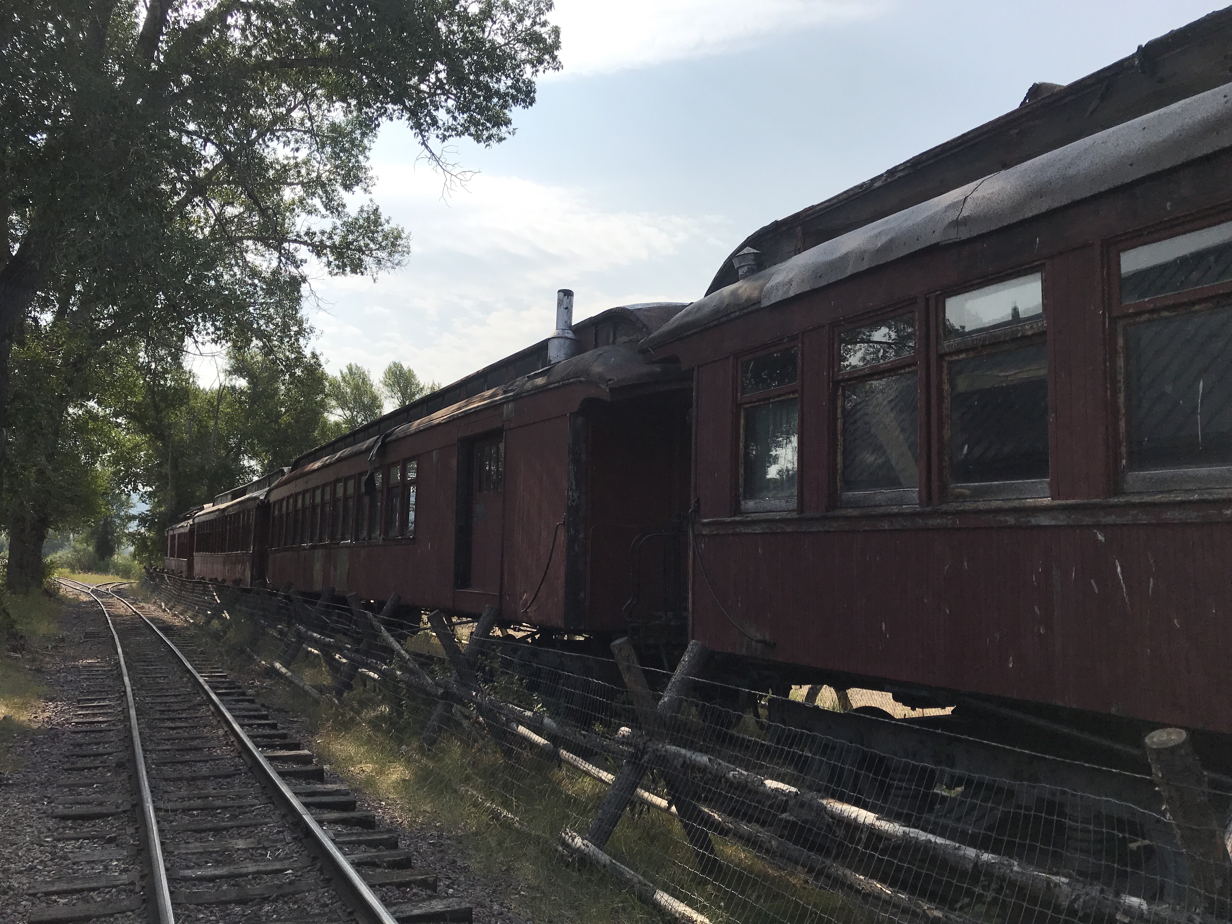
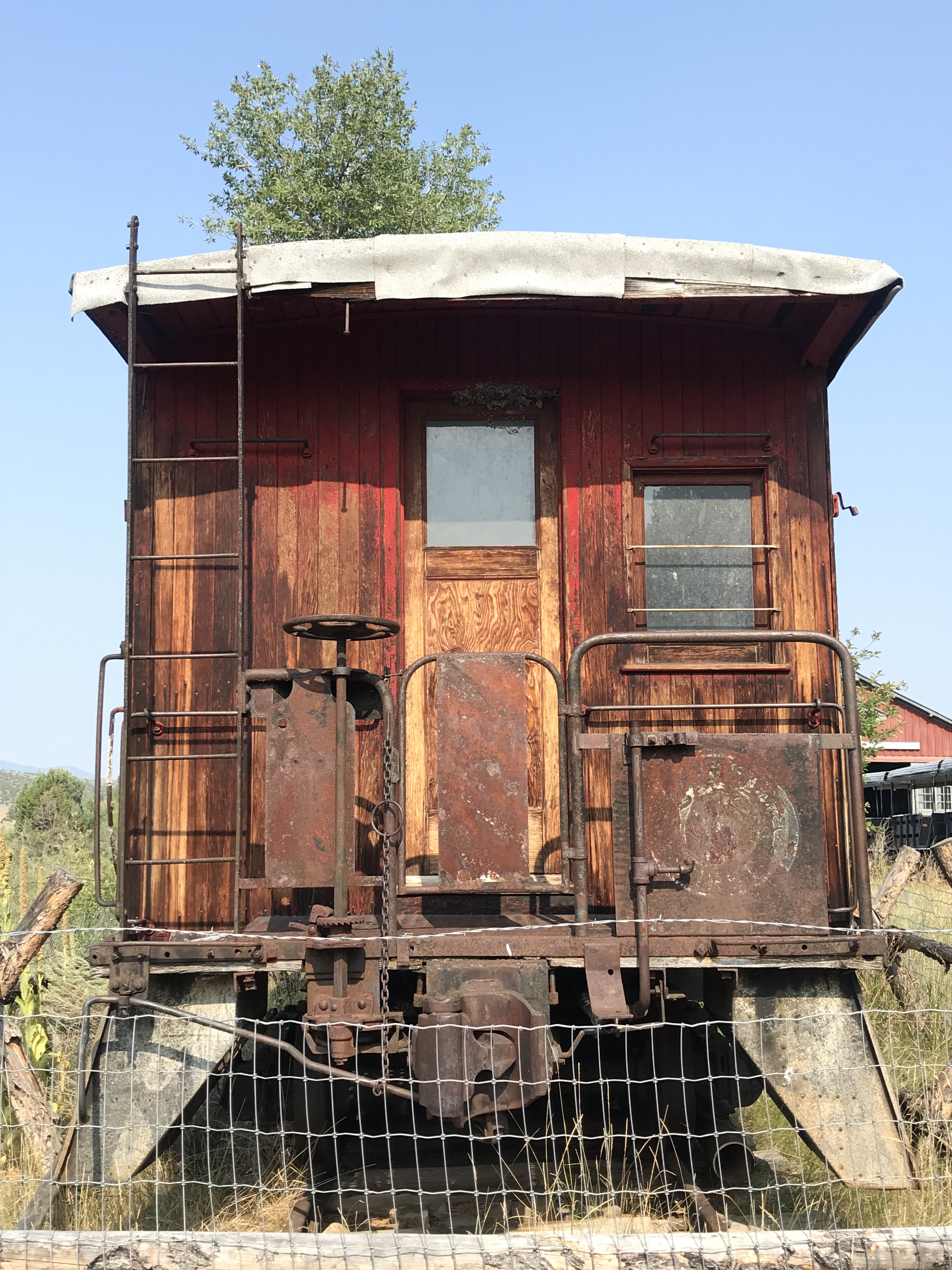
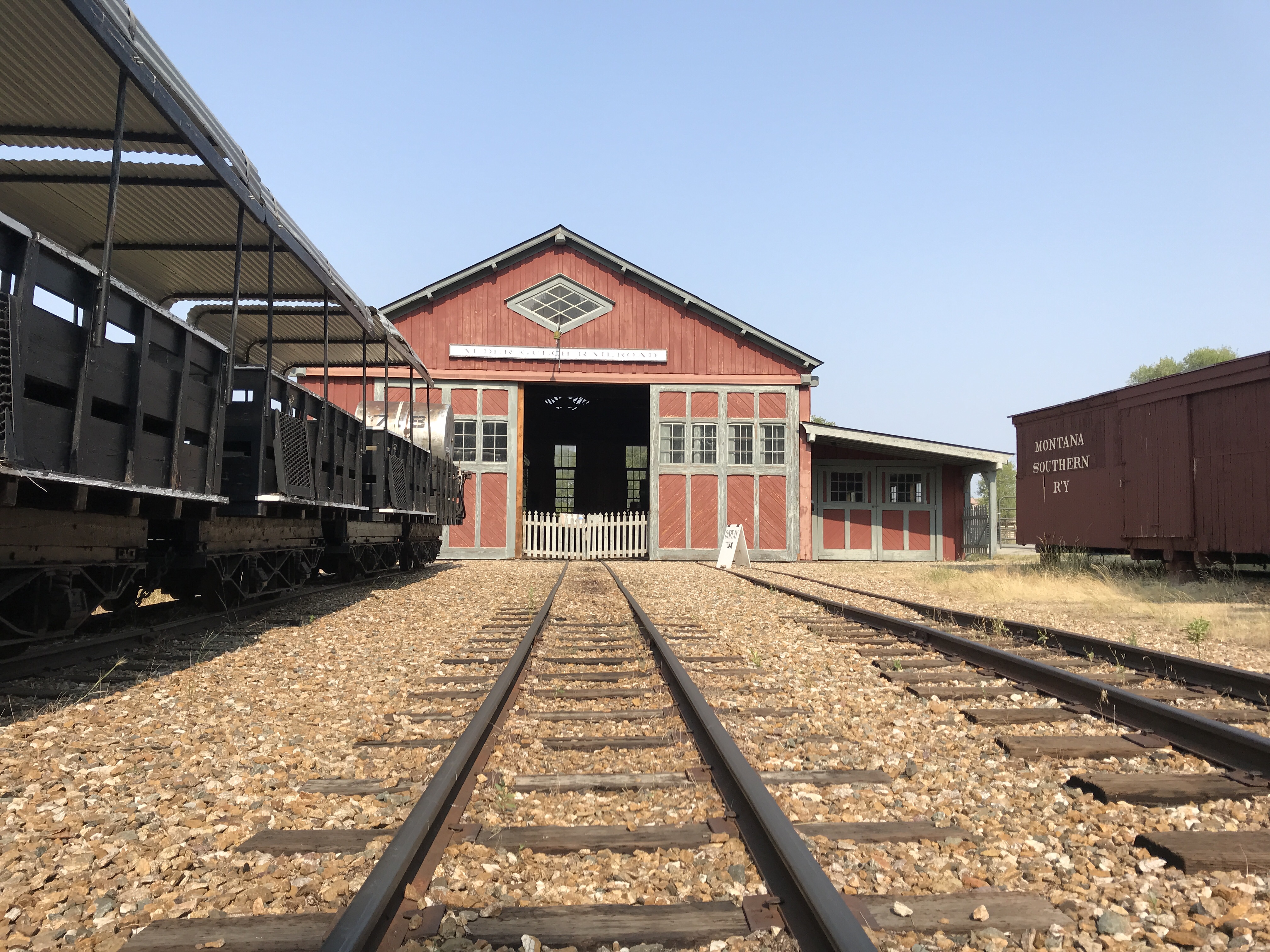
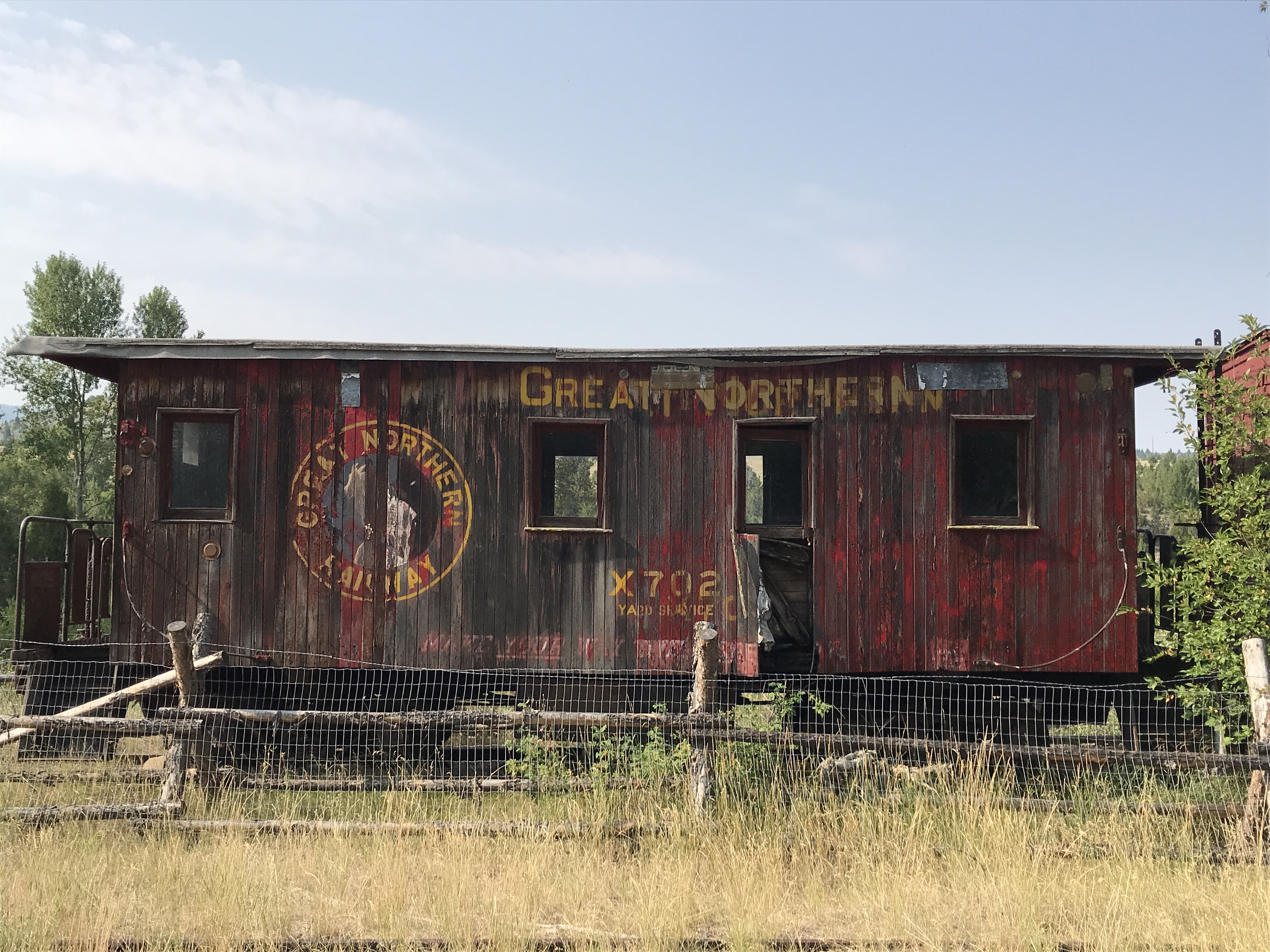
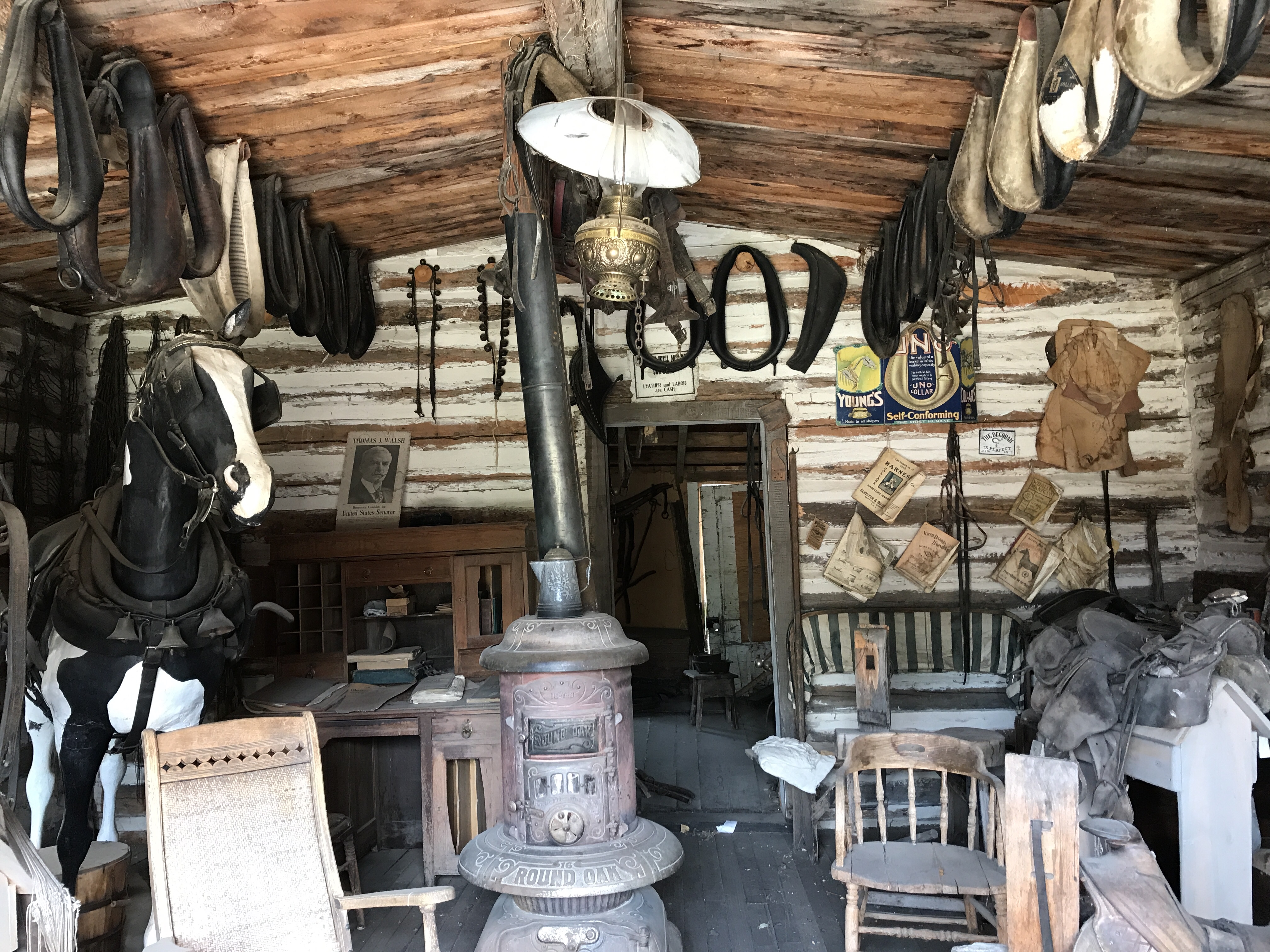
On one side of the road, who can explore the railroad line that the Bovey’s financed in order to bring and store historic trains to the area. They have all largely been restored and rest alongside two reconstructed train stations. There is also a live train that runs on the tracks giving ewww visitors a scenic tour of the area.
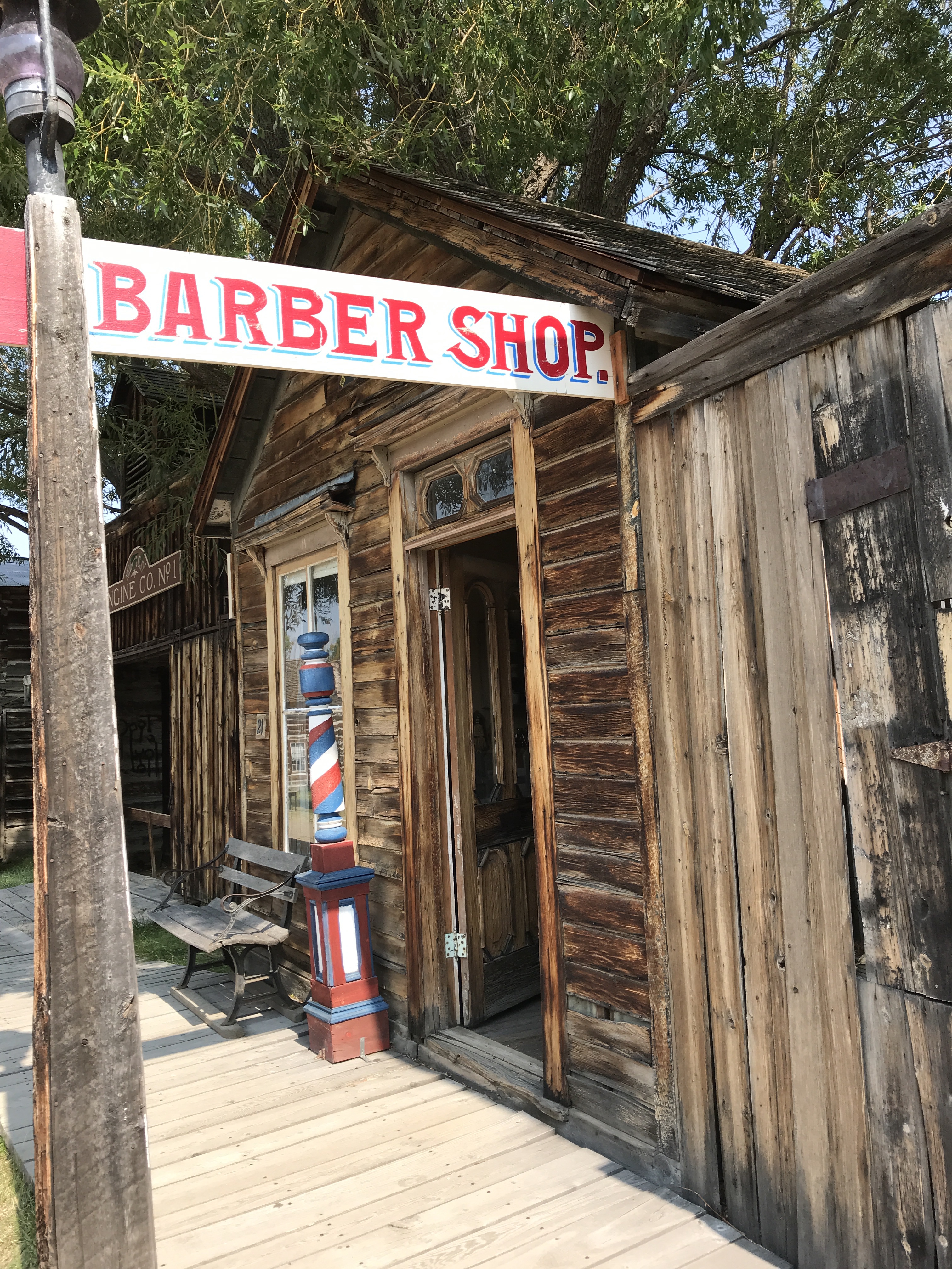
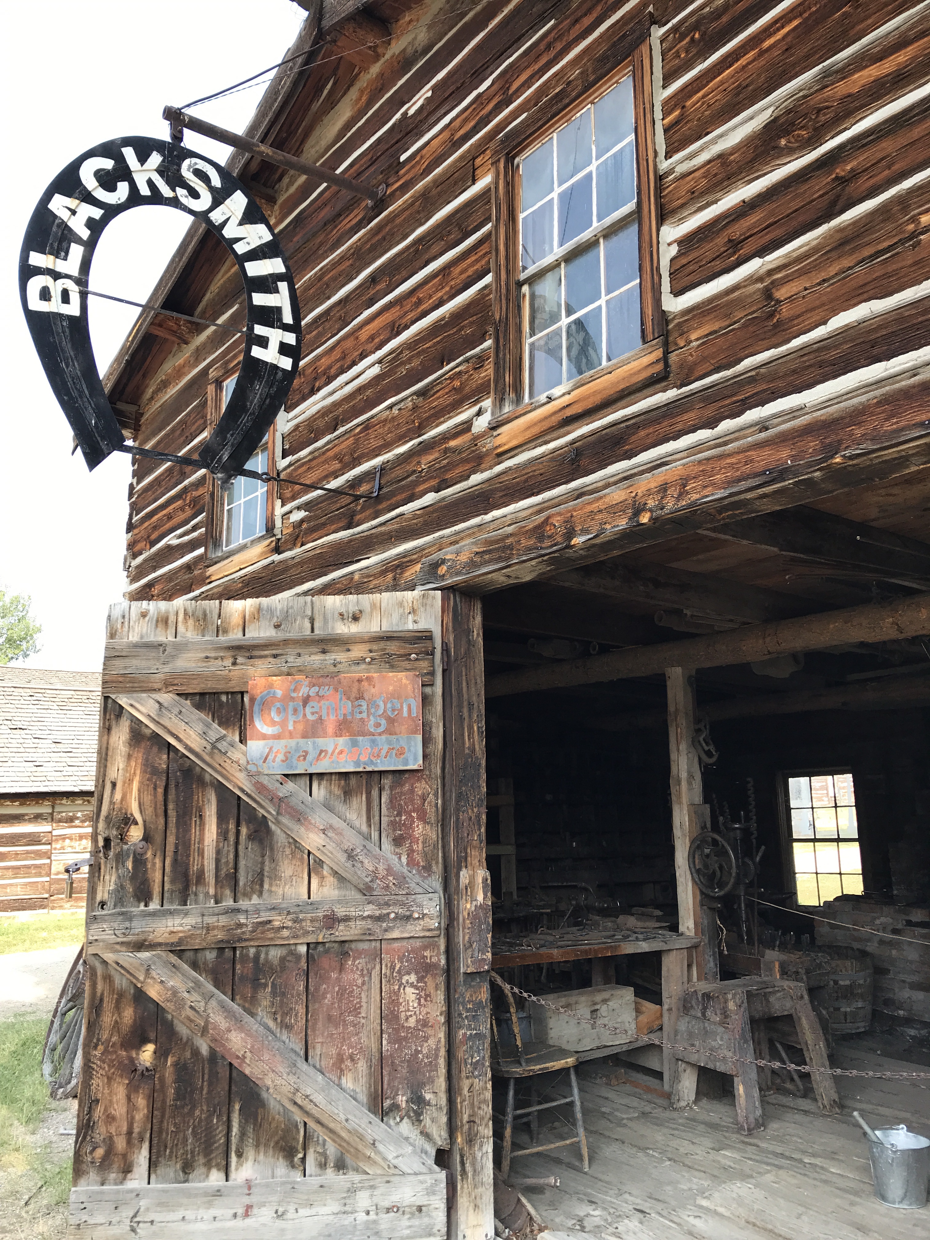
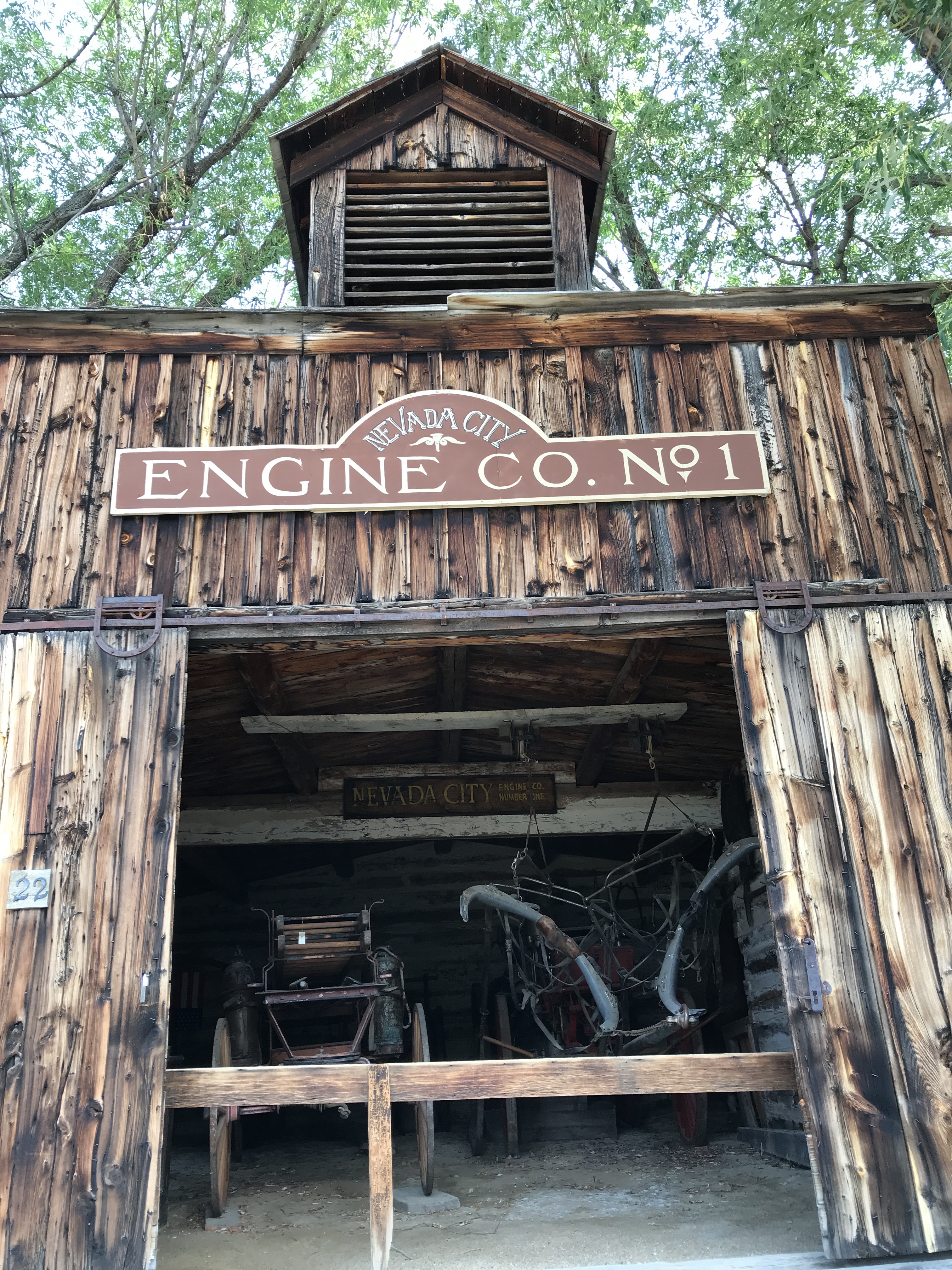
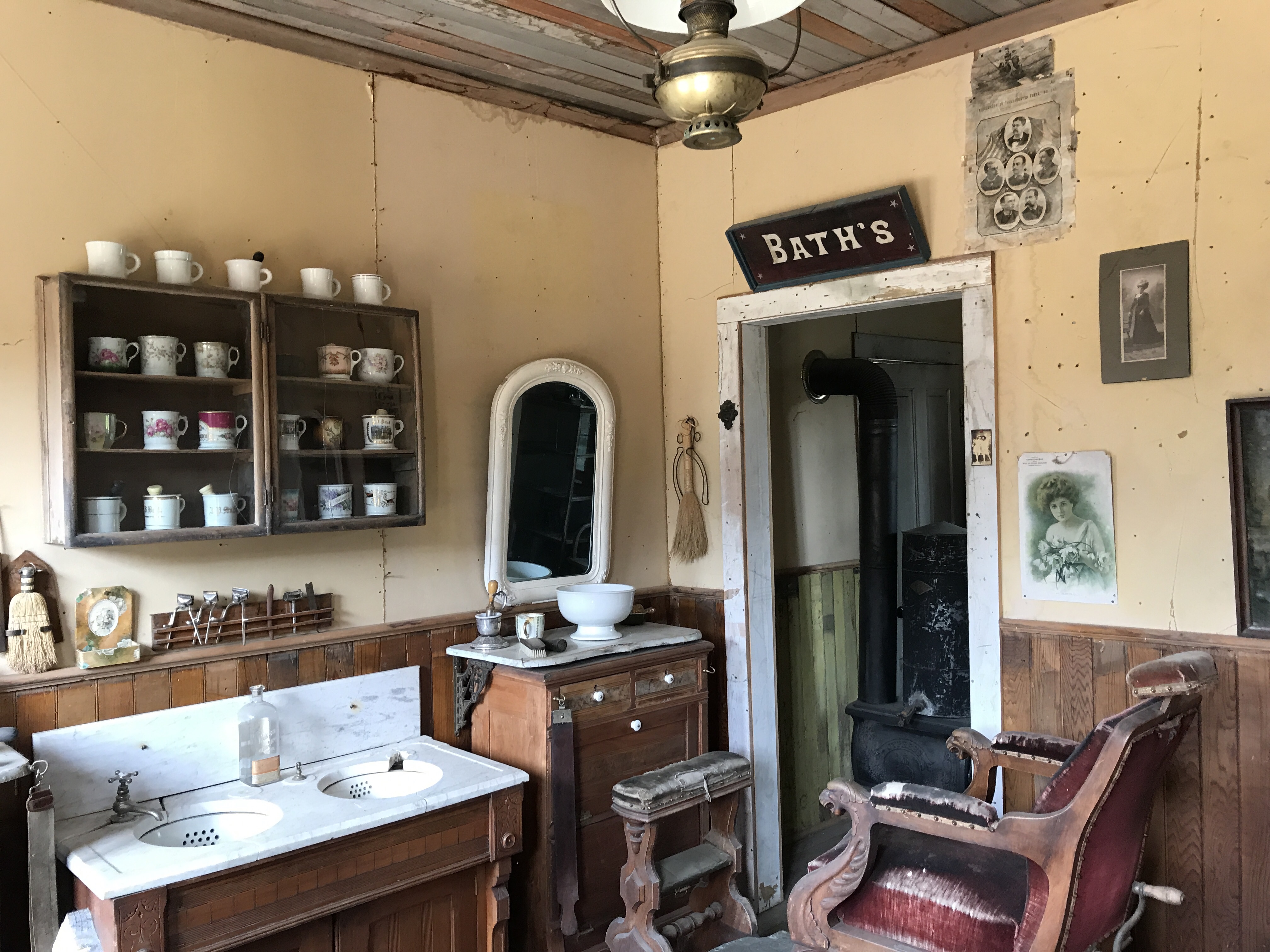
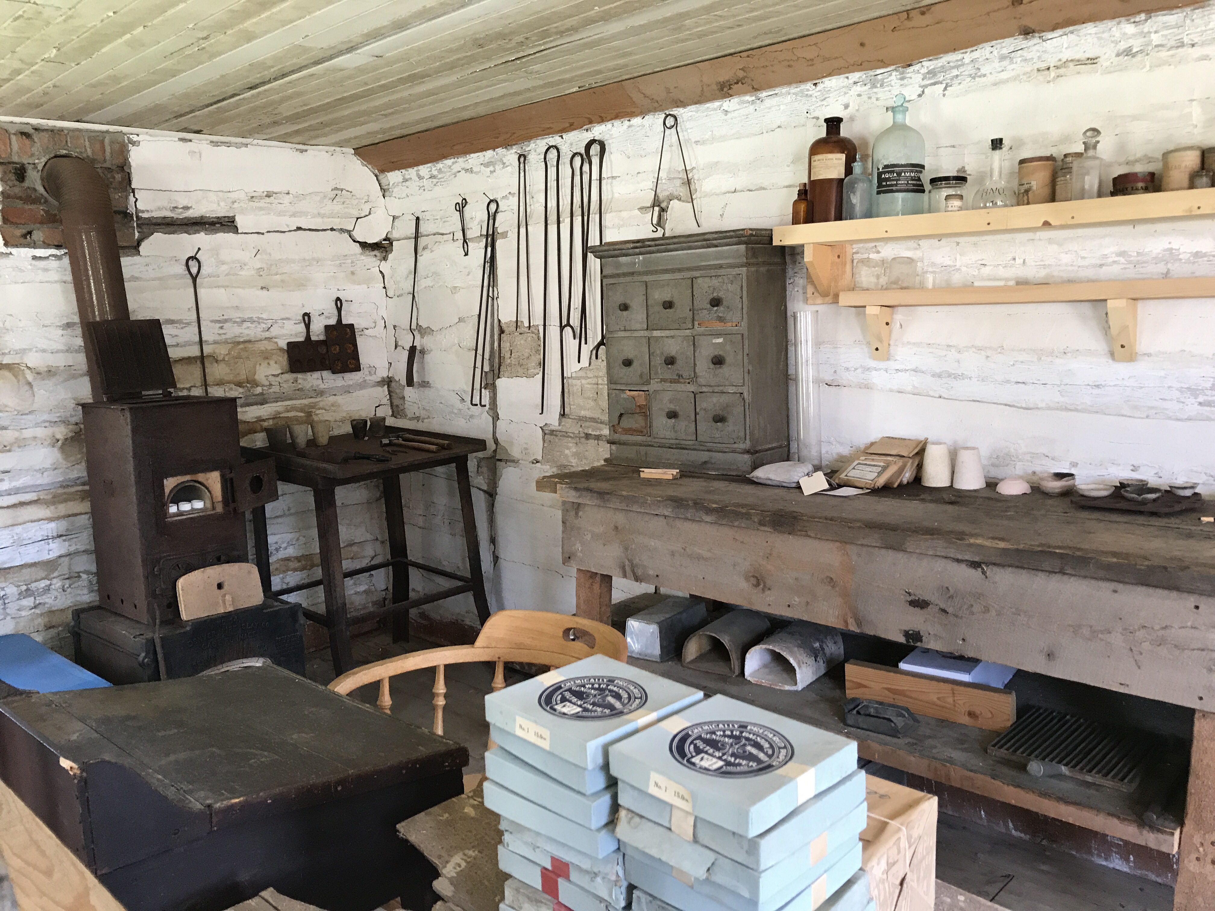
On the other side of the road is the building museum. At one end are refurbished cabins from the 1900s that are now rented out to area visitors. At the other end you can find everything from the city jail, to the babershop, horse stables, China town establishment, old houses, and even an historic post office. There are 47 buildings in all, chronicling the development of Montana from the 1870s through 1980s.
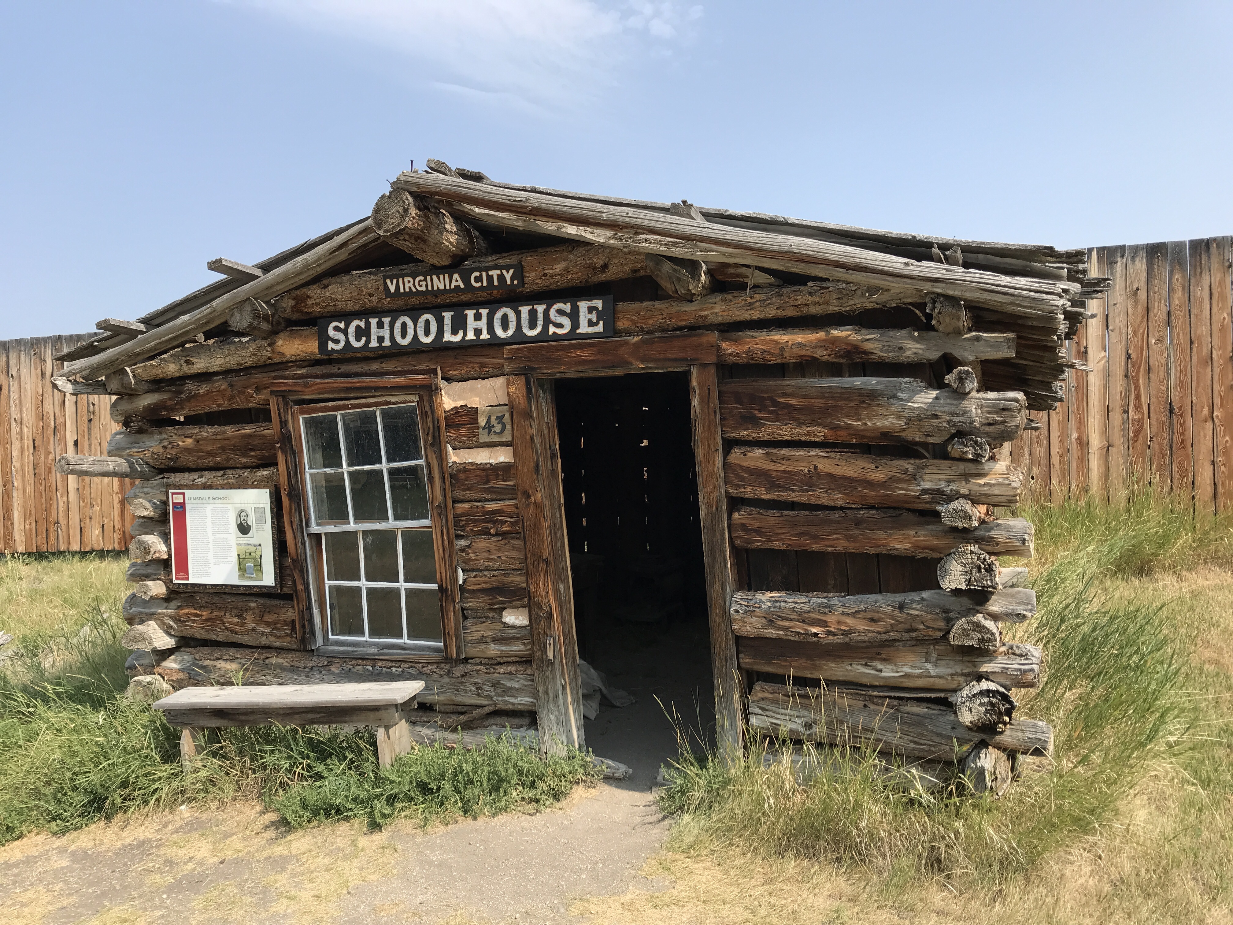
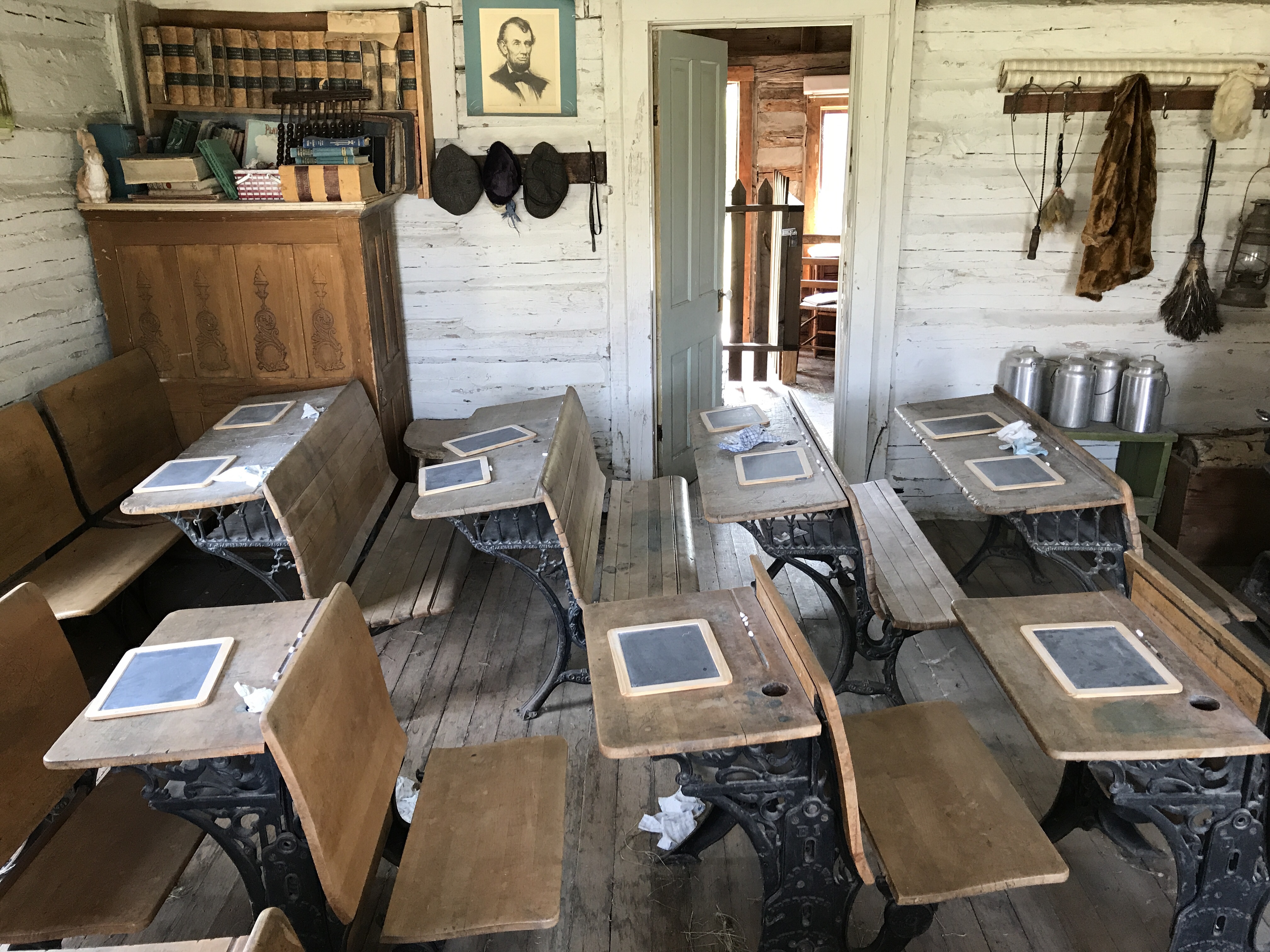
My favorite, of course, were the two schoolhouses brought to the museum. The first is the first schoolhouse in Virginia City, from 1863. A tiny one room building just big enough for a teacher’s desk by the window and log benches against the other four walls. Known as the Dimsdale School for its first teacher Thomas Dimsdale, students could attend the private school for a small fee – $1.75 a week. Dimsdale was an Englishman and was reported to have spent most of his time writing Vigilantes of Montana, a series about the homegrown watch force that protected the town from thieves and robbers. The second schoolhouse is supposedly the first public school in Montana, from 1867. A slightly larger room, with permanent single and double desks anchored in rows to the school floor, a large chalkboard at the front, and stove in the middle to heat the room, gave students in the area a free public education. The teachers made about $40.00 per month and classroom resources were scarce. There was a room built of the back of the schoolhouse, just big enough for a bed, washbowl, and stove, where the teacher lived. In places where the school did not have this extra room, teachers lived with their students’ families, rotating monthly. This building and teacher life was typical of rural schools in Montana into the 1940s.
Many houses from across Montana were also preserved and rebuilt here by the Bovey’s, but one never moved. That was the Finney Homestead, built in stages by Frank Finney beginning in 1864. It started as a low kitchen and front room and was added on to over the following years as the family gained wealth. When Nevada City declined as the gold dried up, the Finney’s stayed and added abandoned buildings to their “estate.” Frank Finney’s daughter, Cora Finney, lived in the house until she passed in 1958, making her last “old-time” resident of Nevada City.
Overall, it is a strange and unique place to wander through, unlike any “museum” I’ve visited before. It is quite remarkable that one couple was able to move so many markers of (mostly) white history to one location for generations to learn through. Today the Montana History Foundation manages and protects the site.
After walking back in time, we headed to our last camping spot before Yellowstone on the Gravelly Range in the Beaverhead Deerlodge National Forest, aptly named Riverview as we sat high above the Madison River. We had our pick of spots and lucked out that a cell phone tower was right down the road! So, a chance to reconnect and a laugh with friends before a night of rest.