Picacho Peak State Park

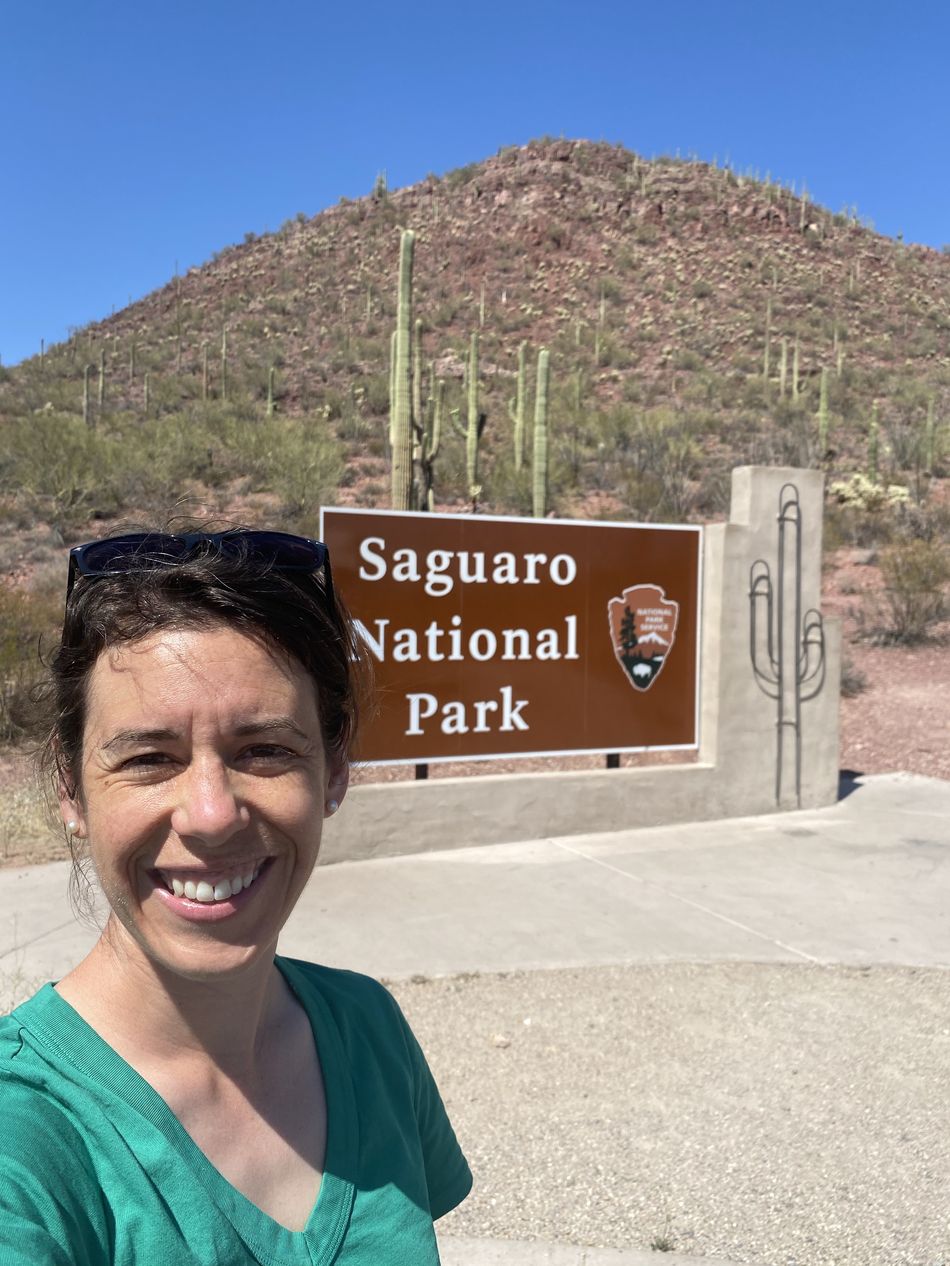
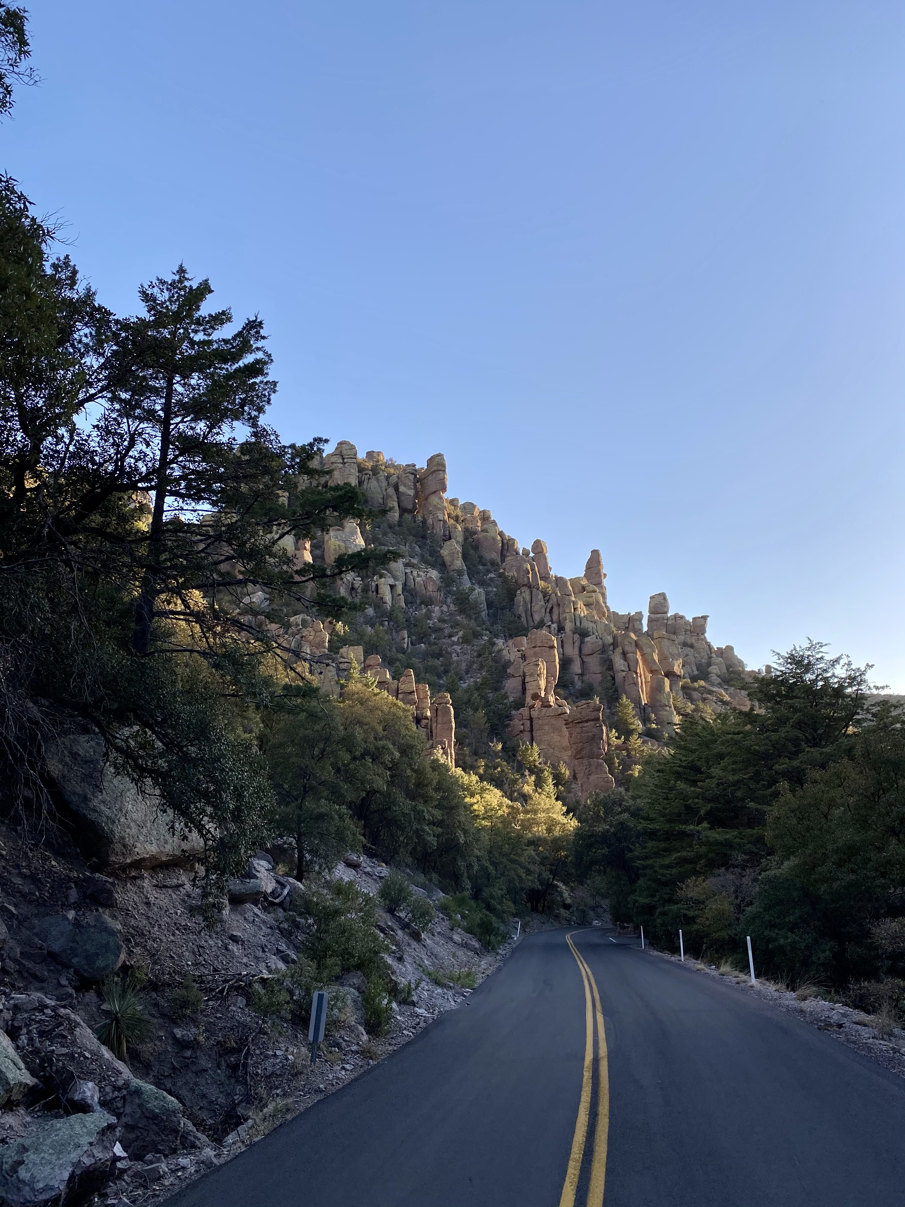
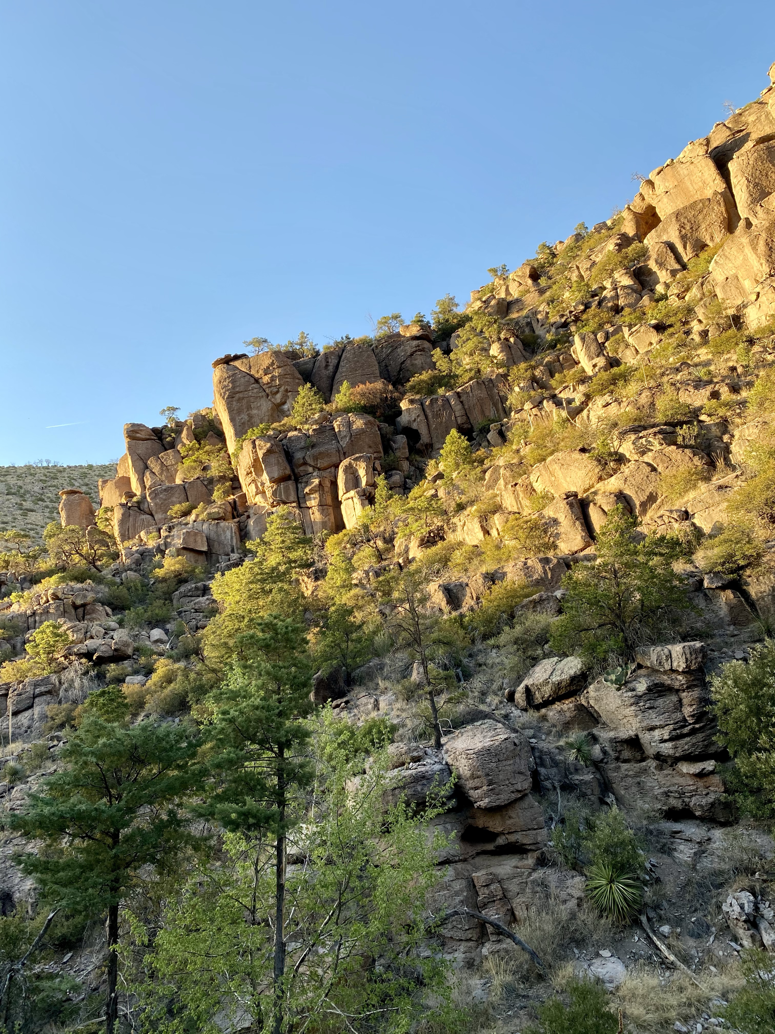
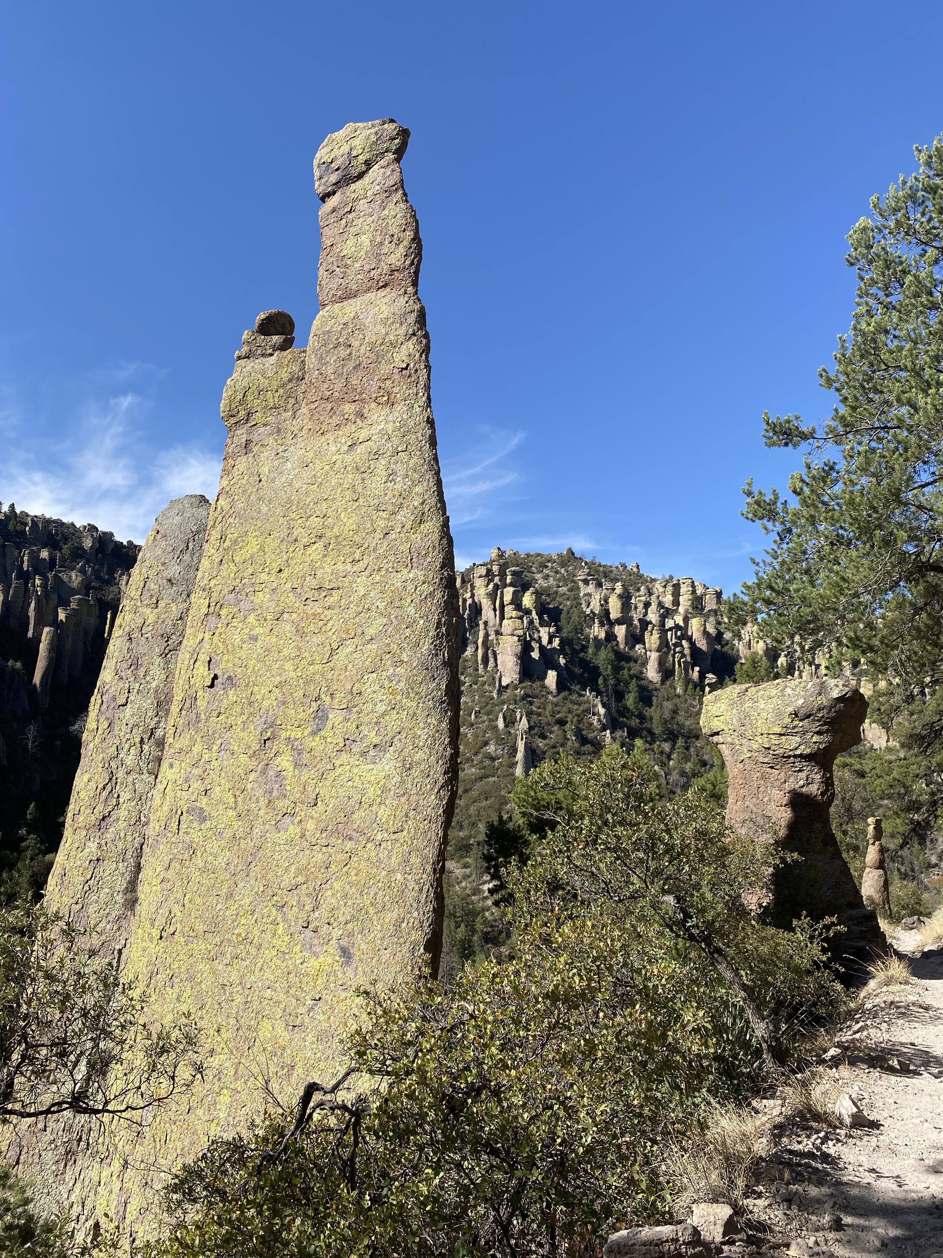
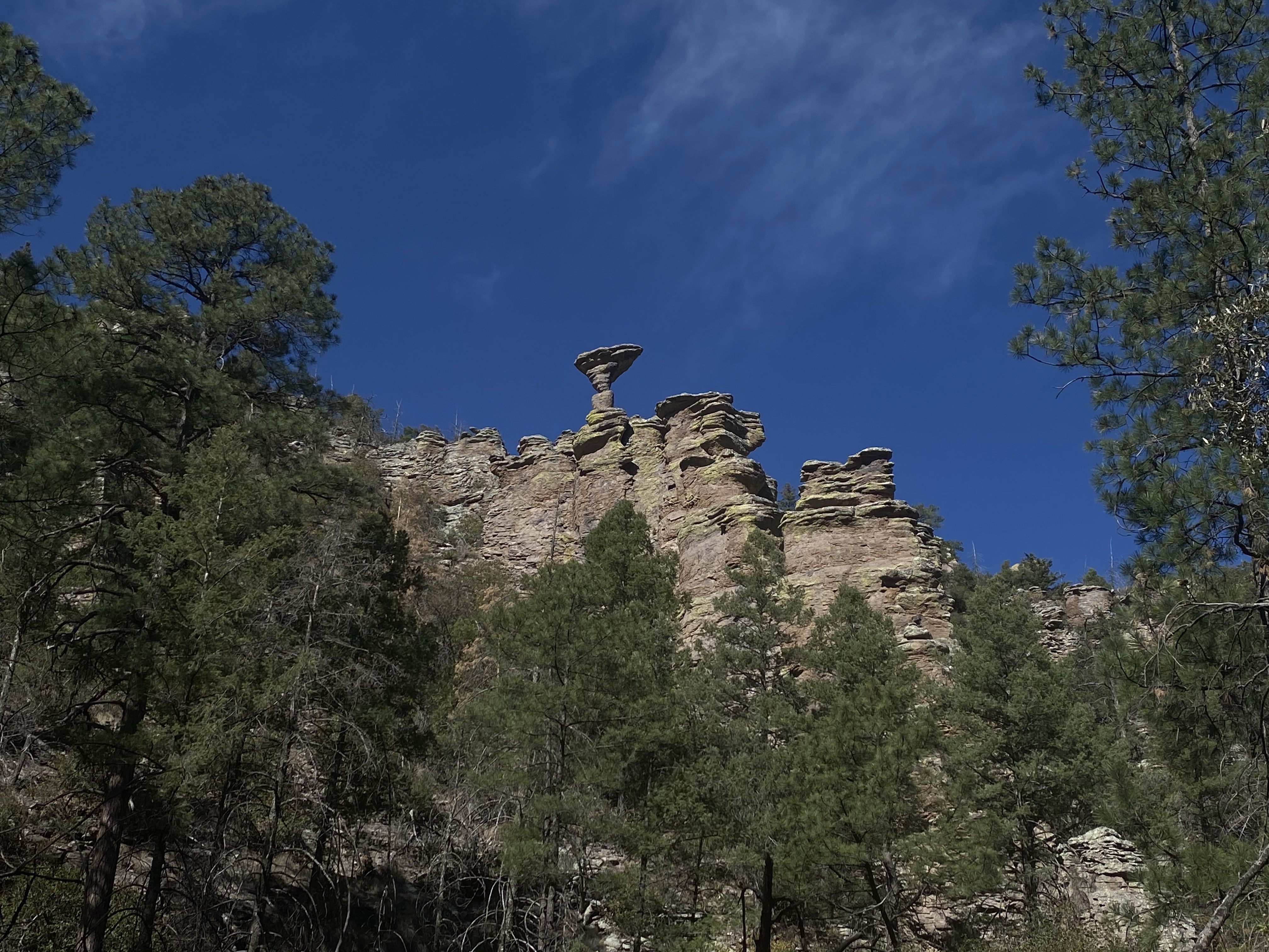
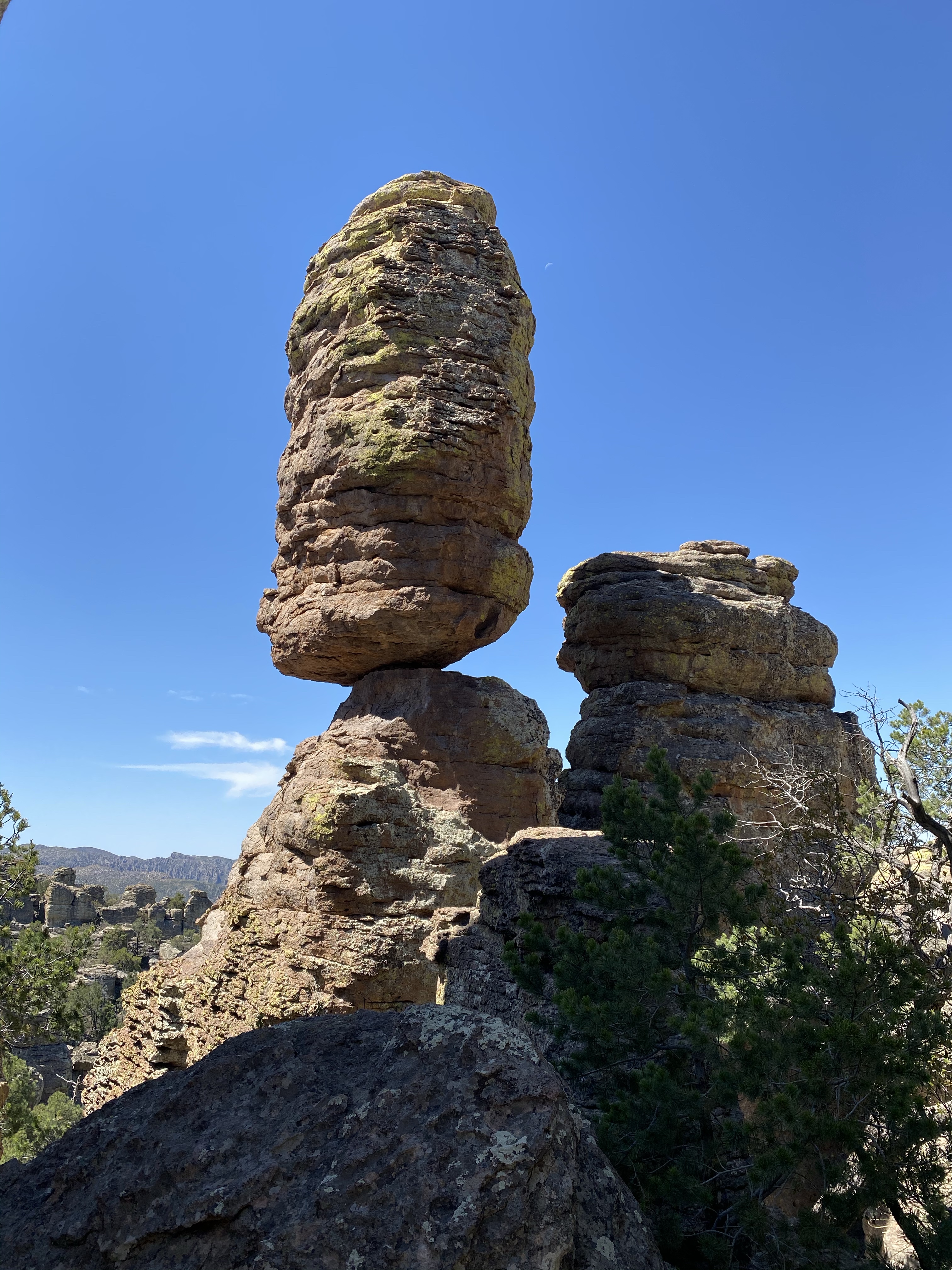
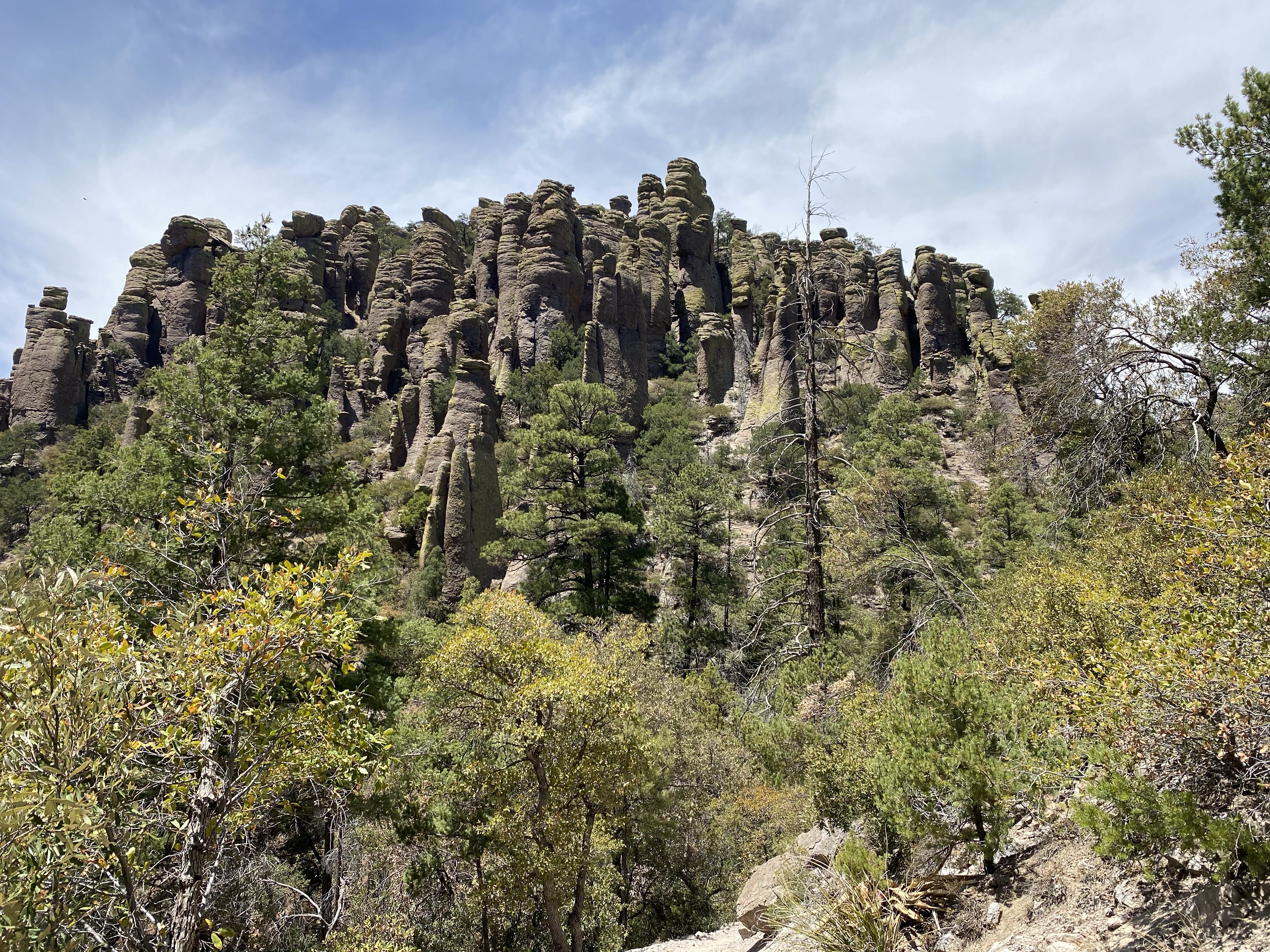
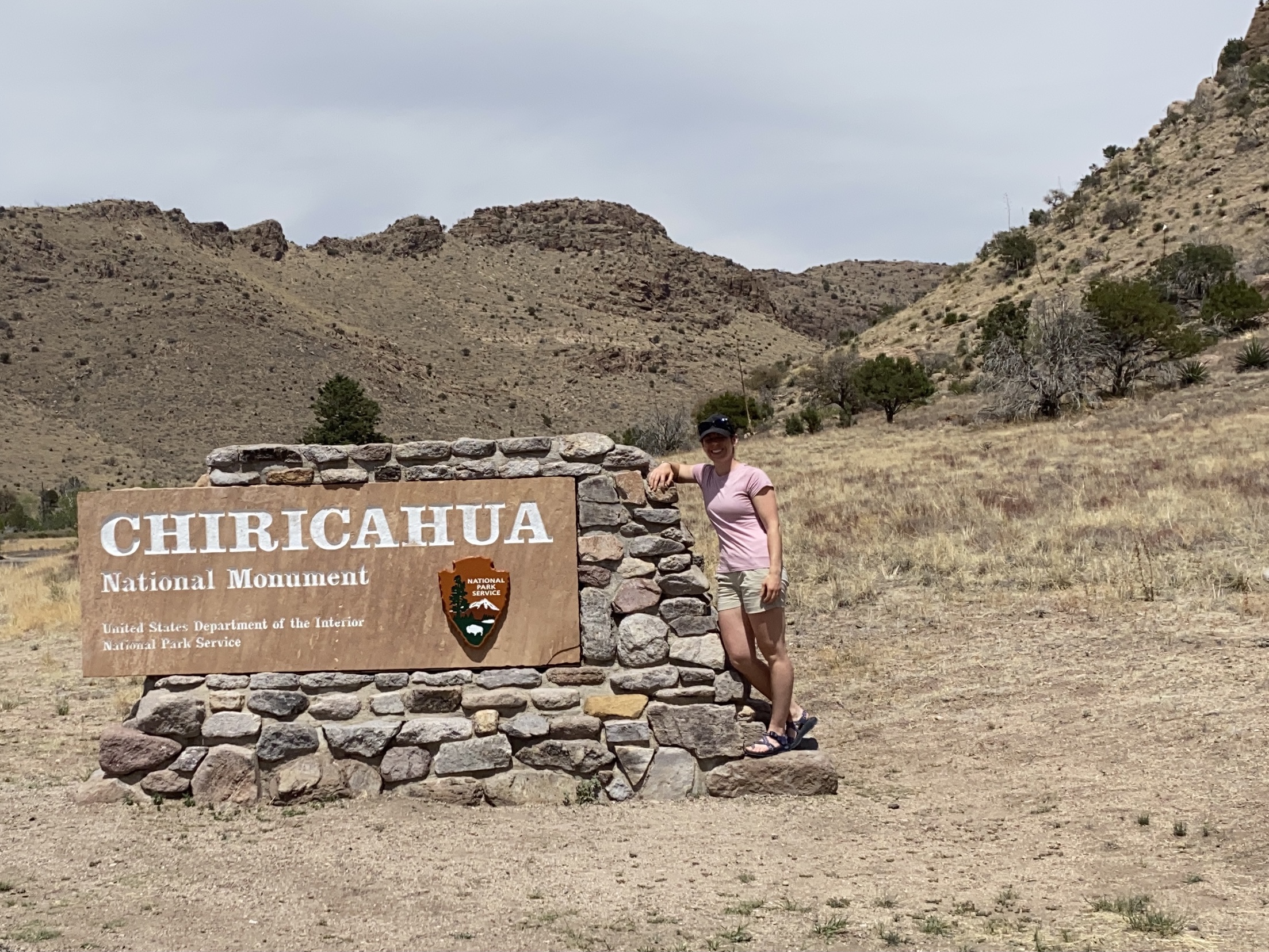
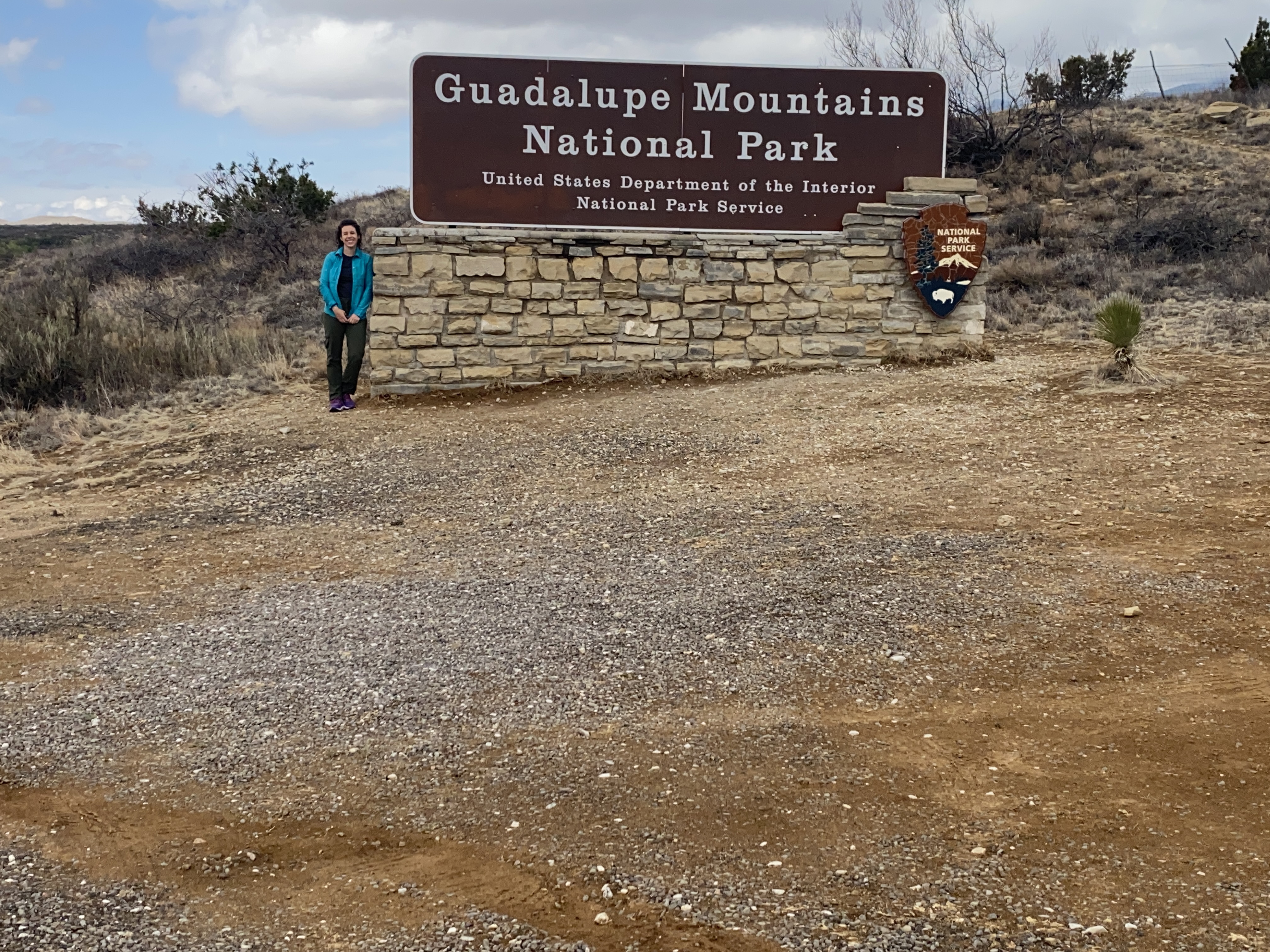
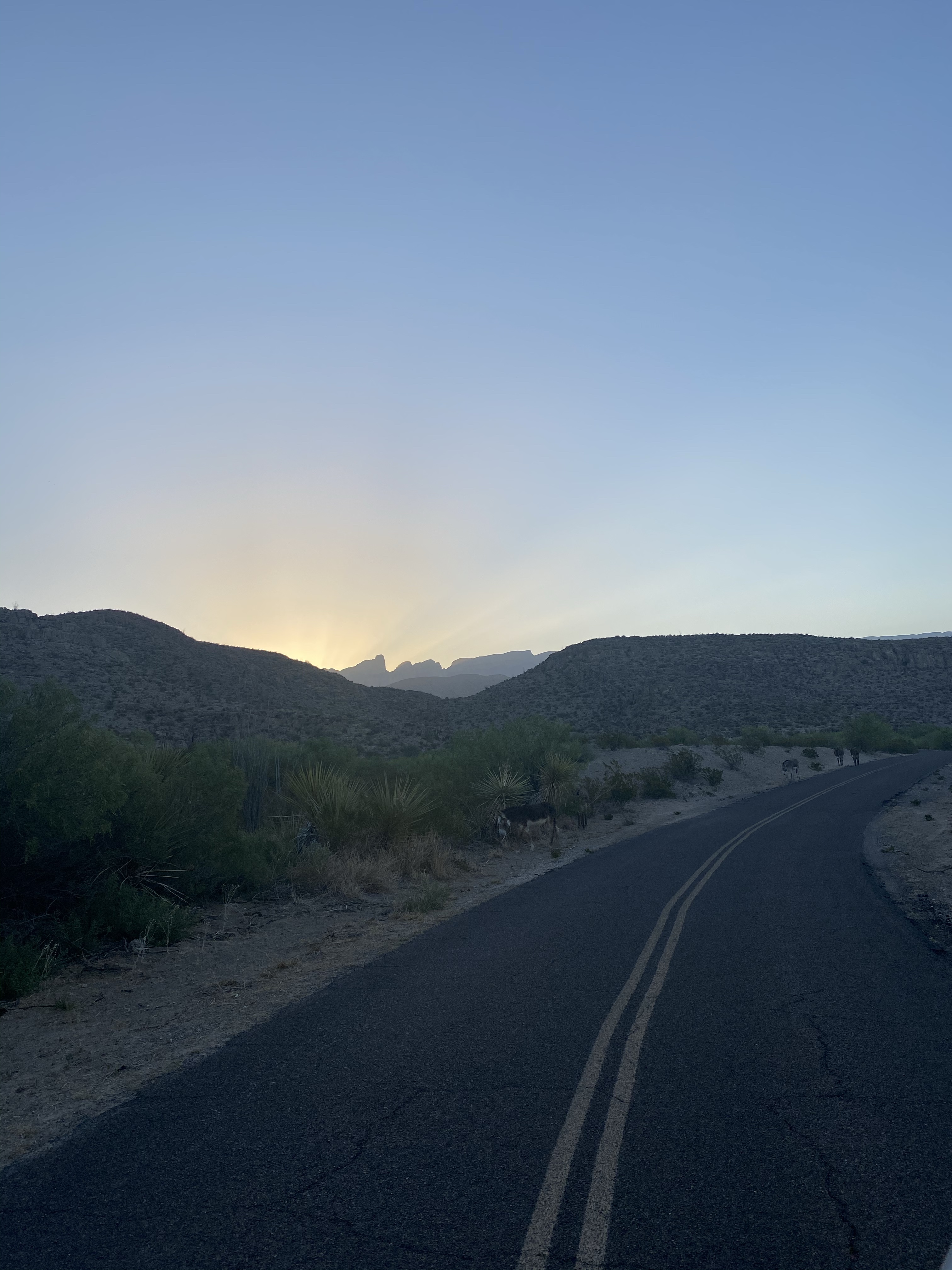
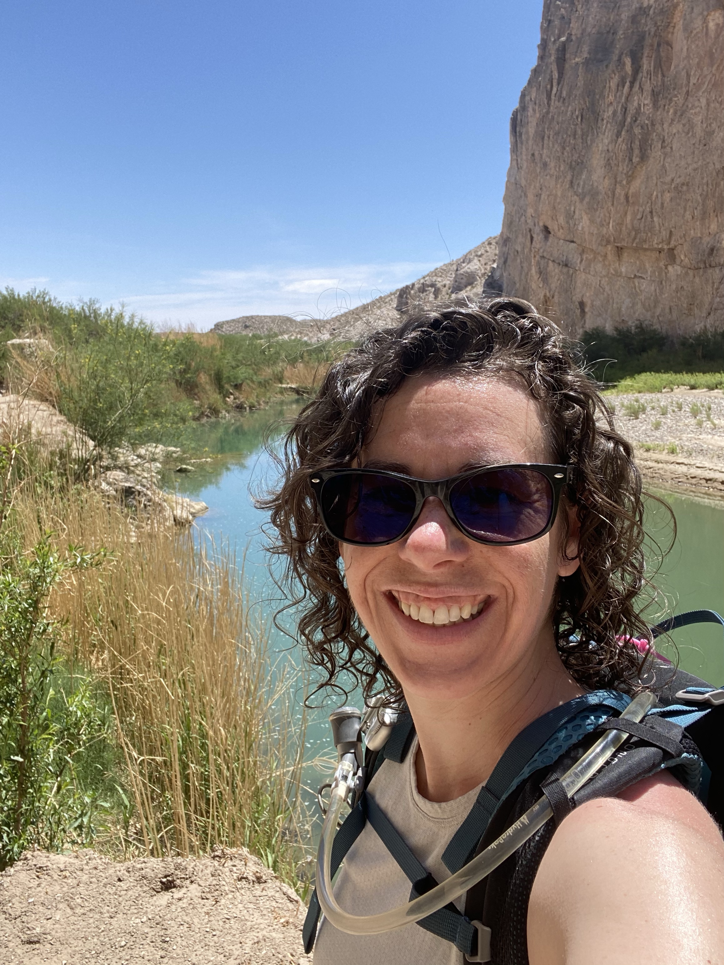
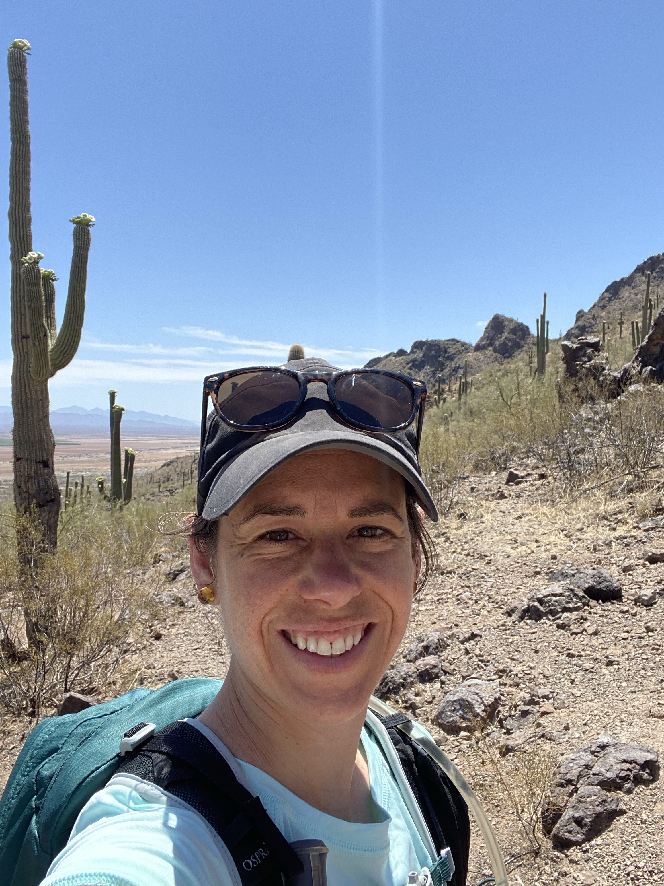
Arizona is bursting with beautiful state parks and I had the good fortune of visiting Picacho Peak. Shout out to my new friend Crystal for the recommendation. Surely a park to visit if you are ever in Arizona, set on the native land of the O’odham tribes.

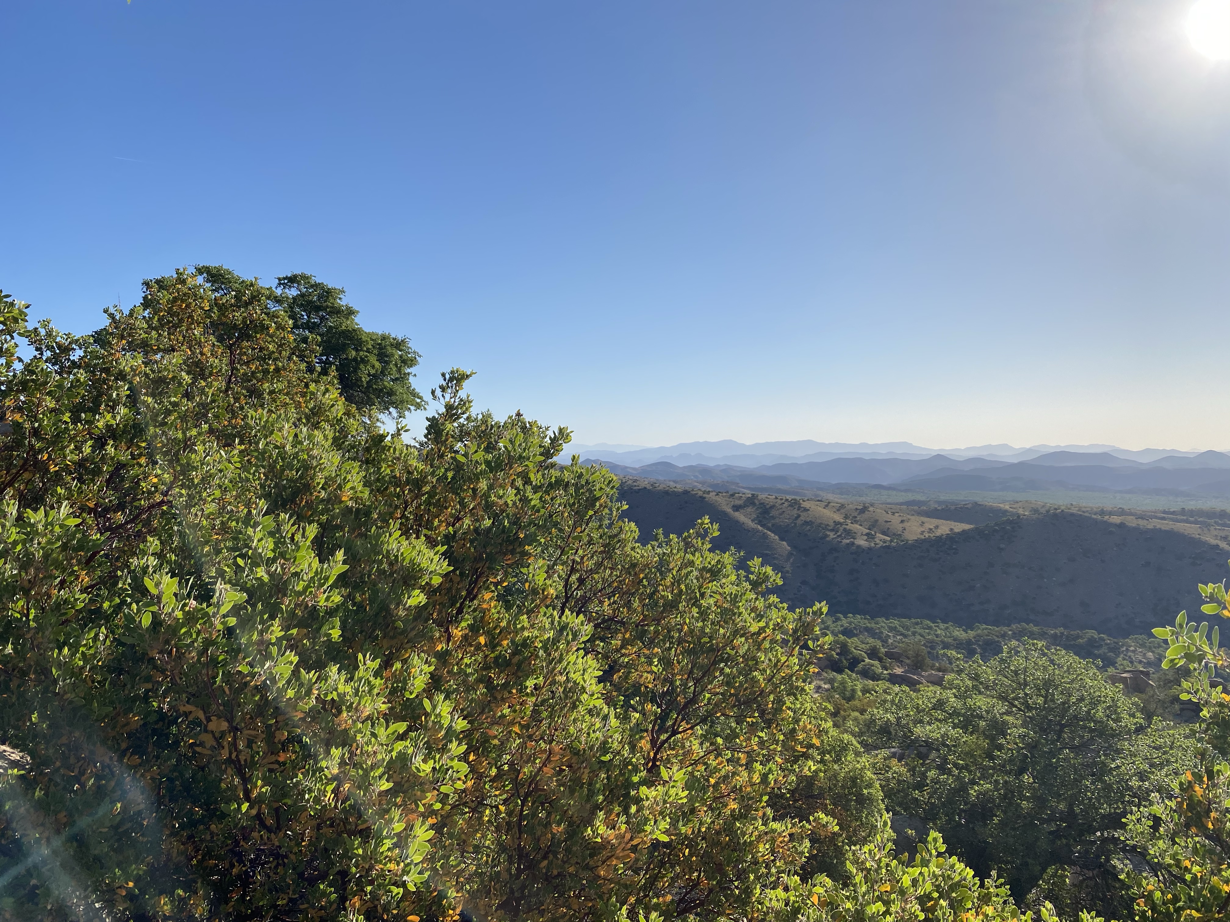
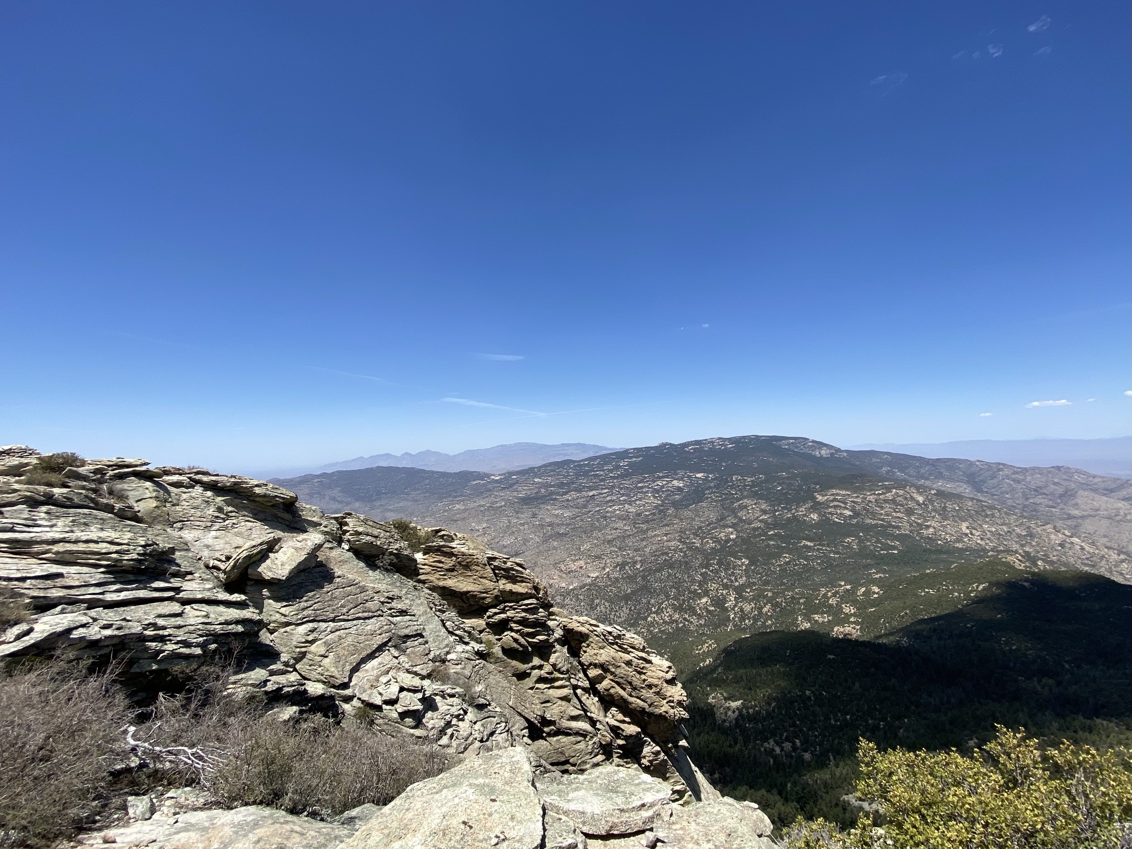
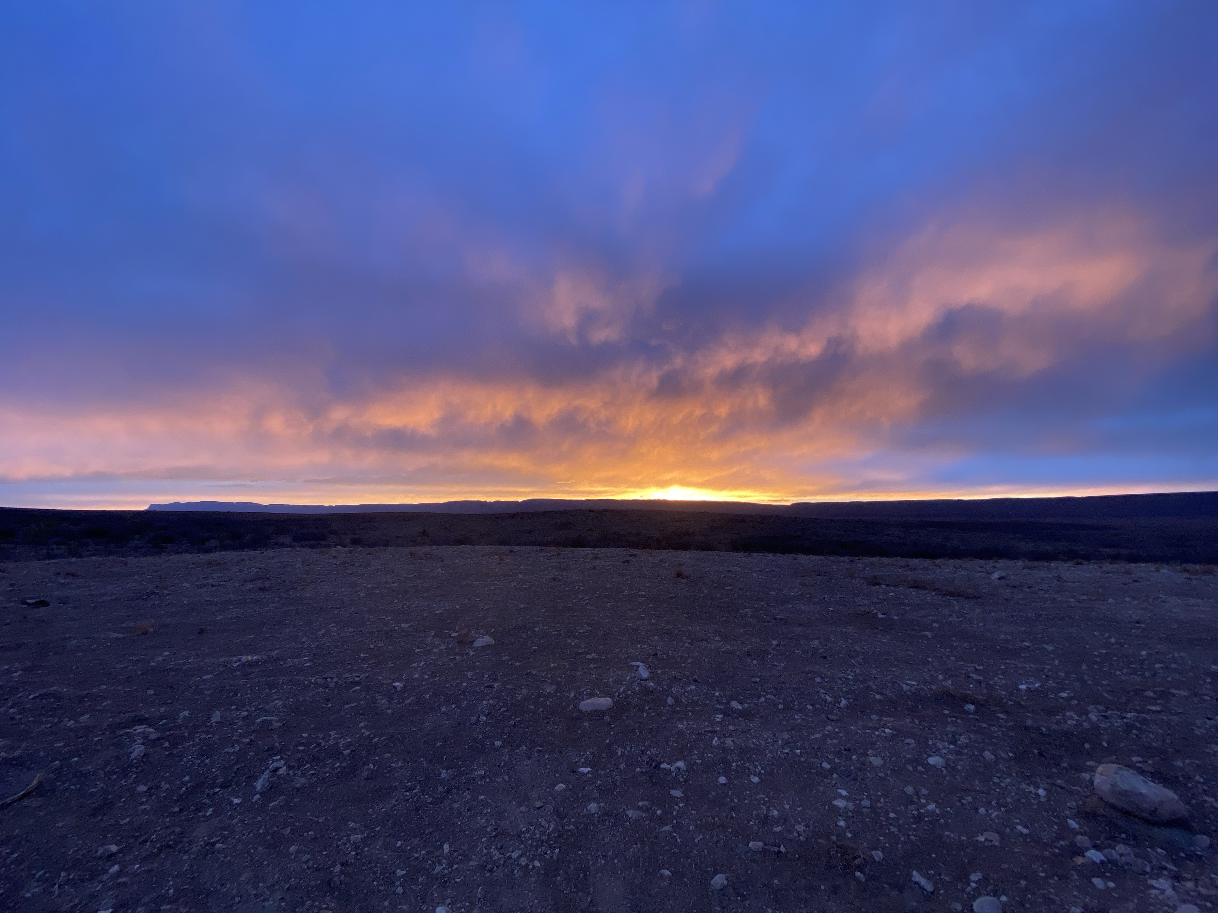
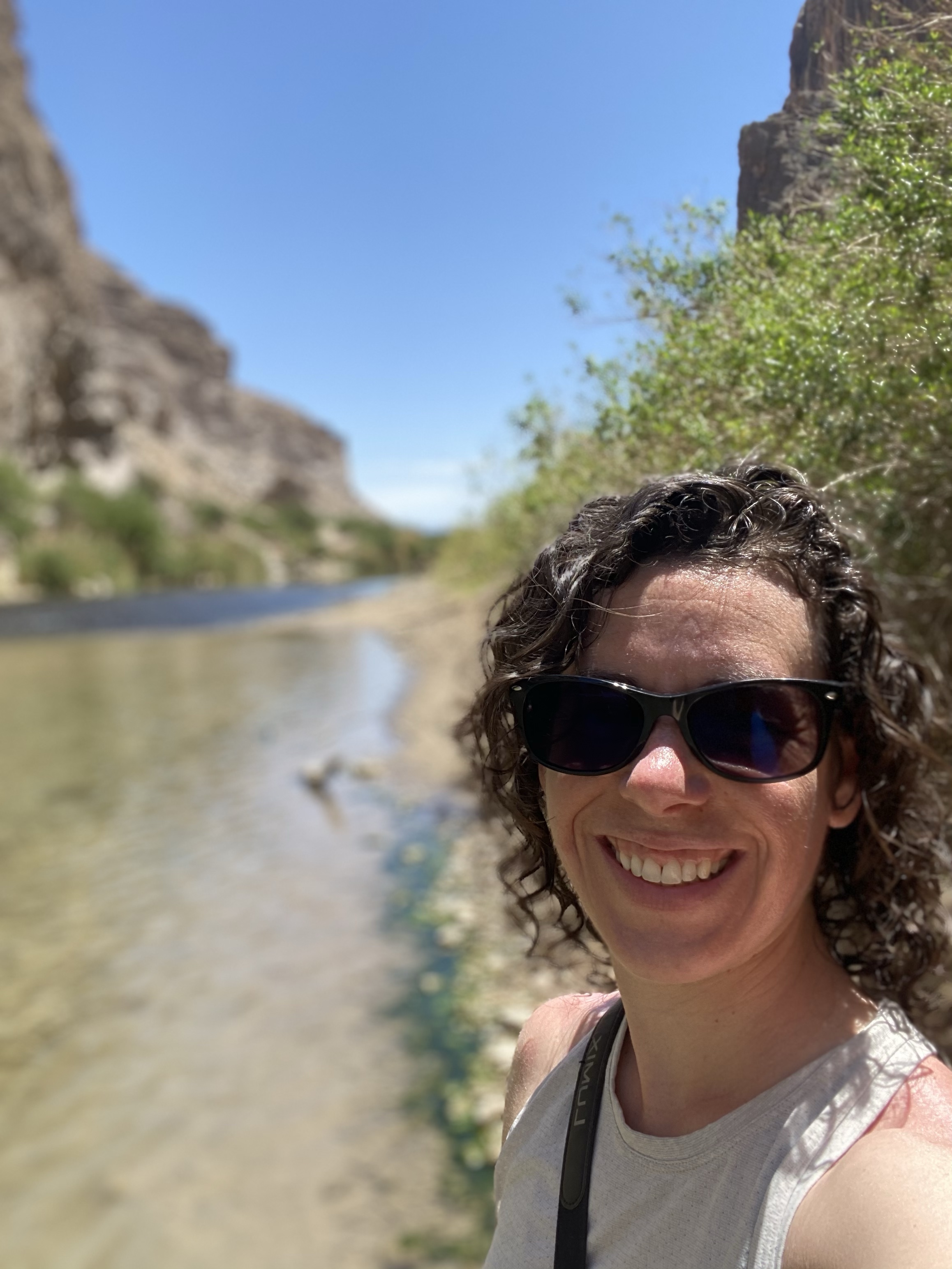
The afternoon I arrived was still sun filled and toasty, but a slight breeze made moving about enjoyable. Exhausted from the climb up Rincon Peak, I promised myself I would take it easy. There is so much to see and do, sometimes it is hard to slow down. But when you slow down, you stumble upon beauty and reflection too. There can be excitement in going slow as well.

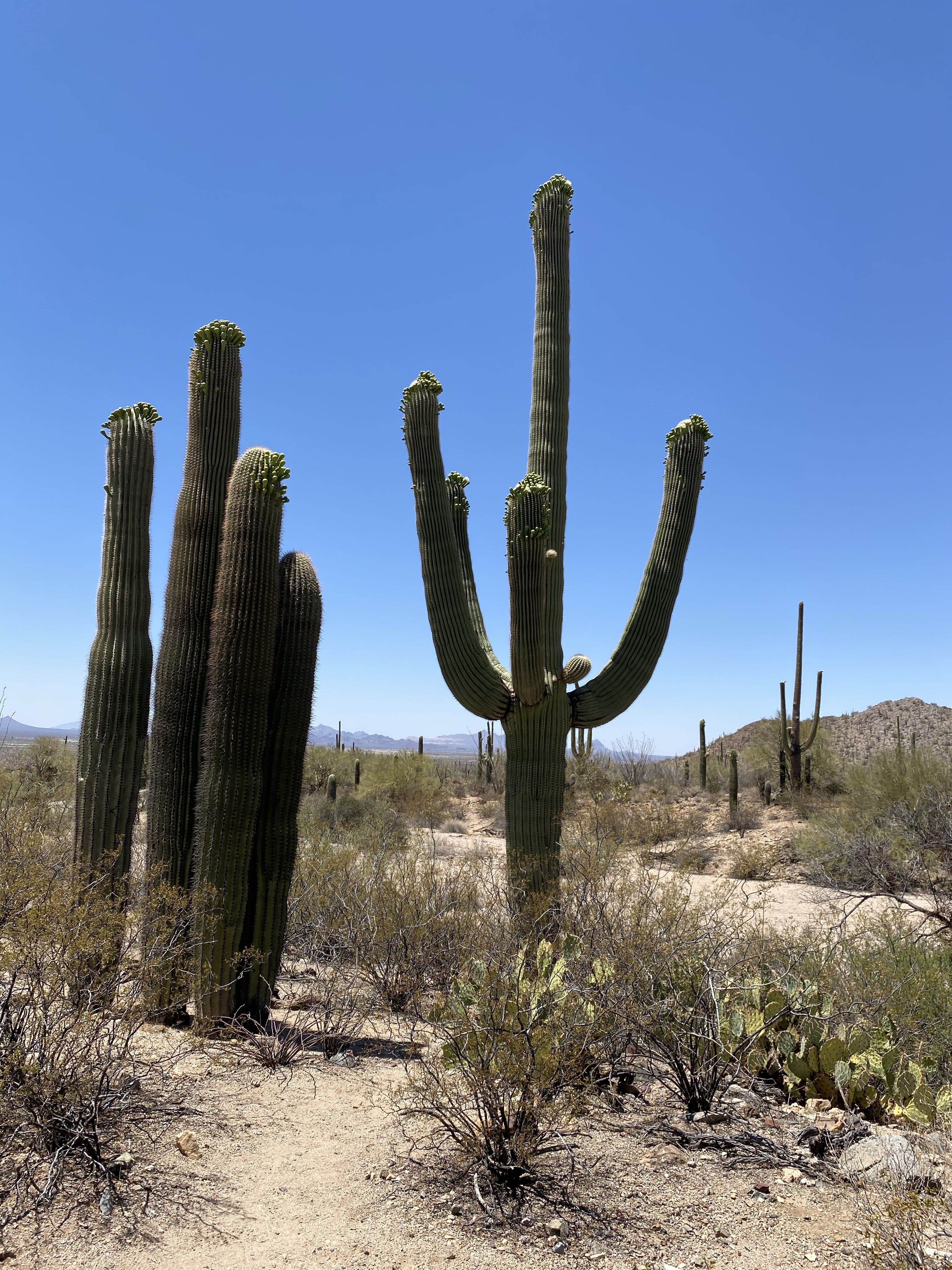
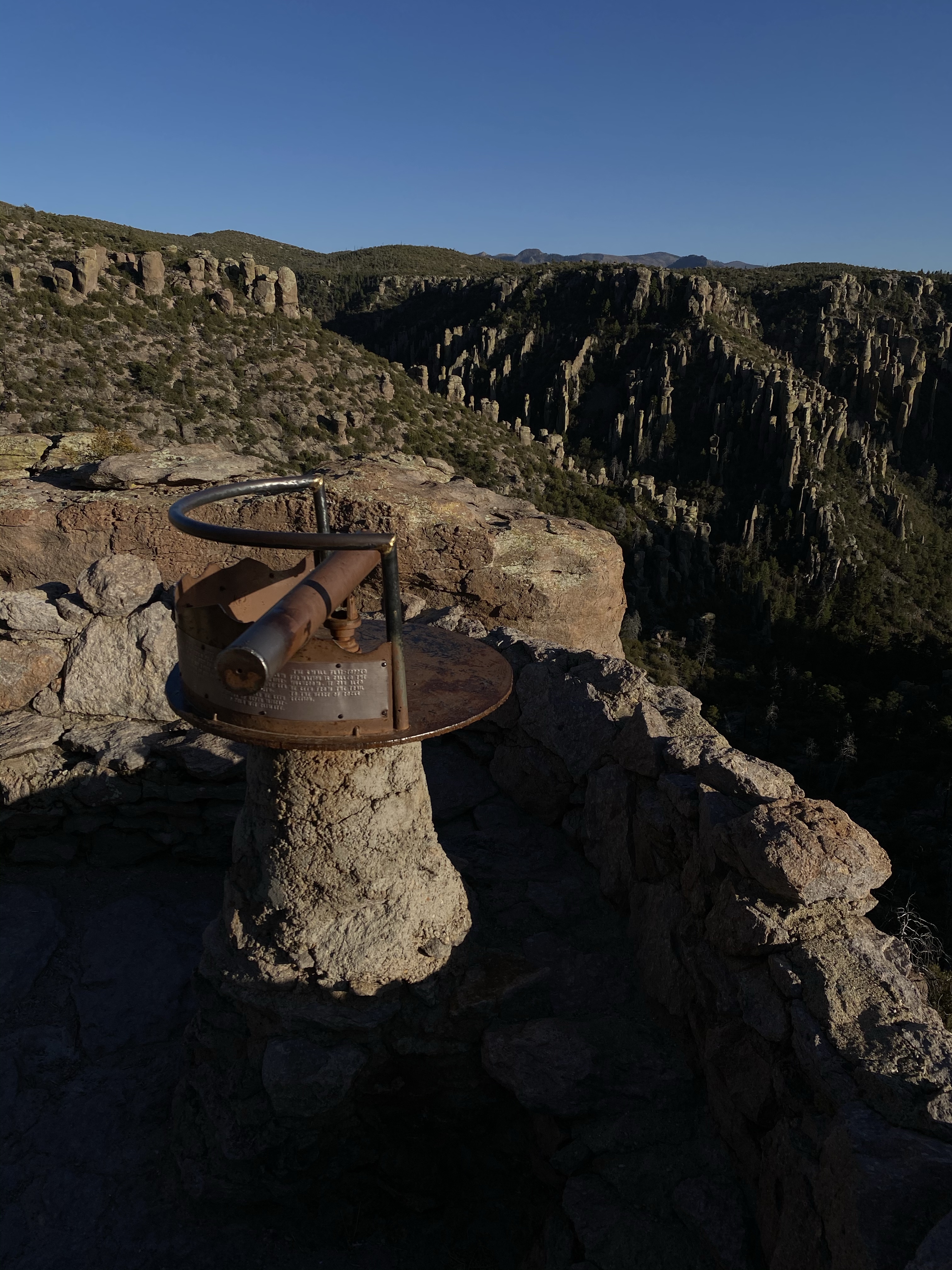
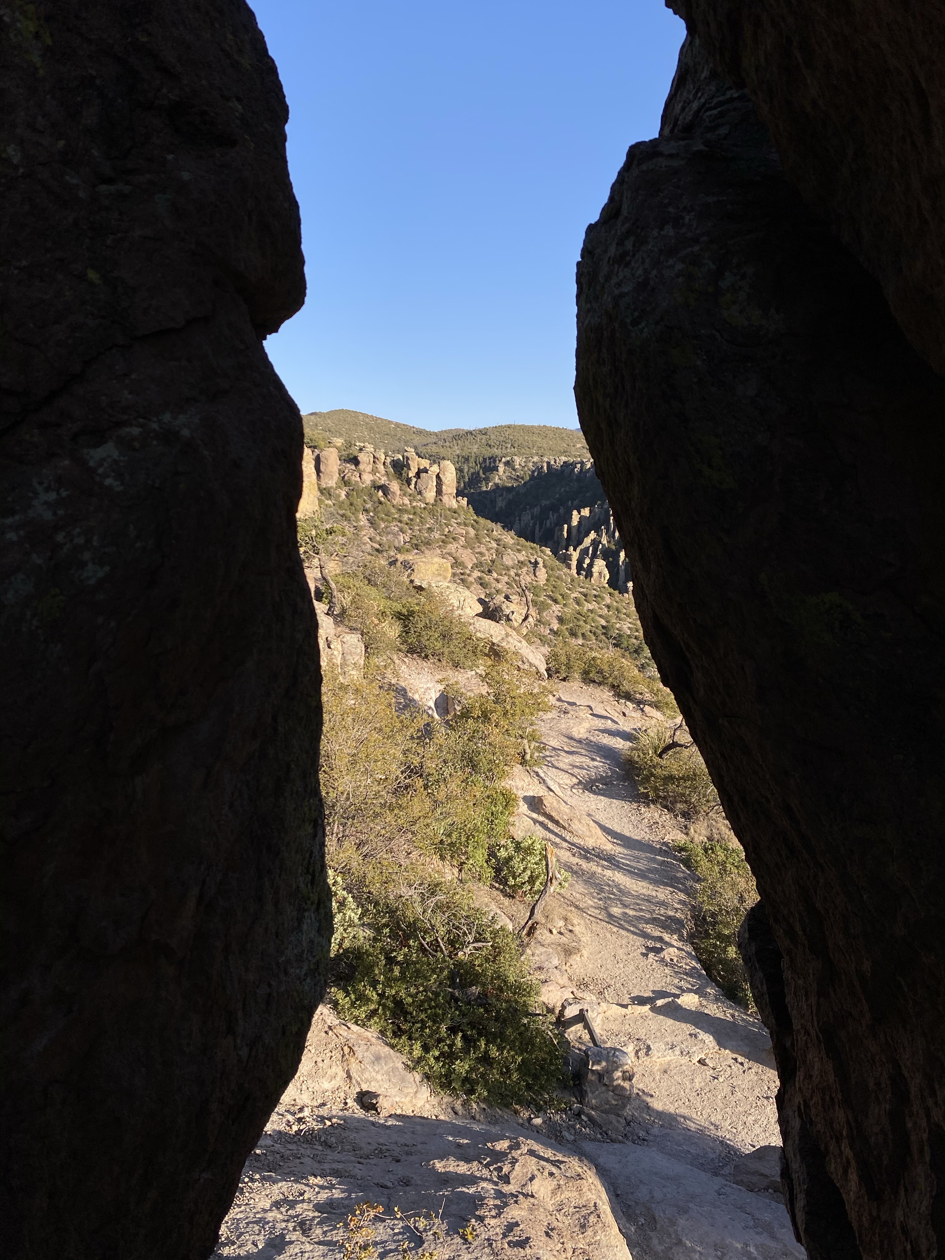
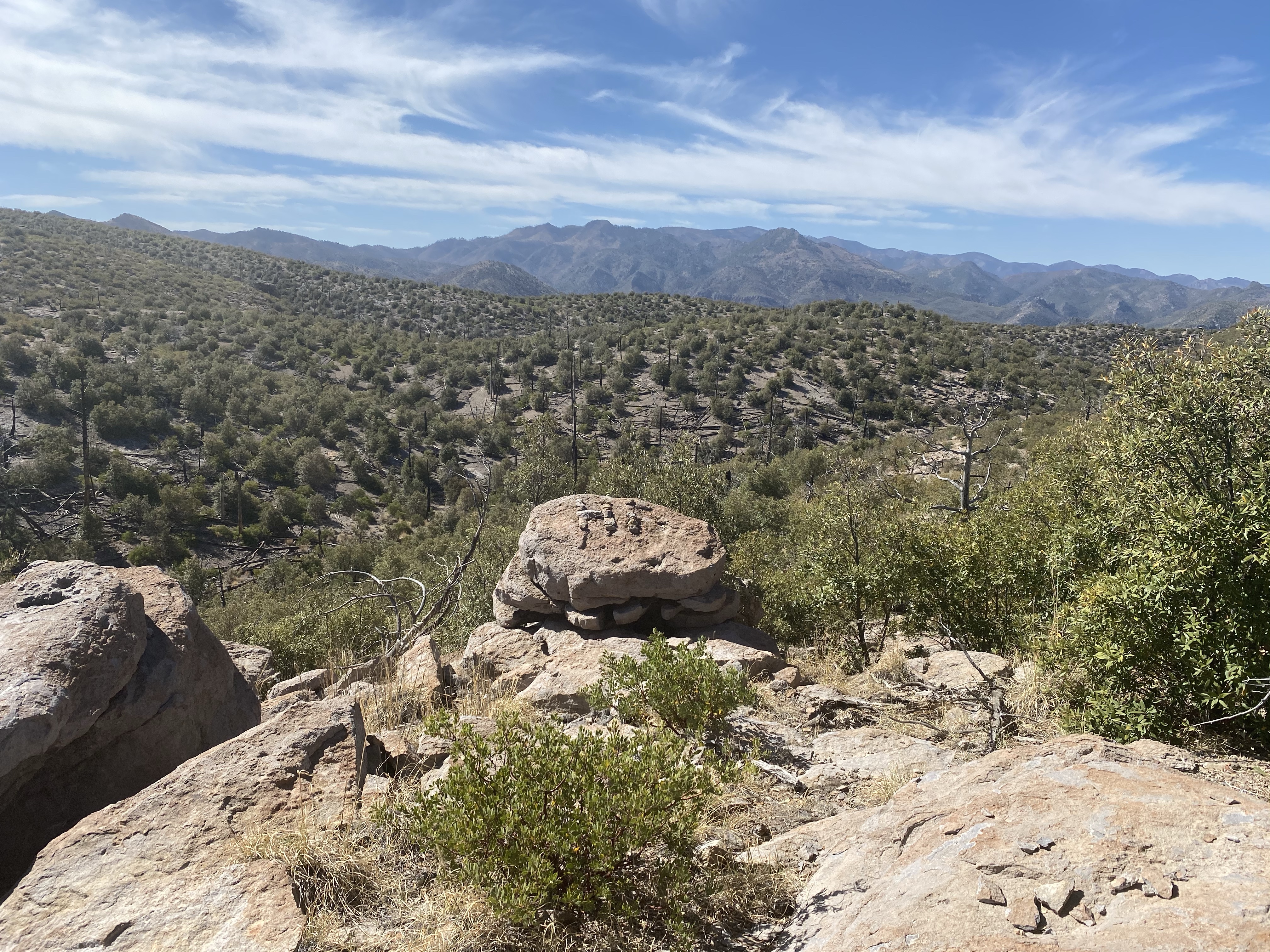
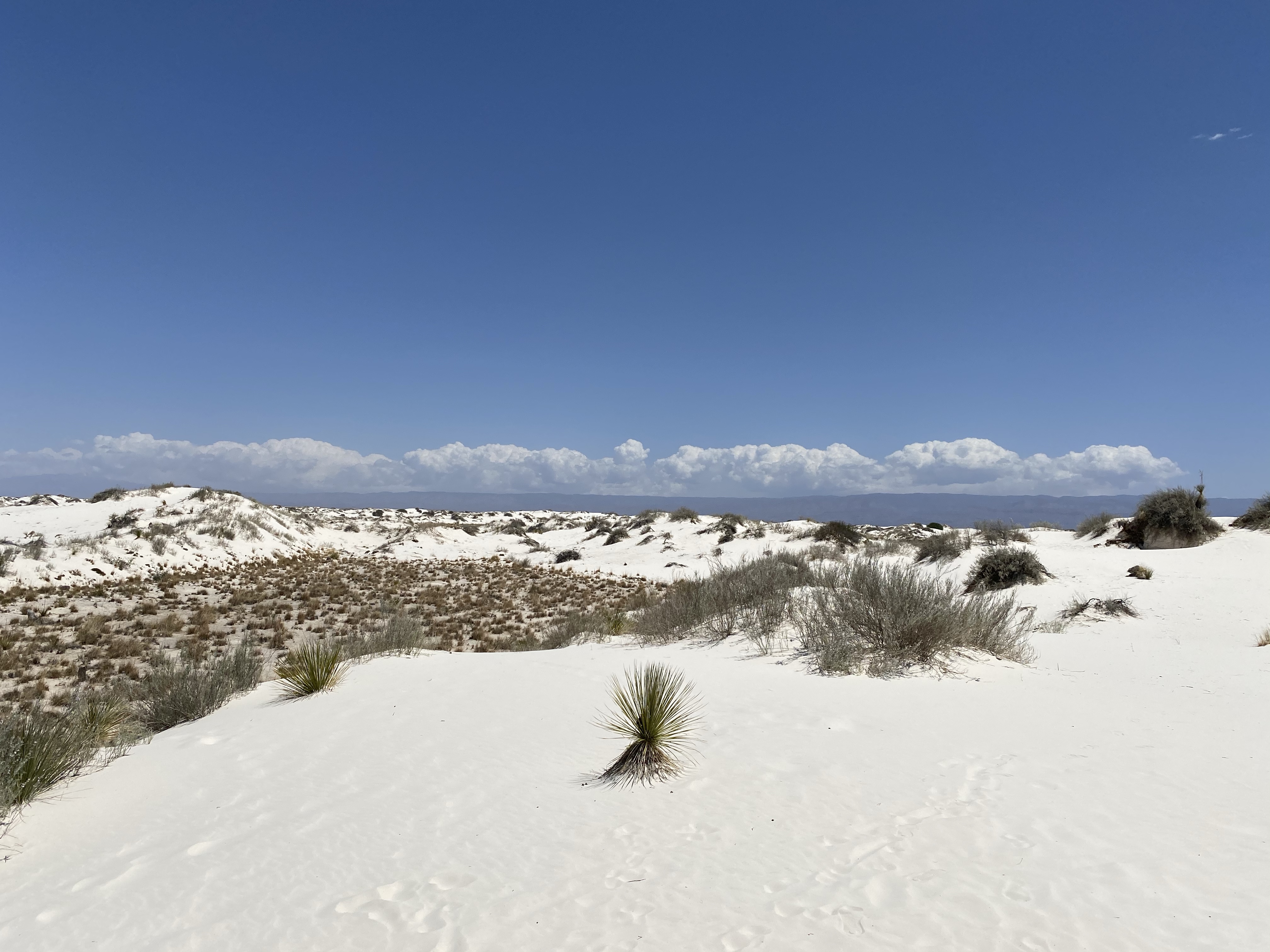
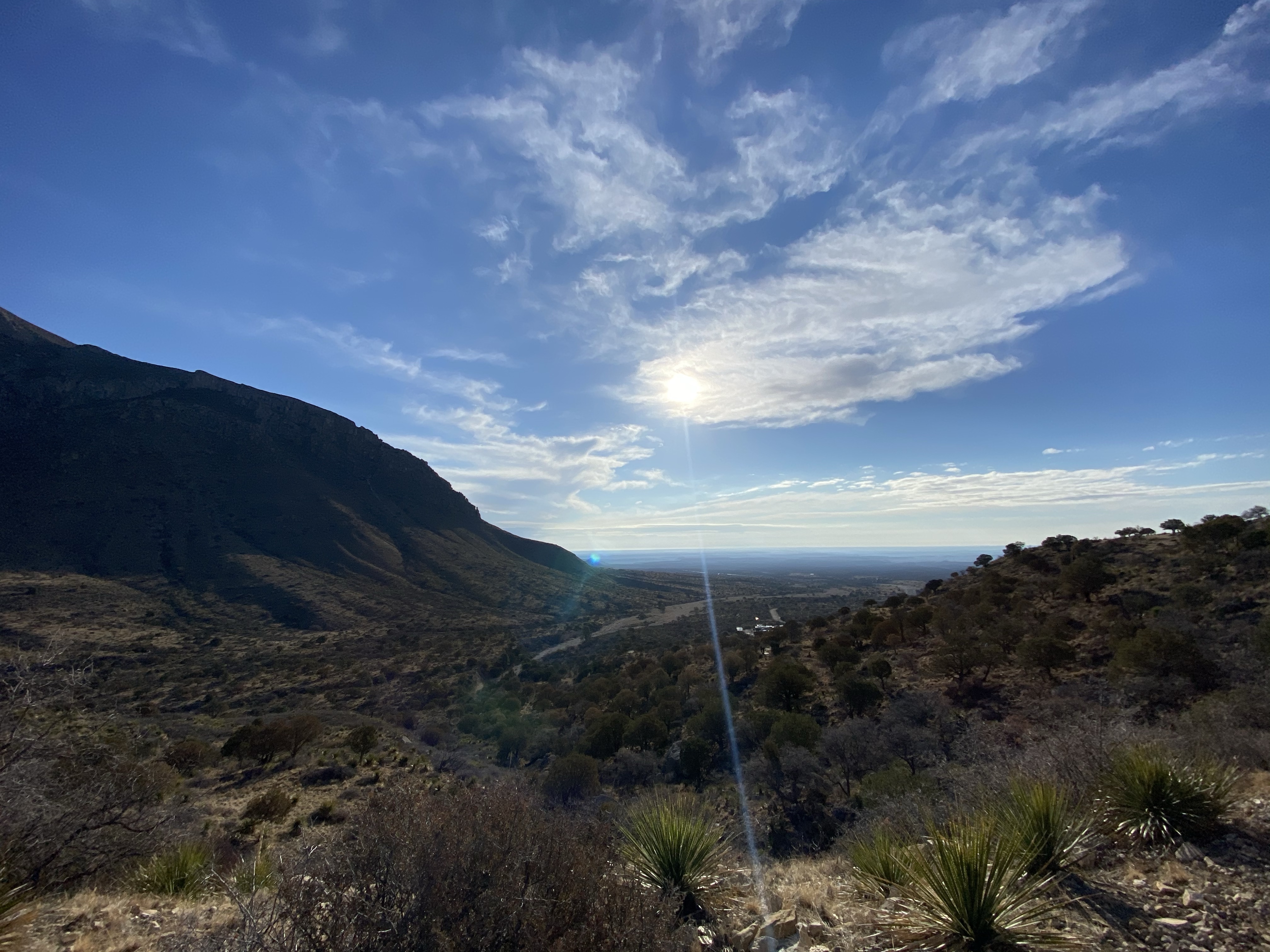
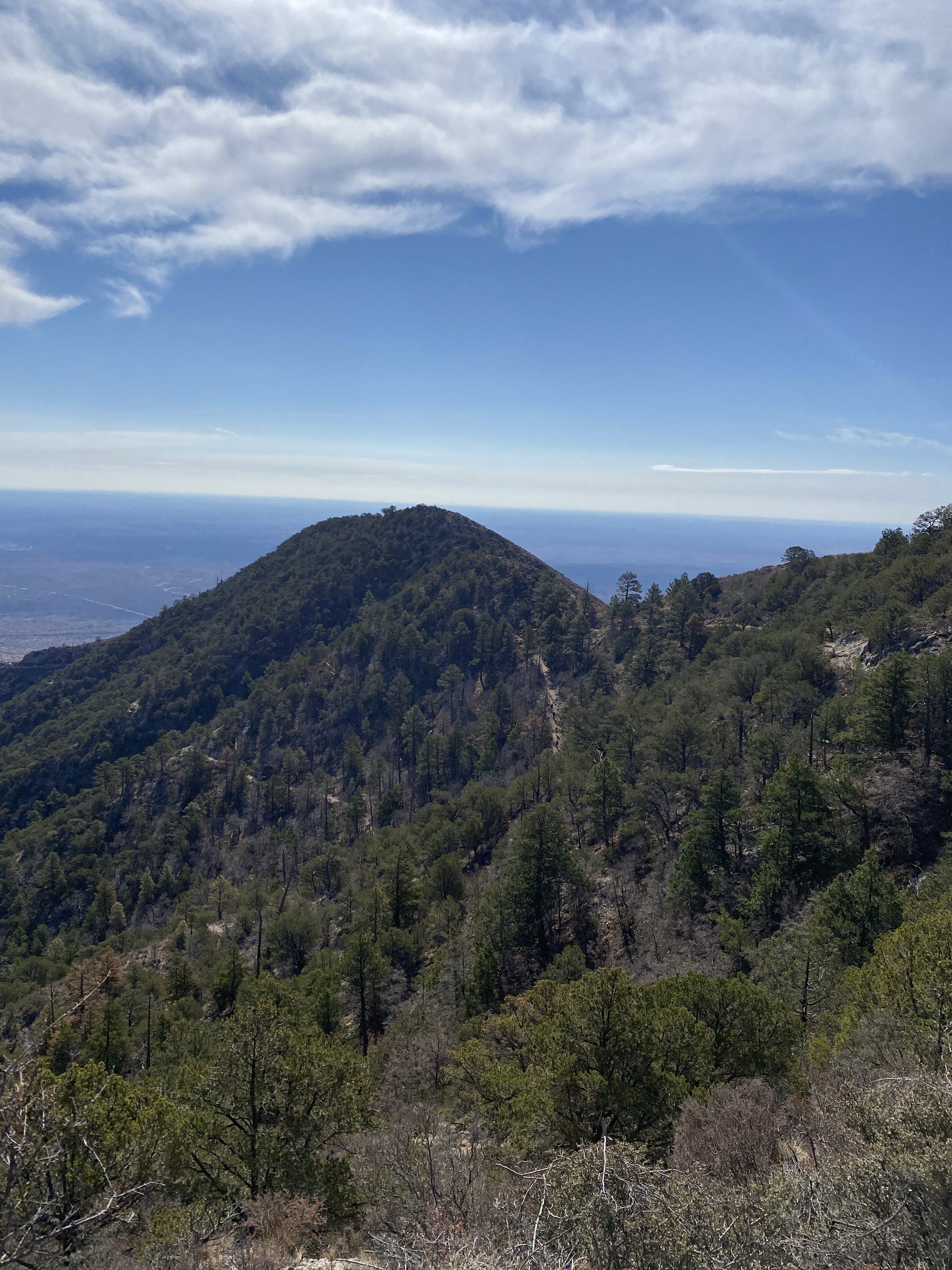
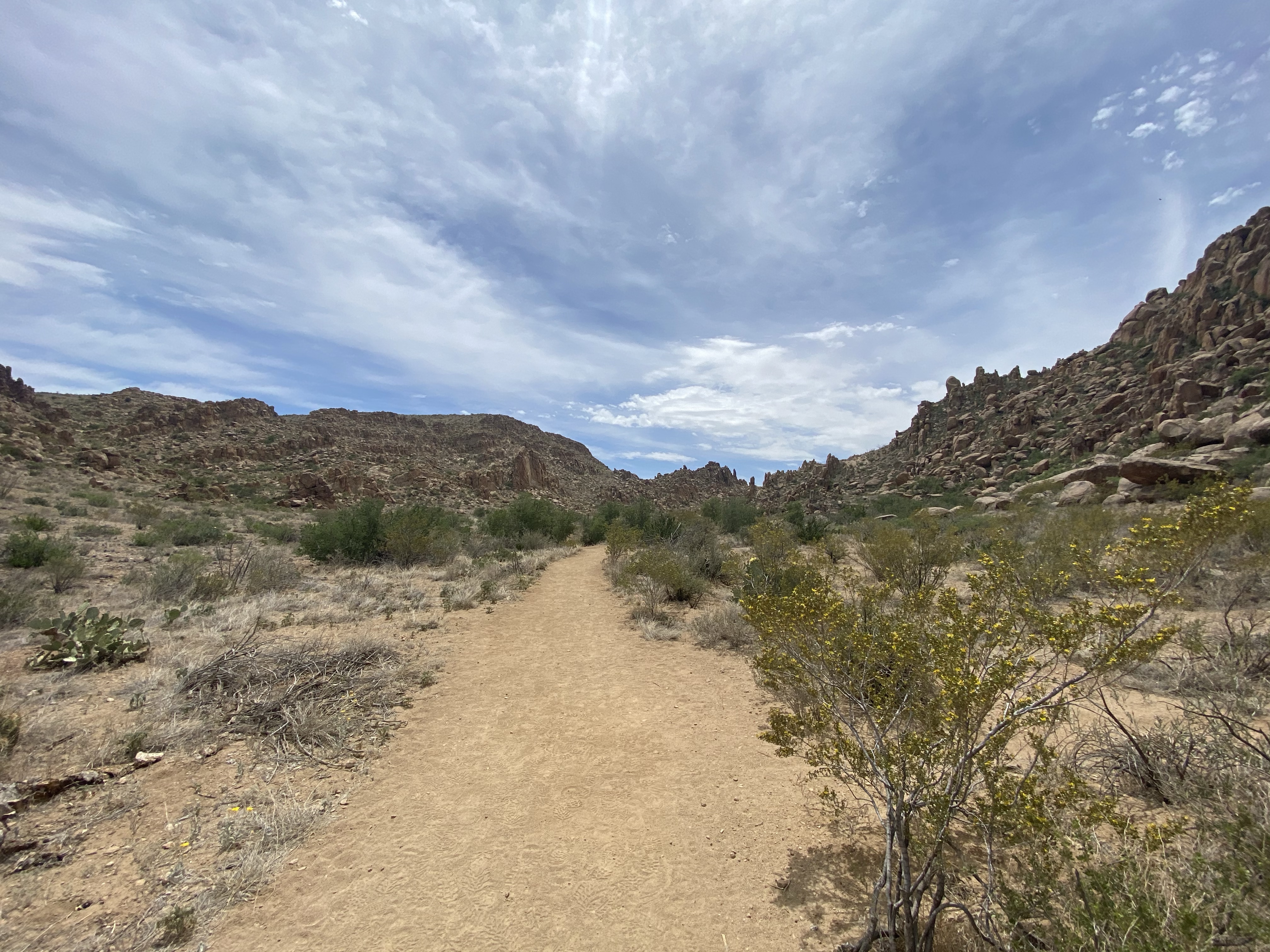
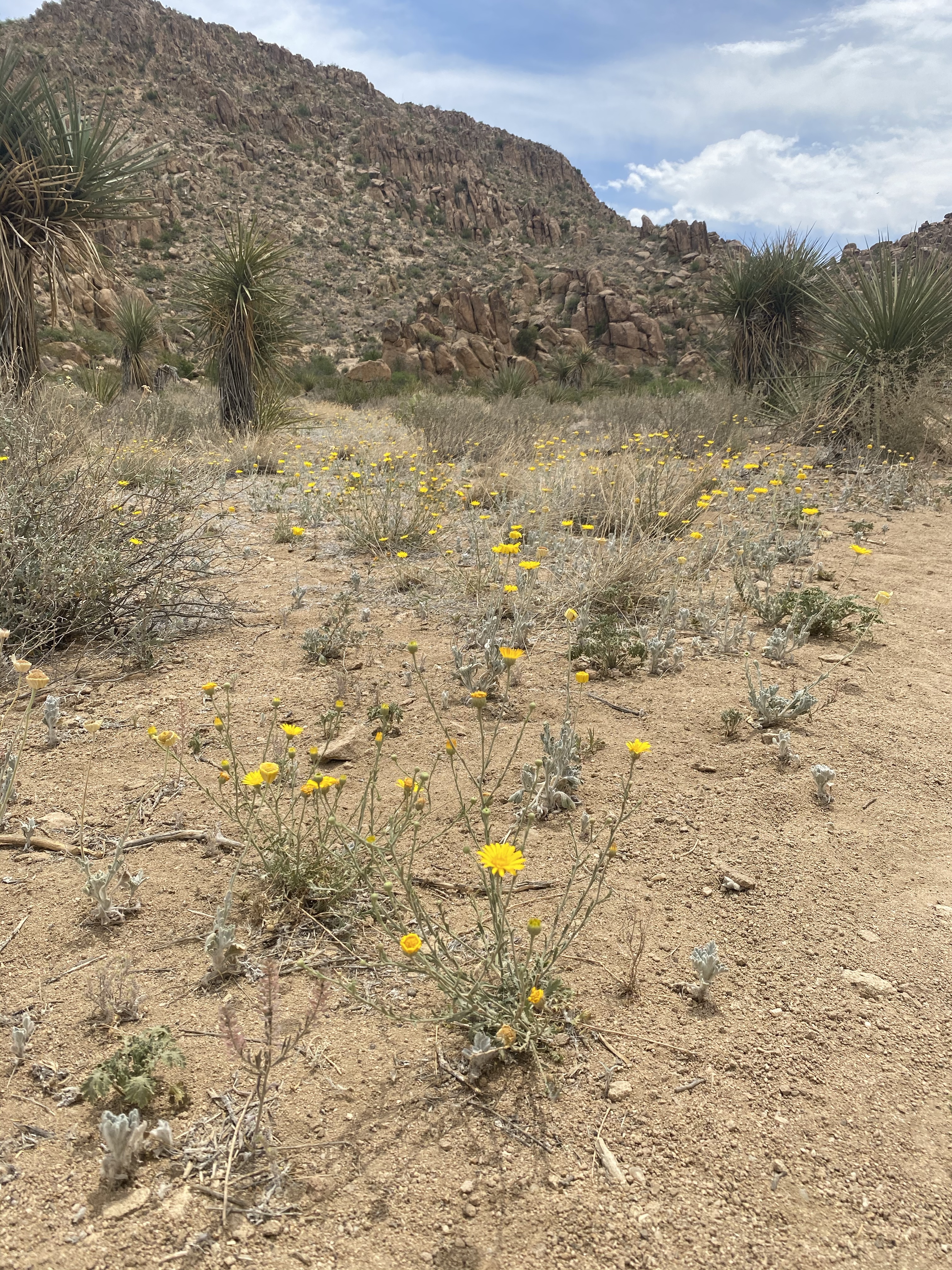
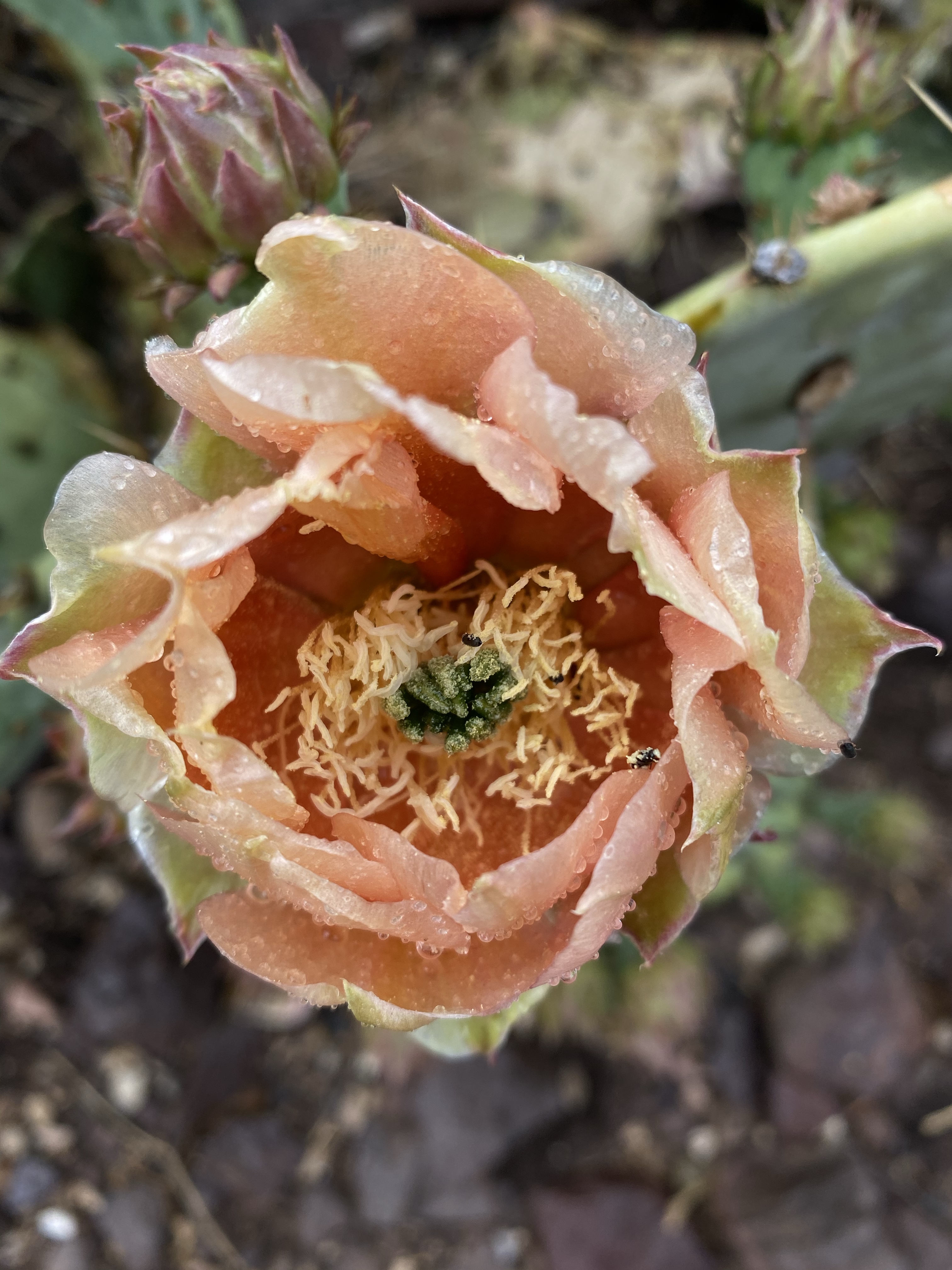
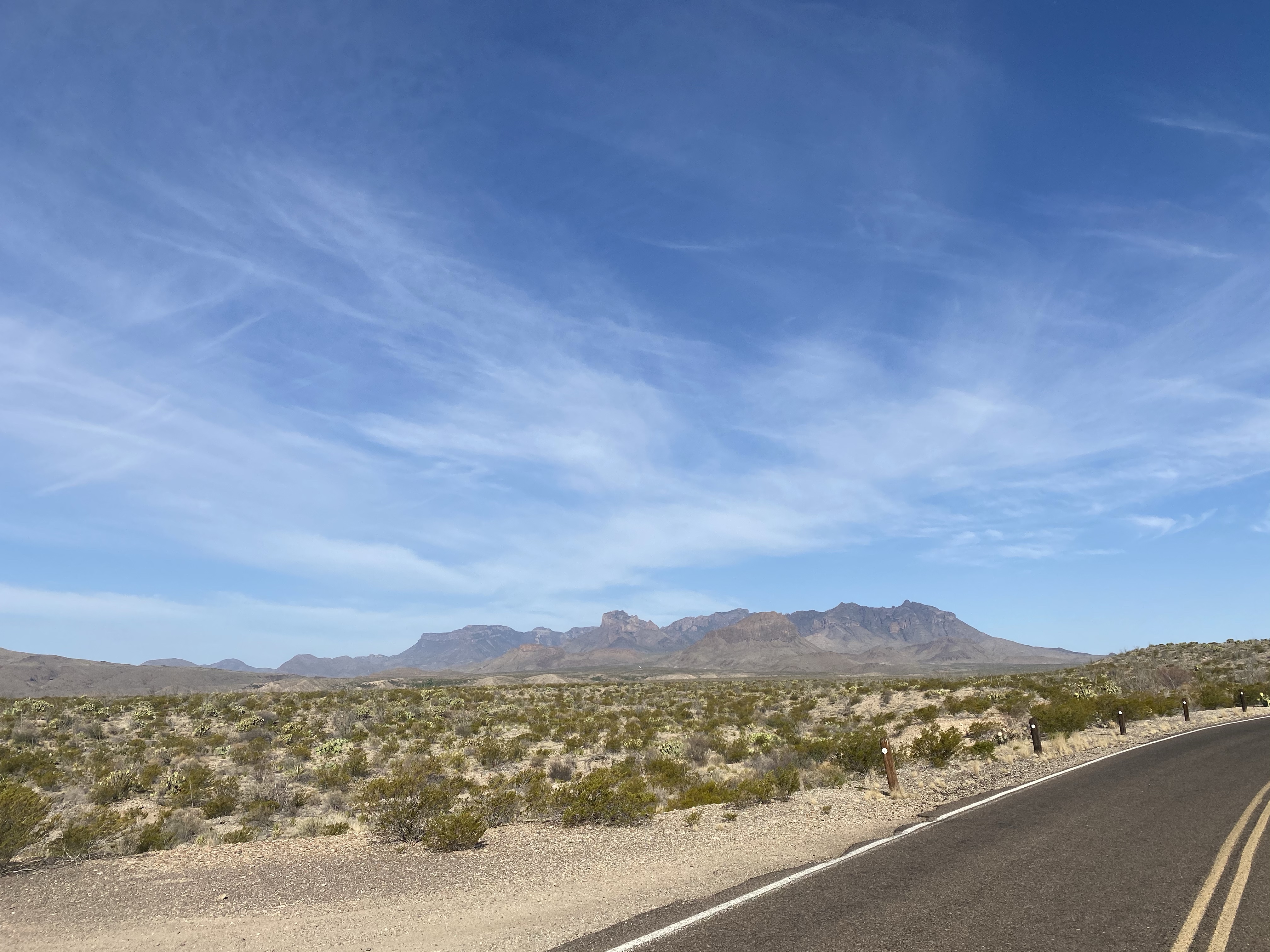
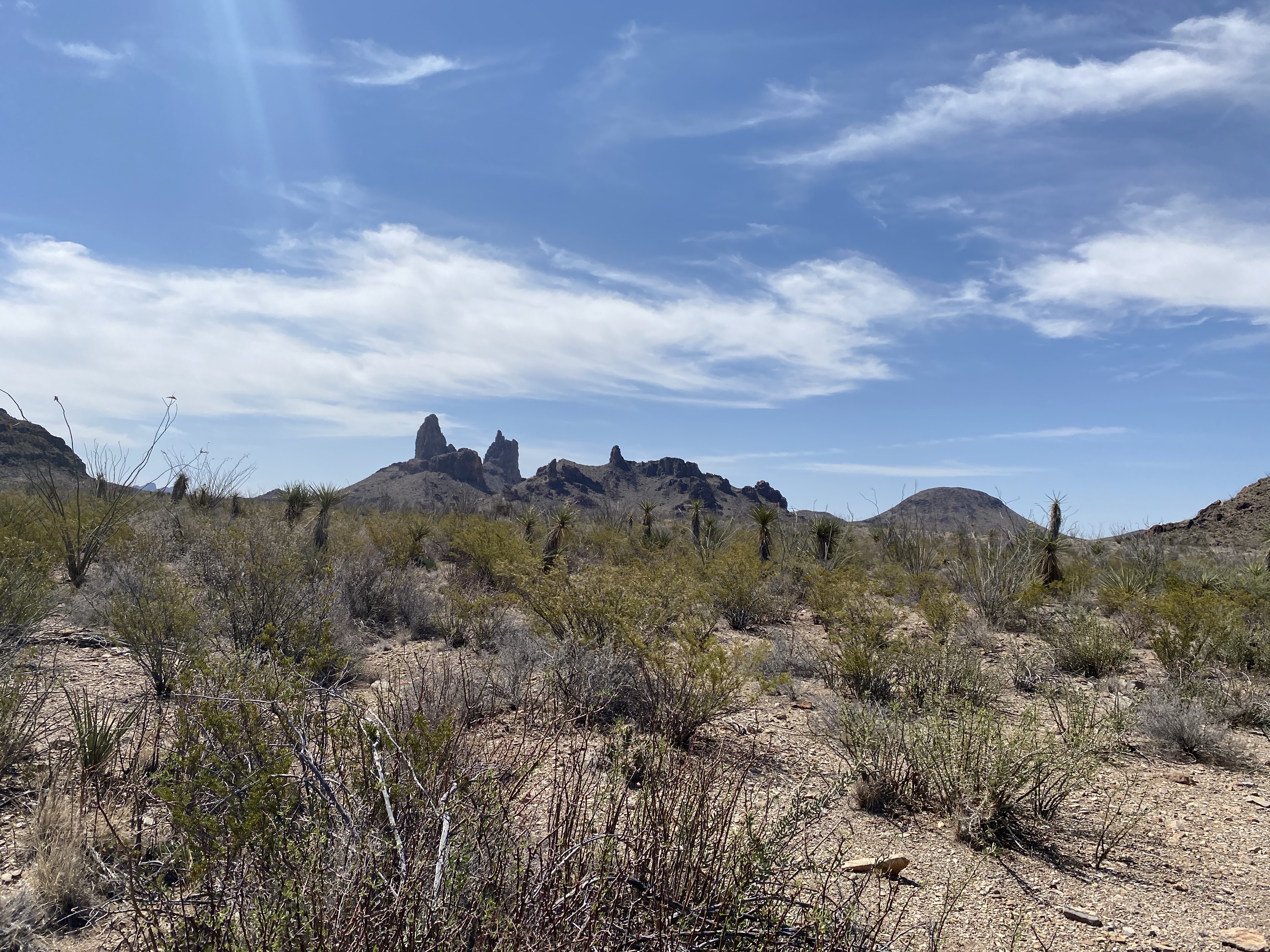
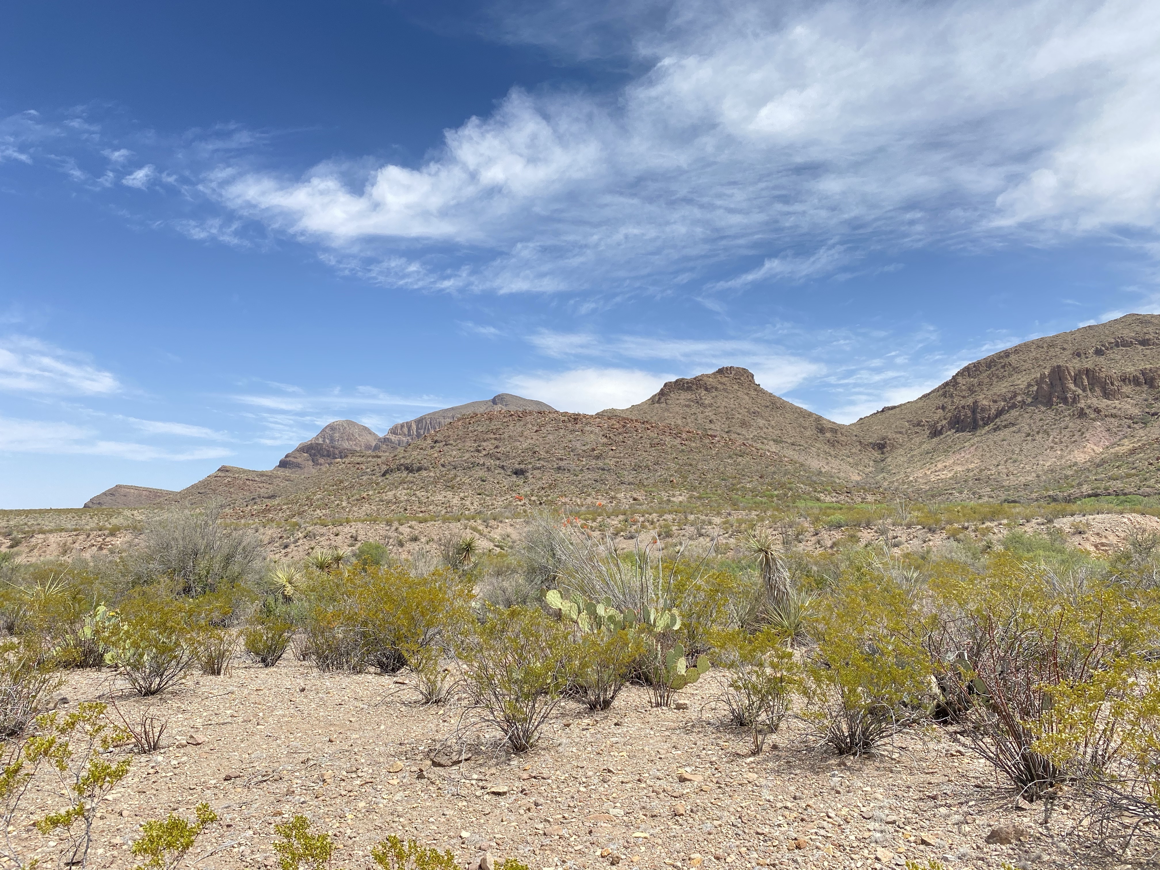
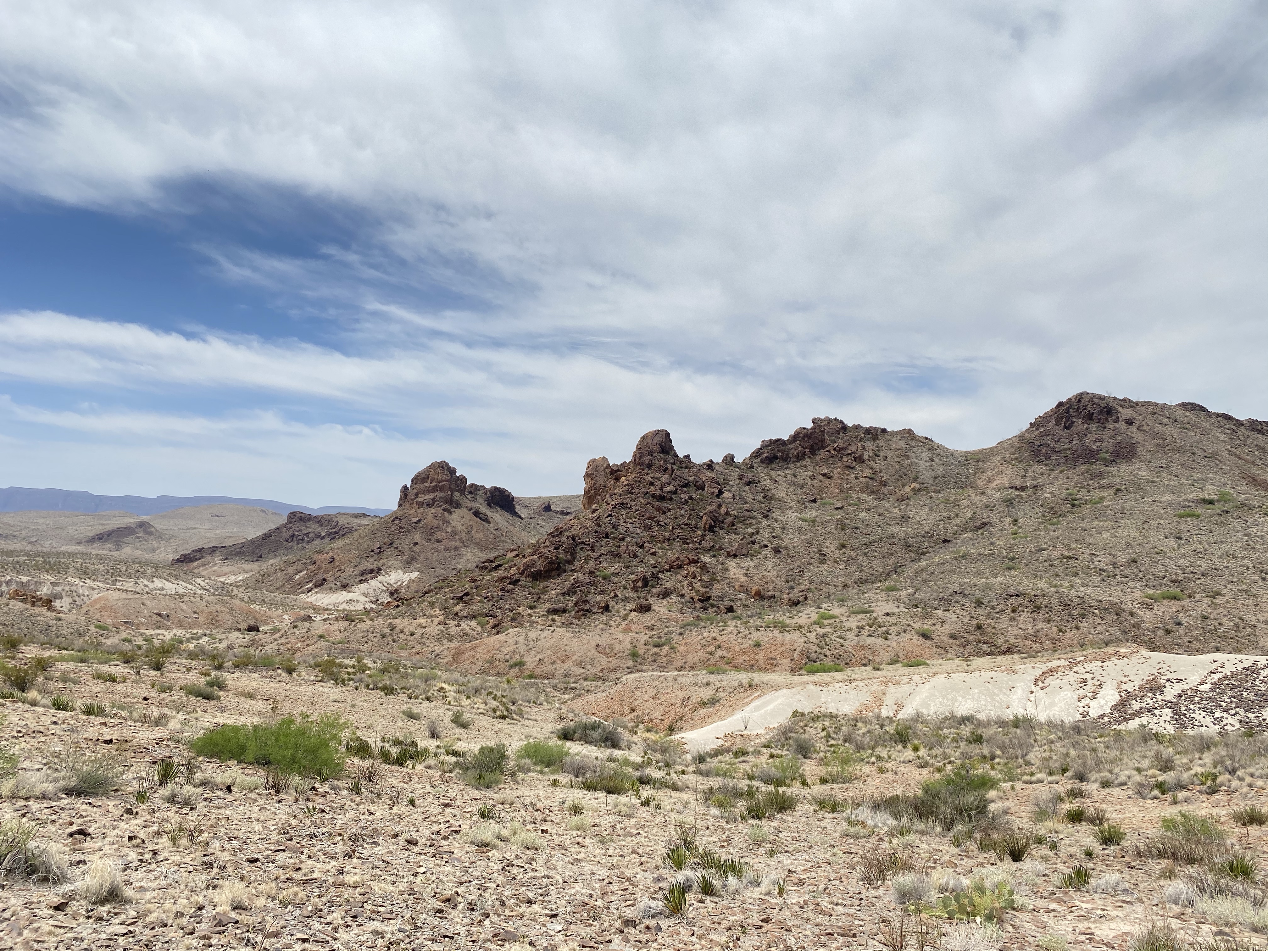
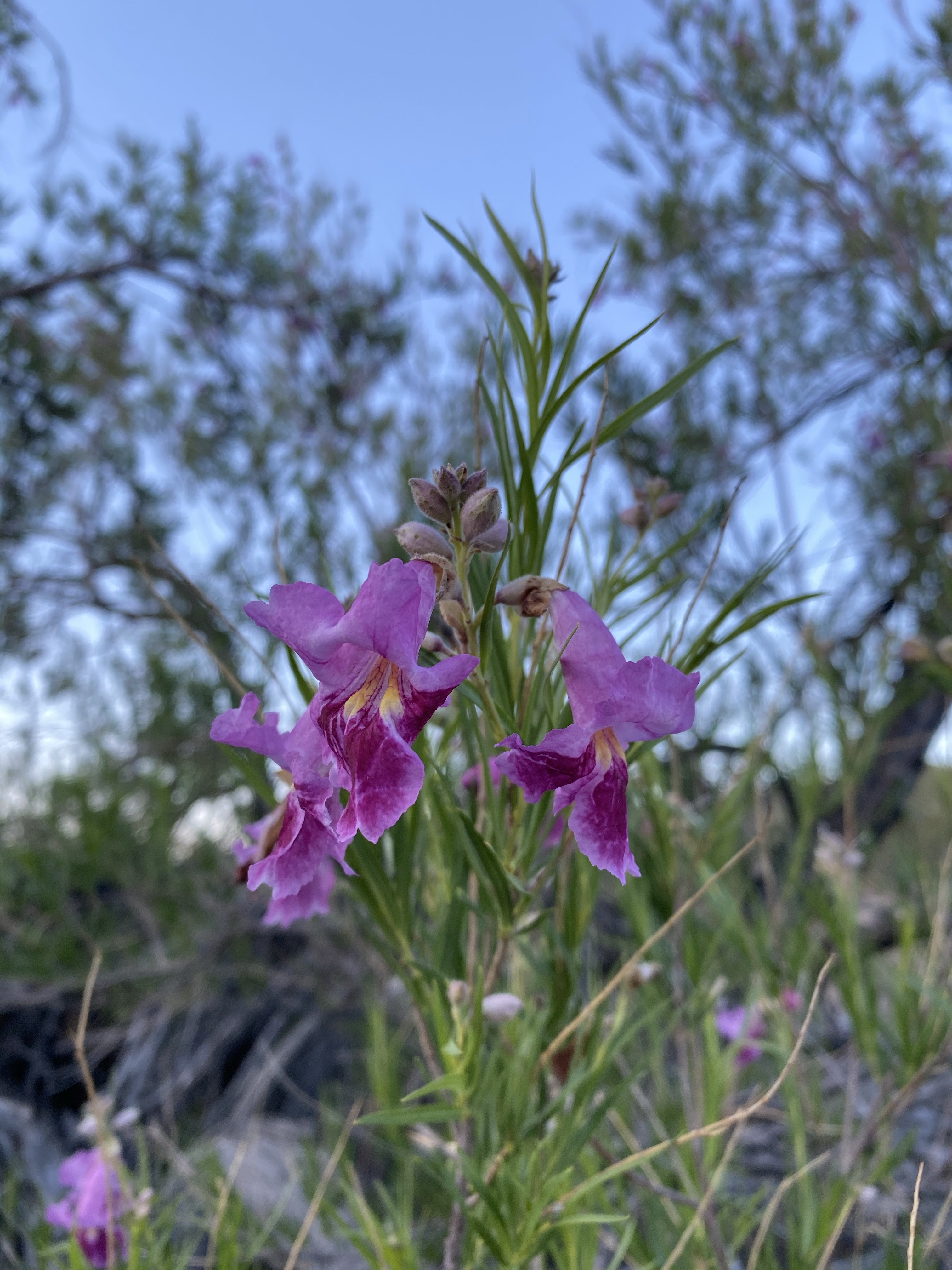
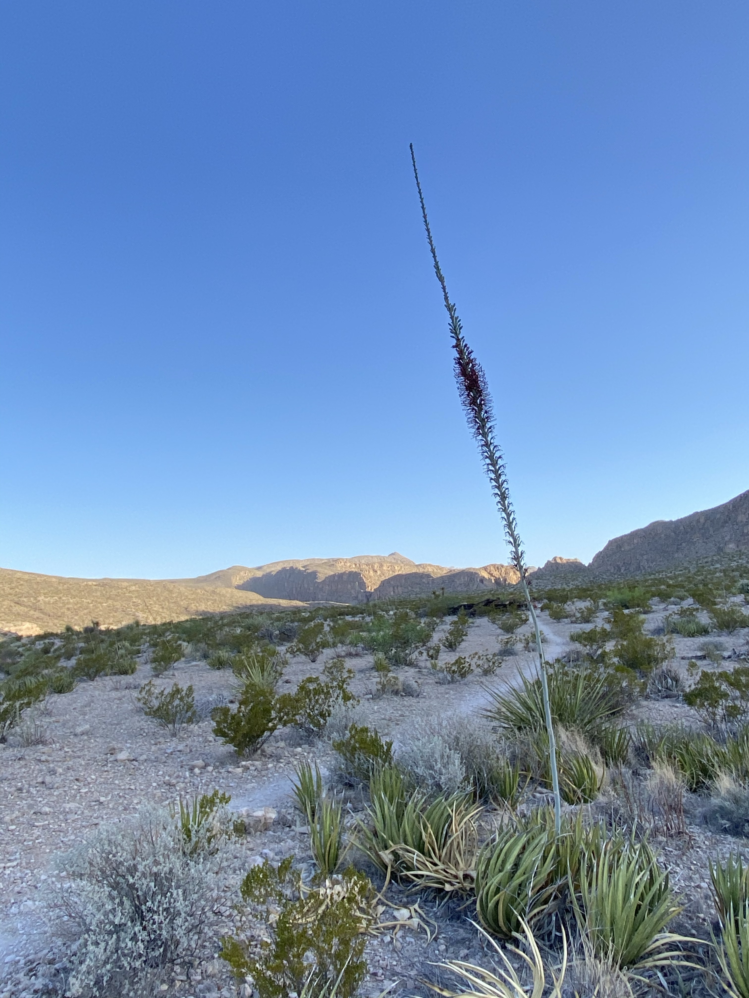
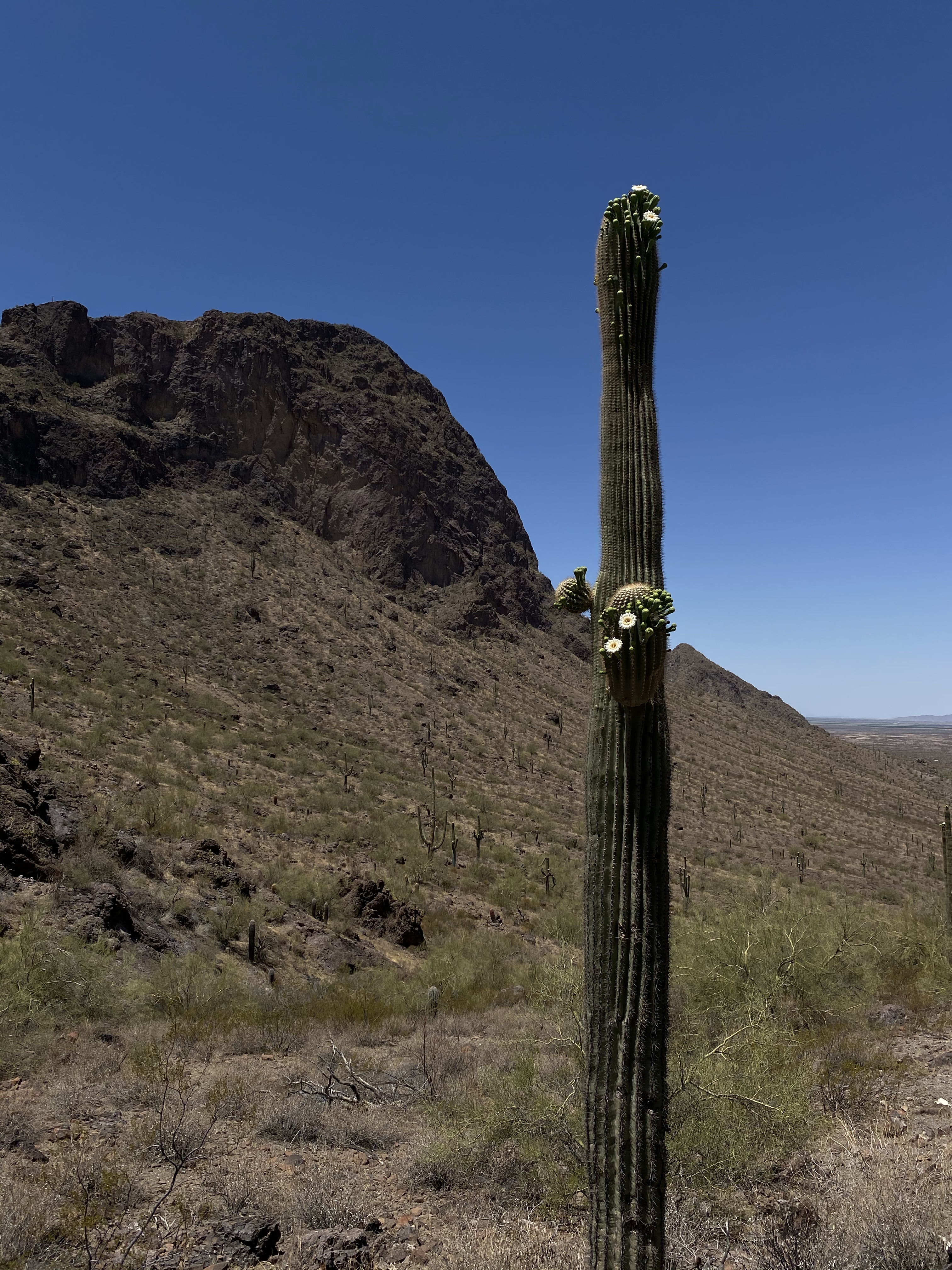
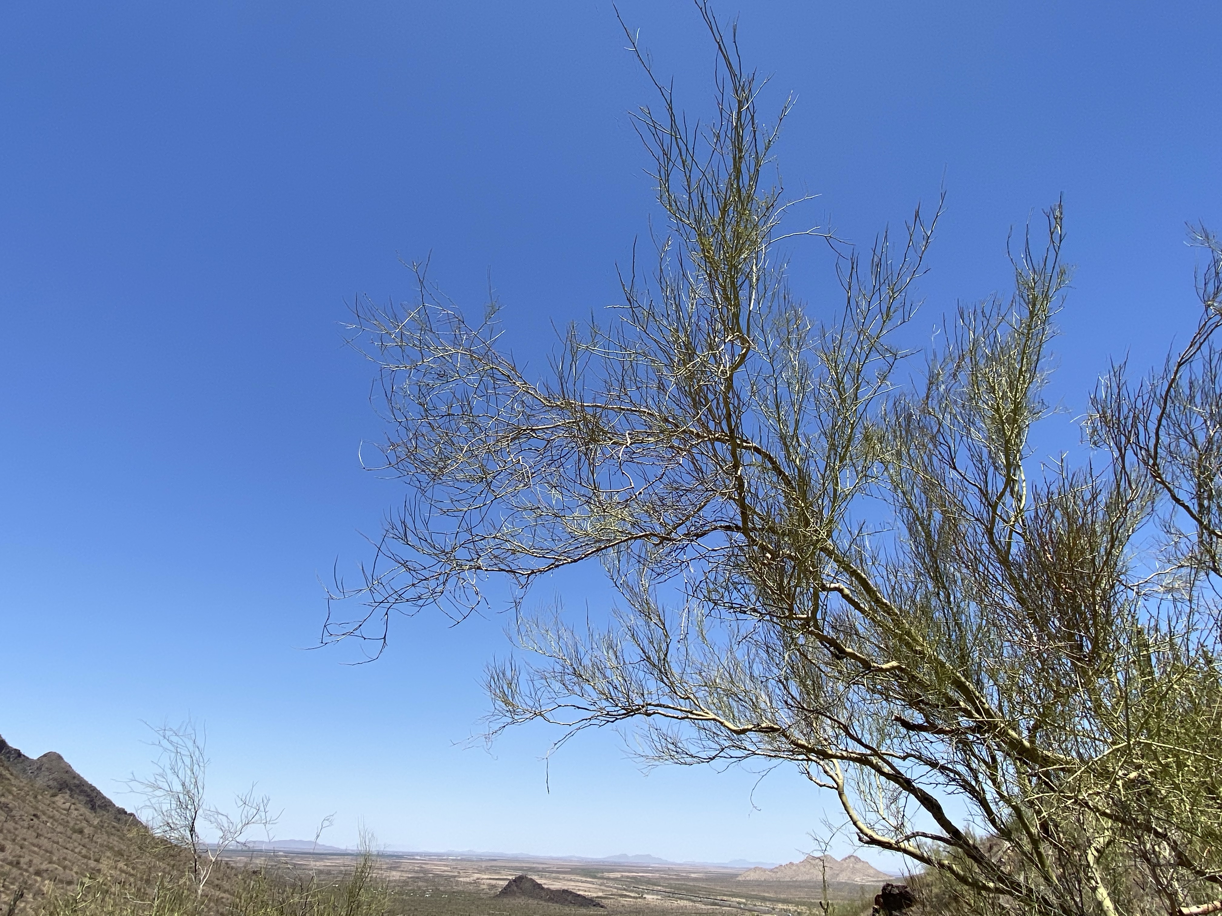
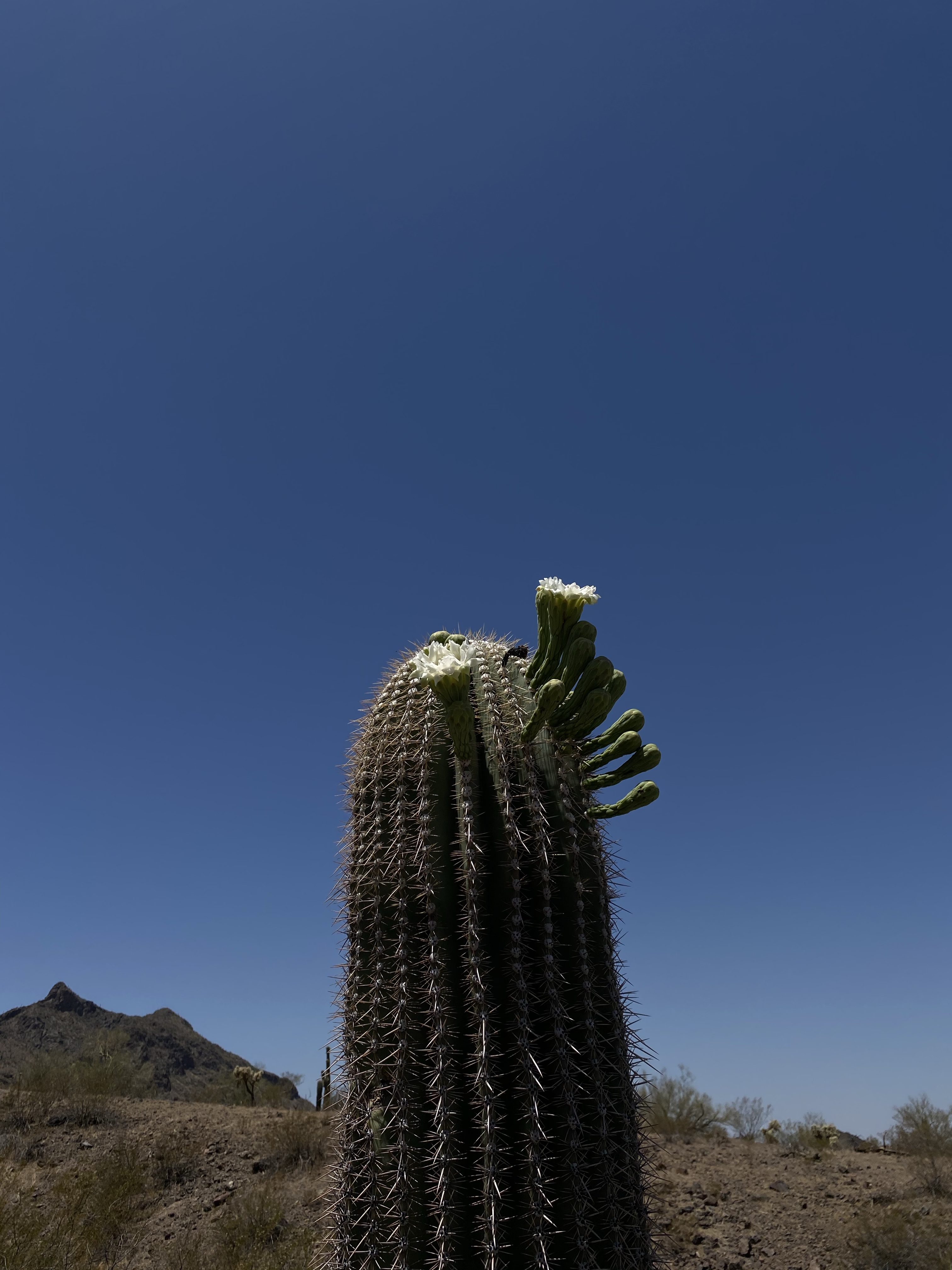
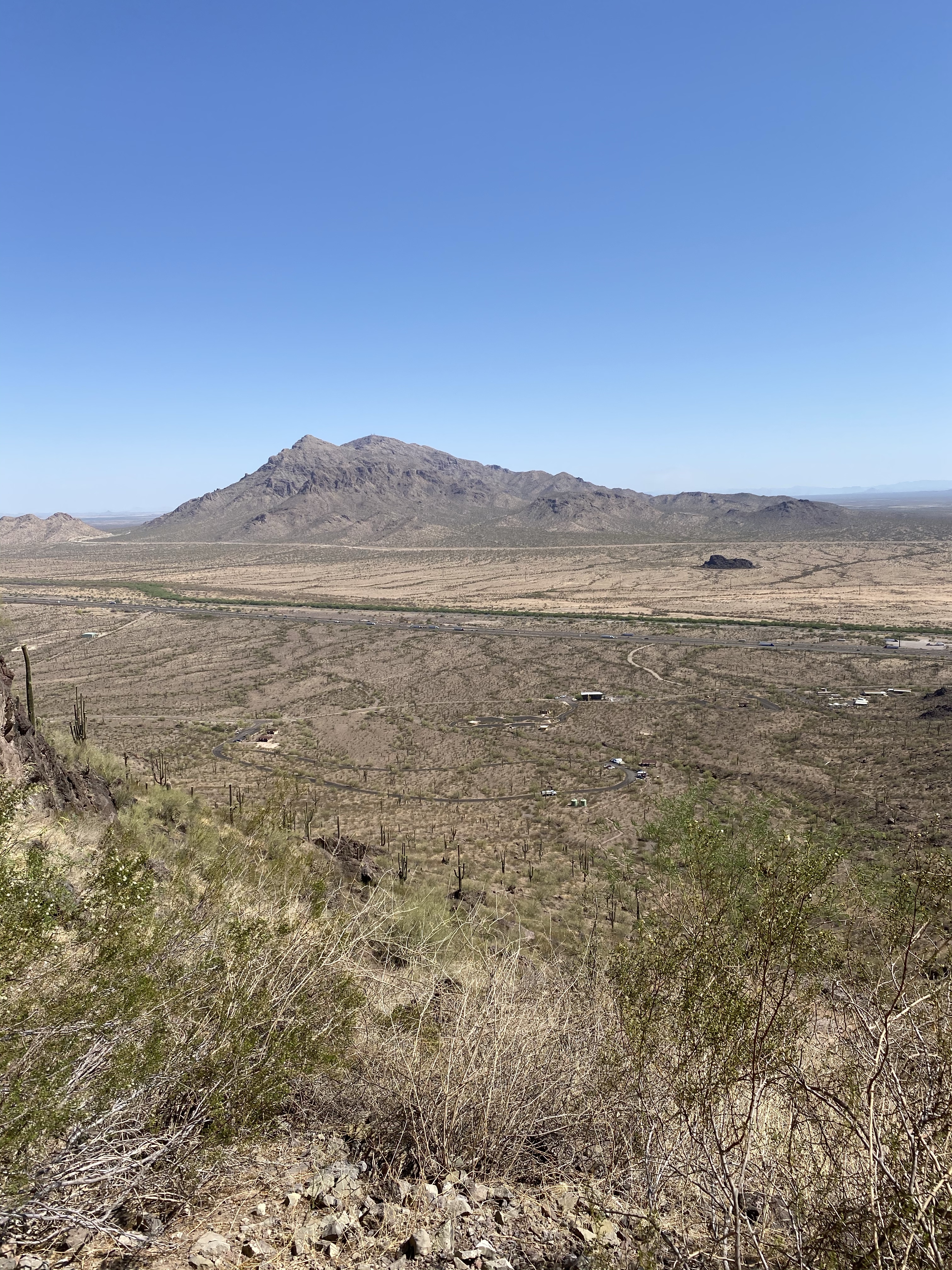
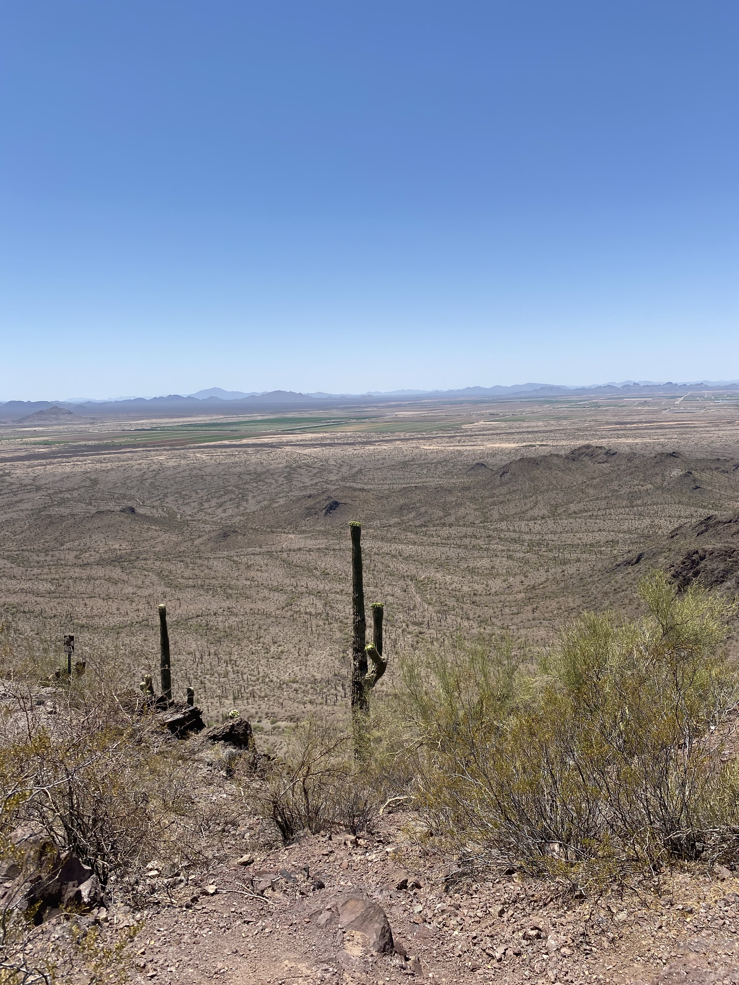
So, I opted for the accessible nature trail and overlook. A slowly climbing series of steps, the Calloway Trail cuts through a cacti forest with giant Saguaro looming on both sides. Standing sticks across the desert floor, largely alone, sometimes accompanied by Palo Verde trees. Their stance often outshines the mountains in the background as each has a unique set of limbs topped by green bulbs and glowing white flowers. Soon I reached the overlook and was again reminded of the vastness of this desert landscape.

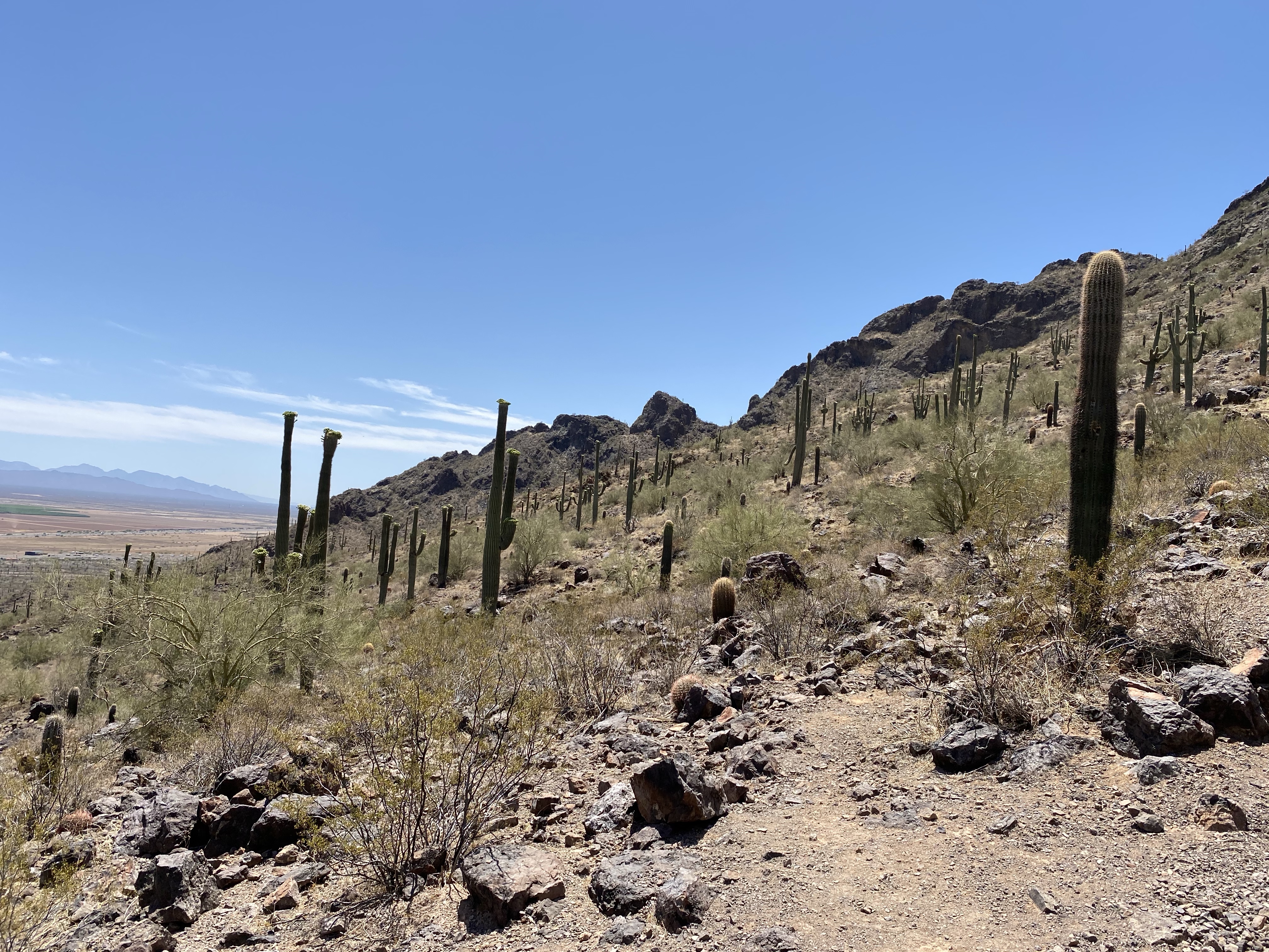
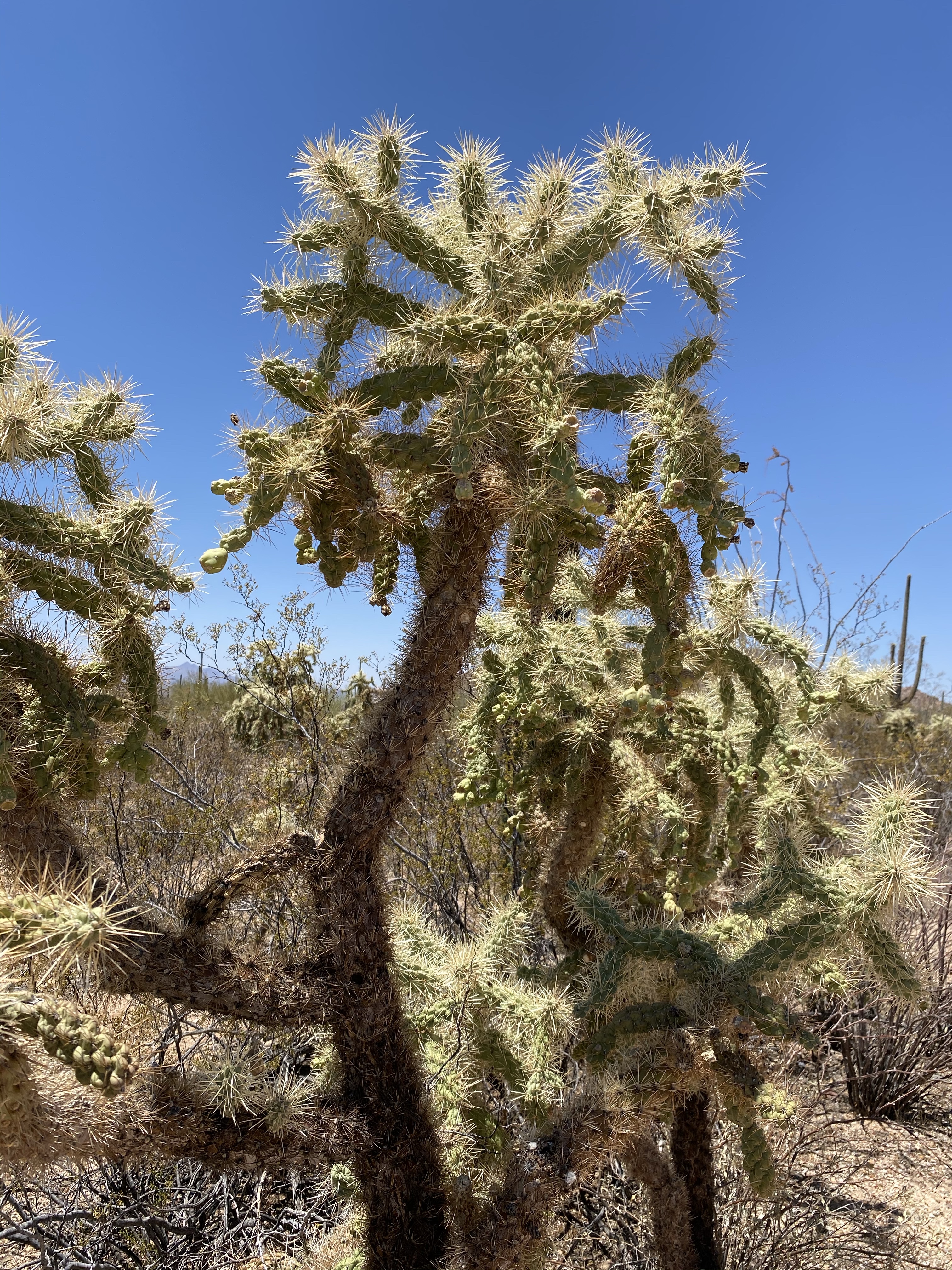
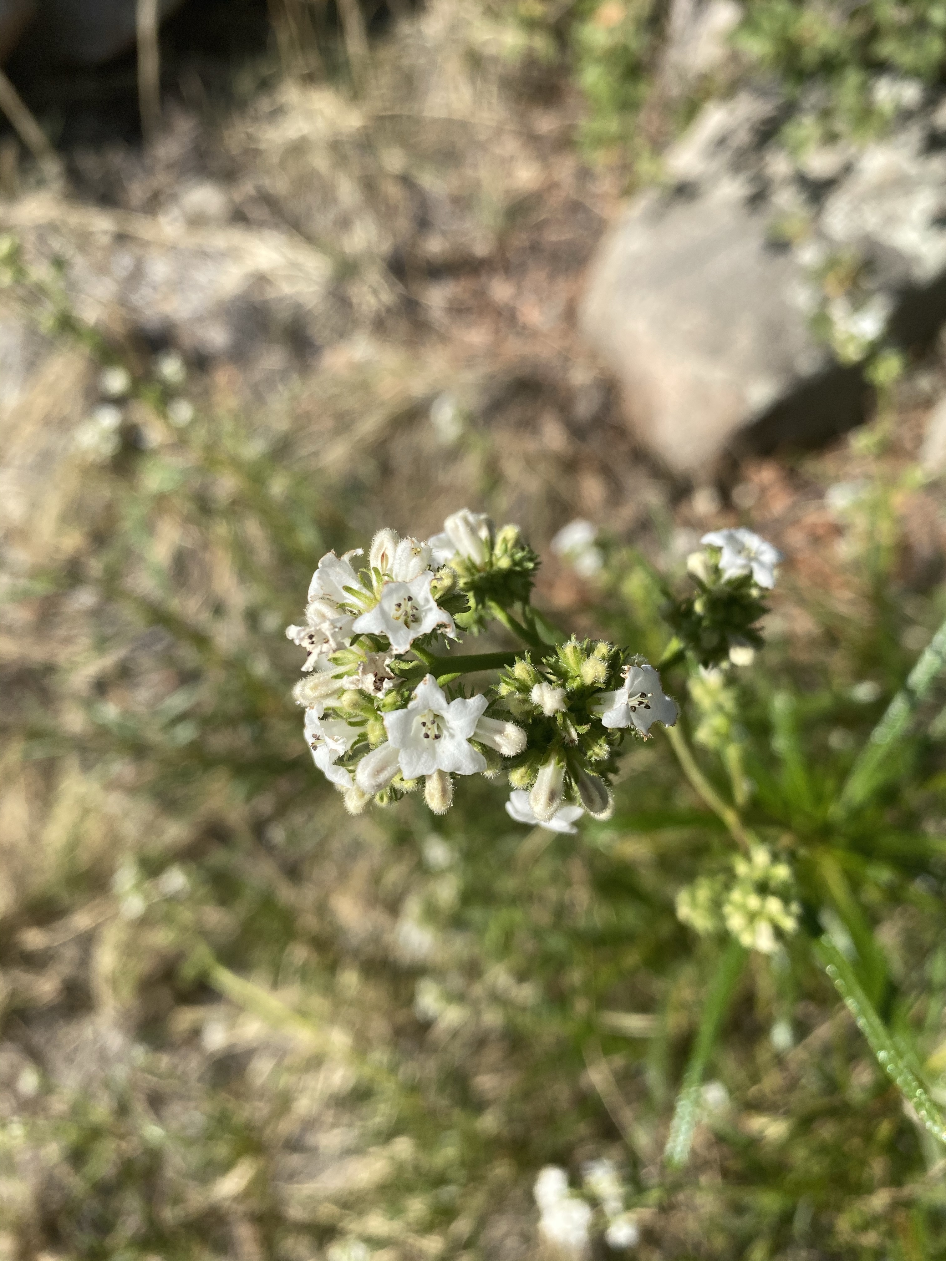
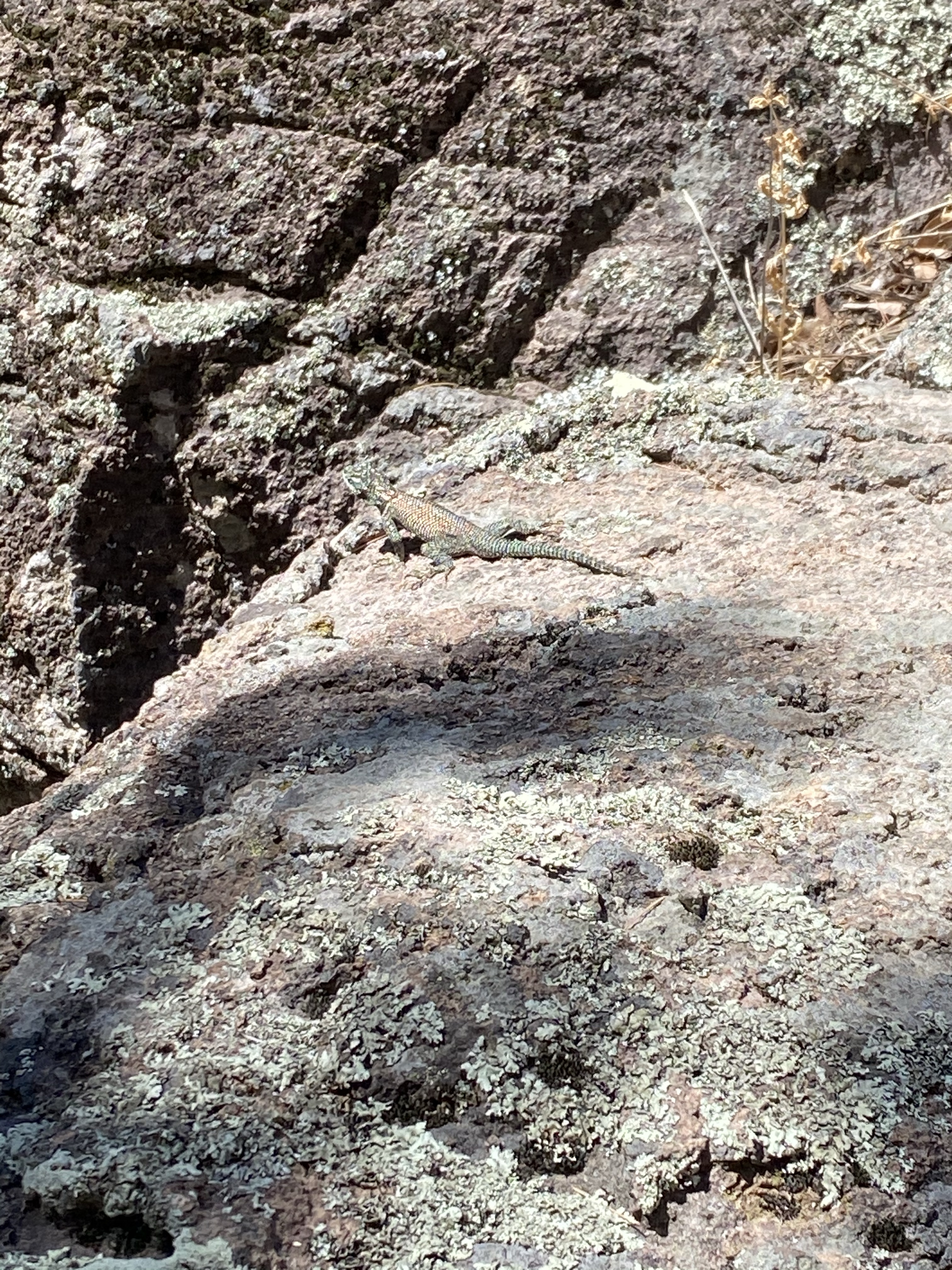
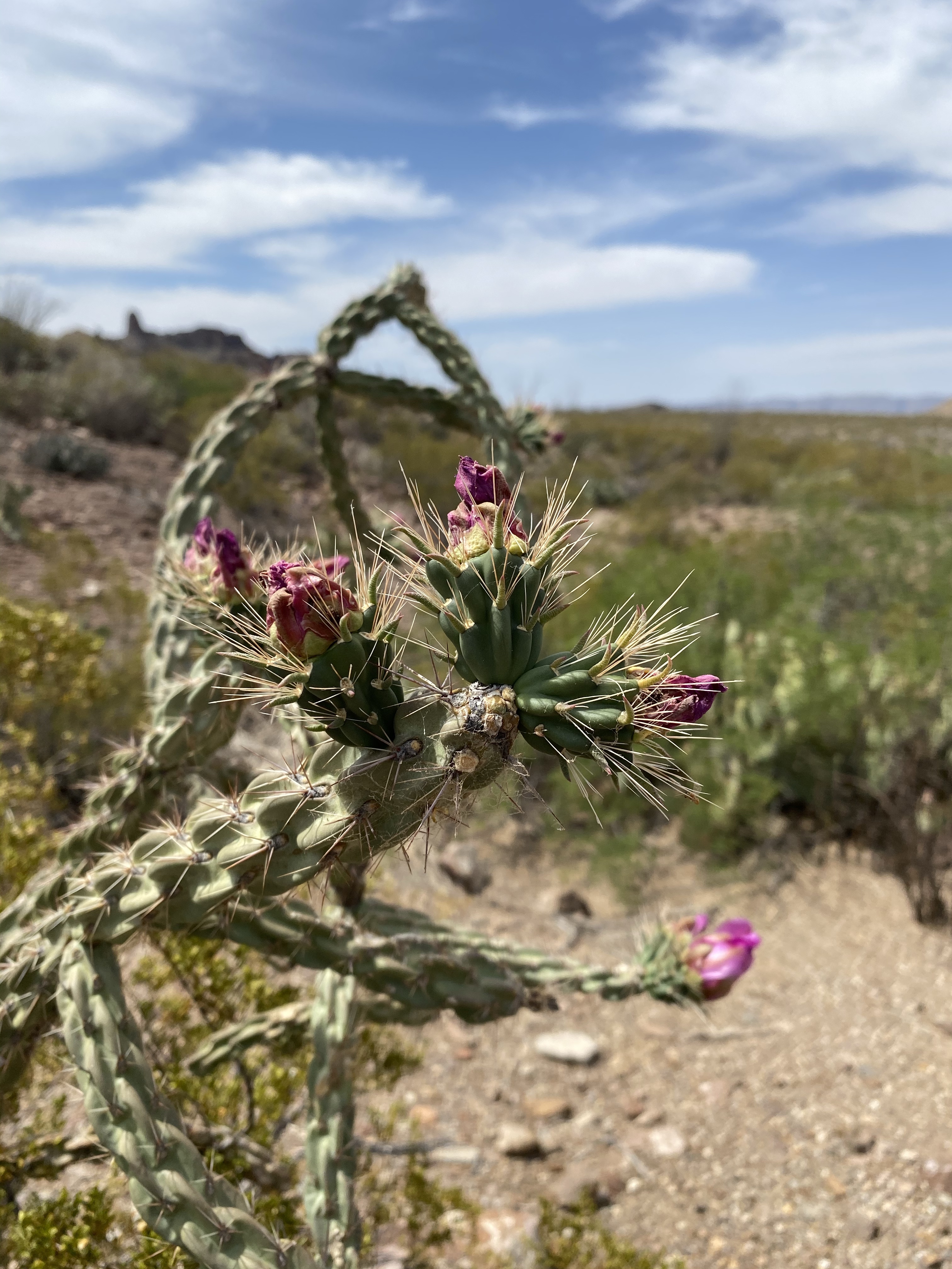
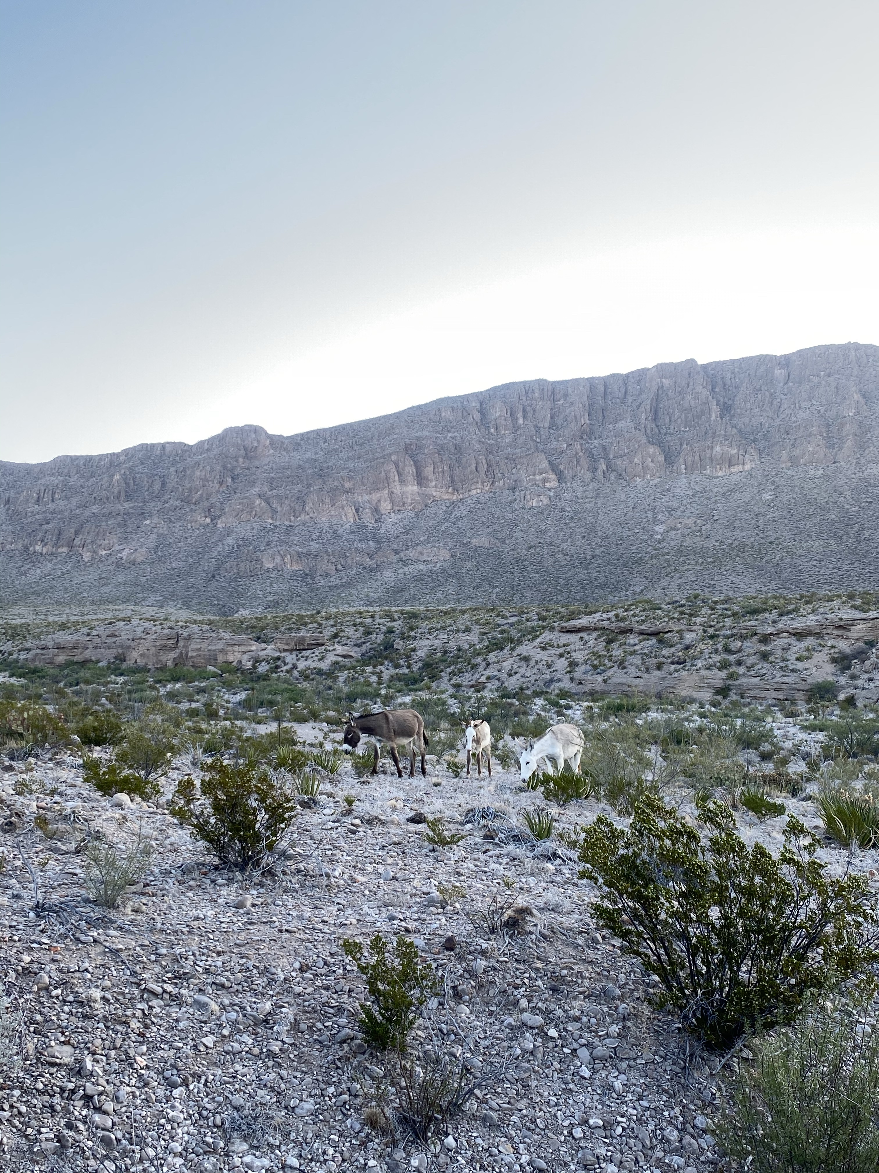
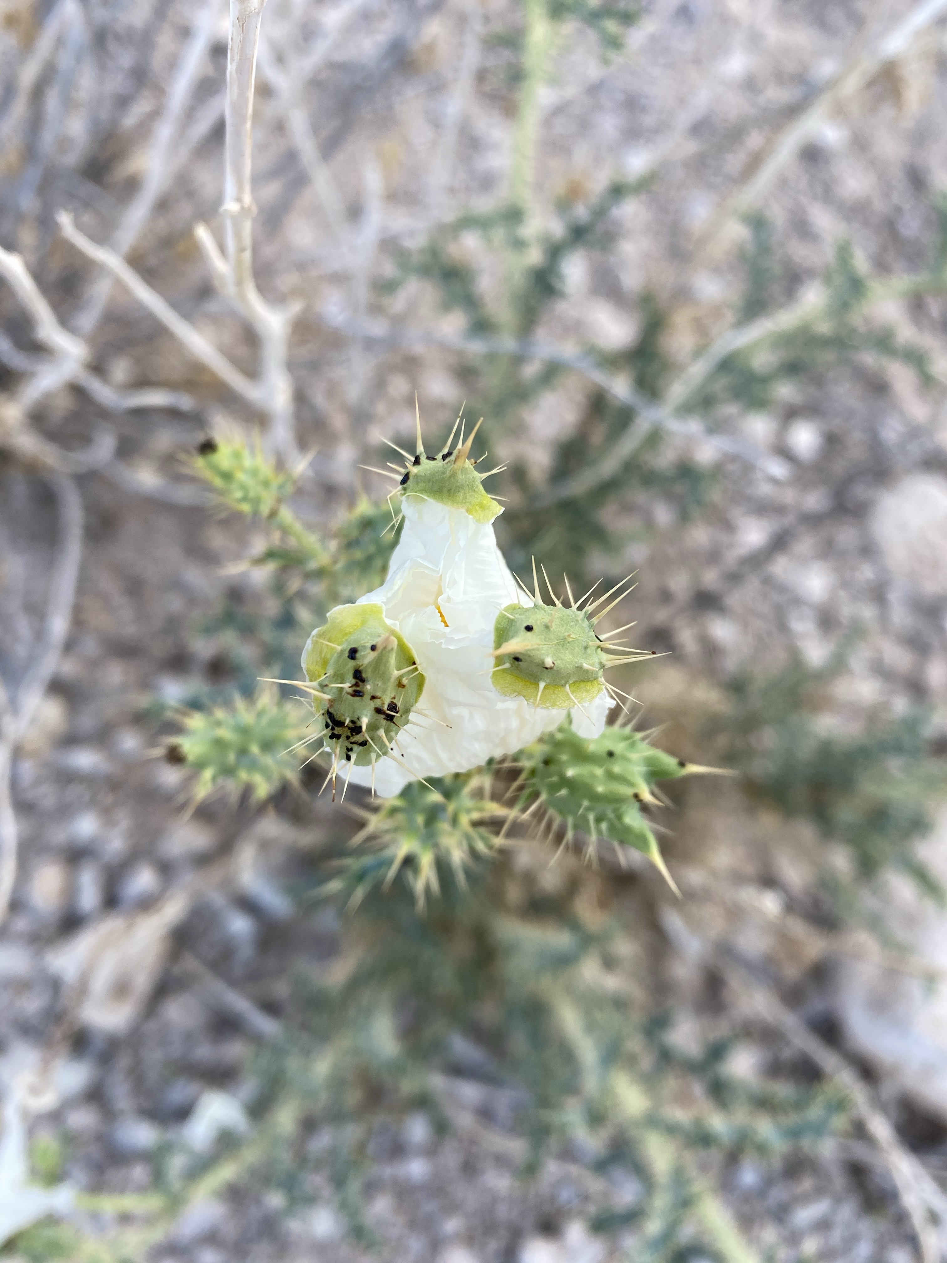
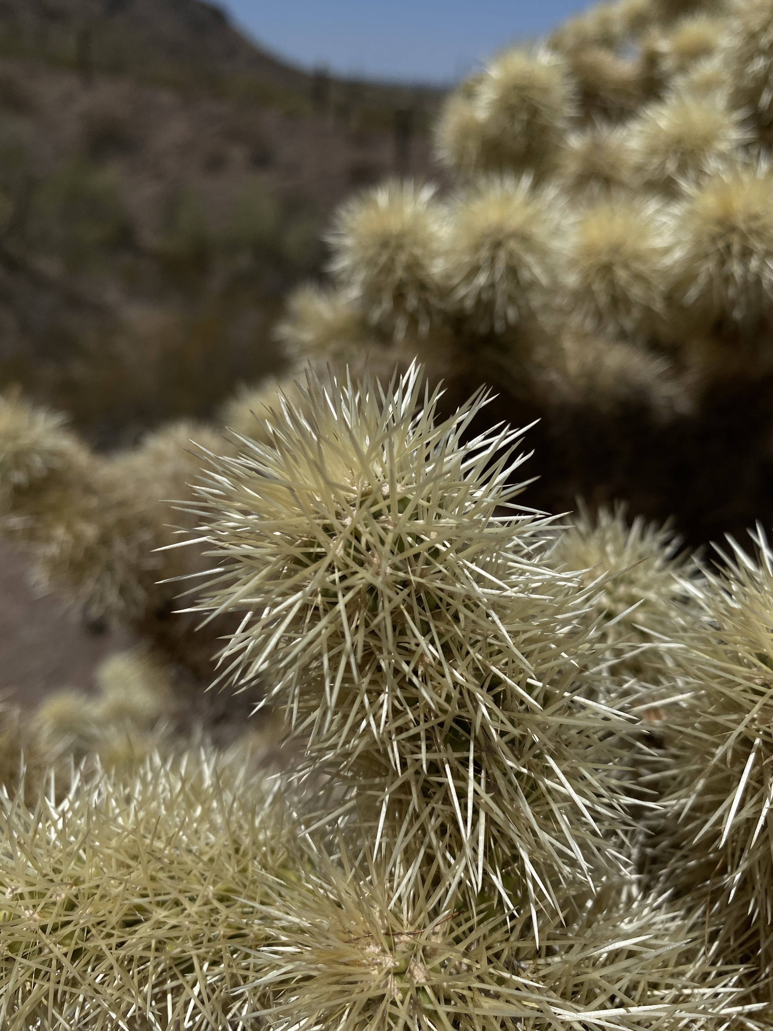
On my way down, I veered off and onto the nature trail to learn more about the area. While the desert appears to be a place for survival of the fittest, and often is, the plants and animals have adapted to sustain life here. They work together in unique ways to thrive. For example, the Saguaro provides shelter for Gila Woodpeckers and Gilded Flickers, almost like a bird hotel. Desert birds also have extremely high body temperatures so they don’t get overheated easily like humans. In addition, the shape of the Cholla cactus is perfect for Cactus Wren to build their dome-shaped nests.

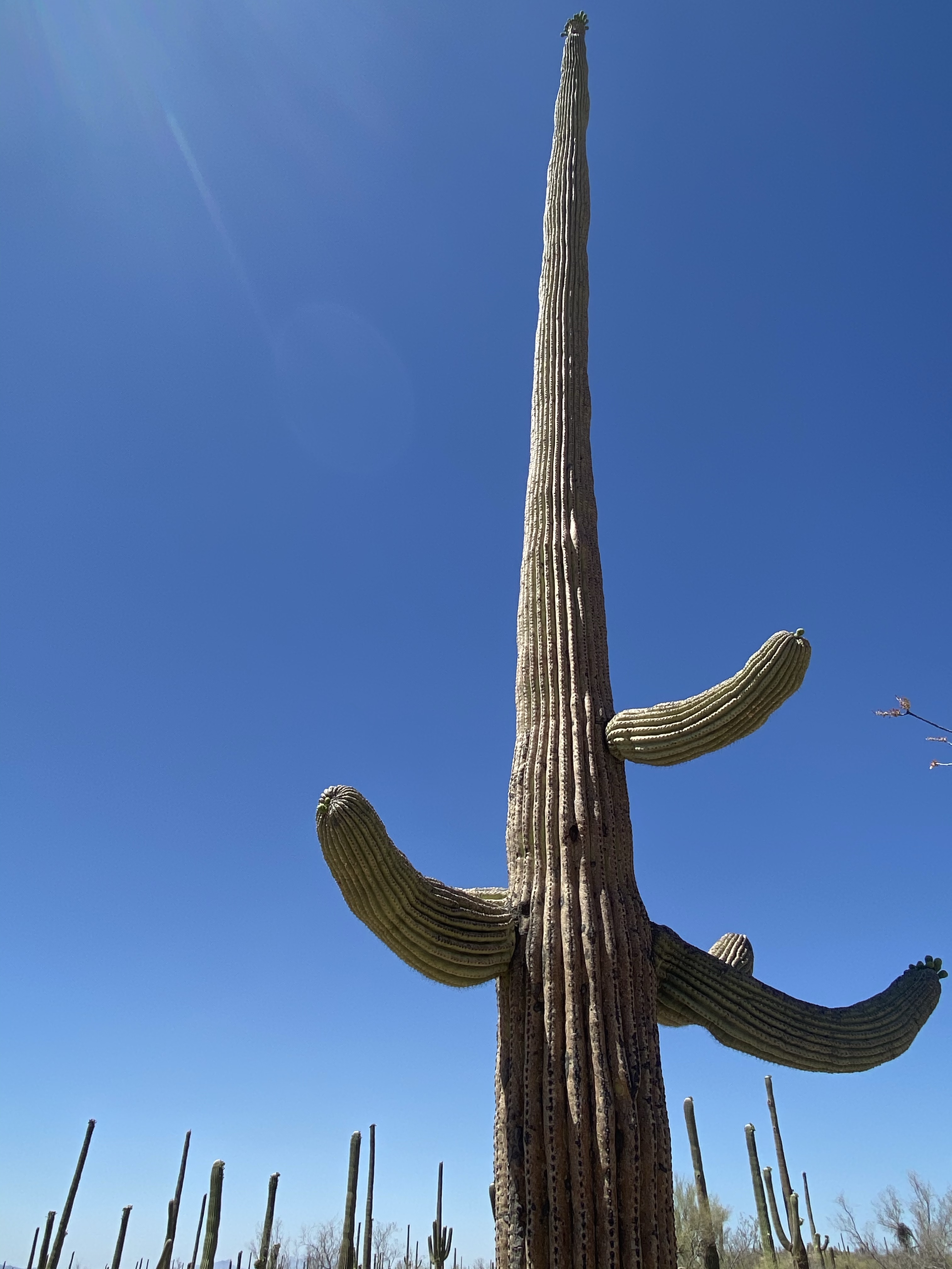
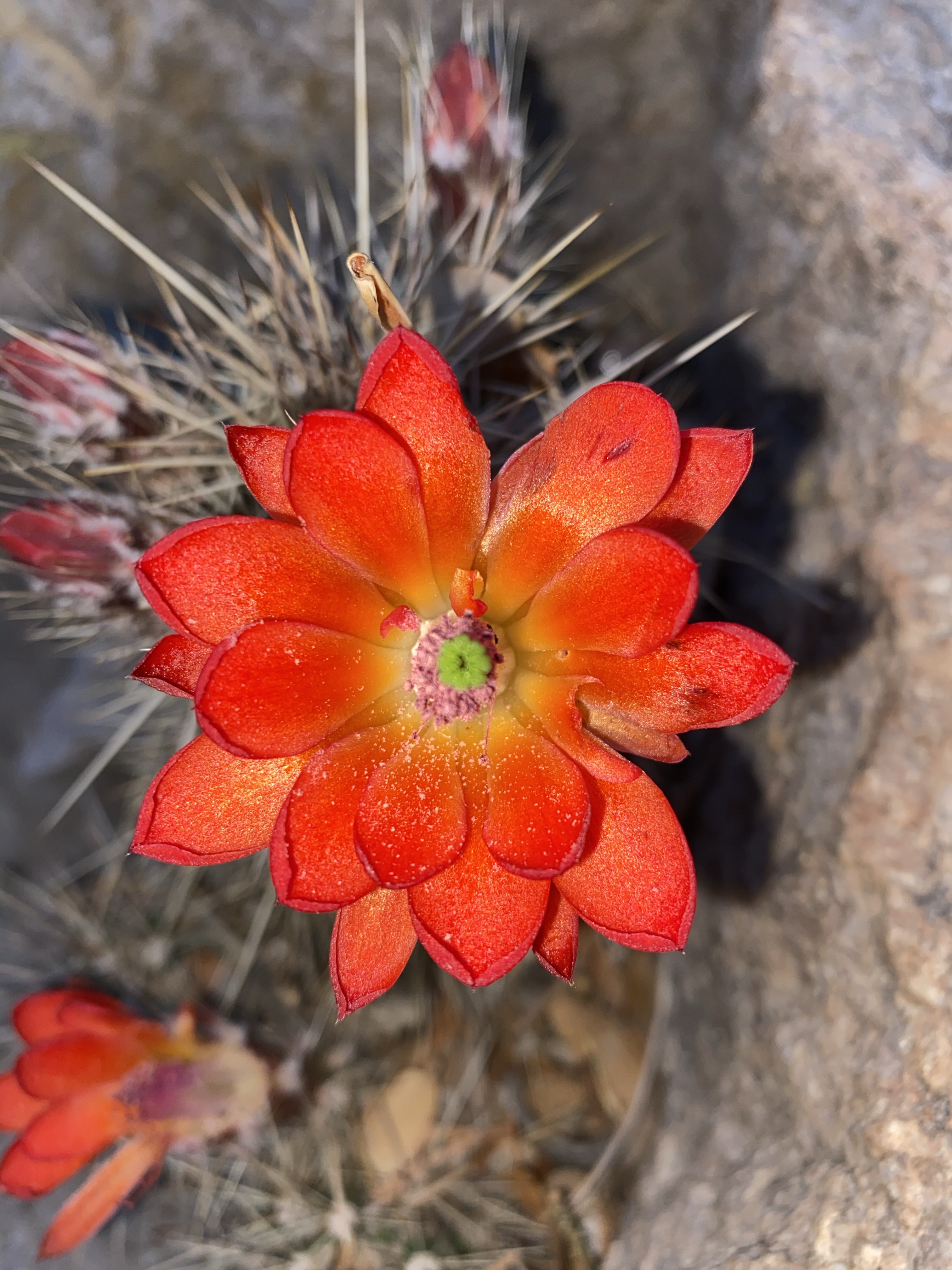
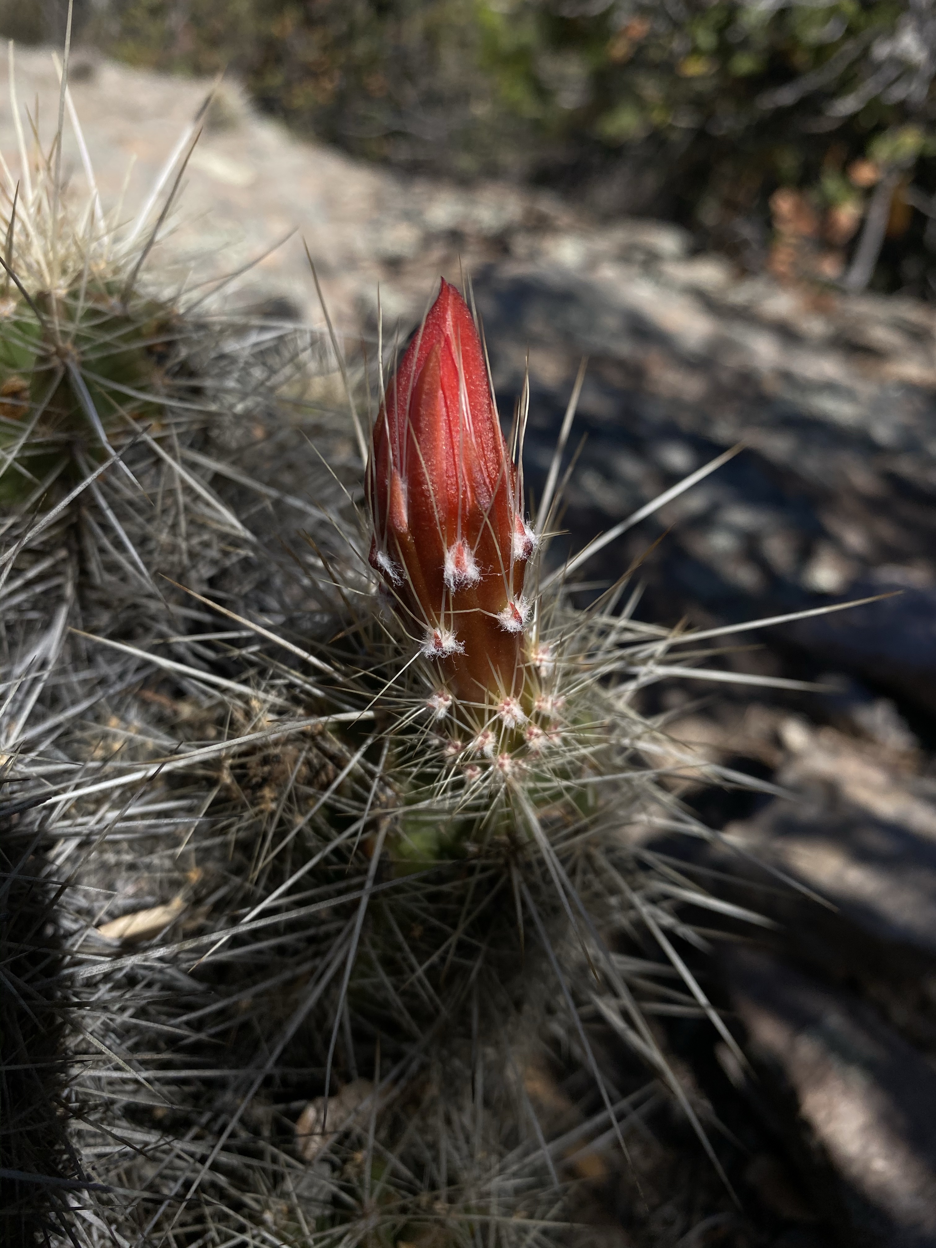
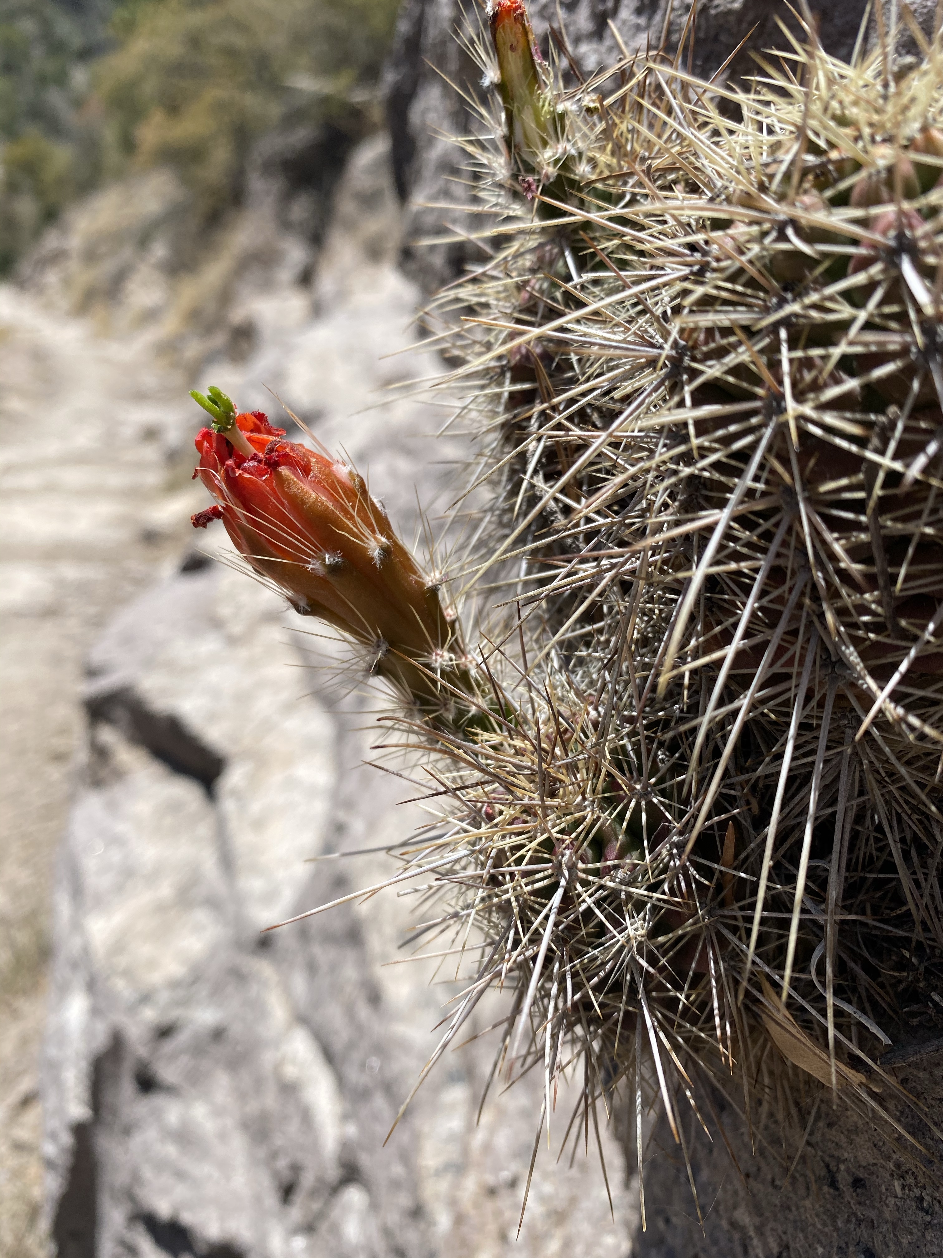
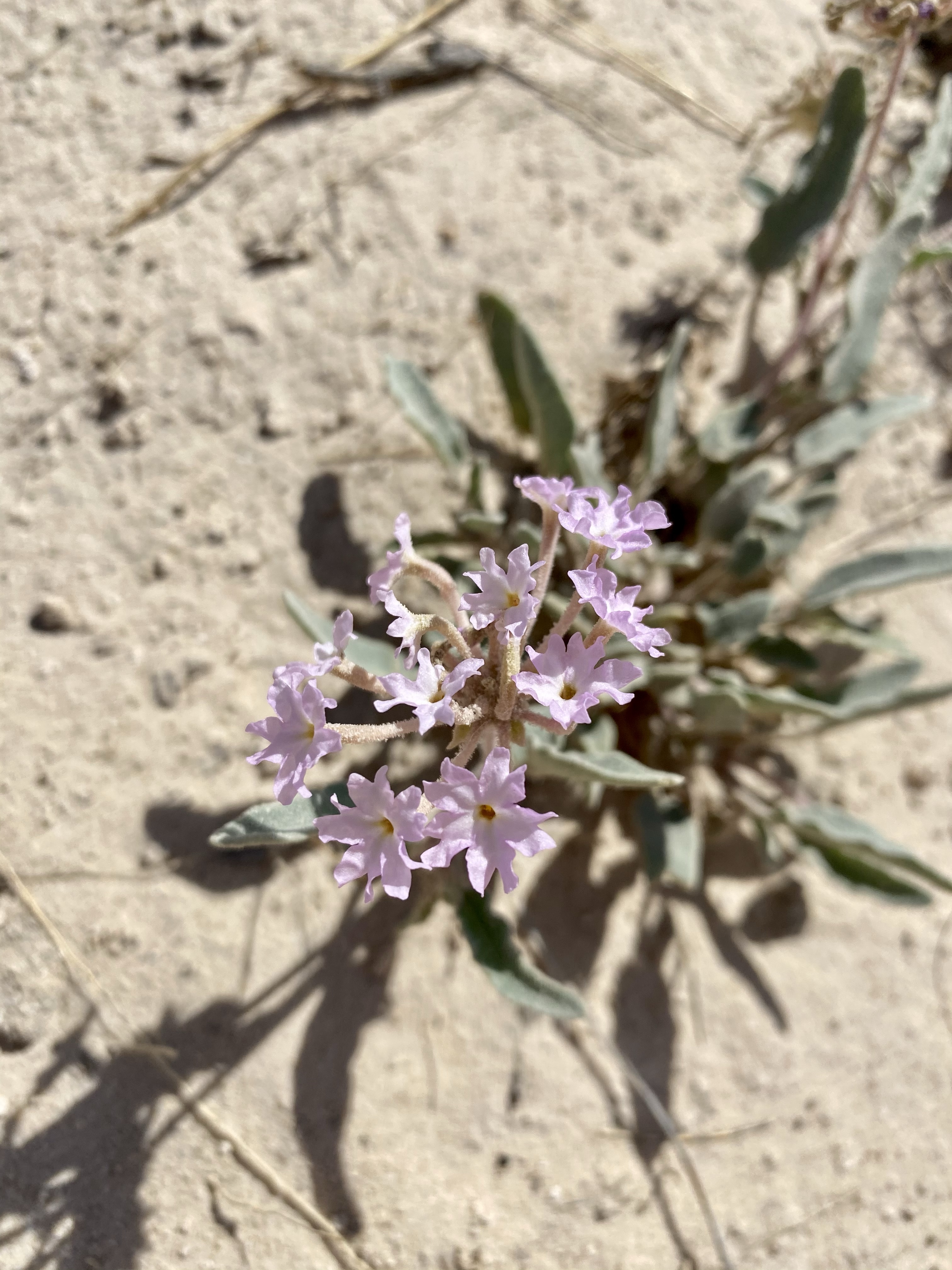
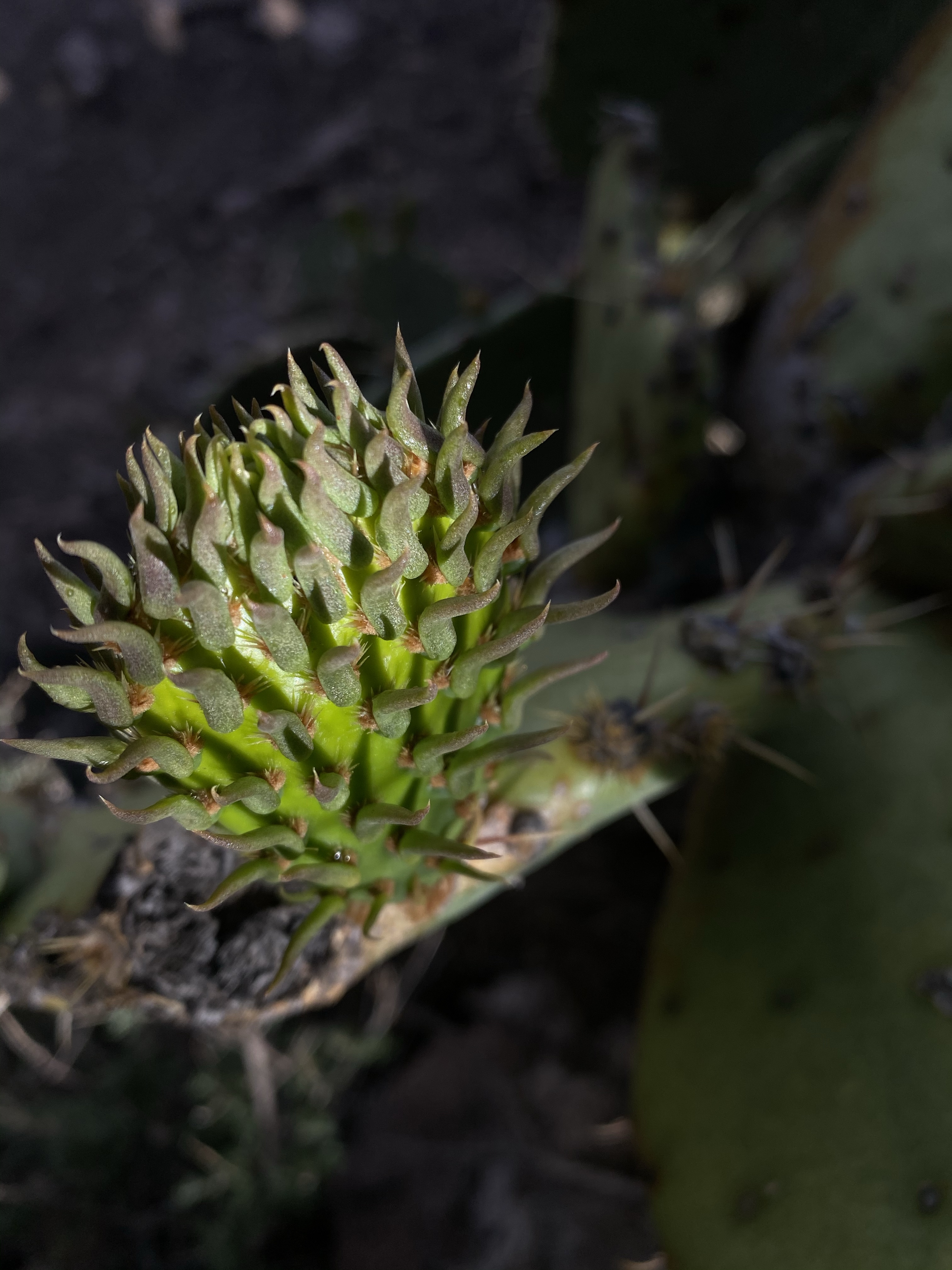
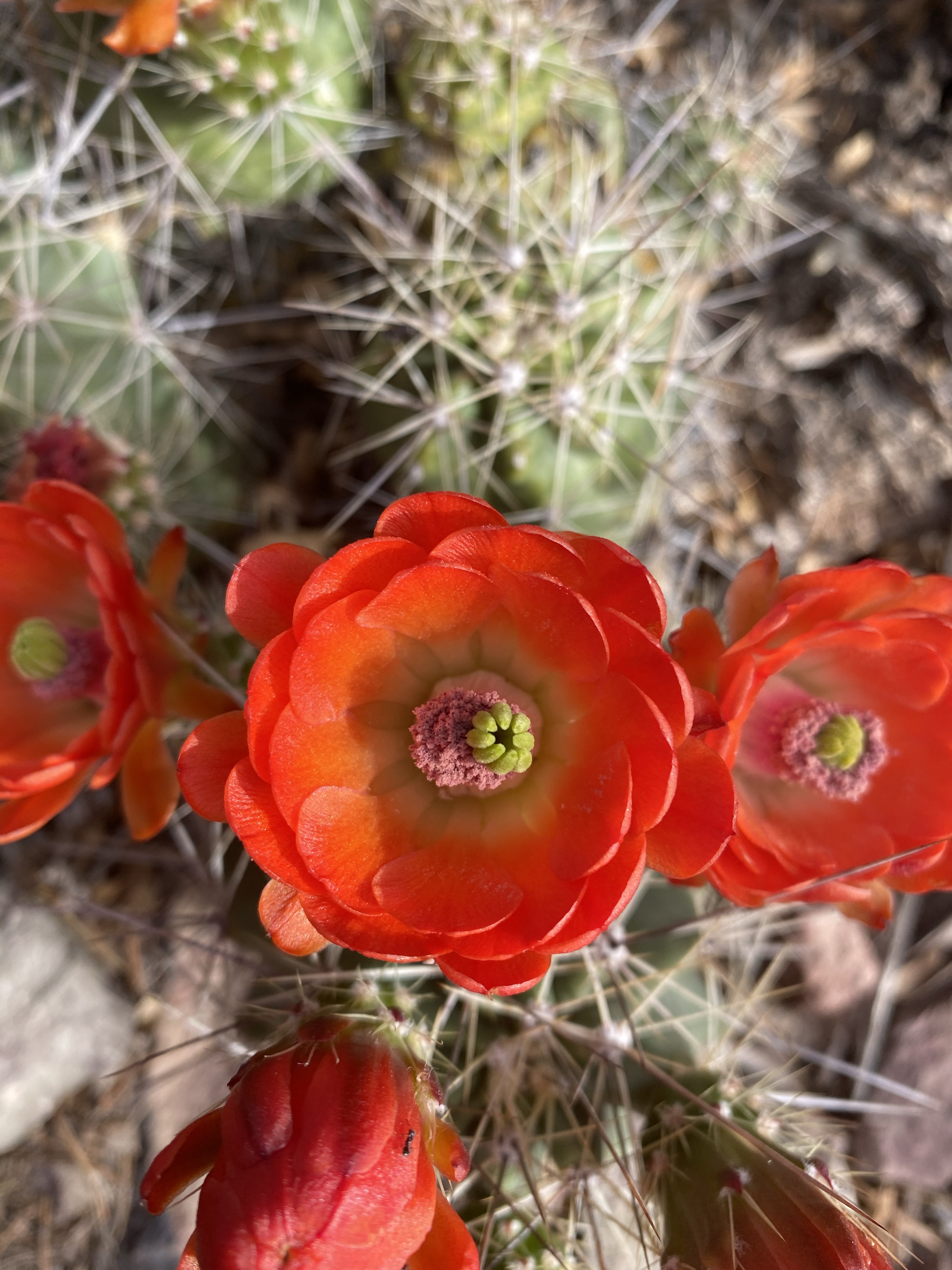
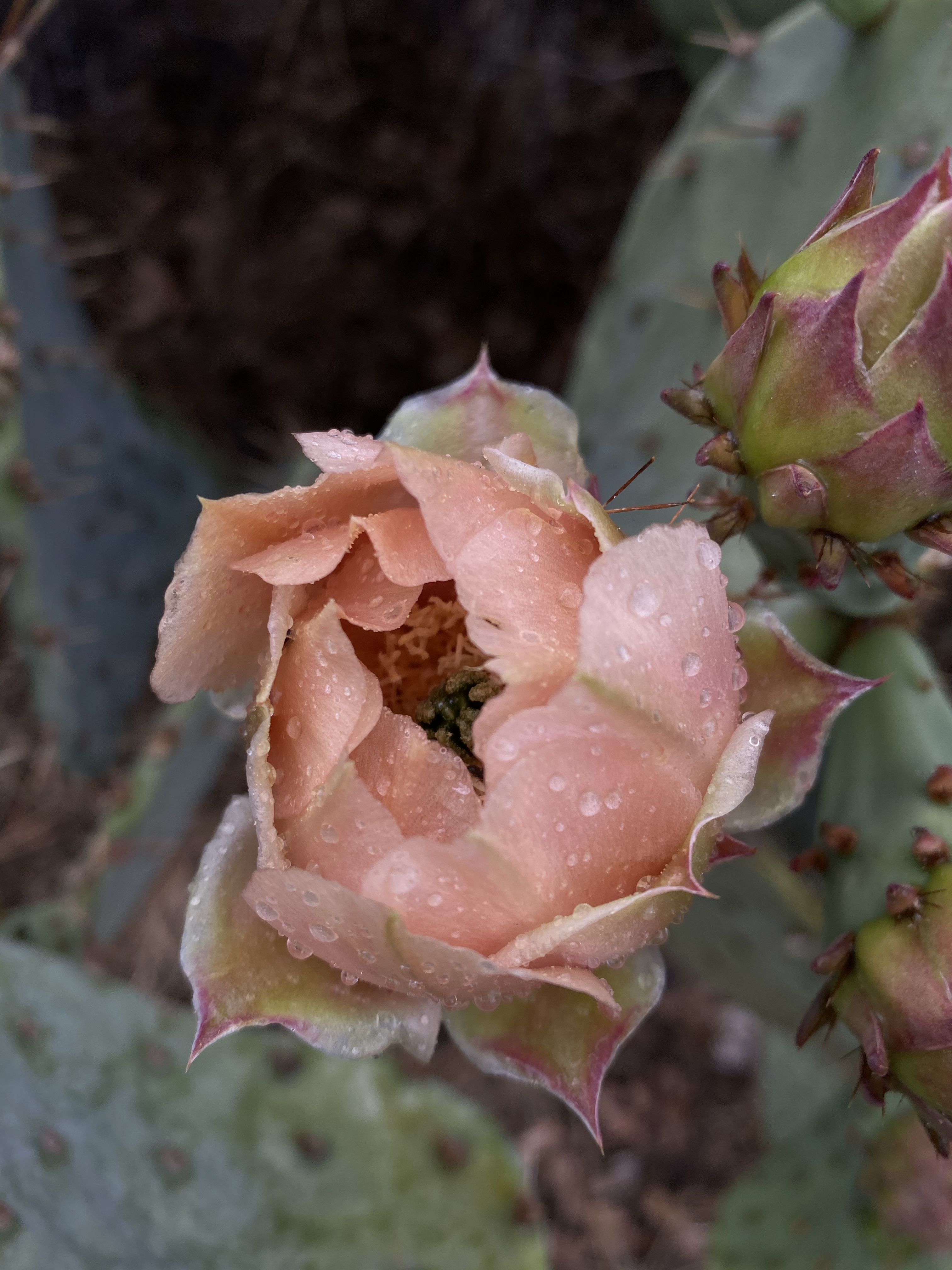
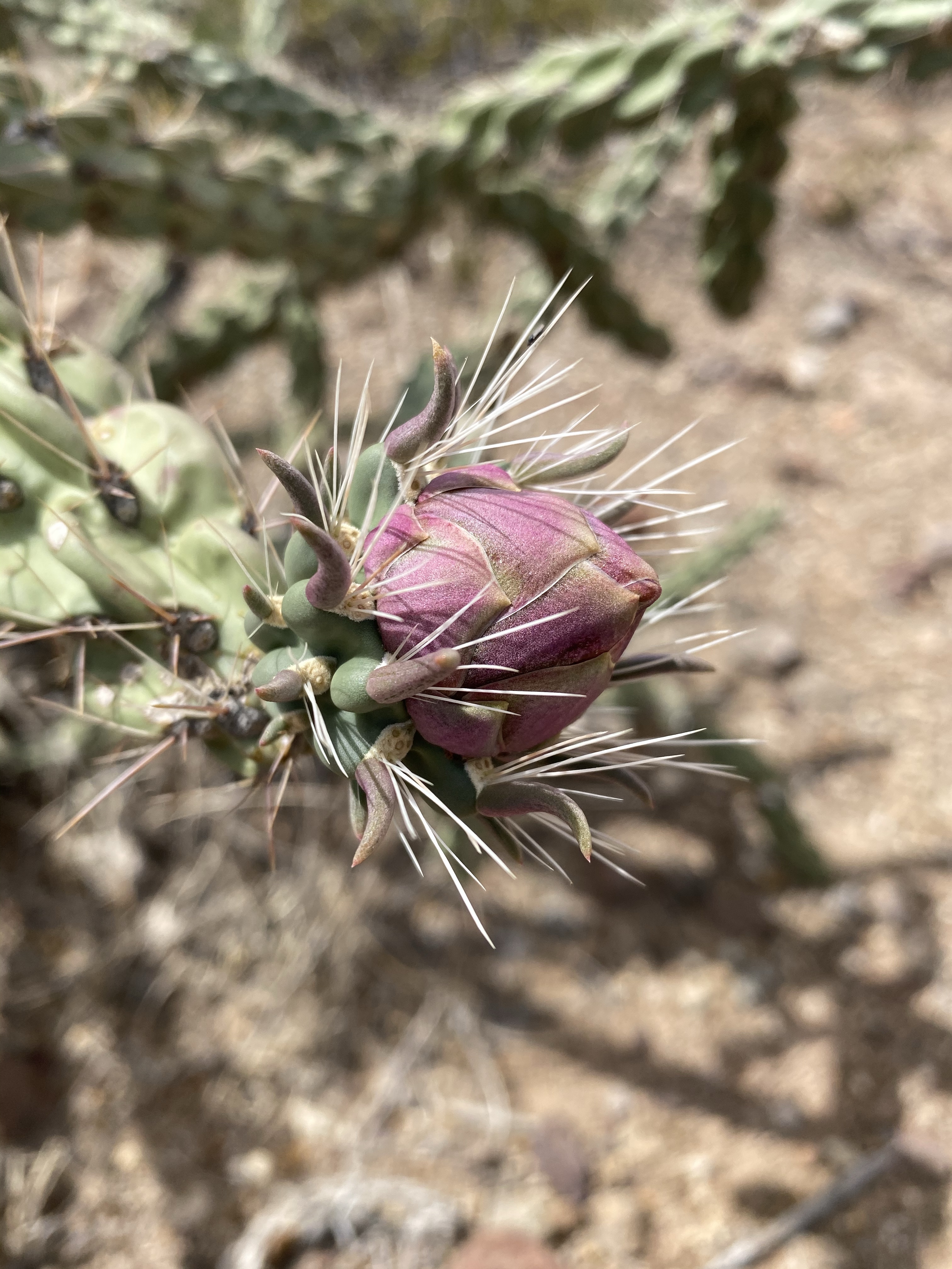
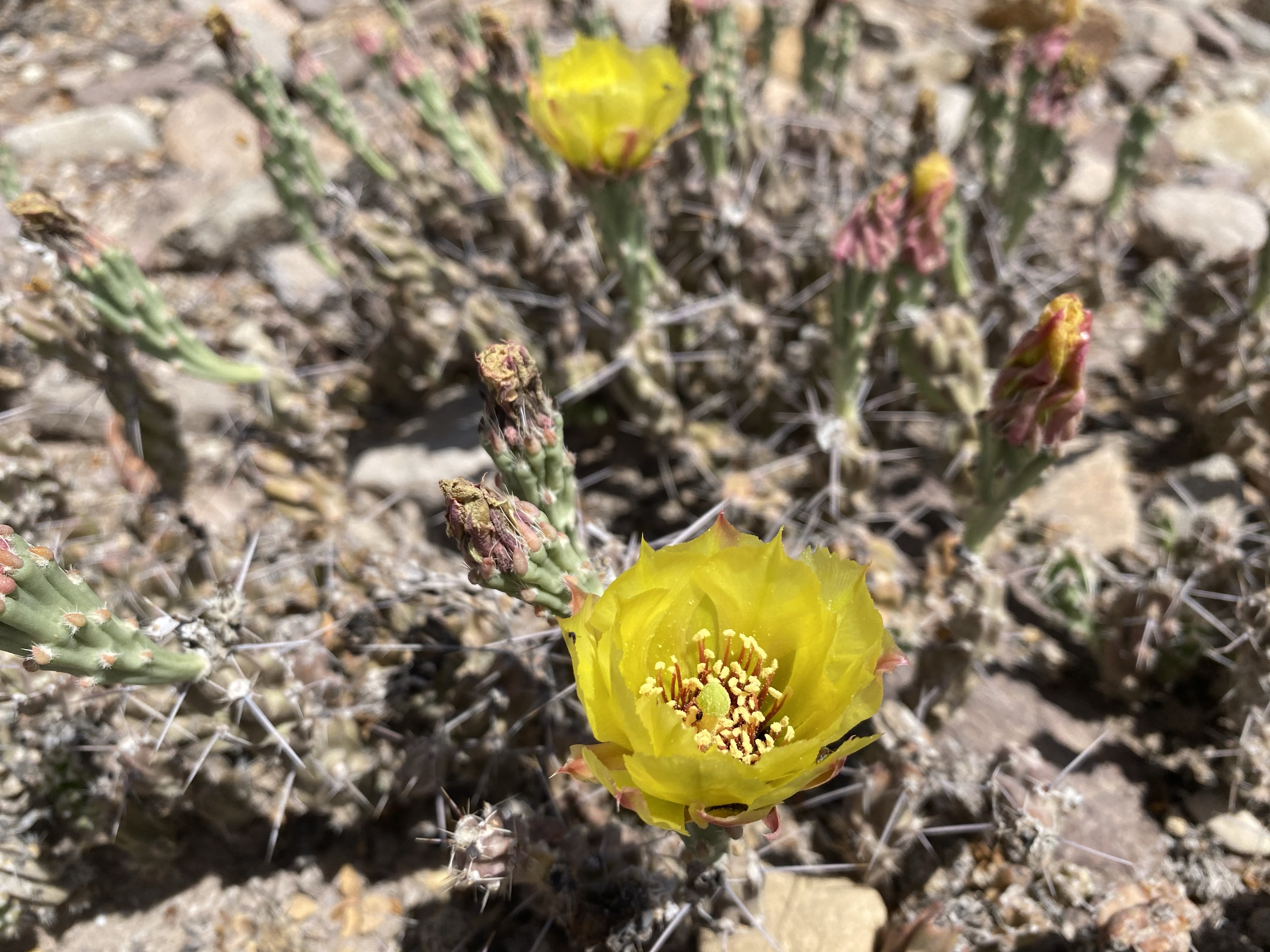
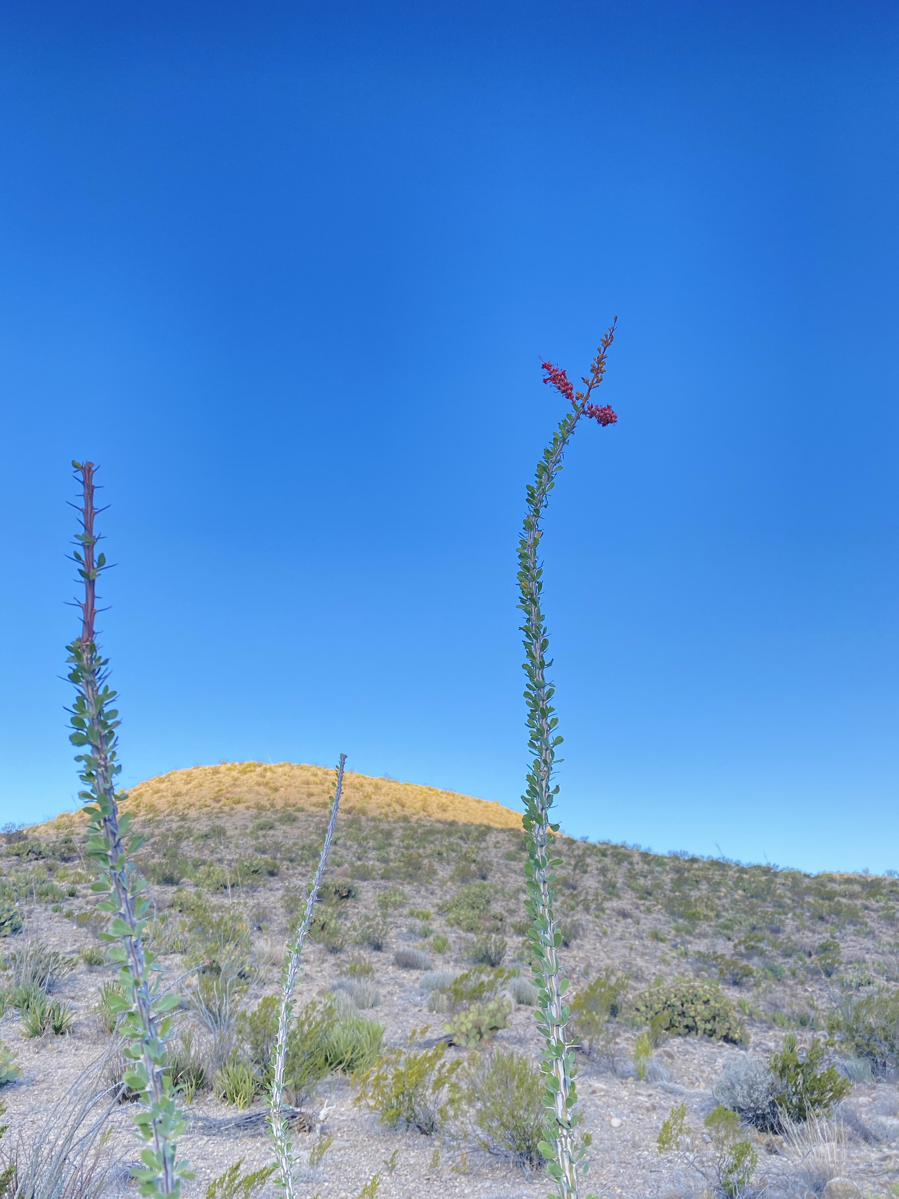
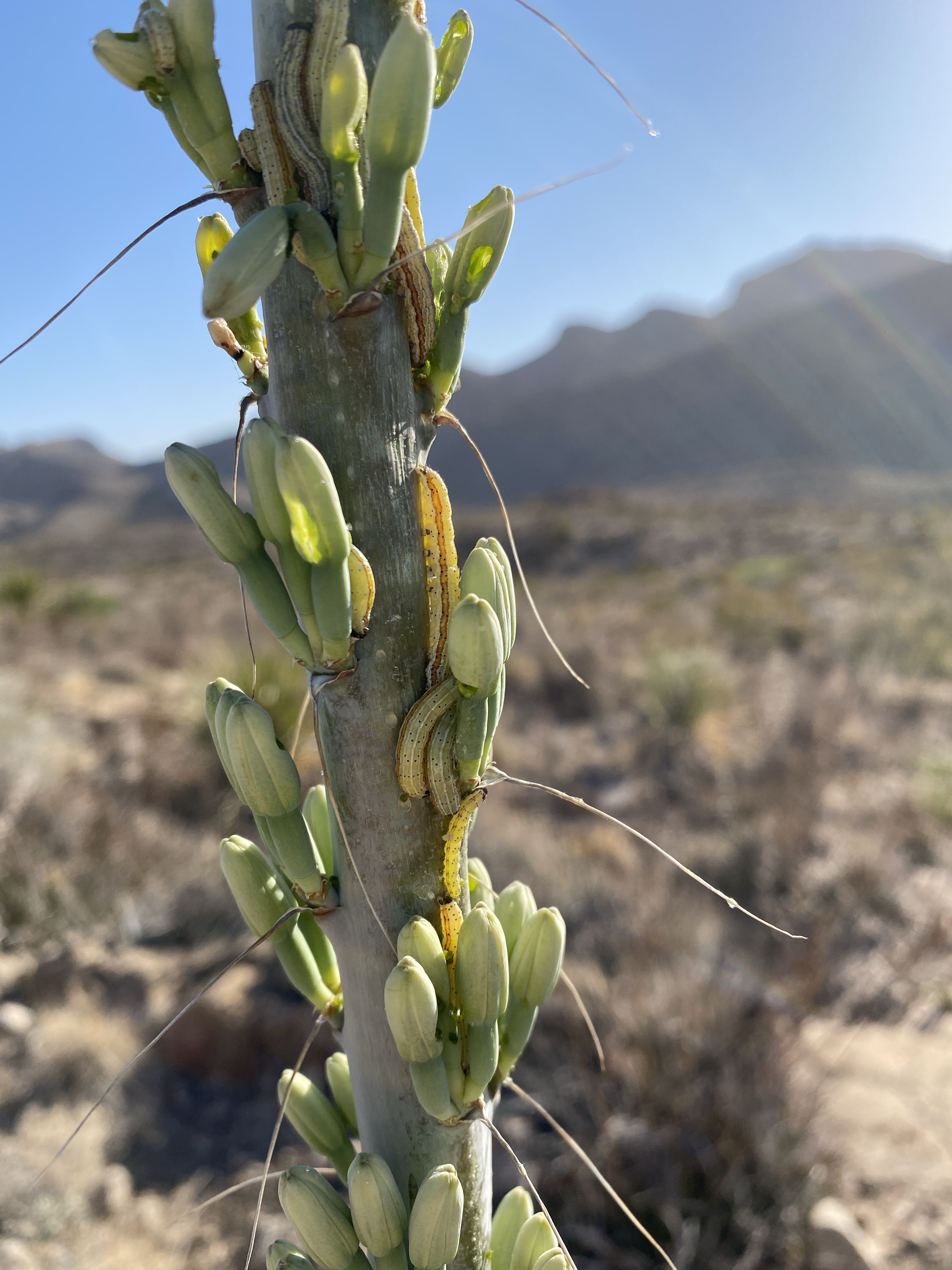
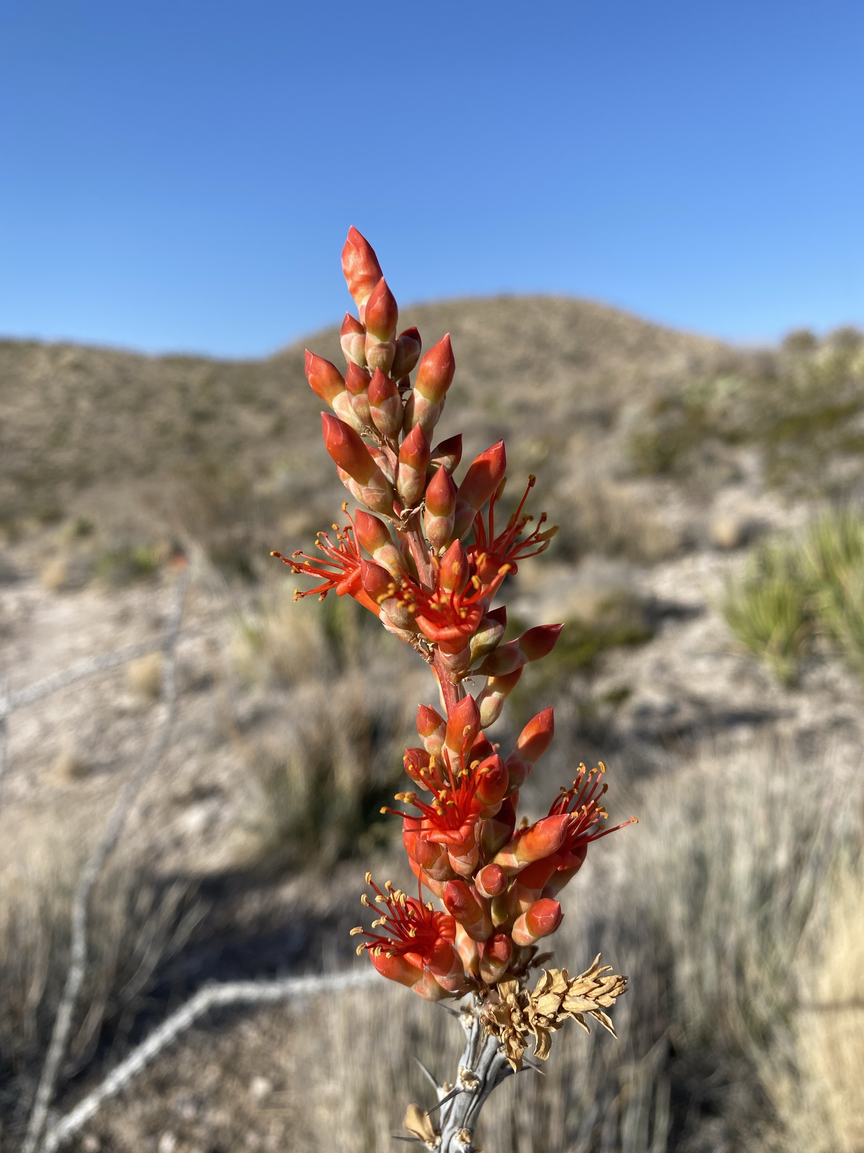
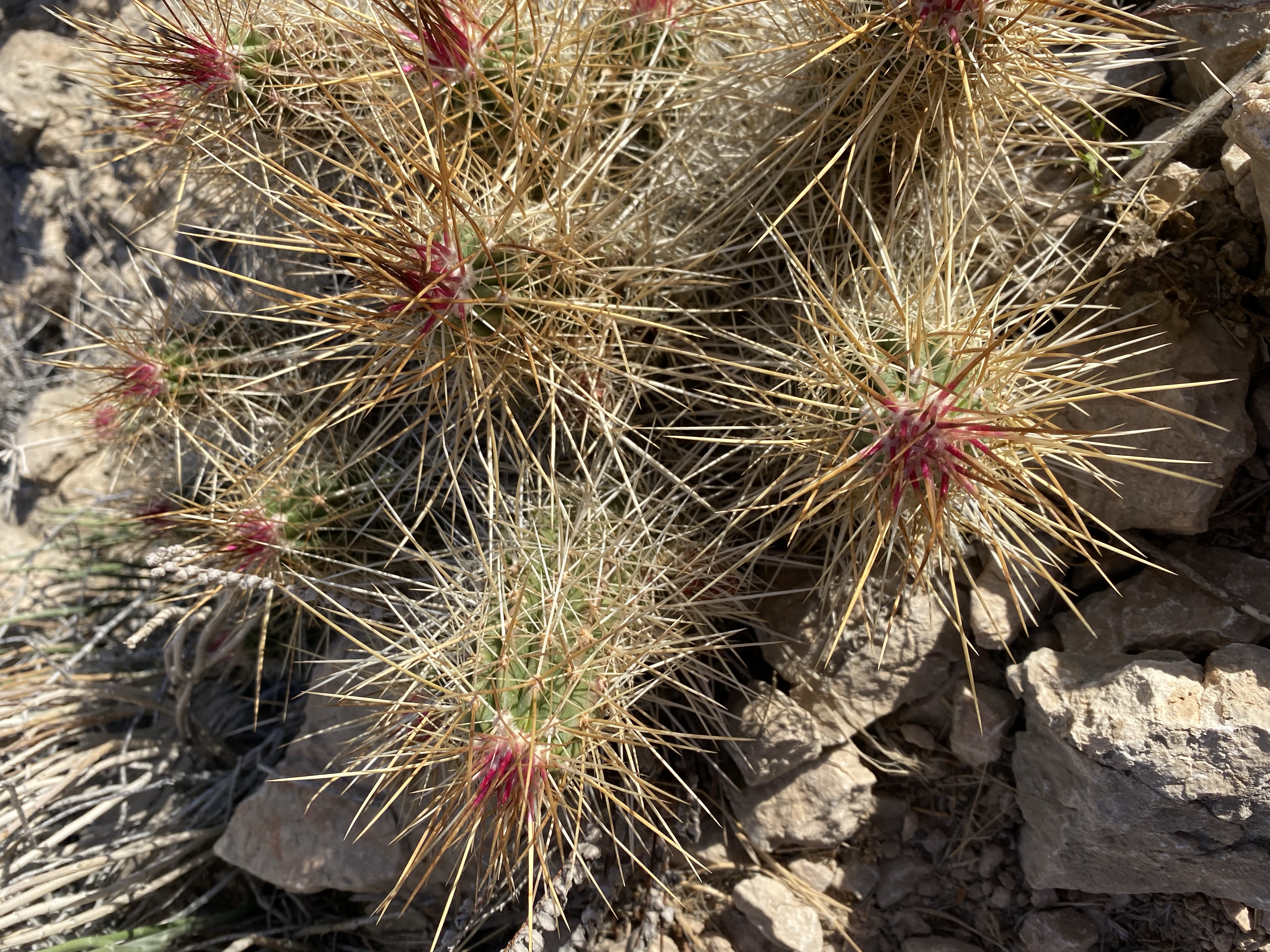
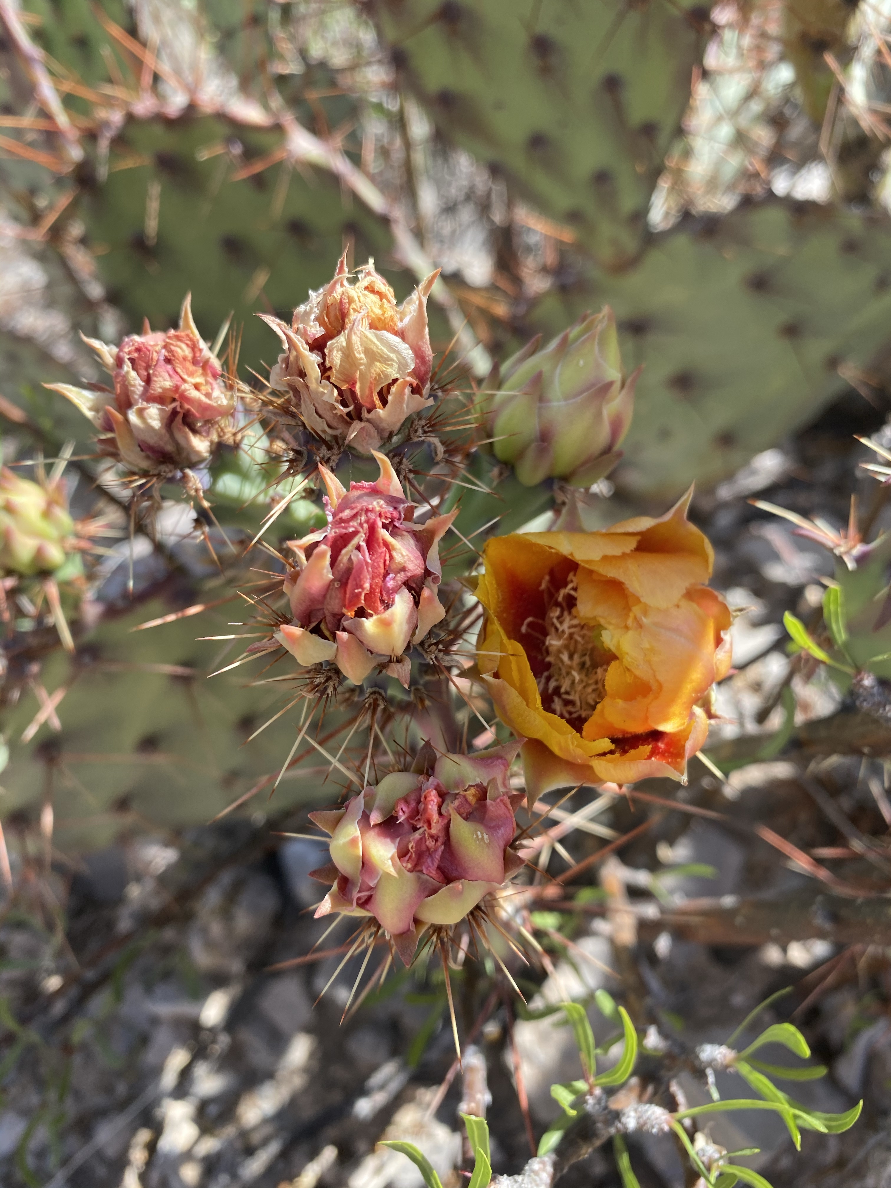
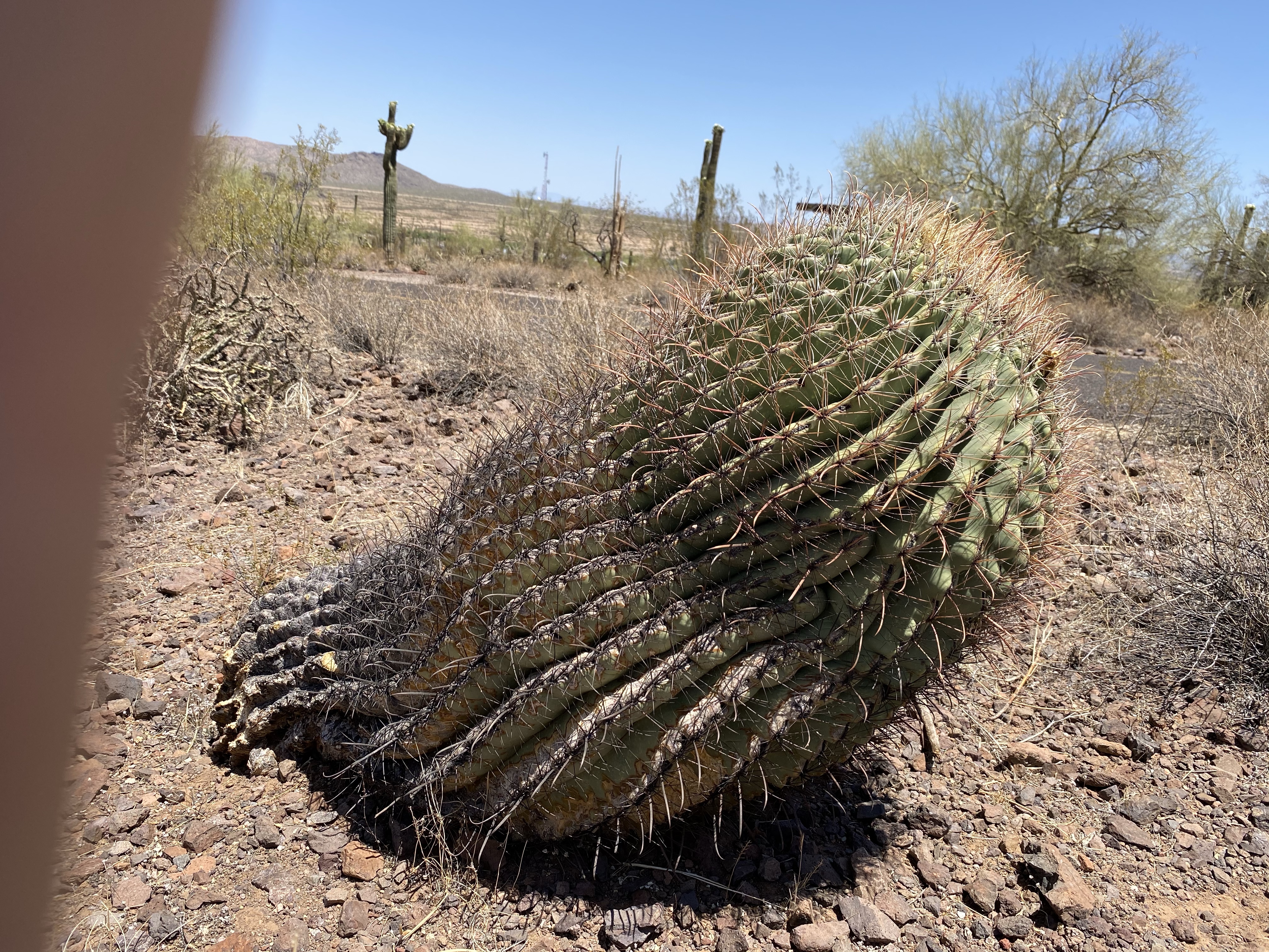
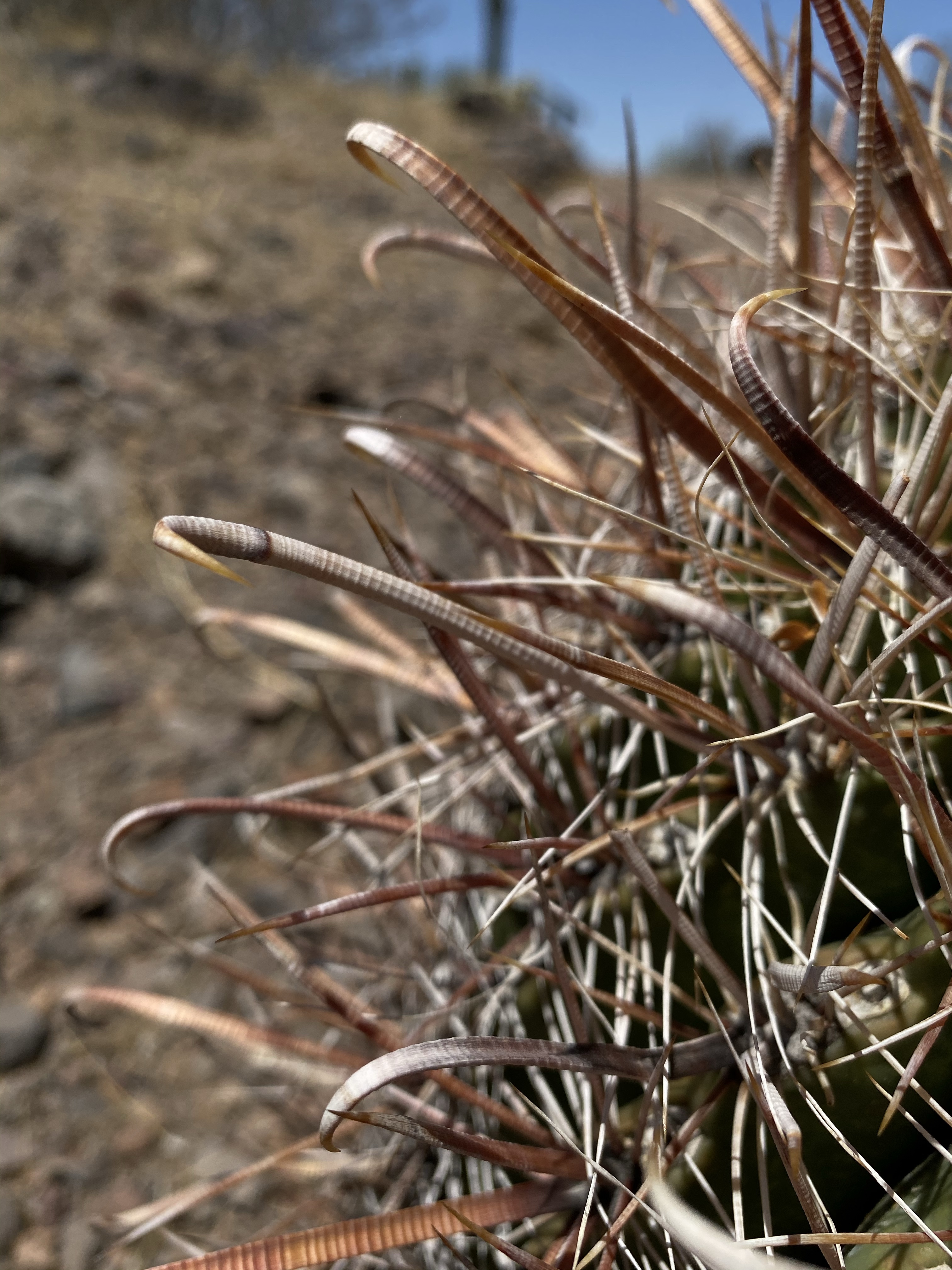
The plants are survivalists too, having adapted their structures and relying on animals. For example, cacti have the special ability of expanding to store water for later use! Their waxy exterior helps them retain moisture as well. Additionally, having spines instead of leaves requires less water usage and reduces the amount of the plant that is exposed to the sun. The Prickly Pear and Jojoba plants adjust by having only the thinest parts of their leaves or pads facing the sun. How cool! Below the surface magic is happening as well, with root structures that either stay shallow and wide or dig deep down to find water. Nature is super cool. And then there’s the Fishhook Barrel Cactus, that loves the sun so much that it eventually uproots itself from leaning too far towards the southwest. Maybe that one still has some learning to do.

The Saguaro have significance too for native people. Respected and revered by many tribes, the cacti provided them with materials for life. The mid-summer fruit provided food and the woody ribs building materials. The Tohono O’odham people continue to celebrate and cultivate the fruit the mighty Saguaro produces.

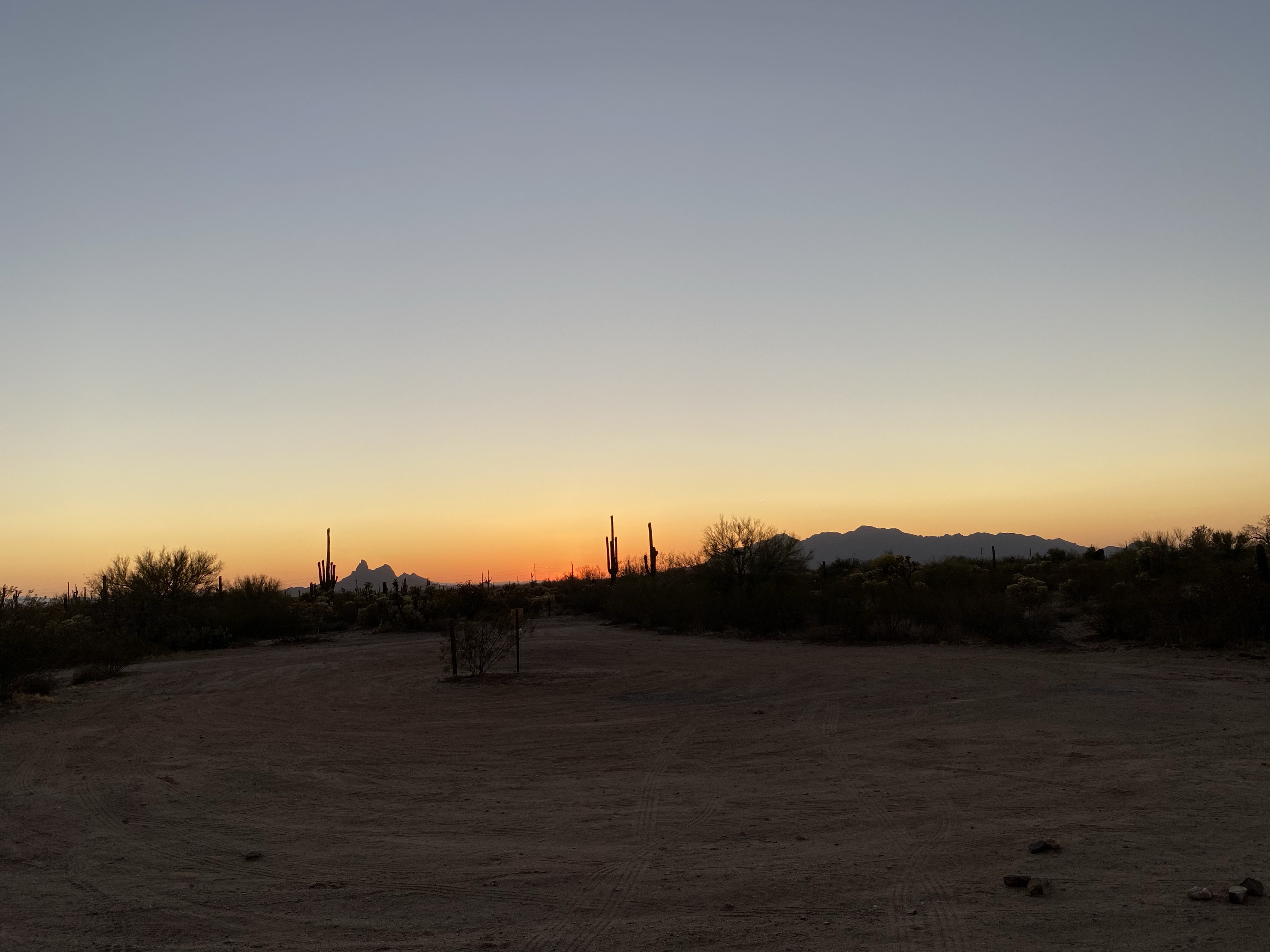
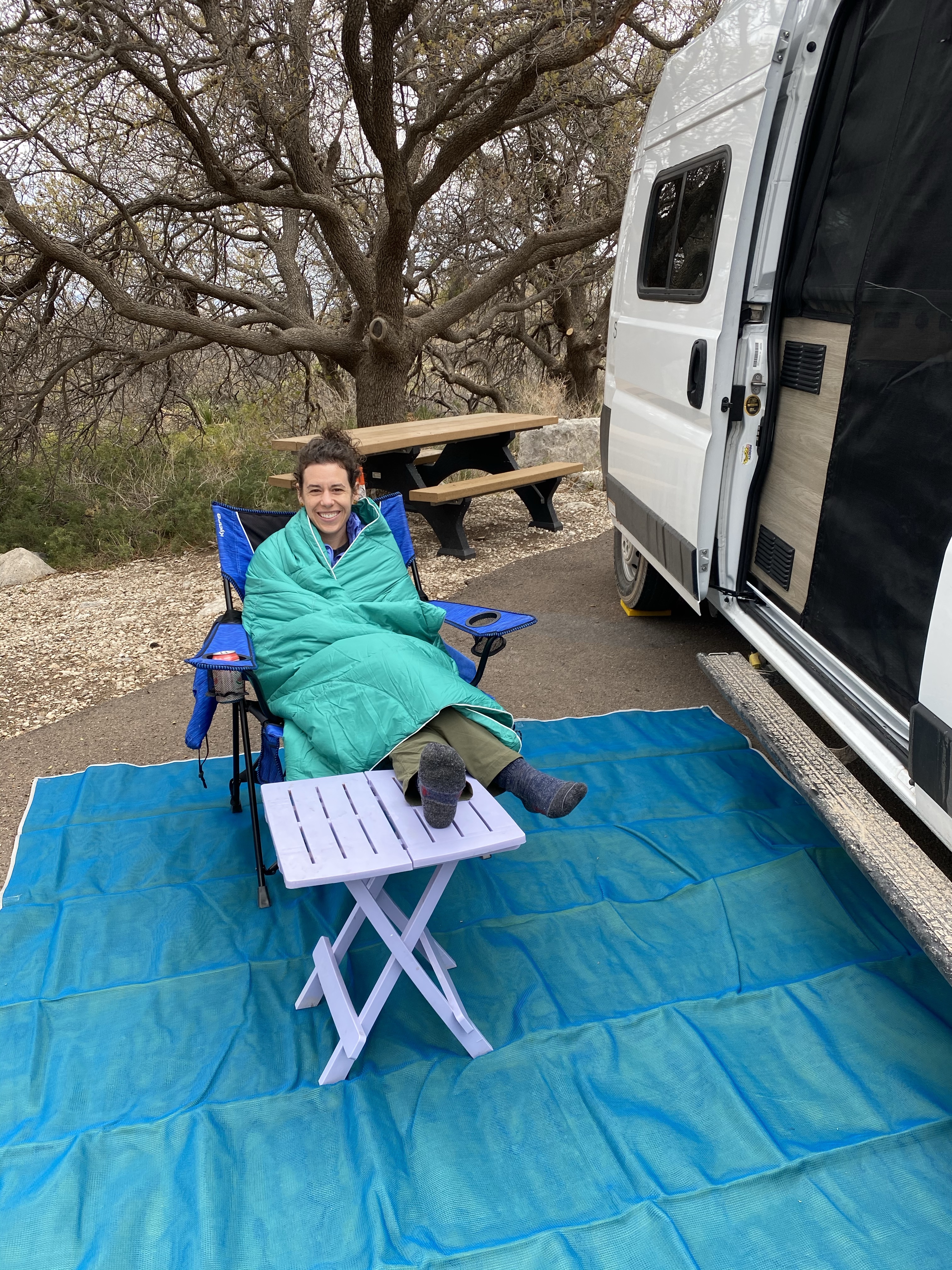
After learning, I settled down into my campsite to chat with my sister and watch the show the squirrels put on. Hoping for a handout, it scooted closed, skitted back and forth, ran away, and came back for another go. At one point, it laid down flat, front arms stretched out, back lays splayed, squashed to the ground. I think it was hoping if it laid still enough, low enough, I wouldn’t notice it! Eventually it grew tired of waiting though and moved on to perhaps a more generous camper. That night was early to bed so I could rise early for Picacho Peak in the morning.

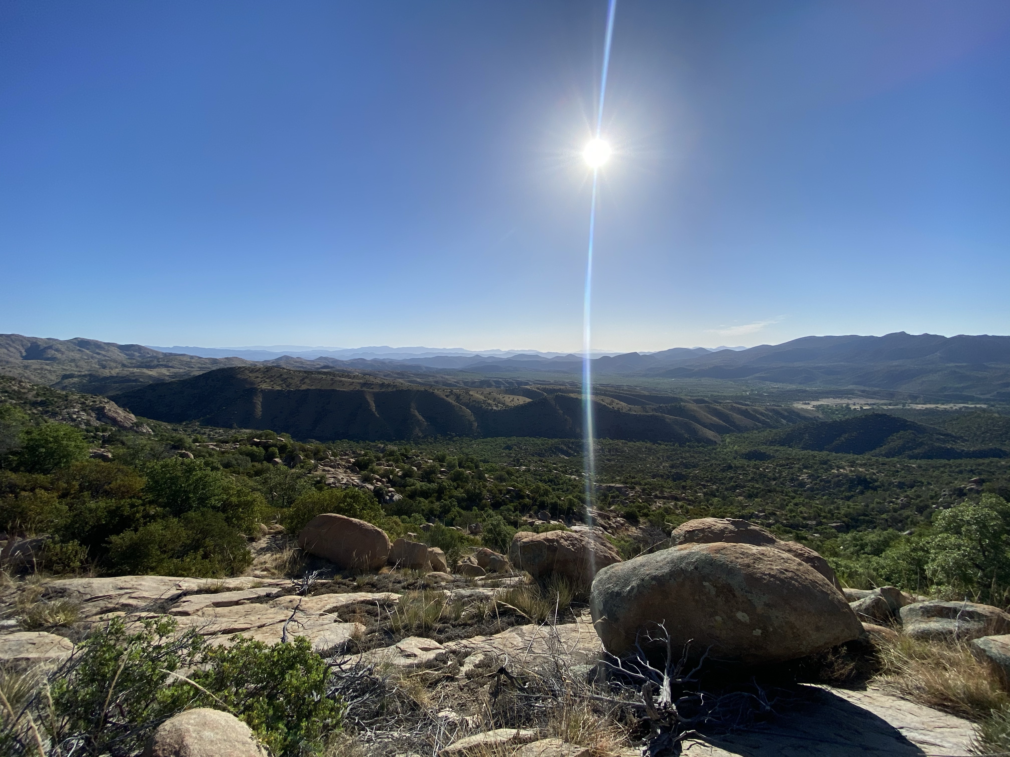
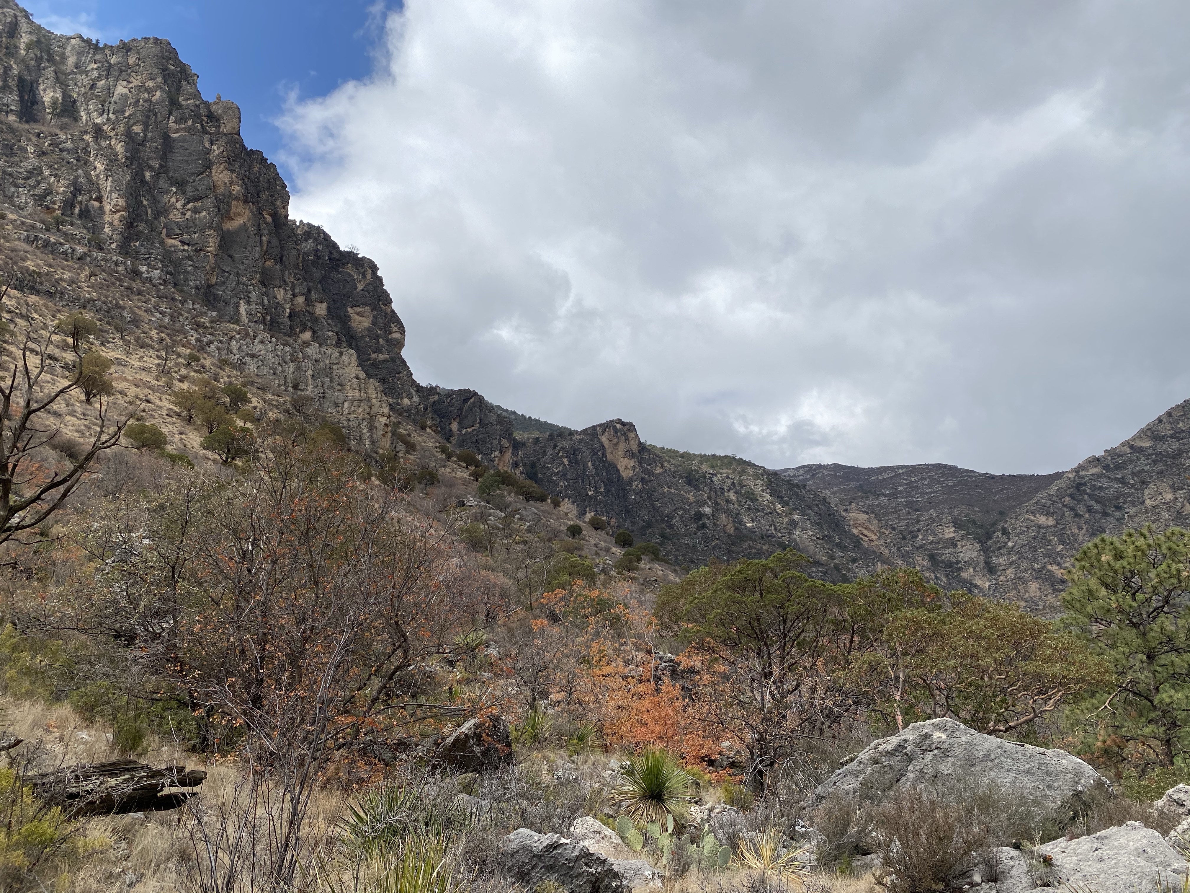
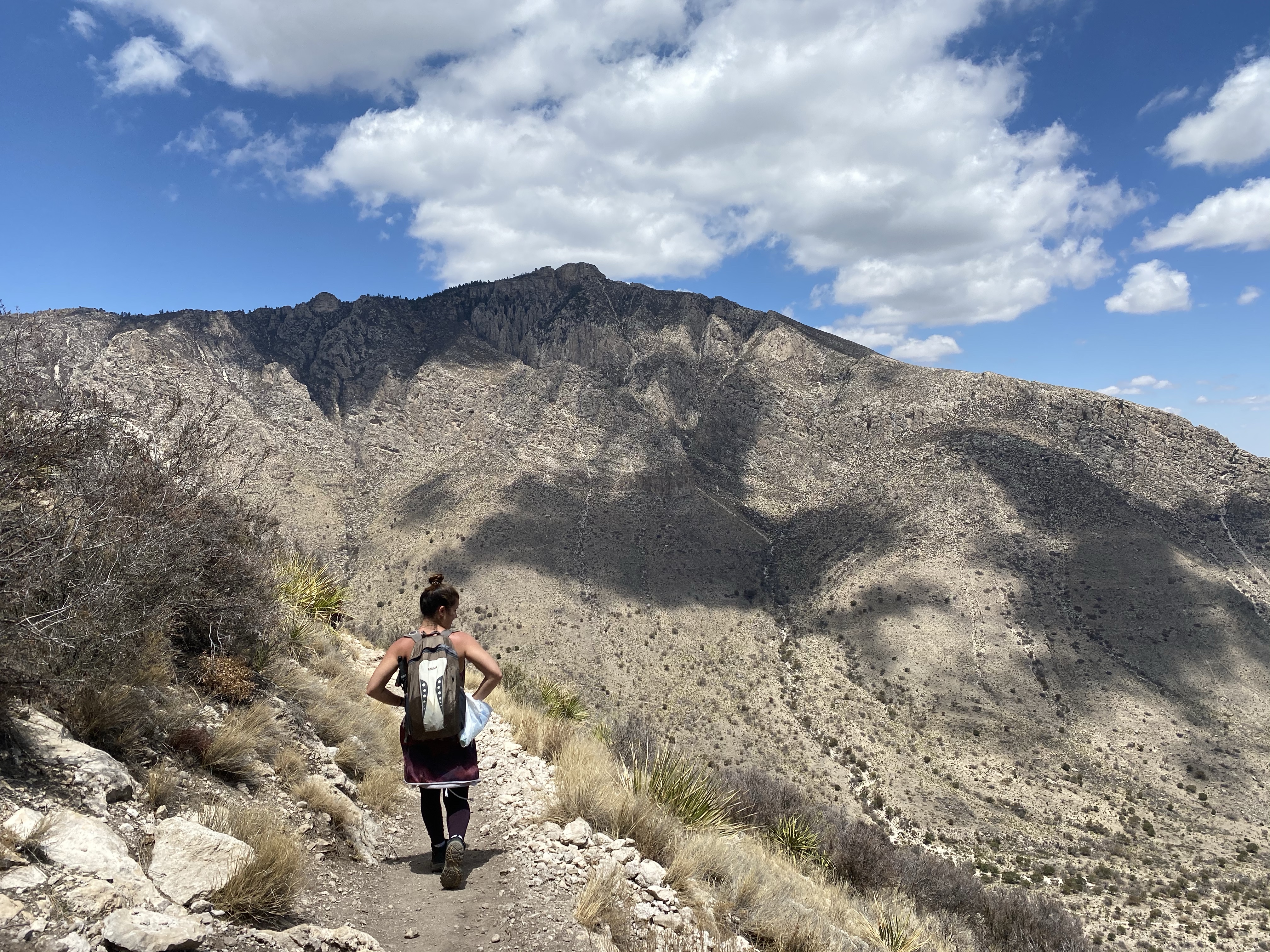
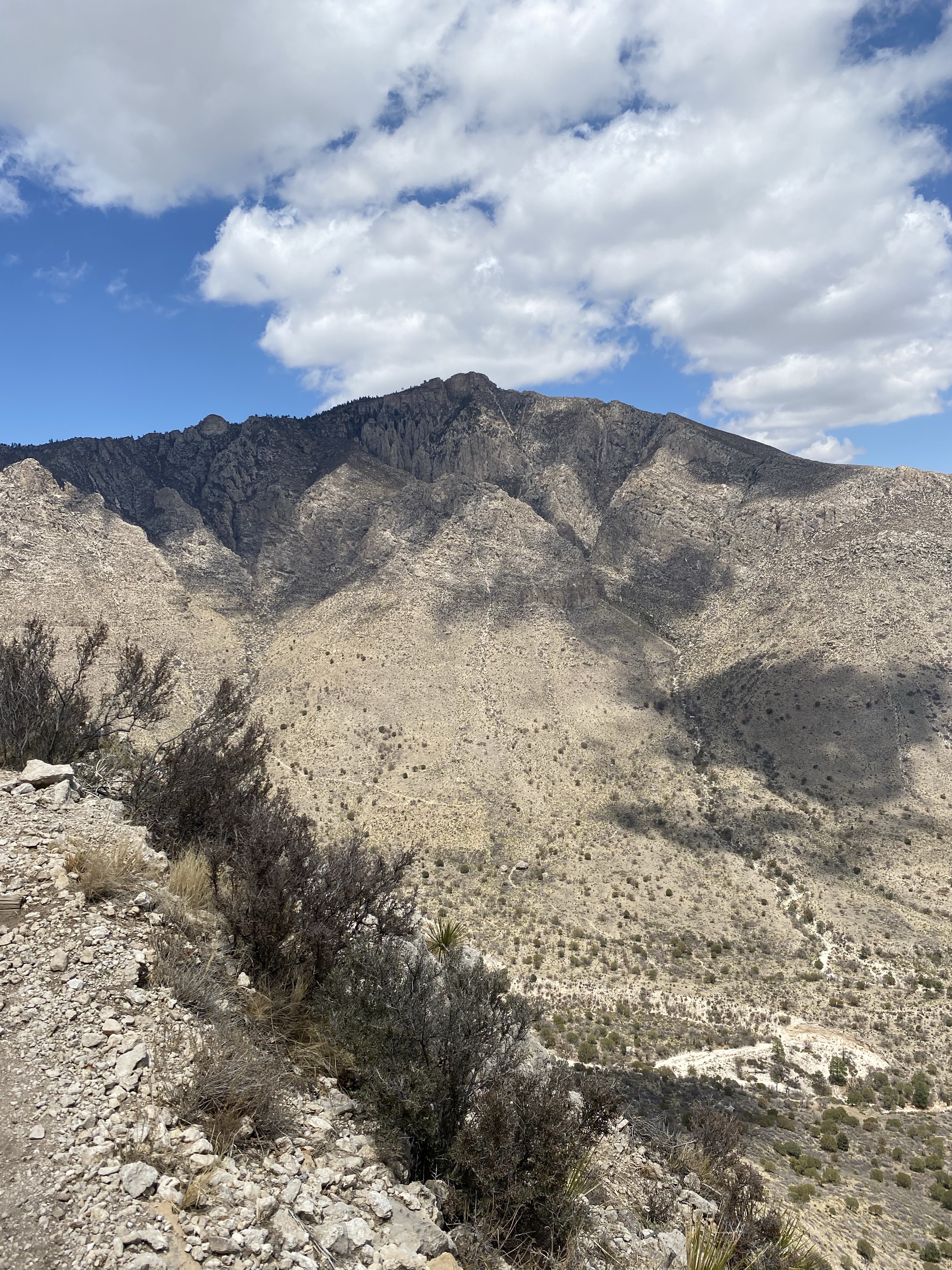
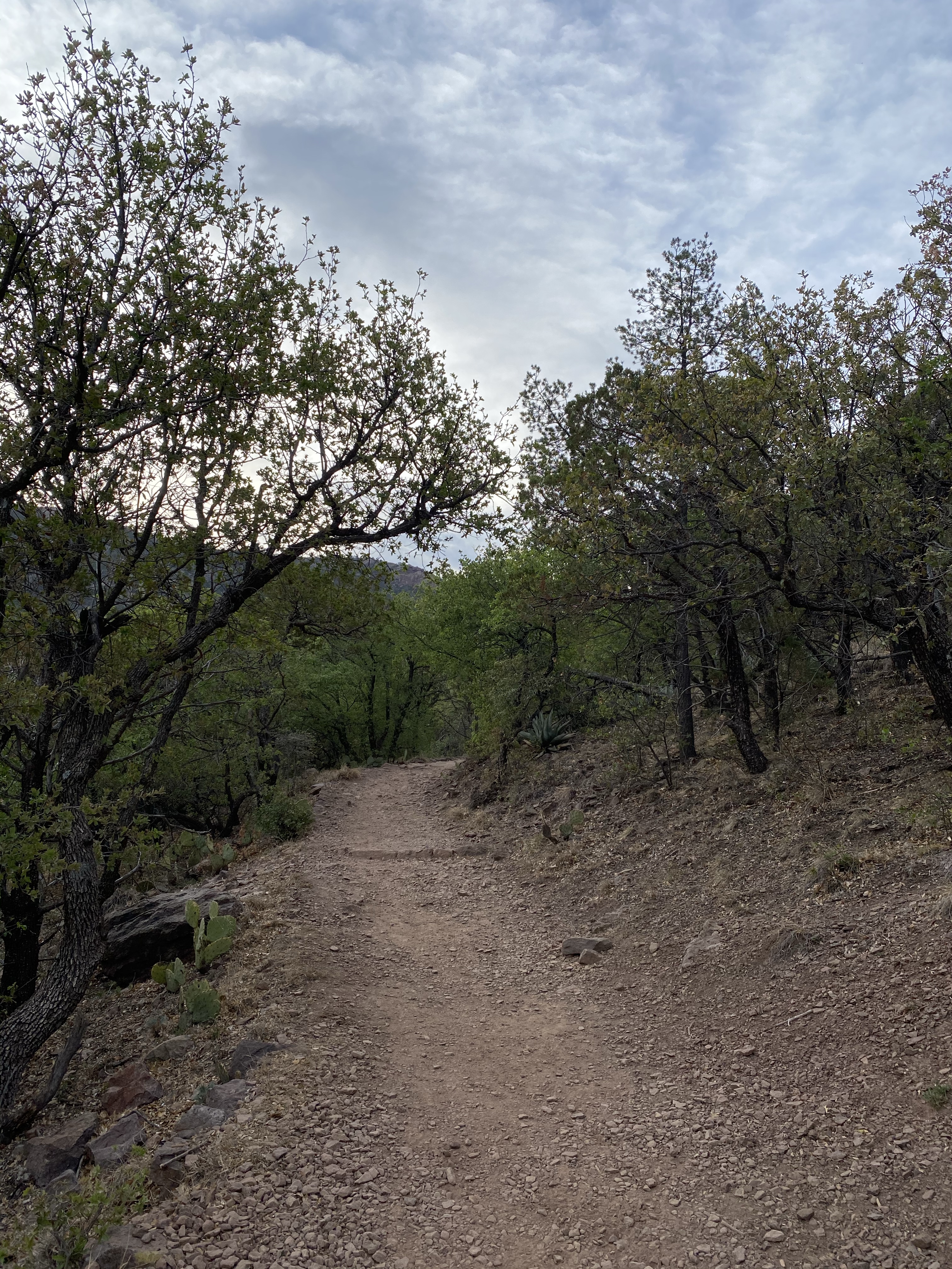
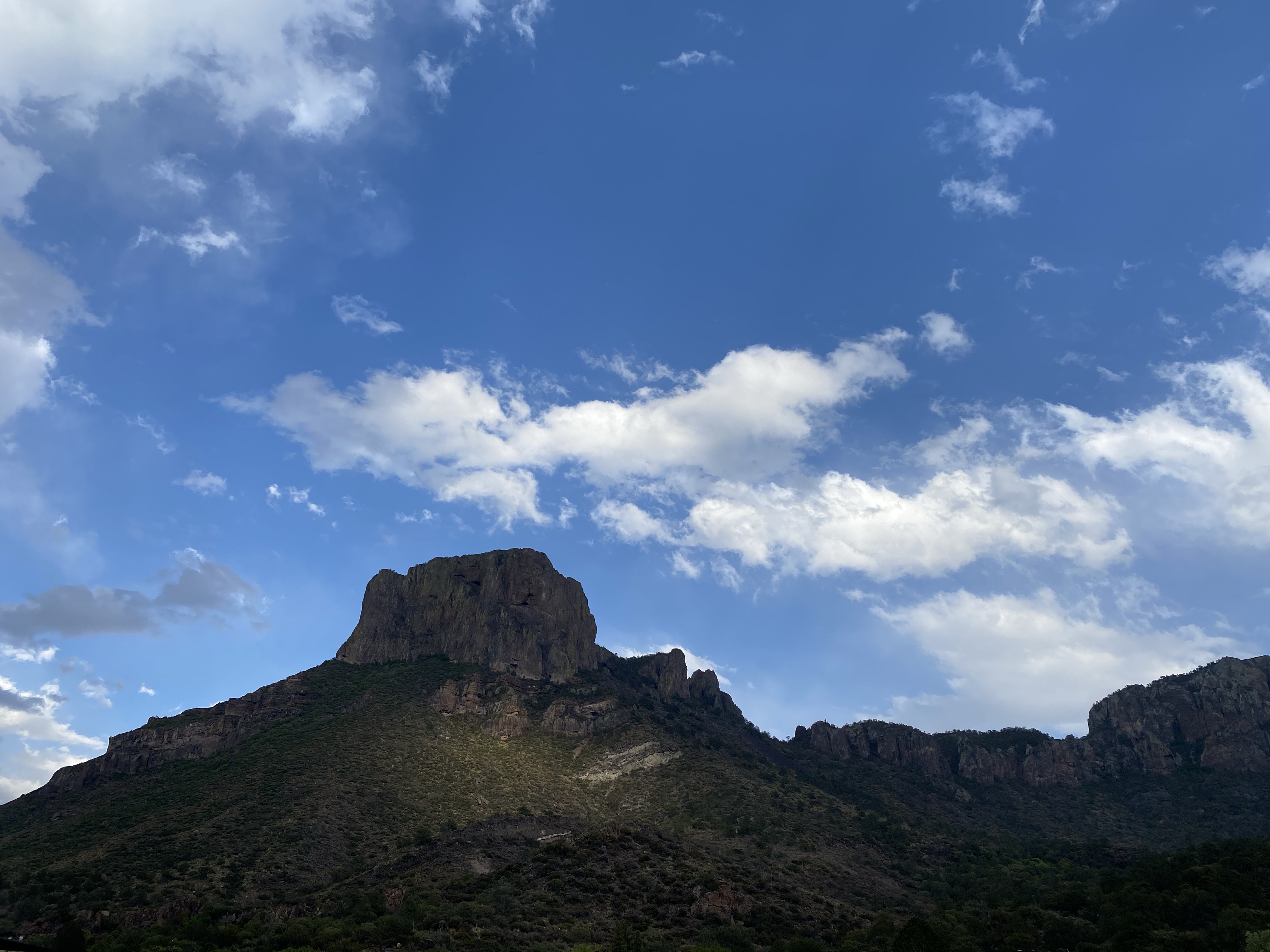
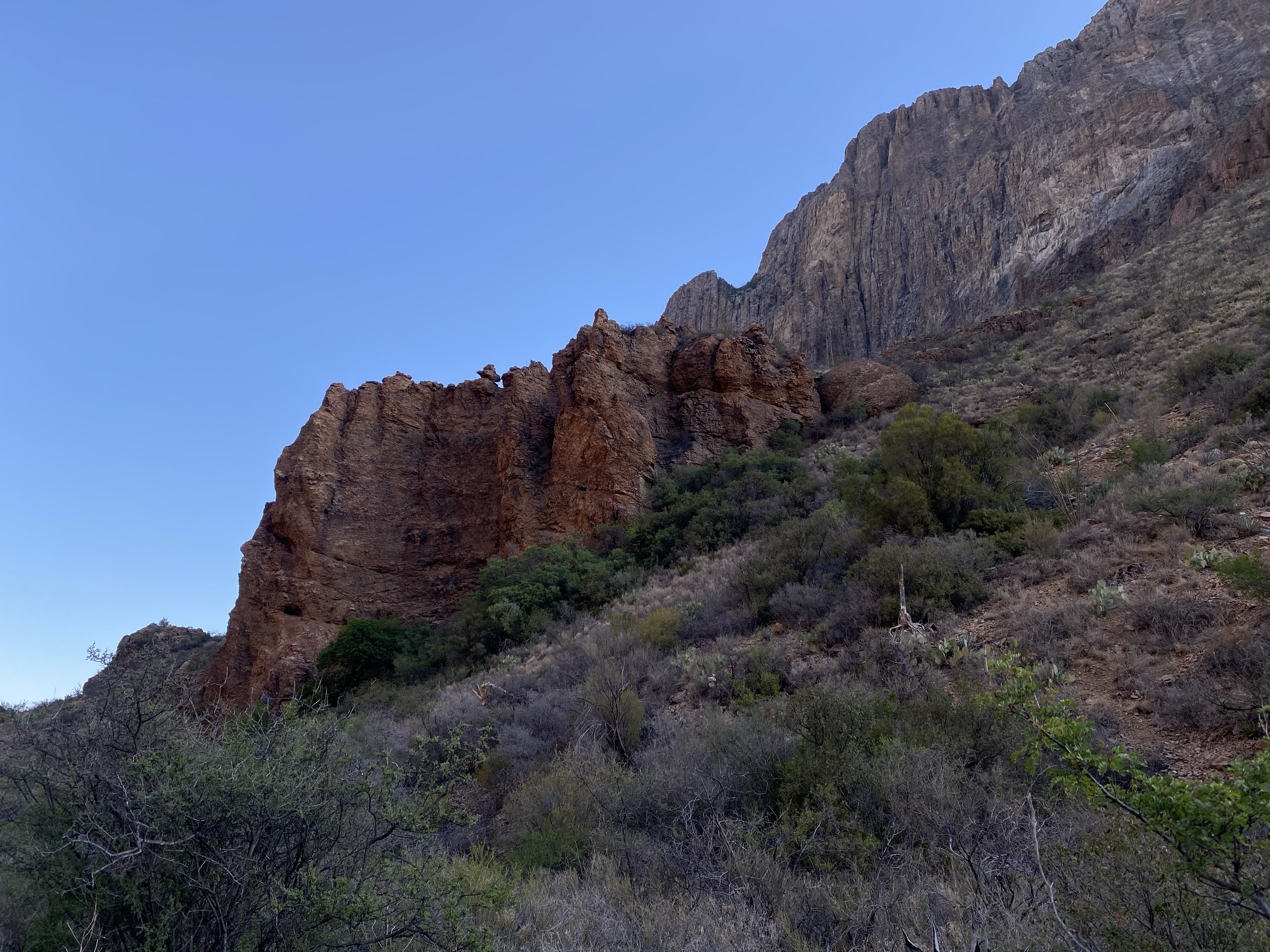
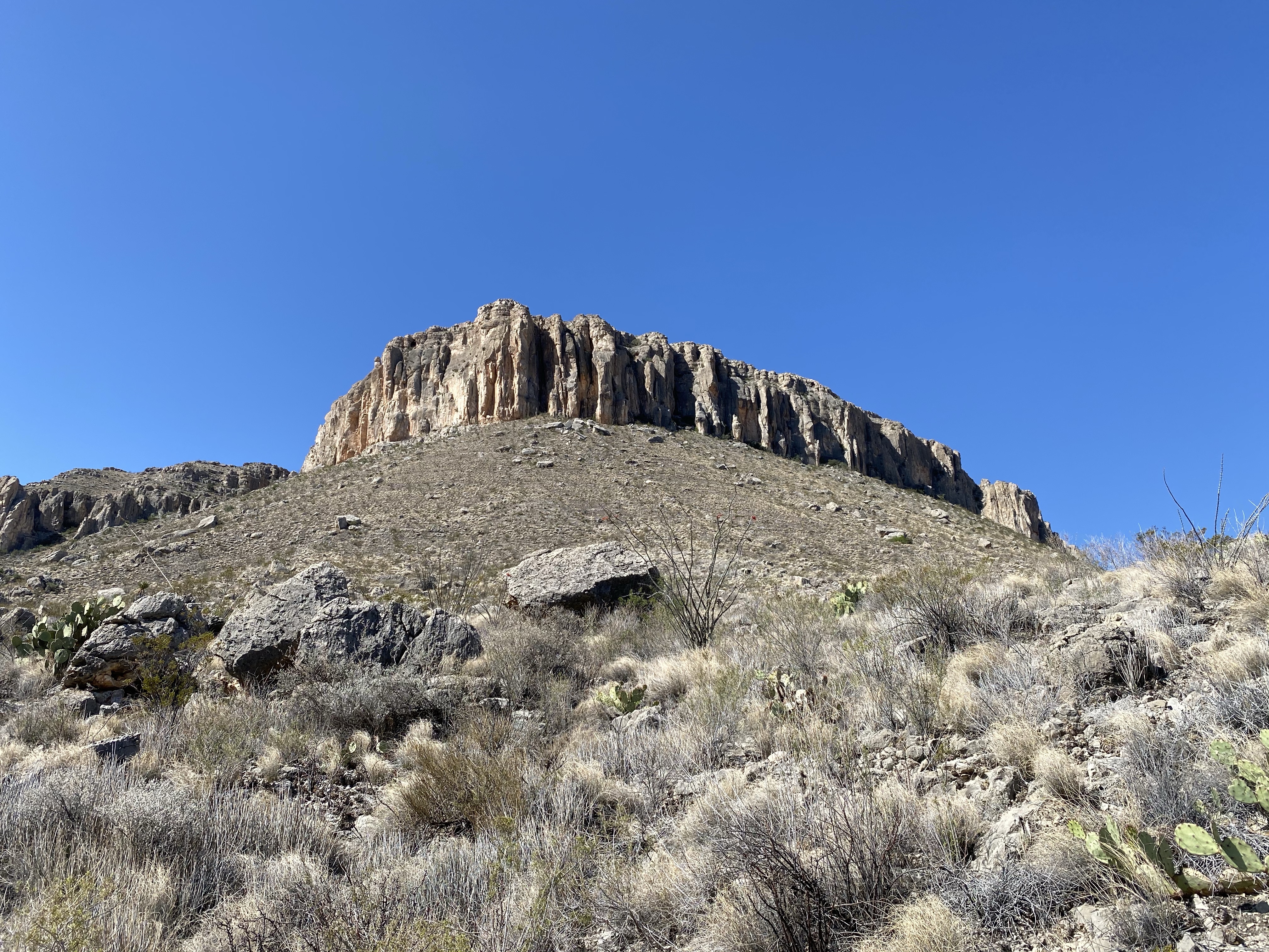
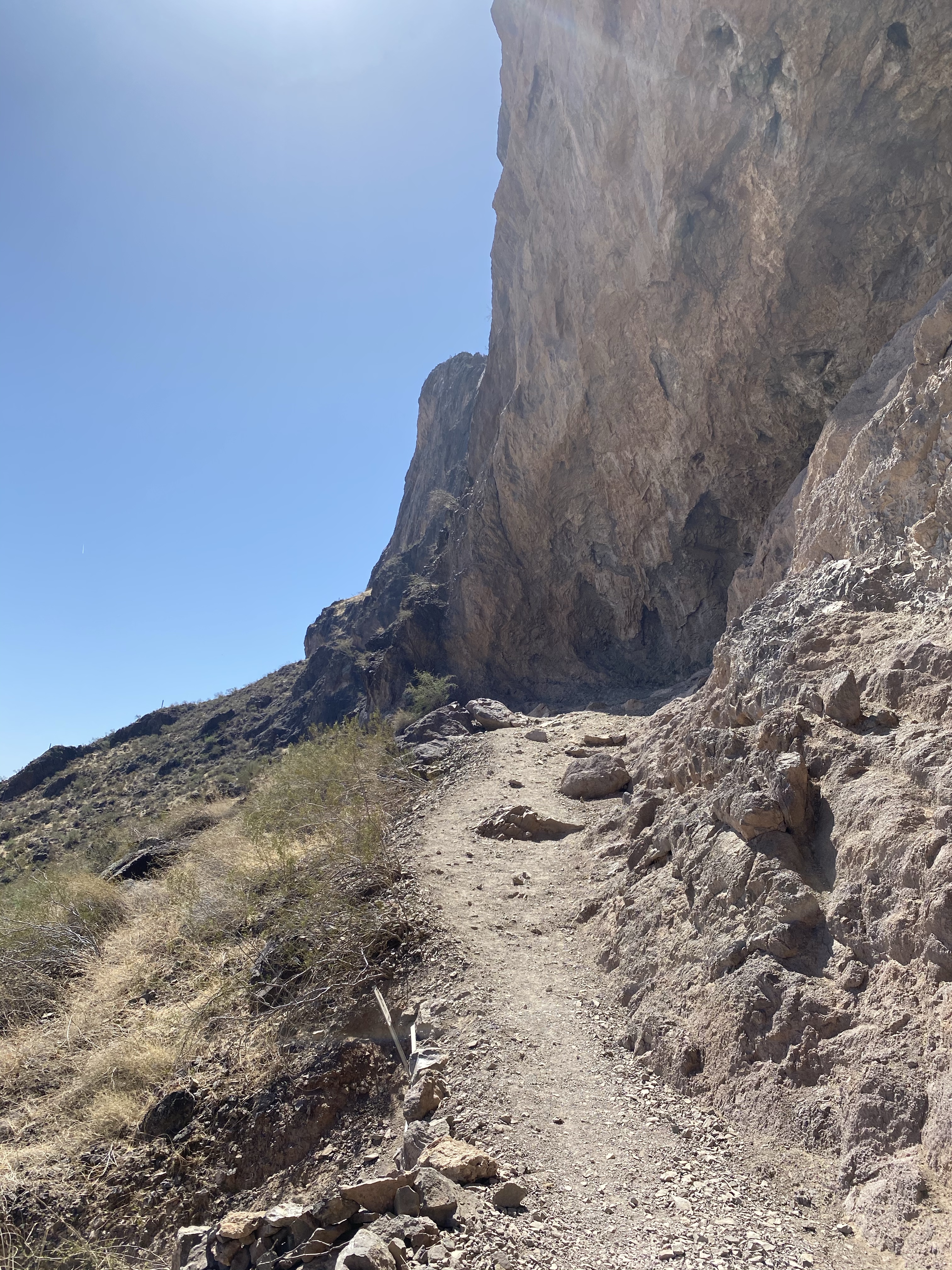
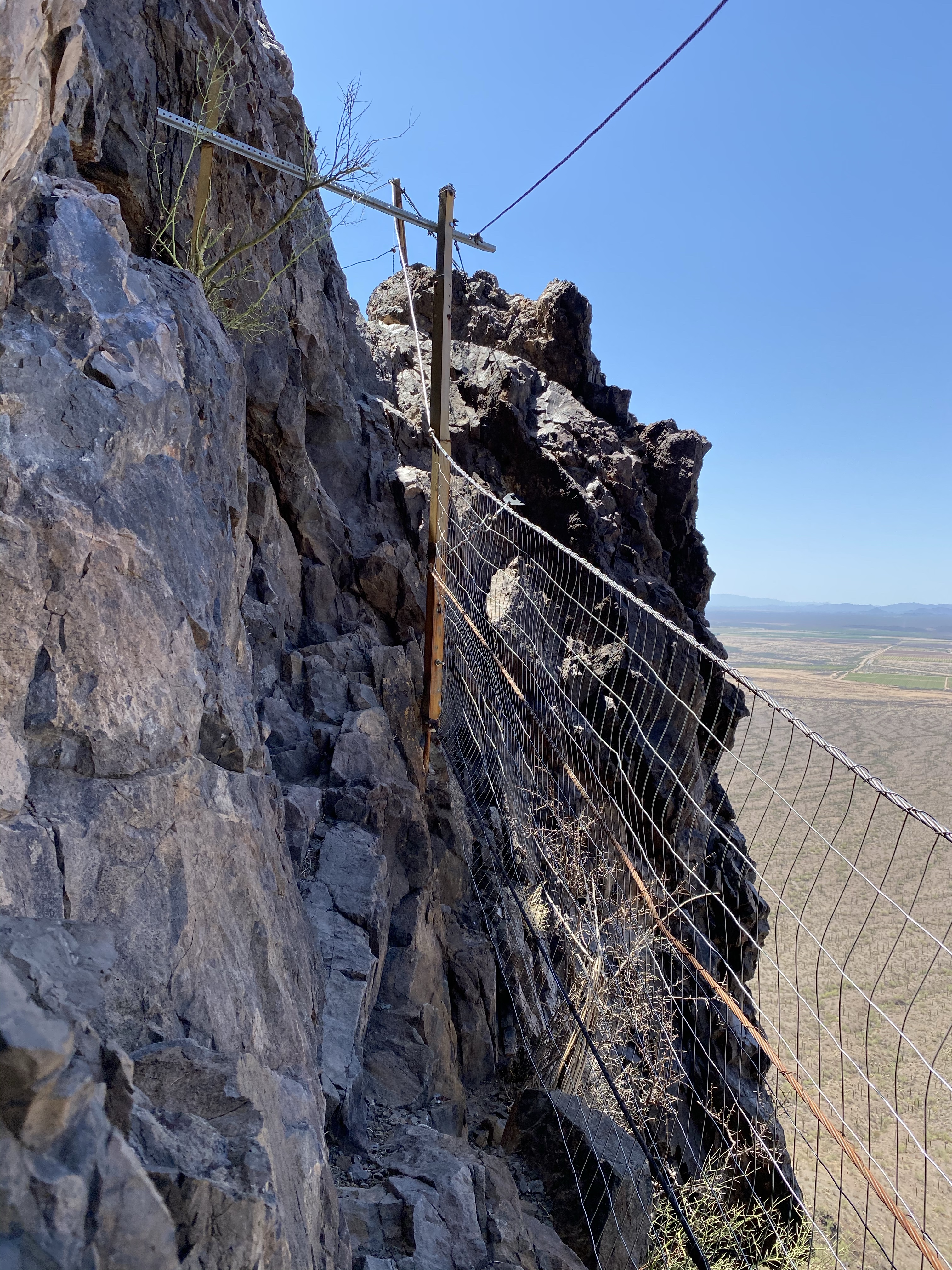
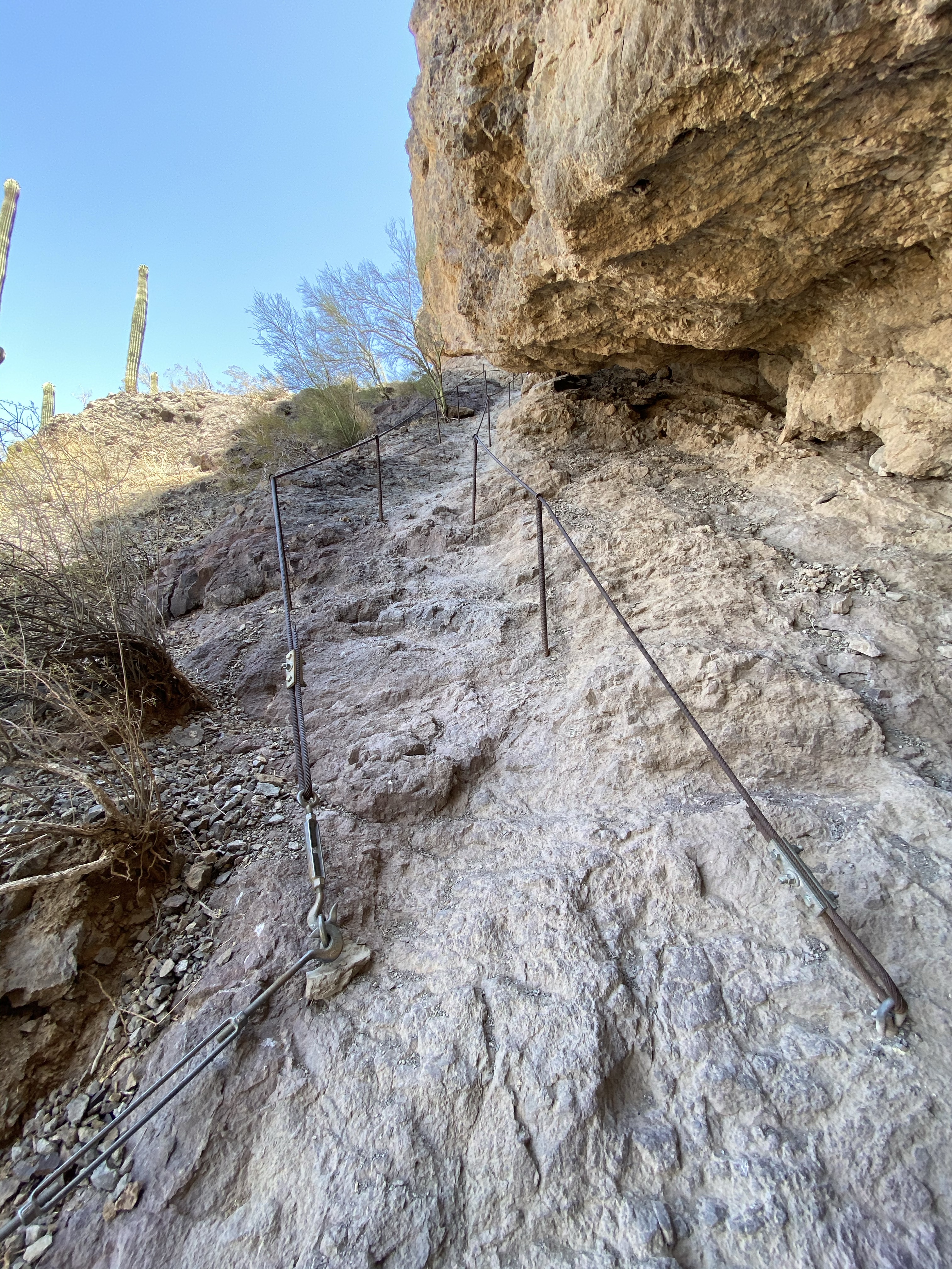
With sun blazing, the next morning I hit Hunter Trail for the short hike to the peak. Just three miles round trip, it sounds initially like it would be easy. But do I do much that is easy? Not these days. Over three miles I was to climb 1,500 feet in elevation over boulders and rocky paths, using cables to guide me along. I didn’t think too much about the challenge ahead, better just to go for it I told myself.

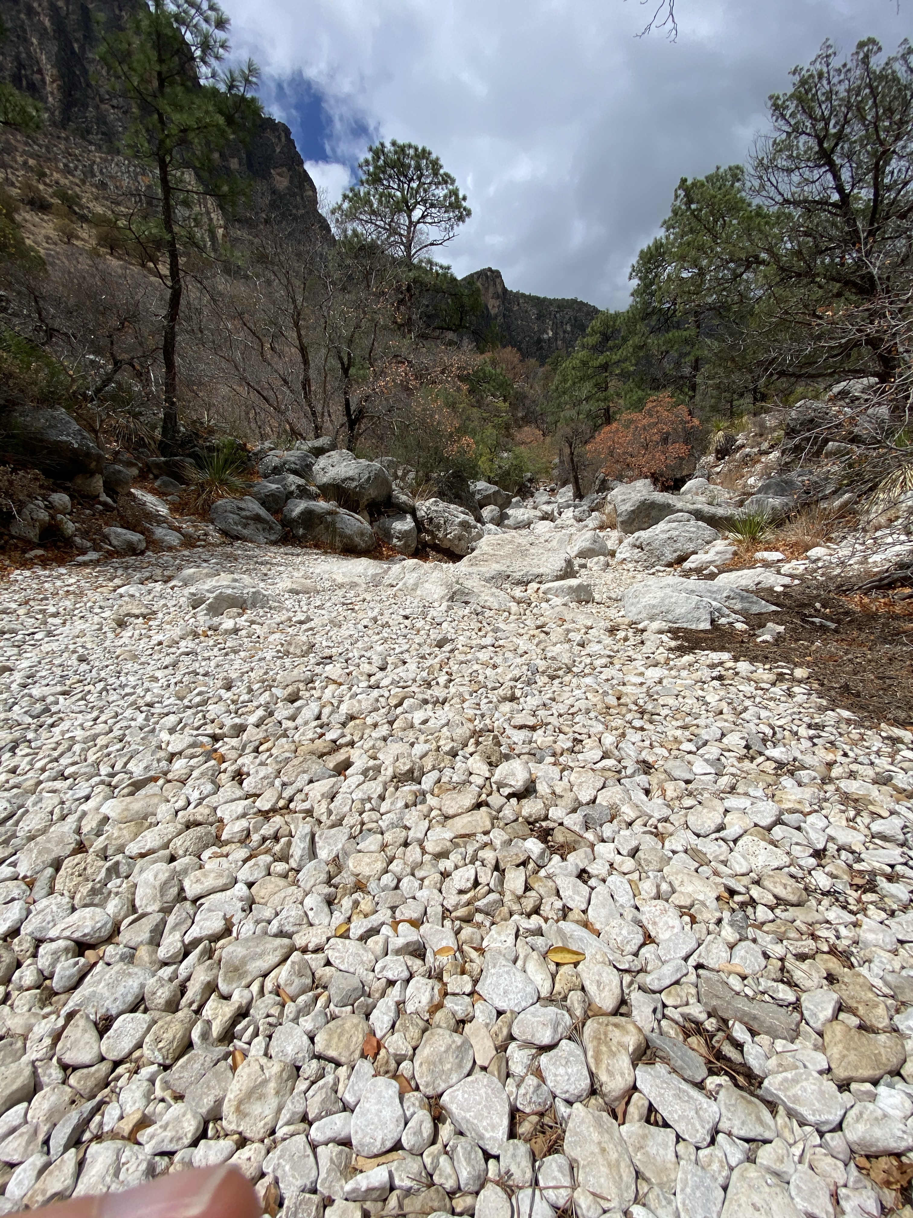
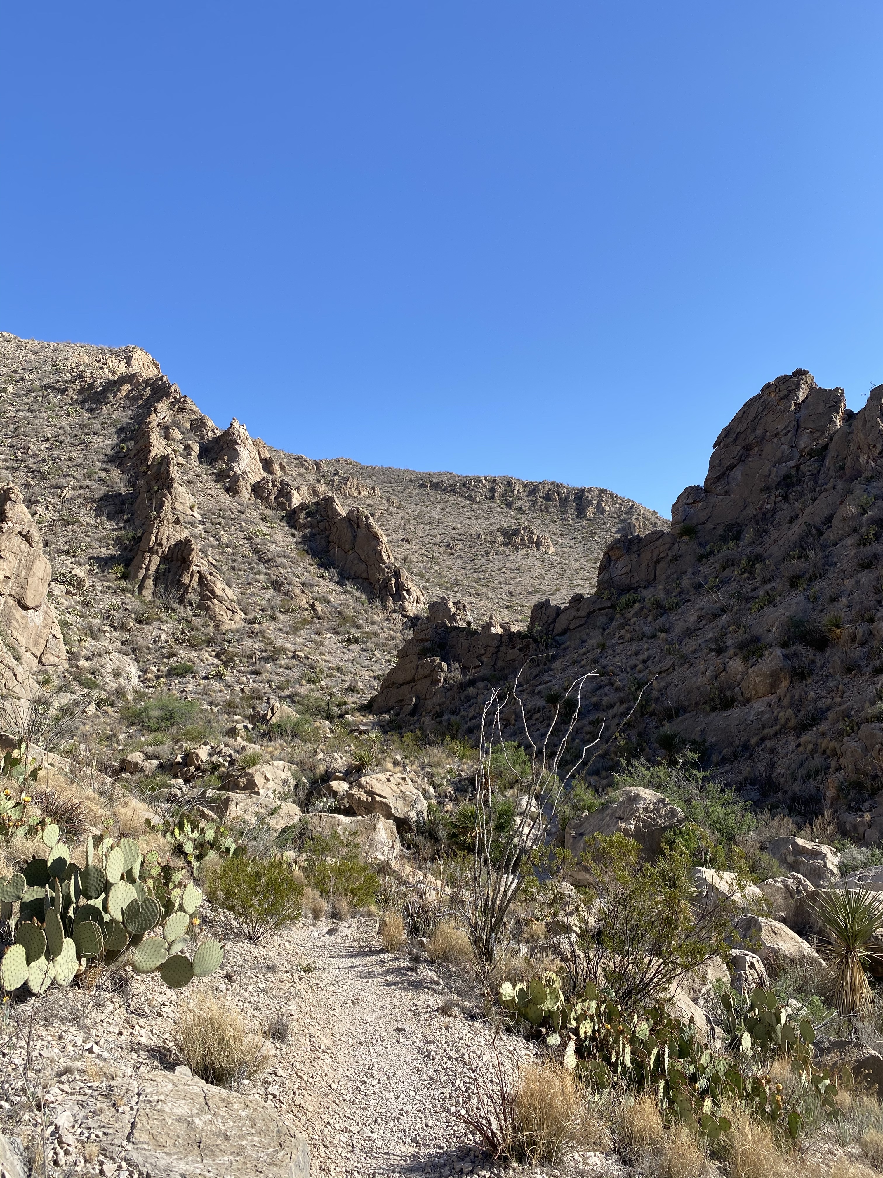
So off I went, slowly climbing the first three-quarters of a mile on a dusty switchback path towards the peak. While a good workout for the lungs, this first part wasn’t much different than what I had been hiking lately. I enjoyed the shaded provided by the cliff wall above me and moved forward to the first lookout.

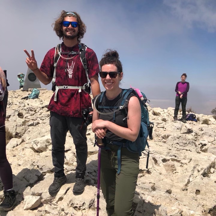
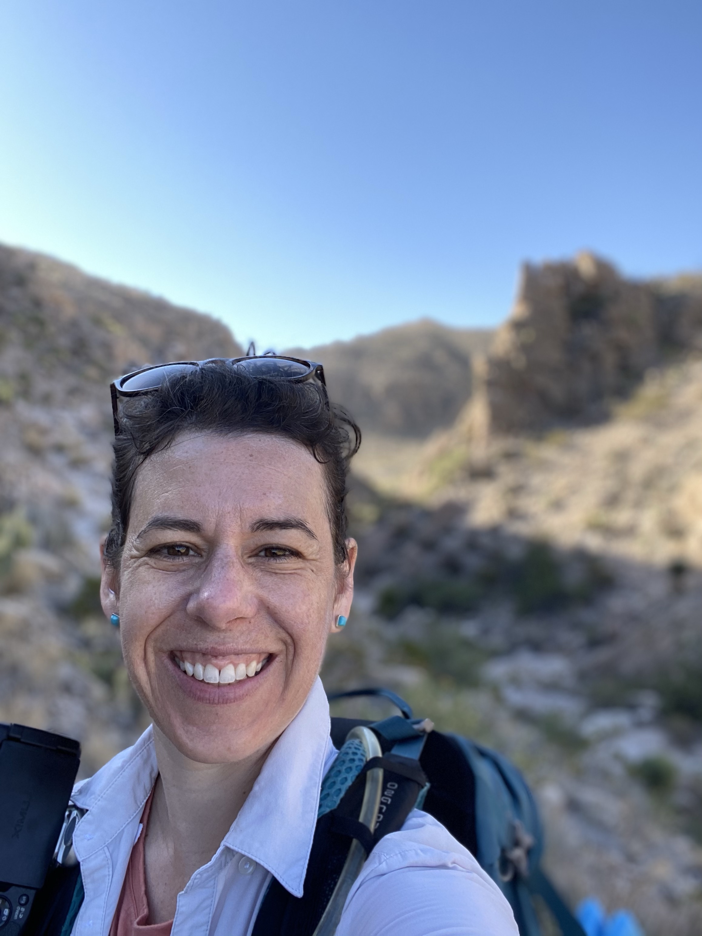
Here I met hikers returning from their ascent, tired, sweaty, and breathing heavy. I waited with another hiker at the rocky landing spot, watching the gloved hikers climb up the chute using cables tethered to the mountain on their side. We were told gloves were essential, and went back to borrow a few pairs left at the bench above. Best move of the day. Then down Dave and I went, unofficially deciding it was better to proceed together rather than alone.

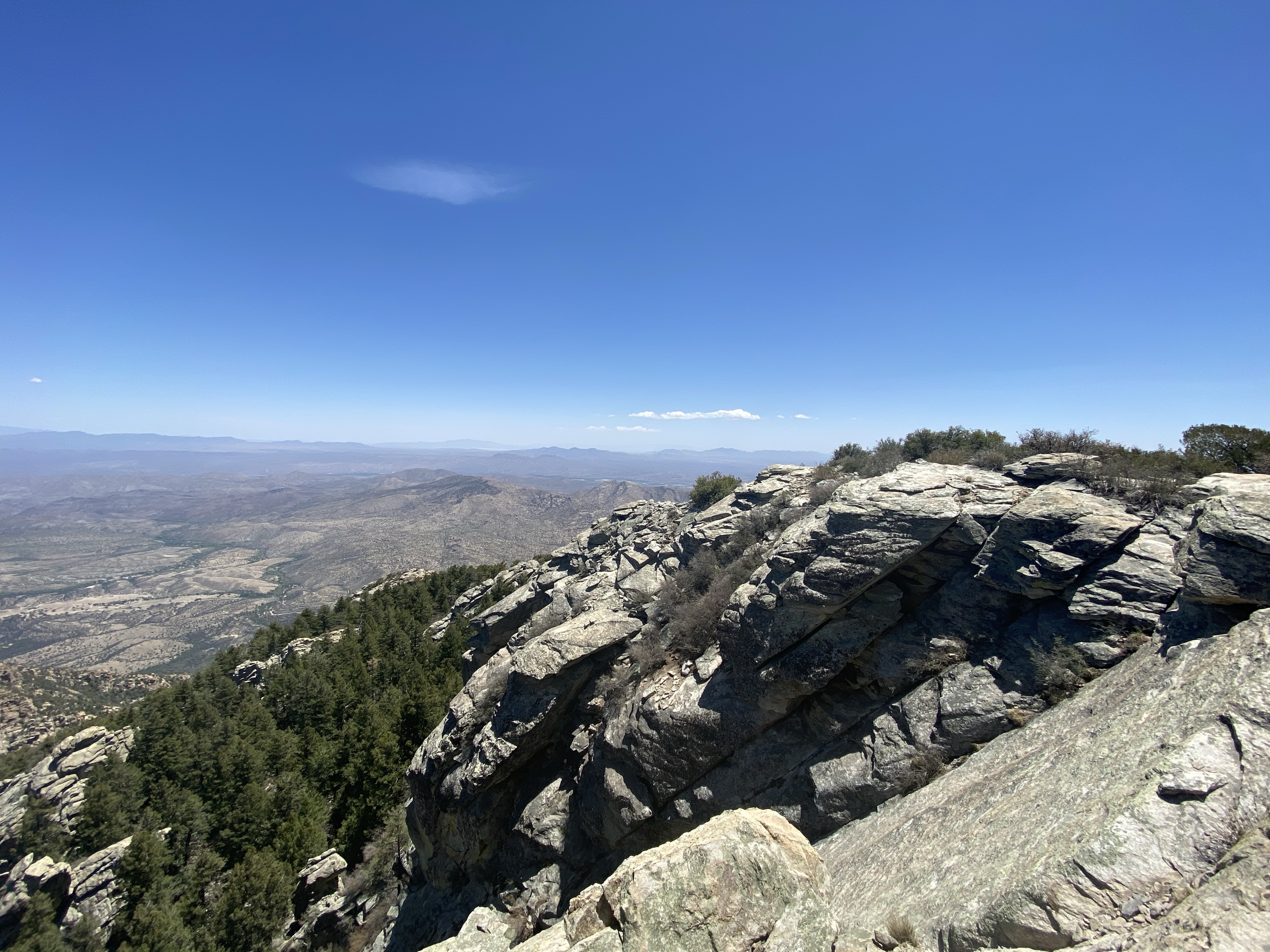
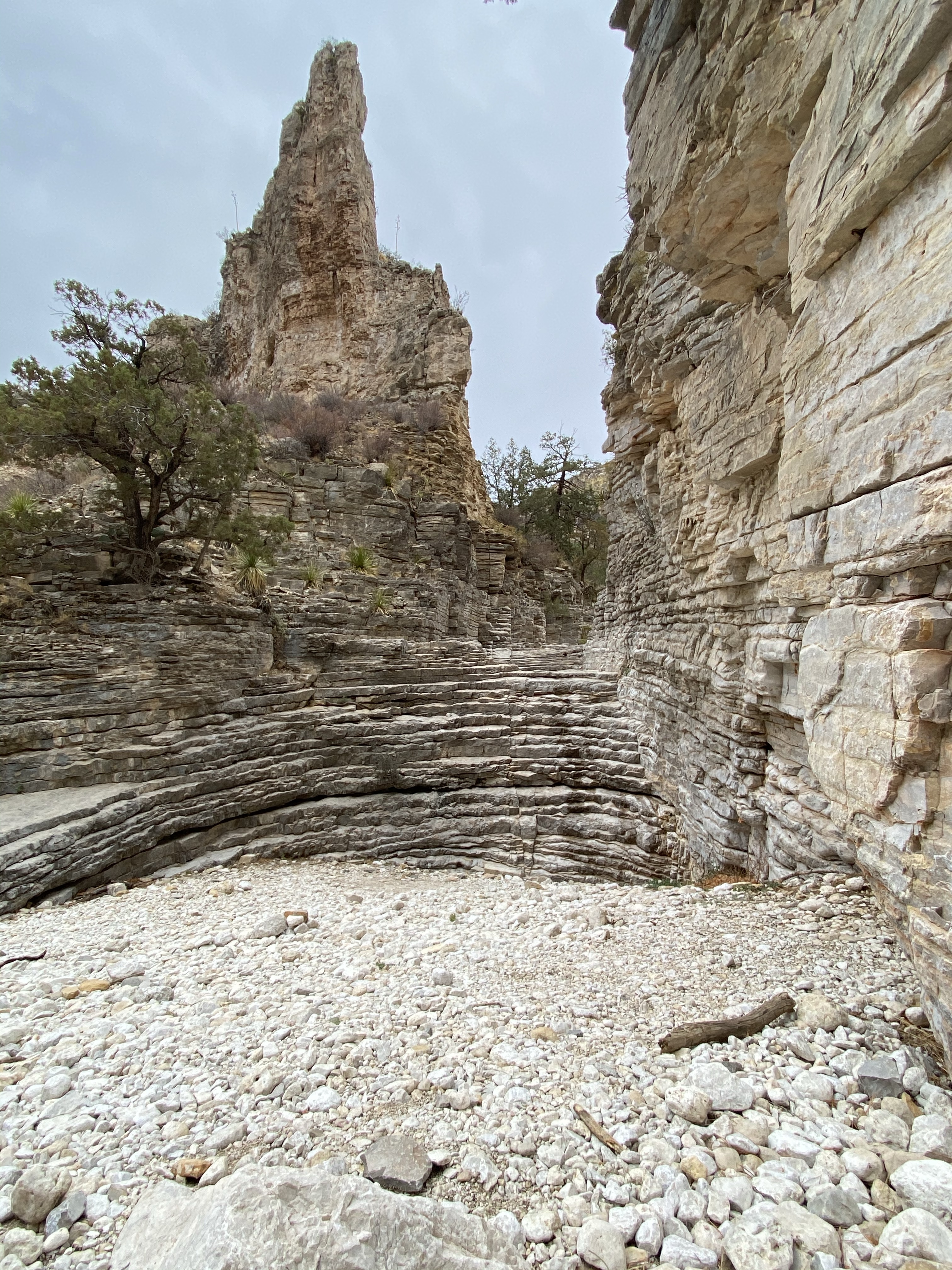
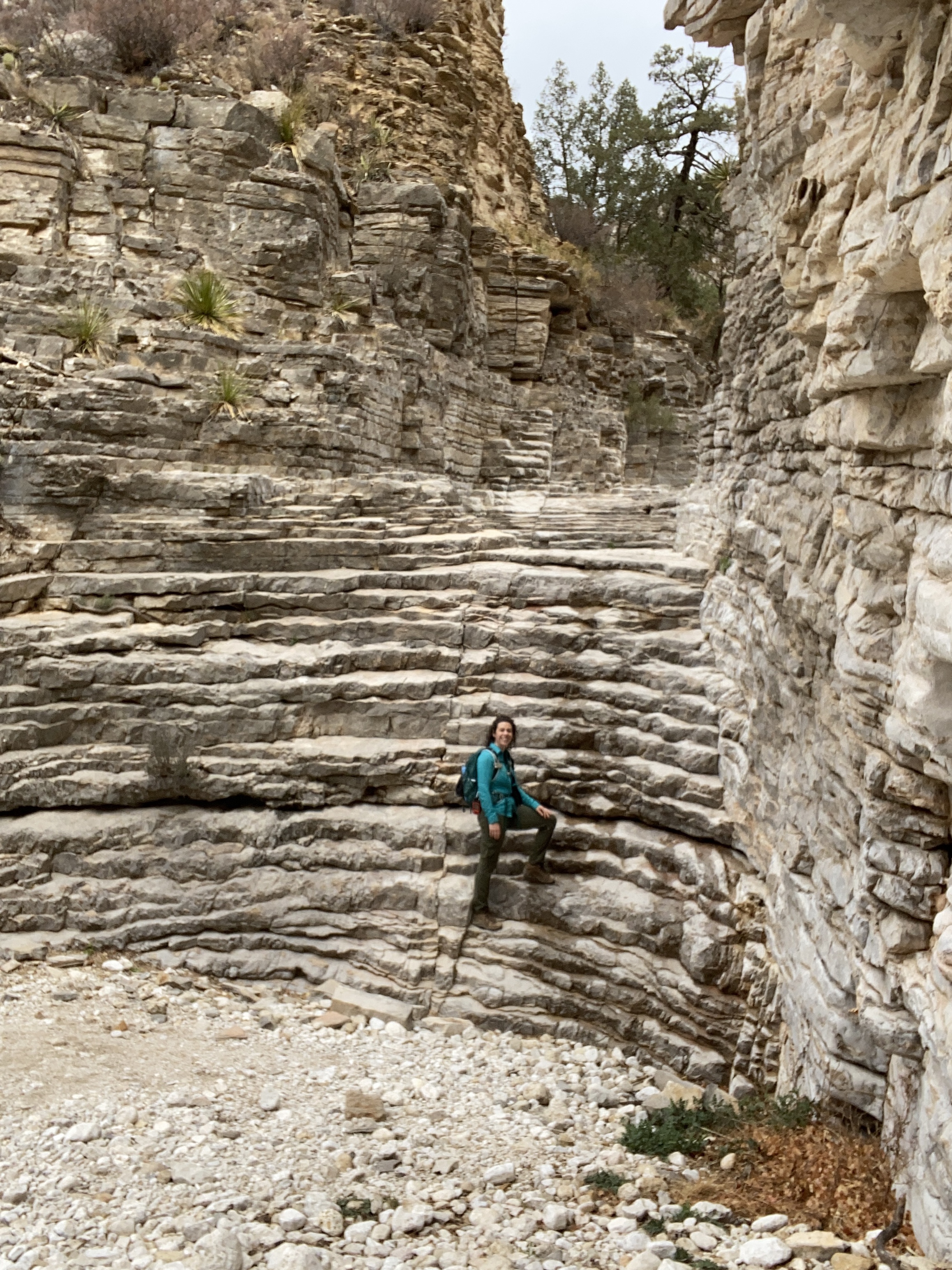
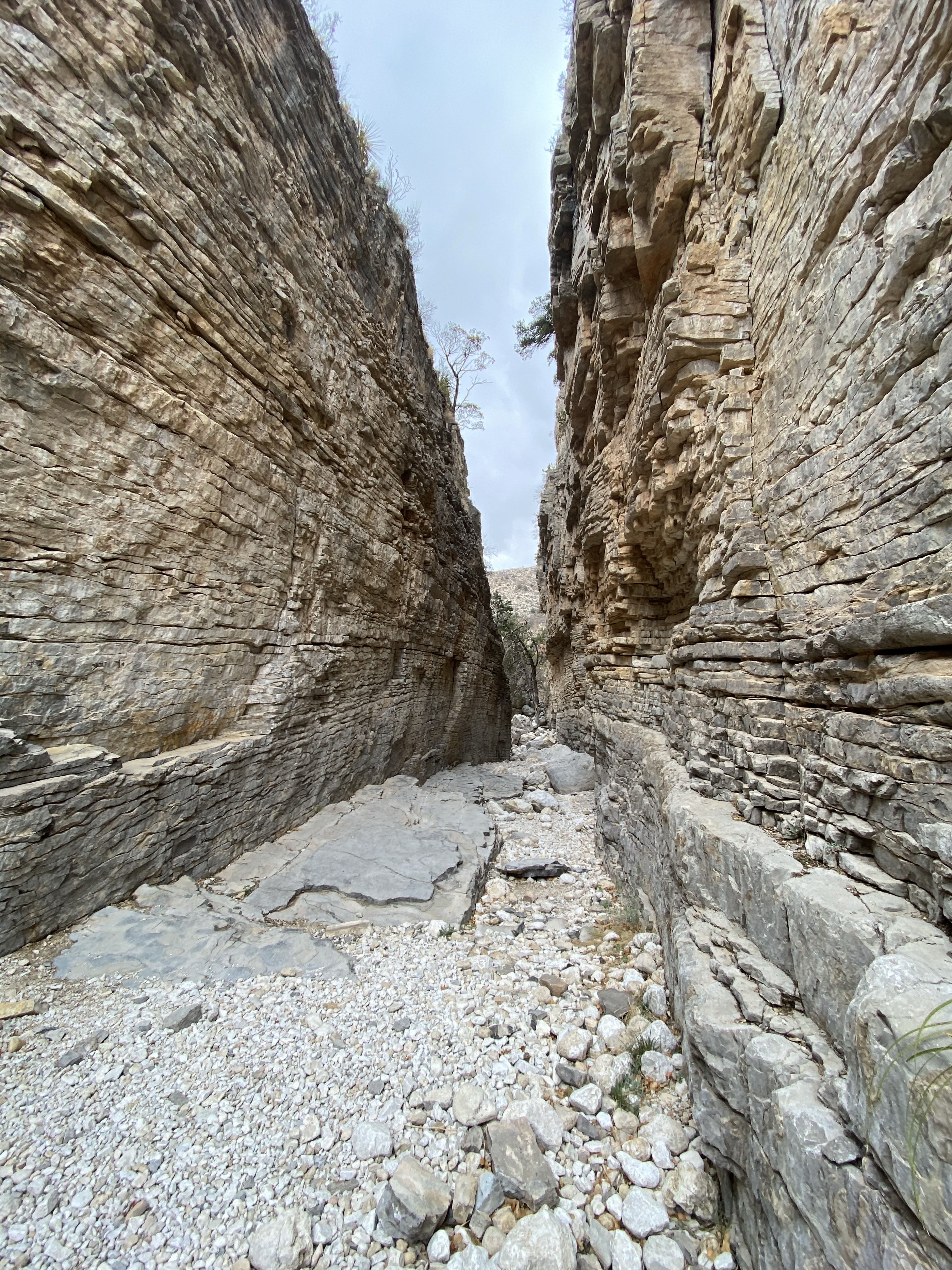
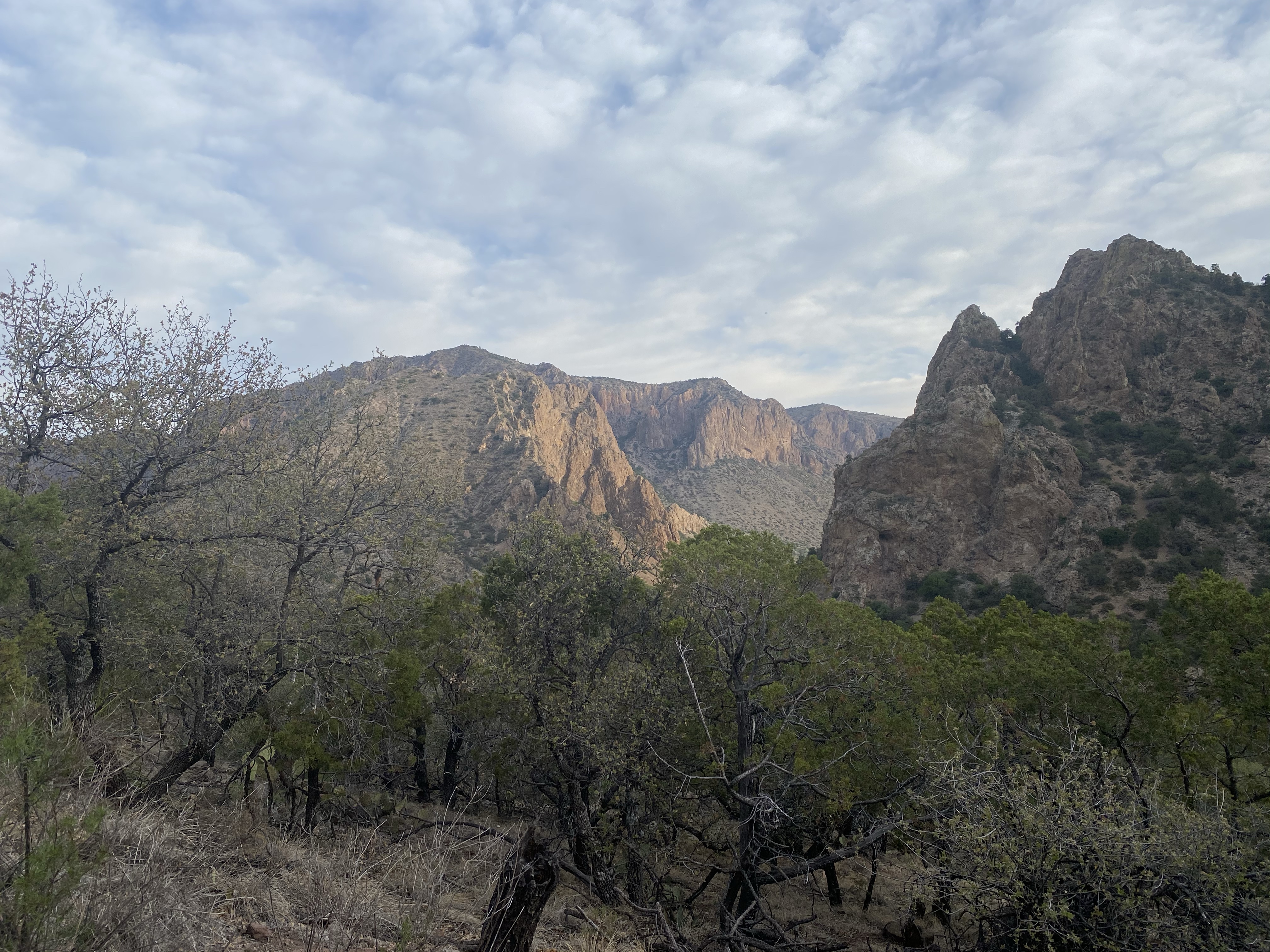
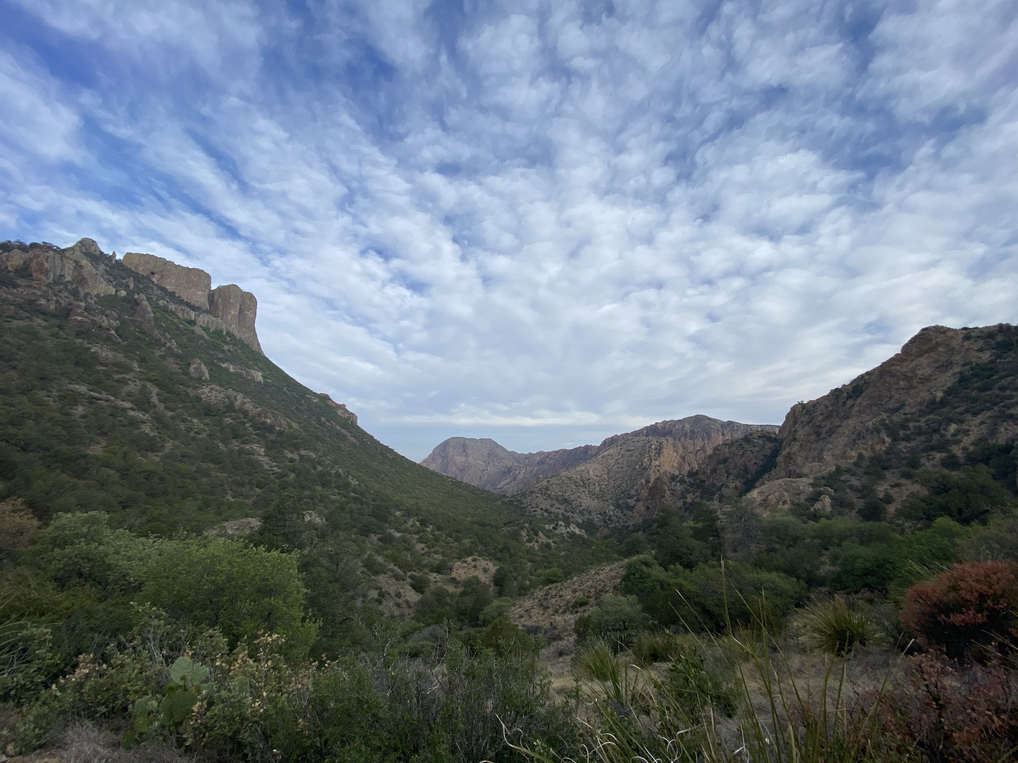
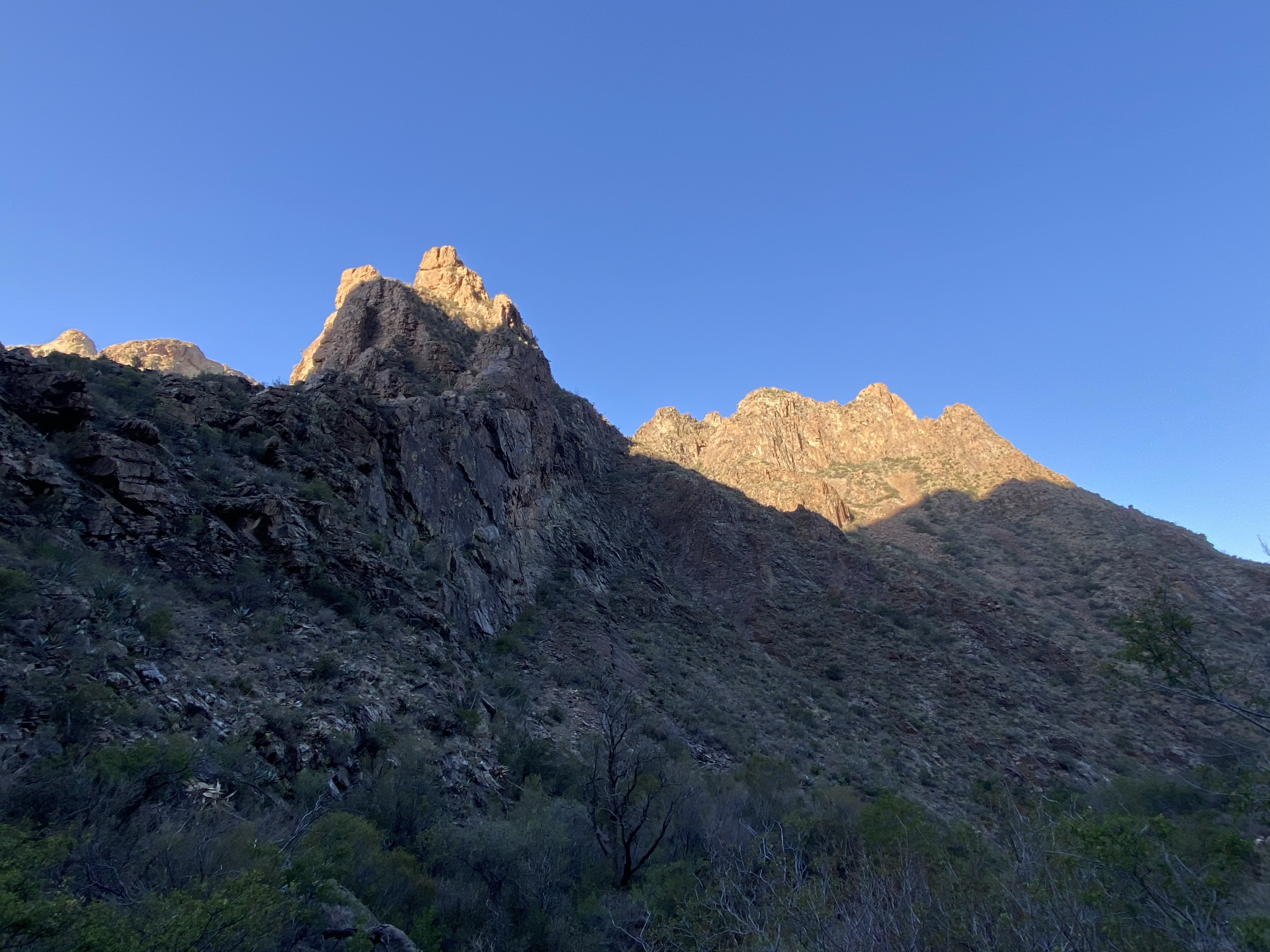
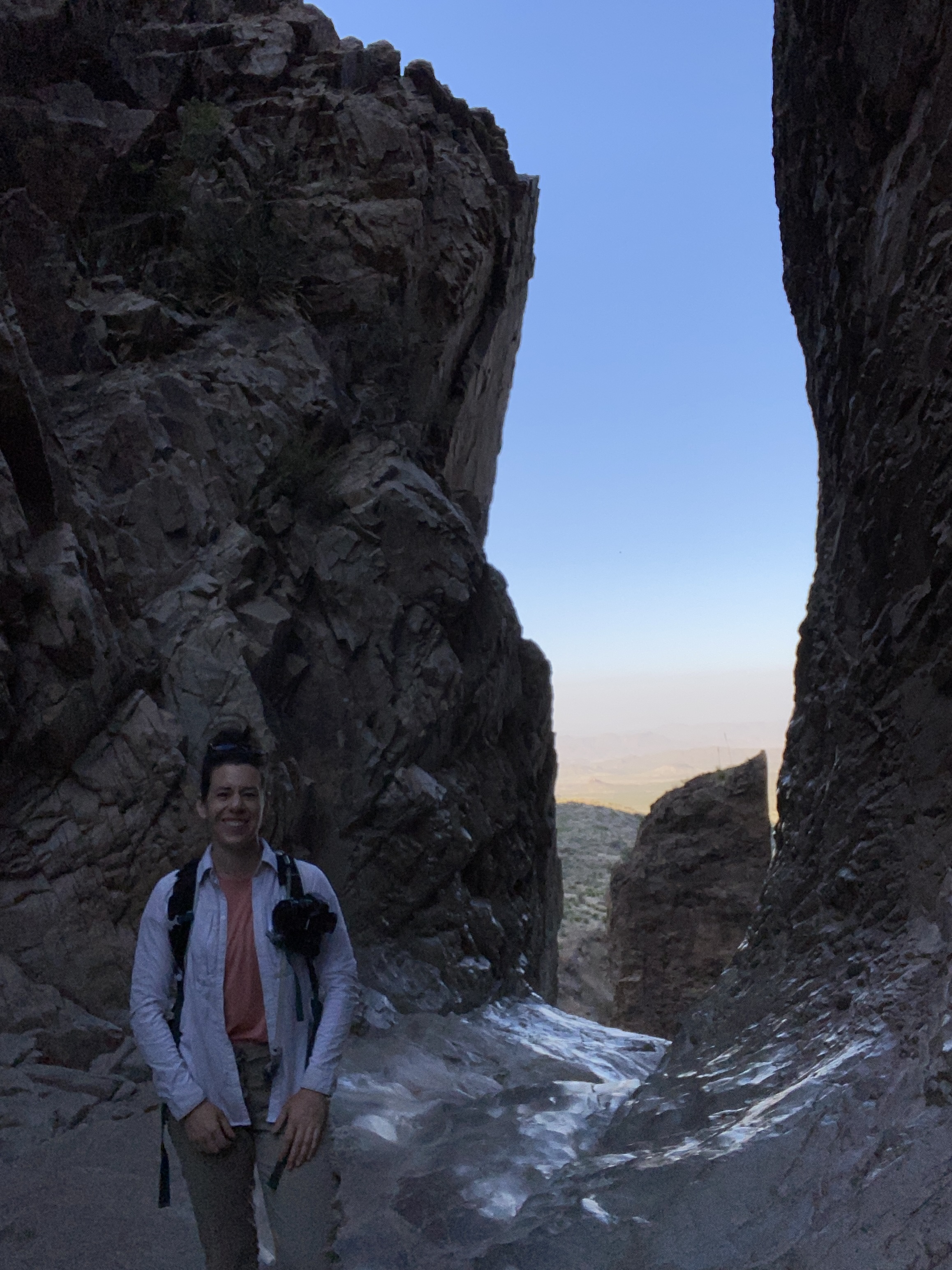
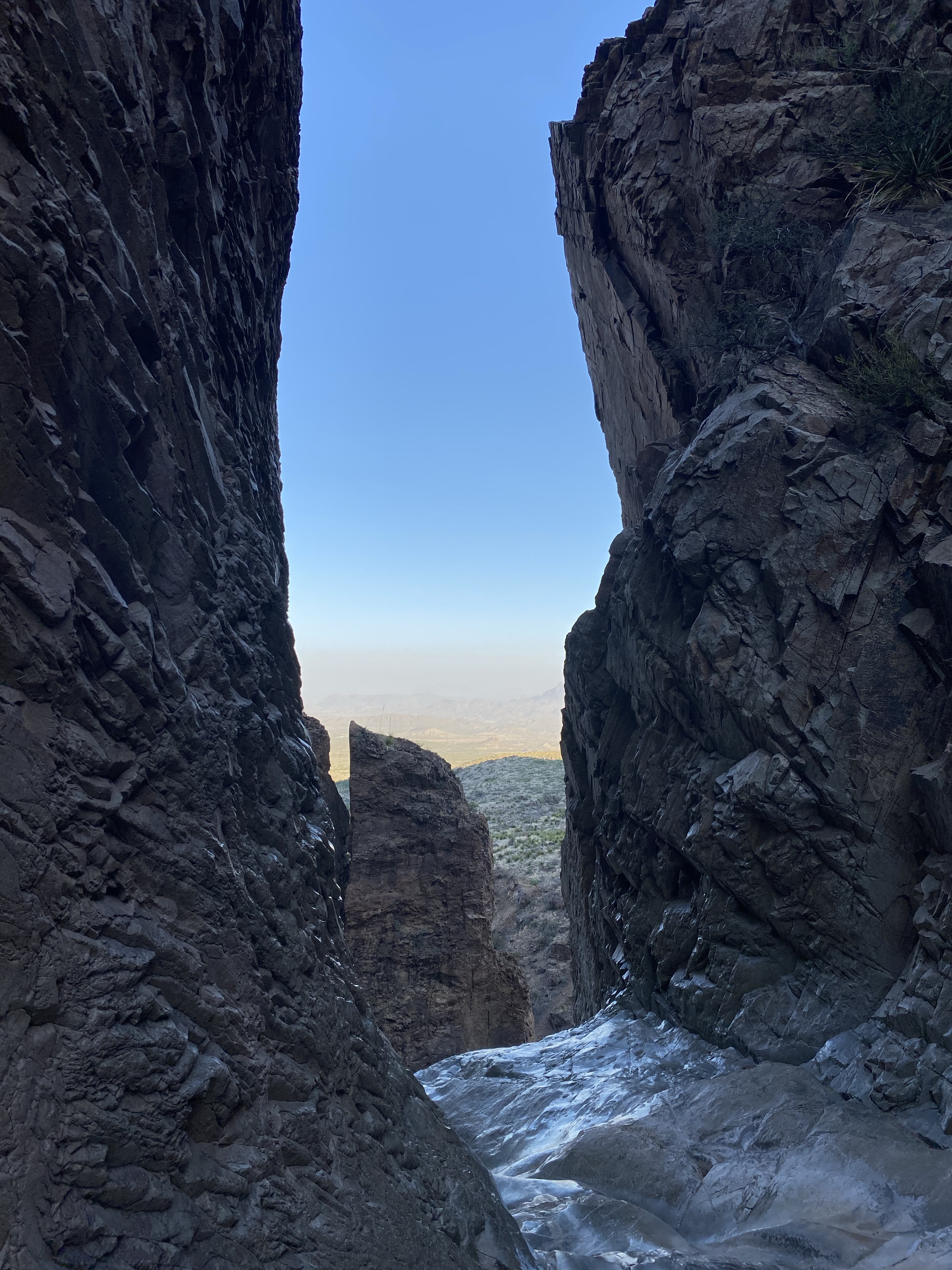
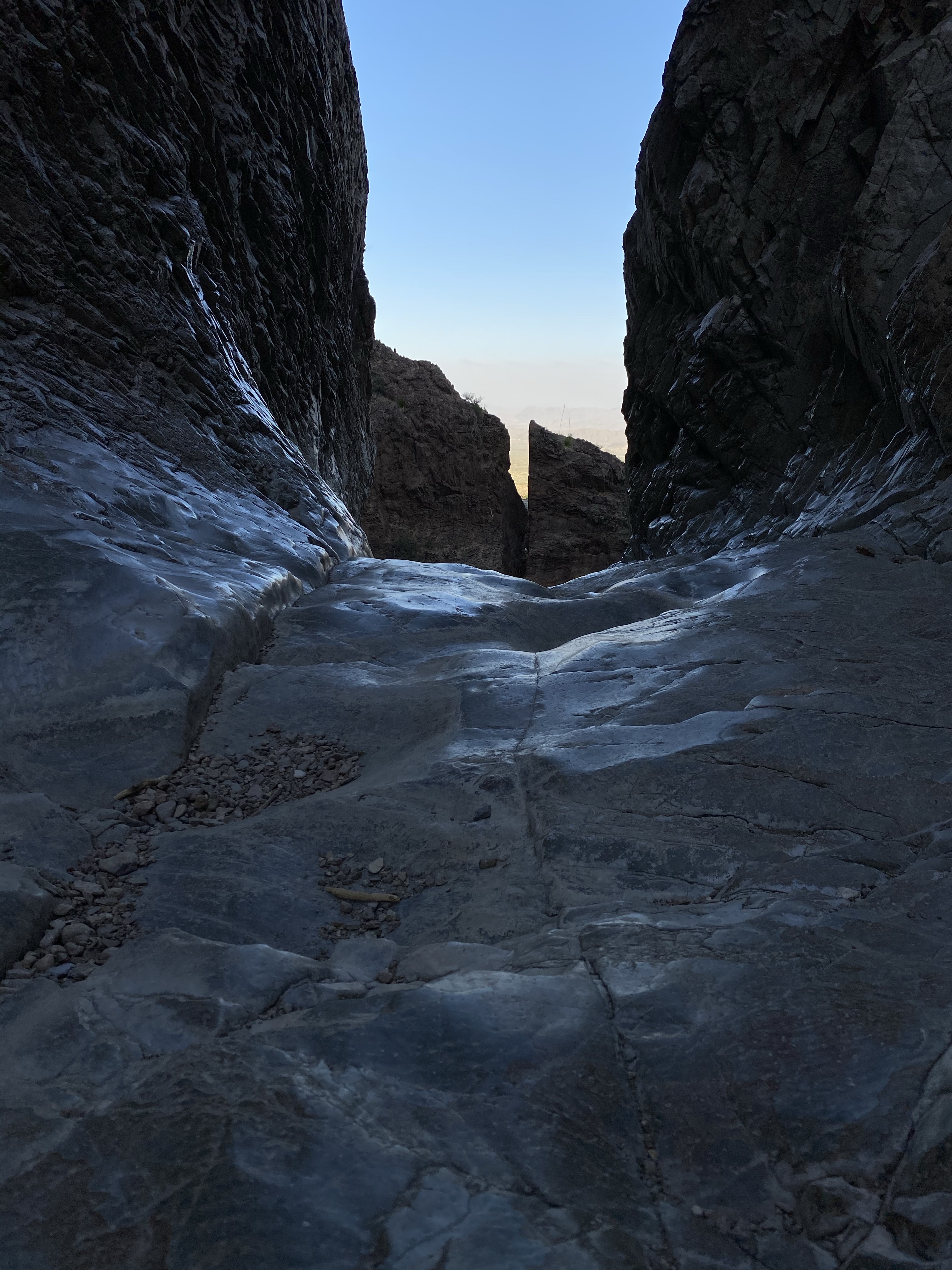
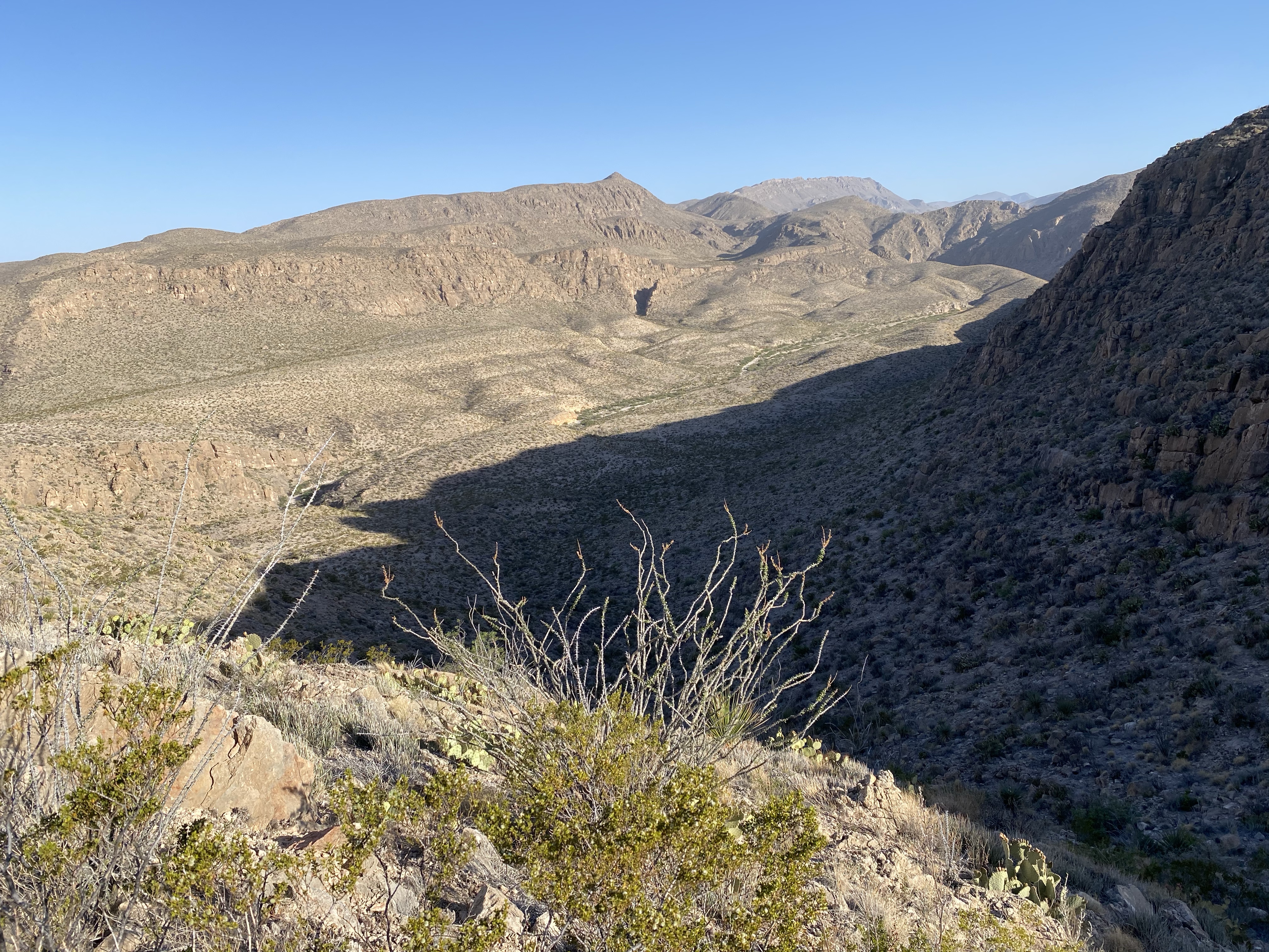
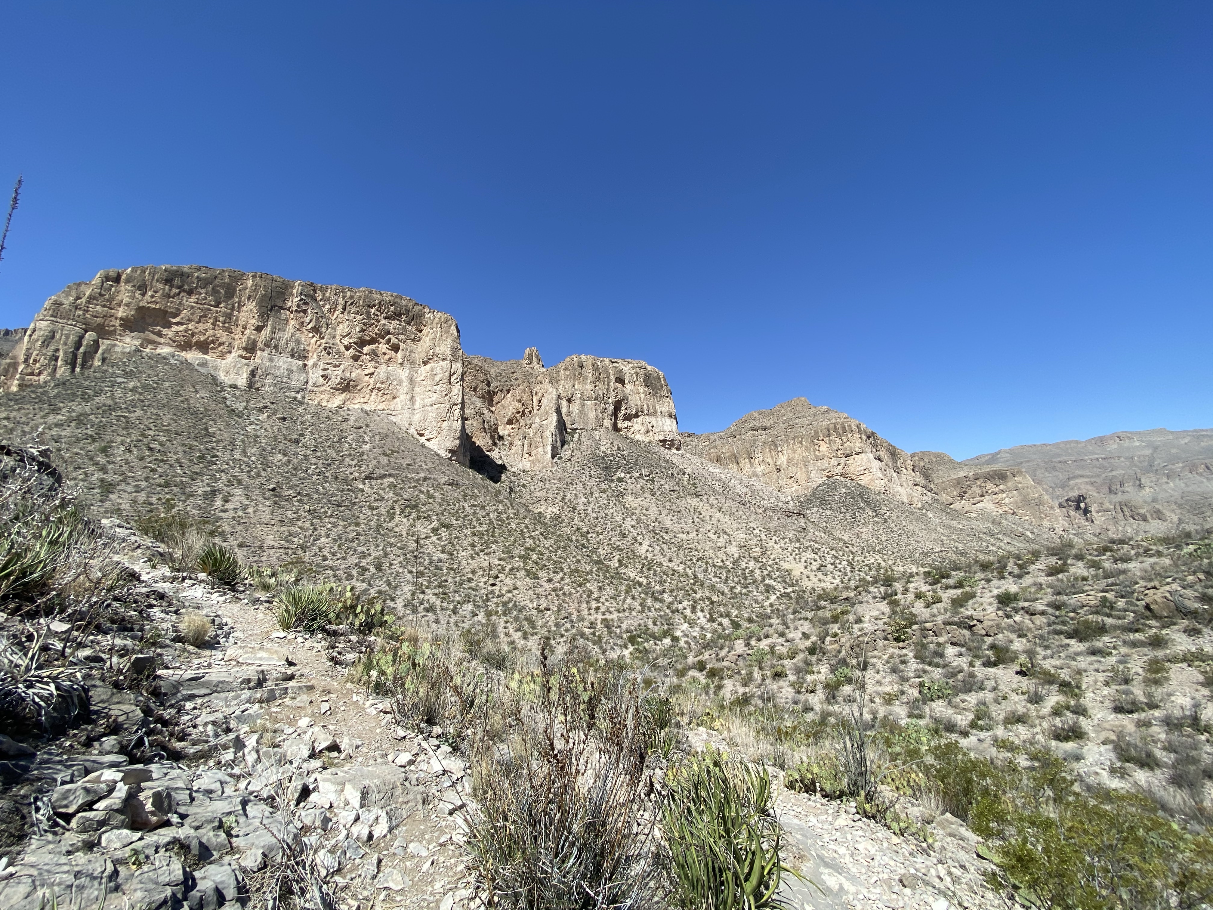
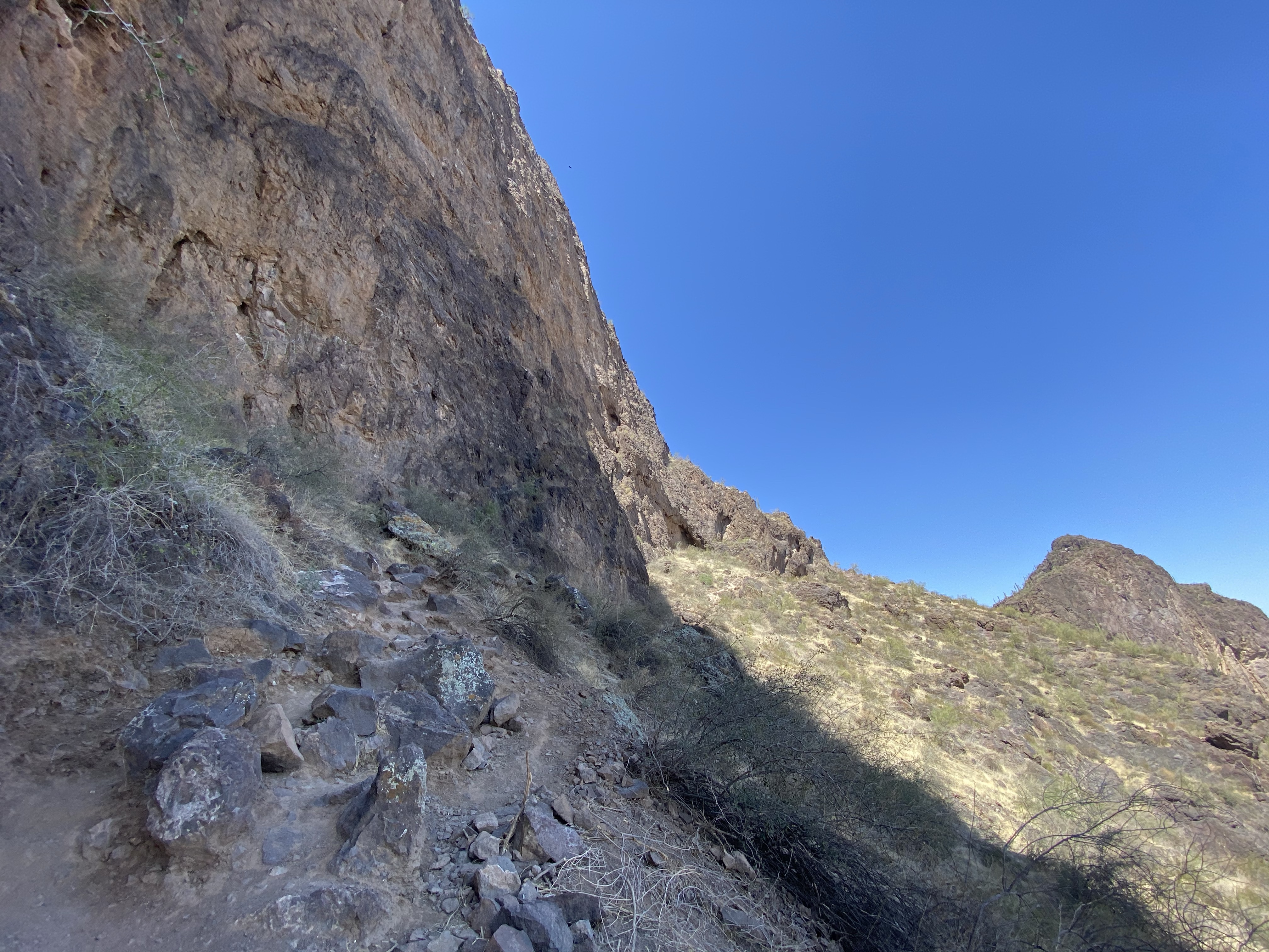
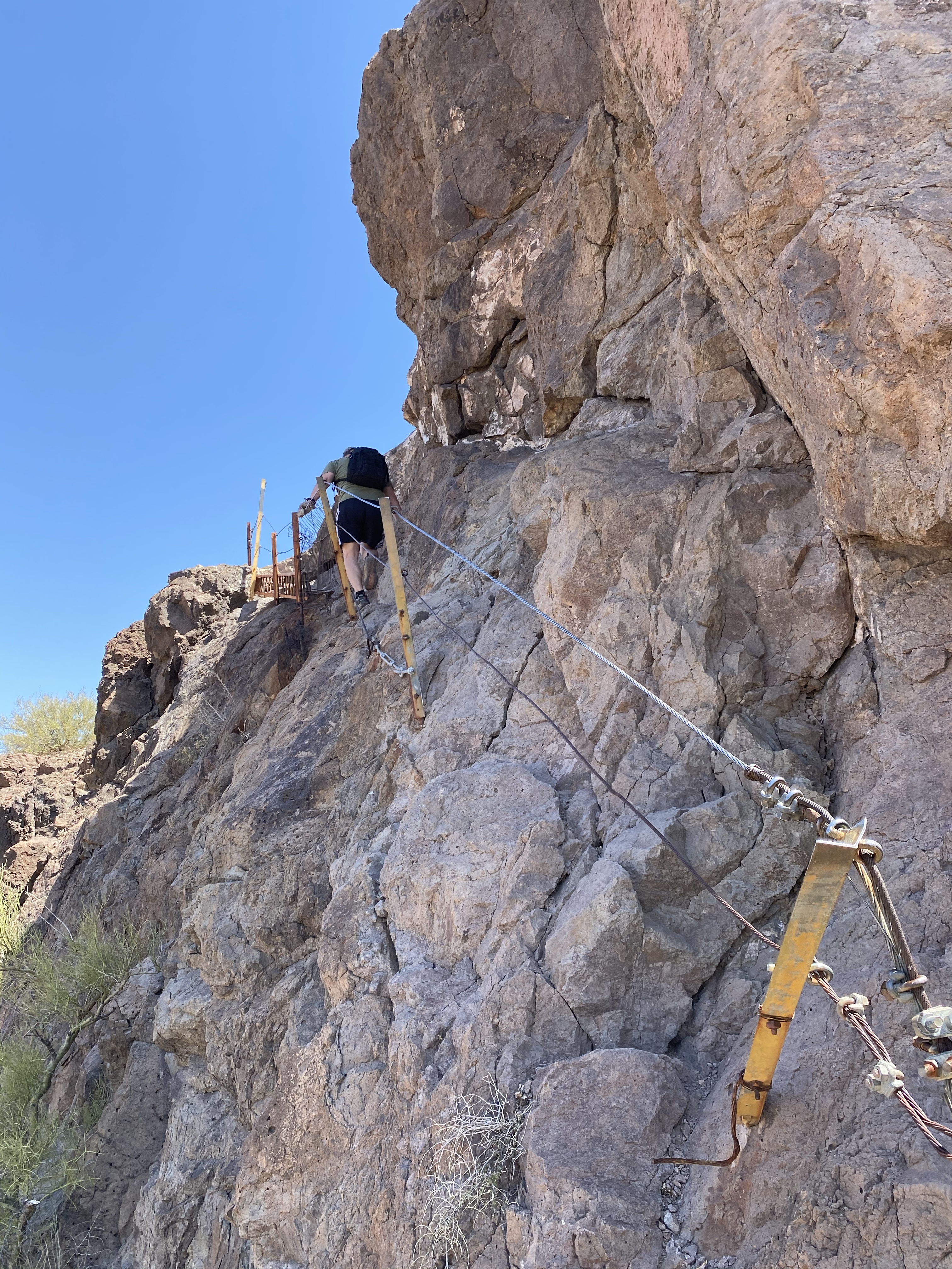
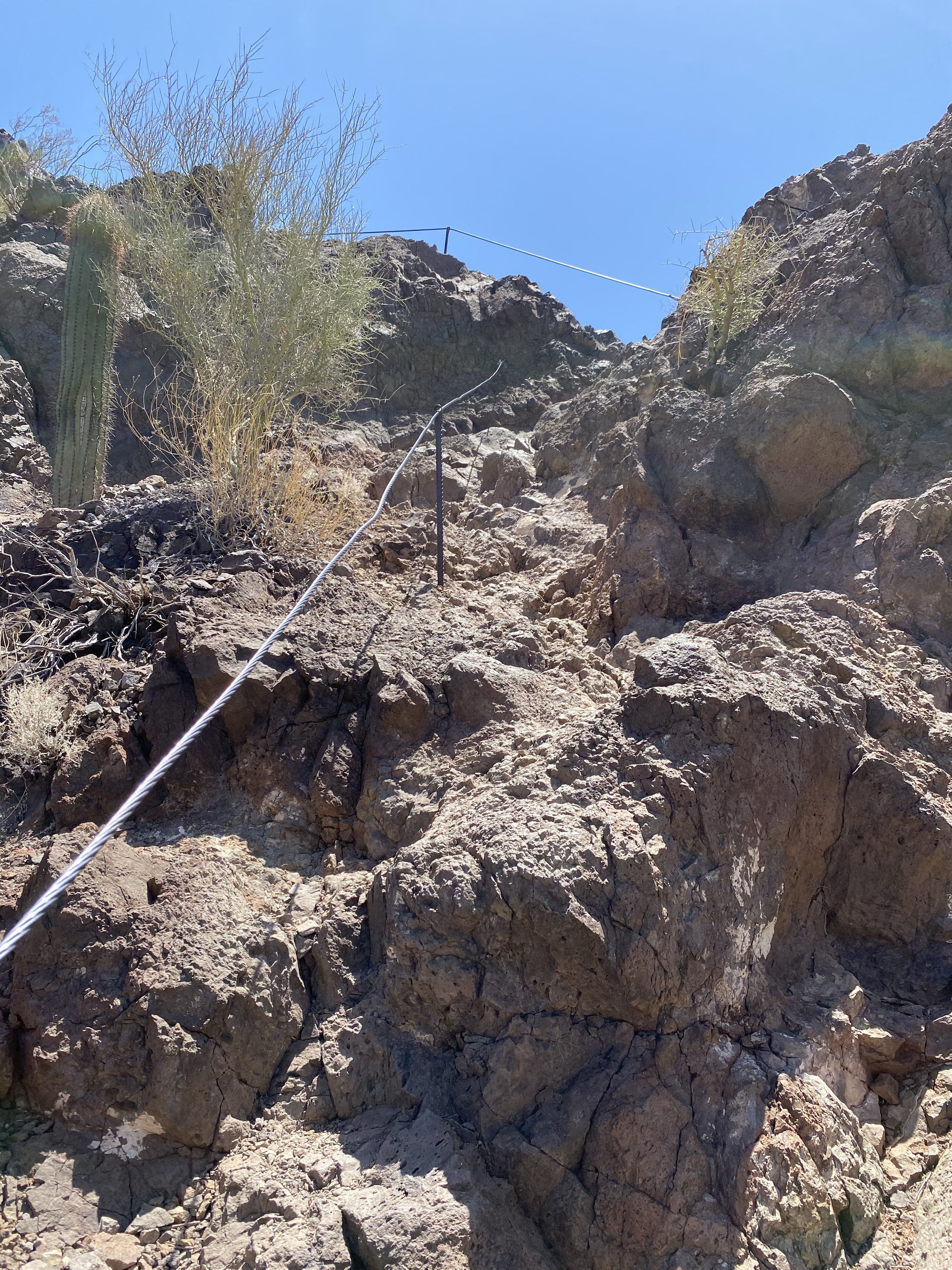
The next half of the trail was a series of ups and downs, over boulders, across ledges, up cliff faces using sturdy cable. We cautiously curved our way around the mountain to the backside, constantly wondering what was up next. Several breaks later, we made it to the last obstacle, or so we thought. In front of us the path climbed almost vertically to the next landing, a set of cables there to help you pull yourself up. Without hesitating (which would have meant I turned around), I followed Dave, carefully placing my feet in the nooks and crannies of the rock beneath me.

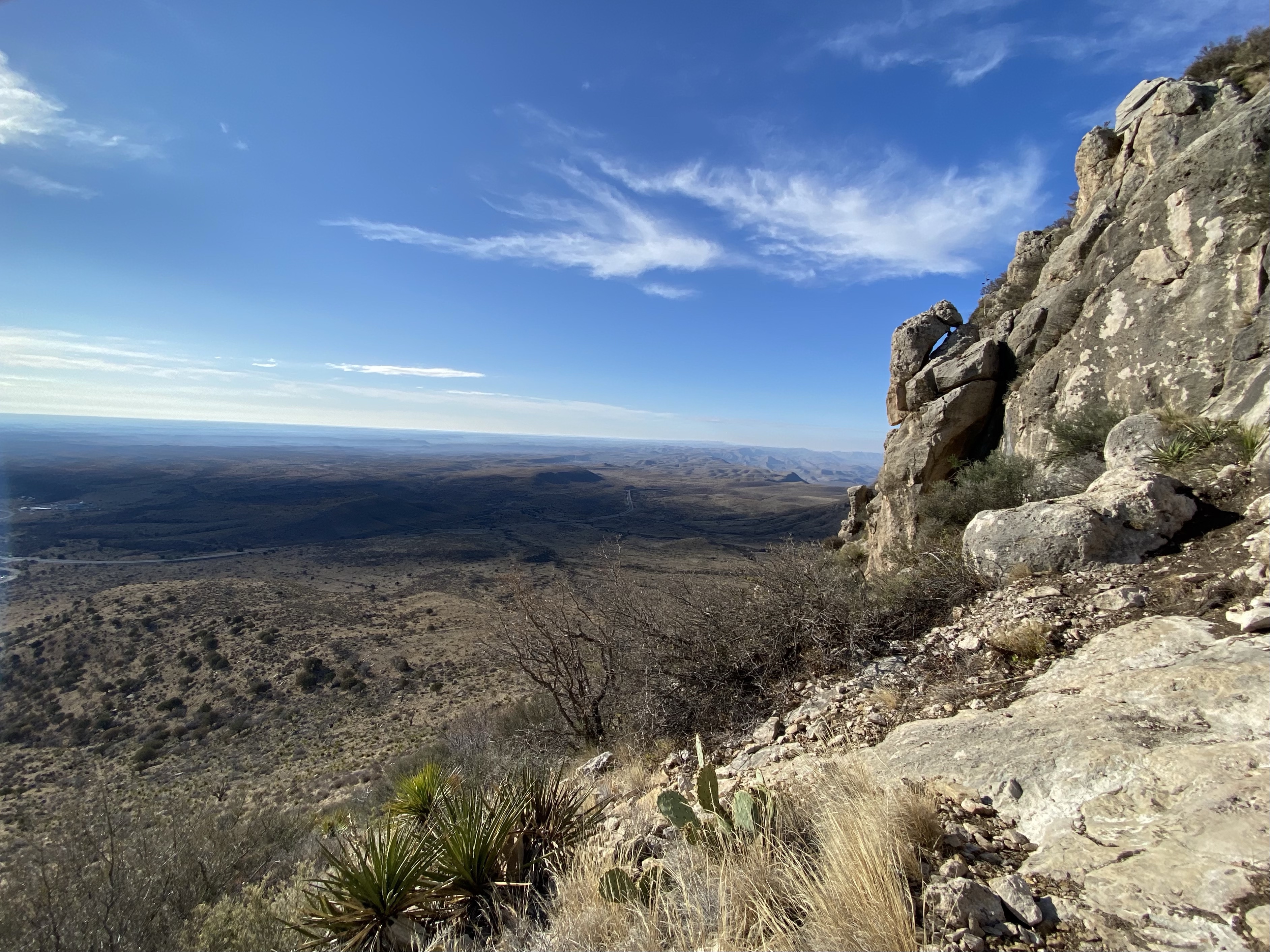
We reached the landing, then shuffled our way across the ledge before us. Hugging the mountain on one side and holding the cable top of the fence on the other, I moved swiftly yet carefully. The short distance got my heart racing and I ignored the fact that I would be making a return trip.

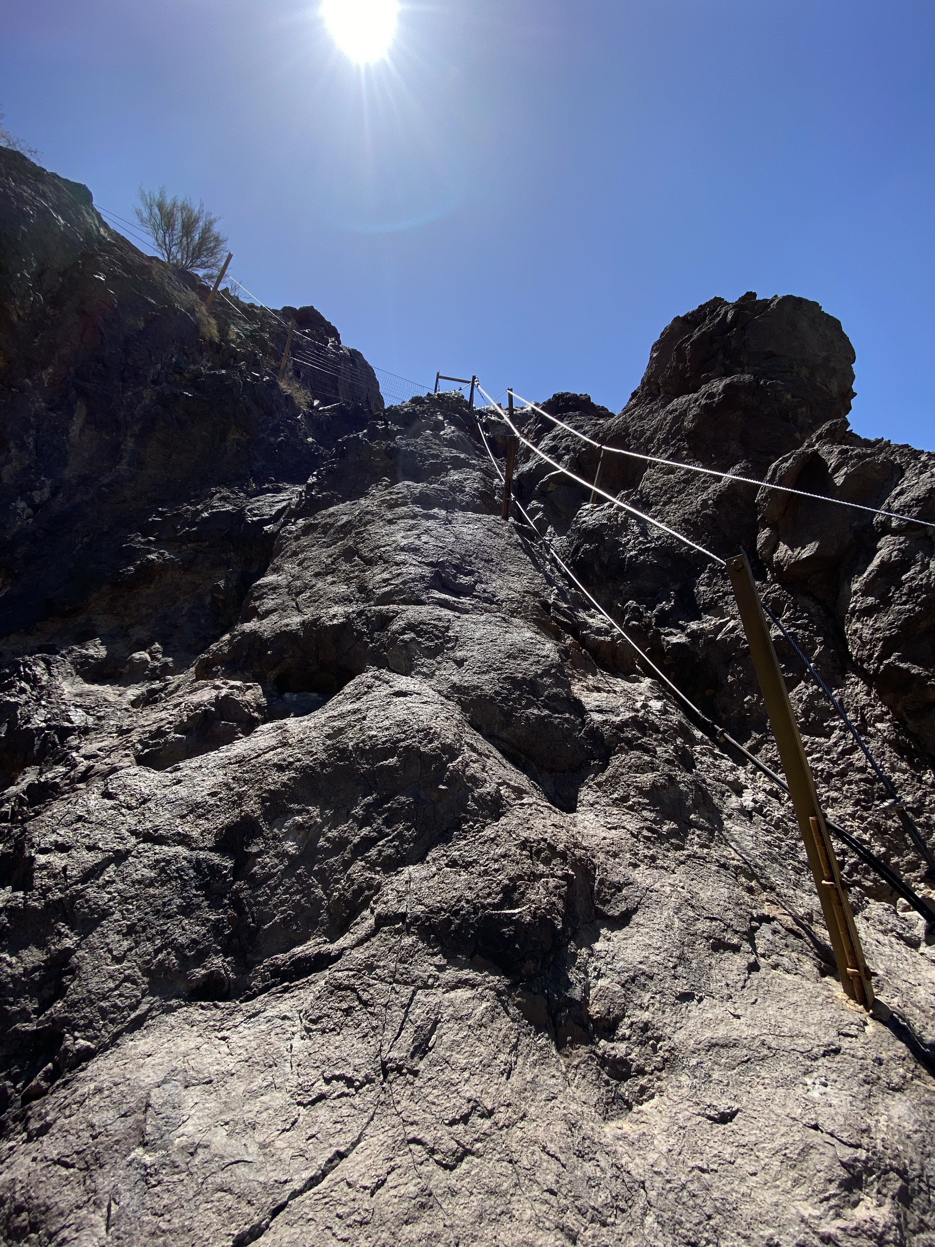
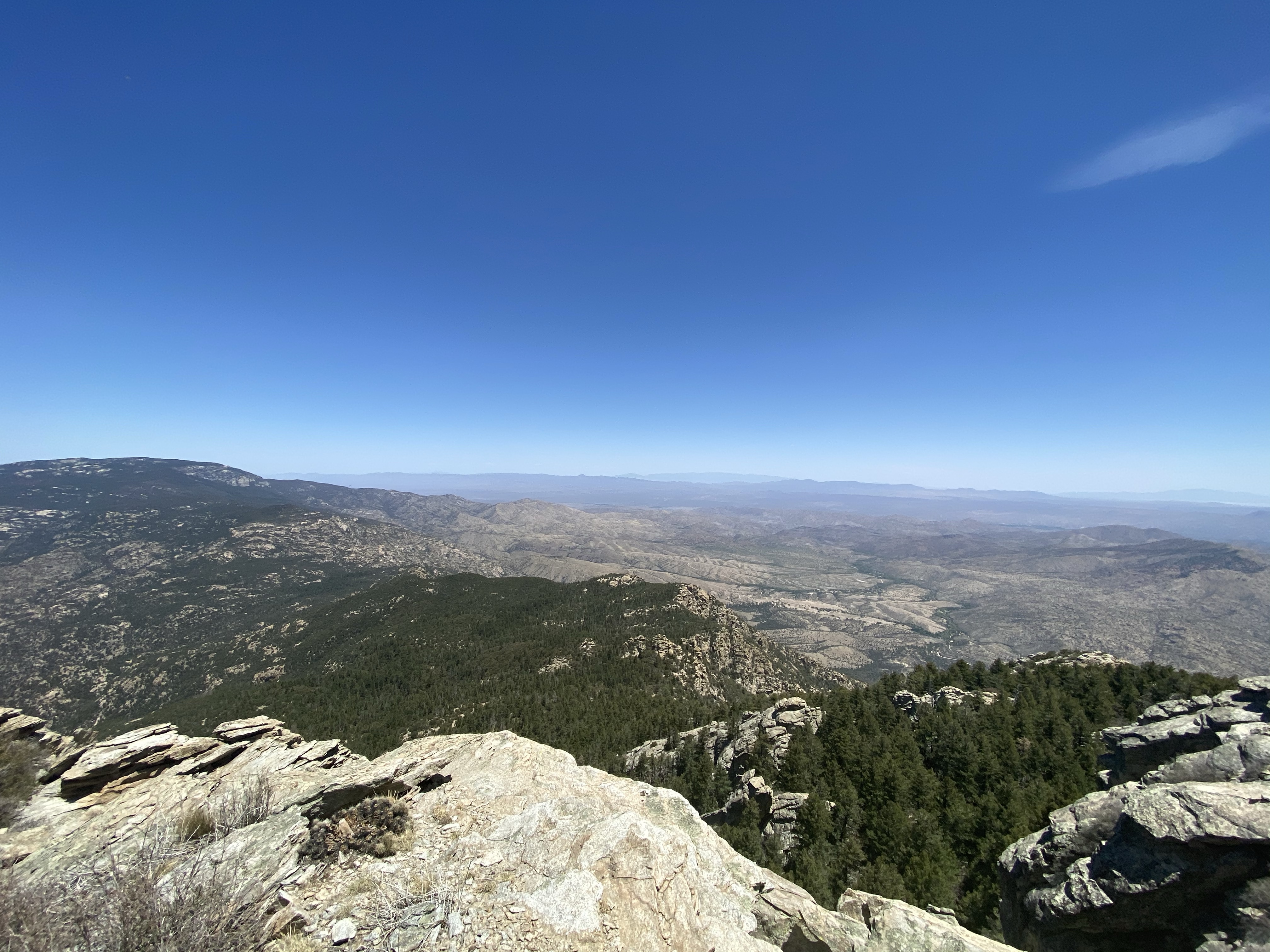
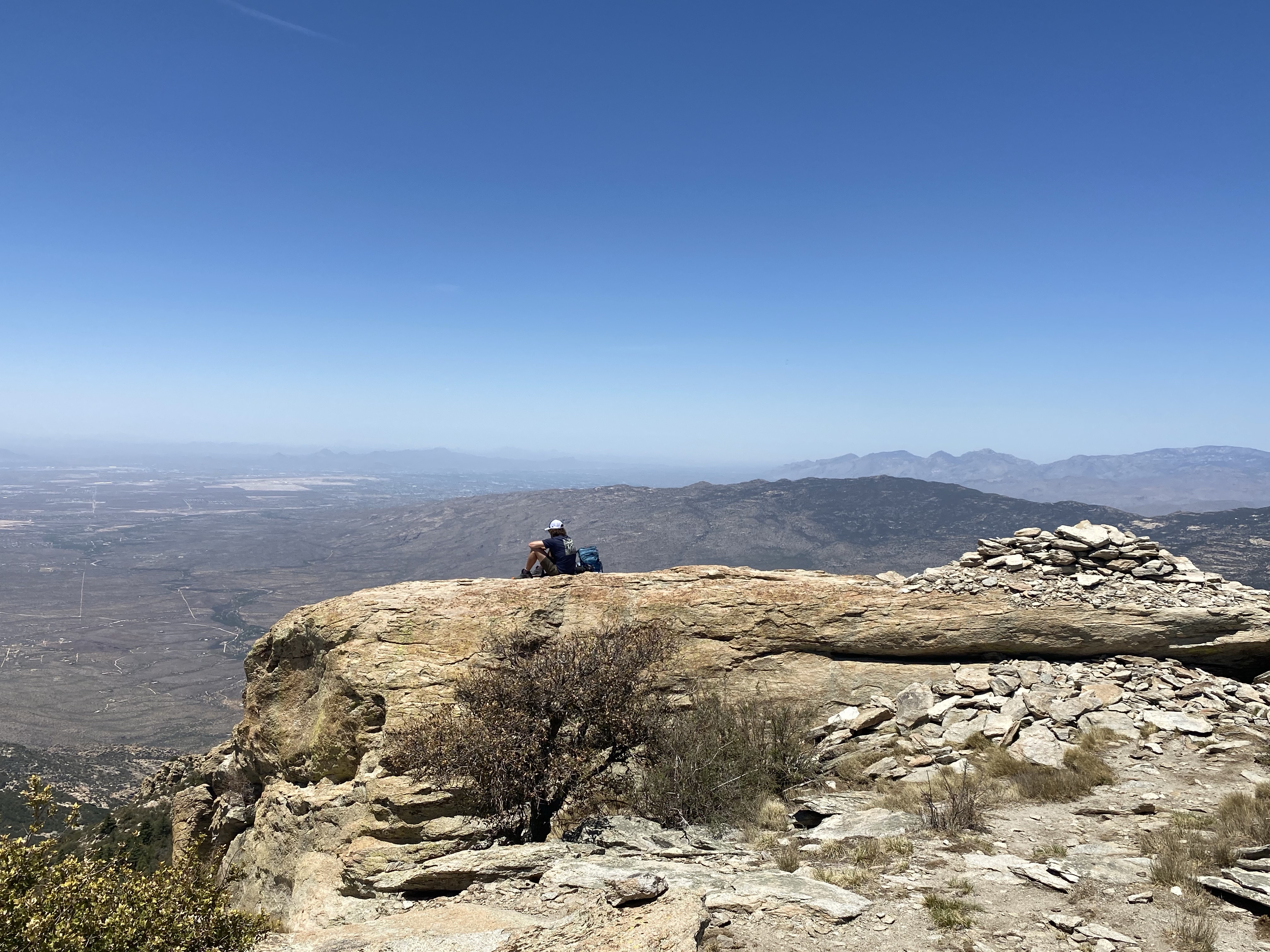
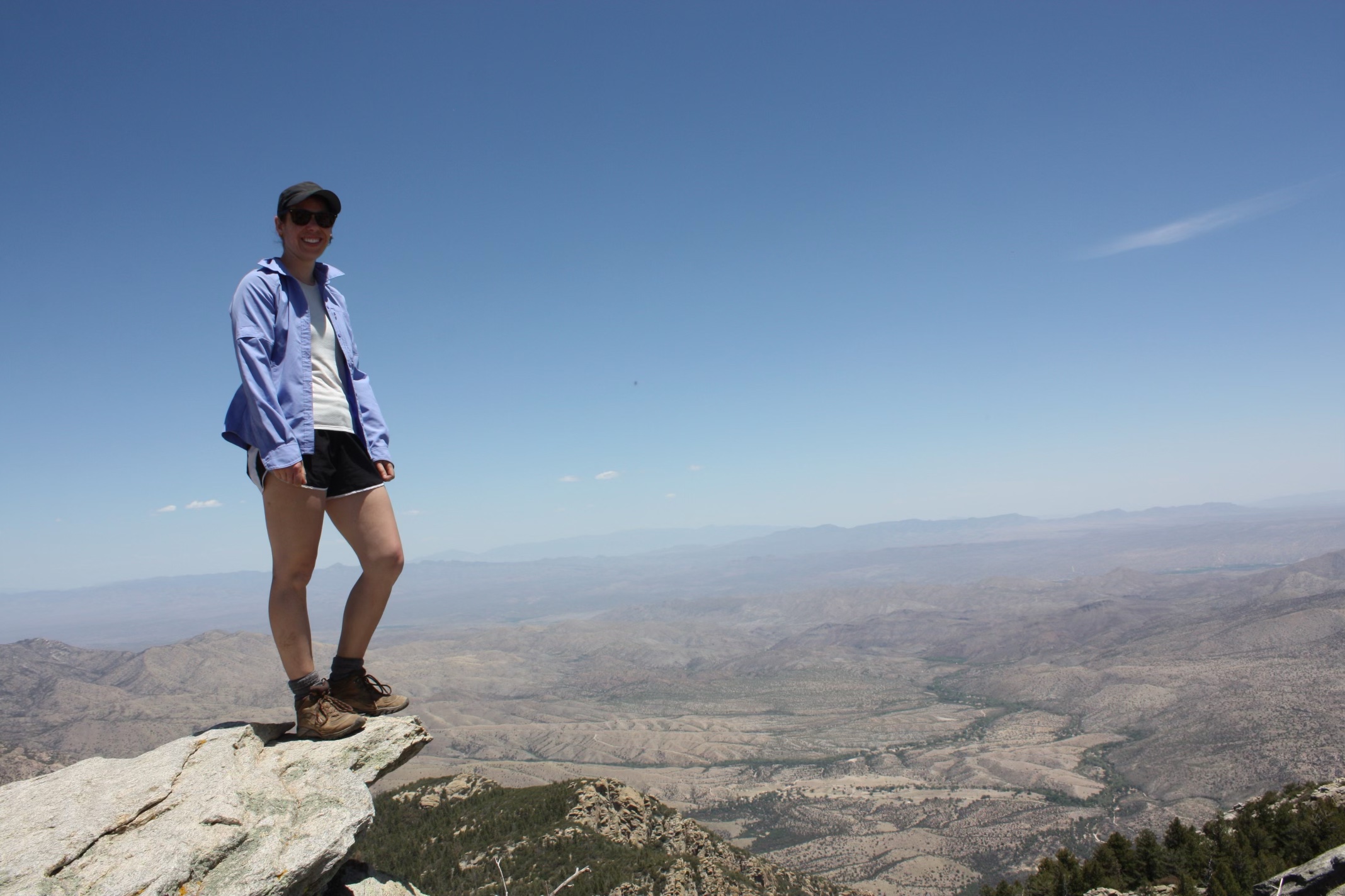
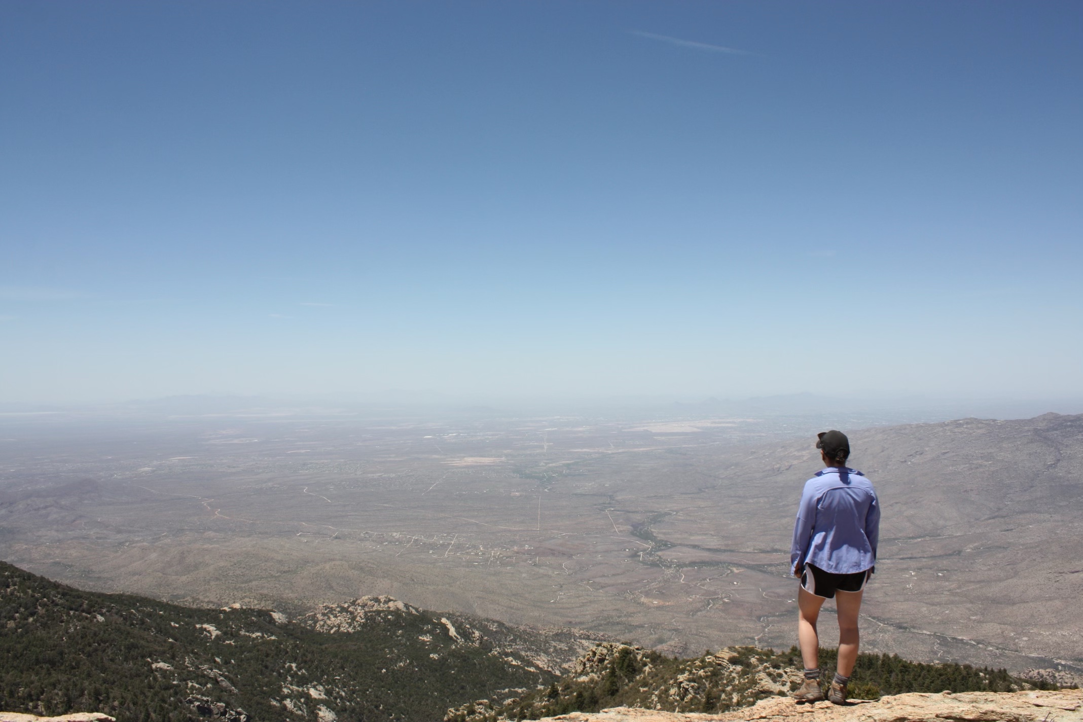
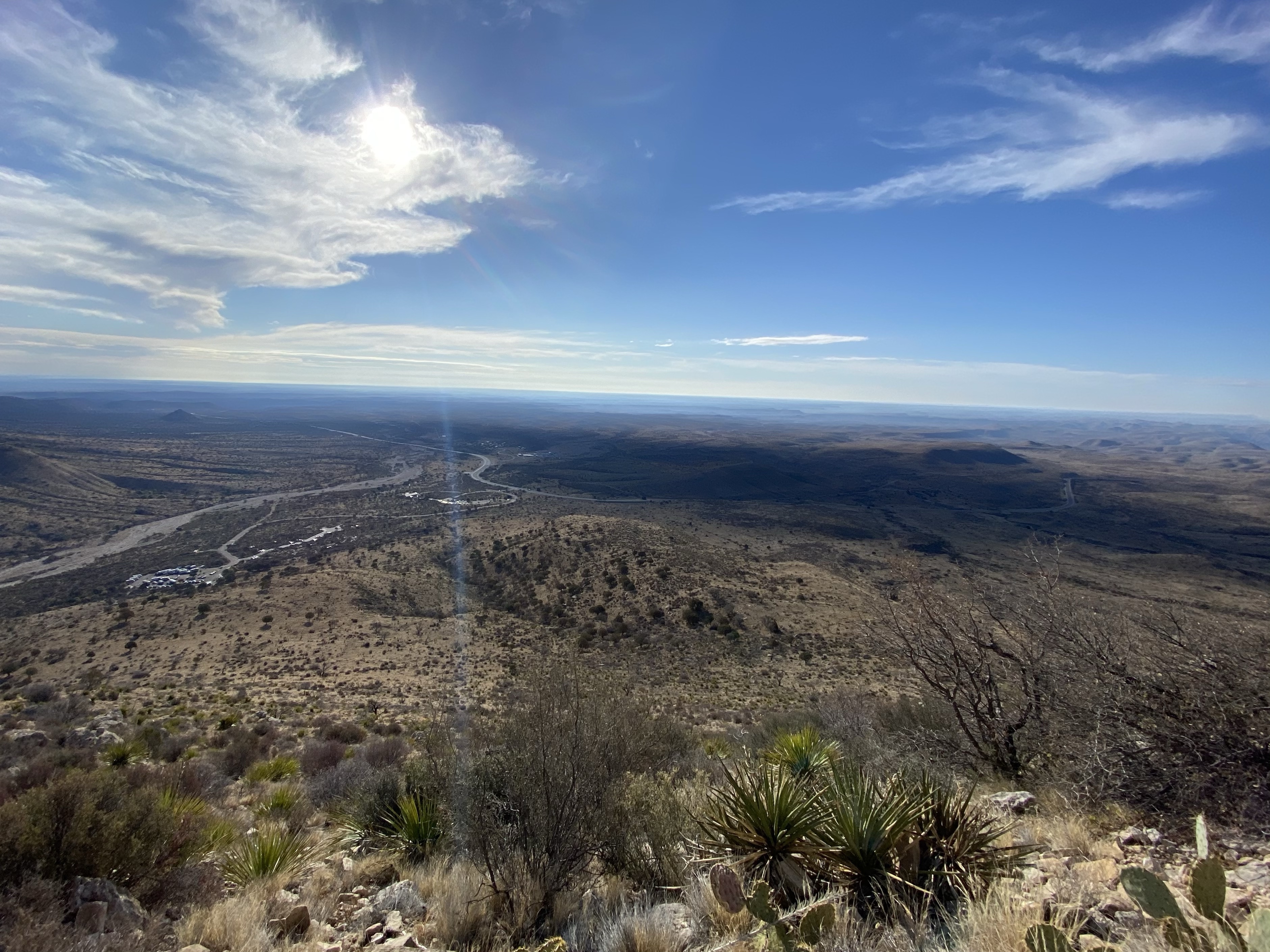
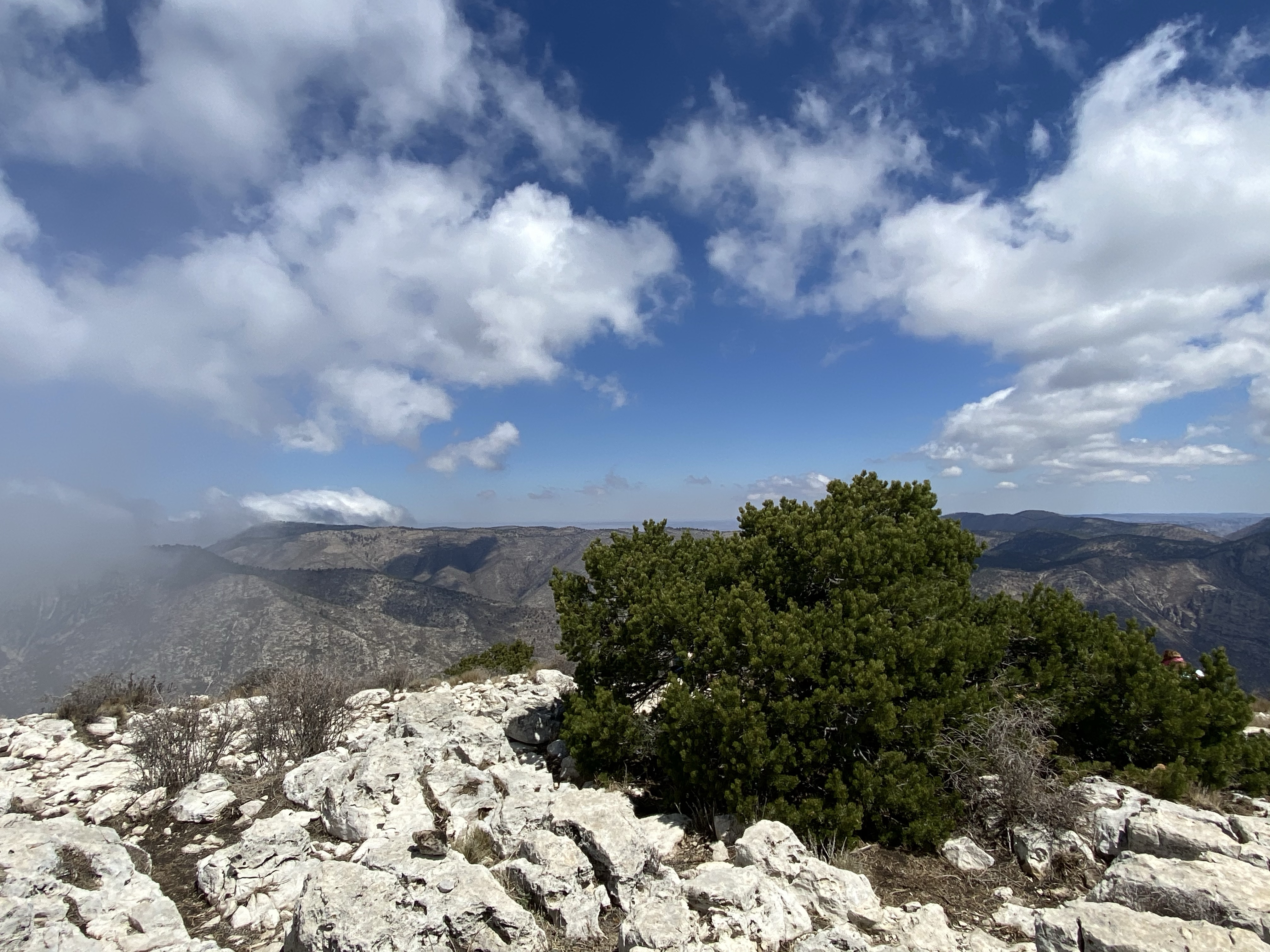
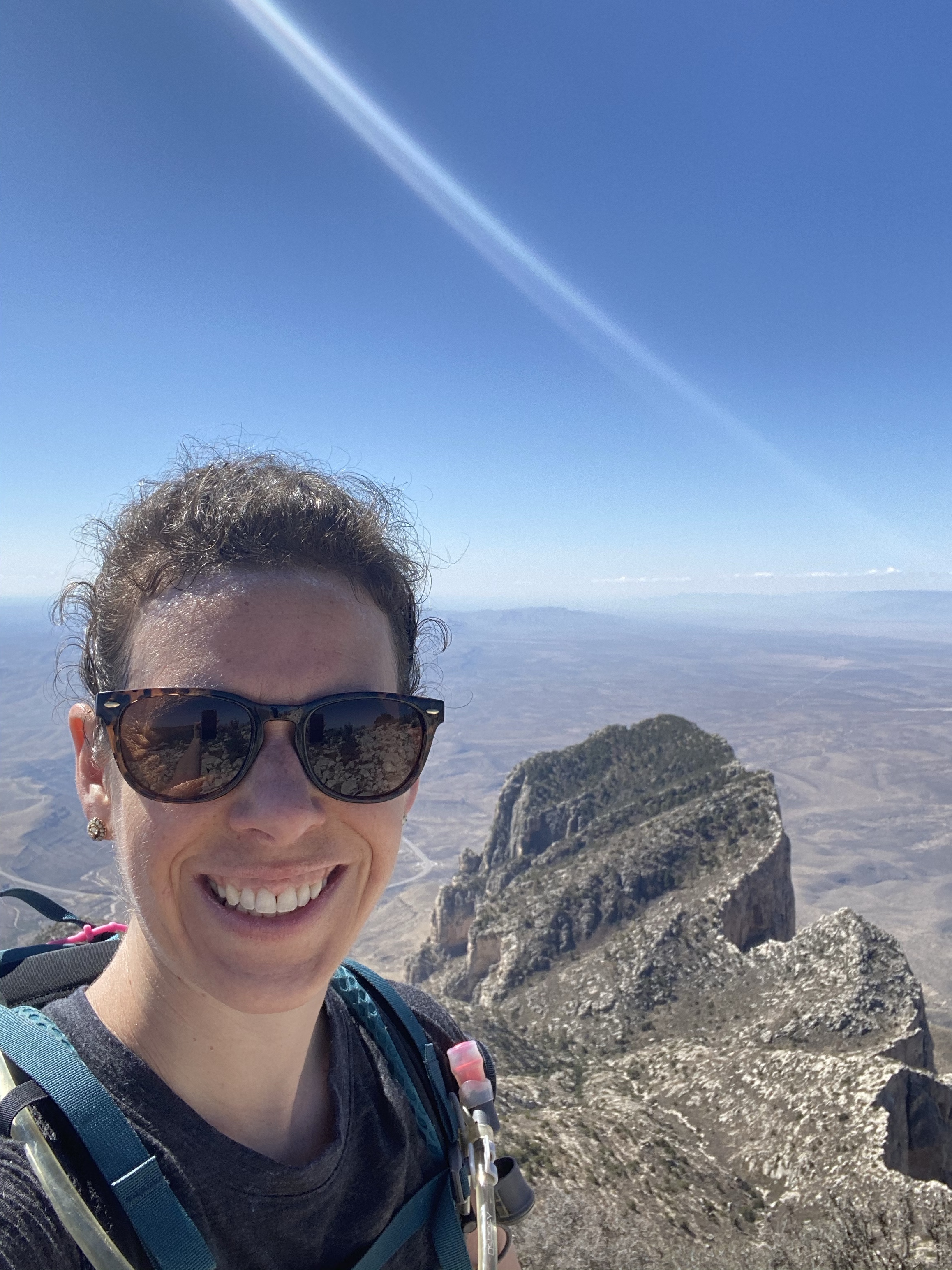
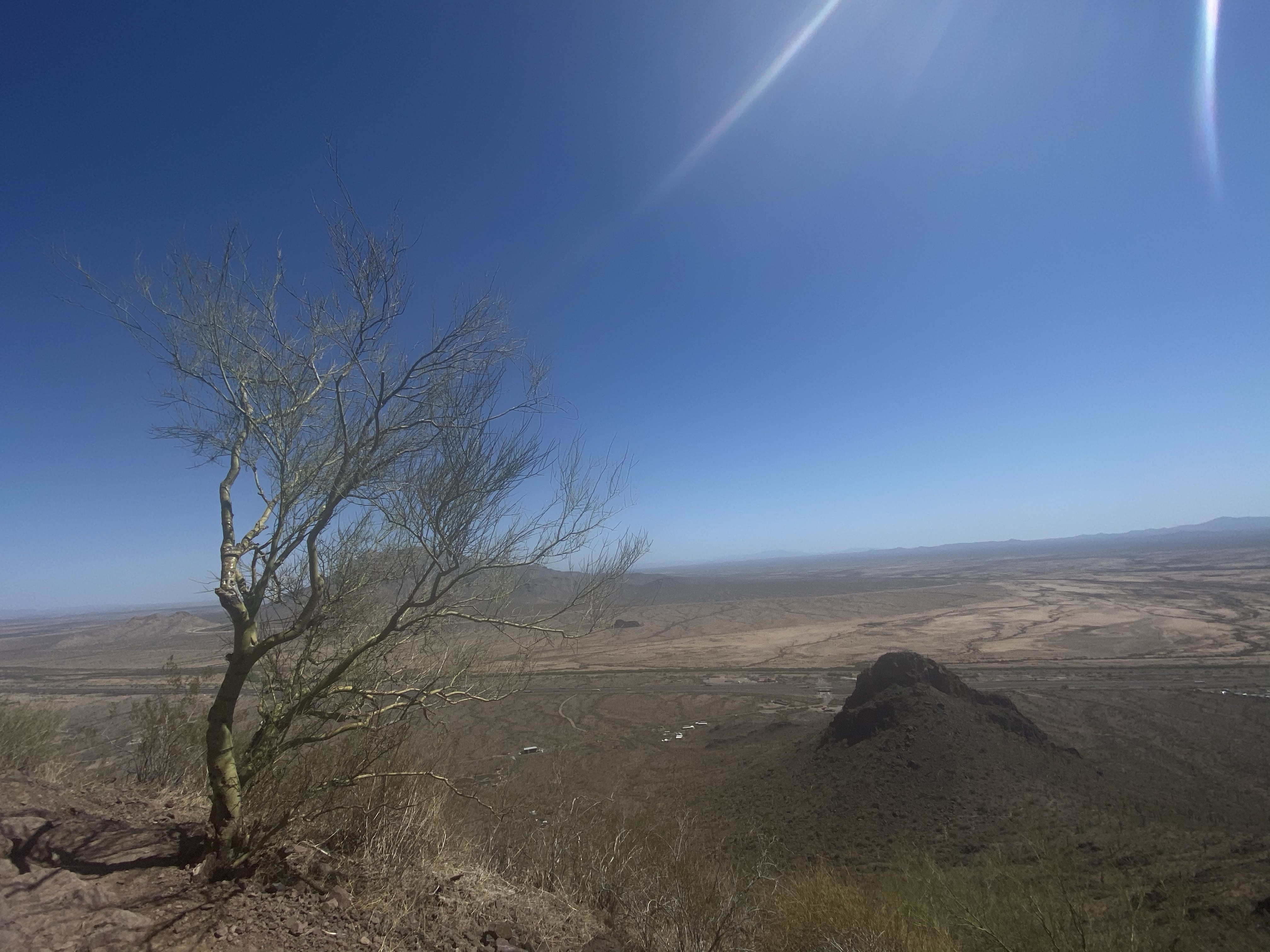
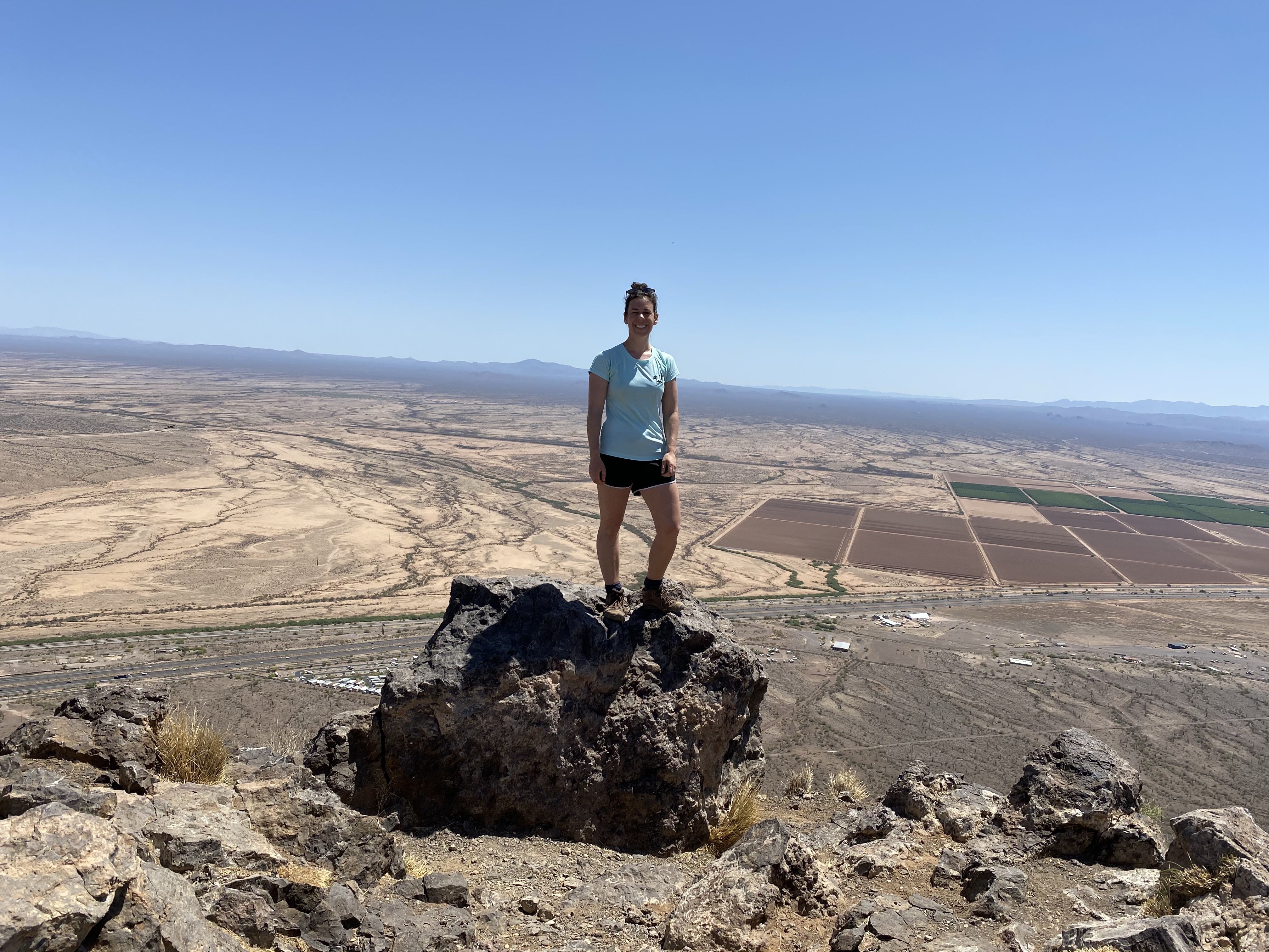
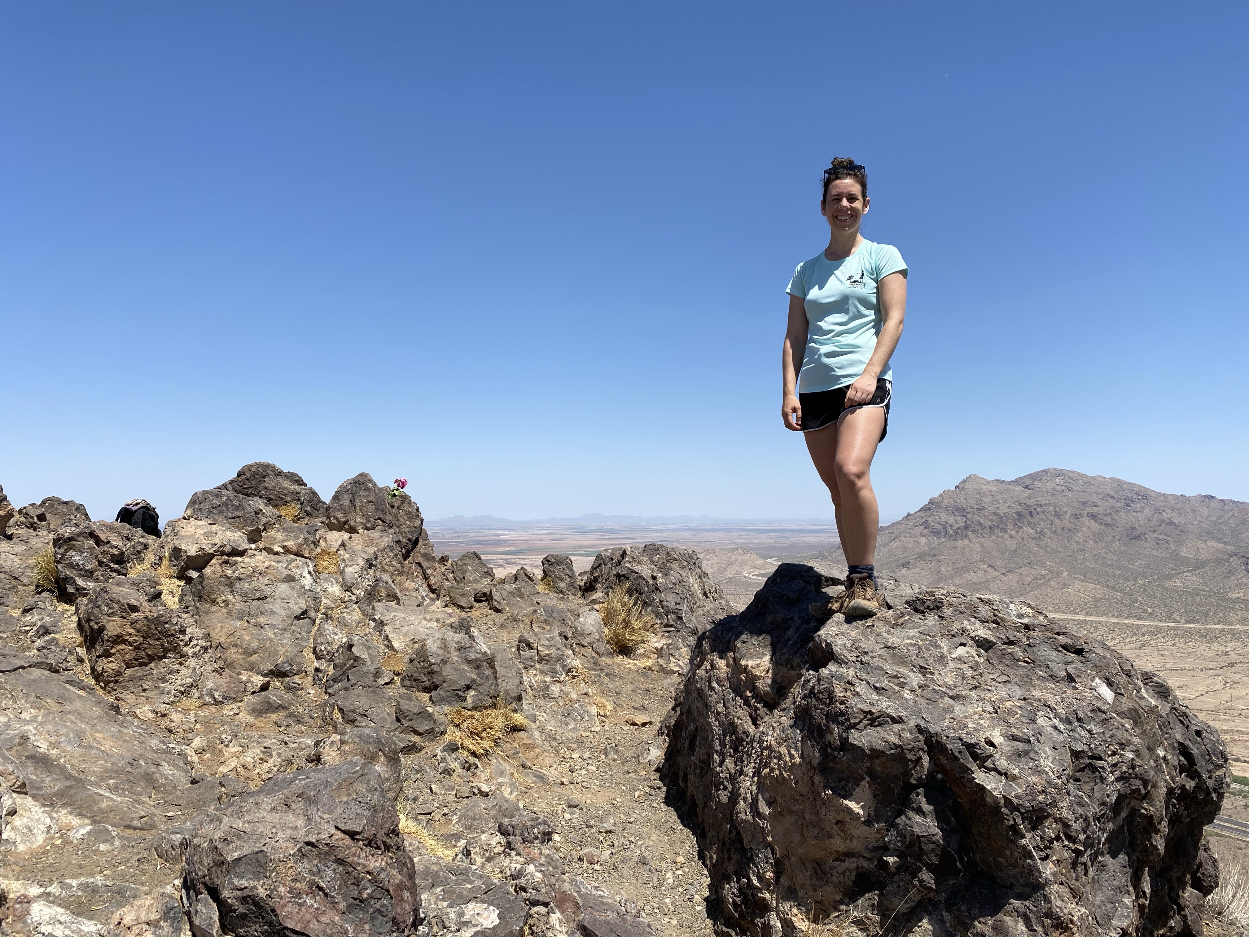
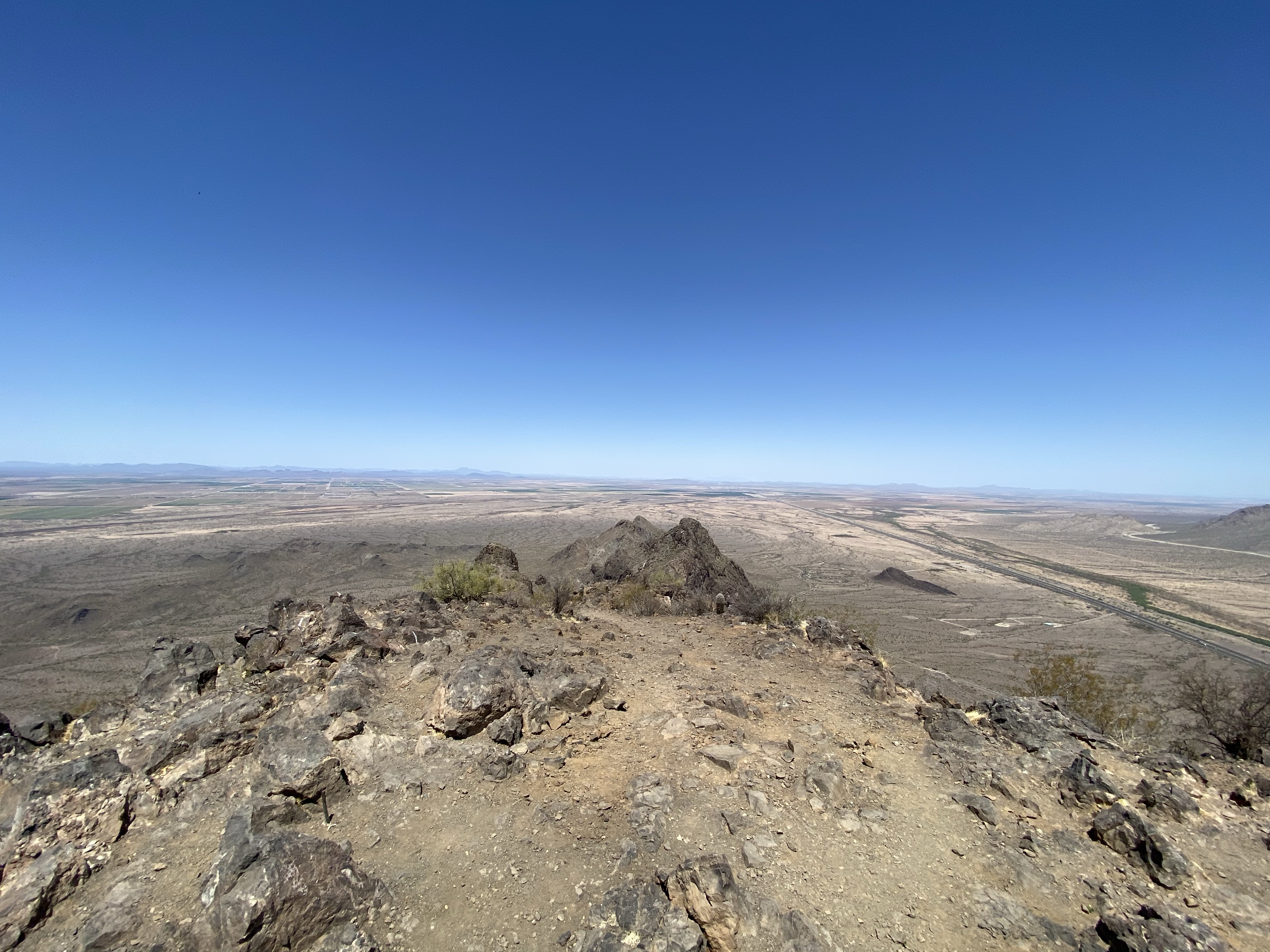
Here we thought we had reached the summit, but no such luck. While the perils of cables and fenced ledges were behind us, a steep series of switchbacks was still ahead of us in order to reach the peak. So up we went, until we reached the summit – empty and beautiful.

Sitting at the peak, admiring the view, I reflected on how many firsts I am accomplishing this trip. I am no longer telling myself I can’t do things. If I want to try it, I am going to try it.

The solitude was interrupted by swallows jetting about, diving around us, most likely protecting a nest somewhere near by. They came awfully close to our heads multiple times, but had the control and grace to zoom around, off into the distance. At speeds of 50-80 miles per hour, they are magnificent to watch. Can you spot them in the videos? Don’t blink!

Eventually we chose to leave them in peace and headed down, slowly but surely, in no rush. Sitting down, sliding on my bottom, using hands were all options I utilized on the way down, prioritizing safety over grace. And make it down we did, celebrating with a fist bump at the end. Another amazing hike in the books!

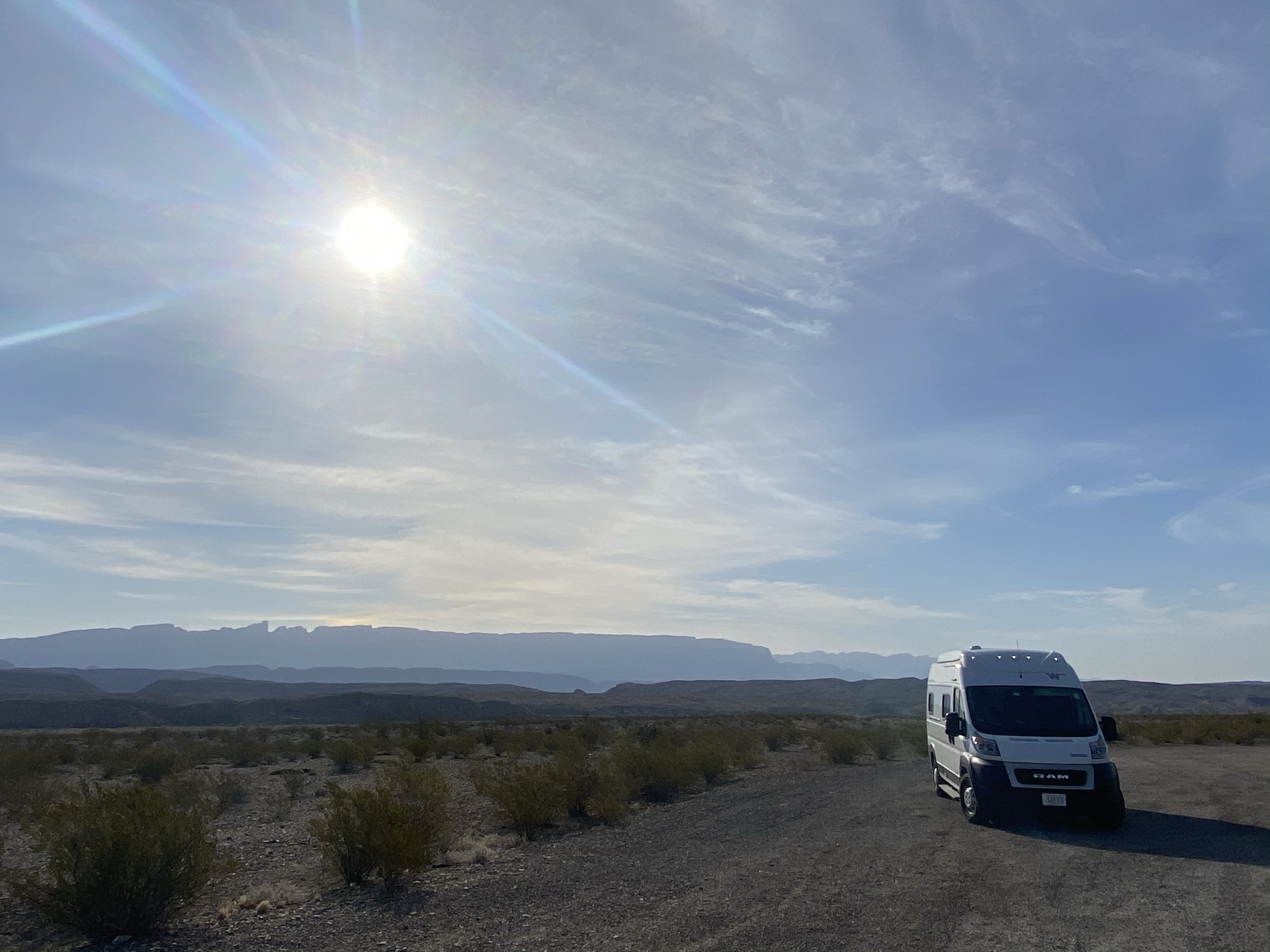
Then it was off to my next destination, a stopover on the way to Joshua Tree National Park. California here I come!

New Challenges Conquered

Continuing west across the desert brought a new sight, magnificent, tall Saguaro cacti. Standing erect, sometimes reaching 50 feet into the air, these plants can live for up to 200 years. They understand the importance of time, of slow steady growth, not blooming until 35 years of life and not sprouting arms until at least 50. But when they do, they form all types of intricate shapes, stretching up, lowering down, and twisting around. 

I met Bryan at the east side of the park and we drove admiringly around the scenic loop. The desert may have little shade, be hot and dusty, but it is anything but lifeless. Among the Saguaro forest are spiny Ocotillo with brilliant red flowers, fuzzy looking Cholla cacti that have protective needles, Prickly Pears donning flowers of various yellows and pinks, and vibrant Palo Verde trees providing protection for young plants. Desert life shows how resiliency and adaptation can create life.

After our drive we settled on a plan for the next day, a long hike to Rincon Peak, and headed over to our camping spot. A little ways down a dirt road we found a peaceful place and settled in for the night. For me, that meant dinner and a shower. For Bryan, hunting for more rattlesnakes. And find one he did! Another set of awesome shots thanks to help from my trusty hiking pole (that is now in the dumpster) and his mission was accomplished. The night ended more calmly with some star watching and early to bed. 

Our hike the next morning started at 6AM, down a long and bumpy dirt road to the backside of Saguaro National Park. With 8 miles and 4,600 feet of elevation gain ahead of us, we needed all the time we could get.  This was about me to my new longest and highest climb, challenging my limits and proving to myself that I can do hard things. 

The trail started out easy enough, winding through flat cattle pastures. Then we hit the park, and the ascent began. Quickly we climbed up the side of the mountain, switchback after switchback, around and over rocks. Just an hour in and we looked back to find the car, a tiny dot in the distance. The morning was still cool though, the sun still rising, and the distant mountain views inspired us to keep going.

As we climbed, the desert changed into sparse forest and pine trees gathered around us. While they provided shade, they also brought flies and gnats, incessantly buzzing around our heads. Now this was our motivation to keep moving! The path levels out temporarily, passing through a valley, and we picked up speed to get through. Soon enough though we were climbing again, the brief break over. 

The forest covering continued, as did the bugs, and the climb go steeper. Switchbacks became shorter, more vertical, and at times almost like crawling. The loose, dry soil beneath our feet made many steps a challenge. Roots, trees, and nearby rocks providing support and grip as we continued upward. 

Many times I thought we had to be close, that looks like the peak. But alas no, 8 miles and 4,600 feet is long. My breaks became more frequent, my speed slower, but my motivation lingered. Bryan led the way, giving me something to chase after, to encourage me to keep stepping forward, one foot at a time. 

Then, finally, after one last scramble over rocks, the summit appeared before us. Rocky and wide open, a panoramic view of Arizona spread before us. A slight breeze greeted us and we settled in to rest and relish our accomplishment!

Sitting there, soaking in the wonders of Mother Nature, Bryan and I reflected on our new found friendship and how grateful we were for meeting at Guadalupe Peak. Among many things, Bryan reminded me that an adventurous spirit lies within me. I enjoy pushing limits, developing new skills, proving to myself that I can accomplish physically challenging things. I’ve often shied away in the past, afraid or not knowing where to start or not having someone to go with, but I won’t any more. I can do it by myself and seek out groups to join. No more quieting certain parts of my identity.

*Photo credits to Bryan Jauch

A long rest and heart filling chat later, we departed the solitude Rincon Peak for the descent to the car. Never let anyone tell you going down is easier than going up. It isn’t, it’s just different challenging. And often seems to take way longer than anticipated because you are so tired!

Slowly but surely we went down, down, down, accompanied by a few wild turkeys gobbling in the distance, a deer here and there, and many, many bugs. Music helped drown out the annoying bugs until we escaped the forest and a gentle breeze gave us some relief. Down, down, down we continued, weaving back and forth across the switchbacks. Many miles later the car came into view, but was still just a speck in the distance. 

We knew we were close when we encountered the fence, marking the border of Saguaro National Park, and then the cow ploppings signifying we were back in the pasture. We passed a few skiddish cows and kept pressing forward through the sandy soil, longing for water and rest. That last mile and a half seemed like 10, but eventually we emerged, tired, hot, and proud.  New milestones reached. 

After the drive back we enjoyed much earned ice cubes in the shade of Sunny and marveled at our accomplishment. Bryan headed out for the night and the next leg of his journey and I enjoyed a much earned shower and cold dinner. It was sad to be alone again, hard to say goodbye to a wonderful friend, and worth all of it for the connection we made in such a short period of time. I look forward to a reunion with Bryan, Natasha, and Crystal at some point down the road. 

The following day, after a luxurious sleep and an early morning FaceTime chat with Crystal, I headed to Saguaro West to check out some more cacti. Most of the day was spent in the car, legs tired and body sore, but a little movement was good. 

Errands and chats with friends back home wrapped up my day and I settled in for another beautiful sunset in the desert, another day on the horizon. 

Side trip: Chiricahua National Monument

On my way to Saguaro, I made a pit stop at Chiricahua National Monument and I’m sure glad that I did. A little out of the way, the remote protected land is a gem in southern Arizona. A long drive through barren desert, passing by endless trains traveling straight across the horizon was rewarded with a mountain oasis rock garden.

At the end of the scenic drive is the Maasai Point, which introduces you to the playground around you. Mountains are covered with burnt red rocks, jumbled together like a bunch of left behind lego pieces. They are mixed between pops of green from the pygmy forest – Alligator juniper, Arizona cypress, and Mexican pinyon. These hardy trees may be short but they are resilient, finding the tiniest bit of soil to latch onto and surviving on the slightest bit of rain.

This protected area is named after the Chiricahua Apache who once roamed freely in these hills. While this spot is known today at Massai Point, named in honor of their fearless fighter Big Foot Massai, the indigenous people called it Yahdeshut, or “Point of Rocks.” The Chiricahua Apache held fast in this area against against invading troops until the 1870s. The Dragoon Mountains provided them with peace and protection for as long as they could withstand the attacks. While they were eventually removed from the land, there are still markers of their legacy. Another example is the Cochise Head, a giant stone outcropping in the mountains that is said to resemble, and named to honor, the last Apache chief in this territory. The Chiricahua Apache were peaceful people, preferring diplomacy, and did their best to coexist with their white neighbors. As you walk around the lookout, you can understand why they worked hard to maintain peace and stay in their beautiful homeland.

The landscape decorating this area is full of columns, pinnacles, and balanced rocks created by volcanic eruptions and shaped by weathering. Water falls into the cracks, slowly eroding the soft earth beneath, developing intricate shapes and patterns. The forms you see today are constantly transforming. Come back in a few years and you will be surprised by a new view.

I meandered around the path, soaking in the views, and then headed down the windy road to my campsite. On the way the sun cast a glow over the rocks around me, highlighting their best features. With every dip of the sun the scene evolved, a wonderful show of nature.

After a good, restful night’s sleep, I headed out early for my hike to the Heart of Rocks. The sun was already blazing at 8AM, but the partially forested trail provided some relief and protection. Down, down, down the trail descended, making the rock towers loom above me. The dusty path skirted tall towers and unique forms, like Mushroom Rock.

Eventually I began to climb, up into the pine forest and along the ridge. Panoramic mountains stretched before me, blue and green and brown in the distance. Vast expanses of uninterrupted nature. Fiery red blooming cacti greeted me along the path, adding dashes of color to the palette.

Eventually I arrived at the Heart of Rocks, a collection of eroded stones that spark imagination. The Kissing Rocks, Thor’s Hammer, and Balanced Rock were among a few named, but tap into your creativity and you could invent names for any rock in this forest. The possibilities are endless.

Inspiration Point was my next stop where mountain tops were lined with pointy grey pinnacles, a fence of armor protecting them. A few lizards greeted me along the way, often startling me as I took a step forward. Usually they skittered off before I could snap a picture but a few less camera shy stayed to pose.

The way back was easy and quiet, only a few other hikers in the trail. I stopped by the Visitors Center on the way out, and took off for my next destination having logged 8 miles for the day! More adventures ahead.

White Sands National Park

While camping near Guadalupe Mountains, Crystal reached out, asking if I perhaps wanted to camp together and visit White Sands with her. Crystal with the cute dog, yes, of course. And now I had Bryan and Natasha too, so a whole group was forming. What a splendid, unexpectedly lovely sequence of events. So I left Guadalupe at dawn, eager to beat high winds, complete errands, and join us with my new friends.

When I finally arrived at Dog Canyon for camping, Crystal was eagerly waiting. Our connection was instantaneous and fulfilling. She hopped in my van for some shade and the conversation flowed easily. It’s such a gift to find people in life who you belong with. Time slipped away from us as we chatted, and Bryan and Natasha eventually showed up to grow the party.

It was a blazing hot day, with no shade to be found, so we set up Crystal’s awning and eased in to an afternoon of relaxing. We made plans to head to the park for sunset and just chill until then. Eventually Bryan had had enough relaxing, and as an aspiring and naturally talented wildflower photographer, set off in search of a subject to capture on camera. Soon he returned, requesting my hiking pole in order to coax a rattlesnake from under a bush, and he was off. At first we all hesitated to follow him, but curiously got the best of us. We soon found him thanks to the loud shaking of the snake’s tail. Crystal, Natasha, and I watched from a distance, terrified and intrigued at the same time. We stayed until Bryan was done, wanting to make sure he was alright. And he was, thank goodness.

With my adrenaline quota filled for the day, I set about making dinner for us all. My friends are all camping in their various cars and haven’t had a good meal in a while. I was happy to serve them, feeling needed. Seasoned chicken breasts and green beans were like a gourmet meal to them and each diner was beyond grateful.

Then we sped off for White Sands, the most magical place in the middle of the desert. Out of nowhere, after miles of brown, dry ground with dusty shrubs, white dunes appear as if dropped from the heavens. We drove into the park, down the winding road, with the blazing sun sinking towards to the tops of the white hills. Life doesn’t get much better than that.

We parked in time to watch the sun give it’s final show, reflecting golden and orange and blue off the distant dunes. Something about this place calls to your inner child and you can’t resist. Cartwheels in the cool, soft sand ensued. We wandering around barefoot, chased Max back and forth, sat and admired. A peaceful and energizing place.

Before the park closed, we strolled down the nature path under the blinking stars, looking for wildlife and soaking up the silence. Then we hopped back in the cars, bringing plenty of sand along, and zoomed back to our campground.

No one was ready for bed yet. The stars were just beginning to shine. So we all laid down and admired the universe above. Shooting stars zipped by us, I counted six in all. Each time I reflected on how privileged I am to be in this place, with these people, and this moment. Thank you universe for bringing us together.

We all eventually went to bed and morning arrived before anyone was ready. Bryan said goodbye to go hunt Gila Monsters, Natasha set up to work from her car, and Crystal and I prepared for a day together enjoying White Sands again. It was hard to say goodbye, but I know we will find a way to connect again.

The rest of that day, with Max in tow, Crystal and I walked the trails at White Sands. The tiny crystals that disintegrate to create this beautiful space are magical. That’s the only word that fits! And someone how, in the middle of this desert, life persists. Trees grow, shrubs flower, lizards skitter about. We stayed and read and watched until the sun was high and hot. Then we departed for lunch and rest, but promised to return for one more sunset.

Lunch was followed by a side trip to the largest pistachio in the world! A store, farm, and winery, a giant pistachio statue was the main attraction. A homage to the founder of the business, it stands tall by the side of the road. We admired it, and laughed, while enjoying some pistachio almond ice cream. We couldn’t pass that up, now could we?

That night we drove all the way to the back, where the shrubs on the dunes disappear and white waves stretch for as far as you can see. We pulled out the red sled I bought earlier, waxed the bottom, and ran (until we wouldn’t) up the dunes. Let me tel you, running up loose sand is hard! Exhausting! Especially as you get close to the top and it falls away, slipping you backwards a bit, with each step. But we made it, and it was totally worth it. Taking turns, making a path, we slid down the dune, letting out shrieks of joy. Gosh, was it fun! I also rolled down the hill, made sand angels, and made pictures in the sand. Crystal and I were out uninhibited selves and it felt amazing.

We stayed until the sun was gone, the night dark, and Crystal’s truck the only vehicle left. We stayed until the last moment, soaking up the serenity, and then slid down one last time. We may have technically been two minutes late leaving the park, but it was totally worth it. After all, I had made a new lifelong friend.

The next morning, before going our separate ways, we had breakfast together and planned our next legs of the journey. While we were parting for now, we both new it was only temporary. We’d be talking again before we knew it. Full hearts.

Guadalupe Mountains NP

Only a short drive down the road from Carlsbad, NM, you cross back into Texas and are greeted by the Guadalupe Mountains. The road rolls upwards, bringing you over a mile above sea level to a beautiful scene. El Capitan juts up before you, and it’s taller friend Guadalupe Peak stands behind it, strong and sturdy.

I spent my first day here on a leisurely hike to Devils Hall. At the back of the parking lot, the trail climbs up into the hill and follows along the dry stream bed. Gnarled trees twist around and around, stretching up for sunlight and down for water. The old, gray bark is wrapped by soft, maroon new growth, displaying the resilience of the desert. Above the clouds were gray and ominous, but no rain ever fell.

Eventually the trail descended into the wash, the dry stream bed, and I found myself climbing over boulders as I wound my way upstream. The loose rocks beneath my feet made for tricking hiking, but one step at a time made for a successful journey. It was a path of many options and I was constantly searching for the adventure.

Towards the end, the trail opens into a wall, a series of shelves dug into the rock. Carefully I found handholds and footholds and climbed my way up and over. The trail continued several hundred more feet until Devils Hall, a narrow canyon carved between the stone walls by years of water gushing down. Although now dry, you could still sense of the power of the water in winter.

I sat and ate lunch with a welcoming group of women. They immediately invited me on future hikes and travels, should our paths ever cross again. Being in nature has been so rewarding for me.

As lunch finished up, the wind began and I headed out before I was too chilled. I would my way over and down the boulders, maneuvering through the wash until the trail headed into the woods again. I got distracted by news of the arrival of my friend’s and found myself off trail, but so did a few other fellow hikers. So we bushwhacked together and made it back safely. It was a good reason to exert the extra energy!

Back in the parking lot, I noticed a few empty RV camping spots. Unfortunately my chair was holding my place at my current camping spot, 30 minutes away, and I was doubtful these spots would last that long. However, luck was on my side! A hiker I met on the trail was camping nearby, saw me, and offered to put his chair in the spot to hold it for me! The kindness of strangers is always heartwarming. I gladly accepted, headed directly to the Visitor Center to pay for the spot, and booked it back to my chair. All turned out well and I was set for my challenging hike in the morning, no more driving required!

The next day was beautiful, perfect for hiking Guadalupe Peak. A staggering mountain measuring 8,751 feet tall, with 3,000 feet of elevation gain over 4.2 miles to reach the top, this was set to be my biggest accomplishment in hiking to date. I got up early that Saturday, with my packed bag and new hiking pole in hand, and headed out as the sun was rising.

Slow and steady was my plan. Just keep putting one foot in front of the other, pole handy for support and lift, was what I told myself. The trail gave no time for warming up though as a series of switchbacks covered the first mile. In fact, after the first mile and a half I had completed most of the elevation gain!

Several people passed me, but I wasn’t in a rush. I enjoyed the growing views with every turn, watching my van quickly shrink in size. Soon I was into a pine forest, providing shade and comfort.

Nearly to the top, I passed a group of women on a guided hike and stopped to chat. Texas natives, this was their first time visiting and climbing the peak. They were amazed that I was out here on my own, saying that I inspired them to keep going. Their love and support kept me going too!

I crossed the bridge shortly after, signaling I was close to the top. No peak though before one last tough climb. And then there I was, towering over El Capitan, above the clouds, at the highest point in Texas. I did it, all on my own.

I found a quiet place to sit and enjoy the views. It was serene and gorgeous, a spot all to myself for a bit. I watched the clouds roll in, a wall cutting across the mountain. Slowly they swirled and dissipated, only to return again and surround El Capitan. They moved i a dreamlike way, no hurry in their flow, just floating wherever the wind blew them.

Eventually a fellow hiker wandered over and he sat down to chat. Come to find out, Bryan, another solo hiker, was also from Massachusetts. Our chat revealed that we had many random things in common – type of car, passion for skiing, crystals, connection to teaching, traveling alone. We both felt the universe had brought us together and decided to hike down together.

On our way out, we ran into the Texan women from earlier. They made it! Denise, Hilda, Cynthia, Melissa – wonderful people, full of life, doing hard things. One thing led to another and I shared how I hadn’t seen any javelina yet, an animal native to the area. Well, Cynthia and Hilda said they were javelina – it was their college mascot! So of course pictures ensued along with laughs. During this time we attracted another solo traveler, Natasha from New Jersey. She’d overhead our conversation and came to say hello! We had an East Coast group growing, and decided to hike down together.

Two other women from Georgia joined our group and we had a nice train going down the mountain. With Natasha, just like Bryan, it felt like we’d been friends forever. Conversation flowed easily and Natasha stuck with me when my pace slowed. I enjoyed the journey down, and was happy for company because it was a long way on tired legs.

At the bottom, Bryan was waiting for us. Feeling accomplished, yet beat, and hot, I invited them over for cold seltzer and shade. I was thrilled I didn’t have to drive anywhere. I was home. 8.4 miles and so much vertical was enough for one day.

We sat chatting for a while, getting to know each other better, forming a bond. We just fit together. It was nearly perfect.

Through our conversation we learned we were all headed to White Sands next and made plans to met up there. The friendship would continue! It was a welcome surprise that I didn’t know I needed and loved so very much.

We eventually said, “See you later” to each other and went our separate ways for the night. I settled in for the night, spent time chatting with my camping neighbor Manuel from Mexico while enjoying wine, and went to bed early. It was a lovely day. Guadalupe Mountains over delivered in every way.

Carlsbad Caverns

After leaving Big Bend, I headed toward Guadalupe Mountains and Carlsbad Caverns. On my way over, I stopped in Terlingua, a small ghost town outside of Big Bend. While there wasn’t much activity, there was a historic cemetery with ornate tombstones and alters. The cemetery was established when the area was booming due to mining. A Mexican-American found cinnabar, a mineral that creates mercury, here in 1902. It was in high demand during WWI. He became the first Hispanic person to make a mining claim and established a strong future for himself, his family, and the community. The cemetery continues to be the resting place of residents as they pass away. The Day of the Dead is celebrated here, when community members and relatives come to honor their ancestors. Graves exist from 1913 to 2021. I wandered around admiring the love that was displayed at each gravesite. I left a donation for the upkeep of the historic site and continued on down the road.

I made it to Guadalupe Mountains National Park in the early evening, but the last campsite had been taken by a trailer that passed me earlier on the highway. Darn! So instead, I continued down the highway towards Carlsbad, got gas which I desperately needed, and then pulled into a spot at Sunset Reef Campground. A free site recommended by my neighbors at Chisos Basin, it was a great spot – quiet, clean, and with a covered picnic table.

I never did use that picnic table though. It was much cooler than at Big Bend, thank goodness, and rainy. I switched into my sweatpants and sweatshirt and ate some dinner inside. I was preoccupied planning my next few days when I heard my neighbors shriek. I looked out my windshield and saw what had their attention, a full double rainbow after the rain! I grabbed my camera and ran outside before it disappeared. What a wonderful treat!

That night was calm and comfortable. I woke well rested the next day, but to steady rain. Luckily Carlsbad Caverns was right down the road and I was able to get a self-guided tour reservation. Plenty to keep me busy, and dry, for the day!

Carlsbad Caverns is a magical underground world. When you visit, take the time to enter through the Natural Entrance outside. A short path from the Visitors Center brings you to the mouth of the cave, a large hole with a winding path leading into the dark ground. During the day you can find Cave swallows humming about the entrance, gathering on the ceiling far above. If you are lucky enough to be here at night in the summer, you’ll be treated to Brazilian free-tailed bats taking their place as they fly from the depths of the caves to find their dinner outside.

The switchbacks lead you down, down, down into the darkness where the magic awaits. With each step you descend farther from the surface until you are 750 feet below ground. While no natural light shines down here, carefully placed lamps light the sloping and damp floor. No light doesn’t mean no life though. Besides bats and swallows, ringtail cats, moths, and millipedes take shelter down here. And cave crickets, spiders, and beetles reside here permanently. Even cooler, scientists are discovering nano organisms that live in the deepest darkest parts of the cave that might help us understand life on other plants and be cures for cancer. Mother Nature is amazing!

It’s chilly down in the cave, steady around 58 degrees. A welcome break from the scorching heat of the last few days.

I spent hours wandering around the paths, from room to room, staring up, down and all around. All around strange masterpieces hung from the ceiling, crept along the walls, and sprouted from the floors. Skinny straws, thick columns, flowing ribbons, bumpy popcorn nodules. The cave formed millions of years ago but continues to grow each day, slowly morphing drop by drop as water trickles down from above.

These caves of the Guadalupe Mountains were formed quite mysteriously. Most caverns are formed when limestone is dissolved by carbonic acid. And parts of these caves may have been created that way too. However, here there are huge gypsum deposits, large rooms without rocks scattered, and no streams. Scientists are still learning how these particular parts of the cave formed and believe it could have to do with sulfuric acid, making this place even more magical.

This park is connected to the ancestral heritage of 14 different tribes, including the Mescalero, Lipan Apache, and Chiricahua. Each group has a special tie to the earth in which they honor what brings them life. The indigenous people were removed from their homelands in the recent past and prohibited from visiting until very recently. They are only now beginning to reconnect with the magic of the caverns and land that brings them food, water, and other resources.

As I slowly meandered through the rooms, each formation was more stunning than the next. When thinking of the brave explorers who first stepped into this unknown world, my heart pounds. In 1989, Jim White stumbled upon a hole on his ranch and threw down a lighted branch to see how deep it went. He came back with a ladder fashioned from fence and sticks and headed down! No fear. Later explorers did the same with delicate ladders and no safety gear to explore deeper and deeper. Elizabeth Willis, daughter of an early investigator, was the first female guide leading visitors through in the 1920s. Inspiring.

It is difficult to describe what I saw and do it justice, so I will let the pictures speak for themselves. What I saw was only a fraction of the caves, new parts of constantly discovered. Perhaps one of you will be a future cave explorer!

Big Bend: Chisos Basin

A little over a week ago I enjoyed my last adventures in Big Bend.

Eager to escape the heat, I spent my last three days at Big Bend in the Chisos Mountains. 7,825 feet at their tallest point, Emory Peak, these rock towers offer cooler temperatures and refreshing winds. They stand in drastic contrast to the desert floor, sprinkled with green pine trees, black bears, and mountain lions. Big Bend is home to the entire Chisos Mountain range and is the only park to encompass an entire range.

My first adventure here started early in the morning, just as the sun was waking up. This was for two reasons. First, the road is being repaired and closed from 8-11 each day. Second, to beat the heat! Going early also meant I was able to nab a parking spot right at the trailhead. Bonus!

The Lost Mine Trail was my pick today, a 5 mile round trip hike with 1,100 feet of elevation gain. According to legend, the Lost Mine Peak hides an ore mine dug by enslaved Chizo people during the invasion of Spanish. The Chizo people were captured, blindfolded, and forced to work in the tunnels. Eventually they revolted and sealed the entrance to the mine, which is still unknown to this day. No ore has ever been found in the rocks on this mountain, but the land is still protected.

Different from the rest of Big Bend, the trail here traverses back and forth through Juniper pines, offering shade and protection from the sun. Each switchback offers a more spectacular view of the mountains and canyons beyond Lost Peak and Big Bend. I couldn’t help but stop and take pictures often, which made me wonder if I’d ever see the top.

Eventually I did reach the summit, a bare rock landing offering views in nearly all directions. Wow was about all I could utter. The trail ends at the top of a small rock outcropping, where you feel on top of the world. I found a place to sit for a while and admire the views.

On my way down, I encountered three people from the fire crew, watching a smoldering spot of forest on the slope across the canyon. This part of the park had a large fire the week before my visit and was only recently contained. Many trails in the Chisos Basin area are still closed. These fire observers were making sure the still burning spot stayed put, far away, so the trail and area could remain open. They explained that it was a difficult area to contain and manage because of the steep slopes there. Luckily the fire hadn’t moved in a few days and rain was on the horizon. Hopefully whatever fell would be enough to naturally end the burning embers. (And I think it was as I have not heard anything about the fire in the days since.)

Back at the car I cleaned up and headed out while the road was open for a two hour window. But before I headed back, I had one more adventure planned for the day. Down Grapevine Hill Road lay a short trail out to Balanced Rock. So Sunny and I turned onto the gravel road and started our bumpy ride. The washboard ground wasn’t so bad, kind of like a free massage, but the last few miles were full of potholes and protruding rocks. I was too committed to turn around, too close, so I kept going. Up and down a few rolling hills, slow and steady, and we made it to the trailhead. Phew!

It wasn’t even lunchtime yet, but it was dry and hot outside. I checked my water levels and decided to go for it. At a quick speed I went, hoping to get back before the hottest part of the day.

The trail carries you into a red rock forest. In all directions boulders cover the hills, mixed in with green brush here and there. Prickly pear, with their spiny needles and soft blooms, lined the path along with delicate yellow flowers.

After pushing through sand for most of the way, I reached a mass of boulders leading the way up to the viewpoint. My hands helped to pull me up and over the rocks, climbing to the main attraction. It was a short but difficult climb with a big reward.

There, at the end of the trail, is a massive rock balanced between two other vertical rocks, creating a window framing the mountains beyond. I climbed up and sat on the side for a while, admiring the view, then hopped down and took my turn under the canopy. A beautiful scene that was hard to pull away from.

Alas, I had to get back, so eventually I turned and left. But the whole trip back, I kept spinning around to catch one more glimpse.

The following day I had planned a lazy morning before checking out of my campsite, but it never dropped below 80 the night before and I was eager to leave. So I packed up early and drove back to Chisos Basin. I had a campsite reserved there for the night, but couldn’t check in until 1:00PM. It didn’t matter though, it was in the 60s when I arrived with a gentle breeze. I pulled into a parking spot, zipped up my window shades, and laid down to get the rest I had missed the night before. Ahhh, much better!

The late morning and early afternoon were then lazy as I caught up on chores and to do list items. Cell service meant I could make calls and answer texts. So I did my adulting and moseyed down to my spot when it was time.

Down in the Basin, still at 5,400 feet, while the sun was shining it was comfortable and the tree at my campsite offered some shade. What a luxury! I set up my space and relaxed into my chair.

Soon my neighbors returned from their morning excursion and we became fast friends. Before I knew it, I was happily watching the dog of one of the group members as the humans headed out for a quick afternoon hike. Maxwell and I became good buddies, sitting together in the chair, enjoying the breeze. It was nice to have a furry friend to keep me company. I miss my guinea pigs, Timmy, Tommy, and Chester, but know they are being well cared for by my sister and friend Kristi. Spending time with Max was just the love I needed.

My neighbors did come back, so sadly I did not inherit a dog. But we did get to chat more, share travel tips, and connect about life. They were grateful for my generosity and gifted me petrified dinosaur dung from Arizona. How cool! The whole experience was another friendly reminder to ask for what you need, be kind, and (safely) talk to strangers. Human connection is cool.

That night, after dinner, I headed up to the village area to watch the sunset from the Window View Trail. Warm rain splashed on my coat as I walked, a welcome relief to the dry, dusty weather. I got there early and snagged a spot on the bench, front and center. As the minutes passed, many observers came and went. I had lovely conversations with a teacher and her husband, a pair of sisters, a man on a quick vacation. The sun kept slipping lower and lower, revealing more layers of mountains stretching into the distance. Threads of silver and gold glowed on the clouds above, eventually bringing out pinks and reds. Eventually most people left, but I stayed to enjoy the ending moments of the show.

Then, all of the sudden, one of the sisters came rushing back to share their were bears down the trail! From our earlier conversation she knew I was longing to see some, so she came back to alert me! We quickly dashed back, stayed at a safe distance, and watched a momma black bear and her two cubs munch on the grasses and shrubs near the path. Although seemingly docile, we stayed far away to admire them. A few people crept close, very close, and while they returned unharmed, it was a very dangerous thing to do. Give nature space, respect the wild.

What a great end to the day though! Another animal checked off the list. At this point it was dark, and I was fairly far from the campground with the bears still roaming nearby, so the sisters offered to drive me back to my campsite. I gratefully accepted.

Back safe and sound, I settled in for a night of good rest. One more hike on the list before I left the following morning.

Early on my last day, I woke up and hit the Window Trail for my final hike in Big Bend. The sun had just risen as I set out, not yet casting its full glow on the Basin. Just the mountain tops were alight as I headed down the quiet trail.

Along my way I dipped under pine trees and traveled next to dry creek beds. Towards the end, the trail climbed down into the wash. Up and over and down stairs I went, slowly descending to the pour off at the end. It was tricky walking over the loose stones, but I took my time.

The trail ended at the “window”, a narrow canyon framing the land beyond. While dry now, you can see evidence of past gushing water as the stone bottom is dimpled, smooth, and shiny. I walked close to the edge, but stayed a good distance away because the drop off is vertical! Straight down to the valley below. It must be very beautiful to see the pour off when water is gushing down during the rainy season. Perhaps I’ll experience that another time!

After eating my snack, I headed back, passing many out going hikers looking to enjoy the same beautiful view. Back at Sunny, I cleaned up, packed up, chatted with my neighbors Crystal, Mason, and Thomas, and headed out for my next destination! More to come.

Big Bend: The West Side

I woke up surprisingly energetic the day after the Marufo Vega trek, but knew I shouldn’t push my luck. So I played it smart and planned a short hike in the late morning and scenic drive for the afternoon. I mean, you didn’t expect me to sit completely still all day, did you?

Mule Ears Spring Trail was my destination of choice, a four mile round trip, out and back jaunt to a natural watering hole in the middle of the desert. Although only 10AM, it was already toasty and temperatures were only going to continue to rise. I quickly tied my boots and buckled my backpack. As I headed to the trailhead, I met another solo traveler and we decided to hike together for a while. The company was welcome and the conversation distracted me from my legs that did prove to be a little sore.

As the trail begins, you climb a series of steps and gain a great view of Mule Ears, a rock formation miles away that resembles the perked and listening ears of a four legged friend. The pointy rock mountains stand in stark contrast to the thick, sturdy walls breaking up the rest of the desert.

The hike continued up and down small rises, out into the desert. The sandy path is lined with cacti and scraggly bushes, muted greens under a layer of dust. The prickly pear blossoms add a pop of color to the scene though, lemon and buttercup yellow, peachy pink, and sometimes even cantaloupe orange. My hiking buddy and I snapped pictures as we moved along, trying to capture the beauty we saw.

Eventually the trail ends abruptly in a lush oasis, a spring of water in the middle of the desert. Areas like this must have provided much needed resources for the Chisos people. Currently they are home to birds and desert mammals looking for some refreshment.

I stopped here for lunch and parted ways with my hiking partner who had the energy to continue on. Alone on the trail, the silence was loud. Barely a rustling on scrub as the wind passed by. The vastness of the desert was clear. It wasn’t uncomfortable though, or frightening. More so it was wondrous, refreshing, to know that in this place there are undeveloped places of calm.

Back at the car, I chatted briefly with another solo traveler, this one from New Hampshire! It was nice to encounter someone from New England, who could relate to the struggles with the heat. Haha!

The rest of the day was spent driving the Ross Maxwell Scenic Drive, taking in the expansive views across the open land. I ended at Santa Elena Canyon, a narrow slot canyon carved out by the Rio Grande River, but opted not to hike to see it because it was crowded and hot. Do you see a pattern here? Heat is not my friend.

Instead I drove to the overlook, parked my camping chair under the awning, and enjoyed the canyon view from afar. Being in the shade was cooler, but even there I was sweating. Drinking water was a constant activity.

Eventually I packed up my belongings, climbed in the car, and cranked the AC for the 50 mile drive back to Rio Grande Village. I was quiet happy about that! That night wrapped up in a lovely conversation with my camping neighbors from Indiana. Tomorrow another adventure!

The Long Hike

Well rested after a cool night’s sleep, I woke up before the sun on my third day to hike the Marufo Vega Trail, my longest trek of any kind to date. The sun peak over the horizon, a glow of orange behind the dusky blue mountains, and the desert life began to find shade. A coyote sprinted in from of Sunny, dashing from one side of the road to the other, looking for a place to hide out as the temperatures rose. Around the corner, just before the trailhead, a few donkeys ambled down the road and into the brush, munching on the grasses as they went. Up ahead, one straggler ran down the hill to find his buddies, late to the party. And then, one more reward for an early start, two wild horses chomping on desert breakfast before finding cooler respite for the day. What a wonderful start to the day!

I spent a few moments checking my gear, ensuring I had enough water, turning on my GPS tracker, sharing my trip with my mom, and then set off down the trail to begin my 14 mile journey. Cool and shaded, the path traveled down a dry creek bed over stones and sand. The mountains loomed around me, just their very peaks lit up by the rising sun. Soon the path climbed a few feet, onto the desert floor, and continued along an old mining line, now just a rusted wire and some fallen wooden beams.

In time I made it to the first climb, up a rocky face and into the mountains. The rocks acted like stairs, guiding my way, and then descended into desert again. The sun came and went as I wove through the land and I enjoyed every brief break I was afforded, knowing the afternoon would offer little reprieve. I slowly sipped my water, trying to balance hydration and conservation. Hiking is the desert is dangerous and a long hike like this risky. Luckily my parents’ voices and cautions repeat in my head, keeping me safe and aware.

Each time I looked up, the word, “Wow” spilled from mouth. In every direction I was surrounded by stone walls jutting up from the earth, rusty red and ashy gray, usually barren but sometimes spotted with a few green dots. The immensity and breadth of the landscape awed me each time.

With energy and enthusiasm still high, I continued forward, along the ridge, until I came to the north and south forks. There I met two backpackers, resting under a rare tree, enjoying the shade before hiking out for the day. Two PT students traveling between rotations, they shared their suggestions about the trail ahead and sent me off with well wishes. After two hours of hiking, four miles down, it was nice to see another person and to take a brief rest. Only 10 more miles to go!

I headed left, down the south fork, and was soon rewarded with a glimpse of the Rio Grande far below. Turquoise and glistening in the sun, it urged me on in hopes of a greater view ahead. From there the path sloped downwards, a series of switchbacks lined with loose rock. I stepped carefully, often sliding a bit and needing to catch my balance before being able to take my next step. Bees buzzed around, but never landed, and a breeze cooled me off every now then as the sun beat down. A few times I thought about turning back, but my desire to complete the challenge and perhaps a bit of my stubbornness kept me going forward and down.

Down, down, down I went, nearly 2,000 feet, but still far above the the river. I did come to a river access point about midway, but walking the extra half mile down and back did not sound appealing. Plus, it was hot now, somewhere in the 90s and I did not want to exert the extra energy. So I continued on, two miles until I would the north fork.

Those next two miles seemed to stretch on forever, no shade in sight. But the red rocks climbing upwards to my left and the green blue river to my right offered a welcome distraction. A turkey vulture soared above me, circling in front of the mountains, riding the wind gusts. I admired its grace but also shouted to it, “I’m not done yet!” Hopefully I wasn’t the meal it was spying.

Each time I came to a rise in the trail, I thought, “Ok, this is it. This is when I start climbing.” But I was fooled many times. I began looking for a lunch spot, something out of the sun, but kept hiking for several miles I passed too long horn steer, seemingly separated from their heard, grazing in the lush vegetation. Then, I saw hikers! Two groups of two passed me, giving me comfort that I was not alone. They were the first people I’d seen about four miles. I never felt uncomfortable being alone though. I had my Garmin inReach for emergencies and knew my mom was tracking me. And it felt liberating to be doing this on my own.

A few more miles and hunger really started to call my name, so I huddled behind a rock that was angled just the right way to shade me from the sun. I pulled out my sitting pad, tucked in my legs, and at a well earned lunch. I stayed long enough to rest my tired feet, and then headed out again.

That’s when the climb begun! And gosh was it steep. Up and over rocks I climbed, finding crevasses to put my foot and hands to pull myself to the next ledge. I stopped at every ounce of shade to catch my breath and get some heat relief. Then off I was again because as a friend once said, “The slower you go, the longer it takes.” I use that for motivation every time I want to stop. And at this point I certainly did. Ten miles in, four to go but the rest largely uphill. Nevertheless, I was glad I chose this route because coming down the boulders would have been way less fun.

Finally I made it to terrain I recognized, back the the fork, the loop part complete! Yay! My energy grew (slightly) as I knew every step was a step closer to Sunny, cold seltzer, and a shower. “I’m coming!” I kept saying to myself.

The hike out was equally gorgeous, providing views of Boquillas and the sprawling greenery surrounding the river edge. Despite being exhausted, I paused every now and then to soak up the view and marvel and the beauty all around.

About a mile away, I ran low and then out of water, so I was grateful I was nearly done and had full tanks in the van. Dreaming of that seltzer pushed me on. I power walked through the stone creek bed and saw Sunny in the distance. My home away from home!

When I arrived, I ripped off my boots, filled a tall glass of water, and sat down. Oh, how glorious it was to sit!

While I was exhausted, I was also energized. 14.5 miles at the end of the day, by myself, was a major accomplishment that I might not have attempted a few months ago. I’m proud of the growth I’ve made.

I hope reading this hasn’t tired you out too much! Who wants to join me for the next excursion?

Big Bend: Boquillas Canyon & Crossing

Day two in Big Bend got a late start, so I didn’t venture too far from the campground. That didn’t mean the day was without adventure though. A short drive from the Rio Grande RV Park is Boquillas Canyon, which looks across the Rio Grande River to the small village of Boquillas, Mexico. Set up on the ridge, a sprinkling of buildings lay across the desert, home to many families.

During non-pandemic times, the village of Boquillas shuttles tourists across the river in canoes to visit their community. Their economy depends on the tourists: the money from the river crossings, the items sold in the market, the diners at the restaurant. All of that has come to a dramatic halt since COVID hit. The people of Boquillas have been struggling to survive ever since.

Because they can’t operate their normal businesses, they have found alternative ways to make a living, although at a large risk. They come across the river anyways near the canyon, selling handmade goods, fresh tamales, and songs. The chance that they could be punished by border control or park police seems to be worth the risk. It’s take this chance, or potentially not be able to feed their families and pay their bills. The effects of COVID continue to be long lasting and far reaching.

As I walked down the short path to the river, I met many men from Mexico selling their goods. They were friendly, respectful, polite. We engaged in brief conversations, both in English and Spanish, but unfortunately I didn’t have any cash to support their business. This bothered me every time I had to say, “No tengo cash.” I desperately wanted to help. Maybe I could return another day.

There was one small way I was able to help. As I neared the Rio Grande, I met Jesus, an elderly man offering to sing songs. From the far bank, he bellowed out beautiful ballads in Spanish about love and happiness. He shared that he has been doing this for 21 years, every day coming to the river, no matter the heat, and singing for visitors. When I explained that I didn’t have any cash, he wondered if I had any granola bars. Yes, yes of course I did! So he paddled over to pick up two, asked me about Massachusetts, and then went back to his tree to find some shade and comfort. There is always a way you can support someone for their efforts. Money would have been more helpful, but food was a good second option.

Then on I went to the river, wide but shallow, bending around through the high walled canyon. I kept going until the end of the path, where the sand ended and the water continued. Prepared with my sandals, I dipped my toes in and was surprised to find the water fairly warm! I guess I shouldn’t have been surprised, it is 90 plus degrees almost every day right now. A step or two in wasn’t enough though and shortly I was wading across to the other side. The water never reached above my knees, but it still took effort to push through the current. Then all of the sudden, I was in Mexico! I stayed long enough for a picture, but then my rule following inner voice starting shouting, “You don’t have your passport!” and I quickly made my way back. But now I can say, “I’ve been to Mexico!” Kind of.

Back on U.S. soil, I chatted with a few fellow hikers and made fast friends with Ragov. We walked back together, chatting about van life and car life – he had make a makeshift home out of his Subaru! I said goodbye to Jesus as we passed his post and continued up the sandy path back to the parking lot. We then joined back up with a man selling tamales on horseback, who Ragov had promised to find on his way out. He followed us back the car, with our permission, so Ragov could get his cash. He then bought two bags, $10 each, chock full of chicken filled pockets of love. Generously, he gave one to me for lunch. The kindness of strangers is refreshing and heartwarming.

After that, I headed right to the campground store ATM so I would have cash next time I came across some Mexican market goods.

Lacking energy, and feeling the heat, I headed to the picnic spot just beyond my campground. Quiet and empty, I put together a cold lunch and sat under the shade of a billowing cottonwood to enjoy it. I followed that up with journaling in my camping chair and then finally walking down to the river one last time, through the reed lined path, to soak up the view. A relaxing and full day, I scooted back to my campsite to hunker down for the night. More adventure tomorrow.