Cuyahoga Valley National Park

We are home! We arrived just in time to celebrate my birthday with my sister. We’ve unpacked, I’ve made it back to my apartment and cuddled with my guinea pigs, and I’m thinking about what is next! Before I share my overall trip reflections, I have one more adventure to tell you about.

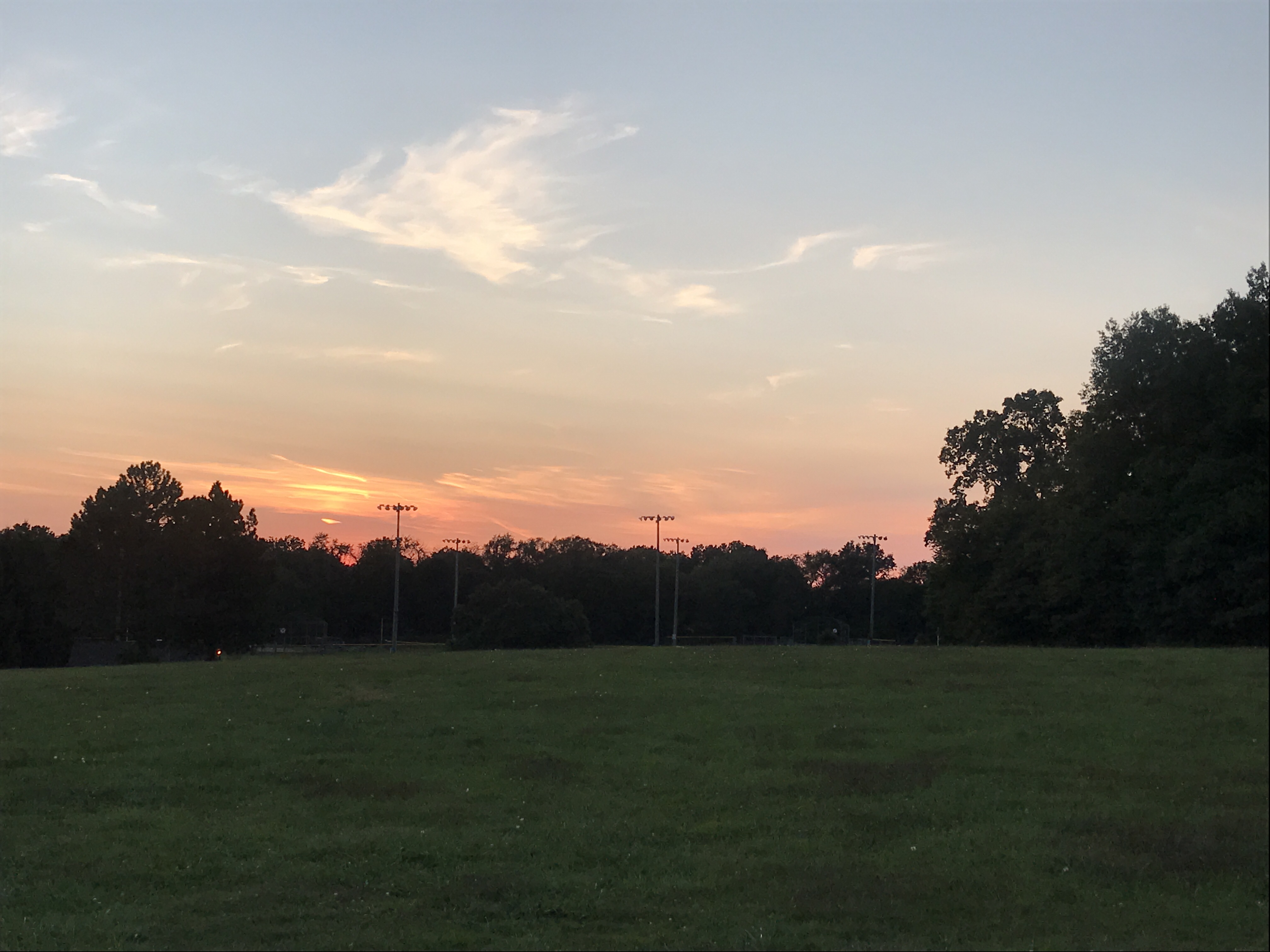
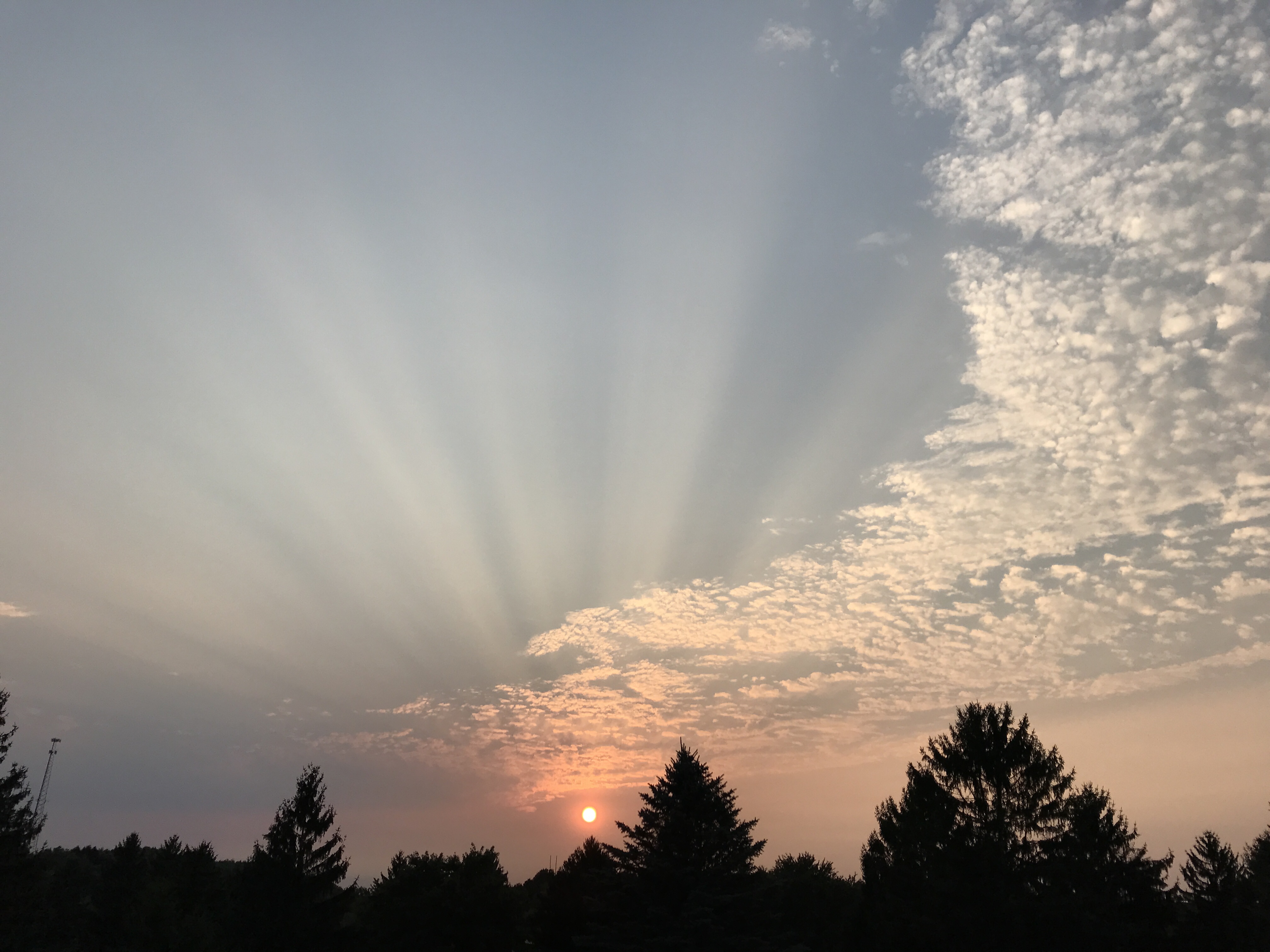
For our last excursion, we stayed in Stow, OH at a very basic and quiet city campground. While it was tough to find a level parking spot, we did get great local knowledge from the host. In fact, he came around our first night and invited us out for an astrology lesson. We joined him in the field at 8:15 and not only got to see Jupiter and Saturn burning bright in the black sky, but also witnessed the International Space Station pass by! It moves a mile every five seconds! It flew high above us, arcing towards the trees. A very special sight to start our adventure near Cuyahoga Valley National Park.

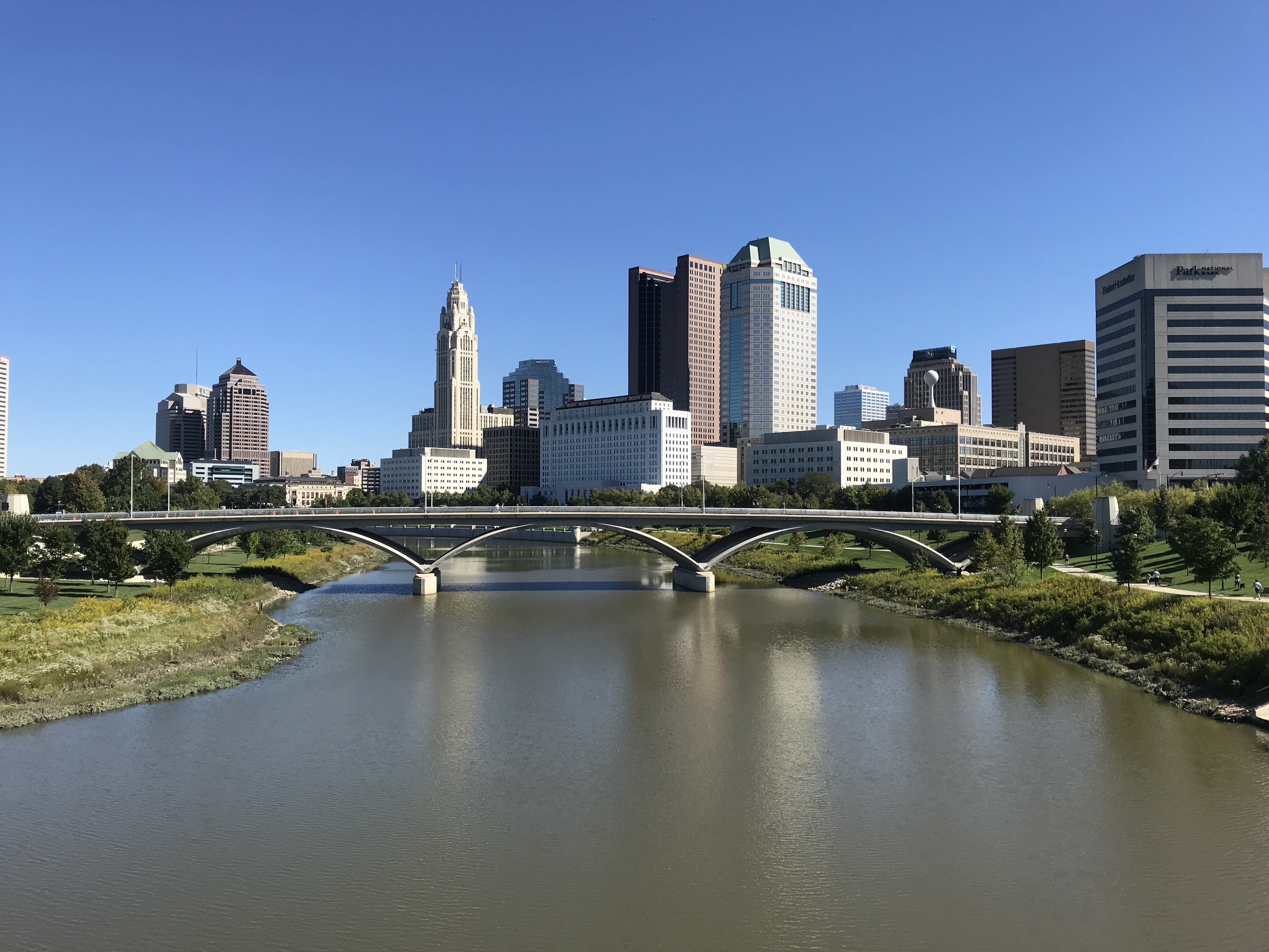
Cuyahoga National Park is a relatively new national park, nestled between Columbus and Akron, Ohio. It stretched for more than thirty miles north to south, protected various lands and animals that depend on the Cuyahoga River that runs through the park. This river was in a nightmarish condition in nearly 70 years ago. Not once, but multiple times the river caught on fire because it was so terribly polluted. Can you imagine that, a river on fire? What a travesty. Since then, the National Park Service and local organizations have been hard at work to rehabilitate the river. A major step happened recently, with the removal of a dam along the water. Rangers and volunteers are thrilled to report that the health of the river is gradually improving, as evidenced by river otters returning to the habitat. That’s a major success!

More successes can be seen as you travel to the different sections of the park. Cuyahoga Valley National Park is slightly difficult to navigate, as the land was reclaimed in sections long after development happened in the area. So there are many roads that run through the park and some houses and farms along the way. It makes navigating your way around cumbersome at times, as you have to leave and re-enter in different locations, but the parts we visited were worth the effort.

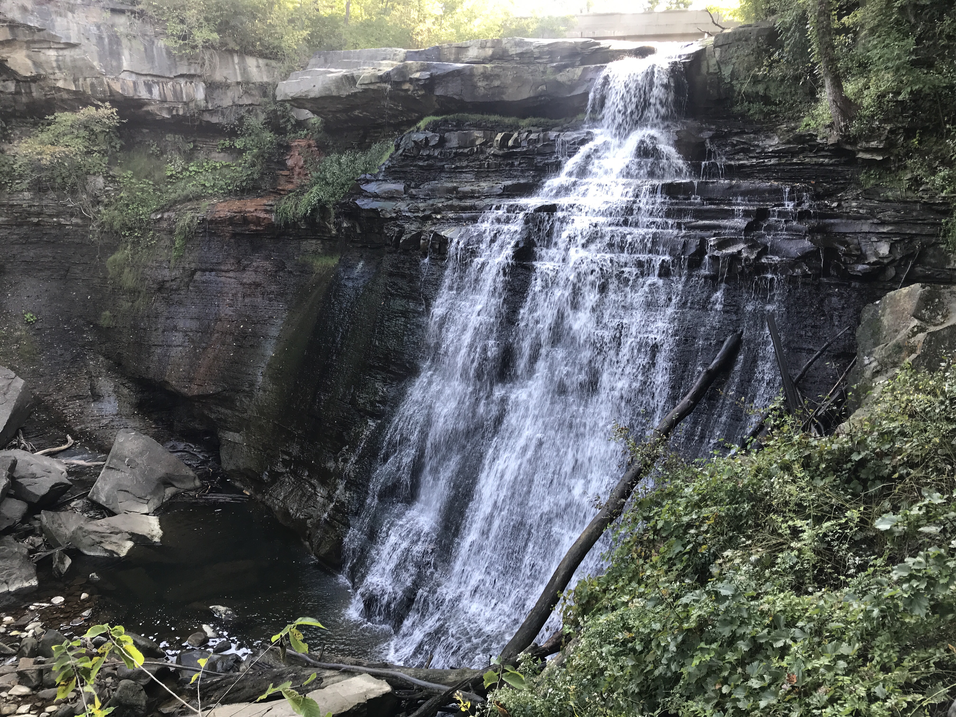
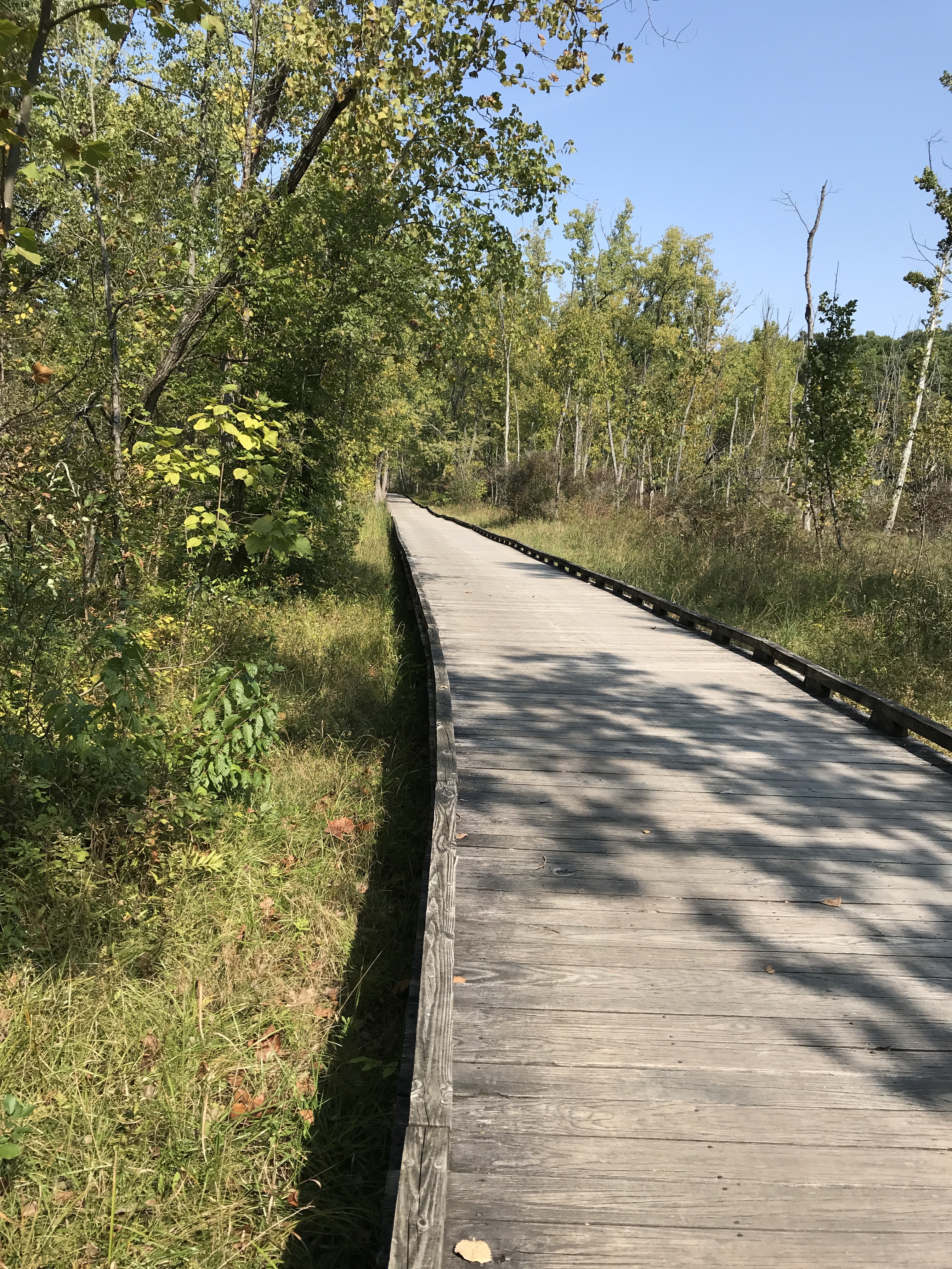
Our first stop was Brandywine Falls, a magnificent surge of water on the Cuyahoga River that plummets over a rock cliff to the gorge below. Follow a series of stairs and boardwalks to the brink of the falls and you have an excellent view. We then hiked around the falls, examining the ruins that were once the mill from the town that existed here in the 1800s, and over to the Standford House, a preserved home in the park.

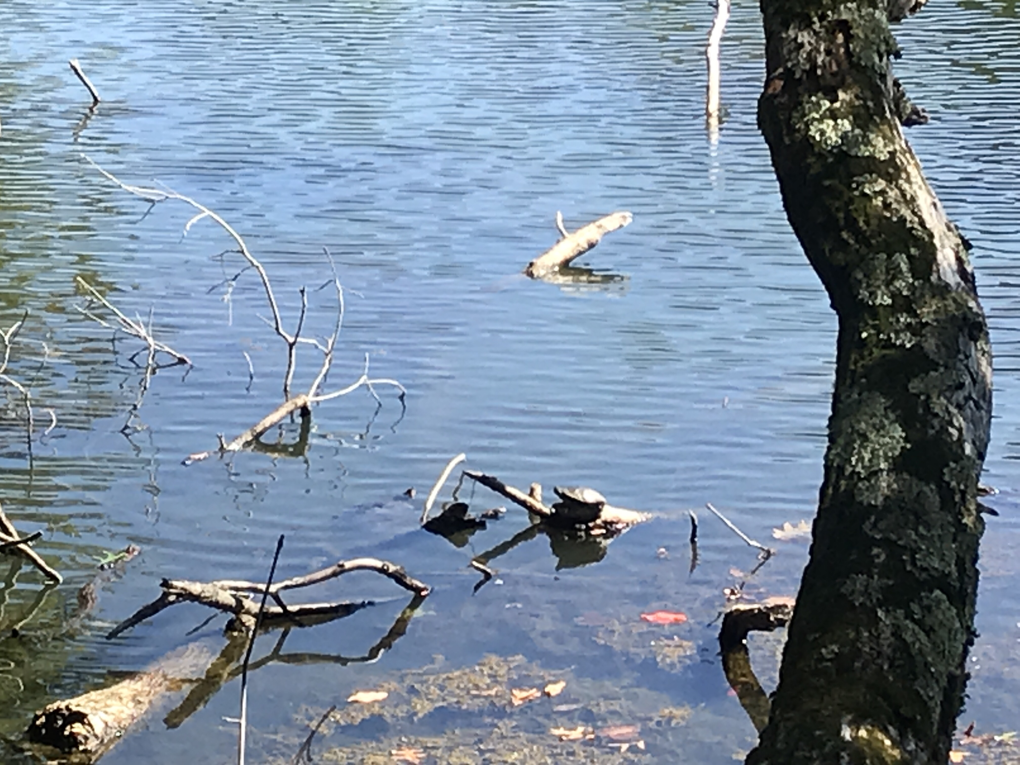
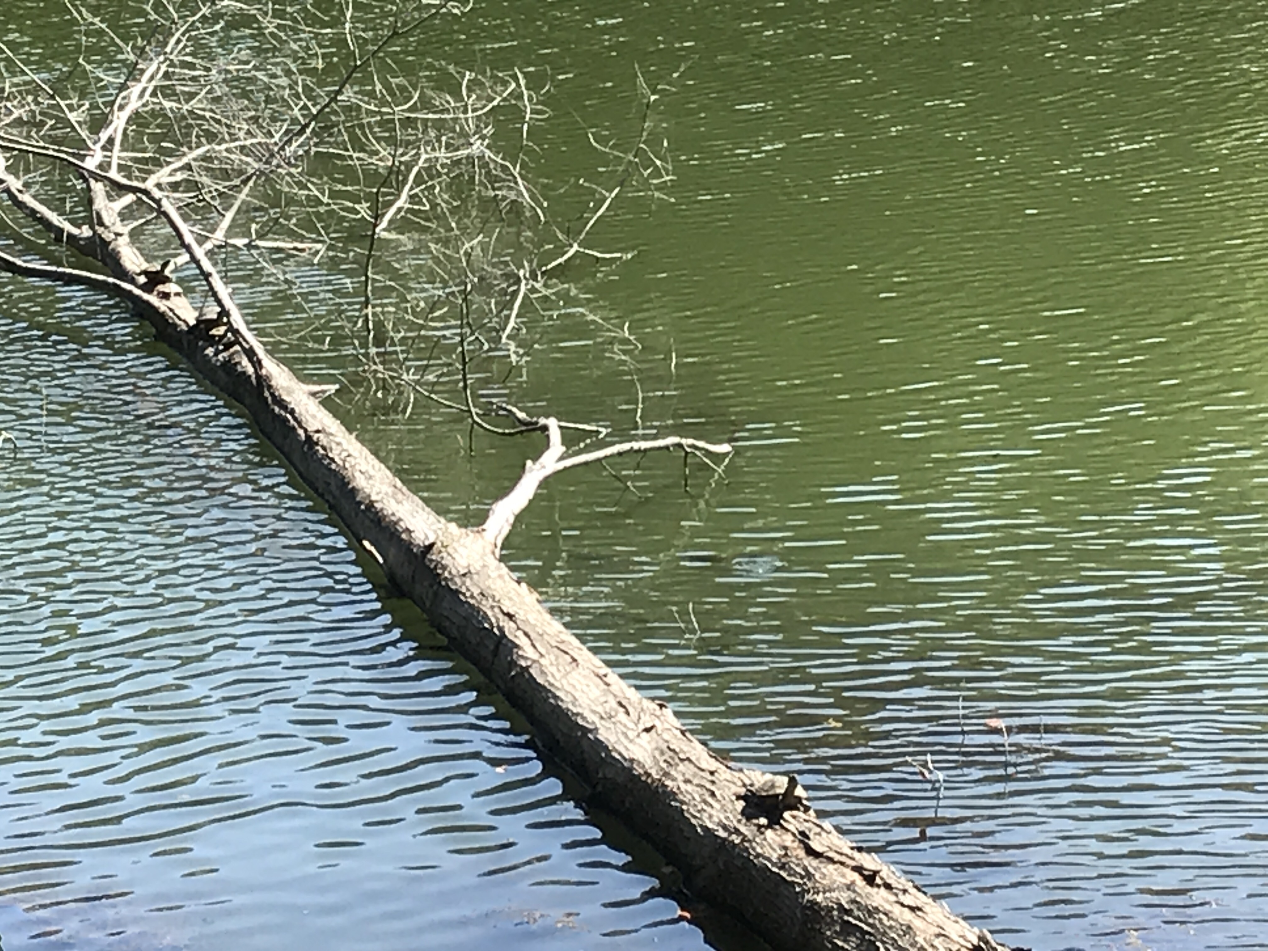
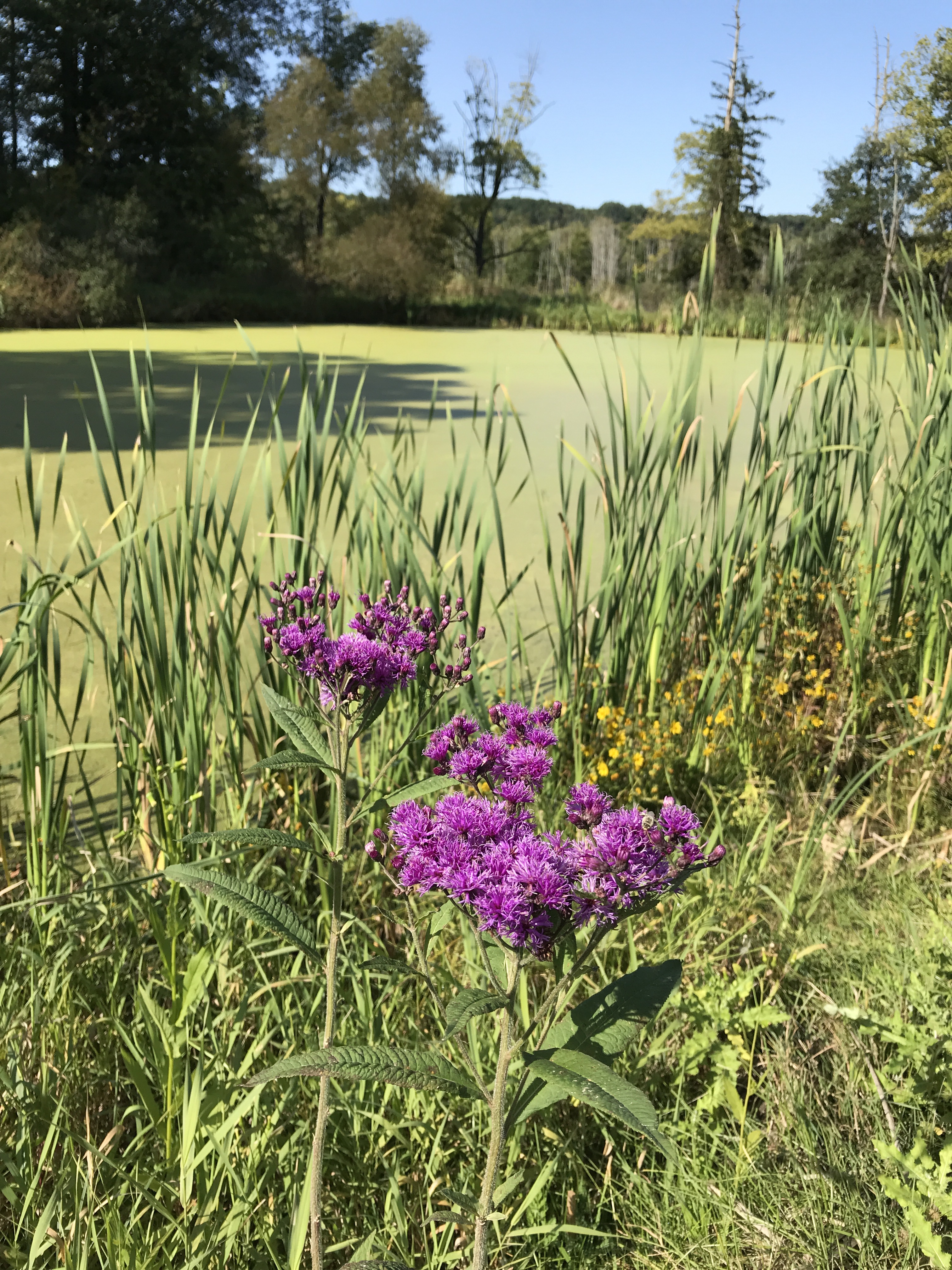
There we had a snack and wandered around the grounds. A small algae covered pond, so still and covered it looked like you could walk on top of it, was home to come frogs and turtles resting in the morning sun. The frogs were well camouflaged in the plants, just barely identifiable by their eyes protruding above the water’s surface. The turtles were easy to spot, but had a blanket of algae resting on their backs. They stayed still as I approached, allowing me to grab a few shots.

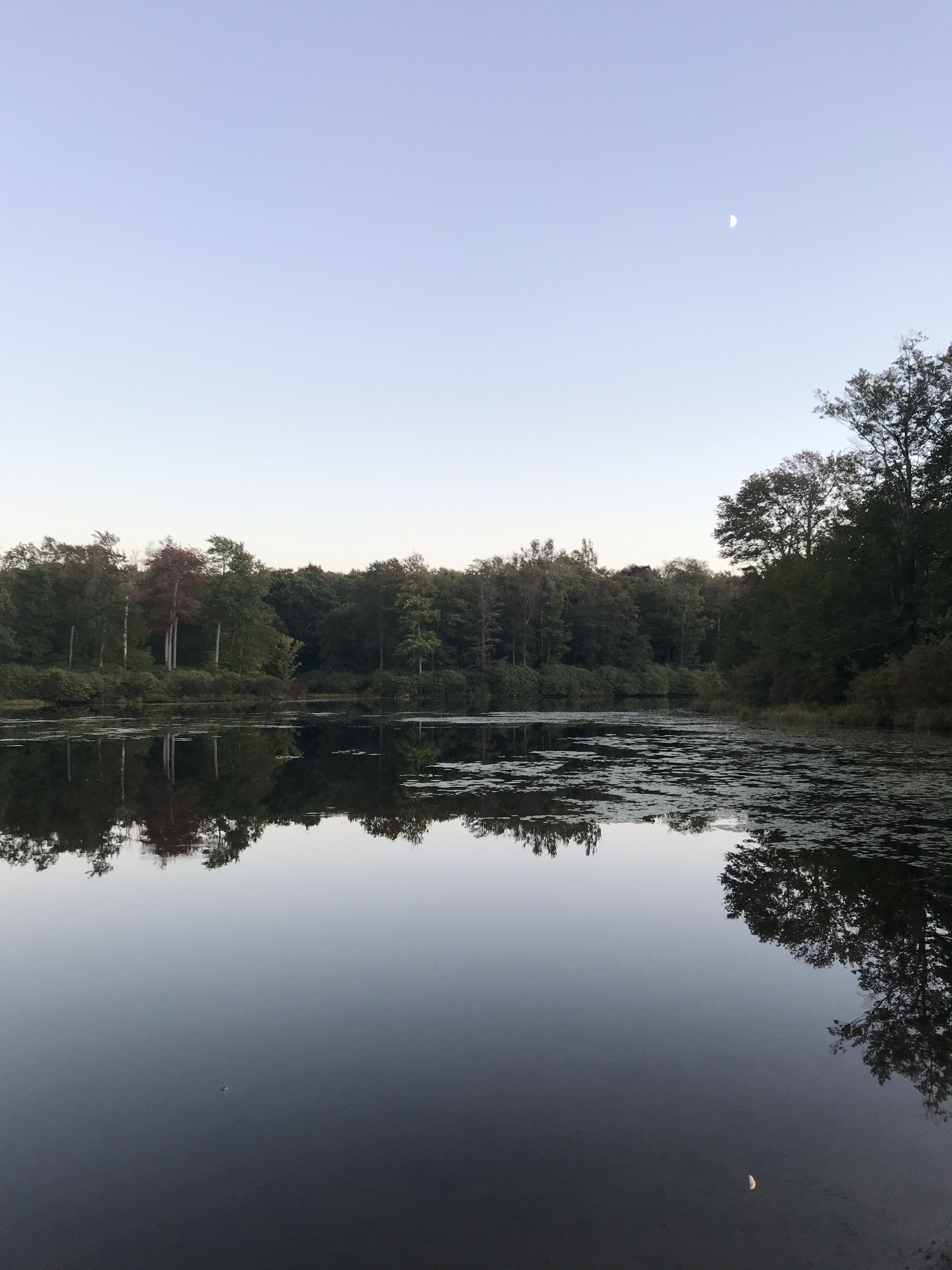
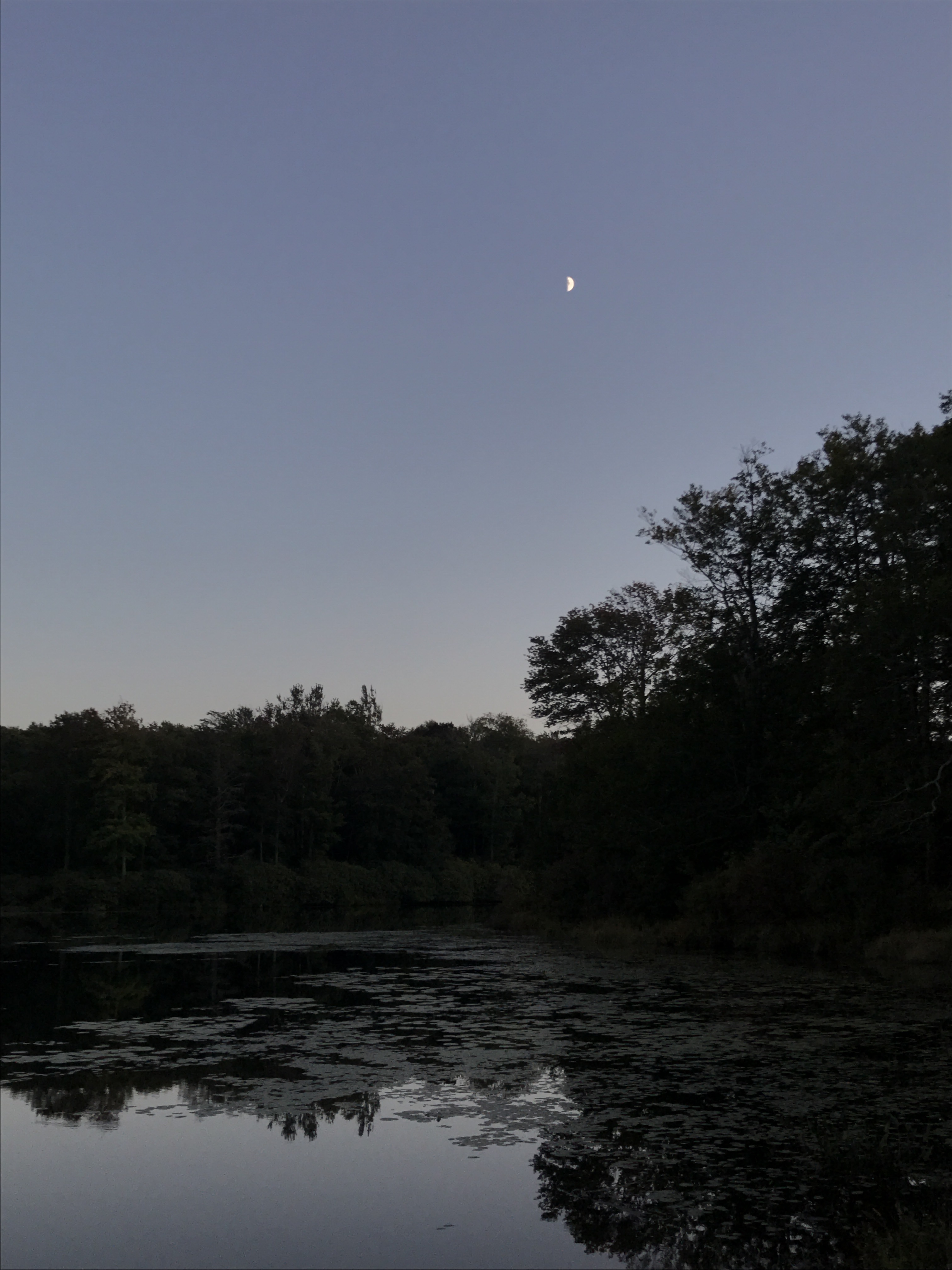
We then retraced our steps towards Brandywine Falls, but stopped at Averill Pond to enjoin lunch. We found a secluded spot on the far side to sit in the sun ourselves and relax. All alone, we enjoyed the peace and quiet.

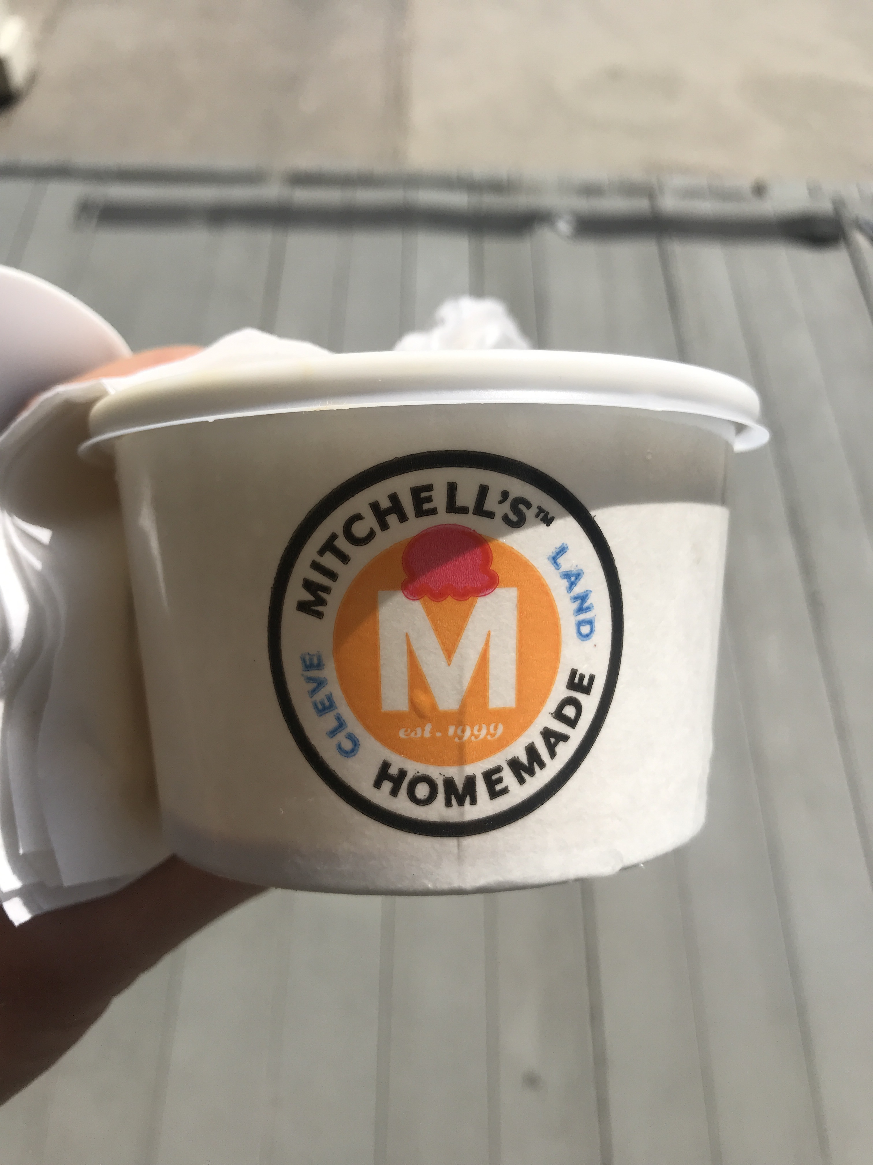
That afternoon we stopped by the Visitors Center and Store, treated ourselves to delicious homemade ice cream, and then headed over to our next hiking spot – The Ledges.

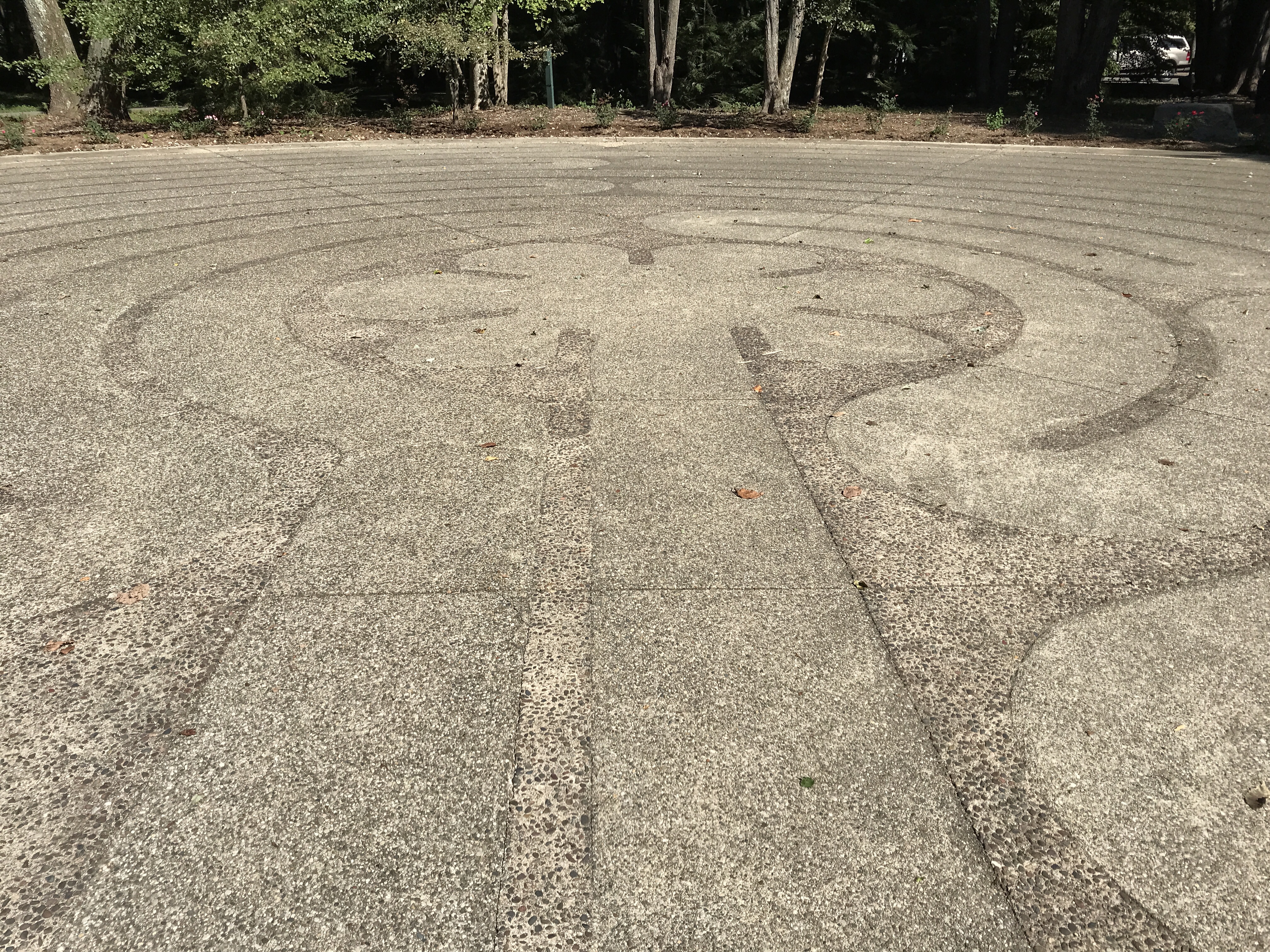
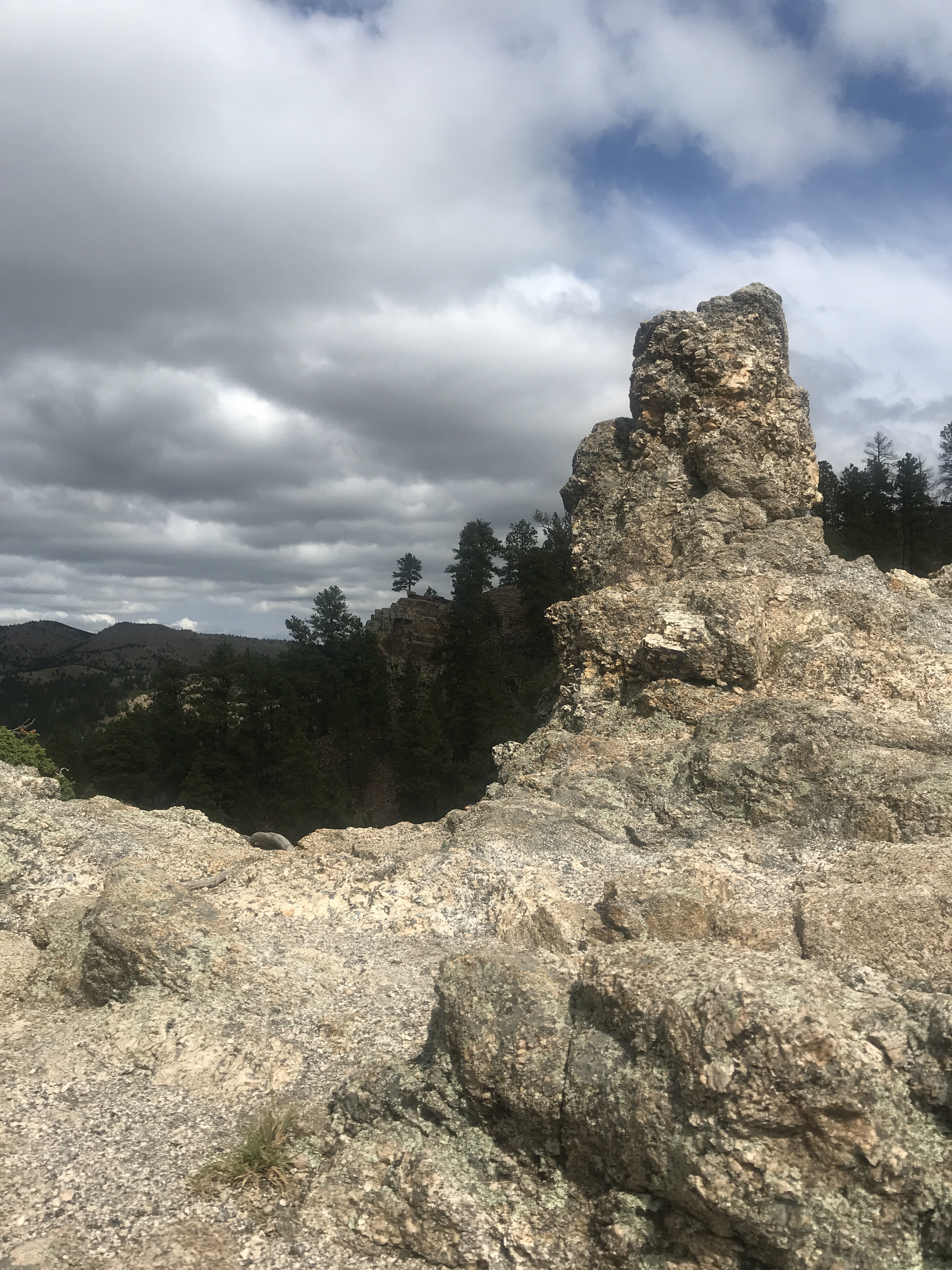
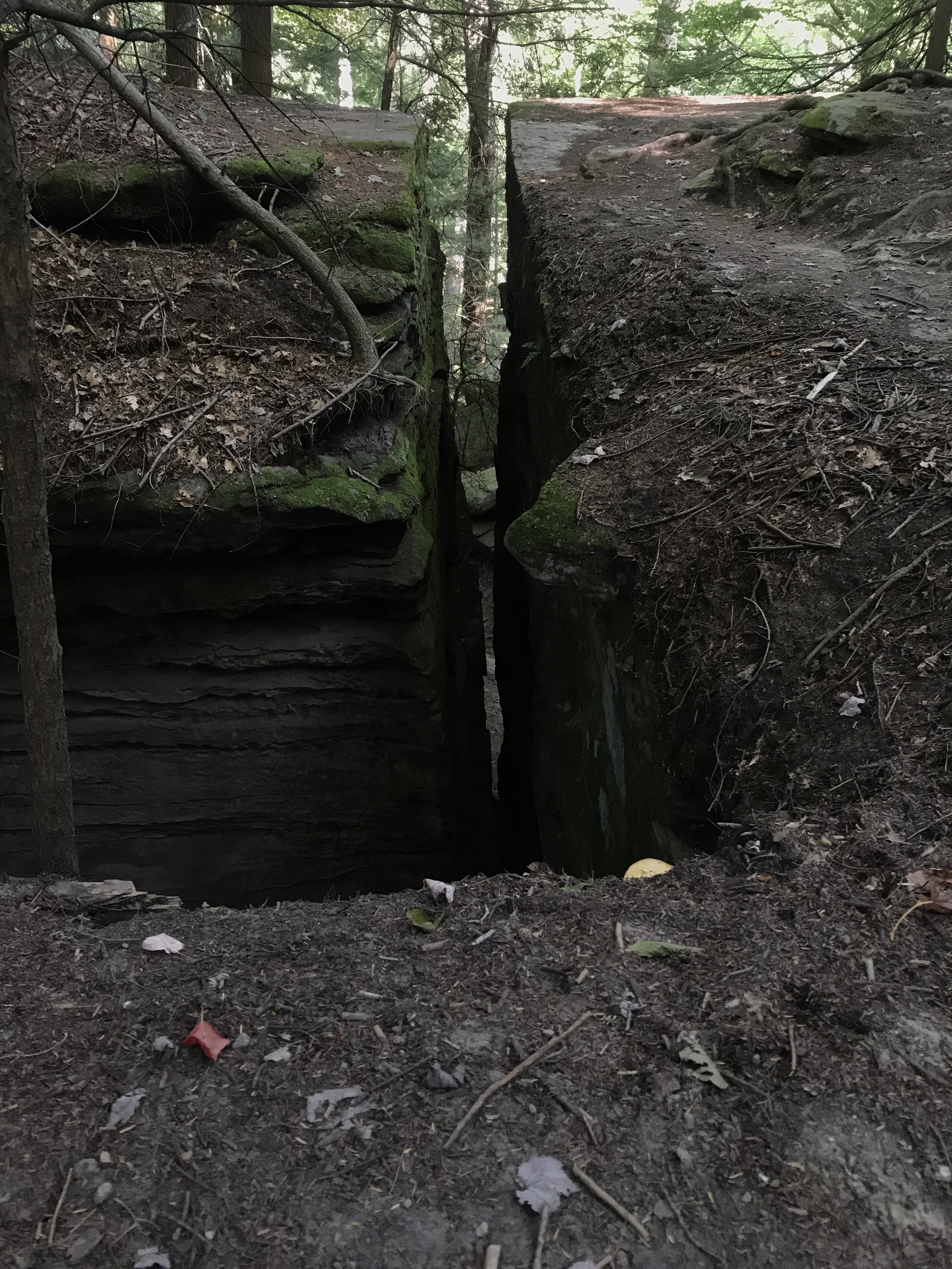
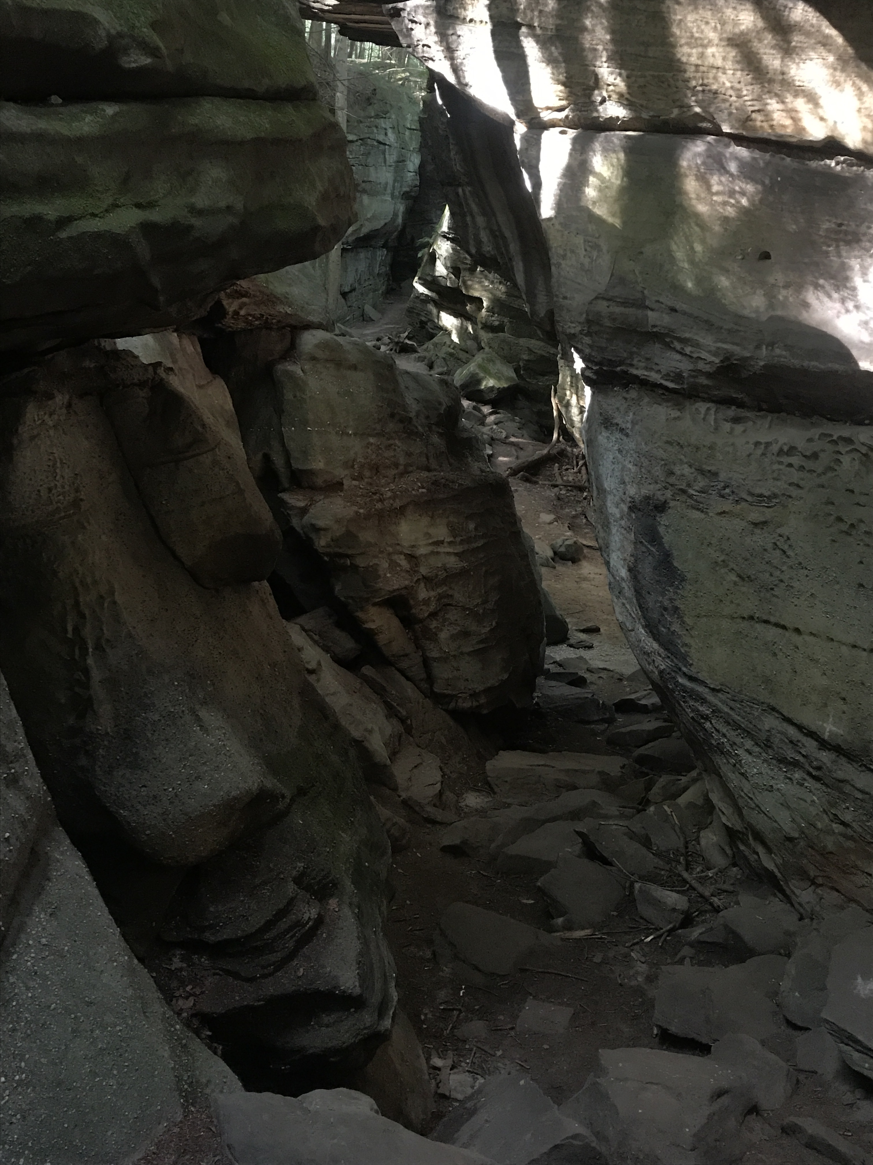
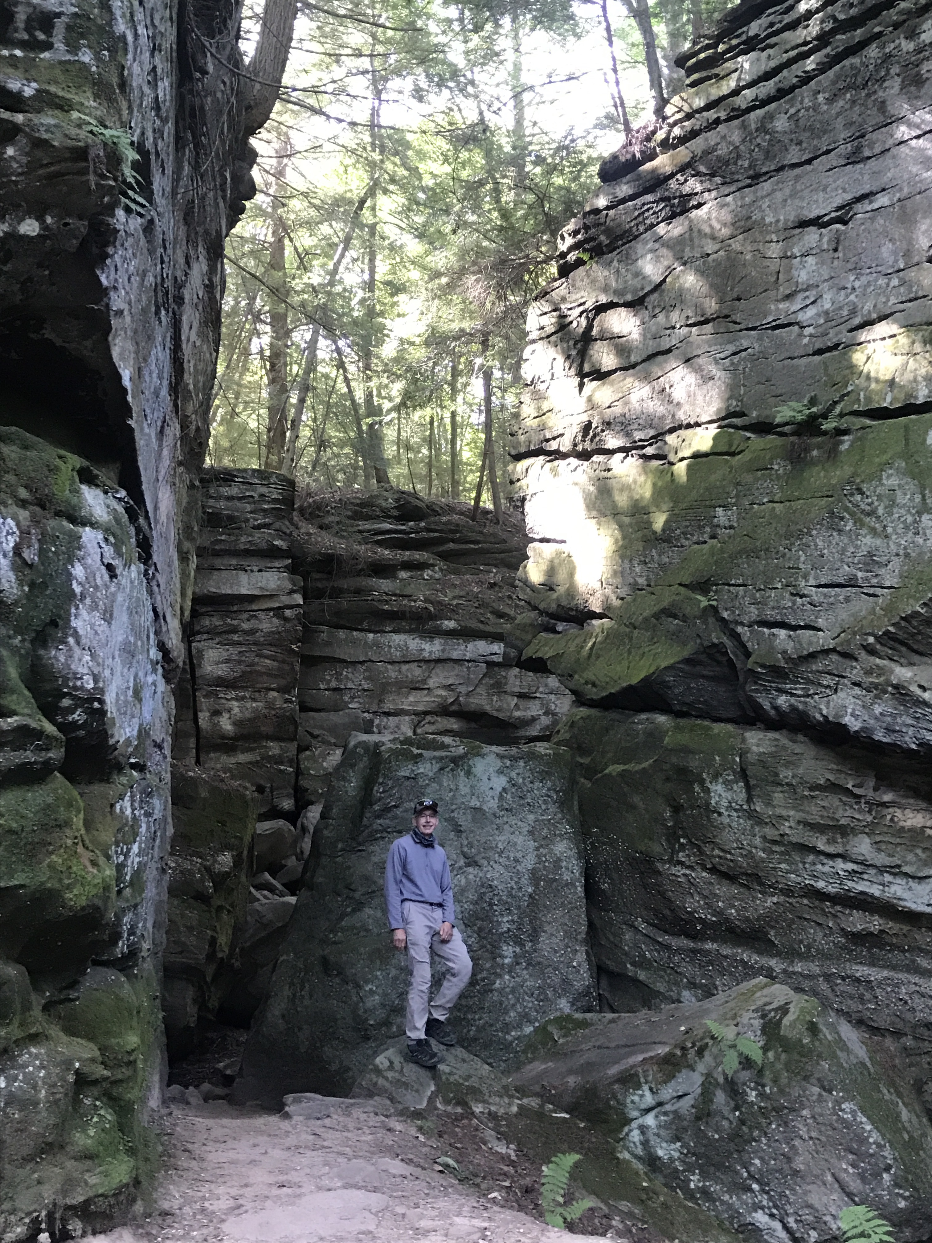
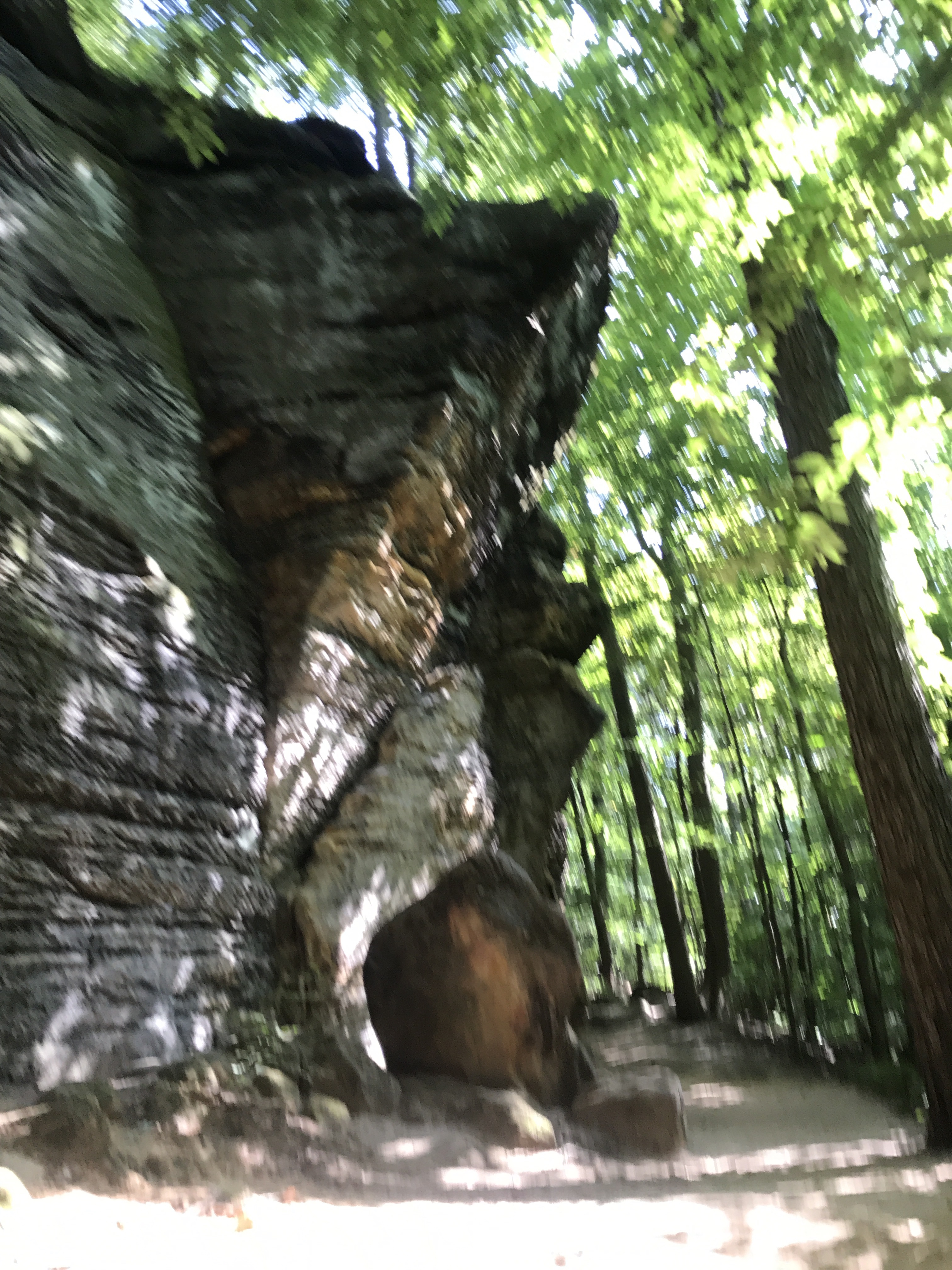
The Ledges was completely different from our morning adventure. Here we wandered above, below, and through tall rock walls. For those who live in Massachusetts, it similar to Purgatory Chasm, but on a much larger scale.

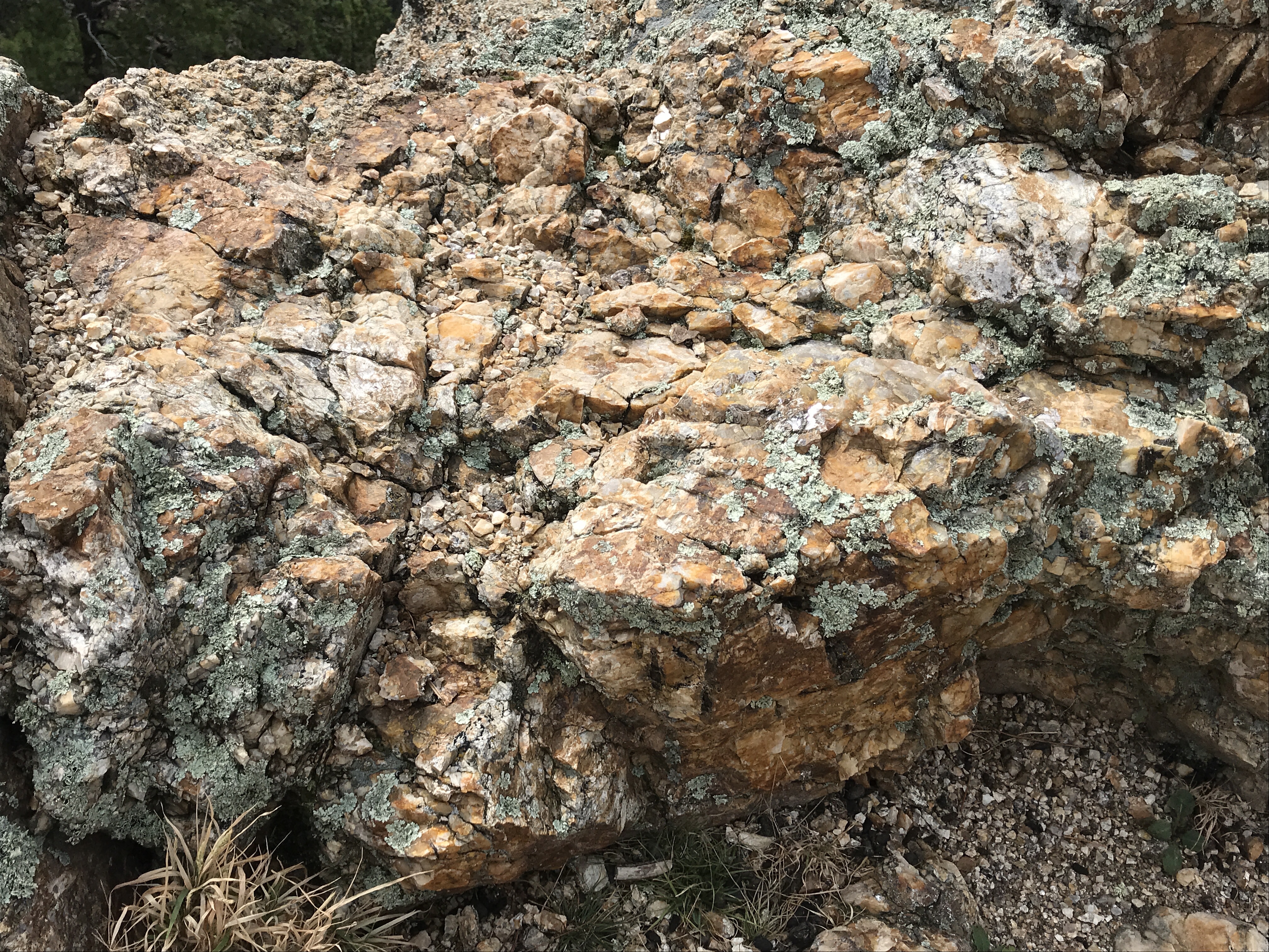
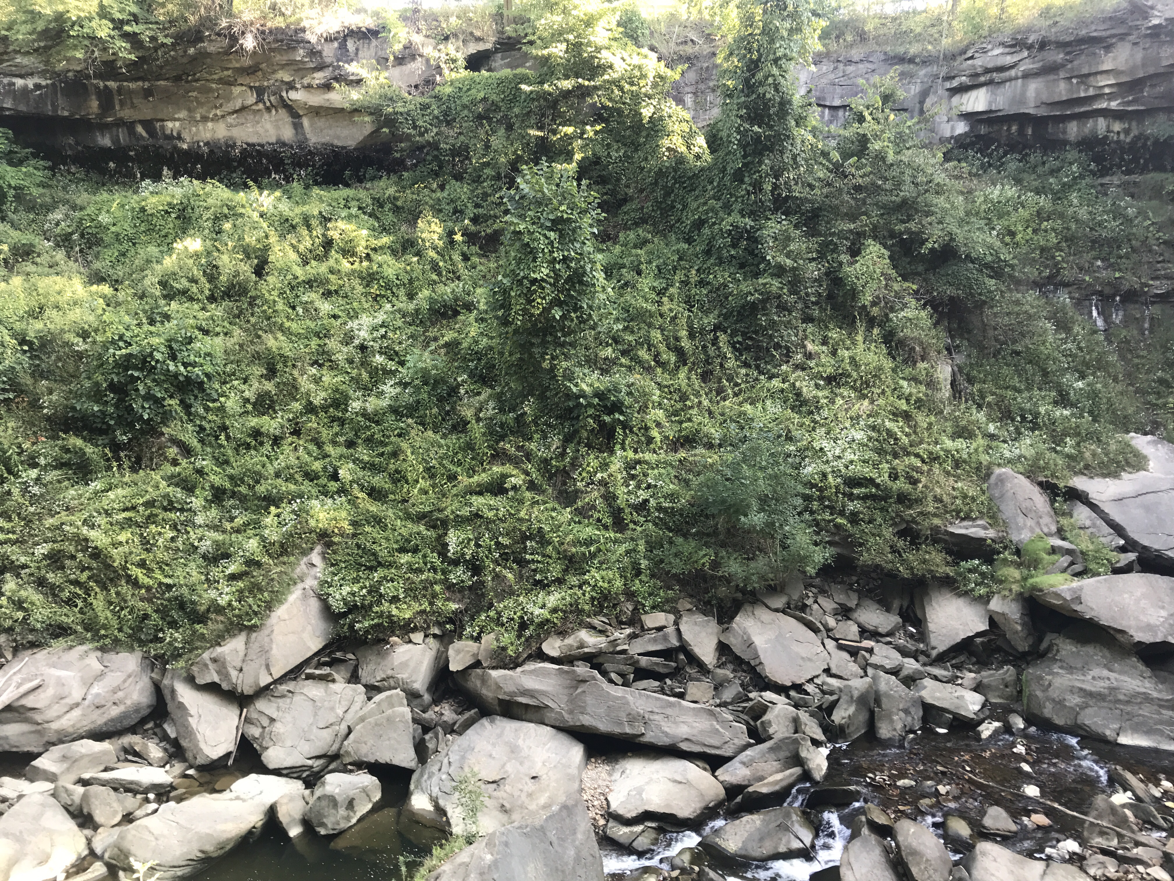
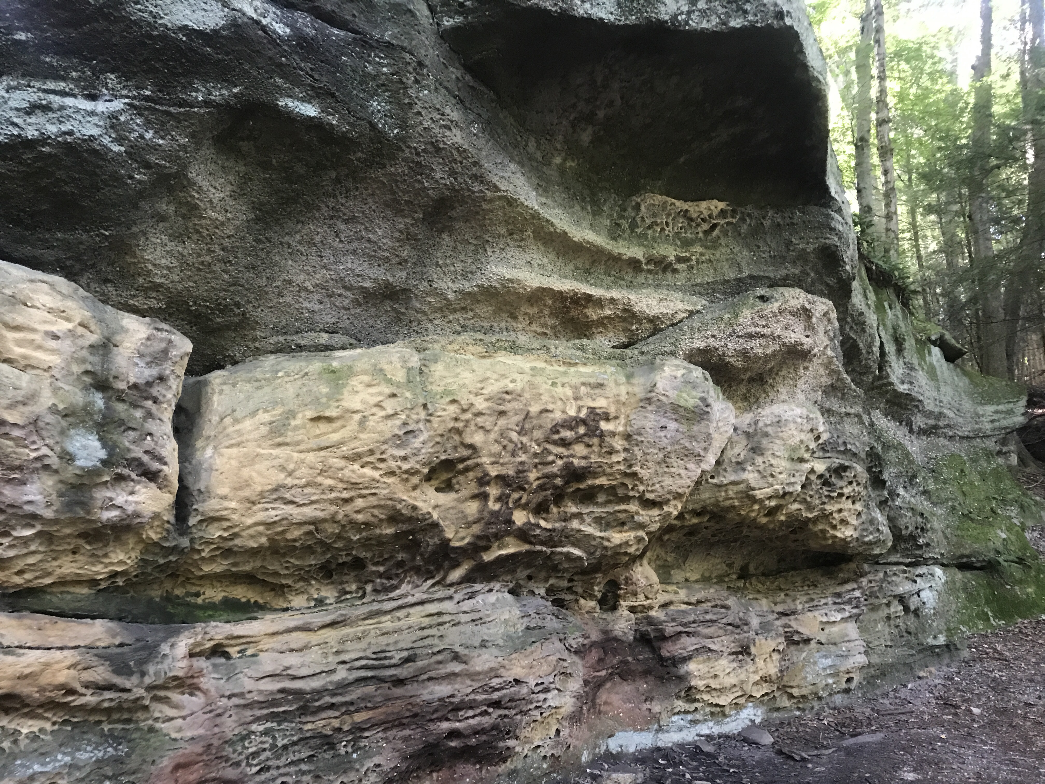
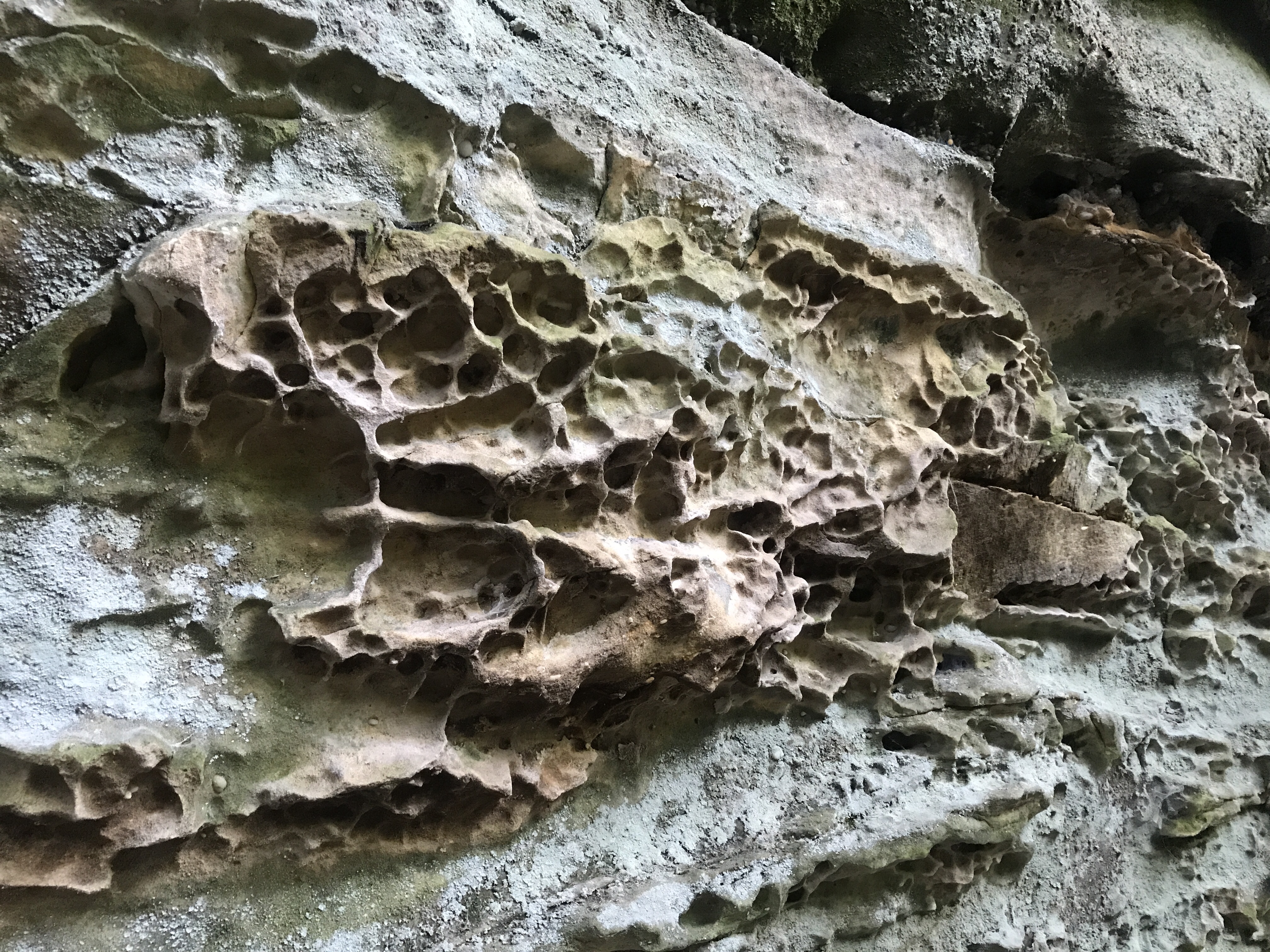
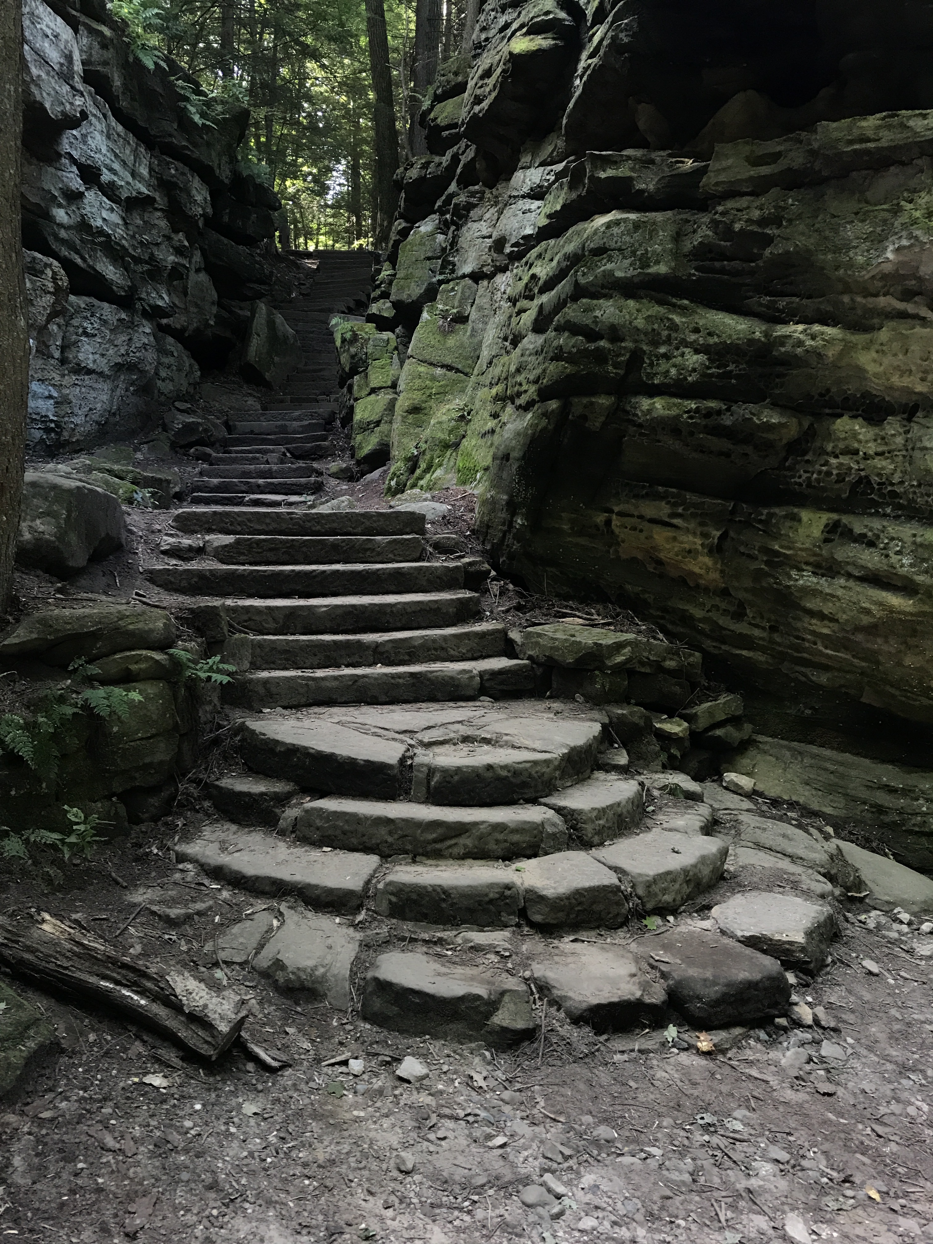
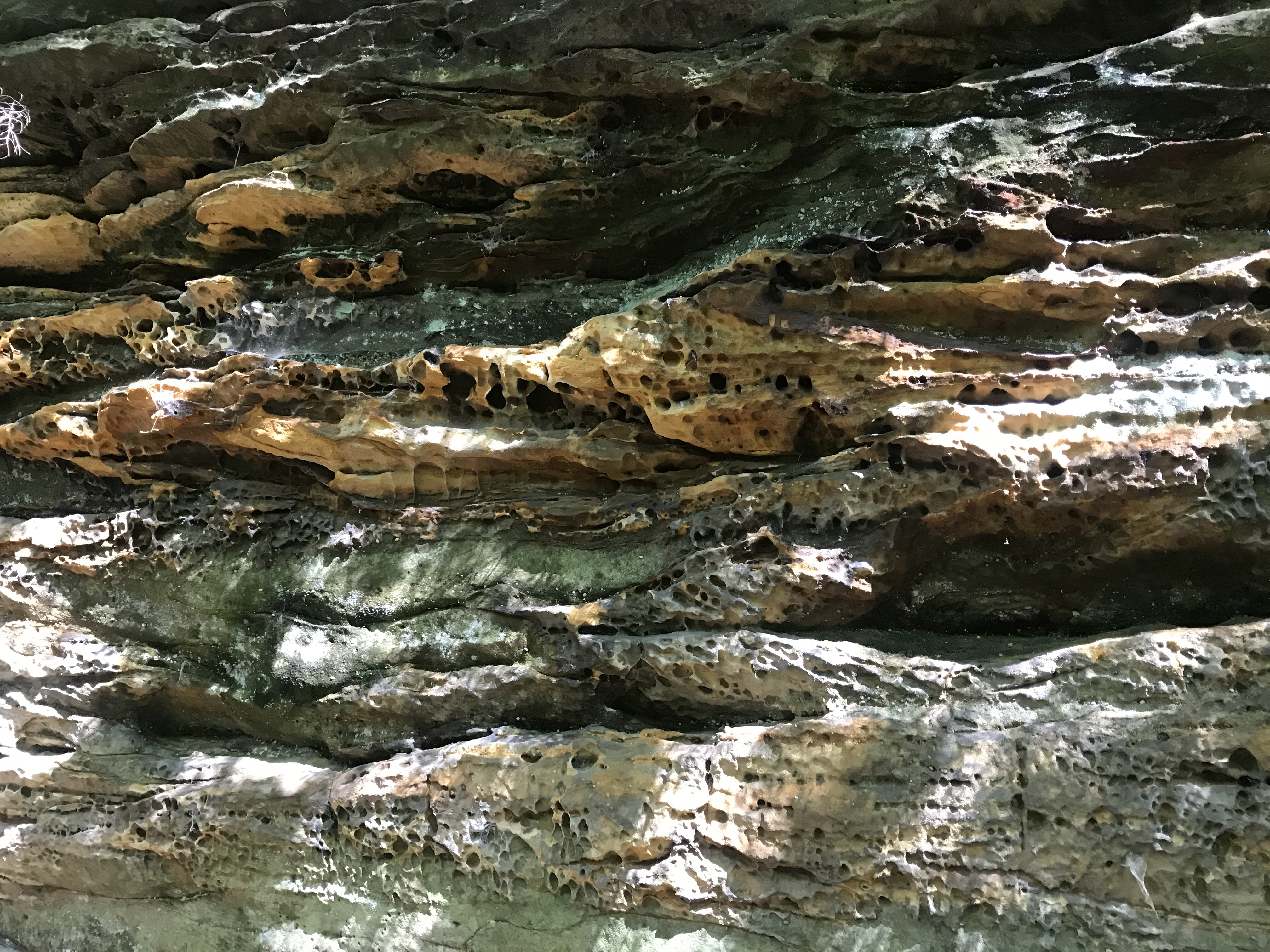
As the path winds to the bottom of the ledges, you are treated to a rainbow of colors streaking across pot-marked stone. In places the rock is a collection of tiny stones embedded in the sandstone, like concrete. The walls bend and wave, sometimes creasing in and making hallways to explore. There are little caves here and there, some closed off to protect bats, others free to explore.

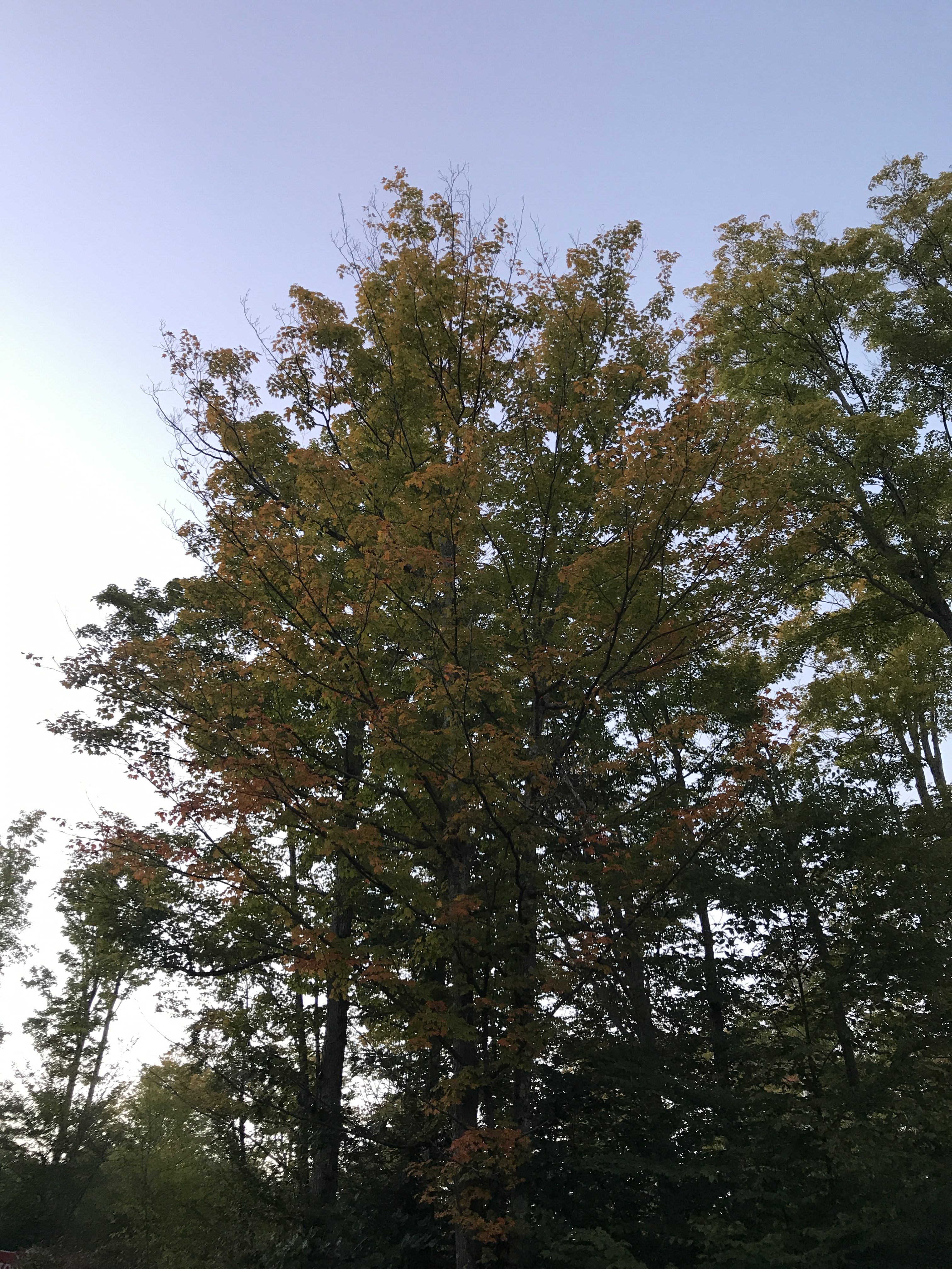
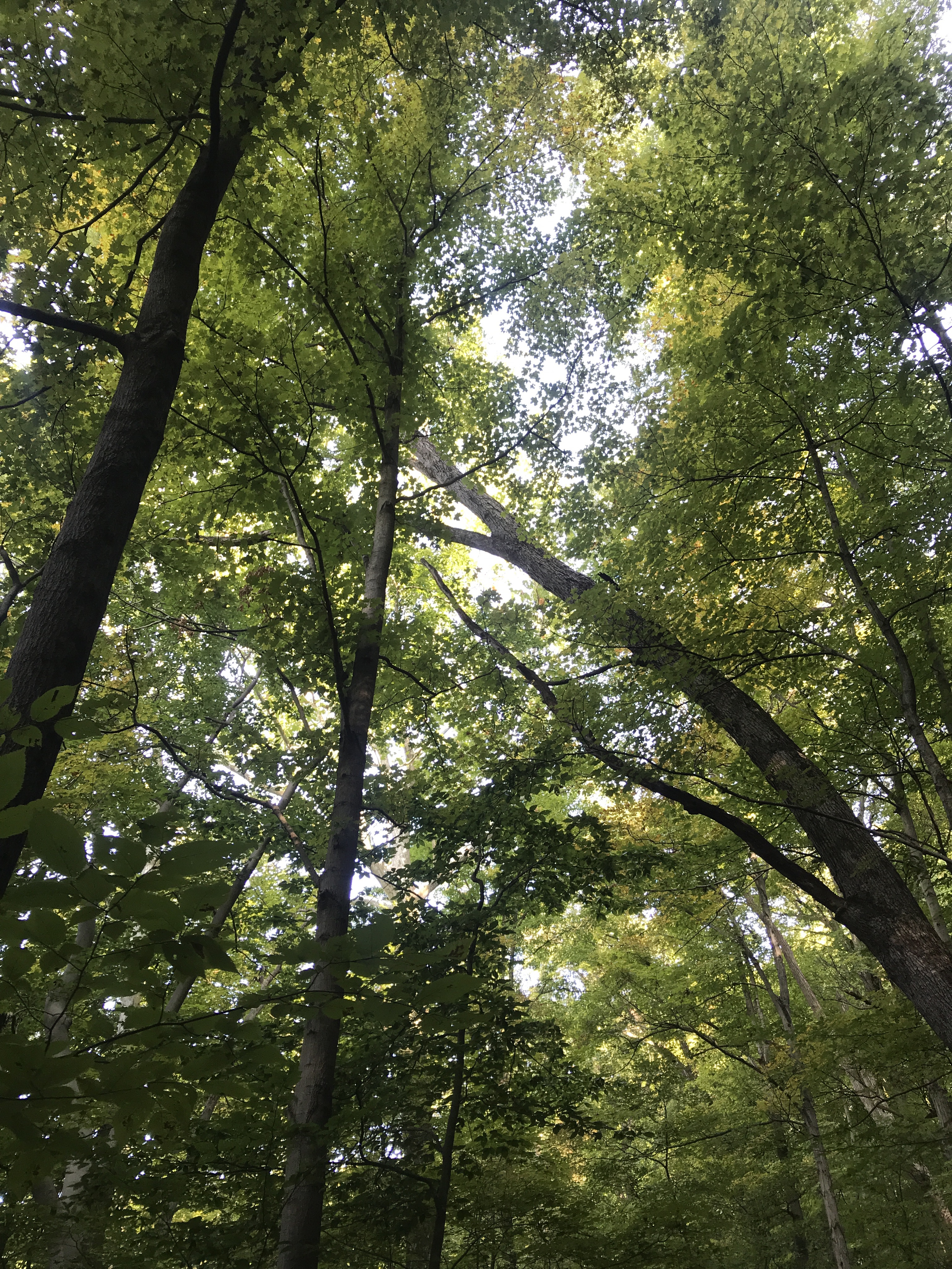
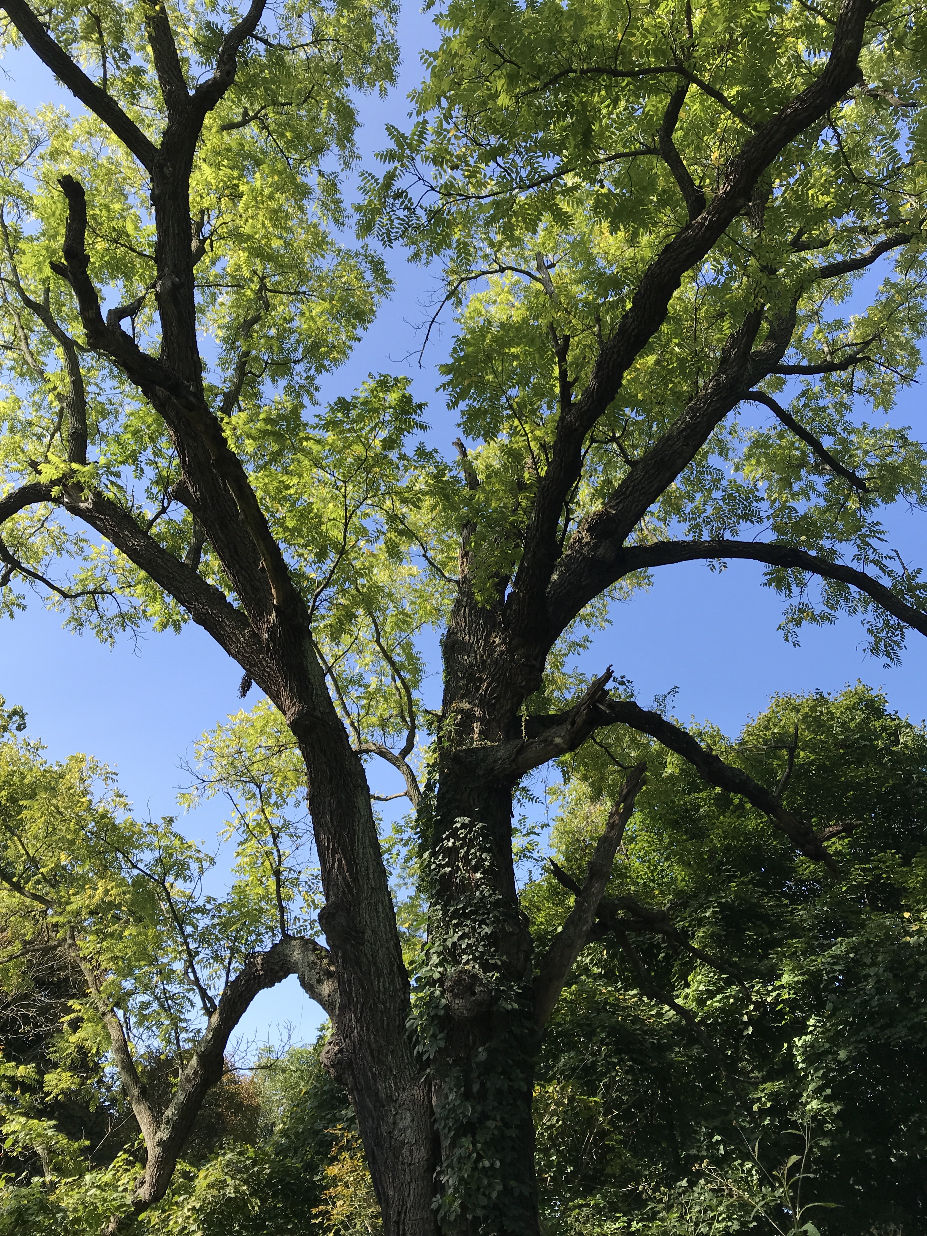
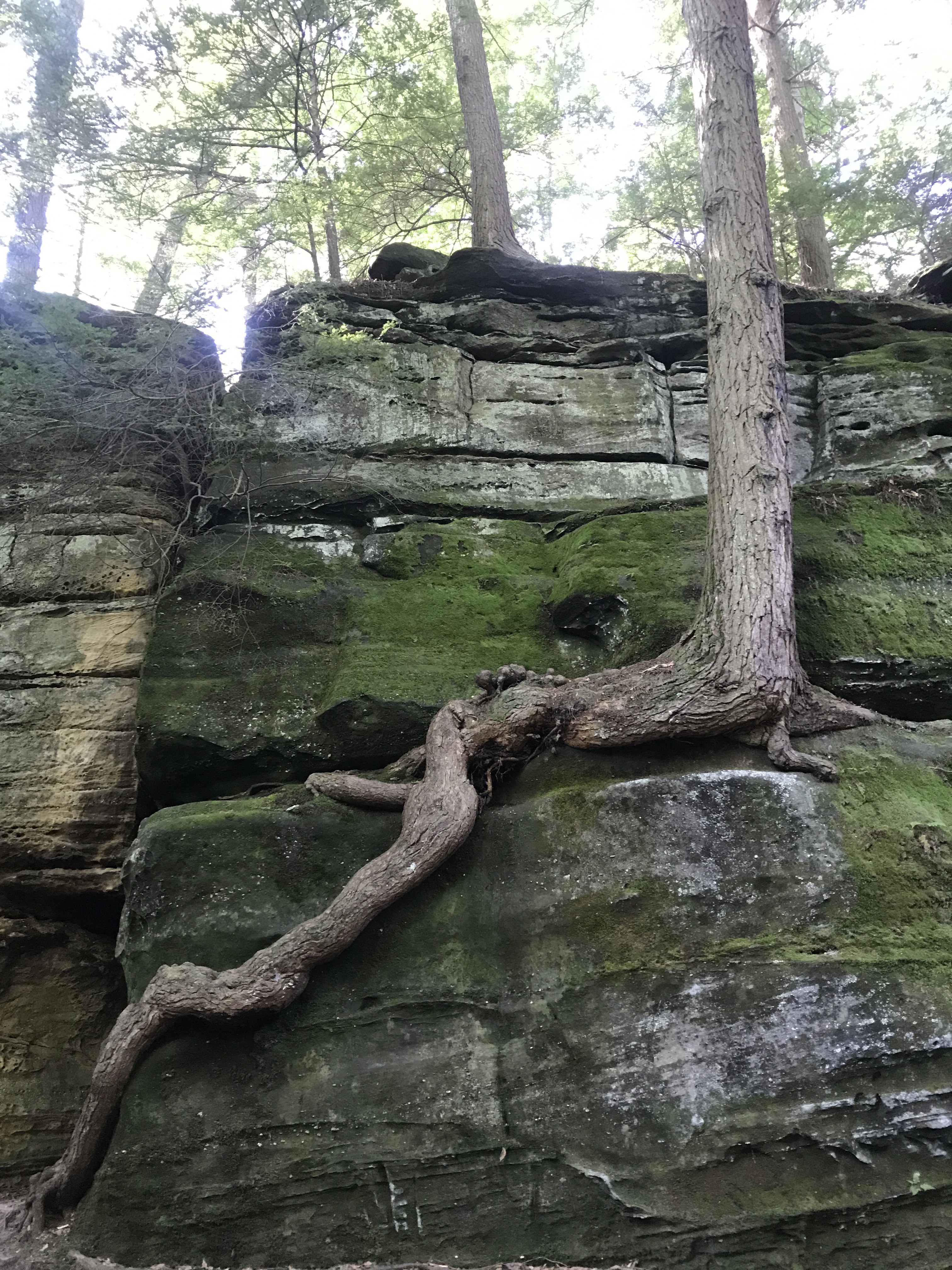
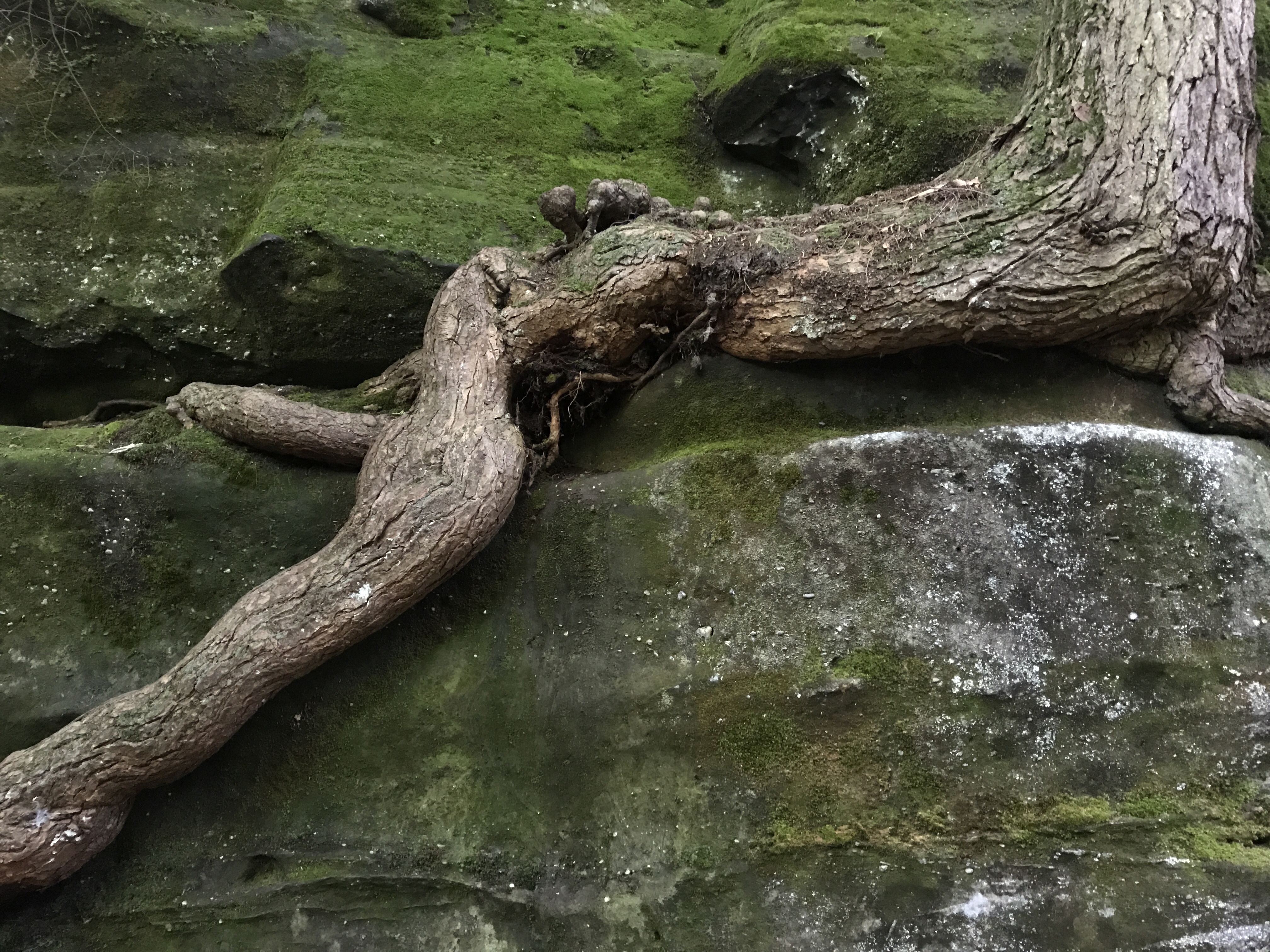
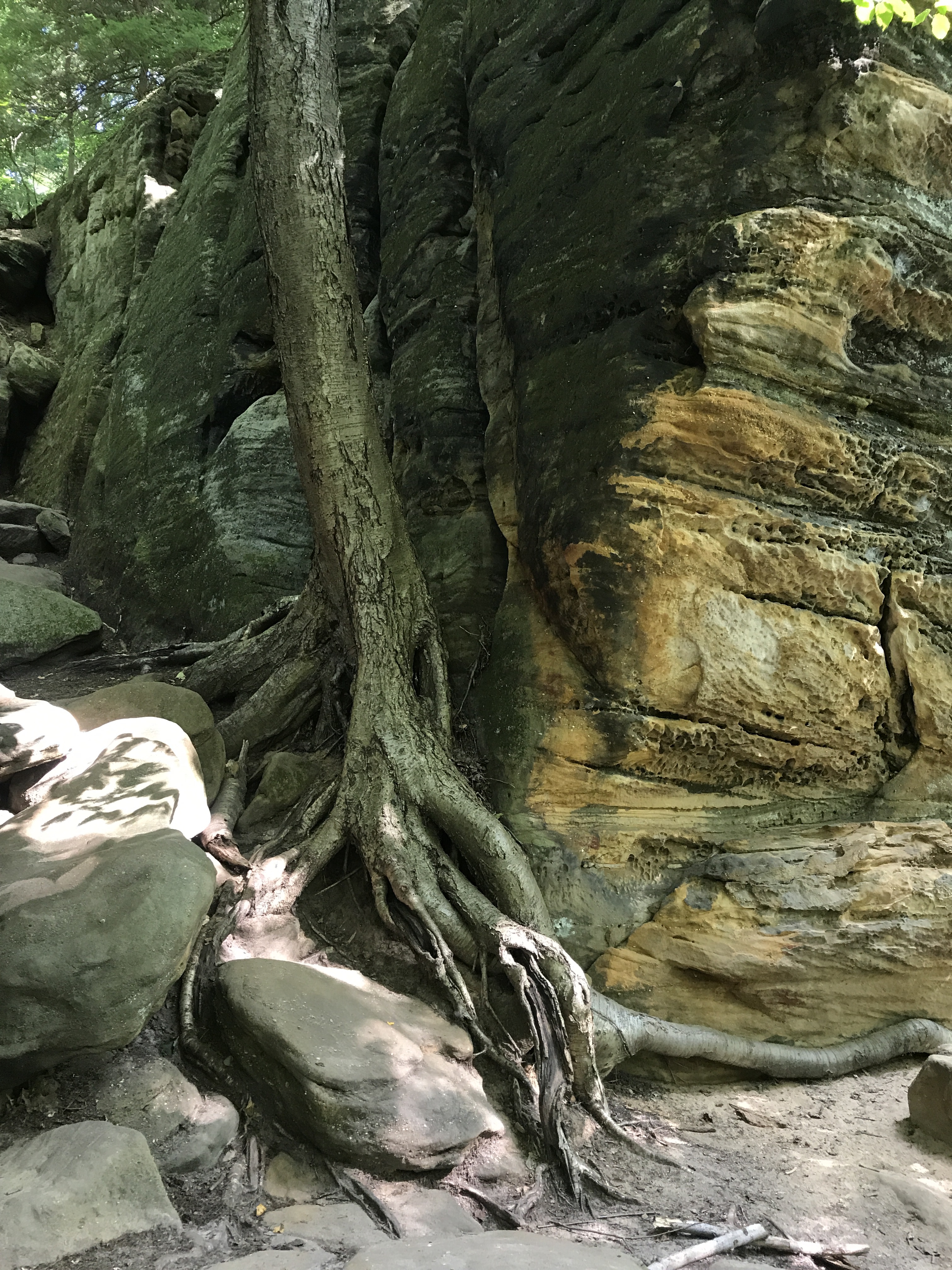
And all around the rocks are trees. Some anchored in the earth floor, sprouting straight up towards the sun, so high you have to crane your head back to see the top. Others are hanging on to the sides of the ledges, their roots trickling down the side to find any earth to hold on to. It’s a wonderland I definitely recommend exploring. CVNP doesn’t have the big sights like the mountains of Glacier or the geysers of Yellowstone, but it has its own magic to it.

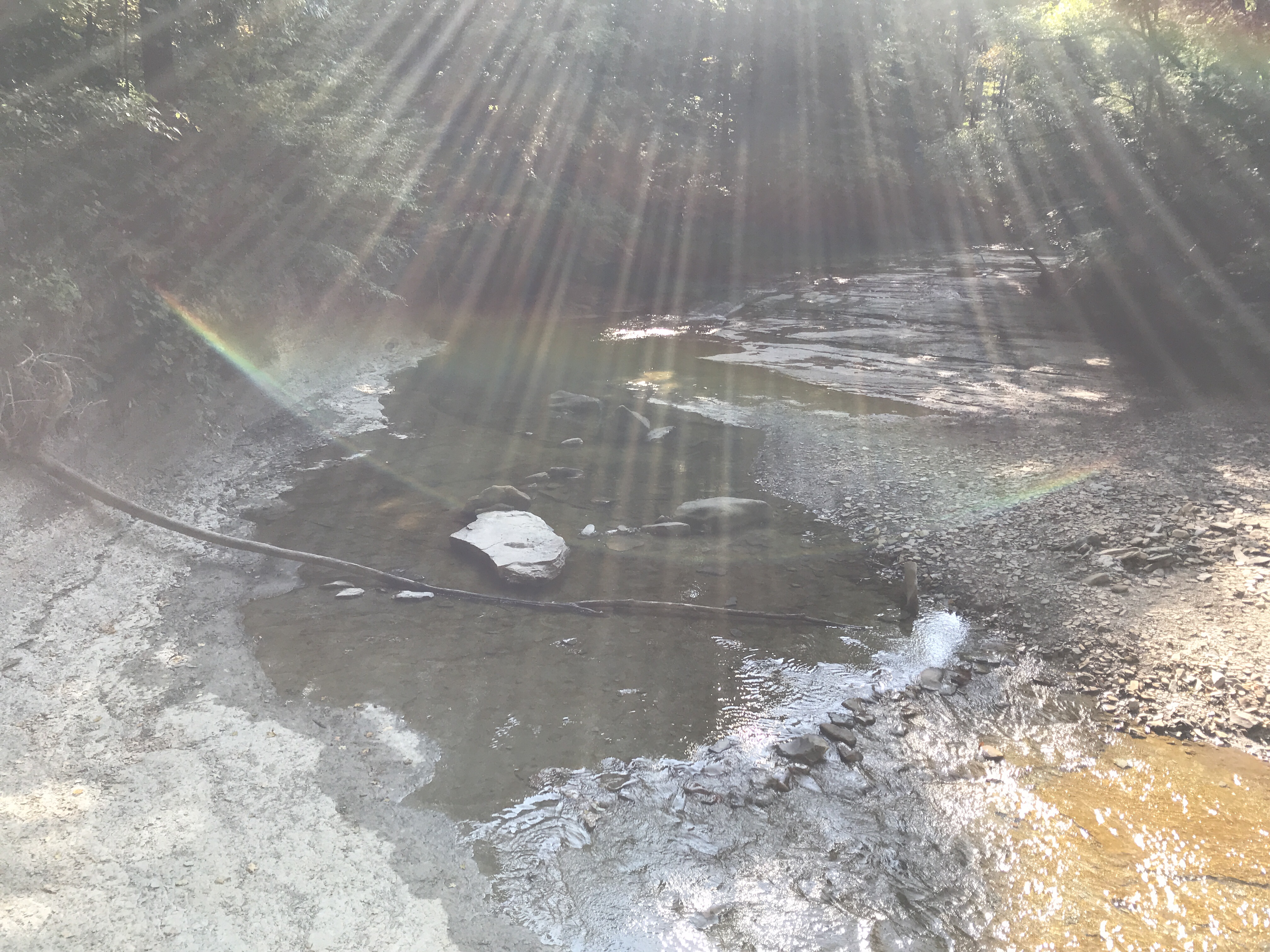
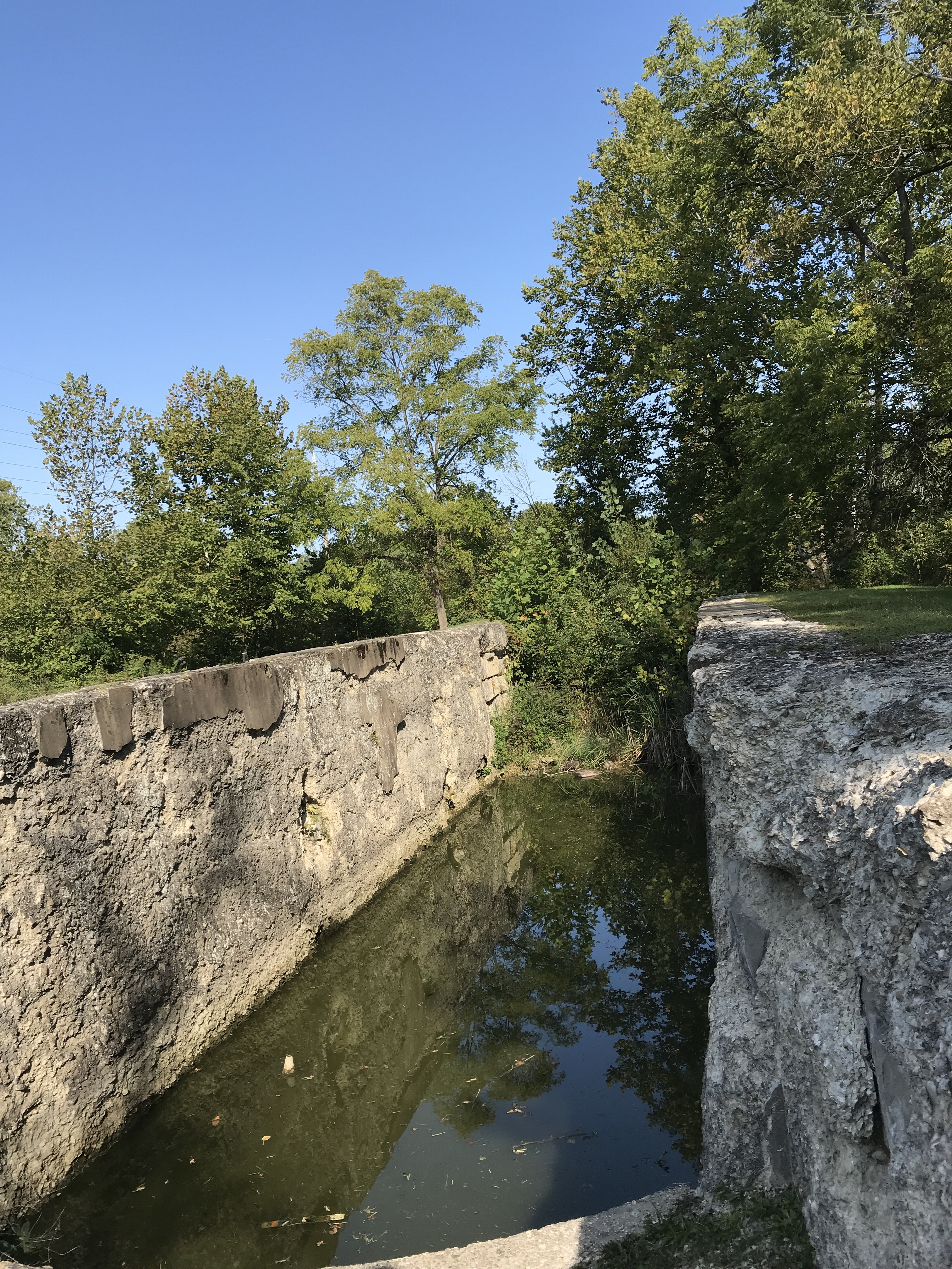
The next morning we spent a few more hours exploring, this time by bike. Stretching the whole length of the park is the Tow Path multi-use trail that runs between the river and the defunct canal system. Whole riding you get to stop and learn about the history of the canal system while enjoying the beautiful, clean water running through the river. It is really amazing to see how improved the water really is today. I’m so grateful there are so many resources to put into protecting and restoring our environment.

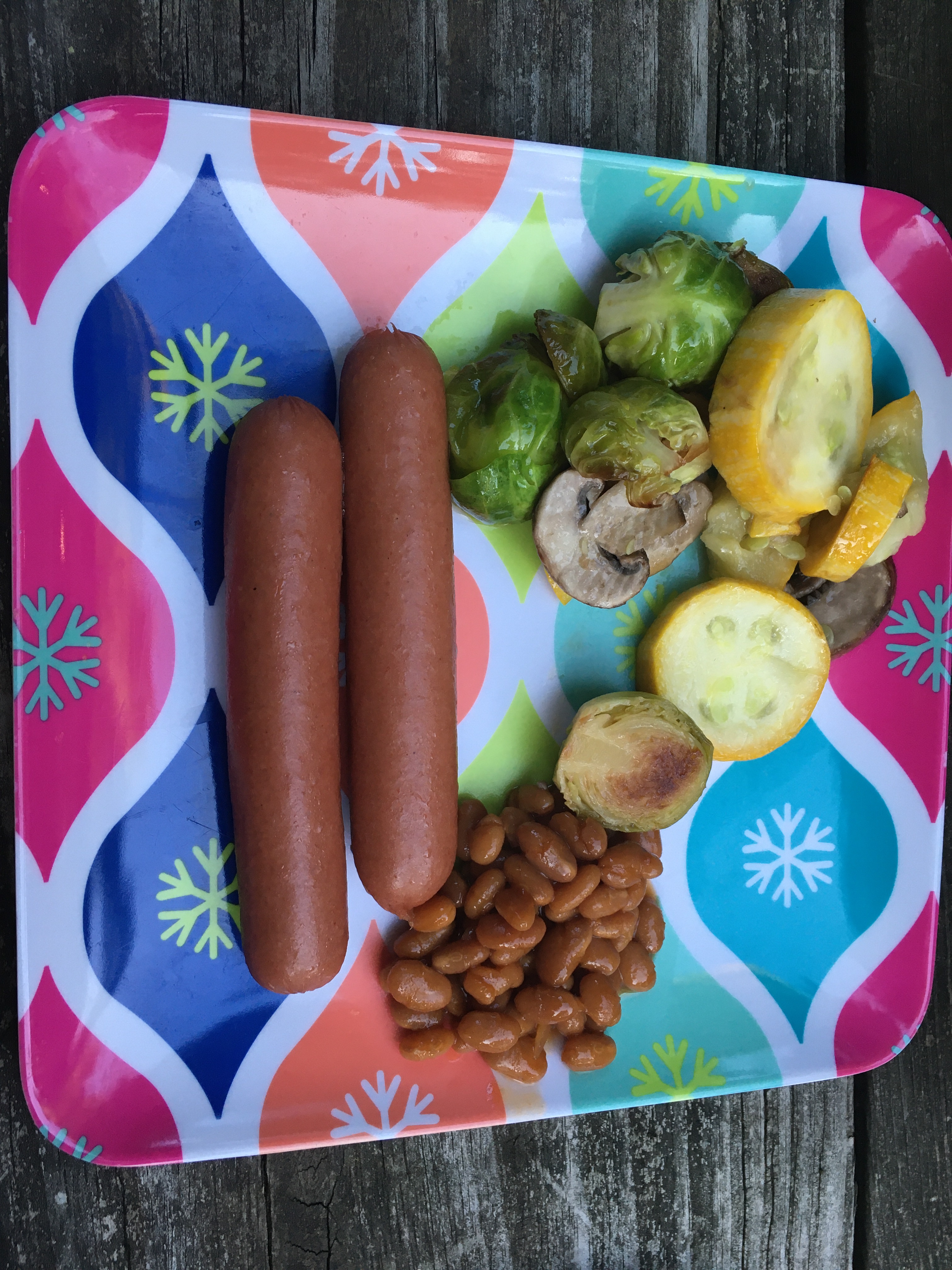
After several miles of riding and a few more turtles, we loaded the bikes back on the motorhomes and continued driving east. Over the next few days we made it through Pennsylvania and New York, and now finally home, but not before having the traditional last dinner of hot dogs a beans! 😉 Now, time to rest and decide what is next. For now, it’s good to be back.

Heading East

We soon found ourselves traveling through Indiana on our way to Ohio. Miles and miles lay between us and home, but we were making good progress. I knew we were getting closer because we finally crossed into Eastern Standard Time!

To break up the drive one day, we stopped by Hawthorne Park in Terre Haute, Indiana. This lovely city park has several walking trails that lead you around one of two ponds, playgrounds to explore, and a small campground. It also has a labyrinth!

The labyrinth isn’t exactly what we expected, as it has no walls, but it was still an interesting find. Created in honor of local man, Kenneth E. Smith and modeled after the floor of the Charles Cathedral in France, the stone maze depicted on the ground winds you back and forth for over have a mile until you reach the center. I enforced the “no crossing the ‘walls’” rule and coerced my dad to participate. My mom was already on board! We raced around, sometimes wondering if we’d ever reach the center, until success! It was a good test of patience and a fun way to stretch our legs. On our way out, I didn’t make my dad follow the path – we just walked out. 😉

We then looped around the lake and were entertained by several turtles sunning themselves on logs sticking above the surface. Some stayed for a photo opt, but others quickly skittered back into the cool waters. We arrived back at the motorhomes and continued driving east.

After a restful night at Today’s Harvest, a lovely Harvest Host spot where we enjoyed ice cream, fresh veggies, and donuts, we headed towards Columbus, Ohio.

The city of Columbus has a lovely walkway along the Scioto River. A vibrant green park stretches along both sides of the river, from the city edge down to the water. Trees and flowers decorate the parks and line the wide pathway that is busy with walkers, runners, and scooter riders. The river flows peaceful beside you, under tall bridges in various designs.

My dad and I walked a few miles while my mom napped, taking in the views and quiet on this Sunday morning. A few trees had begun to change color, with pops of red and orange coated their tops. It made me excited for the fall colors awaiting us at home!

As we went along, there were Lime scooters scattered about, catching my dad’s attention. But of course, he had no interest in riding them and just thought they were strange, so we moved on. Eventually we came to the Science and Industry Center, which has a large children’s park in front. Large outdoor musical instruments lined the edge, which of course we had to play (using hand sanitizer before and after of course!). I like the big tubes you could hit with the gong the best.

Again we came across the scooters, which my dad asked about again. “How do they work? How much do they cost?” I asked if he wanted to ride one, clearly he was interested, but he said no no again. But as we walked, he kept eyeing them, so I just rented one. And guess what, my dad loved it! We zoomed around the patio and sidewalk, testing out the throttle power and breaks. My dad couldn’t have had a bigger smile on his face! I’m glad I just went for it!

After our joy rides, we packed up and headed for our last major stop and final national park for the next two days, Cuyahoga Valley National Park between Columbus, OH and Akron, OH.

The Gateway Arch National Park

Finally out of South Dakota, we made our way south and east to St. Louis, Missouri. Of course, I had to stop at The Gateway Arch. Now a national park (since 2018), it was on the list!

Upon arrival in Missouri, we had some direction challenges. Our first major city in many weeks, we forgot what traffic, lane changes, and quick exits felt like. We bobbed and weaved the best we could safely to follow Google’s directions, but unfortunately missed many turns. Eventually we got off the highway and pulled into a parking lot to breathe. I changed the settings to avoid highways and led us through the calmer city streets towards our destination. Nothing like a good afternoon challenge!

We drove across the Mississippi River, wide, brown, and quickly flowing, to the RV Park at The Casino Queen. While nothing too special, largely a paved parking lot with hookups, it provided a quiet and secure spot for the night. The lovely part was that it provided a great view of The Gateway Arch.

The next morning, we took our well rested bikes off the rack and rode over to the park. Across the Ead Bridge we went, high about the Mississippi River. The city of St. Louis is extremely bike friendly and a half wall barrier provided us safety and protection from the cars.

Once on the far side, we were immediately in the park. The Gateway Arch National Park is an interconnected system of walkways winding around lush green fields. Hardy trees provide shade over benches. While the park is at the edge of the city, you feel very far away from the skyscrapers and cars.

As we rode down the pathway, the Arch stretched upwards before us. A silver sculpture glistening in the morning sun, looking out over the busy river.

Below The Arch is the Visitor Center and Museum, and extensive collection of history that accurately portrays the development of the St. Louis area over the years. It balances the perspective of white history with that of indigenous peoples and Black people, depicting how partnerships, treaties, and relationships developed over time and fell apart. I was impressed by the dedication of the museum and national park to sharing the whole story.

Challenging, thought provoking questions are asked and explored. For example, “Should the settlement of land justify a nation’s ownership?” in regards to westward movement and the Homestead act. Or, “Does staking claim to land justify national ownership?” in reference to the Lewis and Clark expeditions. It explored the fact that every inch of land in the Americas once belonged to Native Americas and how over 500 treaties were made and all broken. It is complicated history, especially since I would not be traveling and learning and enjoying had westward expansion and Lewis and Clark expeditions not happened. I have immense privilege because of this history. And I acknowledge and continue to learn that this came at a great expense. It’s a lot to take in, and often uncomfortable. But I sit with it and learn how to give back. If you ever have the chance to visit, I highly recommend it.

After our eye opening history lesson, we unlocked the bikes and road a few miles on The Greenway below the park, along the river. We snapped some pictures of the monument on Osage and Oglala Sioux land, and headed back to the motorhomes for an afternoon of driving. A Harvest Host winery awaited us.

Last Adventures in South Dakota

With fall approaching and pangs of homesickness poking through for us all, we continue to head east. Some days eight weeks has flown by in a snap and other days it feels as though it’s been forever. We’ve certainly seen a great deal of this complex country and have appreciated the privilege of traveling during this time.

We are nearly home now, but I still have a bit to catch you up on! At times I haven’t posted due to lack of cell service or weak WiFi, but other times it’s been intentional. Partially to enjoy the moments with my parents and in new places and partially for safety. I love sharing and teaching, making it available to all who want to follow along, but also want to make sure I’m protecting myself by not revealing my exact location at the moment. I hope you have patience with me and my delayed postings.

So now, let me tell you about southeast South Dakota! After our last view of The Badlands, we hit the road, heading towards I-70. As we drove, the land turned flat and wide open, filled with grasslands and fields once again. This time however, the corn had been harvested and the stalks were a golden brown swaying in the distance. The grasses were no longer vibrant shades of green but browns, yellows, and even some deep reds. Soy fields were burnt oranges and dark browns, showing early signs of fall.

Soon we came upon Okaton, SD, a ghost town our Google searches brought to our attention. Right off the highway, a small town with a current population of about 36 people lay up the hillside. A few homes are surrounded by the remains of an old railroad town that was once home to the railway workers. You can see the schoolhouse, now someone’s newly renovated home, the grain elevator, and a few dilapidated houses. Most of the former inhabitants moved on due to harsh South Dakota winters and by the 1980s the town was nearly empty because I-90 put the railroad out of commission. In fact, the railroad ties are still there but barely visible under the grasses and cacti.

This prairie ghost town isn’t a tourist destination, it truly is a ghost town. At one point a couple did try to make it into an attraction, and you can see the remains of the faux ghost town buildings they created, but the success didn’t last. I wonder how many people stop by to wander through this town. And I wonder how many others like it exist out West. Perhaps a future trip?

Soon we were rolling down the highway again to the South Dakota/Iowa border. The highways are wide and level, sometimes with a slowly inclining hill, and straight. A few hundred miles later and it was time for another break. Our second find of the day was Porter Sculpture Park, just a few miles from our state park campground.

A large sign at the corner of a cornfield and dirt road welcomed us to the park. Spread across a sloping hill on the side of the highway is the metal artwork by Wayne Porter. A largely self-taught metal worker, he grew up on a farm and learned some welding skills from his father who owned a blacksmith shop. Wayne tried many jobs and eventually devoted his time to his artwork. When he had more work than could fit on his farm, he opened the sculpture park for all to enjoy.

The park is a colorful collection of small and large pieces, some as tall as 60 feet. A giant bull head is the centerpiece of the park. According to his bio, Wayne built the structure in two parts without any measurements or blueprints. When the engineer put the two pieces together for the final product, they fit perfectly. Intelligence comes in so many forms.

As you wander the park, you can read Wayne’s poetry, some political, some comical, others seemingly random. Many connect to the art displayed.

I’ll let the sculptures speak for themselves through the pictures. This man is talented and I’m so glad he decided to share it with the world. My mom and I enjoyed interacting with the sculptures as the sun set over the horizon. For me, this was a good reminder of the unique and memorial experiences you can stumble across when you live spontaneously. Still working on that. 😉

The Badlands National Park

Prepared for a hot, sunny day (finally!), we left out beautiful camping spot and drove the short distance to the park entrance. I was in the lead today, ready to stop at all the scenic viewpoints on the unceeded land of the Cheyenne people. My camera and phone were fully charged!

Rolling grasslands guide you down the road as you enter. Before we went too far, a few bighorn sheep greeted us on the side of the road. They were filling up their tummies with some delicious grass for breakfast, un-phased by the gawking humans.

But these dry plains soon gave way to an other worldly landscape, carved out by years of wind and water erosion. The best way to describe it really is to imagine walking on the moon. For miles and miles around you, the land rises and falls in bumpy, twisting mountains, striped in a variety of colors. Another way to describe it might be a sea of sand waves.

At our next stop, a lone bison was down below at the lookout, roaming about. He eventually found the viewing bench and leaned in to give himself a good back scratch. Well, apparently he didn’t know his own strength and soon the bench went crashing over. Maybe the Park should think about cementing those structures in place. Haha

Quickly we moved on, to yet another spectacular view. The rounded mounds that stretched before us looked as though a paint can of sunshine yellow had been dropped on top of them. Aptly named The Yellow Mounds, these vibrant landforms could brighten any day.

Down the road a bit farther, another bighorn sheep lay resting at a cliff edge, chewing its cud, before we got to the Homestead Lookout. On this day, before us stretched acres of dry, windy grasslands. However, in the early 1900s people had invaded this native Cheyenne land and laid claim to different plots as a result of the Homestead Act. In 1907, nearly every patch of land would have had a fragile shelter that a family lived in as they tried to farm on the harsh soil. Very few succeeded, and many moved on quickly. There was a reason the Cheyenne didn’t live here full time. The families who tried to stick it out at the beginning of the 20th century faced drought, famine, and economic crisis. Therefore it is not surprising that the land today is uninhabited by humans and left to be natural again.

That natural landscape was one we were ready to hike through, so before temperatures got too toasty we headed to the end of the park for the Medicine Loop Trailhead. We parked down a dirt road, signed the backcountry log, and headed out with plenty of water.

I felt like an ant walking among sandcastles at the beach. Down the dusty, dry path we walked with oddly shaped landforms rising before us. Distracted by the colors and shapes, we were startled when my dad yelped and jumped ahead of us on the trail. He had walked right by a rattlesnake! Luckily the snake sounded a warning and my dad moved rapidly away, so we were fine. It slowly slithered down its hole to cooler temperatures and less human annoyances. When its rattling tail was finally gone, we quickly scurried past. We were all on high alert for the rest of the hike, and luckily didn’t disturb any more creatures.

As we, cautiously, wove around the mounds and hills, we soaked up the heat and vitamin D offered by the sun. While we did stay in the trail, The Badlands is one of the few national parks that has an open hiking policy. That means you can hike anywhere in the park, anywhere. We took advantage at lunch time by finding a little bit of shade behind a mound, and climbed some hills for better views, but largely stuck to the trail. We didn’t have a topographical map, so best to follow the markers. With the right gear and training, it would be a great experience to explore the backcountry more.

While looking up was spectacular, especially as we hiked the Castle Trail on the way back, along the ground was intriguing too. Dry and arid here, the ground almost cracks. In area where water flowed after a rainstorm, the dirt shatters and curls like an eggshell. And here and there hardy flowers and trees dig their roots deep to find water and hold on against the sandy winds. A sunflower here, a cactus there. Occasionally, you also walk to the edge of a canyon, where parts of the earth have eroded away below the current ground level. There is a surprising sight around every corner.

The winds refreshed us every so often, and only occasionally whipped sand at us. You can see their strength in my hair standing up straight. Haha

It was a full day of adventure, unlike any park we’ve visited so far. That evening we took well deserved showers and the next morning we stopped for one last opportunity to soak in the views before heading east through South Dakota. It was time to really start heading home.

Wall Drug

On our way to The Badlands, we drove through this interesting small town called Wall. It’s largely a farming community, home to about 900 people. However, for hundreds of miles before you arrive, you see giant signs on the side of the road for Wall Drug. It’s almost like they are begging you to come visit. My parents had stopped on their previous trip, but humored me and let us drop in so I could see what all the hype was about!

Pulling into town, there are building size posters directing you to free parking in the downtown. You really can’t miss it. When you walk to the main street, it is one wide street about the length of a football field with a few souvenir shops but mostly consumed by Wall Drug.

Now Wall Drug isn’t your typical drugstore. In fact, only a tiny fraction of it is actually a drug store at all. Instead, once you walk through front doors you have entered an indoor mall with a maze of interconnected stores that offer everything you need and don’t need. There is a boot shop, a camping store, a rock shop, art galleries, a jewelry boutique, and more. There is a cafeteria serving up warm donuts and 5 cent coffee. There is a clothing shop. A bookshop. You can get your fortune told. And it just keeps going. But that’s not all!

Walk out the back and you enter a courtyard of larger than life statues to climb on, featuring a bucking bronco and a jackalope. There’s also a mini Mt Rushmore (in case you missed the real one) and a water pad shooting up sprays to run through.

And if that’s not enough for you, step into the back building where you can walk by an animatronic T-Rex who might bust out of his enclosure and “eat” you if you time it right as well as corridors of old photos and newspaper clippings to read and study. You could spend hours here if you wanted to. Wall Drug is the town of Wall. It’s worth a stop if you are ever in the area!

When we finally had our fill, our purchased our souvenirs, and were ready to continue driving, we headed out towards The Badlands. I’ll never forget Wall Drug though!

Our next stop for the day was our camping destination right outside The Badlands National Park. My parents took me to this gem of a spot, a dispersed camping area on a cliff above the eroded maze that is The Badlands. You pull off the highway and drive down a bumpy, slanted dirt road, paralleling the cliff edge, until you find your spot for the night. Drive slow, or you might miss the perfect view, but not too slow or you might feel like your vehicle will tip over from the slant in the road (but it won’t, don’t worry!).

We found a level, empty spot on the inner side of the cliff and parked for the night. Although not on the cliff edge as I hoped (compromises had to be made), we still had a spectacular view of the landscape below. After dinner we walked to the end of the road as the sun set over the grasslands. Before it got too dark, my dad and I hopped around on the top of the hills out to a viewpoint. It’s like walking on the moon, craters and pointy mountain tops, valleys and steep walls, dips and rises here and there. A giant playground to explore.

The next morning I woke early hoping to see some animals and the sunrise, but we were fogged it. The sun did burn red through the moisture and eventually opened up the view for us again. It also brought with it tremendous winds! So we packed up and headed for the National Park, ready for more adventure.

Custer State Park: Needles Highway

On day two of our Custer State Park exploring we piled in the Solis and set off for the northern part of the park. Tucked in the upper left corner of the park, almost all by itself, is a unique landscape of rock mountains eroded into tall towers. In order to get there, you have to navigate Needles Highway.

Much like the Going to the Sun Road in Glacier National Park (anyone else still have stressful flashbacks?), Needles Highway is a narrow two lane road that winds up and down the Black Hills. To paint a picture for you, the white line on the edge of the road is the edge of the road. There is no shoulder. While the edges aren’t steep drop offs or rock walls like at Glacier, it’s still unnerving. And exhilarating.

The road turns sharply several times as it climbs upward. Best to honk as you round those hairpin turns! Eventually you come to a tunnel. It gets even more exciting – it’s a one lane tunnel that has been carved through the mountain rock. Oh, and it’s barely wide and tall enough for the van. So, hold your breath and suck it in, through we go! It’s pretty awesome, once you are on the other side and no traffic is coming at you. Haha

After one of such tunnels, we arrived at our parking spot for the hike to the Cathedral Spires and Little Devils Tower. The parking lot is also above and below a hairpin turn. They like to test our stress resiliency here on the Needles Highway.

After a few deep breaths, we did set off down the trail and were immediately rewarded. Before even arriving at the Cathedral Spires, in front of and above you are tall rock towers jutted up from the dry earth below. It’s a climbers dream playground.

When we finally did reach the end of the trail, we were down at the base of the tallest spires. Looking up in amazement, I felt like a tiny ant. The dark gray “needles” spike up in all sizes, shapes, and forms. Deep crevasses separate one from another. The glowing sun bounced off their tops and showered down on us. It did feel a little like being in a cathedral.

Hungry for more amazing sights that nature had to offer, we continued hiking on the Little Devils Tower trail to the next view. While the big landforms were spectacular, so were the small rocks that dotted our path. Vibrant veins of reds, oranges, pinks, and grays ran through the rocks. Many sparkled in the sunshine like a fairy had sprinkled dust all around us. When hiking, don’t forget to look in all directions for beauty.

Towards the end of the trail, to get to the top, you needed to squeeze through two boulders and climb over the rock face. It was at this point that my mom said, “Have fun!” and went to find a sunny spot to rest while my dad and I continued on. Up the opening we went, following blue arrows over the mountain top, looking for the next best hand grab spot or foothold. I’m always up for a challenge.

At the top, though extremely windy, we were rewarded with a splendid view of the landscape surrounding us. Mountains, trees, and open land for as far as you could see. I will certainly miss this.

When the wind became too much (you can see it’s force in my flying hair!), we scrambled down and joined my mom for lunch before the walk back to the car. Then it was down the Needles Highway we went through, surprise, another narrow tunnel, and finally out onto the highway. That day I treated myself to ice cream in town, I think I earned it!

Dinner at the campground and our best fire yet was the wrap up to our time at Custer State Park. I would definitely come back.

Custer State Park: Lovers Leap

Custer State Park should be a national park. This beautiful space of preserved land stretches for 71,000 acres across southwestern South Dakota, nestled in the Black Hills. This land is the ancestral home of the Cheyenne.

My parents found this gem on their cross country voyage two years ago and were eager to share it with me on this trip. I mean, the park has its own bison herd (typically between 850-1450 bison depending on the year), mountain goats, big horn sheep, and plenty of hiking to satisfy your soul. Who wouldn’t want to enjoy this space?

On our first day, we woke up early and set out to find the herd. It was chilly and gray, but the warmth and protection of the Solis kept us comfortable. We slowly drove down the wildlife loop in the park with eyes wide open. All around us were rolling hills with deep green pines, the trees that give the Black Hills their name. It was as if they cast a dark shadow over the hills, climbing up the sides.

We were nearly half way around the loop, curious as to where the herd was hiding, when we spotted them on the left! A large group of bison were slowly sauntering down the side of the road, protecting the calves in their presence. We stopped in a line of cars and admired them as they continued by and casually, as if they owned the road, crossed between a few cars to the clearing on the other side. It was the closest we’ve been to the majestic animals so far!

We thought maybe that was it, until we rolled down the road a mile and saw almost the entire herd of bison sprawled out in the grasslands. Some meandered around, others stood still, many rested on the ground and still others rolled around, giving themselves a good back scratch. We pulled on a dirt road to park aside them for a while. There were so many, and some so far away, they looked like black ants in the grass. It was unbelievably cool.

Most of the time when I think of bison, I think of them as slow moving masses stomping over the ground. But as we sat and observed, we saw their true power. An energetic calf ran around the hillside rambunctiously, up and down, back and forth. The adults tossed their heads and huffed, then galloped around themselves. It was a special few moments.

After soaking up our fill, we continued on to the the newly built Visitors Center to learn about the herd. Did you know that bison can run 3 times faster than the average human? Between 35 and 40 miles per hour! Bison tend to live for 12-20 years and can grow over six feet tall. I took some photos of the other stats and will share below. I’m continually amazed by these creatures.

After our tour of the Visitors Center, we drove over to the Lovers Leap trailhead for a late morning hike. With guidance from a park ranger, we headed up the steep left side of the loop to the lookout point. We climbed the tree line trail to the ridge and then walked across the new growth forest. Soon we came upon the poem the ranger mentioned and scrambled up the rocks to the right for the 360 degree view, a well kept secret. Up top we saw the Black Hills roll in all directions. We settled down for lunch and soaked up the sun. Soon we had a tiny chipmunk visitor dart around us, looking for a free handout, but it was sadly disappointed. There were plenty of pine cones around, so I knew it would be well fed.

Our hike then continued along the ridge and just as we started to descend, my mom spotted something moving in the woods. Big horn sheep! Although at first (and for a while later until consulting our park magazine) we thought they were mountain goats. The female and young bighorn sheep have small, pointy horns that stick straight up like the goats we are familiar with in New England. Only the males have the iconic horns that circle backwards. I learned something new!

So, we climbed up the side of the hill and bushwhacked off the trail a little ways to capture a better view. We made sure to stay far enough away to protect the animals. The two adults milled about, chomping on the flora and fauna around. They kept stopping to stare at us, probably trying to determine if we were friend or foe. It seemed they also had a baby with them as they kept circling the one laying down. Not wanting to disturb them more than we already had, we backed away after a few minutes and continued on down the trail.

The rest of the walk wandered around the bases of the hills, back and forth across the stream, and through lush grasslands. Looking up at the hillsides was another beautiful perspective.

As we neared the end of the loop, we came across a few bison who had wandered off on their own in search of the best grasses. One was in the employee campground, and two more a few hundred yards down the road. It’s almost like they are free range cattle! They seem to be everywhere in this park. I love it!

Back at the car, we switched up our footwear, stopped at the gift shop on our way out, and headed back to the campground for the night. On the way a few more bighorn sheep bounded down the hillside to the edge of the road and gave us a show.

Custer State Park certainly delivered on our first day.

Crazy Horse

After leaving Spearfish, SD, we headed towards Custer State Park. On our way, we made a few stops to check out the local scenes. First we visited Hill City and then went to Crazy Horse Memorial.

Hill City is a small town nestled in between rolling hills with a scenic railroad, long bike path, and bustling downtown area. We wandered in and out of a few shops, stopped at the post office, and tried to get ice cream but it was closed. Sigh. There were interesting metal sculptures in front of stores. It was a nice break on our drive and I’m glad we stopped.

Since it was still early in the day, we drove over to Crazy Horse Memorial. This work of art has been in progress since 1948 as a way to honor and commemorate Crazy Horse, a Native America leader, and all indigenous people and cultures. Sculptor Korczak Ziolkowski began the project after being recruited by Henry Standing Bear. The memorial is an independent project, fully financed by donations and the ticket sales to the site.

As you drive up the long road, you can clearly see the head of the sculpture from miles away. It is tremendous. The closer you get, the larger you recognize this memorial is designed to be. When it is finished, it will be a fantastic feat.

The sculpture is not meant to be an exact image of Crazy Horse, but instead capture his spirit and motivation to protect his people, the Lakota. In fact, I learned that a photograph was never actually taken of the leader.

At the memorial, there are several buildings that make up a museum dedicated to the preservation of native histories and cultures. While Crazy Horse was part of the Lakota tribe, many various tribes are represented through stories, artifacts, and pieces of art throughout the rooms. There are dolls, traditional clothing, weapons, jewelry, cooking ware, photographs, journal entries, letters, and more.

Like so many other indigenous leaders, Crazy Horse only began actively fighting back after seeing treaties with other tribes broken (he refused to ever sign one) and his people being forcibly removed from their land. He fought fiercely, and surrendered peacefully when promised a fair peace agreement, but was attacked in jail and died. His efforts were never forgotten and helped his people remain free for a little longer.

We appreciated the learning provided by the museum for a few hours and admired the work in progress out on the stone mountain. I look forward to seeing the finished product one day.

Devils Tower National Monument

I forgot a major thing we did! Between the gluten accident and the day to day traveling changes, my brain was pretty foggy. Oh, well me tell you about it now!

On our way to South Dakota, we stopped at Devils Tower National Monument on the border of Wyoming. This protected area is sacred to many indigenous tribes, including the Arapaho, Cheyenne, Crow, Kiowa, Lakota, and Shoshone. All have spiritual connections to the landform and sacred narratives about the area. Many Native Americans return to the Tower every year in June, around the summer solstice, when the National Park Service bans climbing on the monument, so that they can practice spiritual traditions. As you walk the trails, you can see prayers bundles tied to the trees in various shades of red, yellow, blue, green, white and black. Devils Tower is seen as the place where the physical and spiritual world connect.

When you admire Devils Tower, you can understand why. The massive rock formation stretches straight into the sky, 600 feet tall in some areas. Various theories involving volcanic activity try to explain this inspiring monument. It’s made of a series of symmetrical columns that are continuing to break off and change the shape of the area. The ground at the base also continually erode, making the Tower grow forever taller.

As you walk around it’s base, you have to lean back and shield your eyes to see the tippy top. Mostly gray, pale oranges and greens cover bits and pieces here and there. Sometimes you might spot a flash of color as a climber reaches for the next crevice to place her hand.

It truly is worth the visit, a magnificent landform in the middle of otherwise flat prairie. You can see it for miles away, set in the middle of blowing grasses with only a few tress at its base that look like ants. If you have have the chance, I encourage you to stop.